Embed Size (px)
Citation preview
EUREF 2016, San Sebastian
Towards a standardized European vertical datum for
coastal mapping
Bas Alberts(RWS)
EMODnet iniative
• European Marine Observation and Data Network (EMODnet): cooperation between organisationsassembling marine data, products and metadata made freely available to users
• “Collect once, use many times”
• Data dissemination through eight thematic data portals
• Coastal mapping was initiated in 2015 (at the end of EMODnet phase II)
Coastal mapping project objectives
• Assess the current availibility of digital coastal maps in the EU
• Disseminate this information by EMODnet
• Share experience of coastal mapping in the EU
• Develop standards for best practices
• Propose how a future Joint European Coastal Mapping Programme could operate
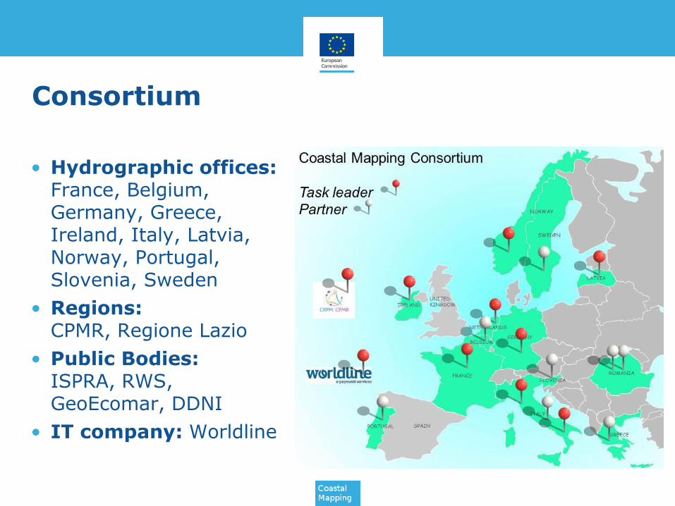
Consortium
• Hydrographic offices: France, Belgium, Germany, Greece, Ireland, Italy, Latvia, Norway, Portugal, Slovenia, Sweden
• Regions: CPMR, Regione Lazio
• Public Bodies: ISPRA, RWS, GeoEcomar, DDNI
• IT company: Worldline
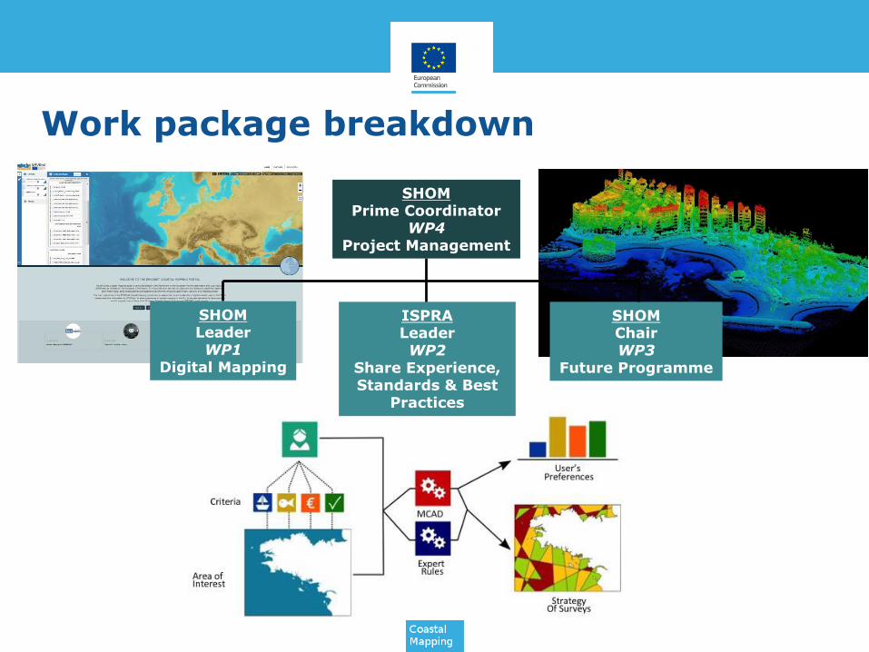
Work package breakdown
SHOMPrime Coordinator
WP4Project Management
SHOMLeaderWP1
Digital Mapping
ISPRALeaderWP2
Share Experience, Standards & Best
Practices
SHOMChairWP3
Future Programme
Work package breakdown
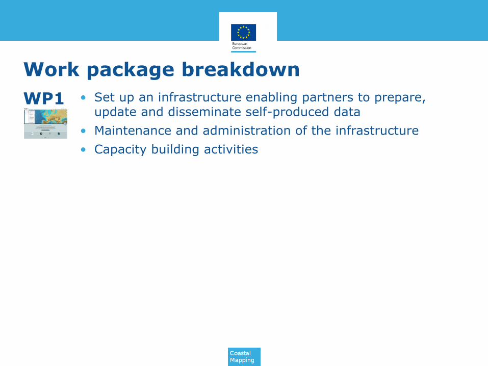
• Set up an infrastructure enabling partners to prepare, update and disseminate self-produced data
• Maintenance and administration of the infrastructure
• Capacity building activities
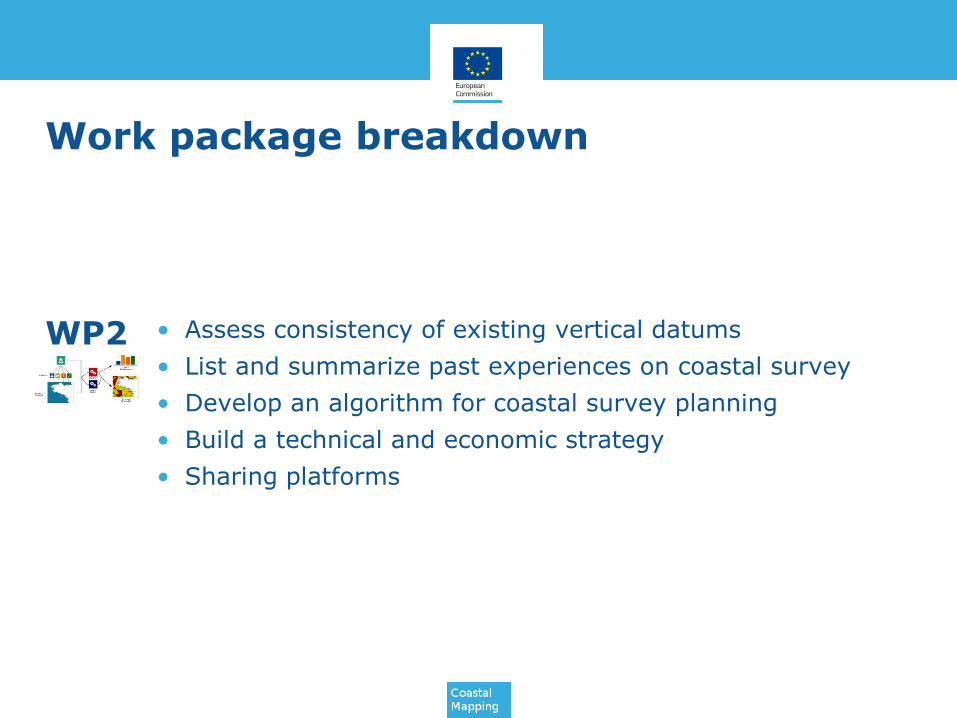
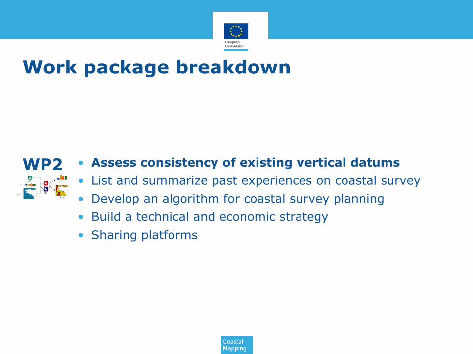
• Assess consistency of existing vertical datums
• List and summarize past experiences on coastal survey
• Develop an algorithm for coastal survey planning
• Build a technical and economic strategy
• Sharing platforms
• Inventory of economic models and governance of data management
• Study current EU fundings
• Validate the proposed programme
• Submit a data acquisition programme
WP1
WP2
WP3
Work package breakdown
• Set up an infrastructure enabling partners to prepare, update and disseminate self-produced data
• Maintenance and administration of the infrastructure
• Capacity building activities
• Assess consistency of existing vertical datums
• List and summarize past experiences on coastal survey
• Develop an algorithm for coastal survey planning
• Build a technical and economic strategy
• Sharing platforms
• Inventory of economic models and governance of data management
• Study current EU fundings
• Validate the proposed programme
• Submit a data acquisition programme
WP1
WP2
WP3

Vertical datum at sea
• Inventory of the used vertical references of the contributing countries.
• Inventory of available transformations to the candidate single vertical references
• Description of current developments in this field
• Analysis of the INSPIRE requirements with respect to coastal data.
• Analysis of differences in adjacent data sets
Vertical datum at sea
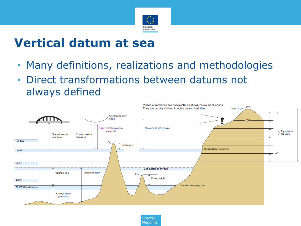
• Many definitions, realizations and methodologies
• Direct transformations between datums notalways defined
Vertical datum at sea
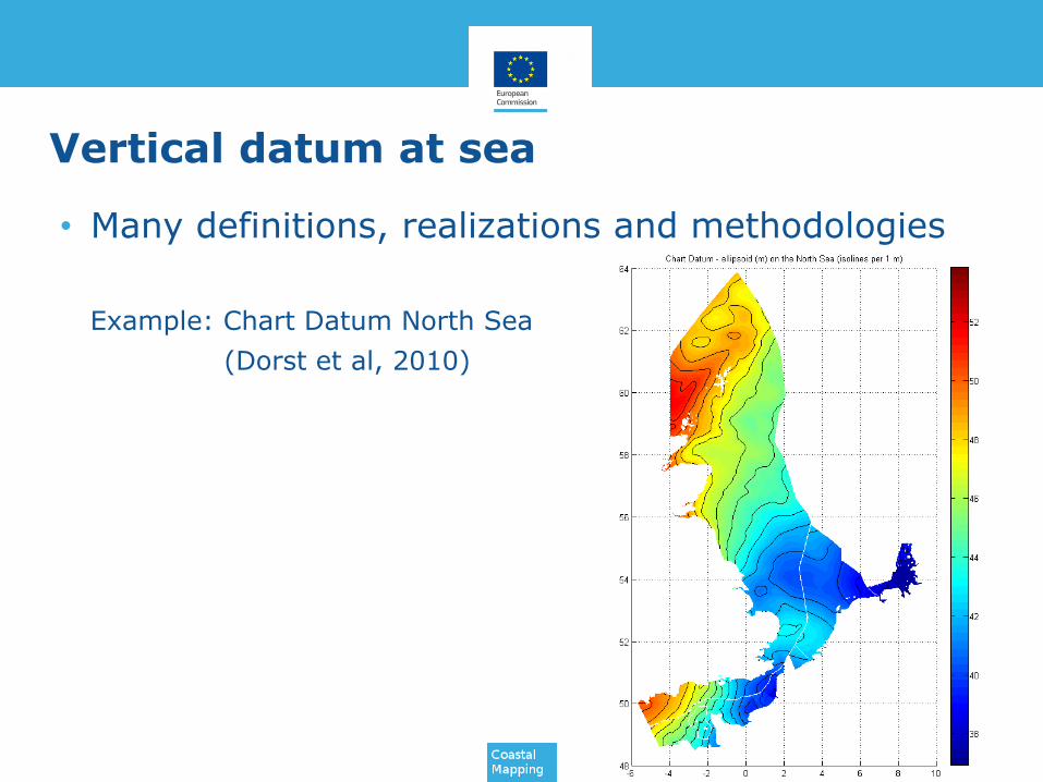
• Many definitions, realizations and methodologies
Example: Chart Datum North Sea
(Dorst et al, 2010)
Vertical datum at sea
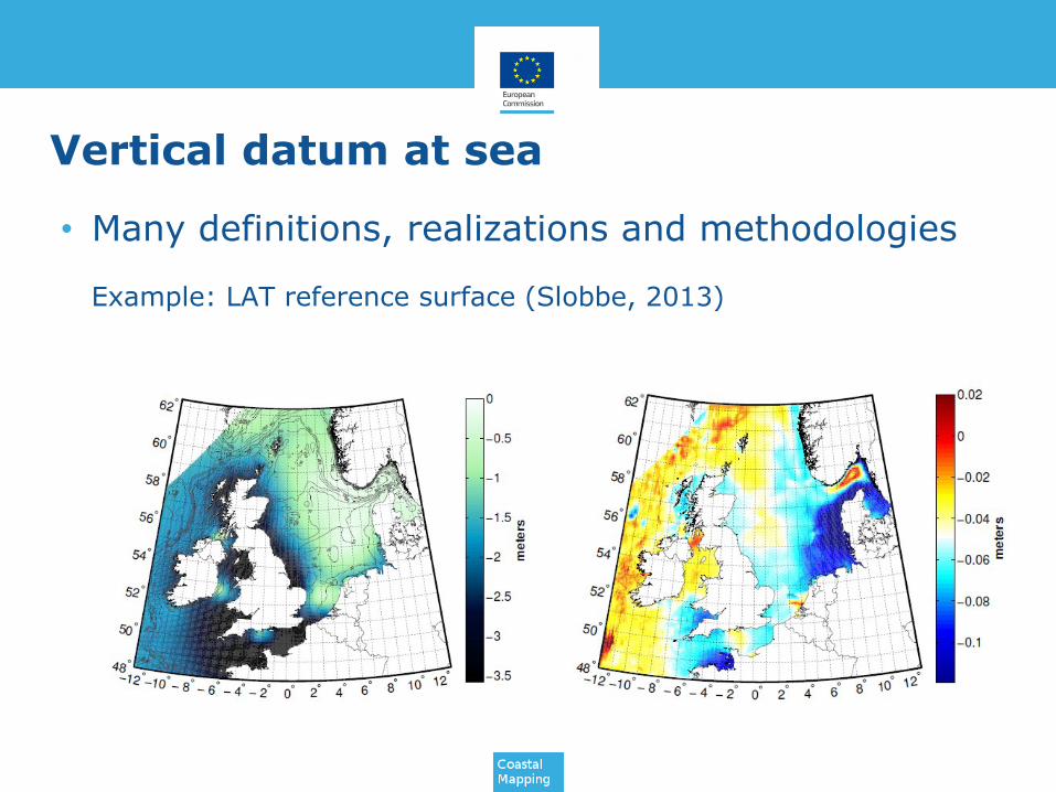
• Many definitions, realizations and methodologies
Example: LAT reference surface (Slobbe, 2013)

Chart Datum
• Reference level in the nautical charts and tables
• IHO guideline (resolution 3/1919 as amended):2a: ... It is further resolved that the Lowest Astronomical Tide (LAT), or as closely equivalent to this level as is practically acceptable to Hydrographic Offices, be adopted as chart datum where tides have an appreciable effect on the water level. …
Note i: LAT (…) is defined as the lowest (…) tide level which can be predicted to occur under average meteorological conditions and under any combination of astronomical conditions. …
Note ii: In non-tidal waters, in order to allow the development of regional solutions, it is recommended that an appropriate long term range of low (…) water definitions of the lower (…) 94-100 percentile be adopted.”
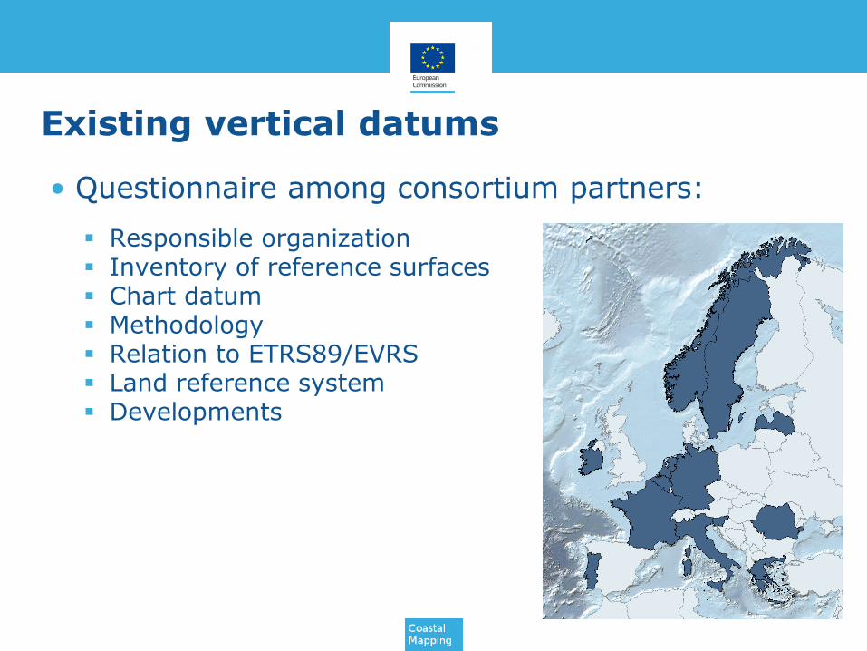
Existing vertical datums
• Questionnaire among consortium partners:
Responsible organization Inventory of reference surfaces Chart datum Methodology Relation to ETRS89/EVRS Land reference system Developments
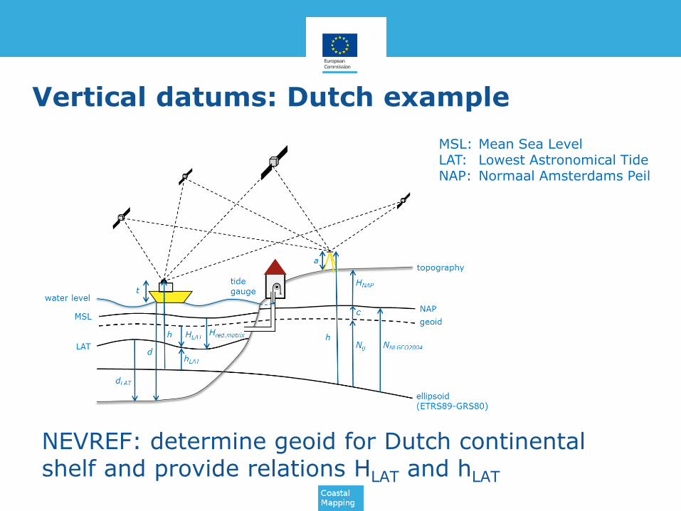
Vertical datums: Dutch example
NEVREF: determine geoid for Dutch continentalshelf and provide relations HLAT and hLAT
MSL: Mean Sea LevelLAT: Lowest Astronomical TideNAP: Normaal Amsterdams Peil
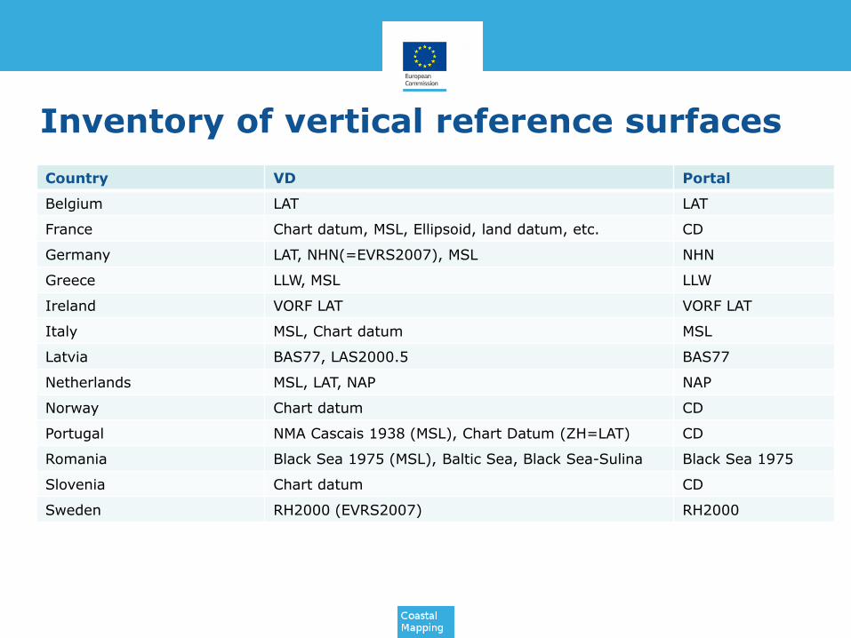
Inventory of vertical reference surfaces
Country VD Portal
Belgium LAT LAT
France Chart datum, MSL, Ellipsoid, land datum, etc. CD
Germany LAT, NHN(=EVRS2007), MSL NHN
Greece LLW, MSL LLW
Ireland VORF LAT VORF LAT
Italy MSL, Chart datum MSL
Latvia BAS77, LAS2000.5 BAS77
Netherlands MSL, LAT, NAP NAP
Norway Chart datum CD
Portugal NMA Cascais 1938 (MSL), Chart Datum (ZH=LAT) CD
Romania Black Sea 1975 (MSL), Baltic Sea, Black Sea-Sulina Black Sea 1975
Slovenia Chart datum CD
Sweden RH2000 (EVRS2007) RH2000
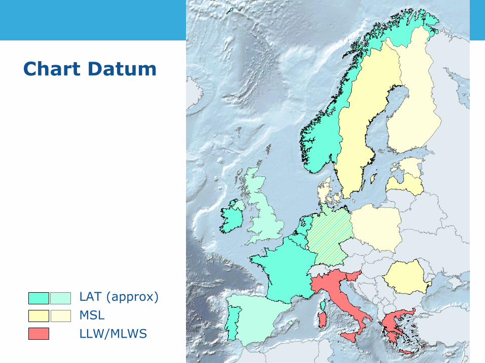
Chart Datum
LAT (approx)
MSL
LLW/MLWS
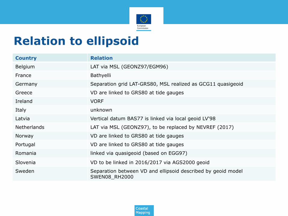
Relation to ellipsoid
Country Relation
Belgium LAT via MSL (GEONZ97/EGM96)
France Bathyelli
Germany Separation grid LAT-GRS80, MSL realized as GCG11 quasigeoid
Greece VD are linked to GRS80 at tide gauges
Ireland VORF
Italy unknown
Latvia Vertical datum BAS77 is linked via local geoid LV'98
Netherlands LAT via MSL (GEONZ97), to be replaced by NEVREF (2017)
Norway VD are linked to GRS80 at tide gauges
Portugal VD are linked to GRS80 at tide gauges
Romania linked via quasigeoid (based on EGG97)
Slovenia VD to be linked in 2016/2017 via AGS2000 geoid
Sweden Separation between VD and ellipsoid described by geoid model SWEN08_RH2000
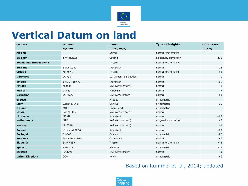
Vertical Datum on land
Based on Rummel et. al, 2014; updated
Country National
System
Datum
(tide gauge)
Type of heights Offset EVRS
(in cm)
Albania Durres normal orthometric
Belgium TWA (DNG) Ostend no gravity correction -232
Bosnia and Herzegovina Trieste normal orthometric
Bulgaria Baltic 1982 Kronstadt normal +23
Croatia HRVS71 Trieste normal orthometric -31
Denmark DVR90 10 Danish tide gauges normal 0
Estonia BHS-77 (BK77) Kronstadt normal +19
Finland N2000 NAP (Amsterdam) normal -1
France IGN69 Marseille normal -47
Germany DHNN92 NAP (Amsterdam) normal +1
Greece Piraeus orthometric
Italy Genova1942 Genova orthometric -30
Ireland MOD Malin Head orthometric
Latvia LAS2000,5 NAP (Amsterdam) normal 0
Lithuania NGVN Kronstadt normal +12
Netherlands NAP NAP (Amsterdam) no gravity correction +2
Norway NN2000 NAP (Amsterdam) normal -1
Poland Kronstadt2006 Kronstadt normal +17
Portugal RNGAP Cascais orthometric -20
Romania Black Sea 1975 Constanta normal +6
Slovenia SI-NVN99 Trieste normal orthometric -42
Spain REDNAP Alicante orthometric -49
Sweden RH2000 NAP (Amsterdam) normal -1
United Kingdom ODN Newlyn orthometric +5
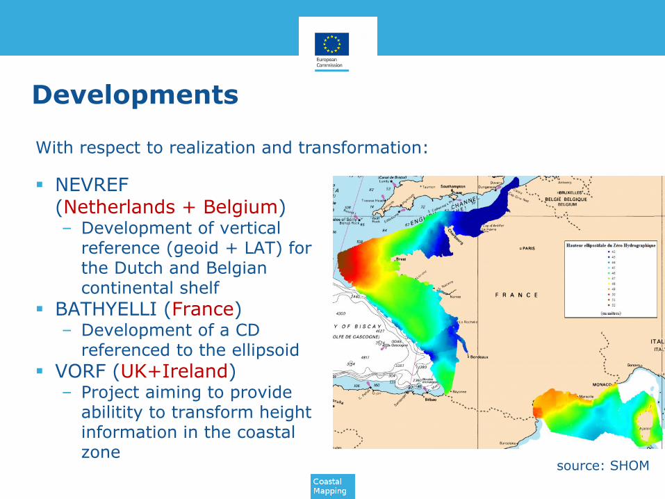
Developments
NEVREF (Netherlands + Belgium)– Development of vertical
reference (geoid + LAT) for the Dutch and Belgiancontinental shelf
BATHYELLI (France)– Development of a CD
referenced to the ellipsoid
VORF (UK+Ireland)– Project aiming to provide
abilitity to transform heightinformation in the coastalzone
With respect to realization and transformation:
source: SHOM

Developments
With respect to harmonization: BLAST/NSHC TWG (North Sea)
– Assessment of consistency of VD and creation of a commonCD/LAT for the North Sea
BSHC Chart datum DWG (Baltic Sea)– EVRS-based harmonized vertical reference for hydrography
and navigation (presented by J.Mononen, EUREF2015)
Source: SMA
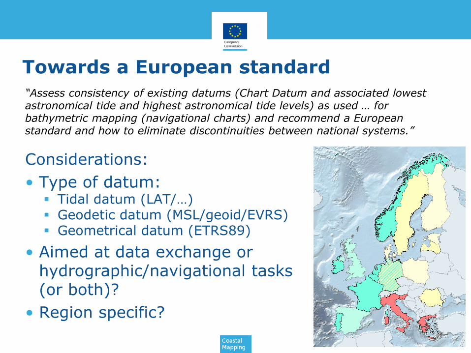
Towards a European standard
Considerations:
• Type of datum: Tidal datum (LAT/…) Geodetic datum (MSL/geoid/EVRS) Geometrical datum (ETRS89)
• Aimed at data exchange or hydrographic/navigational tasks(or both)?
• Region specific?
“Assess consistency of existing datums (Chart Datum and associated lowest astronomical tide and highest astronomical tide levels) as used … for bathymetric mapping (navigational charts) and recommend a European standard and how to eliminate discontinuities between national systems.”
Towards a European standard
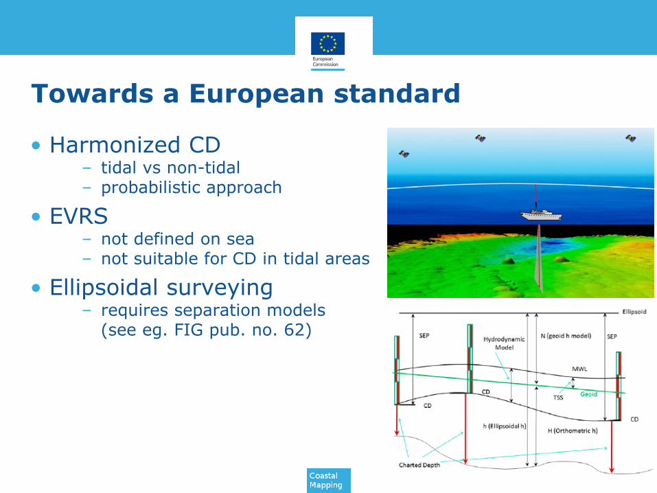
• Harmonized CD– tidal vs non-tidal– probabilistic approach
• EVRS– not defined on sea– not suitable for CD in tidal areas
• Ellipsoidal surveying– requires separation models
(see eg. FIG pub. no. 62)
www.coastal-mapping.eu