Embed Size (px)
Citation preview
1
T O W P A T H T R A I L E X T E N S I O N : A L I G N M E N T A N D D E S I G N S T U D Y • O c t o b e r 2 0 0 2
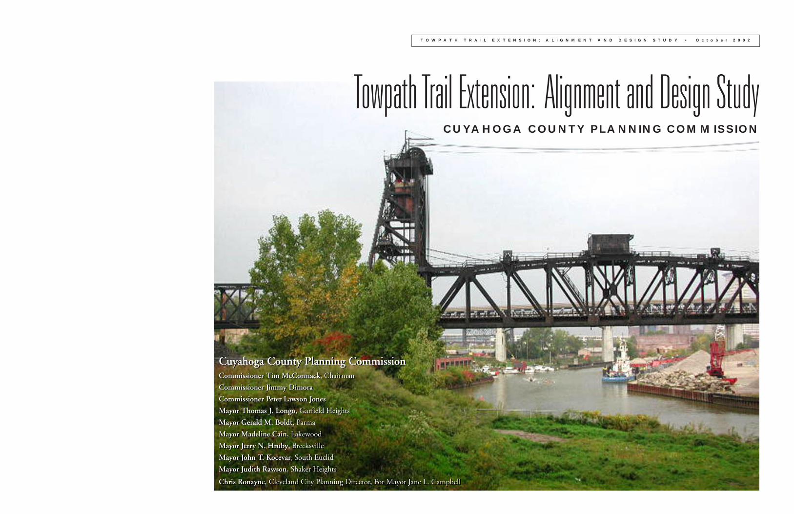
Towpath Trail Extension: Alignment and Design StudyCUYAHOGA COUNTY PLANNING COMMISSION
Cuyahoga County Planning CommissionCommissioner Tim McCormack, Chairman
Commissioner Jimmy Dimora
Commissioner Peter Lawson Jones
Mayor Thomas J. Longo, Garfield Heights
Mayor Gerald M. Boldt, Parma
Mayor Madeline Cain, Lakewood
Mayor Jerry N. Hruby, Brecksville
Mayor John T. Kocevar, South Euclid
Mayor Judith Rawson, Shaker Heights
Chris Ronayne, Cleveland City Planning Director, For Mayor Jane L. Campbell
1
T O W P A T H T R A I L E X T E N S I O N : A L I G N M E N T A N D D E S I G N S T U D Y • O c t o b e r 2 0 0 2
Project Background and SignificanceThe Towpath Trail has become a defining feature in the Cuyahoga Valley landscape. Constructed 175 years ago as part of the
Ohio & Erie Canal, it was a simple dirt path on which to lead animals pulling canal boats. When the economically unprofit-
able canal finally ceased to be used after the 1913 flood, the towpath survived as a silent witness to an earlier era.
The rediscovery of the towpath began with the establishment of the Cuyahoga Valley National Recreation Area (now
Cuyahoga Valley National Park) in 1974 as a unit of the National Park Service. One of the major projects completed by the
National Park Service was the conversion of approximately 20 miles of the towpath into a shared use trail. The success of
this segment of towpath, which has over 1.7 million users per year, has sparked a campaign to extend the Towpath Trail to
over 100 miles as a continuous journey through the federally designated Ohio & Erie National Heritage Corridor. In addi-
tion, the heritage corridor trail will serve as the northeast Ohio section of the State of Ohio’s planned Ohio to Erie Trail.
Cleveland Metroparks has completed additional segments of the Towpath Trail in its Ohio & Erie Canal Reservation,
situated immediately north of the Cuyahoga Valley National Park. Approximately six miles of trail have been completed, and
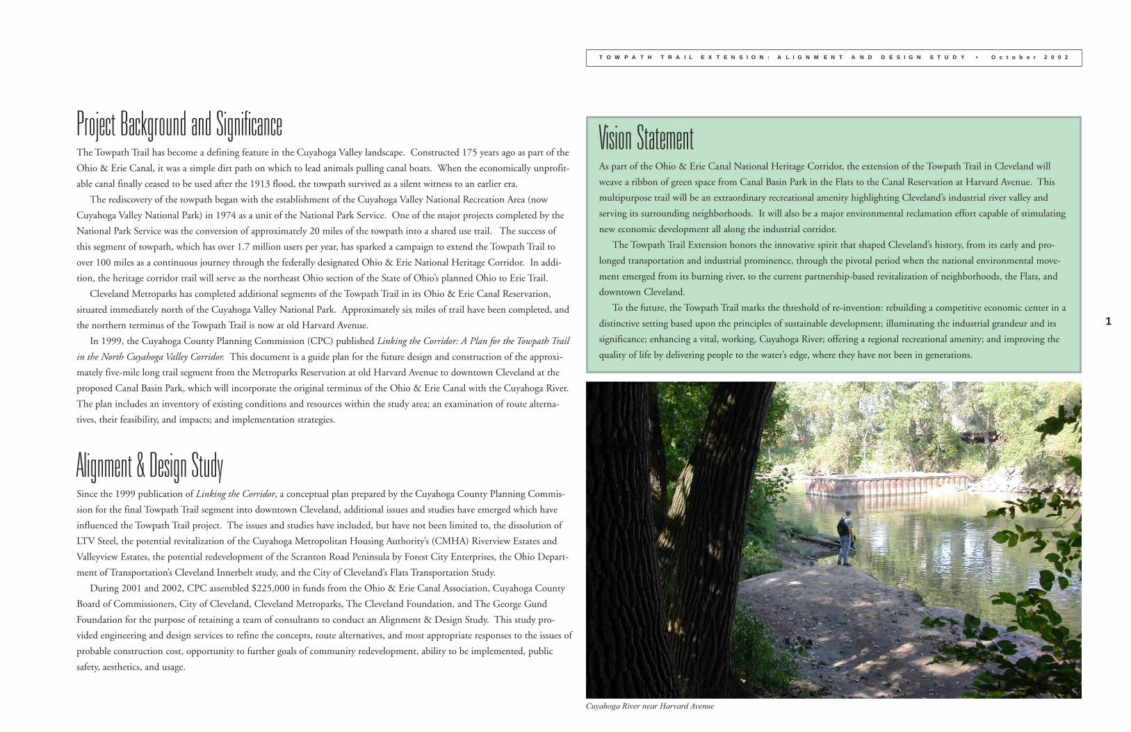
the northern terminus of the Towpath Trail is now at old Harvard Avenue.
In 1999, the Cuyahoga County Planning Commission (CPC) published Linking the Corridor: A Plan for the Towpath Trail
in the North Cuyahoga Valley Corridor. This document is a guide plan for the future design and construction of the approxi-
mately five-mile long trail segment from the Metroparks Reservation at old Harvard Avenue to downtown Cleveland at the
proposed Canal Basin Park, which will incorporate the original terminus of the Ohio & Erie Canal with the Cuyahoga River.
The plan includes an inventory of existing conditions and resources within the study area; an examination of route alterna-
tives, their feasibility, and impacts; and implementation strategies.
Alignment & Design StudySince the 1999 publication of Linking the Corridor, a conceptual plan prepared by the Cuyahoga County Planning Commis-
sion for the final Towpath Trail segment into downtown Cleveland, additional issues and studies have emerged which have
influenced the Towpath Trail project. The issues and studies have included, but have not been limited to, the dissolution of
LTV Steel, the potential revitalization of the Cuyahoga Metropolitan Housing Authority’s (CMHA) Riverview Estates and
Valleyview Estates, the potential redevelopment of the Scranton Road Peninsula by Forest City Enterprises, the Ohio Depart-
ment of Transportation’s Cleveland Innerbelt study, and the City of Cleveland’s Flats Transportation Study.
During 2001 and 2002, CPC assembled $225,000 in funds from the Ohio & Erie Canal Association, Cuyahoga County
Board of Commissioners, City of Cleveland, Cleveland Metroparks, The Cleveland Foundation, and The George Gund
Foundation for the purpose of retaining a team of consultants to conduct an Alignment & Design Study. This study pro-
vided engineering and design services to refine the concepts, route alternatives, and most appropriate responses to the issues of
probable construction cost, opportunity to further goals of community redevelopment, ability to be implemented, public
safety, aesthetics, and usage.
Vision StatementAs part of the Ohio & Erie Canal National Heritage Corridor, the extension of the Towpath Trail in Cleveland will
weave a ribbon of green space from Canal Basin Park in the Flats to the Canal Reservation at Harvard Avenue. This
multipurpose trail will be an extraordinary recreational amenity highlighting Cleveland’s industrial river valley and
serving its surrounding neighborhoods. It will also be a major environmental reclamation effort capable of stimulating
new economic development all along the industrial corridor.
The Towpath Trail Extension honors the innovative spirit that shaped Cleveland’s history, from its early and pro-
longed transportation and industrial prominence, through the pivotal period when the national environmental move-
ment emerged from its burning river, to the current partnership-based revitalization of neighborhoods, the Flats, and
downtown Cleveland.
To the future, the Towpath Trail marks the threshold of re-invention: rebuilding a competitive economic center in a
distinctive setting based upon the principles of sustainable development; illuminating the industrial grandeur and its
significance; enhancing a vital, working, Cuyahoga River; offering a regional recreational amenity; and improving the
quality of life by delivering people to the water’s edge, where they have not been in generations.
Cuyahoga River near Harvard Avenue
2
T O W P A T H T R A I L E X T E N S I O N : A L I G N M E N T A N D D E S I G N S T U D Y • O c t o b e r 2 0 0 2
AlignmentThe preferred alignment for the segment of the Towpath Trail from old Harvard Avenue to Canal Basin Park is off-road,
which is the same as the current sections of trail in the Cuyahoga Valley National Park and the Cleveland Metroparks Canal
Reservation. The trail would be ten-feet wide and paved with asphalt. Wherever feasible, the goal is to have the trail as part
of a swath up to fifty-feet wide that would provide an area for environmental improvements, landscape improvements, and,
where needed, buffers and safety measures for adjacent property owners. The preferred alignment of the trail will co-exist
with existing land uses. It does not result in the replacement of any existing businesses or housing.
The proposed trail would also offer opportunities to explore two of the best physical features of the valley: the river’s edge
and its vistas. Areas suitable for river edge access include both south and north of old Harvard Avenue, the west river bank of
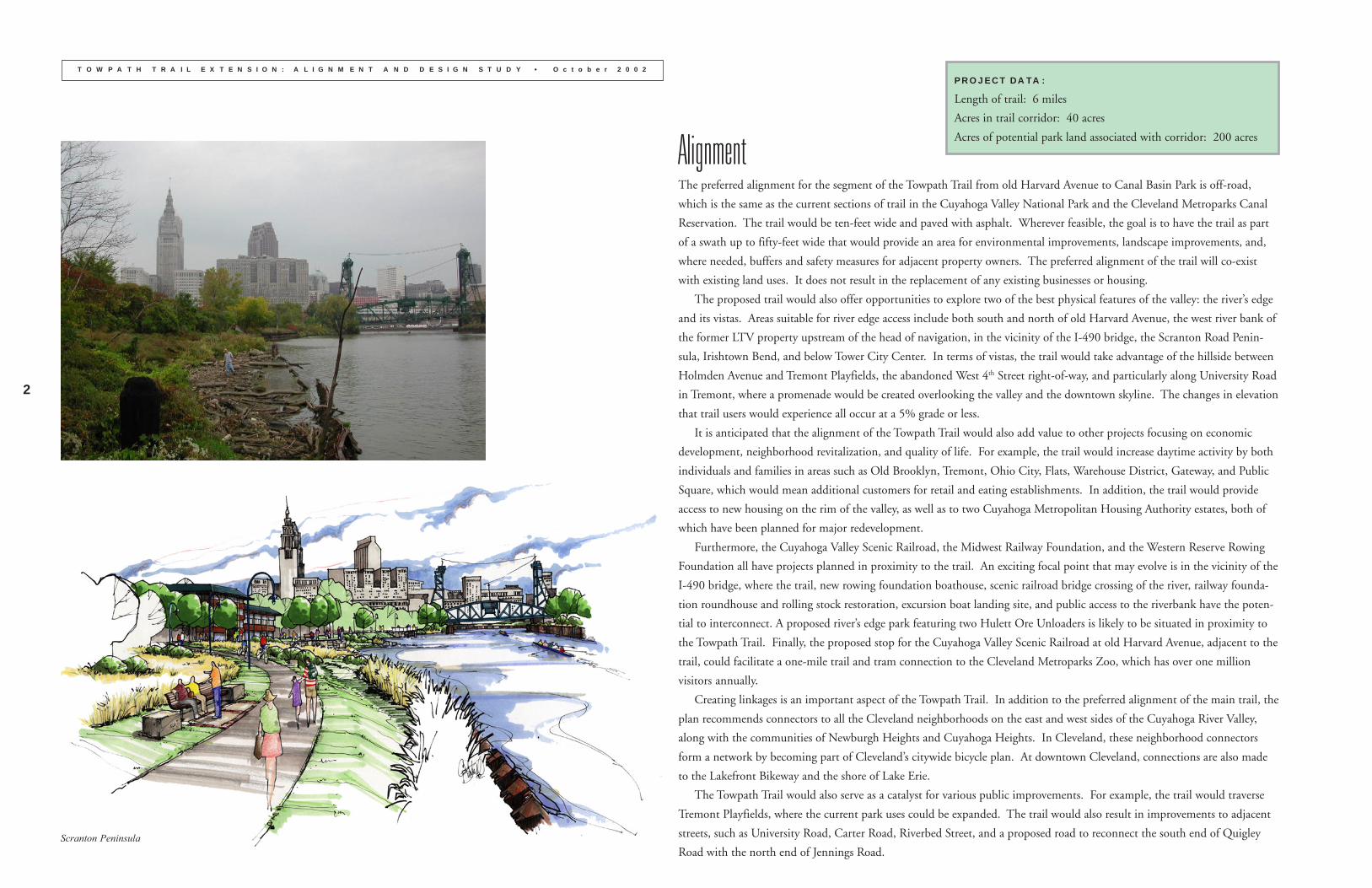
the former LTV property upstream of the head of navigation, in the vicinity of the I-490 bridge, the Scranton Road Penin-
sula, Irishtown Bend, and below Tower City Center. In terms of vistas, the trail would take advantage of the hillside between
Holmden Avenue and Tremont Playfields, the abandoned West 4th Street right-of-way, and particularly along University Road
in Tremont, where a promenade would be created overlooking the valley and the downtown skyline. The changes in elevation
that trail users would experience all occur at a 5% grade or less.
It is anticipated that the alignment of the Towpath Trail would also add value to other projects focusing on economic
development, neighborhood revitalization, and quality of life. For example, the trail would increase daytime activity by both
individuals and families in areas such as Old Brooklyn, Tremont, Ohio City, Flats, Warehouse District, Gateway, and Public
Square, which would mean additional customers for retail and eating establishments. In addition, the trail would provide
access to new housing on the rim of the valley, as well as to two Cuyahoga Metropolitan Housing Authority estates, both of
which have been planned for major redevelopment.
Furthermore, the Cuyahoga Valley Scenic Railroad, the Midwest Railway Foundation, and the Western Reserve Rowing
Foundation all have projects planned in proximity to the trail. An exciting focal point that may evolve is in the vicinity of the
I-490 bridge, where the trail, new rowing foundation boathouse, scenic railroad bridge crossing of the river, railway founda-
tion roundhouse and rolling stock restoration, excursion boat landing site, and public access to the riverbank have the poten-
tial to interconnect. A proposed river’s edge park featuring two Hulett Ore Unloaders is likely to be situated in proximity to
the Towpath Trail. Finally, the proposed stop for the Cuyahoga Valley Scenic Railroad at old Harvard Avenue, adjacent to the
trail, could facilitate a one-mile trail and tram connection to the Cleveland Metroparks Zoo, which has over one million
visitors annually.
Creating linkages is an important aspect of the Towpath Trail. In addition to the preferred alignment of the main trail, the
plan recommends connectors to all the Cleveland neighborhoods on the east and west sides of the Cuyahoga River Valley,
along with the communities of Newburgh Heights and Cuyahoga Heights. In Cleveland, these neighborhood connectors
form a network by becoming part of Cleveland’s citywide bicycle plan. At downtown Cleveland, connections are also made
to the Lakefront Bikeway and the shore of Lake Erie.
The Towpath Trail would also serve as a catalyst for various public improvements. For example, the trail would traverse
Tremont Playfields, where the current park uses could be expanded. The trail would also result in improvements to adjacent
streets, such as University Road, Carter Road, Riverbed Street, and a proposed road to reconnect the south end of Quigley
Road with the north end of Jennings Road.
PROJECT DATA:
Length of trail: 6 miles
Acres in trail corridor: 40 acres
Acres of potential park land associated with corridor: 200 acres
Scranton Peninsula
3
T O W P A T H T R A I L E X T E N S I O N : A L I G N M E N T A N D D E S I G N S T U D Y • O c t o b e r 2 0 0 2
Length and Cost Estimate• The preferred alignment for the Towpath Trail, using the alignment in the Flats of the Scranton Peninsula to
Canal Basin Park via the Carter Road Bridge, is six miles. About one quarter of the route is currently in public
ownership.
• The alignment in the Flats of the Scranton Peninsula to Canal Basin Park via Irishtown Bend adds one addi-
tional mile.
• Design and Construction estimates includes soft costs (contingency, mobilization and demobilization, bonds
and insurances, general conditions, and professional design services), visitor services, trail lighting, wayfinding
signage, and environmental regeneration activities necessary for trail construction. Interpretive exhibits are
included as part of Trailheads.
Future Trail Loops - Design and Construction Costs
Vicinity of Big Creek confluence with Cuyahoga River - $1,570,000 (0.6 miles)
ISG to I-490 via the west river bank and West 3rd Street - $7,760,000 (2.2 miles)
Estimated Cost of Supplemental Projects
South of Harvard to Harvard-Denison Bridge
Old Harvard Avenue Streetscape - $360,000
Cuyahoga Valley Scenic Railroad station and parking area at Old Harvard Avenue - $2,170,000
Harvard-Denison Bridge to ISG
Environmental Regeneration Project on Cuyahoga River east bank - $290,000
ISG to I-490
ISG Trailhead and Interpretive Center - $1,730,000
Overlook Location between Holmden and Clark Avenues - not determined
Tremont Playfields Trailhead and Improvements - $1,000,000
Tremont Playfields Amphitheater/Festival Site - $2,620,000
Overlook at former Clark Avenue and West 3rd Street Terminus - $220,000
Midwest Railway Foundation - West 3rd Street Roundhouse Interpretive Center and Trailhead - not determined
Environmental Regeneration Project on Cuyahoga River east bank - $730,000
I-490 to Scranton Peninsula
Multi-Modal Connector at vicinity of I-490 Bridge - not determined
New Jefferson Avenue Bridge over Cuyahoga River - not determined
Jefferson Avenue Riverbank Overlook - not determined
Kingsbury Run Environmental Regeneration and Conservation Area - $2,070,000
Connection from Tremont Ridge to Cuyahoga River - not determined
Tremont Bend Riverwalk north of Innerbelt Bridge - not determined
Scranton Peninsula to Canal Basin Park via Carter Road Bridge
No Items
Scranton Peninsula to Canal Basin Park via Irishtown Bend
Irishtown Bend Archeological Project - $100,000
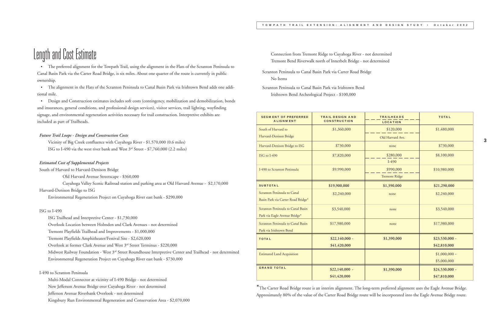
SEGMENT OF PREFERREDALIGNMENT
TRAIL DESIGN ANDCONSTRUCTION
South of Harvard to
Harvard-Denison Bridge
$1,360,000
Harvard-Denison Bridge to ISG $730,000
ISG to I-490 $7,820,000
I-490 to Scranton Peninsula $9,990,000
$19,900,000 $1,390,000 $21,290,000SUBTOTAL
Scranton Peninsula to Canal
Basin Park via Carter Road Bridge*
$2,240,000 $2,240,000
Scranton Peninsula to Canal Basin
Park via Irishtown Bend
TOTAL $22,140,000
$41,420,000
Scranton Peninsula to Canal Basin
Park via Eagle Avenue Bridge*
$3,540,000 none $3,540,000
TRAILHEADS
LOCATION
TOTAL
Old Harvard Ave.
$120,000 $1,480,000
none $730,000
$280,000
I-490
$8,100,000
$990,000 $10,980,000
Tremont Ridge
none
$1,390,000- $23,530,000
$42,810,000
-
Estimated Land Acquisition $1,000,000
$5,000,000
-
$24,530,000
$47,810,000
GRAND TOTAL $1,390,000$22,140,000
$41,420,000
- -
$17,980,000 none $17,980,000
*The Carter Road Bridge route is an interim alignment. The long-term preferred alignment uses the Eagle Avenue Bridge.
Approximately 80% of the value of the Carter Road Bridge route will be incorporated into the Eagle Avenue Bridge route.
4
T O W P A T H T R A I L E X T E N S I O N : A L I G N M E N T A N D D E S I G N S T U D Y • O c t o b e r 2 0 0 2
Environmental RegenerationOne emphasis of the Towpath Trail, beyond its use for transportation and recreation, is a strategy for the environmental
regeneration of the surrounding landscape. Over the generations of urban development and industrial use, the natural systems
of hillsides, wetland pockets, ground water, soil profiles and conditions, and surface drainage have been overlooked in favor of
manufacturing production and the movement of goods by water, rail, and road. The development of a trail through this
landscape brings the opportunity to refocus attention on the natural systems of the river valley. The vision is for a co-exist-
ence between the natural systems and the industrial land uses, where the two are viewed as related infrastructure working in
partnership. The trail provides the framework for exploration and experimentation of effective methods to reintroduce
natural systems objectives.
On average, the trail is planned as a fifty-foot wide linear “ribbon” through the valley, totalling approximately 40 acres. In
some locations the area would be limited to the land necessary to construct the trail, meaning a fourteen-foot right-of-way
(ten feet of paved trail, plus two feet on each side). In other locations, there is the opportunity to include additional land and
protect it as greenspace through projects such as the ecological restoration of hillsides, soil enhancements, improvements to
drainage patterns, and constructed and enhanced wetland pockets of over 200 acres. Examples of these locations include the
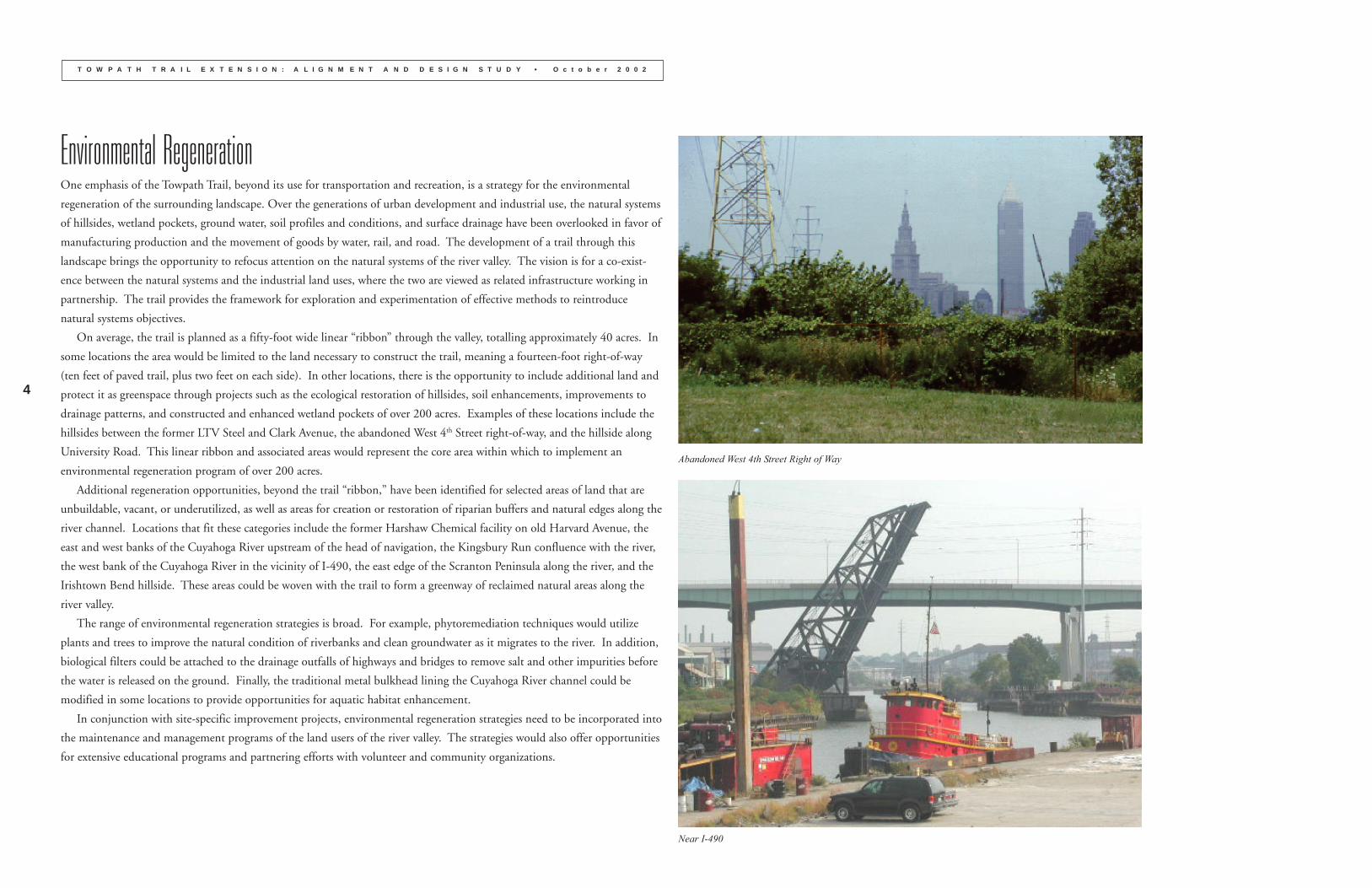
hillsides between the former LTV Steel and Clark Avenue, the abandoned West 4th Street right-of-way, and the hillside along
University Road. This linear ribbon and associated areas would represent the core area within which to implement an
environmental regeneration program of over 200 acres.
Additional regeneration opportunities, beyond the trail “ribbon,” have been identified for selected areas of land that are
unbuildable, vacant, or underutilized, as well as areas for creation or restoration of riparian buffers and natural edges along the
river channel. Locations that fit these categories include the former Harshaw Chemical facility on old Harvard Avenue, the
east and west banks of the Cuyahoga River upstream of the head of navigation, the Kingsbury Run confluence with the river,
the west bank of the Cuyahoga River in the vicinity of I-490, the east edge of the Scranton Peninsula along the river, and the
Irishtown Bend hillside. These areas could be woven with the trail to form a greenway of reclaimed natural areas along the
river valley.
The range of environmental regeneration strategies is broad. For example, phytoremediation techniques would utilize
plants and trees to improve the natural condition of riverbanks and clean groundwater as it migrates to the river. In addition,
biological filters could be attached to the drainage outfalls of highways and bridges to remove salt and other impurities before
the water is released on the ground. Finally, the traditional metal bulkhead lining the Cuyahoga River channel could be
modified in some locations to provide opportunities for aquatic habitat enhancement.
In conjunction with site-specific improvement projects, environmental regeneration strategies need to be incorporated into
the maintenance and management programs of the land users of the river valley. The strategies would also offer opportunities
for extensive educational programs and partnering efforts with volunteer and community organizations.
Abandoned West 4th Street Right of Way
Near I-490
5
T O W P A T H T R A I L E X T E N S I O N : A L I G N M E N T A N D D E S I G N S T U D Y • O c t o b e r 2 0 0 2
Visitor Services and Interpretative OpportunitiesAs part of the Towpath Trail, locations for visitor services and interpretive exhibits have been recommended. The proposed
sites along the length of the trail include various combinations of facilities such as parking, restrooms, shelters, rest stops,
interpretation, and wayfinding signage to promote circulation along the main trail and with neighborhood connectors. The
visitor services and interpretation locations are situated along the route to maximize their potential through grouping with
complimentary amenities and to provide an appropriate distance between activity areas. Some facilities will be needed as part
of the construction of the Towpath Trail, while other facilities will not be needed until supplemental projects are undertaken.
The content of the wayside exhibits will be based on both the natural and cultural history of the valley. The Cuyahoga
Valley National Park and the Cleveland Metroparks Canal Reservation both illustrate the range of exhibit types that are
possible. Potential interpretive themes include successive transportation systems, such as the canal, railroads, shipping, and
highways; bridge engineering; immigrants and neighborhood settlement patterns; innovation in industrial fields such as oil,
chemicals, and paint, as well as iron, steel, fasteners, machine tools, automobiles, and shipbuilding; and the role of the lower
Cuyahoga River Valley in the national environmental movement. In addition, selected parts of the former LTV Steel/West
Side Works have the opportunity to be incorporated into the trail and public improvement program. Several small adminis-
trative buildings along the former LTV entry drive have the potential to be reused for visitor services and indoor interpreta-
tion of the steel story. As an unusual companion piece, a collection of furnaces and mill buildings dating as far back as the
1910’s and clustered near the Clark Avenue overlook at the southern terminus of West 3rd Street create a complete narrative of
steel production for visitor interpretation and experience, much like the examples in the Ruhr Valley of Germany.
Finally, and importantly, the proposed Canal Basin Park and its vicinity include the only visible remains of the 1820’s
Ohio & Erie Canal north of old Harvard Avenue. This area will become a focal point of the northern end of the Ohio &
Erie Canal National Heritage Corridor and will incorporate the Towpath Trail.
Public Art PlanThe development of the Towpath Trail and its various amenities create an excellent opportunity for the integration of art into
the project. For example, public art may be used as a device through which to interpret the rich heritage and stories of the
valley, as a method to create a sense of place, and as a way to enhance the physical improvements.
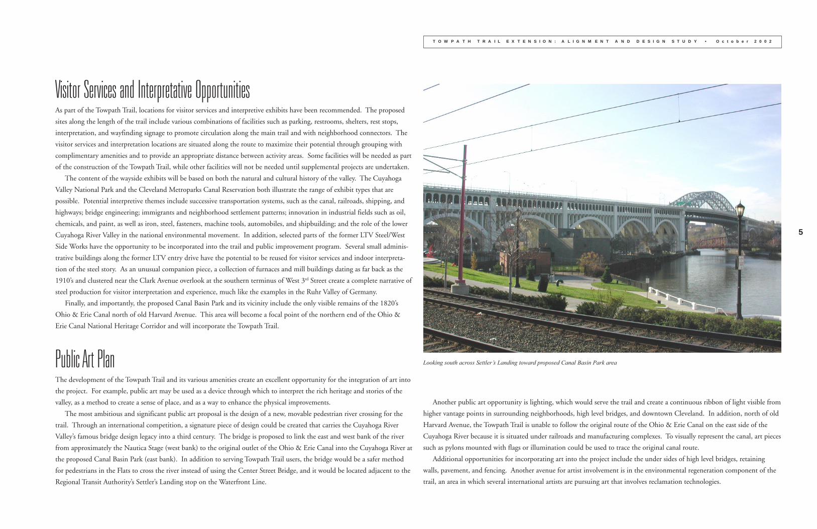
The most ambitious and significant public art proposal is the design of a new, movable pedestrian river crossing for the
trail. Through an international competition, a signature piece of design could be created that carries the Cuyahoga River
Valley’s famous bridge design legacy into a third century. The bridge is proposed to link the east and west bank of the river
from approximately the Nautica Stage (west bank) to the original outlet of the Ohio & Erie Canal into the Cuyahoga River at
the proposed Canal Basin Park (east bank). In addition to serving Towpath Trail users, the bridge would be a safer method
for pedestrians in the Flats to cross the river instead of using the Center Street Bridge, and it would be located adjacent to the
Regional Transit Authority’s Settler’s Landing stop on the Waterfront Line.
Another public art opportunity is lighting, which would serve the trail and create a continuous ribbon of light visible from
higher vantage points in surrounding neighborhoods, high level bridges, and downtown Cleveland. In addition, north of old
Harvard Avenue, the Towpath Trail is unable to follow the original route of the Ohio & Erie Canal on the east side of the
Cuyahoga River because it is situated under railroads and manufacturing complexes. To visually represent the canal, art pieces
such as pylons mounted with flags or illumination could be used to trace the original canal route.
Additional opportunities for incorporating art into the project include the under sides of high level bridges, retaining
walls, pavement, and fencing. Another avenue for artist involvement is in the environmental regeneration component of the
trail, an area in which several international artists are pursuing art that involves reclamation technologies.
Looking south across Settler’s Landing toward proposed Canal Basin Park area
6
T O W P A T H T R A I L E X T E N S I O N : A L I G N M E N T A N D D E S I G N S T U D Y • O c t o b e r 2 0 0 2
Implementation and Phasing OverviewAs each section of the Towpath Trail in Cuyahoga County has been completed over the past ten years, public expectations for
the completion of the trail to downtown Cleveland and the lakefront have grown. This project represents the final link, and
the groundwork for implementation is well underway. Public agencies are integrating the trail into public improvement and
redevelopment projects, partnerships are emerging, and the private sector has begun to respond with development projects.
A diverse constituency has endorsed the project as an important recreational, neighborhood revitalization, and quality of
life amenity for the metropolitan area, including Cuyahoga County, City of Cleveland, Cleveland Metroparks, National Park
Service, Ohio Canal Corridor, Ohio & Erie Canal Association, various local development corporations and nonprofit organi-
zations, and the Greater Cleveland Real Estate Organizations, an umbrella entity representing fourteen real estate industry
groups. A recent article by Plain Dealer columnist Joe Frolik, as part of that newspaper’s continuing “A Quiet Crisis” series,
noted that “the old towpath promises to become a cornerstone attraction for the young professionals and entrepreneurs this
region needs to attract—and a model of cooperation for leaders in and out of government.”
It is anticipated that creative partnering will be the vehicle for implementation, and that the specifics of these partnerships
will evolve as the project moves forward. Implementation will involve a series of distinct activities including securing prop-
erty, acquiring funding, final design and construction documents, construction, operation and maintenance, community
involvement, and stewardship. The roles of the various partners will evolve and change over time and in response to the
specific circumstances of each project. Consequently, a central group to coordinate, advocate and in some cases initiate
various activities will be utilized.
It is recognized that implementation will need to be phased over time, estimated at three to six years. The rate of progress
will primarily depend upon property assemblage, the securing of financial resources, and construction timetables.
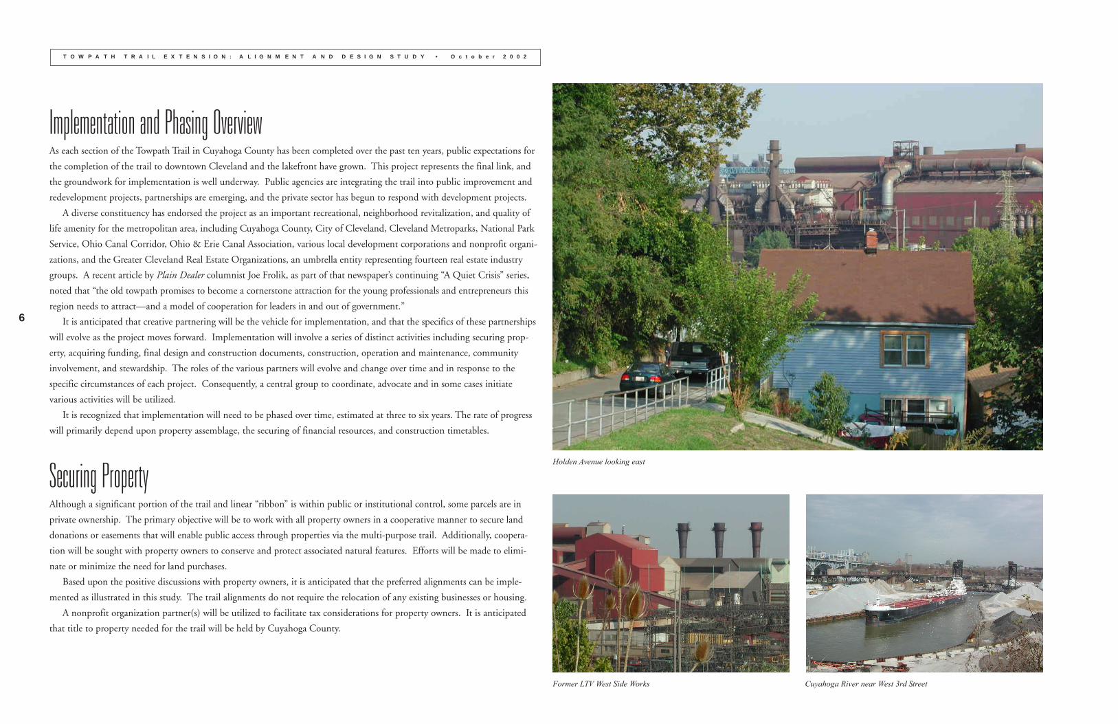
Securing PropertyAlthough a significant portion of the trail and linear “ribbon” is within public or institutional control, some parcels are in
private ownership. The primary objective will be to work with all property owners in a cooperative manner to secure land
donations or easements that will enable public access through properties via the multi-purpose trail. Additionally, coopera-
tion will be sought with property owners to conserve and protect associated natural features. Efforts will be made to elimi-
nate or minimize the need for land purchases.
Based upon the positive discussions with property owners, it is anticipated that the preferred alignments can be imple-
mented as illustrated in this study. The trail alignments do not require the relocation of any existing businesses or housing.
A nonprofit organization partner(s) will be utilized to facilitate tax considerations for property owners. It is anticipated
that title to property needed for the trail will be held by Cuyahoga County.
Holden Avenue looking east
Former LTV West Side Works Cuyahoga River near West 3rd Street
7
T O W P A T H T R A I L E X T E N S I O N : A L I G N M E N T A N D D E S I G N S T U D Y • O c t o b e r 2 0 0 2
FundingTo date, funds from public agencies, foundations, and nonprofit organizations have been utilized for the project. Due to the
project cost, it is assumed that multiple funding sources will be required to realize the full vision of this plan. For example,
some aspects of the project may be most effectively served through use of funds from specific state or federal sources. Other
components may be able to be completed through the ongoing capital improvement programs of the Cuyahoga County
Engineer or City of Cleveland, or funding sources available through the Northeast Ohio Areawide Coordinating Agency
(NOACA). Finally, as multiple projects begin to be implemented simultaneously, such as the main trail, neighborhood trail
connections, and supplemental projects, it will be desirable to strategically coordinate the various funding requests.
ConstructionThe Cuyahoga County Engineer’s Office will oversee construction document preparation, bidding, and construction. Actual
construction is likely to occur over several construction seasons. Once construction is complete, the Engineer’s Office will
transfer day-to-day operation and maintenance responsibilities to another entity.
Operation and MaintenanceEarly in the planning process for trail construction, the selection of the organization(s) that will operate and maintain the trail
network should be made. A prompt commitment for day-to-day responsibilities will enable the management entity to begin
coordination with the Cuyahoga County Engineer’s Office at the earliest possible time.
There are several entities that could be considered for all or part of this role. For example, several of the local partners,
such as Cleveland Metroparks, National Park Service, City of Cleveland, ParkWorks, and Ohio Canal Corridor currently
operate and/or manage public use recreational facilities and open space in the metropolitan area.
Community SupportMany organizations and agencies have been very active in promoting the heritage corridor concept and working for its
protection and improvement, dating back to the 1980’s. Over the years, the number of organizational and individual sup-
porters has grown steadily, creating a network of effective advocates for community involvement, education programs,
interpretive opportunities, and physical improvement projects on behalf of the heritage corridor.
There is also substantial support for the broader goal of rediscovering the river and lakefront in Greater Cleveland. Mayor
Richard Daley of Chicago recently asserted that there is only one significant difference between his city and Cleveland:
“Chicago embraced the lakefront and river, and Cleveland turned its back to them.” In response, the Leadership Cleveland
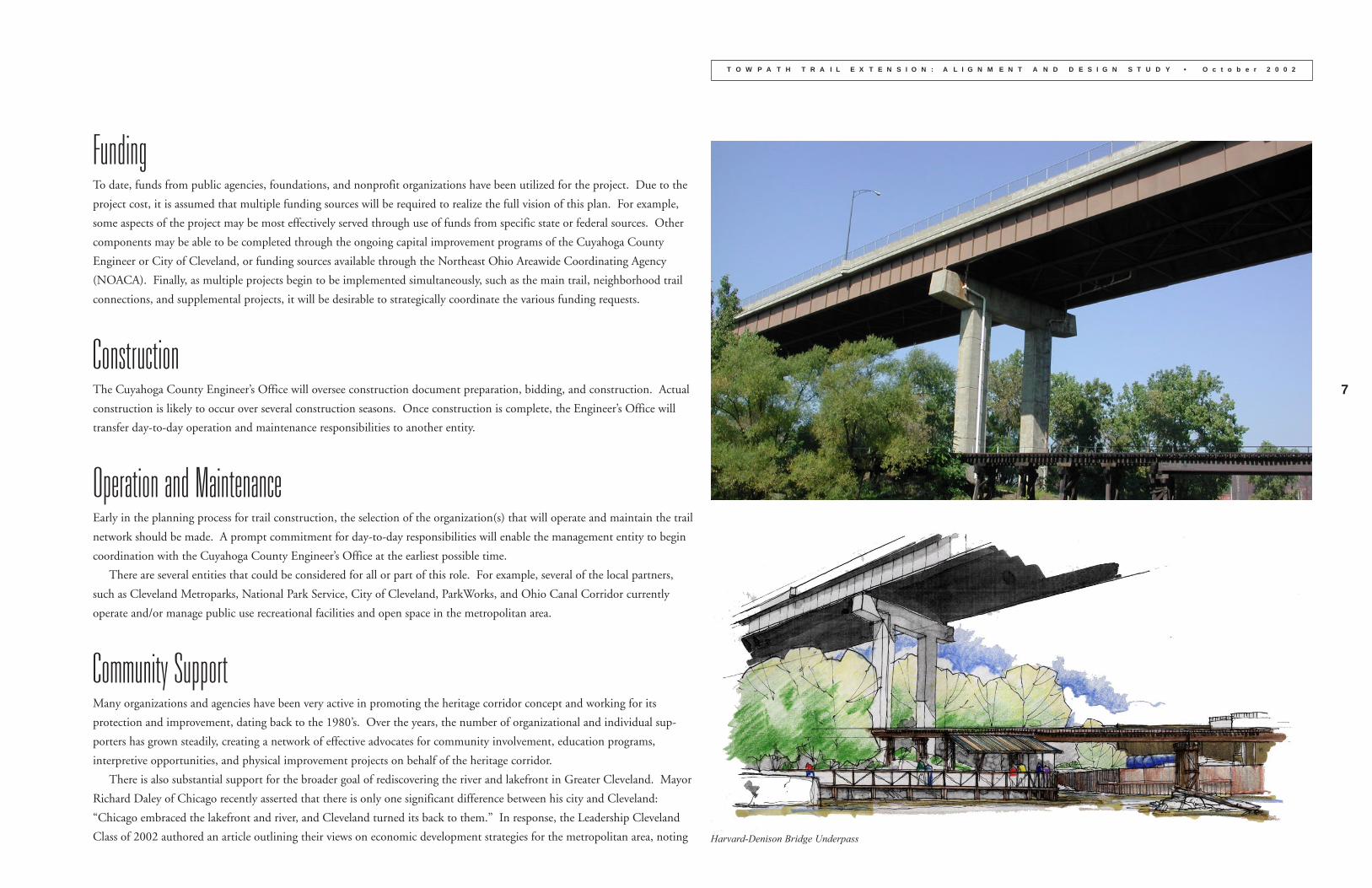
Class of 2002 authored an article outlining their views on economic development strategies for the metropolitan area, noting Harvard-Denison Bridge Underpass
8
T O W P A T H T R A I L E X T E N S I O N : A L I G N M E N T A N D D E S I G N S T U D Y • O c t o b e r 2 0 0 2
the importance of “bike paths, beaches and open space along Lake Erie and the Cuyahoga River. Our water can attract tourism,
and it can be a driver of business. Our water will—with Northeast Ohioans’ support—bring new life to this region.”
This continued effort and support at all levels remains crucial for the realization of the Towpath Trail Extension and supple-
mental projects.
StewardshipThe Towpath Trail Extension project area is brimming with distinctive cultural and natural resources. The stewardship of these
resources will be critical to the ongoing success of the Towpath Trail as a heritage, recreational, and environmental amenity.
The Environmental Regeneration section of the study offers solutions for addressing many of the environmental issues of the
area. These strategies can improve areas intended to remain as open space and be used in coordination with development
projects. In turn, environmental regeneration should be one of the ongoing interpretive themes for the valley.
Although environmental regulations exist at the state and federal levels through agencies such as the Army Corps of Engineers
and the Environmental Protection Agency, local initiatives, particularly within the City of Cleveland, will have a major influence
on the future of the natural and built environments in the project area and adjacent neighborhoods. Existing or future ordi-
nances, programs, and guidelines need to address issues such as protection of environmentally sensitive areas, retention of
neighborhood character, and encouragement of economic development in a manner compatible with both the neighborhoods
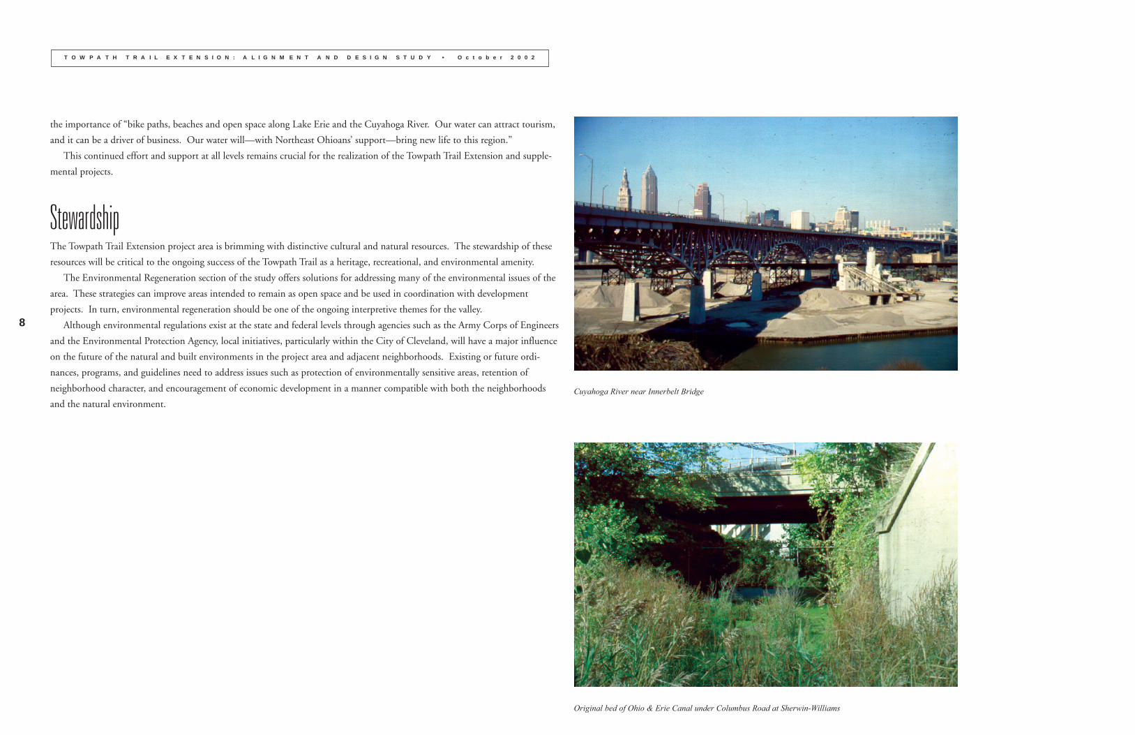
and the natural environment.Cuyahoga River near Innerbelt Bridge
Original bed of Ohio & Erie Canal under Columbus Road at Sherwin-Williams
9
T O W P A T H T R A I L E X T E N S I O N : A L I G N M E N T A N D D E S I G N S T U D Y • O c t o b e r 2 0 0 2
Steering CommitteeAs part of this study, the Cuyahoga County Planning Commission (CPC) established a Steering Committee, whose role
was to provide perspective to CPC concerning issues relevant to the accomplishment of the overall project. The CPC
would like to thank the Steering Committee members for their contributions.
PUBLIC AGENCIES
City of Cleveland Planning Commission, Martin Cader, George Cantor, and Linda Henrichsen
Cleveland Metroparks, Steve Coles, Chief of Planning
Cuyahoga County Engineer, Lenora M. Lockett, P.E., Transportation/Planning Engineer
National Park Service, Dave Humphrey, Chief, Technical Assistance & Prof. Services Div., Cuyahoga Valley National Park
NONPROFIT ORGANIZATIONS
Ohio Canal Corridor, Tim Donovan, Executive Director
ParkWorks, Barb Clint, Director, Programs & Special Projects
NONPROFIT DEVELOPMENT CORPORATIONS
Flats Industry, Jim Cox
Flats Oxbow Association, Jim Pressler, Executive Director
Ohio City Near West Development Corporation, John Wilbur, Executive Director
Old Brooklyn Community Development Corporation, Brian Cummins, Executive Director
Tremont West Development Corporation, Emily Lipovan Holan, Executive Director
In addition, CPC would like to thank the property owners, businesspersons, public agencies, elected officials, and
nonprofit and neighborhood organizations who provided input during the project.
PROJECT FUNDERS
City of Cleveland
The Cleveland Foundation
Cleveland Metroparks
Cuyahoga County Board of Commissioners
The George Gund Foundation
Ohio & Erie Canal Association
CONSULTANT TEAM
schmidtcopelandparkerstevens
Environmental Design Group
Parsons Brinckerhoff Ohio
Adache Ciuni Lynn Associates, Inc.
Carol Poh Miller
Cleveland Public Art
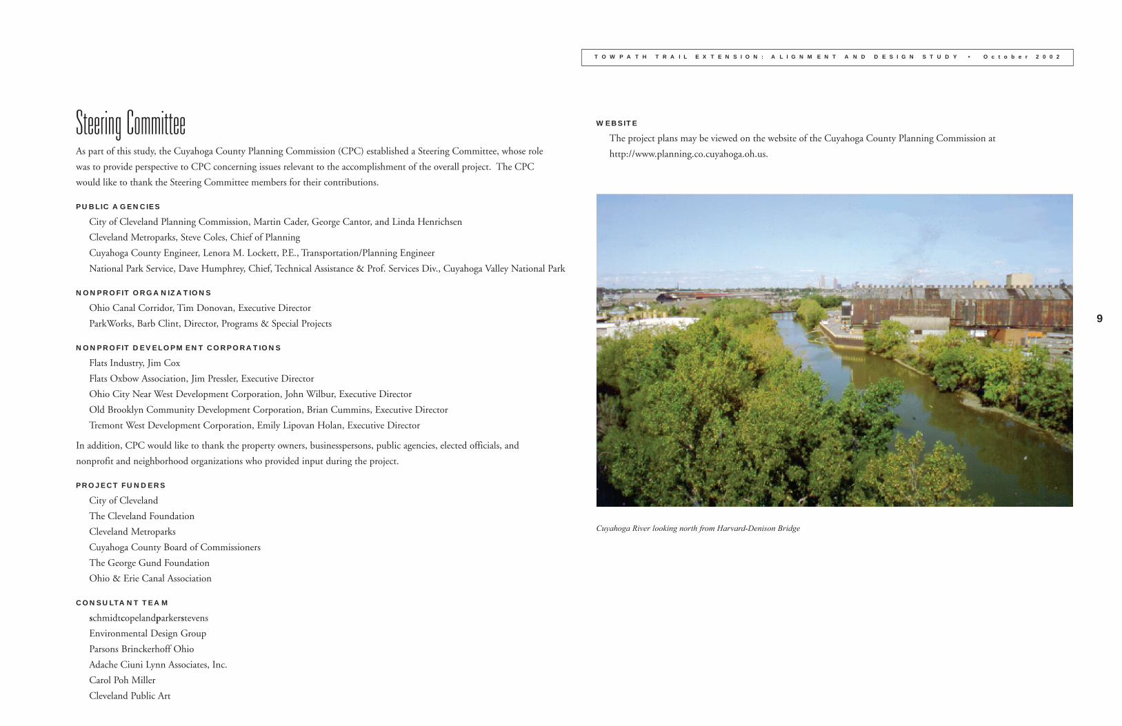
Cuyahoga River looking north from Harvard-Denison Bridge
WEBSITE
The project plans may be viewed on the website of the Cuyahoga County Planning Commission at
http://www.planning.co.cuyahoga.oh.us.