Embed Size (px)
Citation preview
Transit “New Starts”Background and Status
Transit Task ForceMontgomery County
March 2011
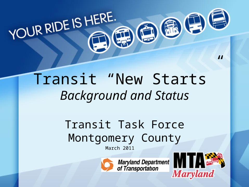
What is “New Starts”?
• Federal program to fund new transit projects• FTA requires project sponsors to follow a rigorous
evaluation process that results in an overall project rating
• Primarily focused on– Project benefits– Project readiness– Ability of the project sponsor to carry out the project
• Typically matched at <50%• Funding decisions made by Congress – national
competition
2
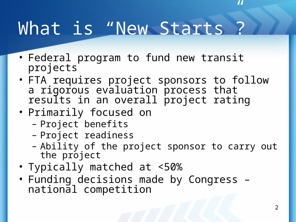
New Start Development Process
Final Design
Construction
Preliminary Engineering/Final EIS
Locally Preferred Alternative
Entry into PE
Entry into Final Design
Full Funding Grant Agreement
FTA Decision Point
Major Development Stage
Systems Planning
Alternatives Analysis/Draft EIS
Pro
ject
Ma
na
ge
me
nt
Ove
rsig
ht
3
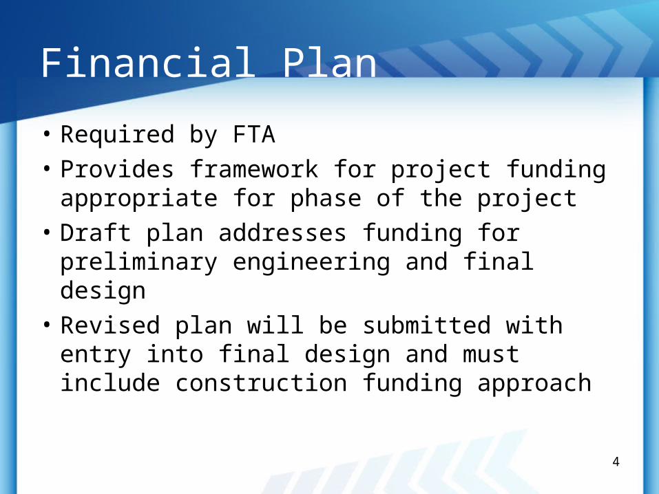
Financial Plan
• Required by FTA
• Provides framework for project funding appropriate for phase of the project
• Draft plan addresses funding for preliminary engineering and final design
• Revised plan will be submitted with entry into final design and must include construction funding approach
4
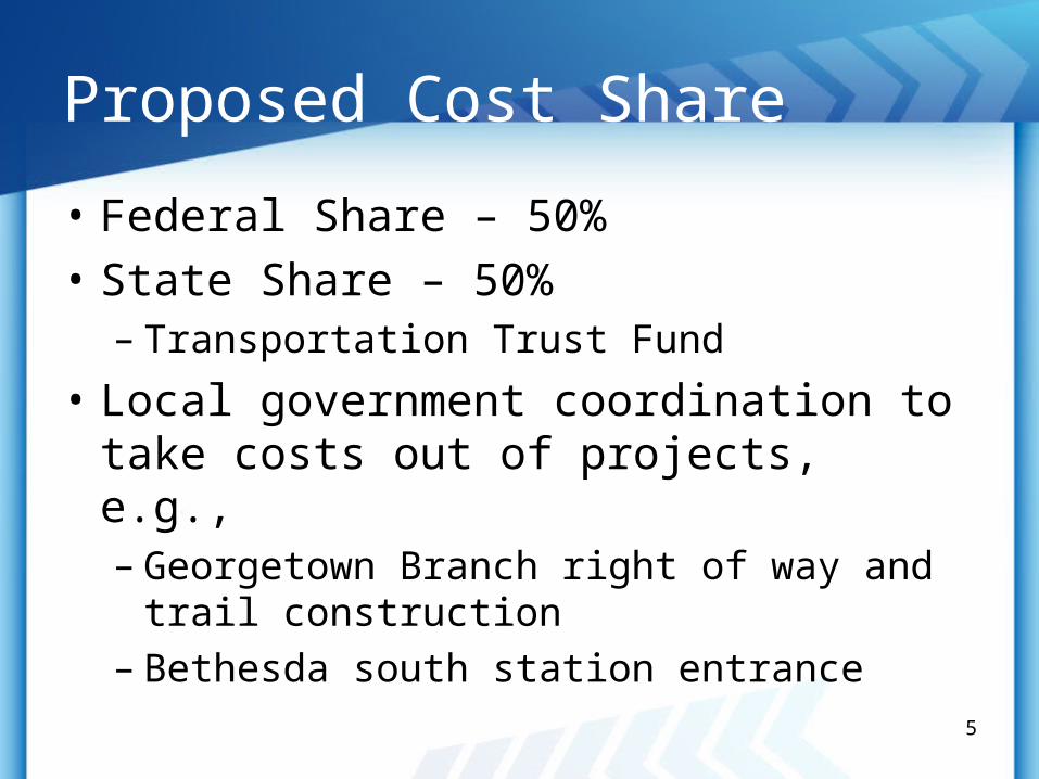
Proposed Cost Share
• Federal Share – 50%
• State Share – 50%– Transportation Trust Fund
• Local government coordination to take costs out of projects, e.g., – Georgetown Branch right of way and trail
construction– Bethesda south station entrance
5
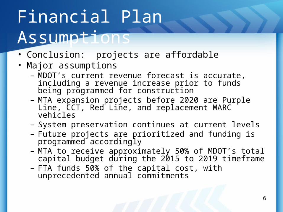
Financial Plan Assumptions
• Conclusion: projects are affordable• Major assumptions
– MDOT’s current revenue forecast is accurate, including a revenue increase prior to funds being programmed for construction
– MTA expansion projects before 2020 are Purple Line, CCT, Red Line, and replacement MARC vehicles
– System preservation continues at current levels– Future projects are prioritized and funding is programmed
accordingly– MTA to receive approximately 50% of MDOT’s total capital
budget during the 2015 to 2019 timeframe– FTA funds 50% of the capital cost, with unprecedented
annual commitments
6
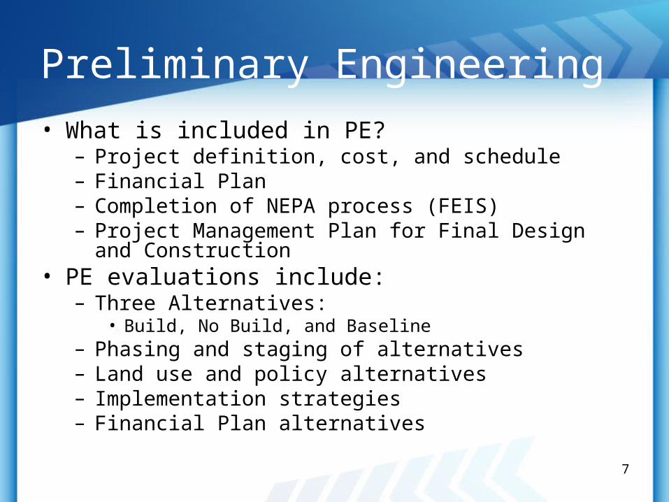
Preliminary Engineering
• What is included in PE?– Project definition, cost, and schedule– Financial Plan– Completion of NEPA process (FEIS)– Project Management Plan for Final Design and
Construction• PE evaluations include:
– Three Alternatives:• Build, No Build, and Baseline
– Phasing and staging of alternatives– Land use and policy alternatives– Implementation strategies– Financial Plan alternatives
7
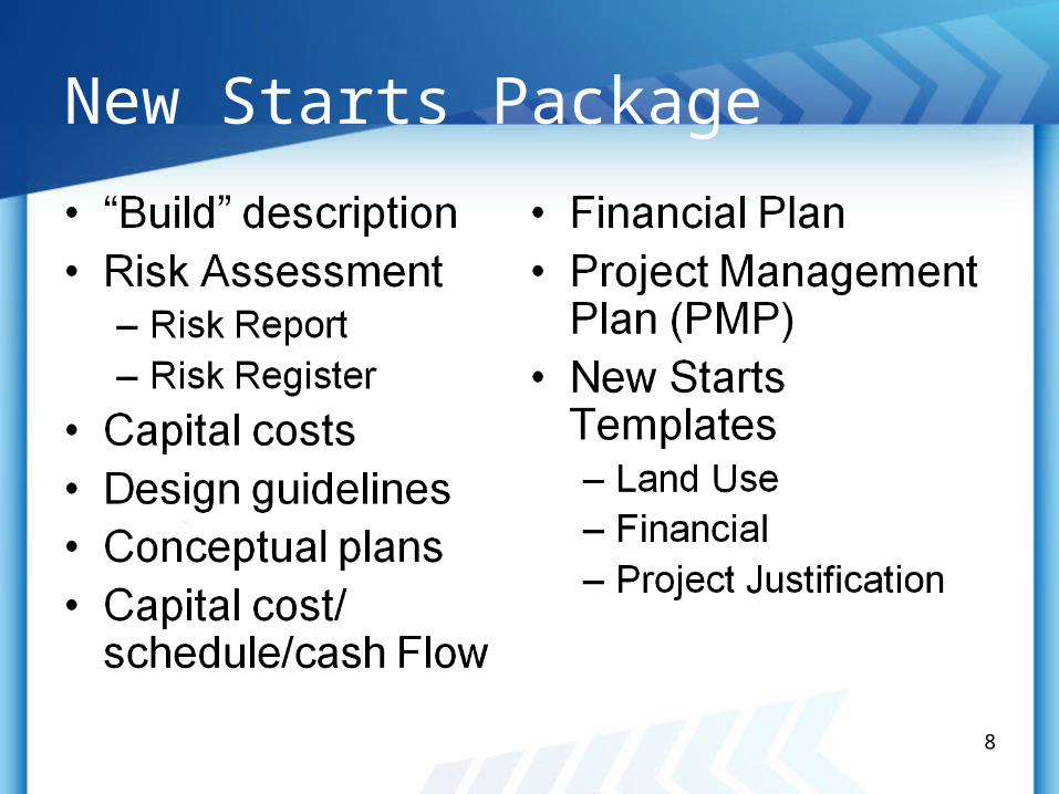
New Starts Package
8
9
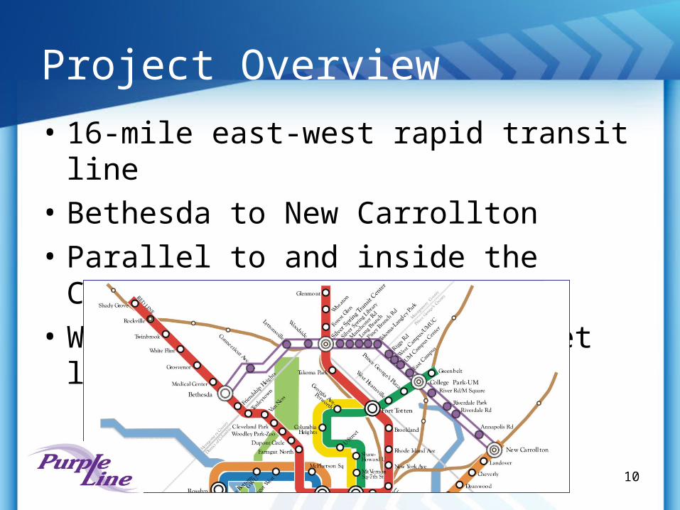
Project Overview
• 16-mile east-west rapid transit line
• Bethesda to New Carrollton
• Parallel to and inside the Capital Beltway
• Will operate mostly at street level
10
Project Goals• Faster and more reliable transit for east-west travel market• Improve access to and connectivity to Metrorail, MARC,
Amtrak, and bus services • Serve transit-dependent populations• Support local, regional and state policies and adopted Master
Plans• Strengthen and revitalize communities in the corridor• Increase potential for Transit Oriented Development at
existing and proposed stations in the corridor• Improve access to existing activity centers including and
planned commercial, office, and residential development in Bethesda, Silver Spring, Takoma/Langley, University of Maryland/College Park, and New Carrollton
11
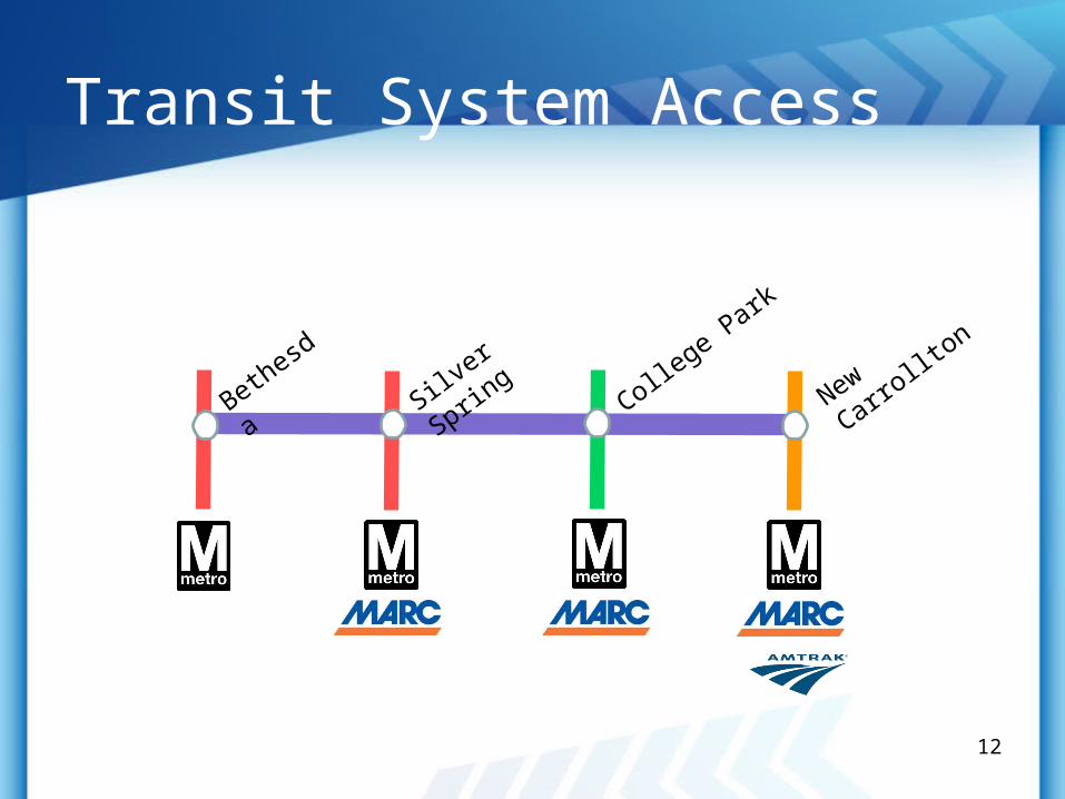
Transit System Access
Bethesda
Silver S
pring
College P
ark
New Carro
llton
12
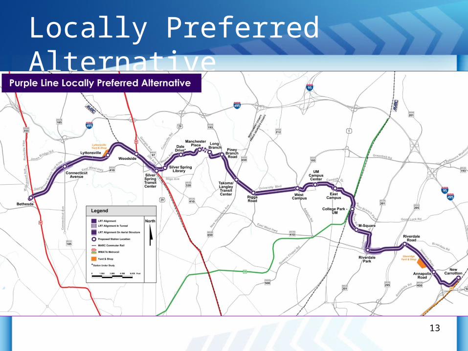
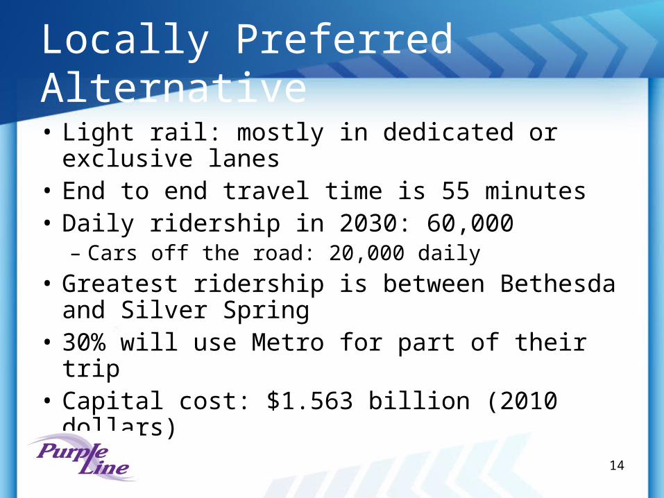
Locally Preferred Alternative
13
Locally Preferred Alternative
• Light rail: mostly in dedicated or exclusive lanes
• End to end travel time is 55 minutes• Daily ridership in 2030: 60,000
– Cars off the road: 20,000 daily
• Greatest ridership is between Bethesda and Silver Spring
• 30% will use Metro for part of their trip• Capital cost: $1.563 billion (2010 dollars)
14
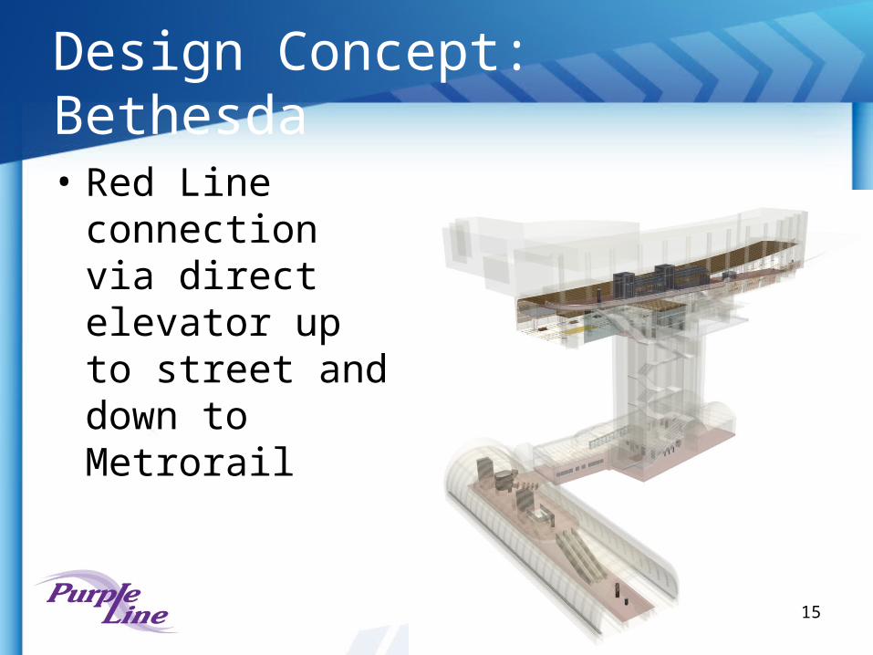
Design Concept: Bethesda
• Red Line connection via direct elevator up to street and down to Metrorail
15
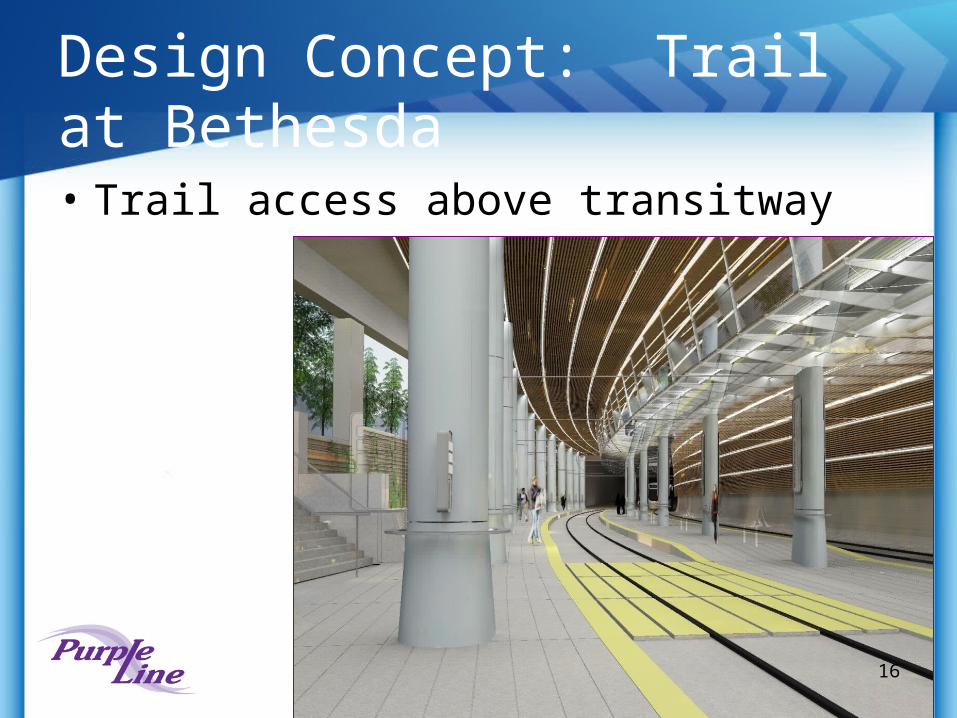
Design Concept: Trail at Bethesda• Trail access above transitway
16
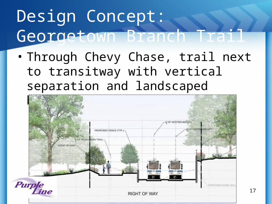
Design Concept: Georgetown Branch Trail• Through Chevy Chase, trail next to
transitway with vertical separation and landscaped buffer
17
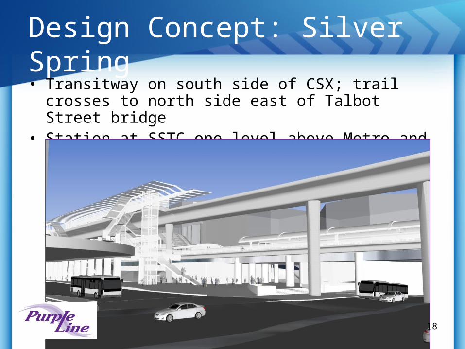
Design Concept: Silver Spring• Transitway on south side of CSX; trail crosses to north
side east of Talbot Street bridge• Station at SSTC one level above Metro and MARC trains
18
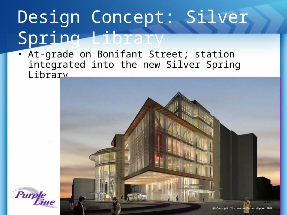
Design Concept: Silver Spring Library• At-grade on Bonifant Street; station integrated into the
new Silver Spring Library
19
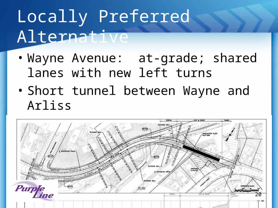
Locally Preferred Alternative
• Wayne Avenue: at-grade; shared lanes with new left turns
• Short tunnel between Wayne and Arliss
• Piney Branch: median operation
20
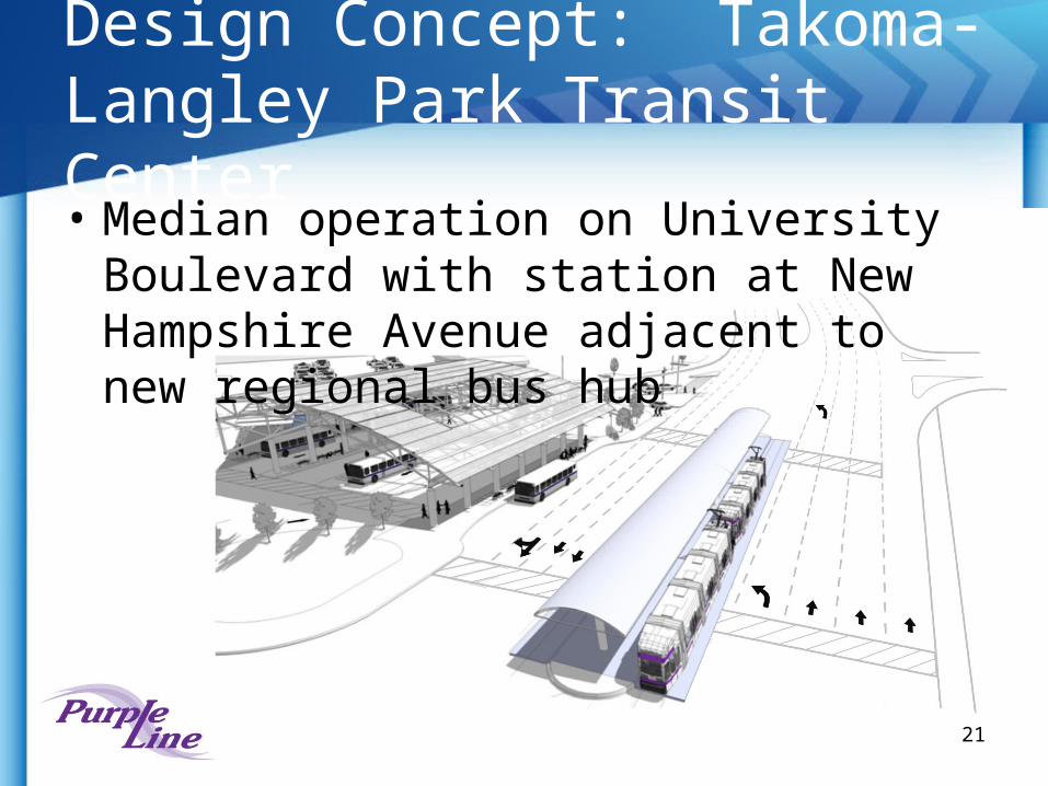
Design Concept: Takoma-Langley Park Transit Center• Median operation on University Boulevard
with station at New Hampshire Avenue adjacent to new regional bus hub
21
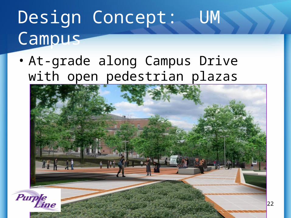
Design Concept: UM Campus
• At-grade along Campus Drive with open pedestrian plazas
22
Locally Preferred Alternative
• Paint Branch Parkway: shared lanes under CSX/Metro• Integrated into the new development at the College
Park Metrorail Station• River Road: dedicated lanes on south side• Kenilworth Avenue: elevated aerial structure, crossing
over the MD 410 intersection• Aerial station in Riverdale Park• MD 410: returns to grade, dedicated right of way on
south side• Veterans Parkway: dedicated right of way on south
side • South side of Ellin Road into New Carrollton Station
23

Public Involvement
• Open houses• Community Focus Groups• Small Group Workshops• Community and civic association meetings• Community outreach events
– Libraries, grocery stores, shopping centers
• www.purplelinemd.com• Newsletters
24
Upcoming Coordination
• Resource agencies• CSX and utilities• Review of development proposals• Montgomery County (Bethesda Station,
Capital Crescent Trail, Takoma/Langley Sector Plan, Takoma/Langley Transit Center)
• Prince George’s County (MD 410, East Campus, River Road, Takoma/Langley Sector Plan)
25
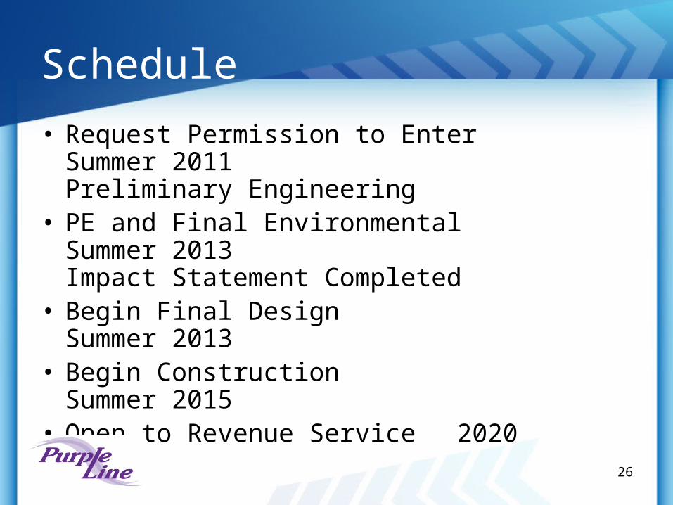
Schedule
• Request Permission to Enter Summer 2011 Preliminary Engineering
• PE and Final Environmental Summer 2013 Impact Statement Completed
• Begin Final Design Summer 2013
• Begin Construction Summer 2015
• Open to Revenue Service 202026
27
Project Overview
• Part of the I-270/US 15 Multi-Modal Corridor Study• Planning studies ongoing since 1990s• Completed Environmental Documents and held Public
Hearings– 2002 Draft Environmental Impact Statement– 2009 Alternatives Analysis/Environmental Assessment– 2010 Supplemental Environmental Analysis (SEA)
• Highway Improvements - 30 miles• Transit Improvements - 13-15 miles• Light Rail Transit (LRT) or Bus Rapid Transit (BRT)
28
Alternatives Evaluation
• Alternative 1: No-Build • Alternative 2: TSM • Alternatives 3A/B, 4A/B, 5A/B/C, 6A/B and 7A/B
– Various highway lanes configurations, including general purpose lanes and managed lanes (HOV or ETL)
– Transit options• “A” – light rail transit on original Master Plan alignment• “B” – bus rapid transit on Original Master Plan alignment• “C” – premium bus service on managed lanes
• Additional Transit Alternatives were evaluated as part of the 2010 SEA– Crown Farm– Life Sciences Center– Kentlands
29
Key Features
• 15 stations+3 as needed for development
• Exclusive running way
• End to end travel time is 44-48 minutes
• Transit transfers to MARC (Metro. Grove) and Red Line (Shady Grove)
• Access from local streets, I-270 interchanges, and direct access ramps
30
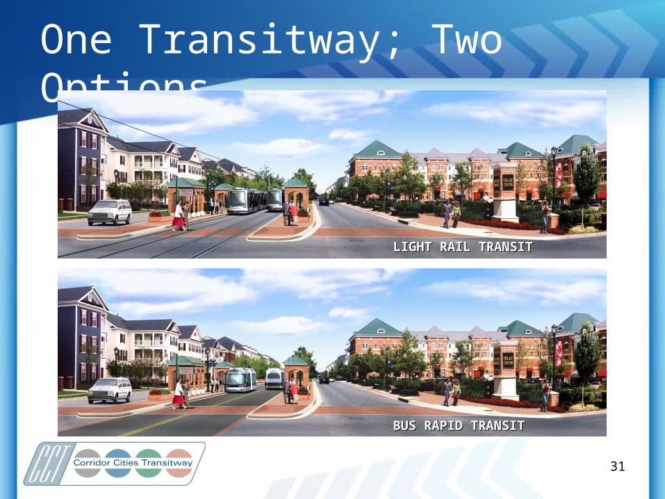
One Transitway; Two Options
LIGHT RAIL TRANSITLIGHT RAIL TRANSIT
BUS RAPID TRANSITBUS RAPID TRANSIT
31
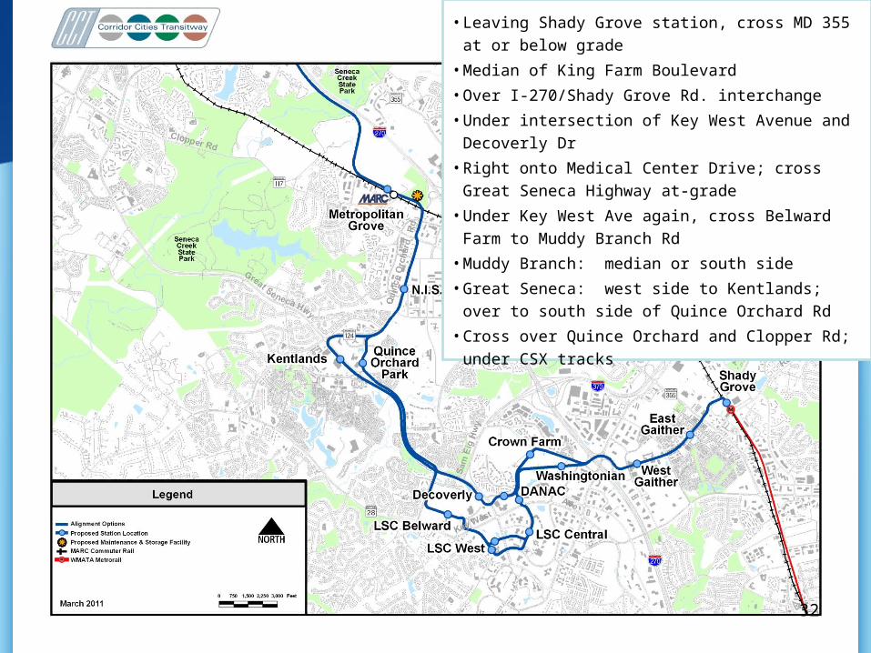
• Leaving Shady Grove station, cross MD 355 at or below
grade
• Median of King Farm Boulevard
• Over I-270/Shady Grove Rd. interchange
• Under intersection of Key West Avenue and Decoverly Dr
• Right onto Medical Center Drive; cross Great Seneca
Highway at-grade
• Under Key West Ave again, cross Belward Farm to
Muddy Branch Rd
• Muddy Branch: median or south side
• Great Seneca: west side to Kentlands; over to south side
of Quince Orchard Rd
• Cross over Quince Orchard and Clopper Rd; under CSX
tracks
32
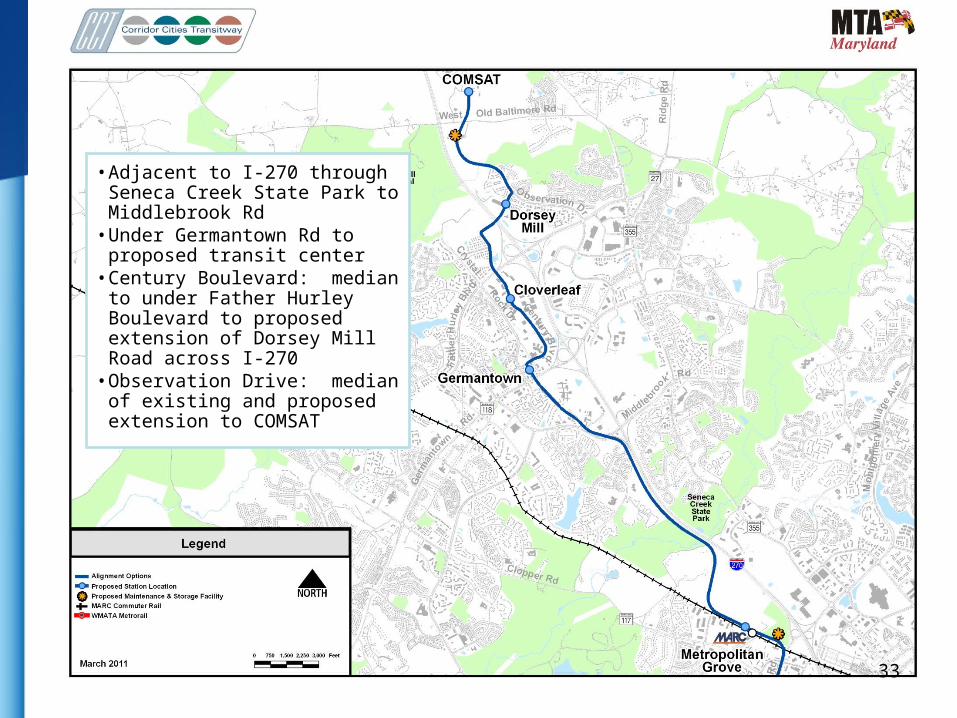
• Adjacent to I-270 through Seneca Creek State Park to Middlebrook Rd
• Under Germantown Rd to proposed transit center
• Century Boulevard: median to under Father Hurley Boulevard to proposed extension of Dorsey Mill Road across I-270
• Observation Drive: median of existing and proposed extension to COMSAT
33
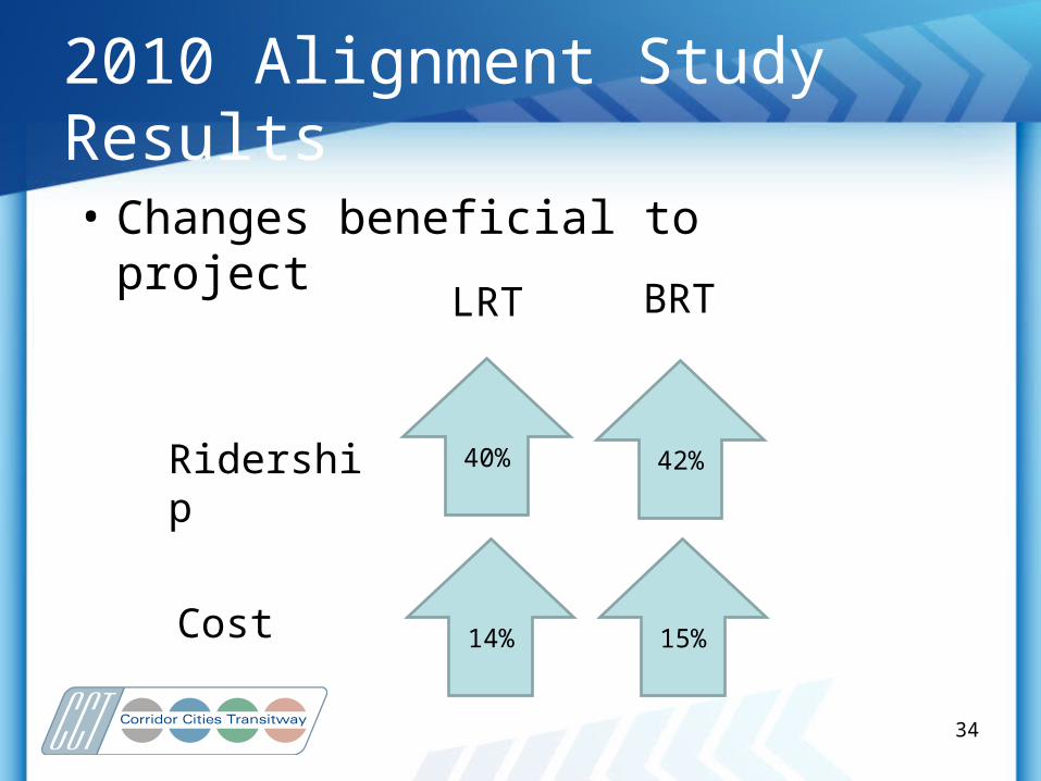
2010 Alignment Study Results
• Changes beneficial to project
40%
15%14%
42%Ridership
Cost
BRTLRT
34
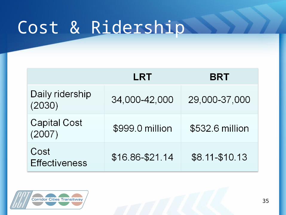
Cost & Ridership
35
Right-of-Way Status
• Approximately 35% lies within publicly controlled land
• Additional 25% has right-of-way protection through reservation or easement
• Remaining 40% has no protections at this time
36
Next Step –Transit Only
• Full proposed highway improvements by 2030 not feasible
• Highway and transit on separate schedules– Highway: Additional studies, Tiered FEIS
approach, break-out projects
– Transit: Select Locally Preferred Alternative (LPA); proceed with FTA New Starts process
• Close coordination between highway and transit studies to continue
37
Locally Preferred Alternative
• Mode Selection – Bus Rapid Transit or Light Rail Transit
• Alternative alignments and environmental impacts• Public Hearing review – evaluate concerns:
– Citizen/community groups– Montgomery County Government– FTA/FHWA– Environmental agencies
• Funding/Affordability• Phasing options
38
Public Outreach
• Ongoing meetings with area community associations, business groups, and local officials
• Enhanced coordination with the City of Rockville and King Farm residents
• www.mta.maryland.gov/cct
• Newsletters
39
Schedule
• Select Preferred Alternative Spring 2011• Request Permission to Enter Fall 2011
Preliminary Engineering
• PE and Final Environmental Fall 2013 Impact Statement Completed
• Begin Final Design Winter 2013/14
• Begin Construction 2014/15
40


![COUNTY COUNCIL FOR MONTGOMERY COUNTY, · PDF fileGermantown Transit Mixed Use (GTMU), 27 [i] j. Montgomery Village (MV), Zoning Text Amendment No.: 16-20 with Staff proposed amendments](https://img.pdfslide.net/doc/110x75/5a9d7c897f8b9a21688b9461/county-council-for-montgomery-county-germantown-transit-mixed-use-gtmu.jpg)