Embed Size (px)
DESCRIPTION
A green environment tinged with black
Citation preview
Artist’s impression
2
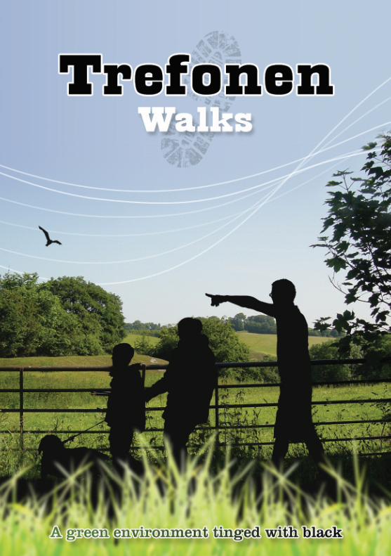
It was not always like thisThe green environment of Trefonen wasonce tinged with the black of coal.
What would have been its impact on thevillage and surrounding countryside?
The walks which follow give you thechance to begin to explore our heritage.
All walks start from the car park of Trefonen Queen Elizabeth II Jubilee Field,off the road running from Oswestry toTrefonen. Trefonen Field is the site of the‘heritage area’. Look at the interpretationpanel next to the car park. You mightwell wonder what the grindstones next toit were used for. And what about themound ahead of you across the Field?
The mound is the spoil heap from TrefonenNo 1 coal mine. The Old Trefonen Collierywas active from 1869 to 1880 and was runby the Trefonen Coal Company.
The shaft is now sealed near the top butwould have been over 250 feet deep. Themine was eventually closed because ofcontinual flooding.
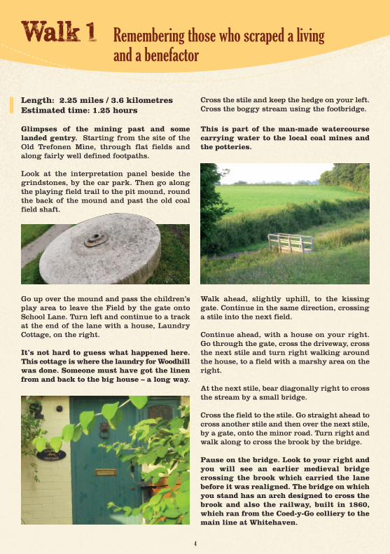
The three large grinding stones, made ofCornish granite, were used to grind theclay, a by-product of the mining and usedin the local pottery industry.
On the side of the mound you will see alone miner, hacking his way into a coalseam. Another miner, on top of the mound,looking over the former coal field site,guards a second interpretation panel, givingyou glimpses of what life was like.
The shaft, at the back of the mound, is nowsurrounded by a beautifully sculpturedfence and nearby is an old coal tub.
Start
3
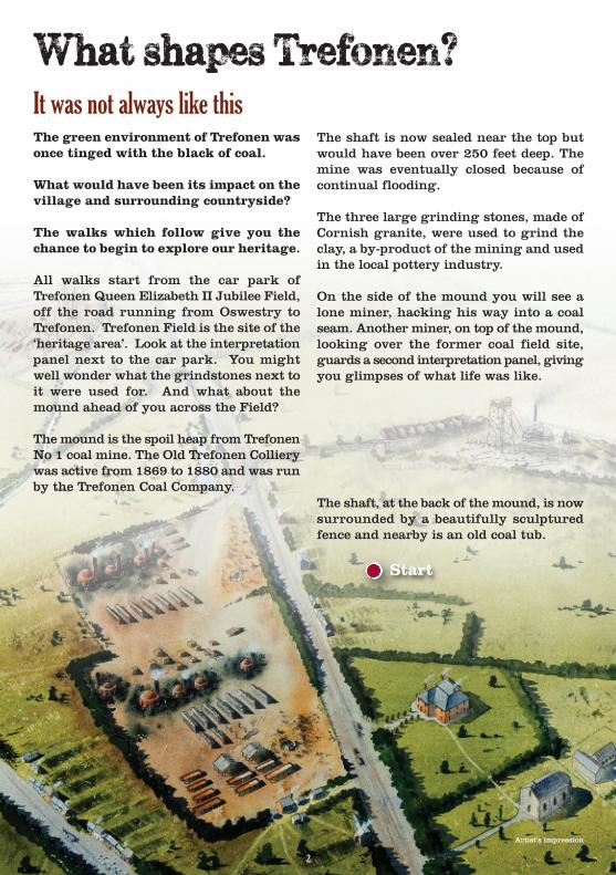
Trefonen FieldThe Field, where the walks start, has recently been significantly developed bythe community, working in partnershipwith Shropshire Council. Local peoplehave fund-raised and secured grants forthe projects on the Field, which now has QE II Jubilee status, granted in 2012.
None of these walks comes into the‘strenuous’ category, but any such outdoor activity and exercise should beembarked on after careful considerationand preparation.
People should consider how fit they are,what the demands of the walk will be, andthe prevailing weather conditions.
Boots or stout shoes should be worn, andwarm and waterproof clothing carried.Around the Trefonen area there are ruralpaths, fields, open countryside and hills.
Stiles are a feature of all these walks.
Several walks follow Offa's Dyke Path fora while; this long-distance path is markedby an acorn symbol.
All walks will be found on the OS ExplorermapTM Sheet 240. Each one can be separately downloaded from the website: www.trefonen.info
The Country Code should be observed:● Be safe – plan ahead, follow any signs and carry a map or guide.
● Leave gates shut and property as you find it.
● Protect wild life, plants and animals.
● Take litter home.
● Keep dogs under close control.
● Consider other people, particularly farmers whose livelihood depends on the land.
If there is a footpath problem in Shropshire it should be reported to:
The Outdoor Recreation Team:[email protected] customer contact centre 0345 678 9000Shropshire CouncilOutdoor RecreationShirehall, Abbey ForegateShrewsburyShropshireSY2 6ND
More detailed information about the history of the area will be found on thewebsite: www.trefonen.info
Remembering those who scraped a living and a benefactor
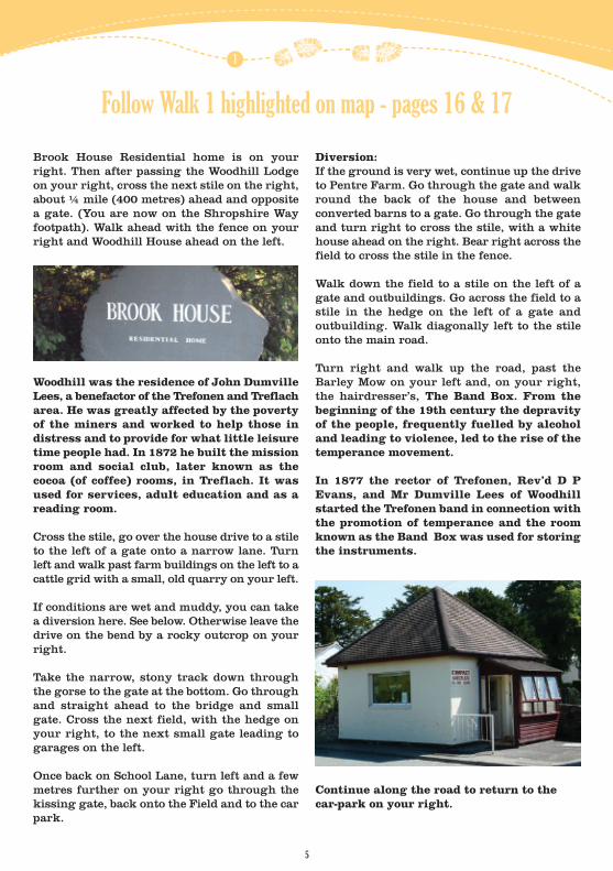
Cross the stile and keep the hedge on your left.Cross the boggy stream using the footbridge.
This is part of the man-made watercoursecarrying water to the local coal mines andthe potteries.
Walk ahead, slightly uphill, to the kissinggate. Continue in the same direction, crossinga stile into the next field.
Continue ahead, with a house on your right.Go through the gate, cross the driveway, crossthe next stile and turn right walking aroundthe house, to a field with a marshy area on theright.
At the next stile, bear diagonally right to crossthe stream by a small bridge.
Cross the field to the stile. Go straight ahead tocross another stile and then over the next stile,by a gate, onto the minor road. Turn right andwalk along to cross the brook by the bridge.
Pause on the bridge. Look to your right andyou will see an earlier medieval bridgecrossing the brook which carried the lane before it was realigned. The bridge on whichyou stand has an arch designed to cross thebrook and also the railway, built in 1860,which ran from the Coed-y-Go colliery to themain line at Whitehaven.
Length: 2.25 miles / 3.6 kilometresEstimated time: 1.25 hours
Glimpses of the mining past and somelanded gentry. Starting from the site of theOld Trefonen Mine, through flat fields andalong fairly well defined footpaths.
Look at the interpretation panel beside thegrindstones, by the car park. Then go alongthe playing field trail to the pit mound, roundthe back of the mound and past the old coalfield shaft.
Go up over the mound and pass the children’splay area to leave the Field by the gate ontoSchool Lane. Turn left and continue to a trackat the end of the lane with a house, LaundryCottage, on the right.
It’s not hard to guess what happened here.This cottage is where the laundry for Woodhillwas done. Someone must have got the linenfrom and back to the big house – a long way.
4
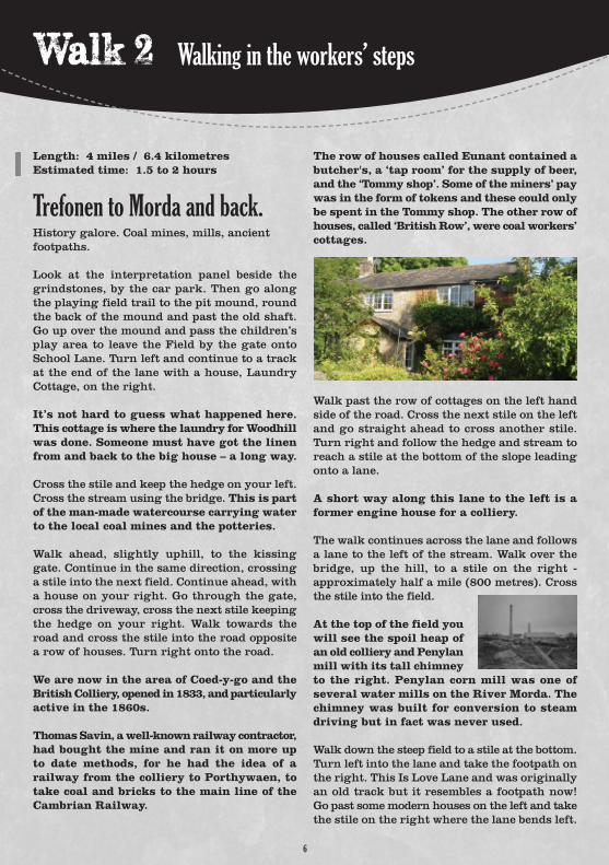
Brook House Residential home is on yourright. Then after passing the Woodhill Lodgeon your right, cross the next stile on the right,about ¼ mile (400 metres) ahead and oppositea gate. (You are now on the Shropshire Way footpath). Walk ahead with the fence on yourright and Woodhill House ahead on the left.
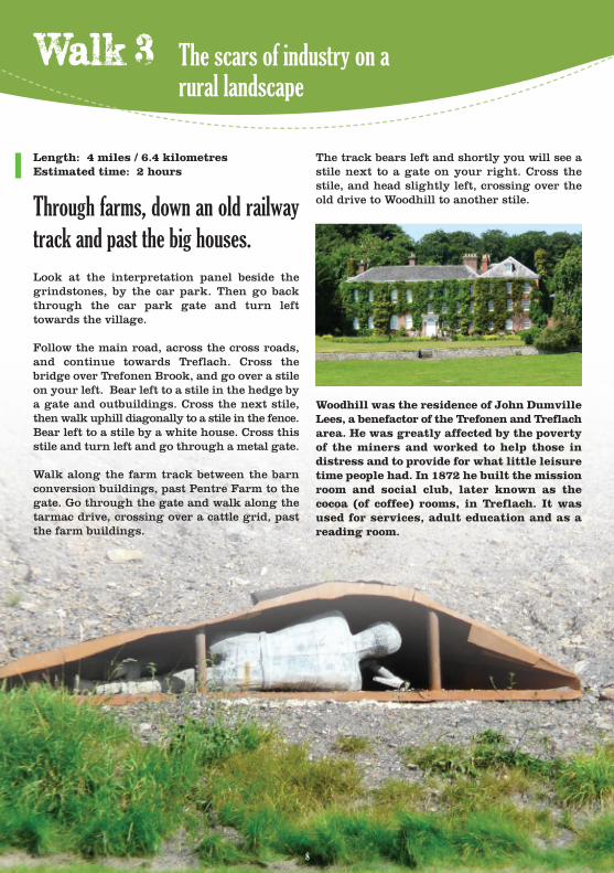
Woodhill was the residence of John DumvilleLees, a benefactor of the Trefonen and Treflacharea. He was greatly affected by the povertyof the miners and worked to help those indistress and to provide for what little leisuretime people had. In 1872 he built the missionroom and social club, later known as thecocoa (of coffee) rooms, in Treflach. It wasused for services, adult education and as areading room.
Cross the stile, go over the house drive to a stileto the left of a gate onto a narrow lane. Turnleft and walk past farm buildings on the left to acattle grid with a small, old quarry on your left.
If conditions are wet and muddy, you can takea diversion here. See below. Otherwise leave thedrive on the bend by a rocky outcrop on yourright.
Take the narrow, stony track down throughthe gorse to the gate at the bottom. Go throughand straight ahead to the bridge and smallgate. Cross the next field, with the hedge onyour right, to the next small gate leading togarages on the left.
Once back on School Lane, turn left and a fewmetres further on your right go through thekissing gate, back onto the Field and to the carpark.
Diversion:If the ground is very wet, continue up the driveto Pentre Farm. Go through the gate and walkround the back of the house and between converted barns to a gate. Go through the gateand turn right to cross the stile, with a whitehouse ahead on the right. Bear right across thefield to cross the stile in the fence.
Walk down the field to a stile on the left of agate and outbuildings. Go across the field to astile in the hedge on the left of a gate and outbuilding. Walk diagonally left to the stileonto the main road.
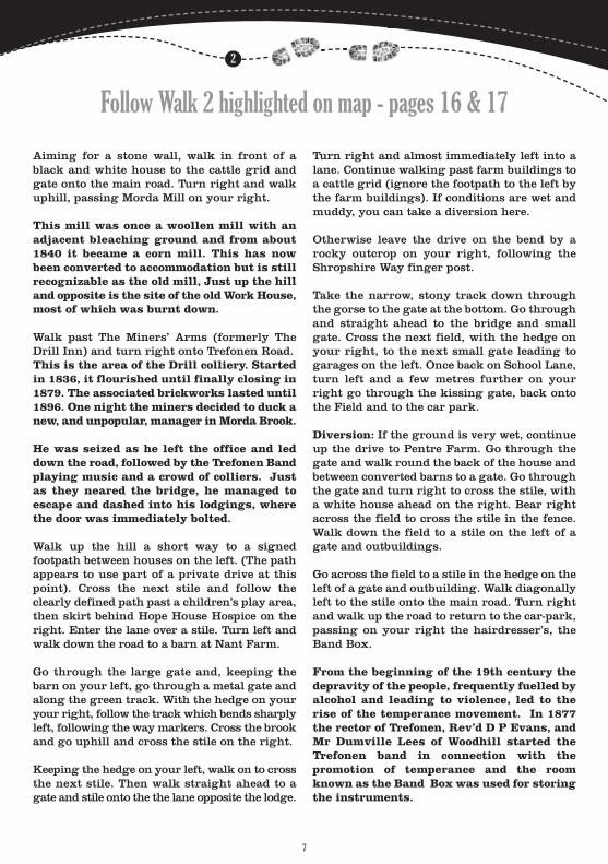
Turn right and walk up the road, past the Barley Mow on your left and, on your right,the hairdresser’s, The Band Box. From the beginning of the 19th century the depravityof the people, frequently fuelled by alcoholand leading to violence, led to the rise of thetemperance movement.
In 1877 the rector of Trefonen, Rev’d D PEvans, and Mr Dumville Lees of Woodhillstarted the Trefonen band in connection withthe promotion of temperance and the roomknown as the Band Box was used for storingthe instruments.
Continue along the road to return to the car-park on your right.
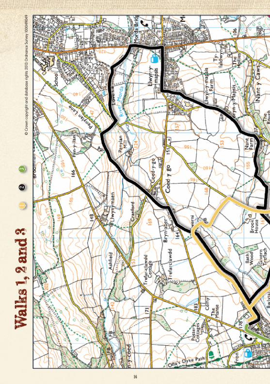
Follow Walk 1 highlighted on map - pages 16 & 17
1
5
Walking in the workers’ steps
6
The row of houses called Eunant contained abutcher's, a ‘tap room’ for the supply of beer,and the ‘Tommy shop’. Some of the miners’ paywas in the form of tokens and these could onlybe spent in the Tommy shop. The other row ofhouses, called ‘British Row’, were coal workers’cottages.
Walk past the row of cottages on the left handside of the road. Cross the next stile on the leftand go straight ahead to cross another stile.Turn right and follow the hedge and stream toreach a stile at the bottom of the slope leadingonto a lane.
A short way along this lane to the left is aformer engine house for a colliery.
The walk continues across the lane and followsa lane to the left of the stream. Walk over thebridge, up the hill, to a stile on the right - approximately half a mile (800 metres). Crossthe stile into the field.
At the top of the field youwill see the spoil heap ofan old colliery and Penylanmill with its tall chimneyto the right. Penylan corn mill was one ofseveral water mills on the River Morda. Thechimney was built for conversion to steamdriving but in fact was never used.
Walk down the steep field to a stile at the bottom.Turn left into the lane and take the footpath onthe right. This Is Love Lane and was originallyan old track but it resembles a footpath now!Go past some modern houses on the left and takethe stile on the right where the lane bends left.
Length: 4 miles / 6.4 kilometresEstimated time: 1.5 to 2 hours
Trefonen to Morda and back.History galore. Coal mines, mills, ancient footpaths.
Look at the interpretation panel beside thegrindstones, by the car park. Then go alongthe playing field trail to the pit mound, roundthe back of the mound and past the old shaft.Go up over the mound and pass the children’splay area to leave the Field by the gate ontoSchool Lane. Turn left and continue to a trackat the end of the lane with a house, LaundryCottage, on the right.
It’s not hard to guess what happened here.This cottage is where the laundry for Woodhillwas done. Someone must have got the linenfrom and back to the big house – a long way.
Cross the stile and keep the hedge on your left.Cross the stream using the bridge. This is partof the man-made watercourse carrying waterto the local coal mines and the potteries.
Walk ahead, slightly uphill, to the kissinggate. Continue in the same direction, crossinga stile into the next field. Continue ahead, witha house on your right. Go through the gate,cross the driveway, cross the next stile keepingthe hedge on your right. Walk towards theroad and cross the stile into the road oppositea row of houses. Turn right onto the road.
We are now in the area of Coed-y-go and theBritish Colliery, opened in 1833, and particularlyactive in the 1860s.
Thomas Savin, a well-known railway contractor,had bought the mine and ran it on more upto date methods, for he had the idea of a railway from the colliery to Porthywaen, totake coal and bricks to the main line of theCambrian Railway.
Follow Walk 2 highlighted on map - pages 16 & 17
2
7
Aiming for a stone wall, walk in front of ablack and white house to the cattle grid andgate onto the main road. Turn right and walkuphill, passing Morda Mill on your right.
This mill was once a woollen mill with anadjacent bleaching ground and from about1840 it became a corn mill. This has nowbeen converted to accommodation but is stillrecognizable as the old mill, Just up the hilland opposite is the site of the old Work House,most of which was burnt down.
Walk past The Miners’ Arms (formerly TheDrill Inn) and turn right onto Trefonen Road.This is the area of the Drill colliery. Startedin 1836, it flourished until finally closing in1879. The associated brickworks lasted until1896. One night the miners decided to duck anew, and unpopular, manager in Morda Brook.
He was seized as he left the office and leddown the road, followed by the Trefonen Bandplaying music and a crowd of colliers. Justas they neared the bridge, he managed to escape and dashed into his lodgings, wherethe door was immediately bolted.
Walk up the hill a short way to a signed footpath between houses on the left. (The pathappears to use part of a private drive at thispoint). Cross the next stile and follow theclearly defined path past a children’s play area,then skirt behind Hope House Hospice on theright. Enter the lane over a stile. Turn left andwalk down the road to a barn at Nant Farm.
Go through the large gate and, keeping thebarn on your left, go through a metal gate andalong the green track. With the hedge on youryour right, follow the track which bends sharplyleft, following the way markers. Cross the brookand go uphill and cross the stile on the right.
Keeping the hedge on your left, walk on to crossthe next stile. Then walk straight ahead to agate and stile onto the the lane opposite the lodge.
Turn right and almost immediately left into alane. Continue walking past farm buildings toa cattle grid (ignore the footpath to the left bythe farm buildings). If conditions are wet andmuddy, you can take a diversion here.
Otherwise leave the drive on the bend by arocky outcrop on your right, following theShropshire Way finger post.
Take the narrow, stony track down throughthe gorse to the gate at the bottom. Go throughand straight ahead to the bridge and smallgate. Cross the next field, with the hedge onyour right, to the next small gate leading togarages on the left. Once back on School Lane,turn left and a few metres further on yourright go through the kissing gate, back ontothe Field and to the car park.
Diversion: If the ground is very wet, continueup the drive to Pentre Farm. Go through thegate and walk round the back of the house andbetween converted barns to a gate. Go throughthe gate and turn right to cross the stile, witha white house ahead on the right. Bear rightacross the field to cross the stile in the fence.Walk down the field to a stile on the left of agate and outbuildings.
Go across the field to a stile in the hedge on theleft of a gate and outbuilding. Walk diagonallyleft to the stile onto the main road. Turn rightand walk up the road to return to the car-park,passing on your right the hairdresser’s, theBand Box.
From the beginning of the 19th century thedepravity of the people, frequently fuelled byalcohol and leading to violence, led to therise of the temperance movement. In 1877the rector of Trefonen, Rev’d D P Evans, andMr Dumville Lees of Woodhill started theTrefonen band in connection with the promotion of temperance and the roomknown as the Band Box was used for storingthe instruments.
The track bears left and shortly you will see astile next to a gate on your right. Cross thestile, and head slightly left, crossing over theold drive to Woodhill to another stile.
Woodhill was the residence of John DumvilleLees, a benefactor of the Trefonen and Treflacharea. He was greatly affected by the povertyof the miners and worked to help those in distress and to provide for what little leisuretime people had. In 1872 he built the missionroom and social club, later known as thecocoa (of coffee) rooms, in Treflach. It wasused for services, adult education and as areading room.
8
Length: 4 miles / 6.4 kilometresEstimated time: 2 hours
Through farms, down an old railway
track and past the big houses.
Look at the interpretation panel beside thegrindstones, by the car park. Then go backthrough the car park gate and turn left towards the village.
Follow the main road, across the cross roads,and continue towards Treflach. Cross thebridge over Trefonen Brook, and go over a stileon your left. Bear left to a stile in the hedge bya gate and outbuildings. Cross the next stile,then walk uphill diagonally to a stile in the fence.Bear left to a stile by a white house. Cross thisstile and turn left and go through a metal gate.
Walk along the farm track between the barnconversion buildings, past Pentre Farm to thegate. Go through the gate and walk along thetarmac drive, crossing over a cattle grid, pastthe farm buildings.
The scars of industry on a rural landscape
Follow Walk 3 highlighted on map - pages 16 & 17
3
9
Cross the stile, and keeping the fence on yourleft, walk up the field to another stile, whichcomes out onto a lane. Cross over to the stile onthe other side of the road and head straightahead, with a farm on your left. Cross the nextstile, and walk ahead to cross the stile next tothe house on the right. (This path can be very boggy.)
At the road, turn left, then take the stile immediately on the right. Head slightly left toa kissing gate at the right hand corner of thefield. Pass through the kissing gate. Headslightly right to a gap between a fence and ahedge on the right.
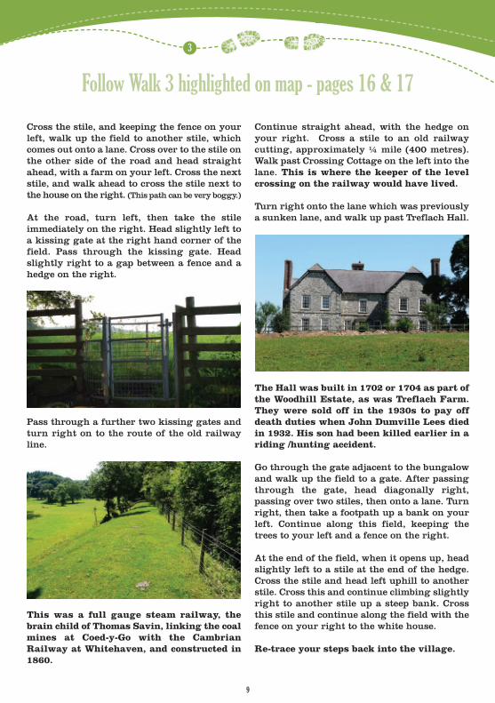
Pass through a further two kissing gates andturn right on to the route of the old railwayline.
This was a full gauge steam railway, thebrain child of Thomas Savin, linking the coalmines at Coed-y-Go with the Cambrian Railway at Whitehaven, and constructed in1860.
Continue straight ahead, with the hedge onyour right. Cross a stile to an old railway cutting, approximately ¼ mile (400 metres).Walk past Crossing Cottage on the left into thelane. This is where the keeper of the levelcrossing on the railway would have lived.
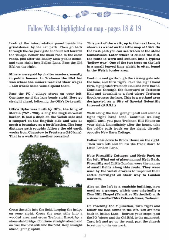
Turn right onto the lane which was previouslya sunken lane, and walk up past Treflach Hall.
The Hall was built in 1702 or 1704 as part ofthe Woodhill Estate, as was Treflach Farm.They were sold off in the 1930s to pay offdeath duties when John Dumville Lees diedin 1932. His son had been killed earlier in ariding /hunting accident.
Go through the gate adjacent to the bungalowand walk up the field to a gate. After passingthrough the gate, head diagonally right, passing over two stiles, then onto a lane. Turnright, then take a footpath up a bank on yourleft. Continue along this field, keeping thetrees to your left and a fence on the right.
At the end of the field, when it opens up, headslightly left to a stile at the end of the hedge.Cross the stile and head left uphill to anotherstile. Cross this and continue climbing slightlyright to another stile up a steep bank. Crossthis stile and continue along the field with thefence on your right to the white house.
Re-trace your steps back into the village.
10
Length: 2.5 miles / 4 kilometresEstimated time: 1.5 hoursAscent: two uphill sections
A shorter walk along forgotten
routes with clues to the past
Miners, drovers and past feuds
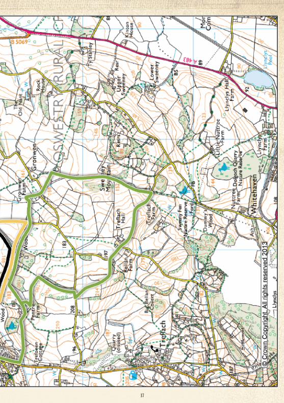
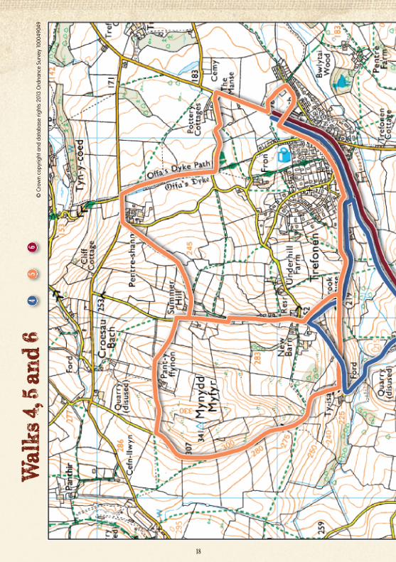
Follow Walk 4 highlighted on map - pages 18 & 19
4
11
Look at the interpretation panel beside thegrindstones, by the car park. Then go backthrough the car park gate and turn left towardsthe village. Follow the main road to the crossroads, just after the Barley Mow public house,and turn right into Bellan Lane. Pass the OldEfel on the right.
Miners were paid by chalter masters, usuallyin public houses. In Trefonen the Efel Innwas where the miners received their wages– and where some would spend them.
Pass the PO / village stores on your left. Continue until the lane bends right. Here gostraight ahead, following the Offa’s Dyke path.
Offa’s Dyke was built by Offa, the king ofMercia (757 - 796), along the English/Welshborder. It had a ditch on the Welsh side anda rampart on the English side and was asmuch a boundary as a fortification. The longdistance path roughly follows the old earthworks from Chepstow to Prestatyn (285 kms).That is a walk for another occasion!
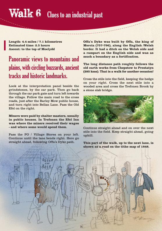
Cross the stile into the field, keeping the hedgeon your right. Cross the next stile into awooded area and cross Trefonen Brook by astone slab bridge. Continue straight ahead andon over the next stile into the field. Keep straightahead, going uphill.
This part of the walk, up to the next lane, isshown as a road on the tithe map of 1848. Onthe first part you can see traces of the stonefoundations. Later where it climbs the hill,the route is worn and sunken into a typical‘hollow way’. One of the two trees on the leftis a small leaved lime which is often foundin the Welsh border area.
Continue and go through the kissing gate intothe lane, and turn right. Take the right handturn, signposted Trefonen Hall and New Barns.Continue through the farmyard of TrefonenHall and downhill to a ford where TrefonenBrook crosses the lane. This is a wetland areadesignated as a Site of Special Scientific Interest (S.S.S.I.)
Walk along the lane, going uphill and round atight right hand bend. Continue walking uphill until you pass Trefonen Hill House onyour right. Immediately after the house, takethe bridle path track on the right, directly opposite New Barn Cottage.
Follow this down to Brook House on the right.Then turn left and follow the track down to Little London Lane.
Note Piccadilly Cottages and Hyde Park onthe left. What out of place names! Hyde Park,Piccadilly and Little London were the namesof small fields along this route. They wereused by the Welsh drovers to impound theircattle overnight on their way to London markets.
Also on the left is a roadside building, nowused as a garage, which was originally aZion Hill Chapel (Primitive Methodist) witha stone inscribed ‘Mrs.Deborah Jones, Trefonen’.
On reaching the Y junction, turn right and follow the lane round to the left. You are nowback in Bellan Lane. Retrace your steps, pastthe PO / stores and the Old Efel, to the main road.Turn left and go up the road, past the churchto return to the car park.
12
Walk down the steps at the back of the moundand ahead is the old mine shaft, now surroundedby a beautifully sculptured fence, remindingus of its former use. Continue past the old coaltub on your left and follow the path round tothe left and up another set of steps where a lonelyminer lies hacking his way into the mound,provoking thoughts of harsh bygone days.
Retrace your steps back along the path untilyou reach the kissing gate leading on to themain Oswestry Road. Turn right and walkalong the road taking care to keep to the pavedfootpaths. Take the next small lane on the left,past the large house with a balcony (The Manse).
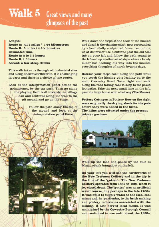
Pottery Cottages in Pottery Row on the rightwere originally the drying sheds for the potsbefore they were baked in the kilns. The kilns were situated under the present cottage gardens.
Walk up the lane and pause by the stile atMeadowbank bungalow on the left.
On your left you will see the earthworks ofthe New Trefonen Colliery and in the dip isthe line of the "gutter". The New TrefonenColliery operated from 1882 to 1891 when ittoo closed down. The "gutter" was an artificialwater course, dug perhaps in the late 1700s.It was built to supply water to the local coalmines and, in particular, to the brick makingand pottery industries associated with themining. It also served local farms. It wasmaintained by the Oswestry Borough Counciland continued in use until about the 1950s.
Length: Route A: 4.75 miles / 7.64 kilometres; Route B: 3 miles / 4.8 kilometresEstimated time: Route A: 2 to 2.5 hours; Route B: 1.5 hoursAscent: a few steep climbs
This walk takes us through old industrial sitesand along ancient earthworks. It is challengingin parts and there is a choice of two routes.
Look at the interpretation panel beside thegrindstones, by the car park. Then go along
the playing field trail towards the villagehall and continue along the trail to the
pit mound and go up the steps.
Follow the path along the top ofthe mound and look at the interpretation panel there.
Great views and many glimpses of the past
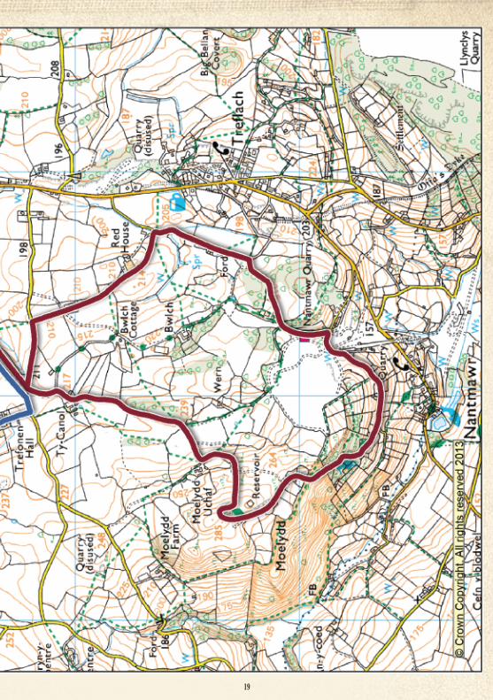
Follow Walk 5 highlighted on map - pages 18 & 19
5
13
It can be clearly seen at this point runningalong the south of the footpath where itmakes its way through the workings of theNew Trefonen Colliery.
Continue walking up the lane until you reacha stile on the right (signed Candy Wood). Go over the stile and onto the Offa's Dyke Path.Offa’s Dyke was built by Offa, the king of Mercia (757 - 796), along the English/Welshborder. It had a ditch on the Welsh side anda rampart on the English side and was asmuch a boundary as a fortification. The longdistance path roughly follows the old earthworks from Chepstow to Prestatyn (285 kms).That is a walk for another occasion!
Follow the line of the Dyke with the hedge onyour right. Take the next stile and walk ahead,still following the dyke until you reach a stileleading onto the road. Leaving the dyke turnleft and go up the road, past Trefalgar Houseand Pentre Shannel Farm and turn left into anarrow lane. Immediately on your right is astile up a steep roadside bank. (Assistance maybe needed here!)
Cross the stile and walk up the field diagonallyleft to the corner. Go through the gate andkeep the hedge on your left until it bends awayfrom you. You keep straight ahead on the sameline, diagonally crossing the field to the oppositehedge. Look for a stile in the hedge and crossit. Go diagonally left towards the top corner ofthe field. The stile ahead is not visible at first.Cross the stile and head for the stile oppositeout onto the lane.
There is now a choice between a longer walk
"A" and a shorter walk "B".A The longer Walk.Turn right and follow the lane uphill past PlasUchaf to a stile on the left. Cross the stile intothe field and walk uphill to a stile in the middleof the hedge. Then walk uphill diagonally rightto cross the stile in the corner of the next field.(A good place to admire the views!)
Turn left onto a track and go through the doublemetal gate (secured with a chain). Walk alongthe track (Don’t worry; you are not on privateproperty.) and to the right of the buildings atPant-y-Ffynon. Walk up the fenced track to thenext stile into the field. Continue in the samedirection, following the fence, to the next stileand then downhill to a stile ahead and on toHafod Lane. (This part can be very boggy afterrain). Hafod means a summer pasture area,and gives us a clue to what happened here.
Turn left and walk along the lane, which finallydrops steeply to the road junction. Turn leftand walk uphill along the lane until you cometo a field gate and walk along the track to thenext gate. Go through the gate and go straightahead on the track, downhill to the gate at thebottom.
Go through the gate onto Little London Lane.Go along the Lane where Route B comes in. Note Piccadilly Cottages and Hyde Park onthe left. What out of place names! Hyde Park,Piccadilly and Little London were the namesof small fields along this route. They wereused by the Welsh drovers to impound theircattle overnight on their way to London markets.
Also on the left is a roadside building, nowused as a garage, which was originally aZion Hill Chapel (Primitive Methodist) witha stone inscribed ‘Mrs. Deborah Jones, Trefonen’.
On reaching the Y junction, turn right and followthe lane round to the left. You are now in BellanLane. Go past the PO / stores and the Old Efel,to the main road. Turn left and go up the road,past the church to return to the car park.
B The Shorter WalkTurn left onto the lane and go straight aheadat the junction. Now take the next track on theleft, soon after the junction and opposite NewBarns Cottage. Follow the bridle way down toBrook House, and turn left.
This track now becomes Little London Lane.Go along the Lane and rejoin Route A.
14
Offa’s Dyke was built by Offa, the king ofMercia (757-796), along the English /Welshborder. It had a ditch on the Welsh side anda rampart on the English side and was asmuch a boundary as a fortification.
The long distance path roughly follows theold earth works from Chepstow to Prestatyn(285 kms). That is a walk for another occasion!
Cross the stile into the field, keeping the hedgeon your right. Cross the next stile into awooded area and cross the Trefonen Brook bya stone slab bridge.
Continue straight ahead and on over the nextstile into the field. Keep straight ahead, goinguphill.
This part of the walk, up to the next lane, isshown as a road on the tithe map of 1848.
Length: 4.4 miles / 7.1 kilometresEstimated time: 2.5 hoursAscent: to the top of Moelydd
Panoramic views to mountains and
plains, with circling buzzards, ancient
tracks and historic landmarks.
Look at the interpretation panel beside thegrindstones, by the car park. Then go backthrough the car park gate and turn left towardsthe village. Follow the main road to the crossroads, just after the Barley Mow public house,and turn right into Bellan Lane. Pass the OldEfel on the right.
Miners were paid by chalter masters, usuallyin public houses. In Trefonen the Efel Innwas where the miners received their wages- and where some would spend them.
Pass the PO / Village Stores on your left. Continue until the lane bends right. Here gostraight ahead, following Offa’s Dyke path.
Clues to an industrial past
Follow Walk 6 highlighted on map - pages 18 & 19
6
15
On the first part you can see traces of thestone foundations. Later where it climbs thehill, the route is worn and sunken into a typical ‘hollow way’. One of the two trees onthe left is a small leaved lime which is oftenfound in the Welsh border area.
Continue and go through the kissing gate intothe lane. Turn left, then immediately right andhead up the lane for Ty Canol Farm. Walkthrough the farmyard and then, keeping left,cross the stile.
Follow the lane through a copse, crossing thenext stile on your right into the open field, stillfollowing Offa’s Dyke. Keeping the hedgerowon your right, follow the footpath markers upthe hill, making a sharp left at the top. Stillkeeping the hedgerow on your right, followthe stony track to the next stile. Cross the stilethen turn right.
The many pits and craters are relics of earlierlead workings of an unknown date, most likely17th century. Calamine - zinc carbonate - wasalso mined here in the late 18th century andtaken via canal to Holywell, in Flintshire,where it was used in the manufacture of brass.
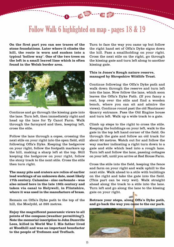
Remain on Offa’s Dyke path to the top of thehill, the Moelydd, at 285 metres.
Enjoy the magnificent panoramic views to allpoints of the compass (weather permitting!).Note the memorial inscription to John DumvilleLees, killed in World War I. His father livedat Woodhill and was an important benefactorto the people of Trefonen and Treflach.
Turn to face the way you came up but followthe right hand set of Offa’s Dyke signs downthe hill. Pass a smallholding on your right.Cross the next stile on the right, go throughthe kissing gate and turn left along to anotherkissing gate.
This is Jones’s Rough nature reserve, managed by Shropshire Wildlife Trust.
Continue following the Offa’s Dyke path andwalk down through the reserve and turn leftinto the lane. Now follow the lane, which soonleaves the Offa’s Dyke Path. (If you fancy arest, hop over the stile and find a woodenbench, where you can sit and admire theviews). Continue round past the old NantmawrQuarry entrance. Pass the Old Engine houseand turn left. Walk up a wide track to a gate.
Climb up steps to the right to cross the stile.Keeping the buildings on your left, walk to thegate in the top left hand corner of the field. Gothrough the gate and follow an old track forabout 60 metres. Watch out for and follow theway marker indicating a right turn down to agate and stile which lead into a rough lane.Turn left and follow the lane, passing cottageson your left, until you arrive at Red House Farm.
Cross the stile into the field, keeping the fenceand farm on your right and walk uphill to thenext stile. Walk ahead to a stile with buildingson the right and take the gate into the field.(This part can be very wet). Walk straightahead along the track to a stile into the lane.Turn left and go along the lane to the kissinggate on your right.
Retrace your steps, along Offa’s Dyke path,and go back the way you came to the car park.
16
32
1©
Cro
wn
copy
right
and
dat
abas
e rig
hts
2013
Ord
nanc
e Su
rvey
100
0490
49
17
18
65
4©
Cro
wn
copy
right
and
dat
abas
e rig
hts
2013
Ord
nanc
e Su
rvey
100
0490
49
19
Illustrations by Phil Kenning – www.kenning-illustration.co.uk
Graphic Design by Rob Smith – www.hollyhilldesign.net
Sculptures by David Howorth – www.davidhoworth.co.uk
Panels and frames by Brissco – www.brissco.com
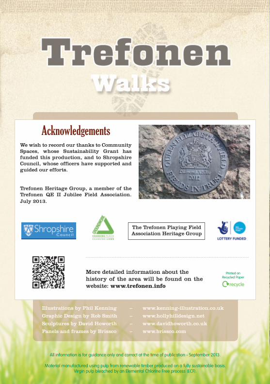
AcknowledgementsWe wish to record our thanks to CommunitySpaces, whose Sustainability Grant hasfunded this production, and to ShropshireCouncil, whose officers have supported andguided our efforts.
Trefonen Heritage Group, a member of theTrefonen QE II Jubilee Field Association.July 2013.
The Trefonen Playing Field Association Heritage Group
More detailed information about the history of the area will be found on thewebsite: www.trefonen.info
Printed on Recycled Paper
All information is for guidance only and correct at the time of publication - September 2013.
Material manufactured using pulp from renewable timber produced on a fully sustainable basis. Virgin pulp bleached by an Elemental Chlorine Free process (ECF).