Embed Size (px)
Citation preview

Tributary Modeling and Coastal Mapping w.r.t. Watershed
Planning in the Great Lakes
US Army Corpsof Engineers
Detroit District
Great Lakes Hydraulics and Hydrology OfficeIf it flows, we can model it!
Dr. Jim Selegean, P.E., U.S. Army Corps of Engineers
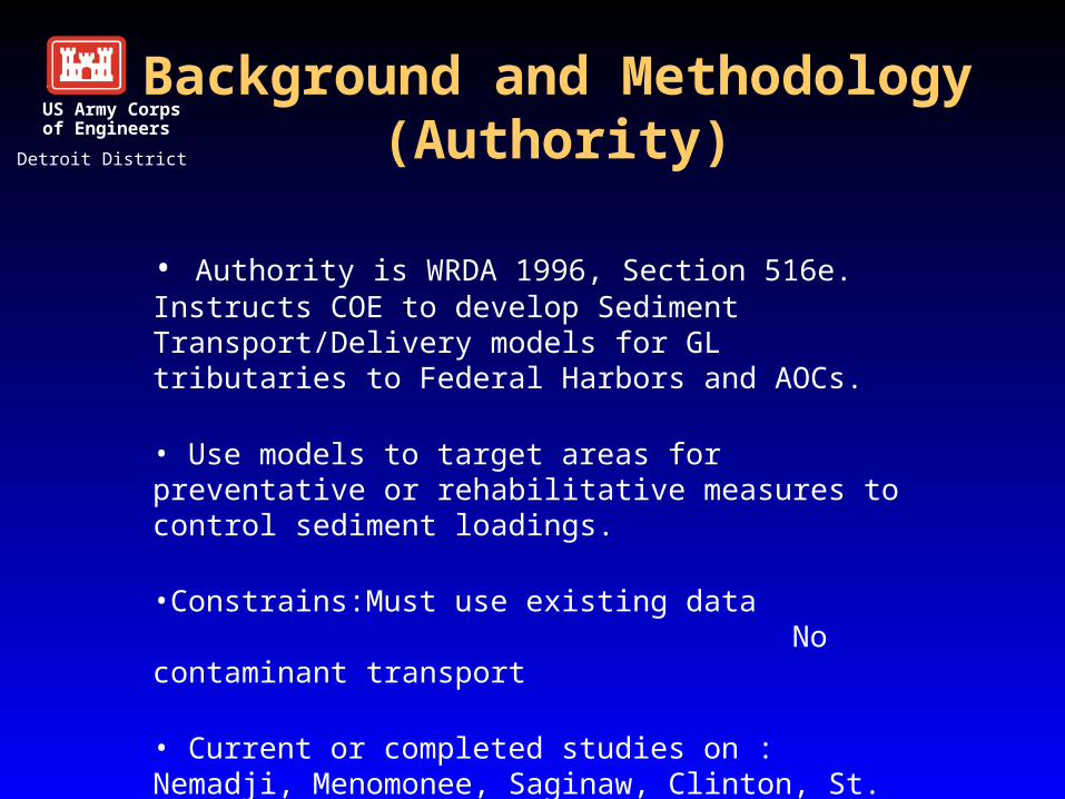
Background and Methodology(Authority)
• Authority is WRDA 1996, Section 516e. Instructs COE to develop Sediment Transport/Delivery models for GL tributaries to Federal Harbors and AOCs.
• Use models to target areas for preventative or rehabilitative measures to control sediment loadings.
•Constrains: Must use existing data No contaminant transport
• Current or completed studies on : Nemadji, Menomonee, Saginaw, Clinton, St. Joseph, Dead, St. Louis, Grand and Sebewaing Rivers
US Army Corpsof Engineers
Detroit District
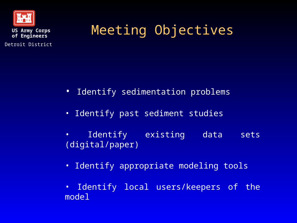
Meeting Objectives
• Identify sedimentation problems
• Identify past sediment studies
• Identify existing data sets (digital/paper)
• Identify appropriate modeling tools
• Identify local users/keepers of the model
US Army Corpsof Engineers
Detroit District
Previous Studies
• Saginaw River – Ag Watershed
• Nemadji River – Forested Watershed
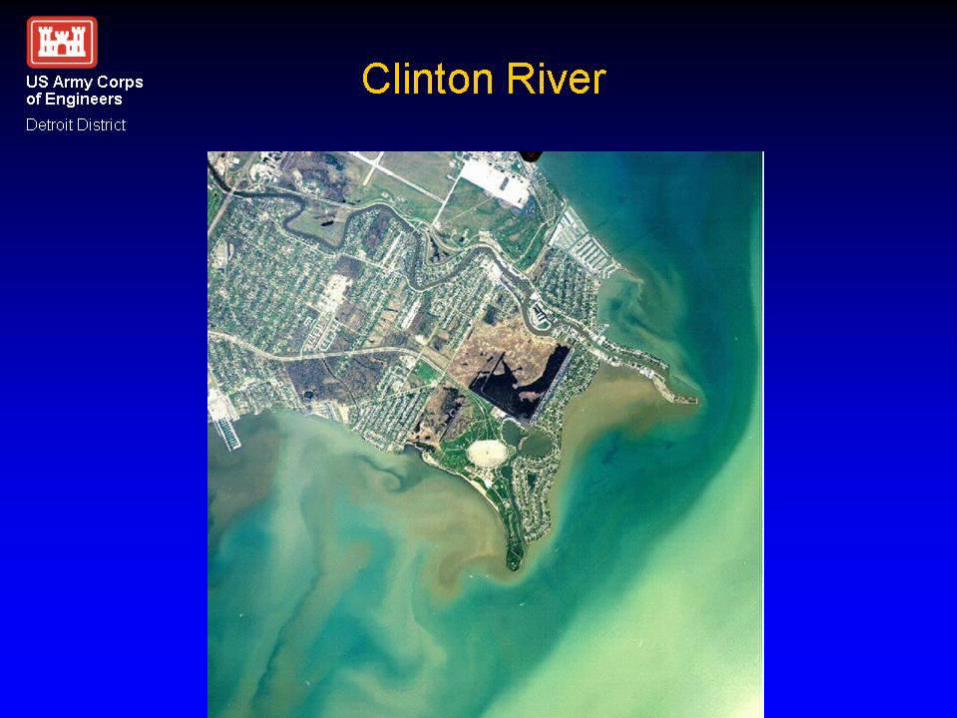
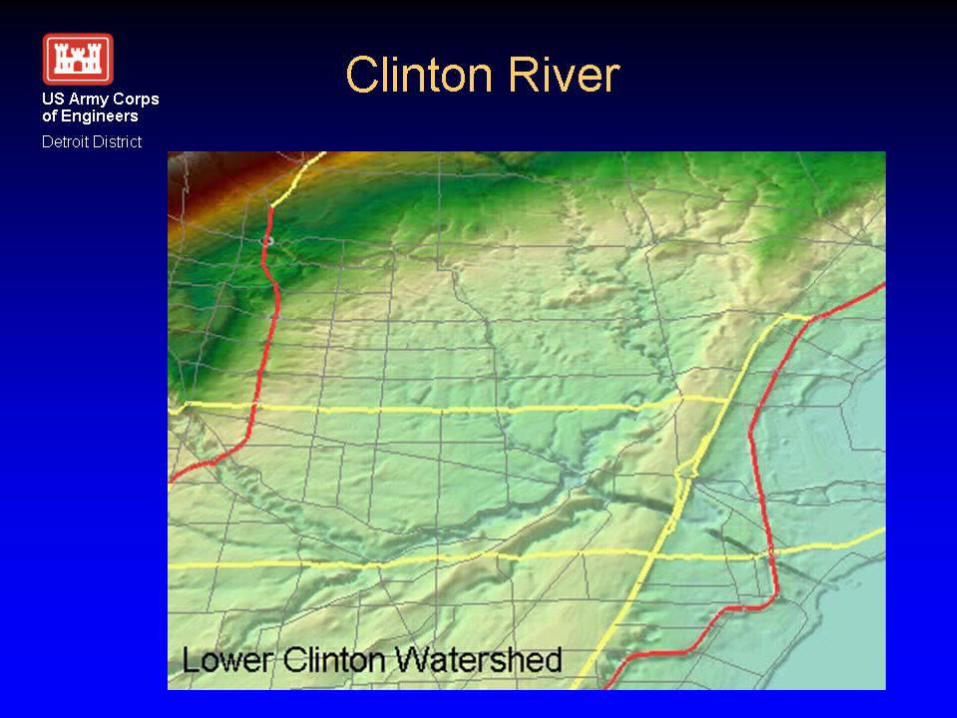
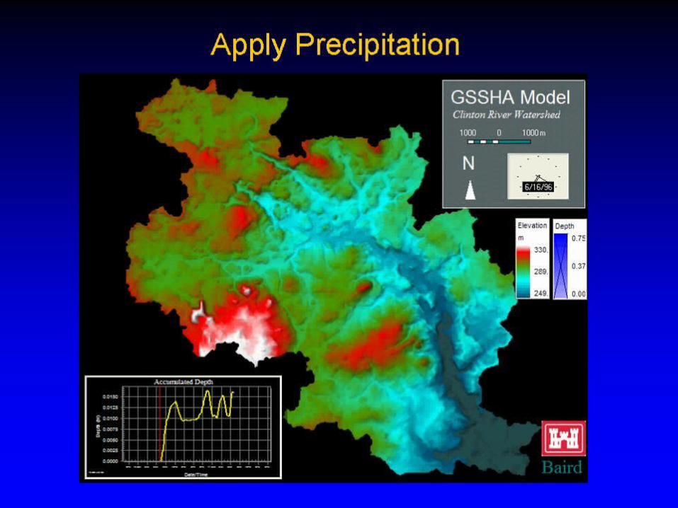
• Clinton River – Urbanizing Watershed
US Army Corpsof Engineers
Detroit District

Saginaw River
Phase I - Scoping
Phase II - Model Development
Phase III – Technology Transfer/User Workshop
US Army Corpsof Engineers
Detroit District

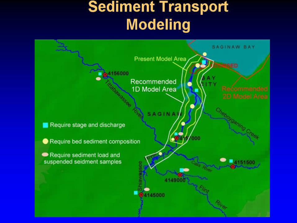
• 6,000 square mile watershed• Mostly agricultural and forested some urban• Large fraction of watershed is sand/silt• 275,000 cu. yards dredged each year by the
Corps at a cost of $1.1M • Sediment sources: mostly agricultural runoff
• 6,000 square mile watershed• Mostly agricultural and forested some urban• Large fraction of watershed is sand/silt• 275,000 cu. yards dredged each year by the
Corps at a cost of $1.1M • Sediment sources: mostly agricultural runoff
Saginaw RiverUS Army Corpsof Engineers
Detroit District


Summary
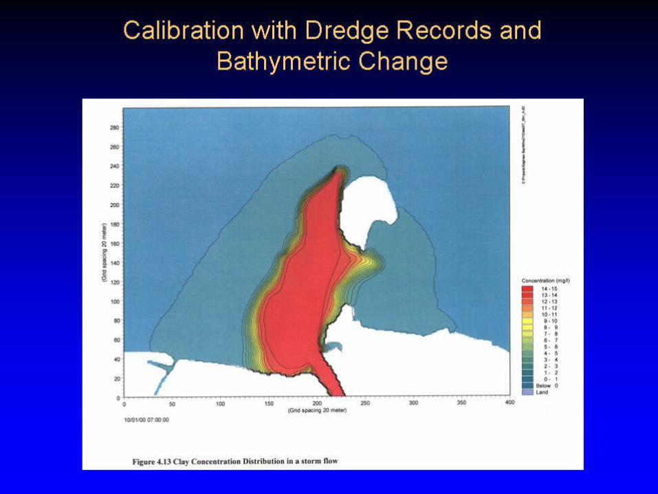
• Deposition of sediment in Federal Channel can be significantly reduced by adopting agricultural BMPs (30-45% reduction in Cass River sediments)
• Sand deposits in channel while clays and silts deposit elsewhere in Saginaw Bay
• Results thus far suggest that a sediment trap in the river may be effective at localizing the deposition of sand.
US Army Corpsof Engineers
Detroit District


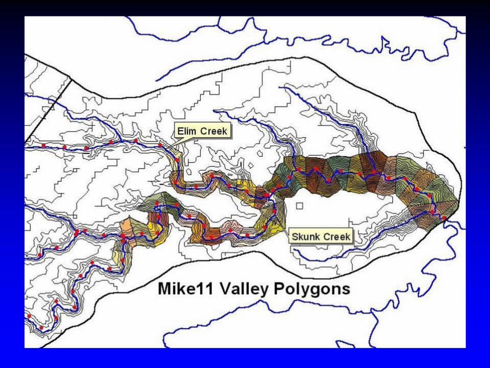

Nemadji Technology Transfer
• Users Manual
• Workshop to trail local users
• NRCS/Carleton County currently using model to manage forestry practices within the watershed
US Army Corpsof Engineers
Detroit District


Watersheds Studied
• Nemadji Forestry Harvest - Complete• Saginaw/Cass Agricultural - Complete• Menomonee Urbanization - Complete• Clinton Urbanization - Modeling• St. Joseph Agricultural - Modeling• Dead Dam Failure - Modeling• St. Louis Env. Restoration - Scoping• Sebewaing Agricultural - Scoping

US Army Corpsof Engineers
Detroit District
USACEAnd
Coastal Mapping


U S A rm y C o rp so f E n g in e e rs
D e tro it D is tr ic t
Additional Data Sets in Coastal Database


For further information:
US Army Corpsof Engineers
Detroit District
U.S. Army Corps of EngineersGreat Lakes Hydraulics and Hydrology Office
Dr. James Selegean, P.E.477 Michigan AveDetroit, MI 48226
(313)226-6791