Embed Size (px)
Citation preview
Map & Guide
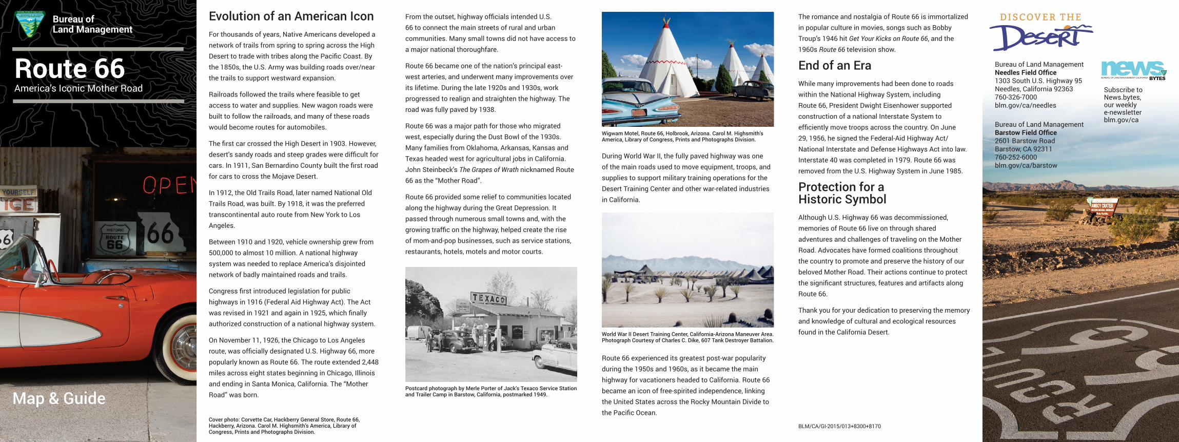
Route 66America’s Iconic Mother Road
Bureau of Land Management
Evolution of an American IconFor thousands of years, Native Americans developed a network of trails from spring to spring across the High Desert to trade with tribes along the Pacific Coast. By the 1850s, the U.S. Army was building roads over/near the trails to support westward expansion.
Railroads followed the trails where feasible to get access to water and supplies. New wagon roads were built to follow the railroads, and many of these roads would become routes for automobiles.
The first car crossed the High Desert in 1903. However, desert’s sandy roads and steep grades were difficult for cars. In 1911, San Bernardino County built the first road for cars to cross the Mojave Desert.
In 1912, the Old Trails Road, later named National Old Trails Road, was built. By 1918, it was the preferred transcontinental auto route from New York to Los Angeles.
Between 1910 and 1920, vehicle ownership grew from 500,000 to almost 10 million. A national highway system was needed to replace America’s disjointed network of badly maintained roads and trails.
Congress first introduced legislation for public highways in 1916 (Federal Aid Highway Act). The Act was revised in 1921 and again in 1925, which finally authorized construction of a national highway system.
On November 11, 1926, the Chicago to Los Angeles route, was officially designated U.S. Highway 66, more popularly known as Route 66. The route extended 2,448 miles across eight states beginning in Chicago, Illinois and ending in Santa Monica, California. The “Mother Road” was born.
From the outset, highway officials intended U.S. 66 to connect the main streets of rural and urban communities. Many small towns did not have access to a major national thoroughfare.
Route 66 became one of the nation’s principal east-west arteries, and underwent many improvements over its lifetime. During the late 1920s and 1930s, work progressed to realign and straighten the highway. The road was fully paved by 1938.
Route 66 was a major path for those who migrated west, especially during the Dust Bowl of the 1930s. Many families from Oklahoma, Arkansas, Kansas and Texas headed west for agricultural jobs in California. John Steinbeck’s The Grapes of Wrath nicknamed Route 66 as the “Mother Road”.
Route 66 provided some relief to communities located along the highway during the Great Depression. It passed through numerous small towns and, with the growing traffic on the highway, helped create the rise of mom-and-pop businesses, such as service stations, restaurants, hotels, motels and motor courts.
During World War II, the fully paved highway was one of the main roads used to move equipment, troops, and supplies to support military training operations for the Desert Training Center and other war-related industries in California.
Route 66 experienced its greatest post-war popularity during the 1950s and 1960s, as it became the main highway for vacationers headed to California. Route 66 became an icon of free-spirited independence, linking the United States across the Rocky Mountain Divide to the Pacific Ocean.
The romance and nostalgia of Route 66 is immortalized in popular culture in movies, songs such as Bobby Troup’s 1946 hit Get Your Kicks on Route 66, and the 1960s Route 66 television show.
End of an EraWhile many improvements had been done to roads within the National Highway System, including Route 66, President Dwight Eisenhower supported construction of a national Interstate System to efficiently move troops across the country. On June 29, 1956, he signed the Federal-Aid Highway Act/National Interstate and Defense Highways Act into law. Interstate 40 was completed in 1979. Route 66 was removed from the U.S. Highway System in June 1985.
Protection for a Historic SymbolAlthough U.S. Highway 66 was decommissioned, memories of Route 66 live on through shared adventures and challenges of traveling on the Mother Road. Advocates have formed coalitions throughout the country to promote and preserve the history of our beloved Mother Road. Their actions continue to protect the significant structures, features and artifacts along Route 66.
Thank you for your dedication to preserving the memory and knowledge of cultural and ecological resources found in the California Desert.
Bureau of Land Management Needles Field Office 1303 South U.S. Highway 95 Needles, California 92363 760-326-7000 blm.gov/ca/needles
Bureau of Land Management Barstow Field Office 2601 Barstow Road Barstow, CA 92311 760-252-6000 blm.gov/ca/barstow
Wigwam Motel, Route 66, Holbrook, Arizona. Carol M. Highsmith’s America, Library of Congress, Prints and Photographs Division.
Cover photo: Corvette Car, Hackberry General Store, Route 66, Hackberry, Arizona. Carol M. Highsmith’s America, Library of Congress, Prints and Photographs Division.
World War II Desert Training Center, California-Arizona Maneuver Area. Photograph Courtesy of Charles C. Dike, 607 Tank Destroyer Battalion.
Subscribe to News.bytes, our weekly e-newsletter blm.gov/ca
BLM/CA/GI-2015/013+8300+8170
Postcard photograph by Merle Porter of Jack’s Texaco Service Station and Trailer Camp in Barstow, California, postmarked 1949.
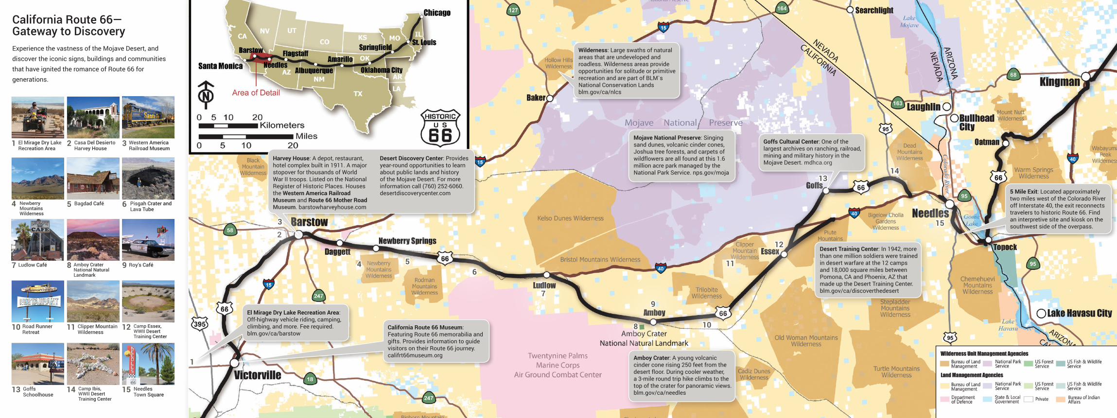
California Route 66— Gateway to DiscoveryExperience the vastness of the Mojave Desert, and discover the iconic signs, buildings and communities that have ignited the romance of Route 66 for generations.
El Mirage Dry Lake Recreation Area: Off-highway vehicle riding, camping, climbing, and more. Fee required. blm.gov/ca/barstow
California Route 66 Museum: Featuring Route 66 memorabilia and gifts. Provides information to guide visitors on their Route 66 journey. califrt66museum.org
Harvey House: A depot, restaurant, hotel complex built in 1911. A major stopover for thousands of World War II troops. Listed on the National Register of Historic Places. Houses the Western America Railroad Museum and Route 66 Mother Road Museum. barstowharveyhouse.com
Desert Discovery Center: Provides year-round opportunities to learn about public lands and history of the Mojave Desert. For more information call (760) 252-6060. desertdiscoverycenter.com
Amboy Crater: A young volcanic cinder cone rising 250 feet from the desert floor. During cooler weather, a 3-mile round trip hike climbs to the top of the crater for panoramic views. blm.gov/ca/needles
Goffs Cultural Center: One of the largest archives on ranching, railroad, mining and military history in the Mojave Desert. mdhca.org
Mojave National Preserve: Singing sand dunes, volcanic cinder cones, Joshua tree forests, and carpets of wildflowers are all found at this 1.6 million acre park managed by the National Park Service. nps.gov/moja
Wilderness: Large swaths of natural areas that are undeveloped and roadless. Wilderness areas provide opportunities for solitude or primitive recreation and are part of BLM`s National Conservation Lands blm.gov/ca/nlcs
Desert Training Center: In 1942, more than one million soldiers were trained in desert warfare at the 12 camps and 18,000 square miles between Pomona, CA and Phoenix, AZ that made up the Desert Training Center. blm.gov/ca/discoverthedesert
5 Mile Exit: Located approximately two miles west of the Colorado River off Interstate 40, the exit reconnects travelers to historic Route 66. Find an interpretive site and kiosk on the southwest side of the overpass.
El Mirage Dry Lake Recreation Area
Newberry Mountains Wilderness
Ludlow Café
Road Runner Retreat
Goffs Schoolhouse
Casa Del Desierto Harvey House
Bagdad Café
Amboy Crater National Natural Landmark
Clipper Mountain Wilderness
Camp Ibis, WWII Desert Training Center
Western America Railroad Museum
Pisgah Crater and Lava Tube
Roy’s Café
Camp Essex, WWII Desert Training Center
Needles Town Square
2
5 6
31
4
7
10
13 14 15
11 12
8 9
1
23
46
7
5
8
9
10
11
12
1314
15