Embed Size (px)
Citation preview
#
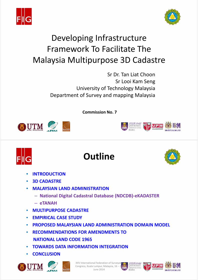
Commission No. 7
#
Developing Infrastructure
Framework To Facilitate The
Malaysia Multipurpose 3D Cadastre
Sr Dr. Tan Liat Choon
Sr Looi Kam Seng
University of Technology Malaysia
Department of Survey and mapping Malaysia
#
Outline
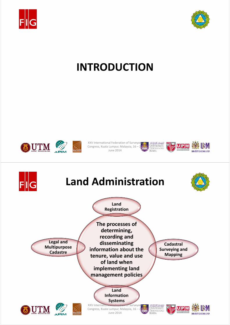
• INTRODUCTION
• 3D CADASTRE
• MALAYSIAN LAND ADMINISTRATION
– National Digital Cadastral Database (NDCDB)-eKADASTER
– eTANAH
• MULTIPURPOSE CADASTRE
• EMPIRICAL CASE STUDY
• PROPOSED MALAYSIAN LAND ADMINISTRATION DOMAIN MODEL
• RECOMMENDATIONS FOR AMENDMENTS TO
NATIONAL LAND CODE 1965
• TOWARDS DATA INFORMATION INTEGRATION
• CONCLUSION
XXV International Federation of Surveyors
Congress, Kuala Lumpur, Malaysia, 16 – 21
June 2014
#
INTRODUCTION
XXV International Federation of Surveyors
Congress, Kuala Lumpur, Malaysia, 16 – 21
June 2014
#
Land Administration
The processes of determining, recording and disseminating
information about the tenure, value and use
of land when implementing land
management policies
Land Registration
Legal and Multipurpose
Cadastre
Land Information
Systems
Cadastral Surveying and
Mapping
XXV International Federation of Surveyors
Congress, Kuala Lumpur, Malaysia, 16 – 21
June 2014
#
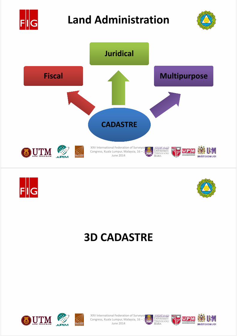
Land Administration
CADASTRE
Fiscal
Juridical
Multipurpose
XXV International Federation of Surveyors
Congress, Kuala Lumpur, Malaysia, 16 – 21
June 2014
#
3D CADASTRE
XXV International Federation of Surveyors
Congress, Kuala Lumpur, Malaysia, 16 – 21
June 2014
#
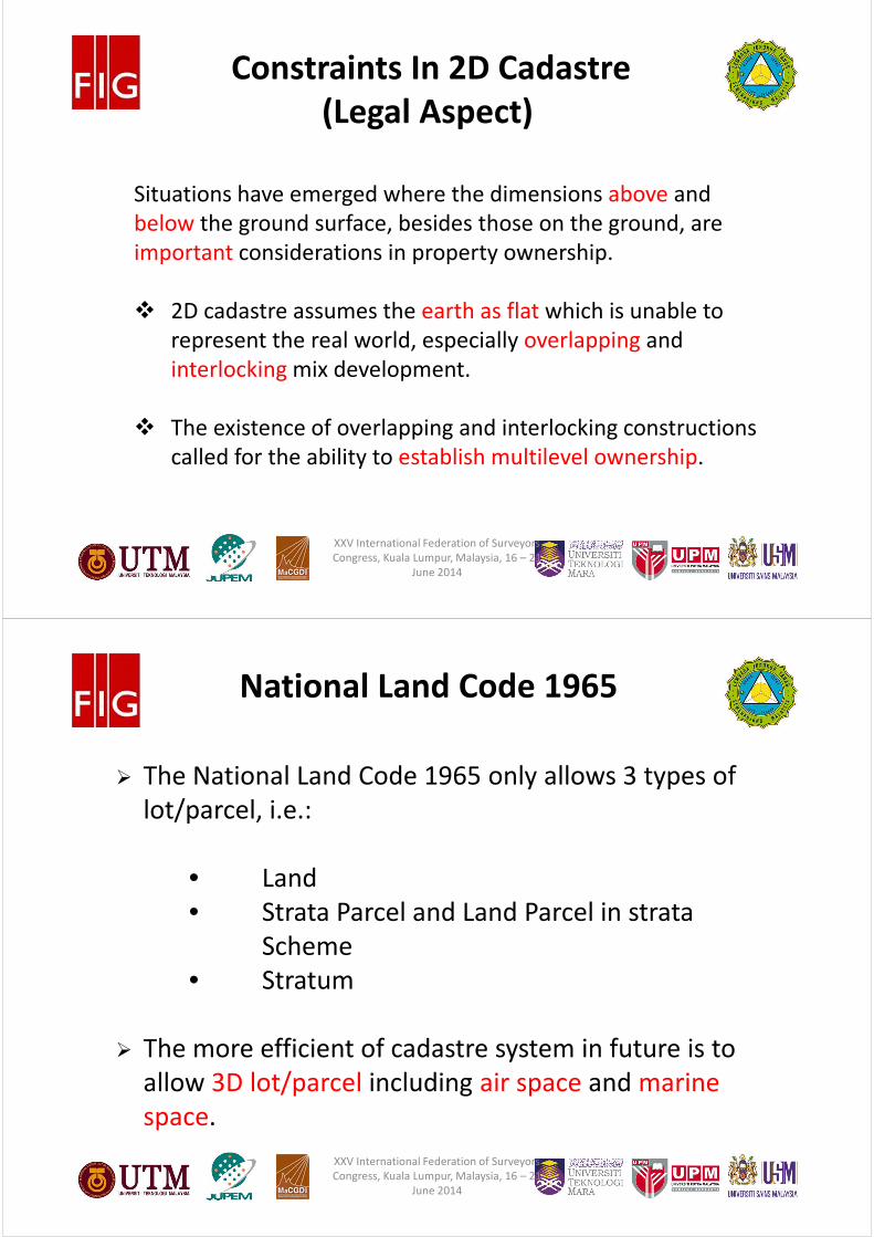
Constraints In 2D Cadastre
(Legal Aspect)
Situations have emerged where the dimensions above and
below the ground surface, besides those on the ground, are
important considerations in property ownership.
� 2D cadastre assumes the earth as flat which is unable to
represent the real world, especially overlapping and
interlocking mix development.
� The existence of overlapping and interlocking constructions
called for the ability to establish multilevel ownership.
XXV International Federation of Surveyors
Congress, Kuala Lumpur, Malaysia, 16 – 21
June 2014
#
National Land Code 1965
� The National Land Code 1965 only allows 3 types of
lot/parcel, i.e.:
• Land
• Strata Parcel and Land Parcel in strata
Scheme
• Stratum
� The more efficient of cadastre system in future is to
allow 3D lot/parcel including air space and marine
space.
XXV International Federation of Surveyors
Congress, Kuala Lumpur, Malaysia, 16 – 21
June 2014
#
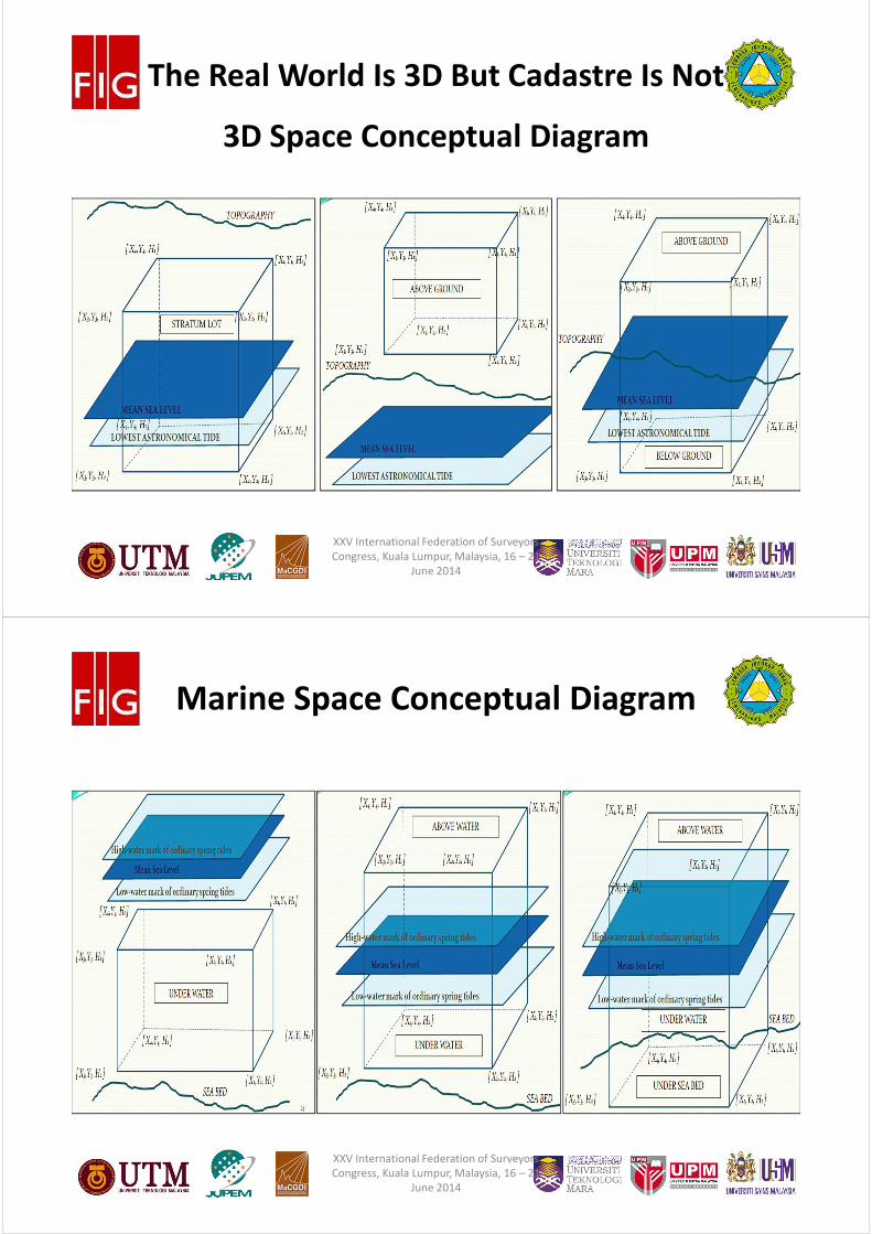
3D Space Conceptual Diagram
The Real World Is 3D But Cadastre Is Not
XXV International Federation of Surveyors
Congress, Kuala Lumpur, Malaysia, 16 – 21
June 2014
#
Marine Space Conceptual Diagram
XXV International Federation of Surveyors
Congress, Kuala Lumpur, Malaysia, 16 – 21
June 2014
#
MALAYSIAN LAND
ADMINISTRATION
XXV International Federation of Surveyors
Congress, Kuala Lumpur, Malaysia, 16 – 21
June 2014
#
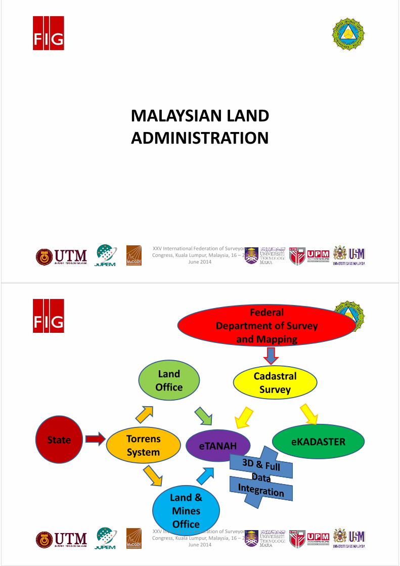
State Torrens
System
Land &
Mines
Office
Land
Office
eTANAH eKADASTER
Cadastral
Survey
Federal
Department of Survey
and Mapping
XXV International Federation of Surveyors
Congress, Kuala Lumpur, Malaysia, 16 – 21
June 2014
#
National Digital Cadastral Database
(NDCDB)
XXV International Federation of Surveyors
Congress, Kuala Lumpur, Malaysia, 16 – 21
June 2014
#
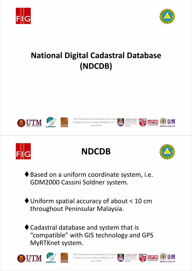
NDCDB
�Based on a uniform coordinate system, i.e. GDM2000 Cassini Soldner system.
�Uniform spatial accuracy of about < 10 cm throughout Peninsular Malaysia.
�Cadastral database and system that is “compatible” with GIS technology and GPS MyRTKnet system.
XXV International Federation of Surveyors
Congress, Kuala Lumpur, Malaysia, 16 – 21
June 2014
#
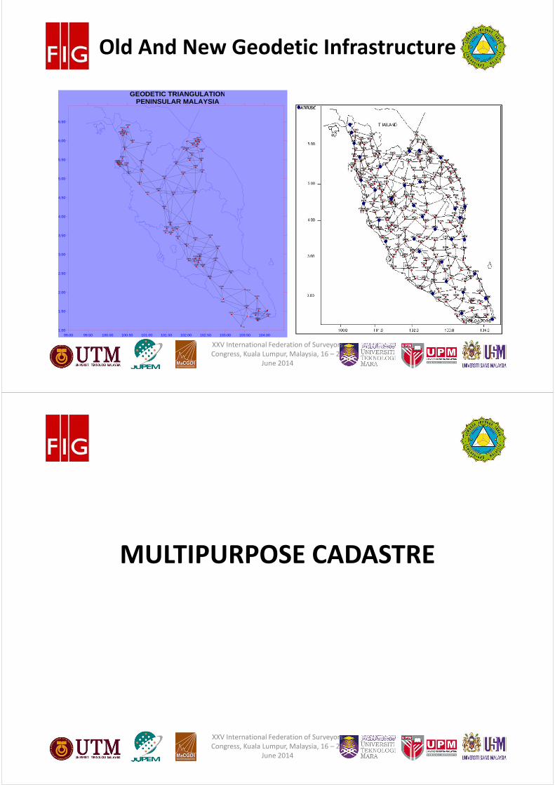
Old And New Geodetic Infrastructure
G001
G003
G004
G005
G007
G008
G009
G010
G011
G012
G013
G015
G016
G017
G018
G019
G020
G021
G022
G023
G024
G025
G026
G027
G028
G029
G030G031
G032G033
G034
G035
G036
G037
G038 G039
G040
G041
G042
G043
G044
G045
G046
G047
G048
G049
G050
G051
G052
G053
G054
G055
G056
G057
G058
G059
G060
G061
G062
G063
G064
G065
G066
G067
G068
G069
G070
G071
G072
G073
G074G075
G076
G077
99.00 99.50 100.00 100.50 101.00 101.50 102.00 102.50 103.00 103.50 104.001.00
1.50
2.00
2.50
3.00
3.50
4.00
4.50
5.00
5.50
6.00
6.50
GEODETIC TRIANGULATIONPENINSULAR MALAYSIA
G002
G014
G084
P4
P075
XXV International Federation of Surveyors
Congress, Kuala Lumpur, Malaysia, 16 – 21
June 2014
#
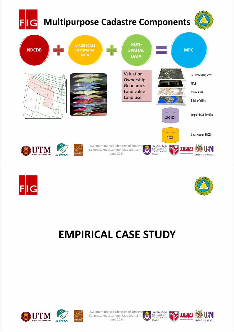
MULTIPURPOSE CADASTRE
XXV International Federation of Surveyors
Congress, Kuala Lumpur, Malaysia, 16 – 21
June 2014
#
NDCDBLARGE SCALE
GEOSPATIAL
DATA
NON-
SPATIAL
DATA
MPC
Valuation
Ownership
Geonames
Land value
Land use
Multipurpose Cadastre Components
XXV International Federation of Surveyors
Congress, Kuala Lumpur, Malaysia, 16 – 21
June 2014
#
EMPIRICAL CASE STUDY
XXV International Federation of Surveyors
Congress, Kuala Lumpur, Malaysia, 16 – 21
June 2014
#
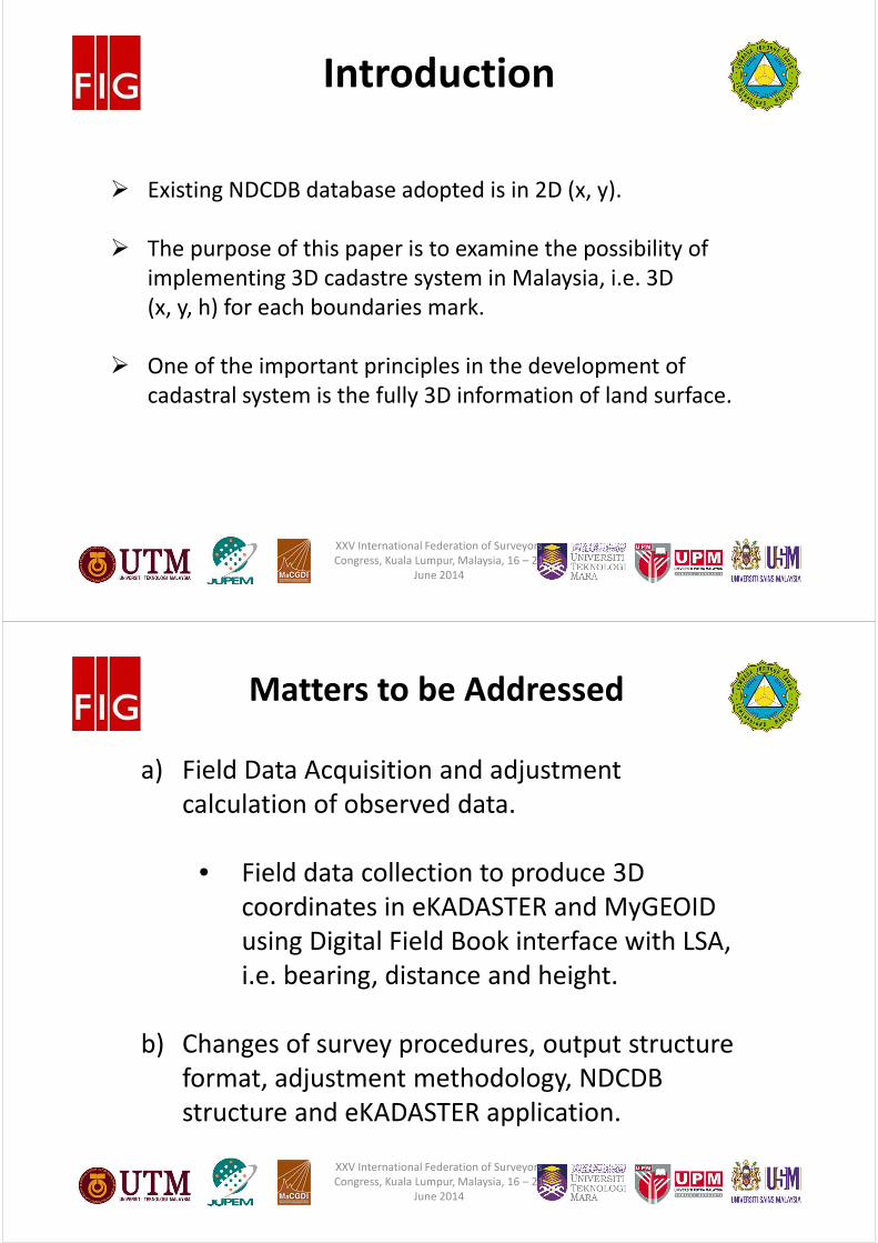
Introduction
� Existing NDCDB database adopted is in 2D (x, y).
� The purpose of this paper is to examine the possibility of
implementing 3D cadastre system in Malaysia, i.e. 3D
(x, y, h) for each boundaries mark.
� One of the important principles in the development of
cadastral system is the fully 3D information of land surface.
XXV International Federation of Surveyors
Congress, Kuala Lumpur, Malaysia, 16 – 21
June 2014
#
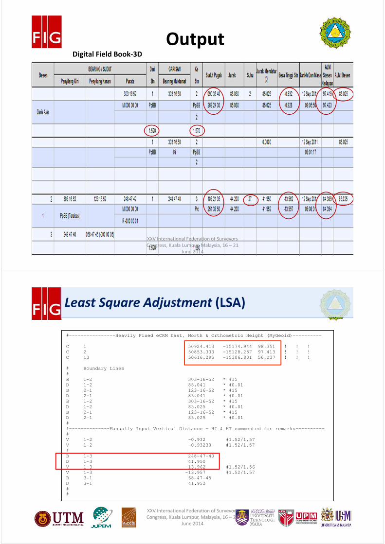
Matters to be Addressed
a) Field Data Acquisition and adjustment
calculation of observed data.
• Field data collection to produce 3D
coordinates in eKADASTER and MyGEOID
using Digital Field Book interface with LSA,
i.e. bearing, distance and height.
b) Changes of survey procedures, output structure
format, adjustment methodology, NDCDB
structure and eKADASTER application.
XXV International Federation of Surveyors
Congress, Kuala Lumpur, Malaysia, 16 – 21
June 2014
#
OutputDigital Field Book-3D
XXV International Federation of Surveyors
Congress, Kuala Lumpur, Malaysia, 16 – 21
June 2014
#
#----------------Heavily Fixed eCRM East, North & O rthometric Height (MyGeoid)---------- C 1 50924.413 - 15174.944 98.351 ! ! ! C 2 50853.333 - 15128.287 97.413 ! ! ! C 13 50616.295 - 15306.801 56.237 ! ! ! # Boundary Lines # B 1-2 303-16-52 * #15 D 1-2 85.041 * #0.01 B 2-1 123-16-52 * #15 D 2-1 85.041 * #0.01 B 1-2 303-16-52 * #15 D 1-2 85.025 * #0.01 B 2-1 123-16-52 * #15 D 2-1 85.025 * #0.01 # #--------------Manually Input Vertical Distance – H I & HT commented for remarks---------- # V 1-2 -0.932 #1.52/1.57 V 1-2 -0.93230 #1.52/1.57 # B 1-3 248-47-40 D 1-3 41.950 V 1-3 -13.962 #1.52/1.56 V 1-3 -13.957 #1.52/1.57 B 3-1 68-47-45 D 3-1 41.952 # #
Least Square Adjustment (LSA)
XXV International Federation of Surveyors
Congress, Kuala Lumpur, Malaysia, 16 – 21
June 2014
#
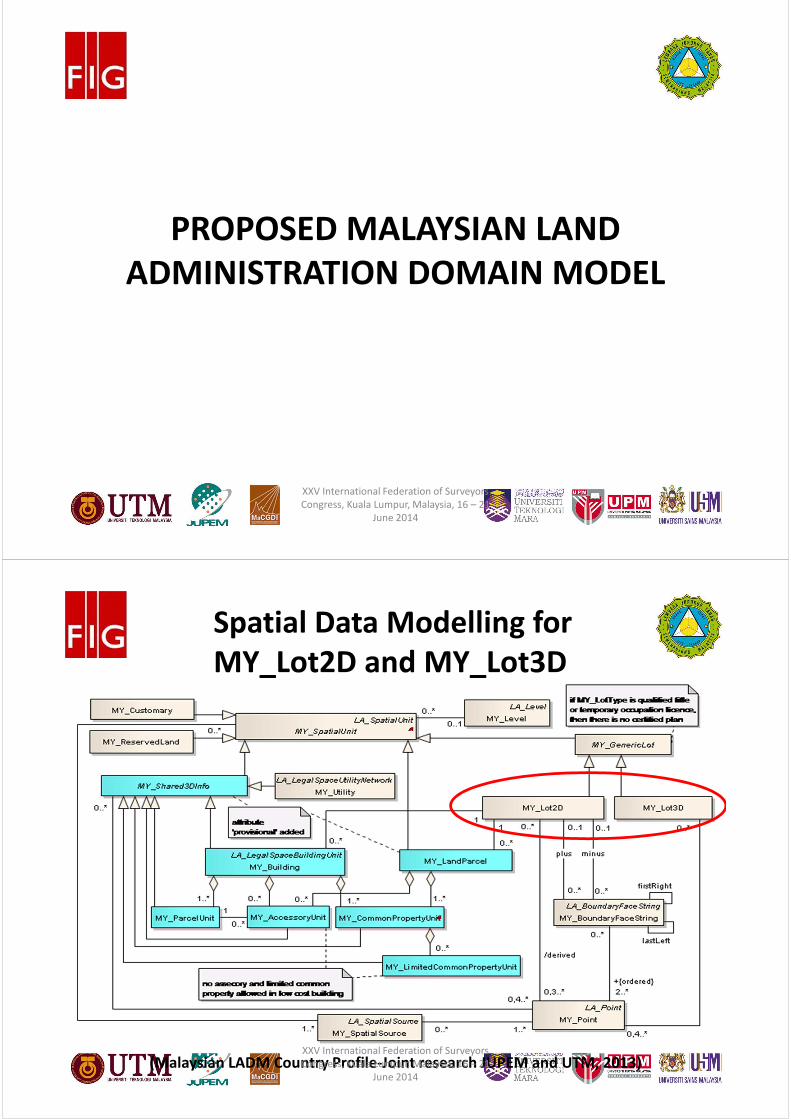
PROPOSED MALAYSIAN LAND
ADMINISTRATION DOMAIN MODEL
XXV International Federation of Surveyors
Congress, Kuala Lumpur, Malaysia, 16 – 21
June 2014
#(Malaysian LADM Country Profile-Joint research JUPEM and UTM, 2013)
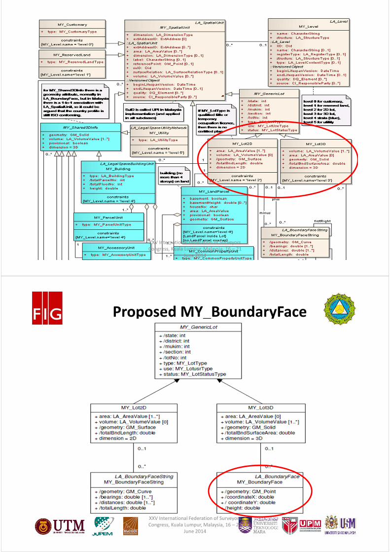
Spatial Data Modelling for
MY_Lot2D and MY_Lot3D
XXV International Federation of Surveyors
Congress, Kuala Lumpur, Malaysia, 16 – 21
June 2014
#
XXV International Federation of Surveyors
Congress, Kuala Lumpur, Malaysia, 16 – 21
June 2014
#
Proposed MY_BoundaryFace
XXV International Federation of Surveyors
Congress, Kuala Lumpur, Malaysia, 16 – 21
June 2014
#
RECOMMENDATIONS FOR
AMENDMENTS TO NATIONAL
LAND CODE 1965
XXV International Federation of Surveyors
Congress, Kuala Lumpur, Malaysia, 16 – 21
June 2014
#
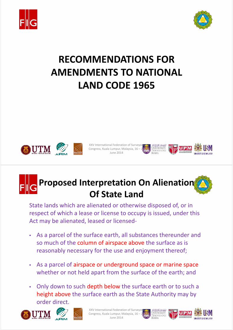
Proposed Interpretation On Alienation
Of State LandState lands which are alienated or otherwise disposed of, or in
respect of which a lease or license to occupy is issued, under this
Act may be alienated, leased or licensed-
• As a parcel of the surface earth, all substances thereunder and
so much of the column of airspace above the surface as is
reasonably necessary for the use and enjoyment thereof;
• As a parcel of airspace or underground space or marine space
whether or not held apart from the surface of the earth; and
• Only down to such depth below the surface earth or to such a
height above the surface earth as the State Authority may by
order direct.XXV International Federation of Surveyors
Congress, Kuala Lumpur, Malaysia, 16 – 21
June 2014
#
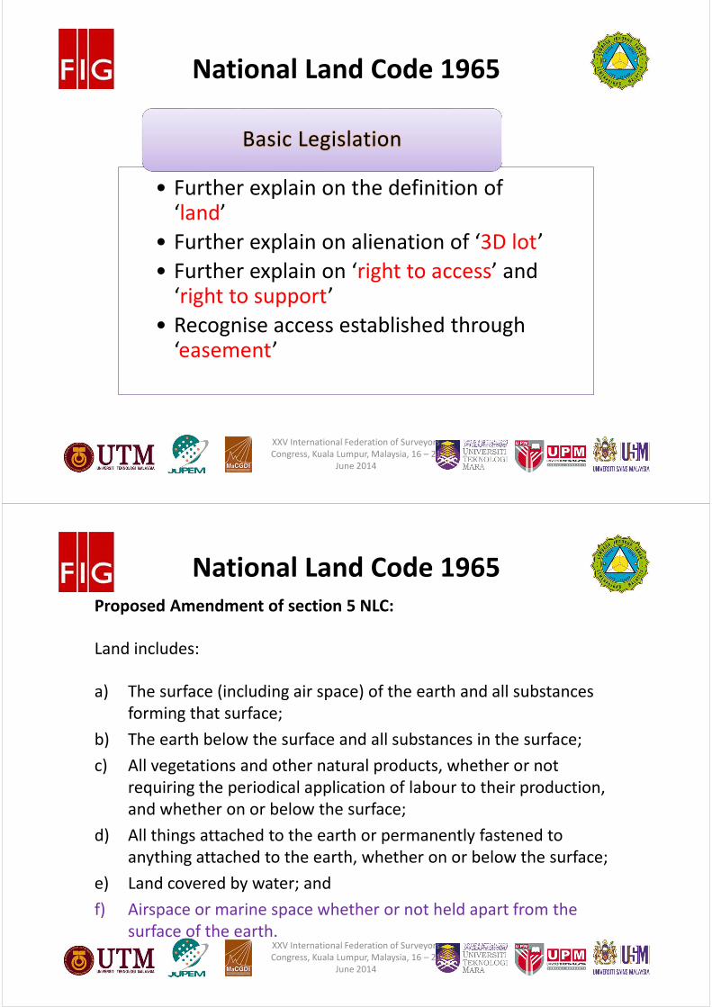
National Land Code 1965
• Further explain on the definition of ‘land’
• Further explain on alienation of ‘3D lot’
• Further explain on ‘right to access’ and ‘right to support’
• Recognise access established through ‘easement’
Basic Legislation
XXV International Federation of Surveyors
Congress, Kuala Lumpur, Malaysia, 16 – 21
June 2014
#
National Land Code 1965
Proposed Amendment of section 5 NLC:
Land includes:
a) The surface (including air space) of the earth and all substances
forming that surface;
b) The earth below the surface and all substances in the surface;
c) All vegetations and other natural products, whether or not
requiring the periodical application of labour to their production,
and whether on or below the surface;
d) All things attached to the earth or permanently fastened to
anything attached to the earth, whether on or below the surface;
e) Land covered by water; and
f) Airspace or marine space whether or not held apart from the
surface of the earth.XXV International Federation of Surveyors
Congress, Kuala Lumpur, Malaysia, 16 – 21
June 2014
#
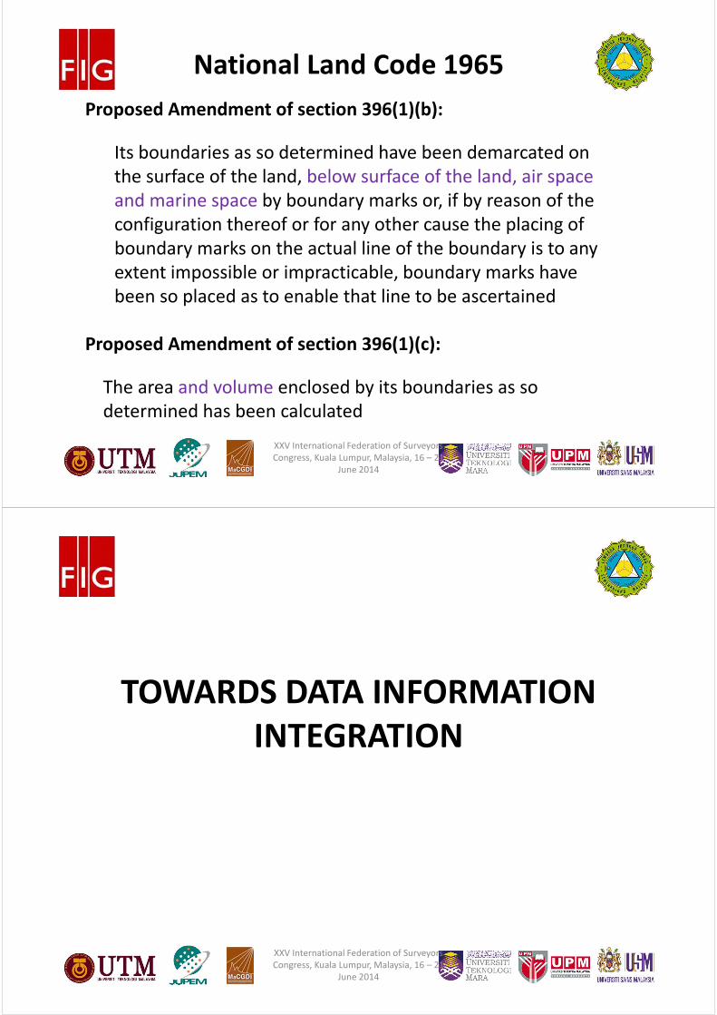
National Land Code 1965
Proposed Amendment of section 396(1)(b):
Its boundaries as so determined have been demarcated on
the surface of the land, below surface of the land, air space
and marine space by boundary marks or, if by reason of the
configuration thereof or for any other cause the placing of
boundary marks on the actual line of the boundary is to any
extent impossible or impracticable, boundary marks have
been so placed as to enable that line to be ascertained
Proposed Amendment of section 396(1)(c):
The area and volume enclosed by its boundaries as so
determined has been calculated
XXV International Federation of Surveyors
Congress, Kuala Lumpur, Malaysia, 16 – 21
June 2014
#
TOWARDS DATA INFORMATION
INTEGRATION
XXV International Federation of Surveyors
Congress, Kuala Lumpur, Malaysia, 16 – 21
June 2014
#
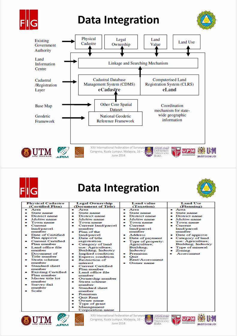
Data Integration
XXV International Federation of Surveyors
Congress, Kuala Lumpur, Malaysia, 16 – 21
June 2014
#
Data Integration
XXV International Federation of Surveyors
Congress, Kuala Lumpur, Malaysia, 16 – 21
June 2014
#
CONCLUSION
XXV International Federation of Surveyors
Congress, Kuala Lumpur, Malaysia, 16 – 21
June 2014
#
Conclusion
� The current Malaysian NDCDB and land legislation do not
provide 3D information and do not allow registration
rights for overlapping properties except underground land
respectively.
� It is believe that the eKADASTER and eTANAH will make a
paradigm shift and able to improve the current land title
registration and cadastral survey practice.
� Malaysia cadastre and land administration systems should
be transform to enable multipurpose cadastre, 3D
cadastre, marine cadastre and LADM (Homogeneous
Cadastre).
XXV International Federation of Surveyors
Congress, Kuala Lumpur, Malaysia, 16 – 21
June 2014

#
Acknowledgment
• Financial assistance from Malaysian Land
Surveyors Board (LJT).
• University of Technology Malaysia
• Department of Survey and Mapping Malaysia
(JUPEM).
XXV International Federation of Surveyors
Congress, Kuala Lumpur, Malaysia, 16 – 21
June 2014
#
Thank you for your attention!
University of Technology Malaysia,
Department of Survey and Mapping Malaysia
Email: [email protected],
XXV International Federation of Surveyors
Congress, Kuala Lumpur, Malaysia, 16 – 21
June 2014