Embed Size (px)
Citation preview
TUFLOW Conference 2015
Building TUFLOW Models in Flood Modeller
Dr Bob Potter
Flood Modeller Product Manager
2
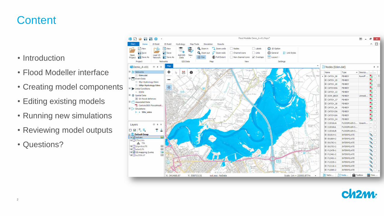
Content
• Introduction
• Flood Modeller interface
• Creating model components
• Editing existing models
• Running new simulations
• Reviewing model outputs
• Questions?

3
4
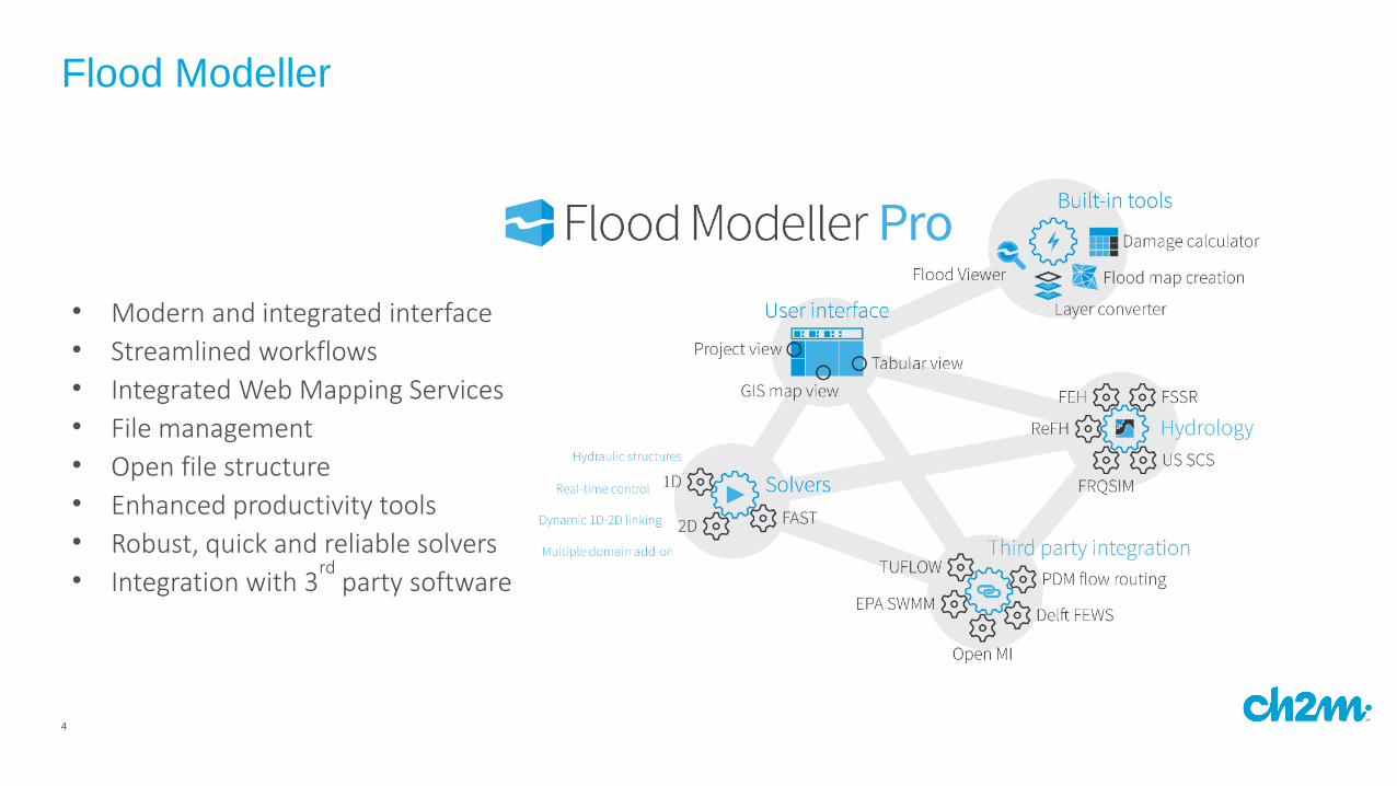
Flood Modeller
• Modern and integrated interface
• Streamlined workflows
• Integrated Web Mapping Services
• File management
• Open file structure
• Enhanced productivity tools
• Robust, quick and reliable solvers
• Integration with 3rd
party software
5
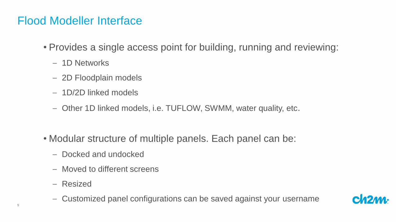
• Provides a single access point for building, running and reviewing:
– 1D Networks
– 2D Floodplain models
– 1D/2D linked models
– Other 1D linked models, i.e. TUFLOW, SWMM, water quality, etc.
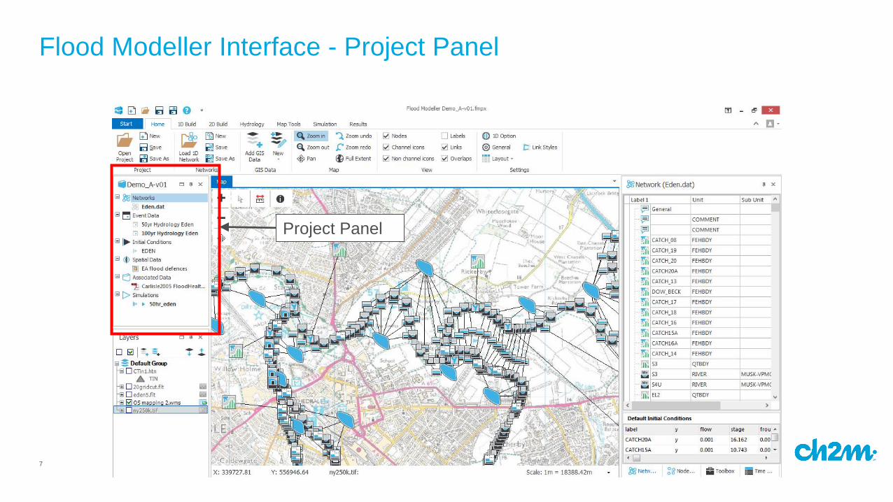
• Modular structure of multiple panels. Each panel can be:
– Docked and undocked
– Moved to different screens
– Resized
– Customized panel configurations can be saved against your username
Flood Modeller Interface
6
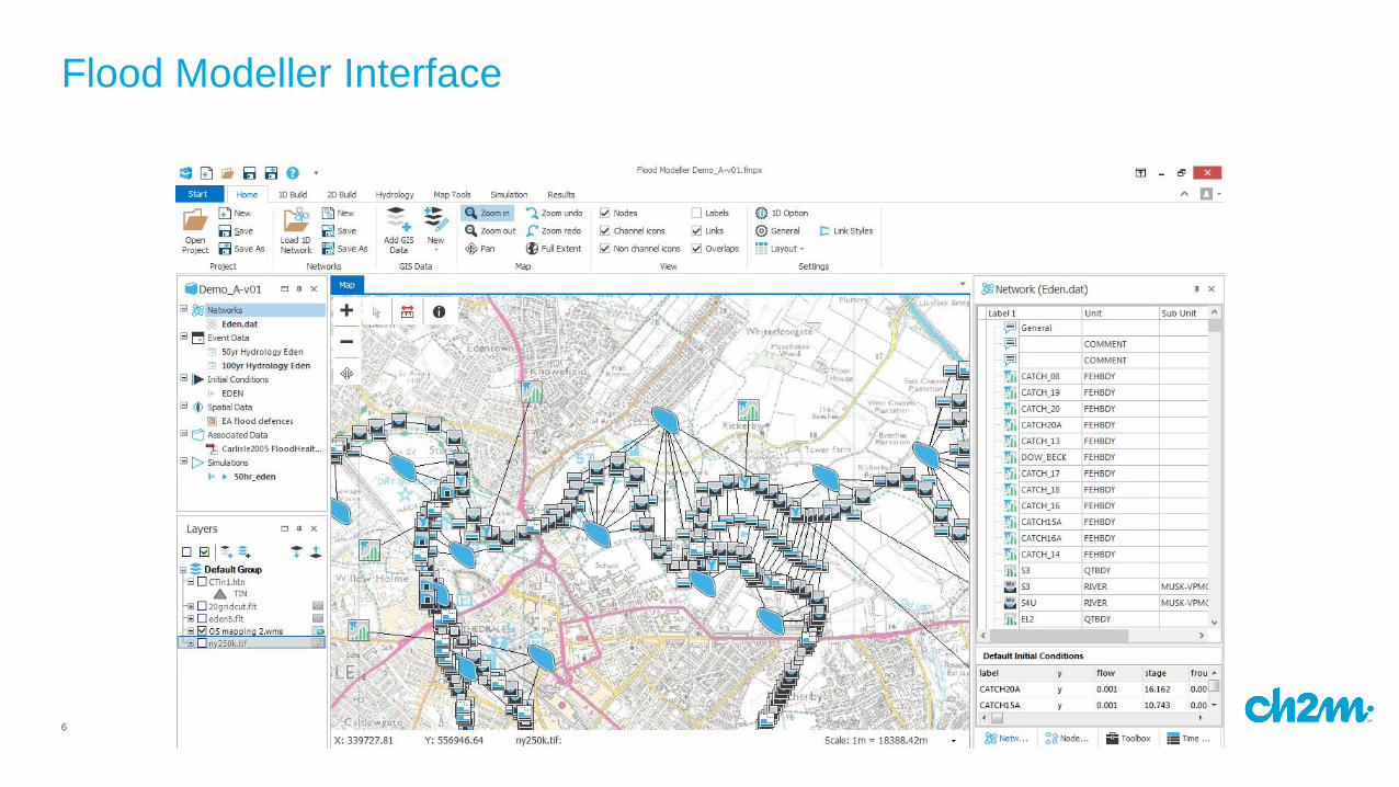
Flood Modeller Interface
7
Flood Modeller Interface - Project Panel
Project Panel
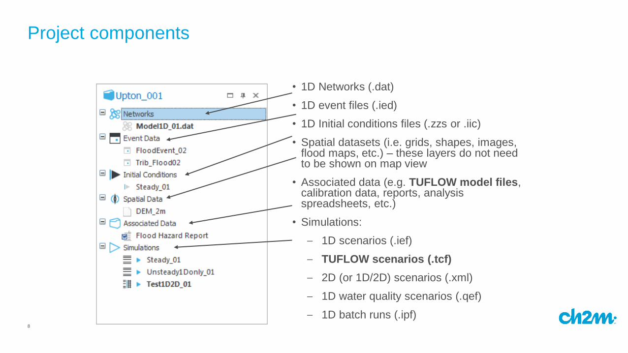
8
• 1D Networks (.dat)
• 1D event files (.ied)
• 1D Initial conditions files (.zzs or .iic)
• Spatial datasets (i.e. grids, shapes, images, flood maps, etc.) – these layers do not need to be shown on map view
• Associated data (e.g. TUFLOW model files, calibration data, reports, analysis spreadsheets, etc.)
• Simulations:
– 1D scenarios (.ief)
– TUFLOW scenarios (.tcf)
– 2D (or 1D/2D) scenarios (.xml)
– 1D water quality scenarios (.qef)
– 1D batch runs (.ipf)
Project components
9
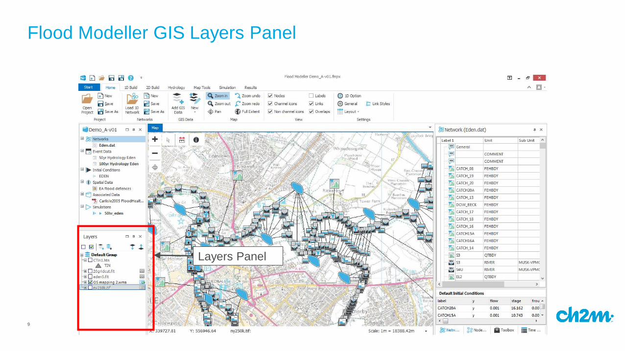
Flood Modeller GIS Layers Panel
Layers Panel
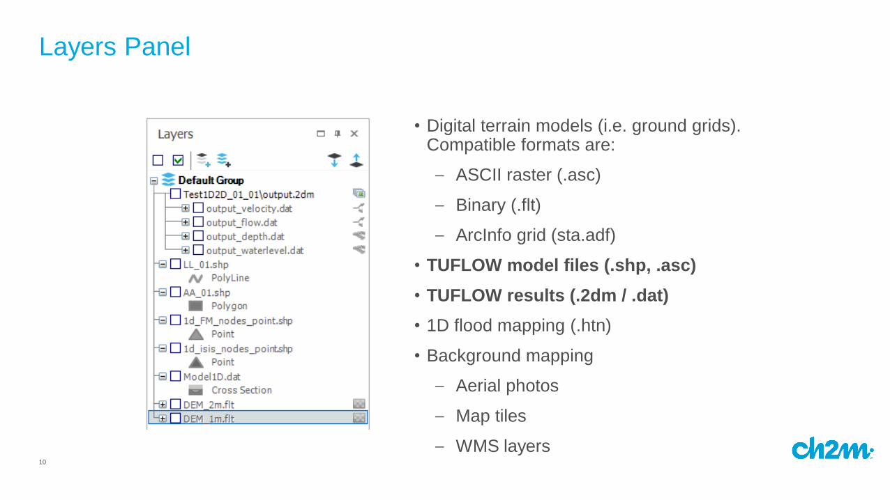
10
• Digital terrain models (i.e. ground grids). Compatible formats are:
– ASCII raster (.asc)
– Binary (.flt)
– ArcInfo grid (sta.adf)
• TUFLOW model files (.shp, .asc)
• TUFLOW results (.2dm / .dat)
• 1D flood mapping (.htn)
• Background mapping
– Aerial photos
– Map tiles
– WMS layers
Layers Panel
11
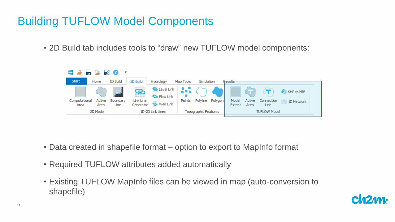
• 2D Build tab includes tools to “draw” new TUFLOW model components:
• Data created in shapefile format – option to export to MapInfo format
• Required TUFLOW attributes added automatically
• Existing TUFLOW MapInfo files can be viewed in map (auto-conversion to
shapefile)
Building TUFLOW Model Components
12
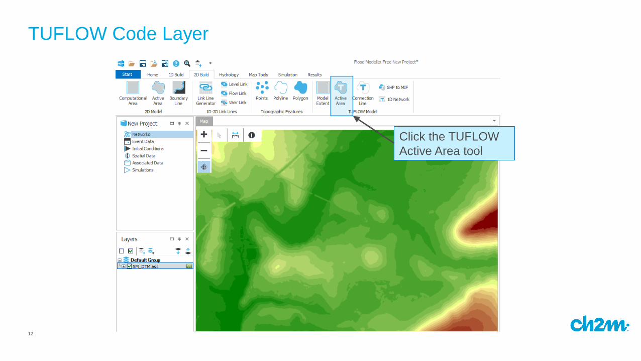
TUFLOW Code Layer
Click the TUFLOW
Active Area tool
13
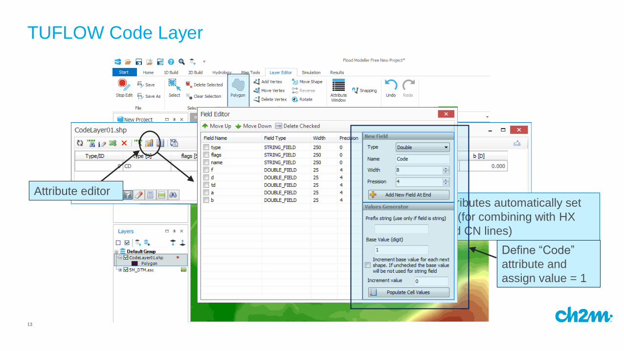
TUFLOW Code Layer
Click to draw code
layer shape
Attributes automatically set
up (for combining with HX
and CN lines)
Attribute editor
Define “Code”
attribute and
assign value = 1
14
TUFLOW Boundary Line
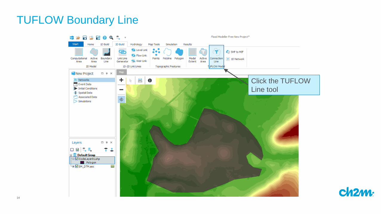
Click the TUFLOW
Line tool
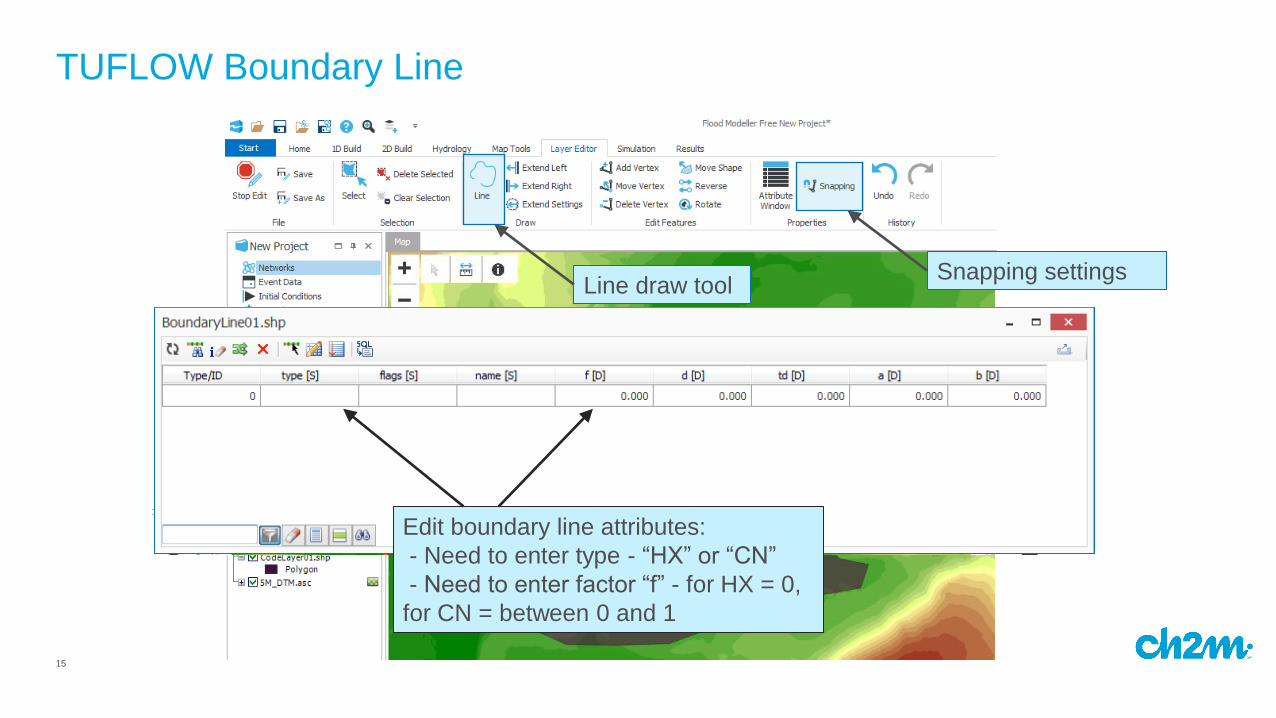
15
TUFLOW Boundary Line
Snapping settings
Snap to code layer for an
edge boundary line
Edit boundary line attributes:
- Need to enter type - “HX” or “CN”
- Need to enter factor “f” - for HX = 0,
for CN = between 0 and 1
Line draw tool
16
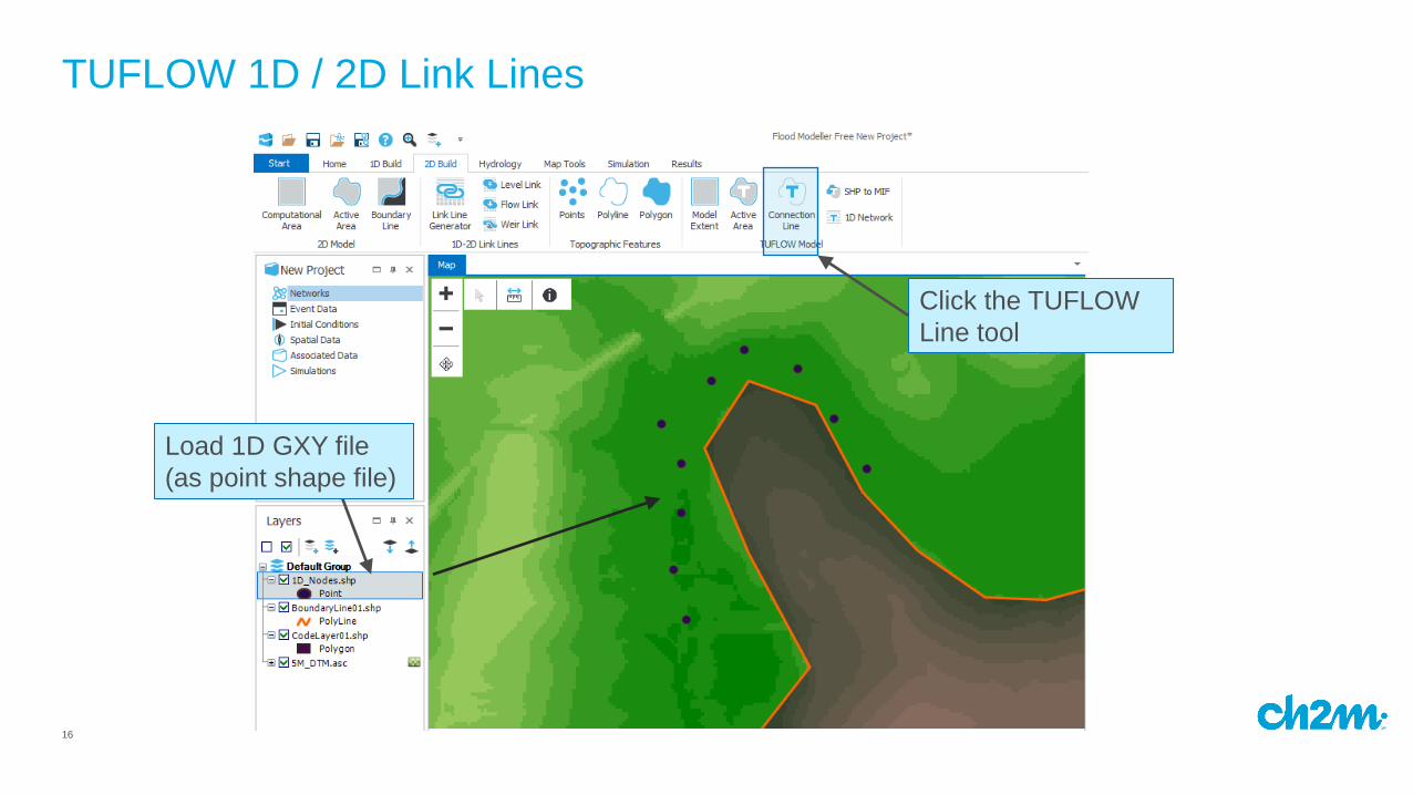
TUFLOW 1D / 2D Link Lines
Click the TUFLOW
Line tool
Load 1D GXY file
(as point shape file)
17
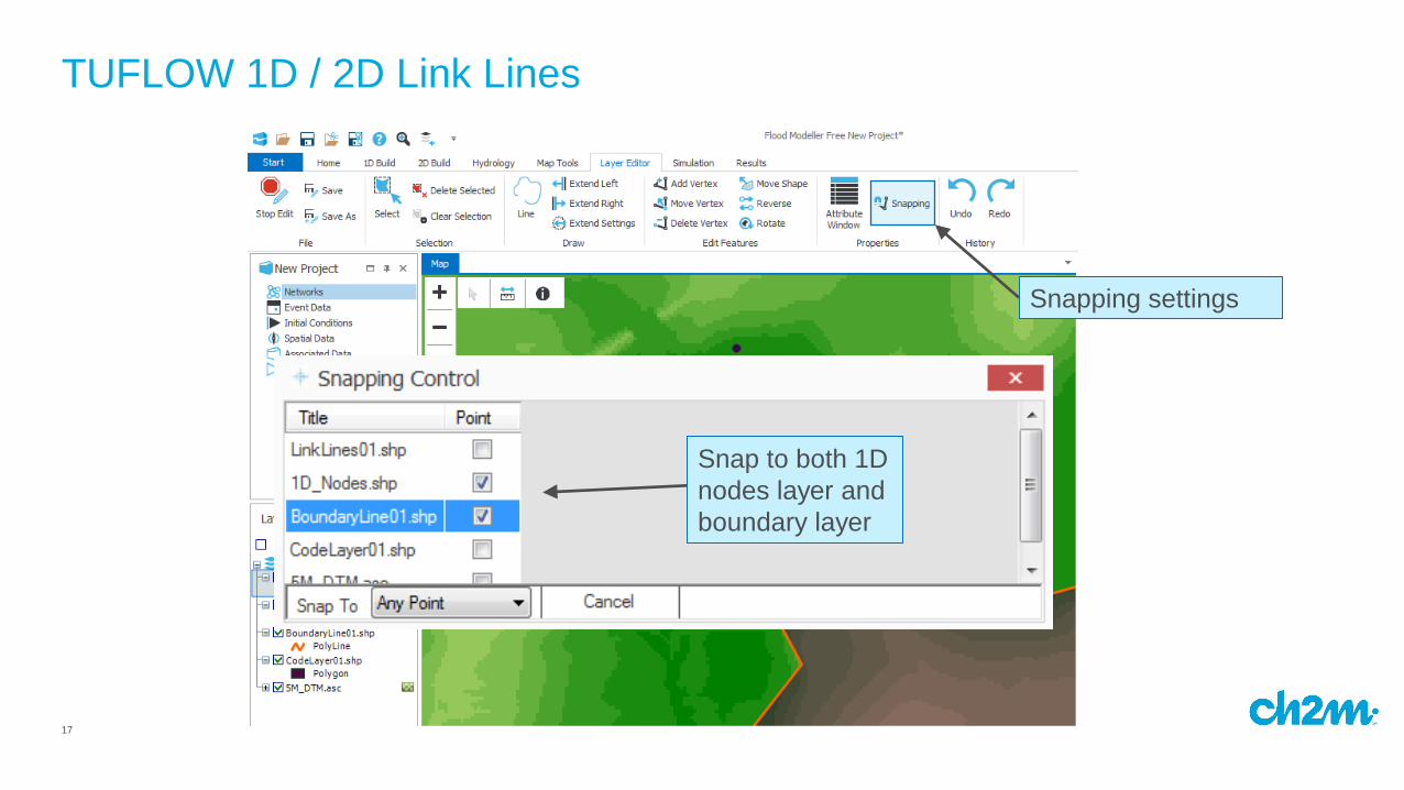
TUFLOW 1D / 2D Link Lines
Snapping settings
Snap to both 1D
nodes layer and
boundary layer
18
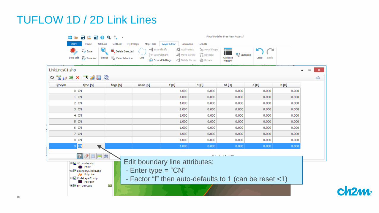
TUFLOW 1D / 2D Link Lines
Line draw tool
Edit boundary line attributes:
- Enter type = “CN”
- Factor “f” then auto-defaults to 1 (can be reset <1)
19
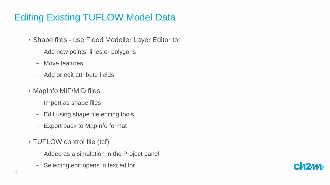
Editing Existing TUFLOW Model Data
• Shape files - use Flood Modeller Layer Editor to:
– Add new points, lines or polygons
– Move features
– Add or edit attribute fields
• MapInfo MIF/MID files
– Import as shape files
– Edit using shape file editing tools
– Export back to MapInfo format
• TUFLOW control file (tcf)
– Added as a simulation in the Project panel
– Selecting edit opens in text editor
20
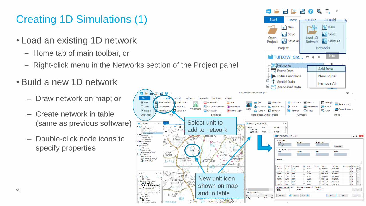
• Load an existing 1D network
– Home tab of main toolbar, or
– Right-click menu in the Networks section of the Project panel
• Build a new 1D network
Creating 1D Simulations (1)
– Draw network on map; or
– Create network in table
(same as previous software)
– Double-click node icons to
specify properties
New unit icon
shown on map
and in table
Select unit to
add to network
21
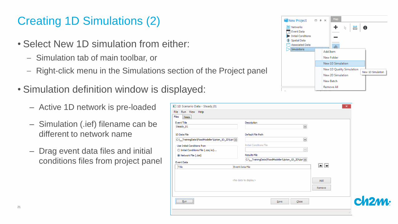
• Select New 1D simulation from either:
– Simulation tab of main toolbar, or
– Right-click menu in the Simulations section of the Project panel
• Simulation definition window is displayed:
Creating 1D Simulations (2)
– Active 1D network is pre-loaded
– Simulation (.ief) filename can be
different to network name
– Drag event data files and initial
conditions files from project panel
22
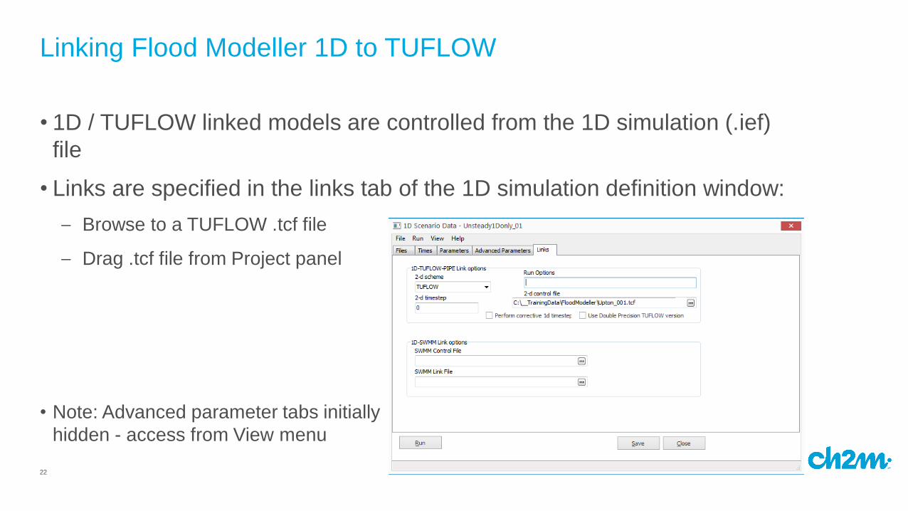
• 1D / TUFLOW linked models are controlled from the 1D simulation (.ief)
file
• Links are specified in the links tab of the 1D simulation definition window:
– Browse to a TUFLOW .tcf file
– Drag .tcf file from Project panel
Linking Flood Modeller 1D to TUFLOW
• Note: Advanced parameter tabs initially
hidden - access from View menu
23
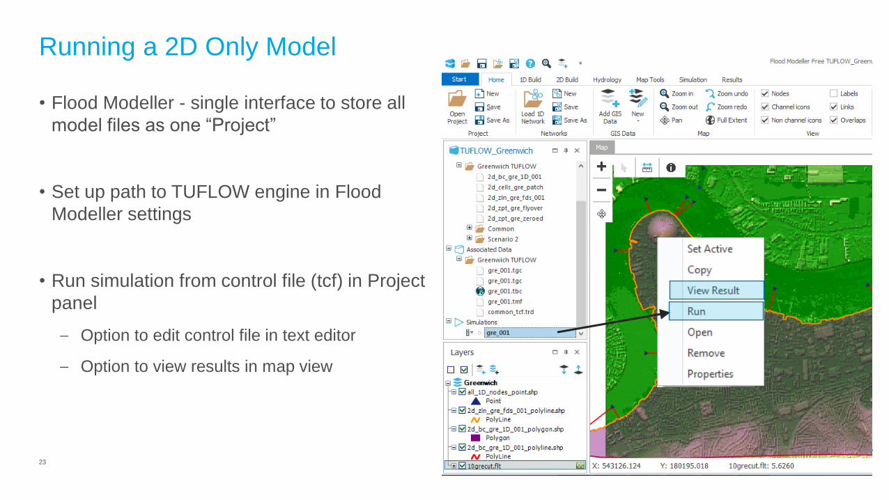
Running a 2D Only Model
• Flood Modeller - single interface to store all
model files as one “Project”
• Set up path to TUFLOW engine in Flood
Modeller settings
• Run simulation from control file (tcf) in Project
panel
– Option to edit control file in text editor
– Option to view results in map view
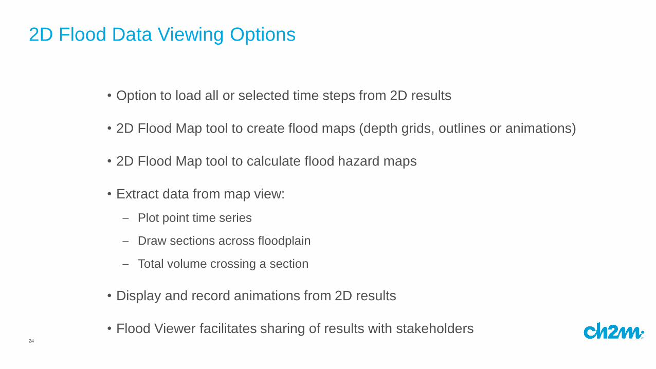
24
• Option to load all or selected time steps from 2D results
• 2D Flood Map tool to create flood maps (depth grids, outlines or animations)
• 2D Flood Map tool to calculate flood hazard maps
• Extract data from map view:
– Plot point time series
– Draw sections across floodplain
– Total volume crossing a section
• Display and record animations from 2D results
• Flood Viewer facilitates sharing of results with stakeholders
2D Flood Data Viewing Options
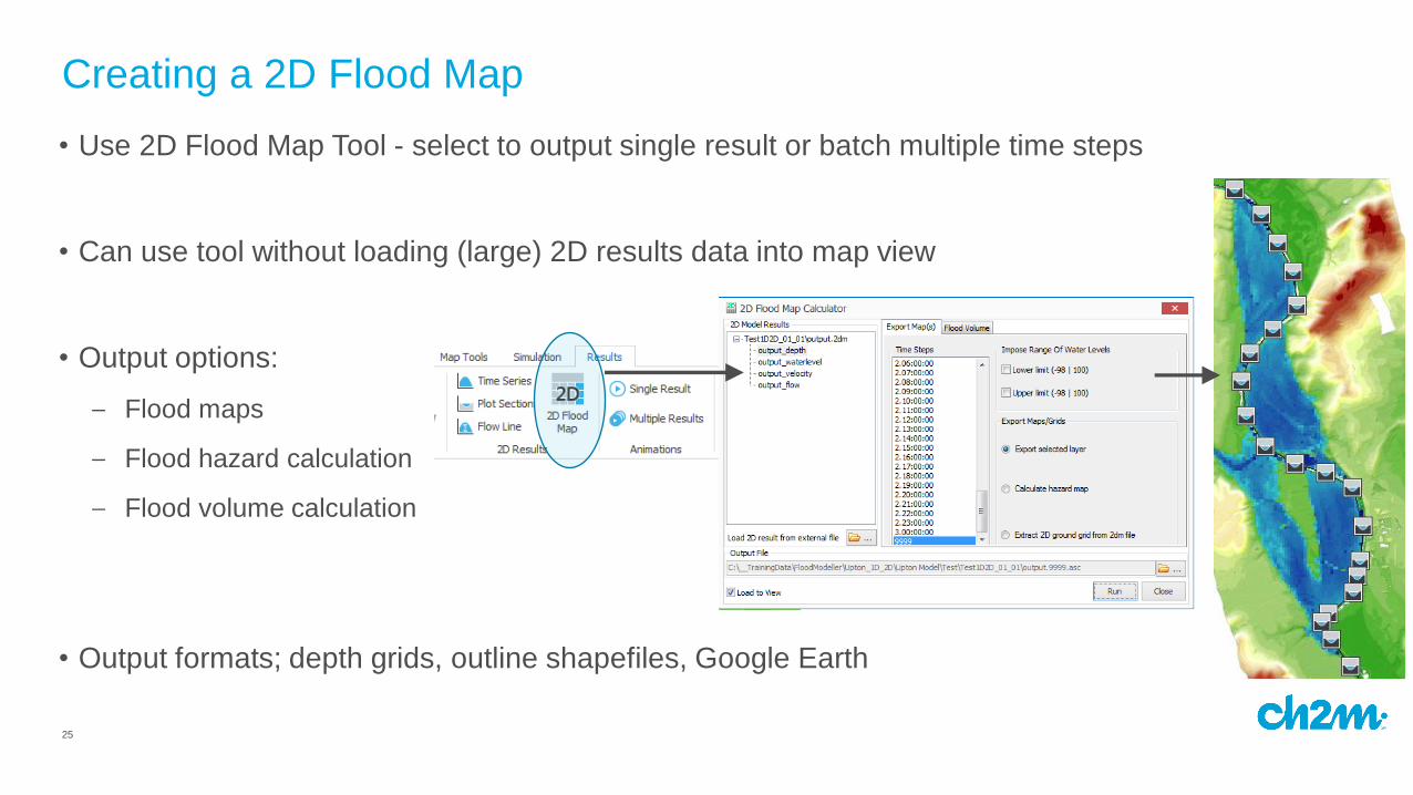
25
• Use 2D Flood Map Tool - select to output single result or batch multiple time steps
• Can use tool without loading (large) 2D results data into map view
• Output options:
– Flood maps
– Flood hazard calculation
– Flood volume calculation
• Output formats; depth grids, outline shapefiles, Google Earth
Creating a 2D Flood Map
26
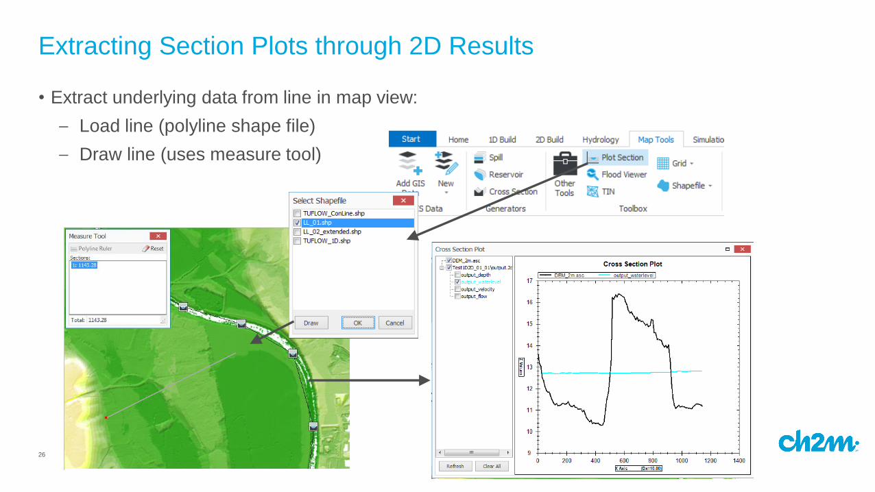
• Extract underlying data from line in map view:
– Load line (polyline shape file)
– Draw line (uses measure tool)
Extracting Section Plots through 2D Results
27
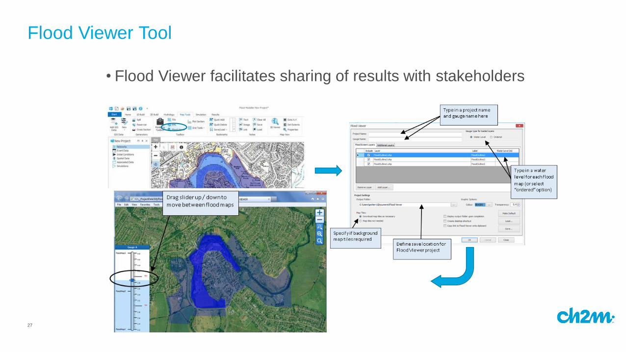
• Flood Viewer facilitates sharing of results with stakeholders
Flood Viewer Tool
28
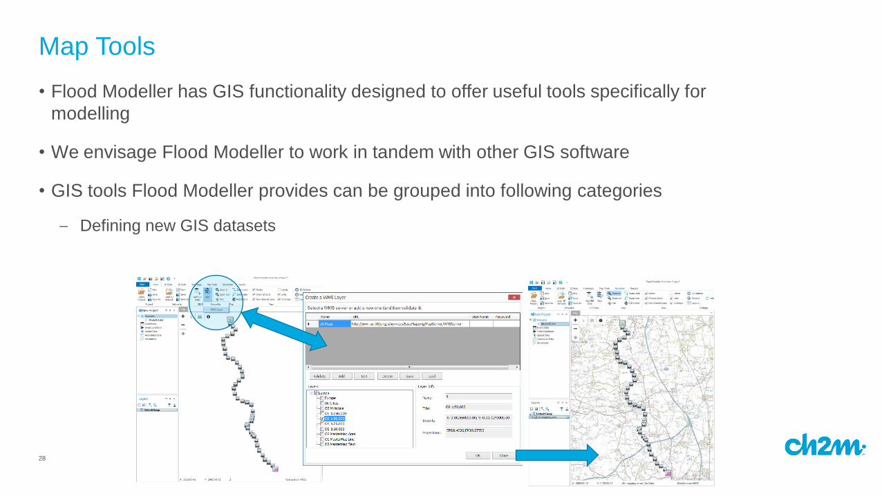
• Flood Modeller has GIS functionality designed to offer useful tools specifically for
modelling
• We envisage Flood Modeller to work in tandem with other GIS software
• GIS tools Flood Modeller provides can be grouped into following categories
Map Tools
– Defining new GIS datasets
29
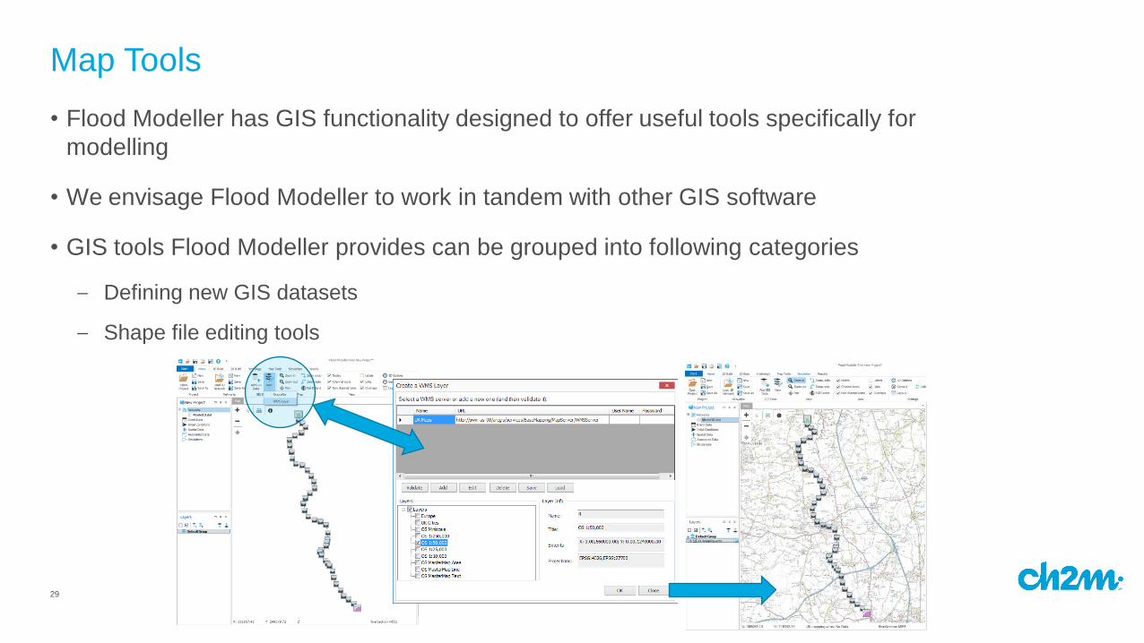
• Flood Modeller has GIS functionality designed to offer useful tools specifically for
modelling
• We envisage Flood Modeller to work in tandem with other GIS software
• GIS tools Flood Modeller provides can be grouped into following categories
Map Tools
– Defining new GIS datasets
– Shape file editing tools
30
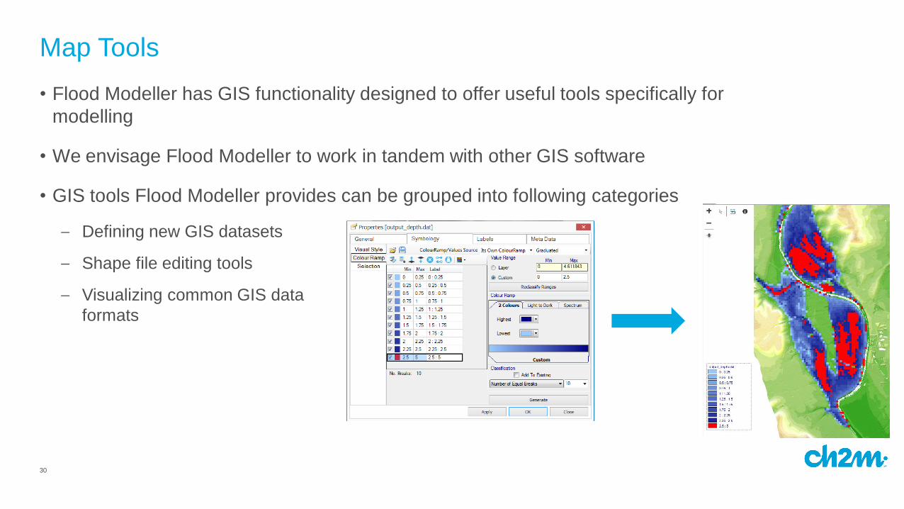
• Flood Modeller has GIS functionality designed to offer useful tools specifically for
modelling
• We envisage Flood Modeller to work in tandem with other GIS software
• GIS tools Flood Modeller provides can be grouped into following categories
Map Tools
– Defining new GIS datasets
– Shape file editing tools
– Visualizing common GIS data
formats
31
• Flood Modeller has GIS functionality designed to offer useful tools specifically for
modelling
• We envisage Flood Modeller to work in tandem with other GIS software
• GIS tools Flood Modeller provides can be grouped into following categories
Map Tools
– Defining new GIS datasets
– Shape file editing tools
– Visualizing common GIS data
formats
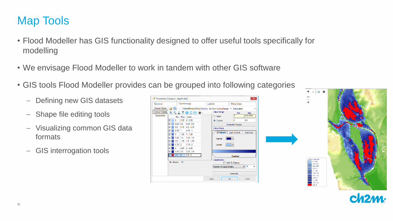
– GIS interrogation tools
32
• Flood Modeller has GIS functionality designed to offer useful tools specifically for
modelling
• We envisage Flood Modeller to work in tandem with other GIS software
• GIS tools Flood Modeller provides can be grouped into following categories
Map Tools
– Defining new GIS datasets
– Shape file editing tools
– Visualizing common GIS data
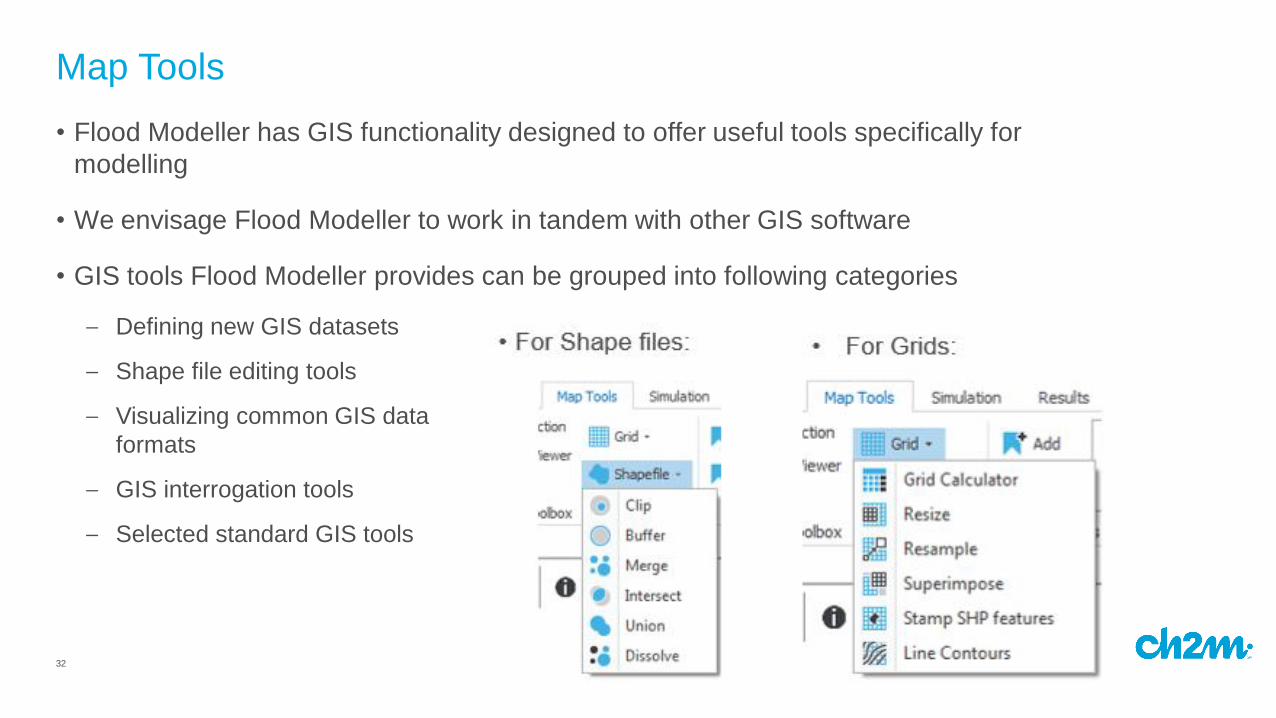
formats
– GIS interrogation tools
– Selected standard GIS tools
33
• Flood Modeller has GIS functionality designed to offer useful tools specifically for
modelling
• We envisage Flood Modeller to work in tandem with other GIS software
• GIS tools Flood Modeller provides can be grouped into following categories
Map Tools
– Defining new GIS datasets
– Shape file editing tools
– Visualizing common GIS data
formats
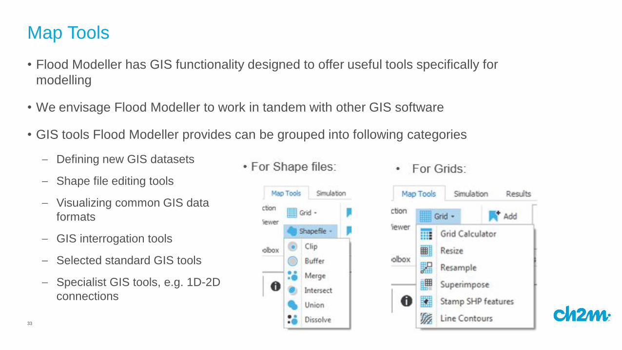
– GIS interrogation tools
– Selected standard GIS tools
– Specialist GIS tools, e.g. 1D-2D
connections

34
Summing up - Flood Modeller provides…
• Capability to build and run 1D / 2D linked river models
• User friendly environment for building TUFLOW model components:
– Specific tools for 1D / 2D integrated models
• A repository to store all model files associated to a project
• An interface to control your model simulations
• A map (and associated tools) for visualising and analysing your model results

35
2016 (and beyond)
• Development is ongoing - we ‘re keen to hear your ideas!
• www.floodmodeller.com for more information and Ideas Lab
Thank you - Any questions?