Embed Size (px)
Citation preview
ULSTER ARCHAEOLOGICAL SOCIETY
Survey Report: No. 18
Survey of Lime Kiln at Murlough Bay
County Antrim
UAS/09/03
In association with
JUNE WELSH

2
© Ulster Archaeological Society
First published 2011
Ulster Archaeological Society
c/o School of Geography, Archaeology and Palaeoecology
The Queen’s University of Belfast
42 Fitzwilliam Street
Belfast
BT9 6AX
3
CONTENTS
Page
List of figures 4
1. Summary 5
2. Introduction 6
3. 2009 UAS survey 9
4. Discussion 12
5. Conclusions and Recommendations for further work 17
6. Bibliography 19
Appendix
A. Photographic record form 20
4
LIST OF FIGURES
Figures page
1. View of the Lime Kiln looking south 5
2. East-facing elevation of the Lime Kiln, Murlough Bay 6
3. OS County Series Antrim Sheet 5 (part of) 1834 7
4. OS County Series Antrim Sheet 5 (part of) 1855 7
5. OS County Series Antrim Sheet 5 (part of) 1935 8
6. Lime Kiln in the townland of Bighouse 8
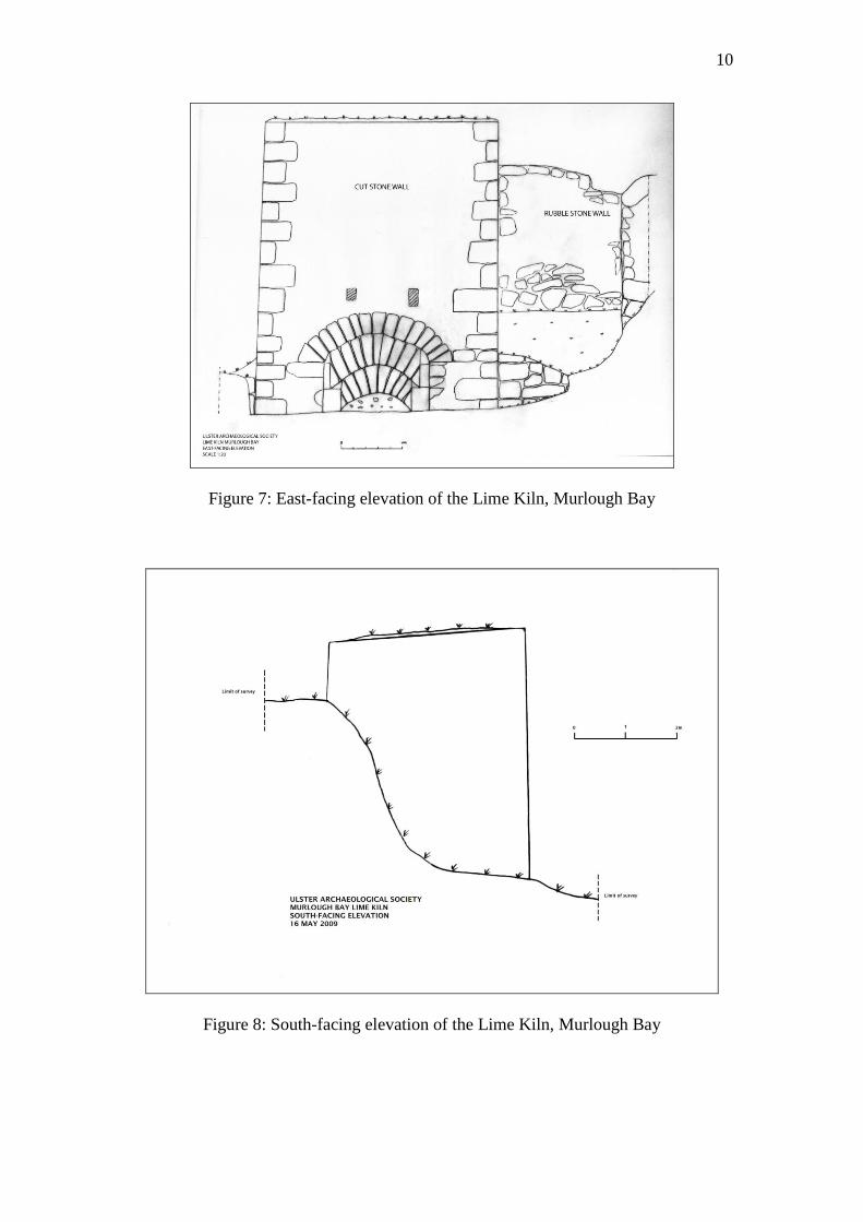
7. East-facing elevation of the Lime Kiln, Murlough Bay 10
8. South-facing elevation of the Lime Kiln, Murlough Bay 10
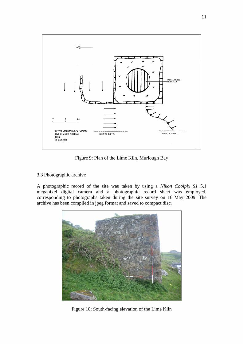
9. Plan of the Lime Kiln, Murlough Bay 11
10. South-facing elevation of the Lime Kiln, Murlough Bay 11
11. UAS survey team members at work at the Lime Kiln, Murlough Bay 12
12. Draw-hole at the Lime Kiln, Murlough Bay 14
13. Example of burnt lime, www.buildinglimesforumireland.com 14
14. Diagram of a working kiln (Ursula Mattenberger) 15
15. Larger vent at the Lime Kiln, Murlough Bay 16
16. Iron grille at the top of the Lime Kiln flue, Murlough Bay 16
17. Stone lean-to at the Lime Kiln, Murlough Bay 17
18. A double lime kiln at Ballintoy, County Antrim 18
19. Lime kiln at Hook Peninsula, County Wexford 18
20. Lime kiln in the grounds of Tintern Abbey, County Wexford 19
5
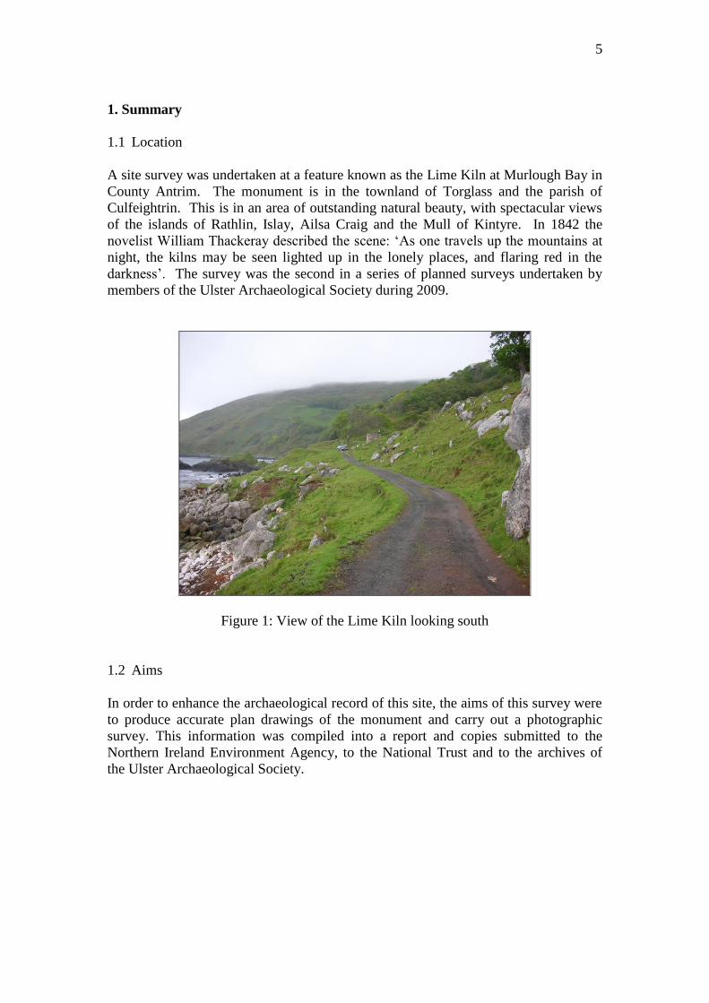
1. Summary
1.1 Location
A site survey was undertaken at a feature known as the Lime Kiln at Murlough Bay in
County Antrim. The monument is in the townland of Torglass and the parish of
Culfeightrin. This is in an area of outstanding natural beauty, with spectacular views
of the islands of Rathlin, Islay, Ailsa Craig and the Mull of Kintyre. In 1842 the
novelist William Thackeray described the scene: ‘As one travels up the mountains at
night, the kilns may be seen lighted up in the lonely places, and flaring red in the
darkness’. The survey was the second in a series of planned surveys undertaken by
members of the Ulster Archaeological Society during 2009.
Figure 1: View of the Lime Kiln looking south
1.2 Aims
In order to enhance the archaeological record of this site, the aims of this survey were
to produce accurate plan drawings of the monument and carry out a photographic
survey. This information was compiled into a report and copies submitted to the
Northern Ireland Environment Agency, to the National Trust and to the archives of
the Ulster Archaeological Society.
6
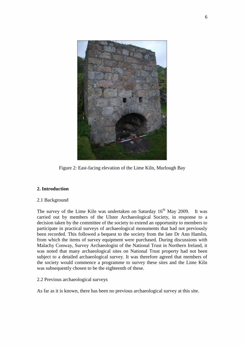
Figure 2: East-facing elevation of the Lime Kiln, Murlough Bay
2. Introduction
2.1 Background
The survey of the Lime Kiln was undertaken on Saturday 16th
May 2009. It was
carried out by members of the Ulster Archaeological Society, in response to a
decision taken by the committee of the society to extend an opportunity to members to
participate in practical surveys of archaeological monuments that had not previously
been recorded. This followed a bequest to the society from the late Dr Ann Hamlin,
from which the items of survey equipment were purchased. During discussions with
Malachy Conway, Survey Archaeologist of the National Trust in Northern Ireland, it
was noted that many archaeological sites on National Trust property had not been
subject to a detailed archaeological survey. It was therefore agreed that members of
the society would commence a programme to survey these sites and the Lime Kiln
was subsequently chosen to be the eighteenth of these.
2.2 Previous archaeological surveys
As far as it is known, there has been no previous archaeological survey at this site.
7
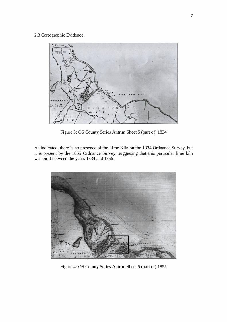
2.3 Cartographic Evidence
Figure 3: OS County Series Antrim Sheet 5 (part of) 1834
As indicated, there is no presence of the Lime Kiln on the 1834 Ordnance Survey, but
it is present by the 1855 Ordnance Survey, suggesting that this particular lime kiln
was built between the years 1834 and 1855.
Figure 4: OS County Series Antrim Sheet 5 (part of) 1855
8
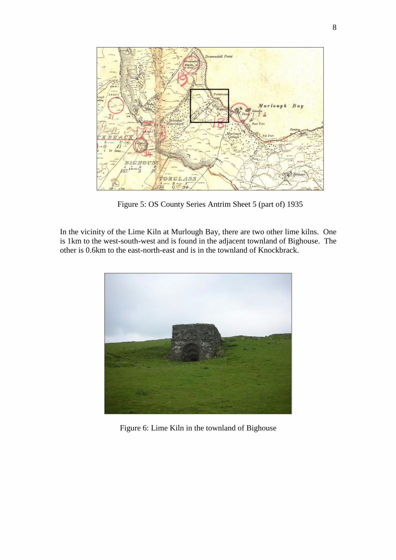
Figure 5: OS County Series Antrim Sheet 5 (part of) 1935
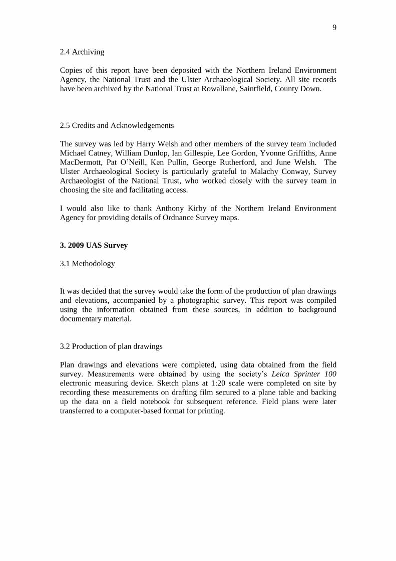
In the vicinity of the Lime Kiln at Murlough Bay, there are two other lime kilns. One
is 1km to the west-south-west and is found in the adjacent townland of Bighouse. The
other is 0.6km to the east-north-east and is in the townland of Knockbrack.
Figure 6: Lime Kiln in the townland of Bighouse
9
2.4 Archiving
Copies of this report have been deposited with the Northern Ireland Environment
Agency, the National Trust and the Ulster Archaeological Society. All site records
have been archived by the National Trust at Rowallane, Saintfield, County Down.
2.5 Credits and Acknowledgements
The survey was led by Harry Welsh and other members of the survey team included
Michael Catney, William Dunlop, Ian Gillespie, Lee Gordon, Yvonne Griffiths, Anne
MacDermott, Pat O’Neill, Ken Pullin, George Rutherford, and June Welsh. The
Ulster Archaeological Society is particularly grateful to Malachy Conway, Survey
Archaeologist of the National Trust, who worked closely with the survey team in
choosing the site and facilitating access.
I would also like to thank Anthony Kirby of the Northern Ireland Environment
Agency for providing details of Ordnance Survey maps.
3. 2009 UAS Survey
3.1 Methodology
It was decided that the survey would take the form of the production of plan drawings
and elevations, accompanied by a photographic survey. This report was compiled
using the information obtained from these sources, in addition to background
documentary material.
3.2 Production of plan drawings
Plan drawings and elevations were completed, using data obtained from the field
survey. Measurements were obtained by using the society’s Leica Sprinter 100
electronic measuring device. Sketch plans at 1:20 scale were completed on site by
recording these measurements on drafting film secured to a plane table and backing
up the data on a field notebook for subsequent reference. Field plans were later
transferred to a computer-based format for printing.
10
Figure 7: East-facing elevation of the Lime Kiln, Murlough Bay
Figure 8: South-facing elevation of the Lime Kiln, Murlough Bay
11
Figure 9: Plan of the Lime Kiln, Murlough Bay
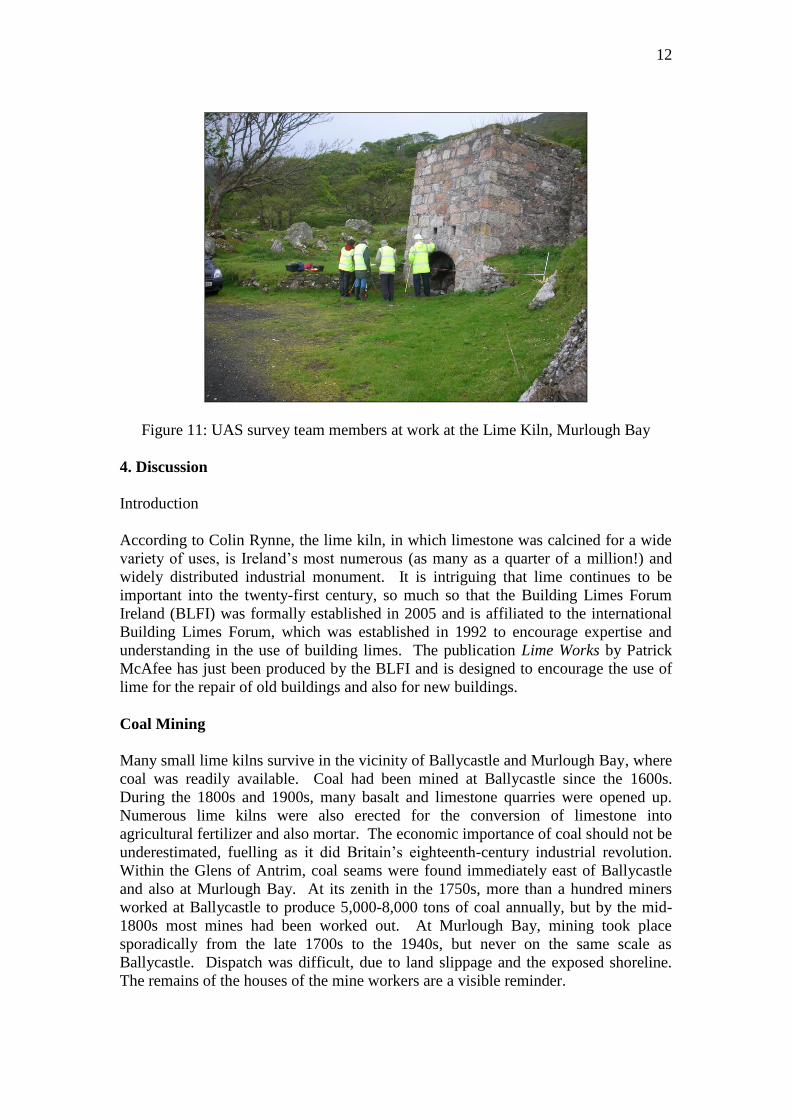
3.3 Photographic archive
A photographic record of the site was taken by using a Nikon Coolpix S1 5.1
megapixel digital camera and a photographic record sheet was employed,
corresponding to photographs taken during the site survey on 16 May 2009. The
archive has been compiled in jpeg format and saved to compact disc.
Figure 10: South-facing elevation of the Lime Kiln
12
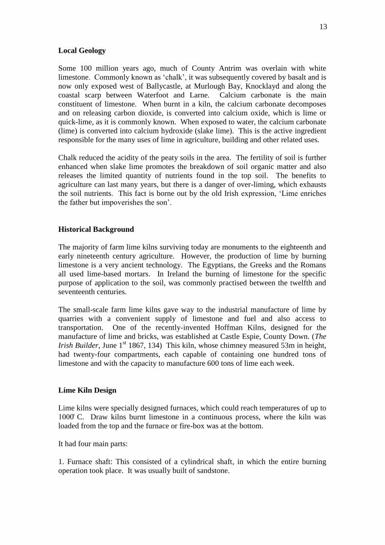
Figure 11: UAS survey team members at work at the Lime Kiln, Murlough Bay
4. Discussion
Introduction
According to Colin Rynne, the lime kiln, in which limestone was calcined for a wide
variety of uses, is Ireland’s most numerous (as many as a quarter of a million!) and
widely distributed industrial monument. It is intriguing that lime continues to be
important into the twenty-first century, so much so that the Building Limes Forum
Ireland (BLFI) was formally established in 2005 and is affiliated to the international
Building Limes Forum, which was established in 1992 to encourage expertise and
understanding in the use of building limes. The publication Lime Works by Patrick
McAfee has just been produced by the BLFI and is designed to encourage the use of
lime for the repair of old buildings and also for new buildings.
Coal Mining
Many small lime kilns survive in the vicinity of Ballycastle and Murlough Bay, where
coal was readily available. Coal had been mined at Ballycastle since the 1600s.
During the 1800s and 1900s, many basalt and limestone quarries were opened up.
Numerous lime kilns were also erected for the conversion of limestone into
agricultural fertilizer and also mortar. The economic importance of coal should not be
underestimated, fuelling as it did Britain’s eighteenth-century industrial revolution.
Within the Glens of Antrim, coal seams were found immediately east of Ballycastle
and also at Murlough Bay. At its zenith in the 1750s, more than a hundred miners
worked at Ballycastle to produce 5,000-8,000 tons of coal annually, but by the mid-
1800s most mines had been worked out. At Murlough Bay, mining took place
sporadically from the late 1700s to the 1940s, but never on the same scale as
Ballycastle. Dispatch was difficult, due to land slippage and the exposed shoreline.
The remains of the houses of the mine workers are a visible reminder.
13
Local Geology
Some 100 million years ago, much of County Antrim was overlain with white
limestone. Commonly known as ‘chalk’, it was subsequently covered by basalt and is
now only exposed west of Ballycastle, at Murlough Bay, Knocklayd and along the
coastal scarp between Waterfoot and Larne. Calcium carbonate is the main
constituent of limestone. When burnt in a kiln, the calcium carbonate decomposes
and on releasing carbon dioxide, is converted into calcium oxide, which is lime or
quick-lime, as it is commonly known. When exposed to water, the calcium carbonate
(lime) is converted into calcium hydroxide (slake lime). This is the active ingredient
responsible for the many uses of lime in agriculture, building and other related uses.
Chalk reduced the acidity of the peaty soils in the area. The fertility of soil is further
enhanced when slake lime promotes the breakdown of soil organic matter and also
releases the limited quantity of nutrients found in the top soil. The benefits to
agriculture can last many years, but there is a danger of over-liming, which exhausts
the soil nutrients. This fact is borne out by the old Irish expression, ‘Lime enriches
the father but impoverishes the son’.
Historical Background
The majority of farm lime kilns surviving today are monuments to the eighteenth and
early nineteenth century agriculture. However, the production of lime by burning
limestone is a very ancient technology. The Egyptians, the Greeks and the Romans
all used lime-based mortars. In Ireland the burning of limestone for the specific
purpose of application to the soil, was commonly practised between the twelfth and
seventeenth centuries.
The small-scale farm lime kilns gave way to the industrial manufacture of lime by
quarries with a convenient supply of limestone and fuel and also access to
transportation. One of the recently-invented Hoffman Kilns, designed for the
manufacture of lime and bricks, was established at Castle Espie, County Down. (The
Irish Builder, June 1st 1867, 134) This kiln, whose chimney measured 53m in height,
had twenty-four compartments, each capable of containing one hundred tons of
limestone and with the capacity to manufacture 600 tons of lime each week.
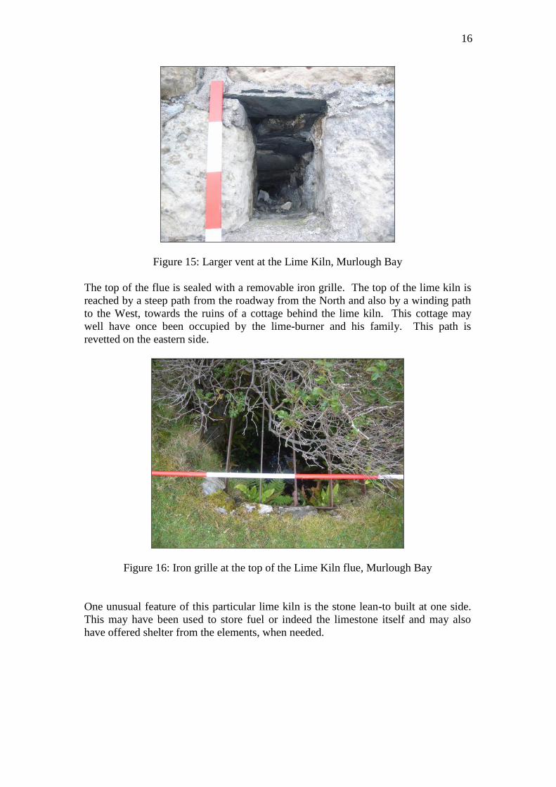
Lime Kiln Design
Lime kilns were specially designed furnaces, which could reach temperatures of up to
C. Draw kilns burnt limestone in a continuous process, where the kiln was
loaded from the top and the furnace or fire-box was at the bottom.
It had four main parts:
1. Furnace shaft: This consisted of a cylindrical shaft, in which the entire burning
operation took place. It was usually built of sandstone.
14
2. Masonry casing: Lime kilns were often built into a bank of rising ground and
secured on the other sides by a stone-built structure, often rectangular in shape. The
space between the furnace shaft and the outer structure was filled in with stones, clay,
sand and other non-combustible materials. This ensured support, insulation and also
provided room for expansion within the kiln.
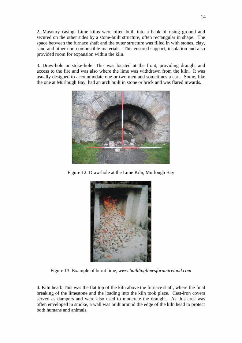
3. Draw-hole or stoke-hole: This was located at the front, providing draught and
access to the fire and was also where the lime was withdrawn from the kiln. It was
usually designed to accommodate one or two men and sometimes a cart. Some, like
the one at Murlough Bay, had an arch built in stone or brick and was flared inwards.
Figure 12: Draw-hole at the Lime Kiln, Murlough Bay
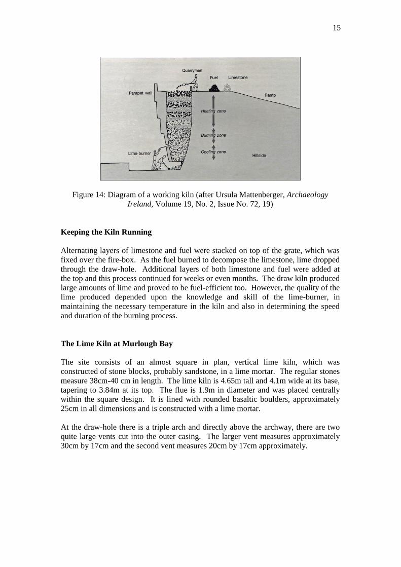
Figure 13: Example of burnt lime, www.buildinglimesforumireland.com
4. Kiln head: This was the flat top of the kiln above the furnace shaft, where the final
breaking of the limestone and the loading into the kiln took place. Cast-iron covers
served as dampers and were also used to moderate the draught. As this area was
often enveloped in smoke, a wall was built around the edge of the kiln head to protect
both humans and animals.
15
Figure 14: Diagram of a working kiln (after Ursula Mattenberger, Archaeology
Ireland, Volume 19, No. 2, Issue No. 72, 19)
Keeping the Kiln Running
Alternating layers of limestone and fuel were stacked on top of the grate, which was
fixed over the fire-box. As the fuel burned to decompose the limestone, lime dropped
through the draw-hole. Additional layers of both limestone and fuel were added at
the top and this process continued for weeks or even months. The draw kiln produced
large amounts of lime and proved to be fuel-efficient too. However, the quality of the
lime produced depended upon the knowledge and skill of the lime-burner, in
maintaining the necessary temperature in the kiln and also in determining the speed
and duration of the burning process.
The Lime Kiln at Murlough Bay
The site consists of an almost square in plan, vertical lime kiln, which was
constructed of stone blocks, probably sandstone, in a lime mortar. The regular stones
measure 38cm-40 cm in length. The lime kiln is 4.65m tall and 4.1m wide at its base,
tapering to 3.84m at its top. The flue is 1.9m in diameter and was placed centrally
within the square design. It is lined with rounded basaltic boulders, approximately
25cm in all dimensions and is constructed with a lime mortar.
At the draw-hole there is a triple arch and directly above the archway, there are two
quite large vents cut into the outer casing. The larger vent measures approximately
30cm by 17cm and the second vent measures 20cm by 17cm approximately.
16
Figure 15: Larger vent at the Lime Kiln, Murlough Bay
The top of the flue is sealed with a removable iron grille. The top of the lime kiln is
reached by a steep path from the roadway from the North and also by a winding path
to the West, towards the ruins of a cottage behind the lime kiln. This cottage may
well have once been occupied by the lime-burner and his family. This path is
revetted on the eastern side.
Figure 16: Iron grille at the top of the Lime Kiln flue, Murlough Bay
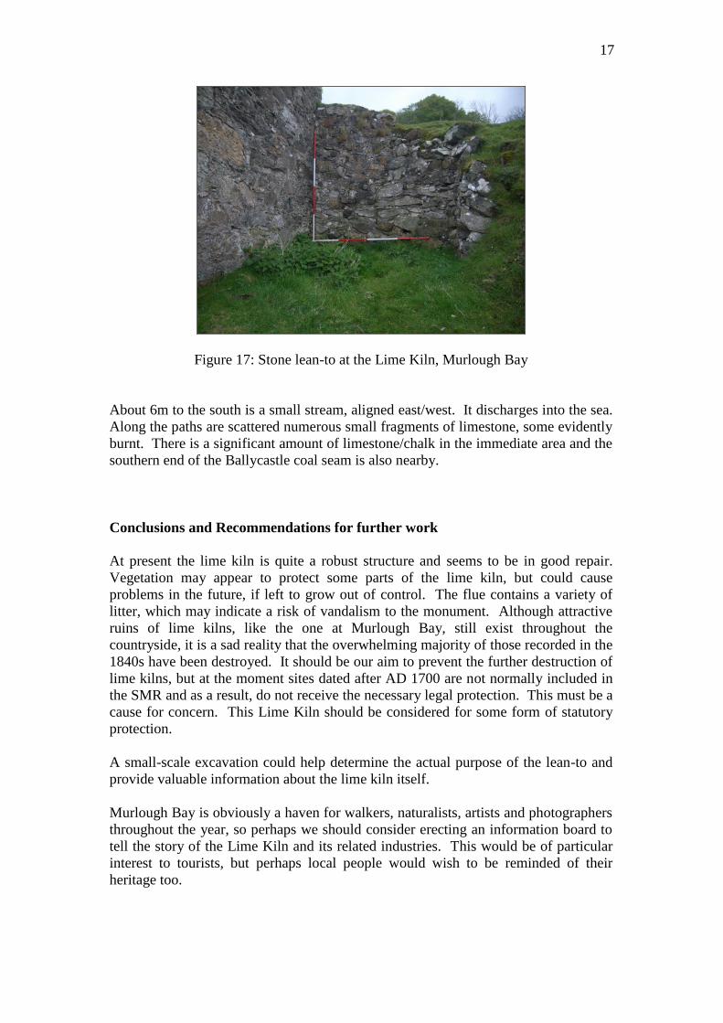
One unusual feature of this particular lime kiln is the stone lean-to built at one side.
This may have been used to store fuel or indeed the limestone itself and may also
have offered shelter from the elements, when needed.
17
Figure 17: Stone lean-to at the Lime Kiln, Murlough Bay
About 6m to the south is a small stream, aligned east/west. It discharges into the sea.
Along the paths are scattered numerous small fragments of limestone, some evidently
burnt. There is a significant amount of limestone/chalk in the immediate area and the
southern end of the Ballycastle coal seam is also nearby.
Conclusions and Recommendations for further work
At present the lime kiln is quite a robust structure and seems to be in good repair.
Vegetation may appear to protect some parts of the lime kiln, but could cause
problems in the future, if left to grow out of control. The flue contains a variety of
litter, which may indicate a risk of vandalism to the monument. Although attractive
ruins of lime kilns, like the one at Murlough Bay, still exist throughout the
countryside, it is a sad reality that the overwhelming majority of those recorded in the
1840s have been destroyed. It should be our aim to prevent the further destruction of
lime kilns, but at the moment sites dated after AD 1700 are not normally included in
the SMR and as a result, do not receive the necessary legal protection. This must be a
cause for concern. This Lime Kiln should be considered for some form of statutory
protection.
A small-scale excavation could help determine the actual purpose of the lean-to and
provide valuable information about the lime kiln itself.
Murlough Bay is obviously a haven for walkers, naturalists, artists and photographers
throughout the year, so perhaps we should consider erecting an information board to
tell the story of the Lime Kiln and its related industries. This would be of particular
interest to tourists, but perhaps local people would wish to be reminded of their
heritage too.
18
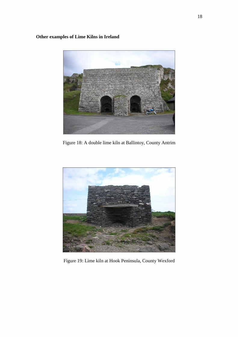
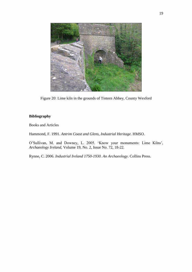
Other examples of Lime Kilns in Ireland
Figure 18: A double lime kiln at Ballintoy, County Antrim
Figure 19: Lime kiln at Hook Peninsula, County Wexford
19
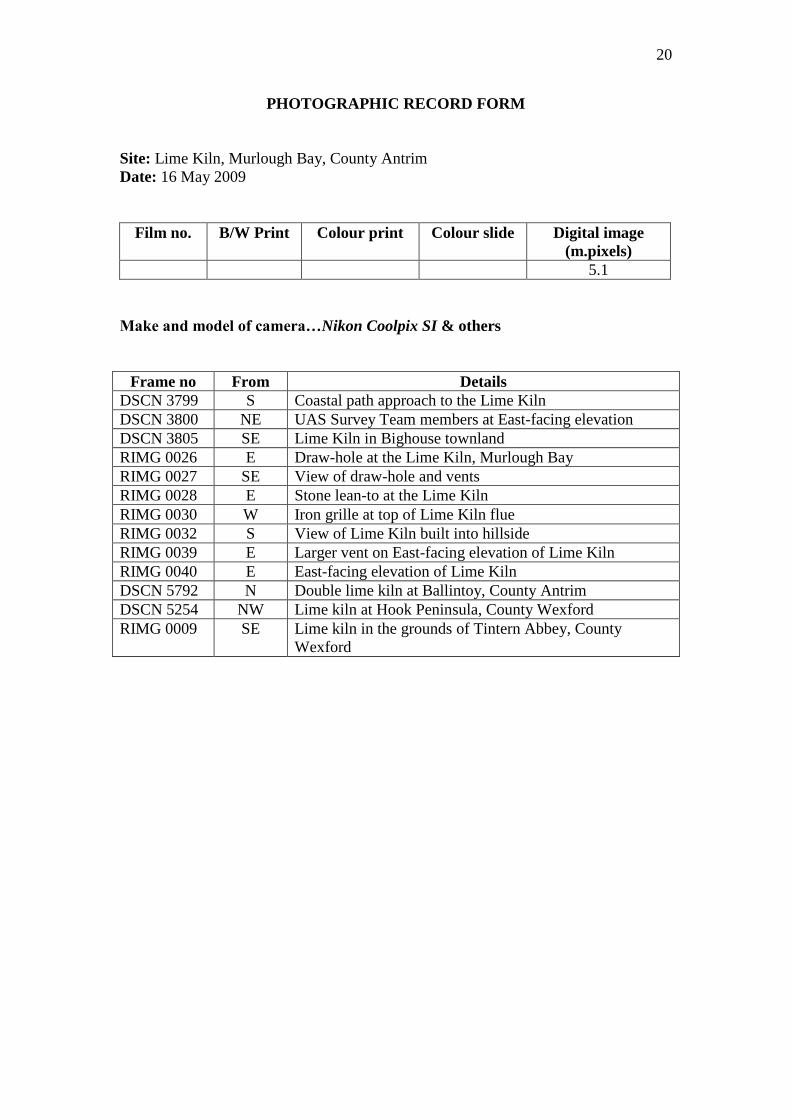
Figure 20: Lime kiln in the grounds of Tintern Abbey, County Wexford
Bibliography
Books and Articles
Hammond, F. 1991. Antrim Coast and Glens, Industrial Heritage. HMSO.
O’Sullivan, M. and Downey, L. 2 5. ‘Know your monuments: Lime Kilns’,
Archaeology Ireland, Volume 19, No. 2, Issue No. 72, 18-22.
Rynne, C. 2006. Industrial Ireland 1750-1930. An Archaeology. Collins Press.
20
PHOTOGRAPHIC RECORD FORM
Site: Lime Kiln, Murlough Bay, County Antrim
Date: 16 May 2009
Film no. B/W Print Colour print Colour slide Digital image
(m.pixels)
5.1
Make and model of camera…Nikon Coolpix SI & others
Frame no From Details
DSCN 3799 S Coastal path approach to the Lime Kiln
DSCN 3800 NE UAS Survey Team members at East-facing elevation
DSCN 3805 SE Lime Kiln in Bighouse townland
RIMG 0026 E Draw-hole at the Lime Kiln, Murlough Bay
RIMG 0027 SE View of draw-hole and vents
RIMG 0028 E Stone lean-to at the Lime Kiln
RIMG 0030 W Iron grille at top of Lime Kiln flue
RIMG 0032 S View of Lime Kiln built into hillside
RIMG 0039 E Larger vent on East-facing elevation of Lime Kiln
RIMG 0040 E East-facing elevation of Lime Kiln
DSCN 5792 N Double lime kiln at Ballintoy, County Antrim
DSCN 5254 NW Lime kiln at Hook Peninsula, County Wexford
RIMG 0009 SE Lime kiln in the grounds of Tintern Abbey, County
Wexford