Embed Size (px)
Citation preview
UNCLASSIFIED
U.S. GEOLOGICAL SURVEYSouthern California Seismic Network
(USGS/SCSN)
Prepared by
Gary Cone
UNCLASSIFIED 2
USGS/SCSN
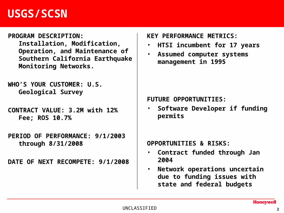
PROGRAM DESCRIPTION: Installation, Modification, Operation, and Maintenance of Southern California Earthquake Monitoring Networks.
WHO’S YOUR CUSTOMER: U.S. Geological Survey
CONTRACT VALUE: 3.2M with 12% Fee; ROS 10.7%
PERIOD OF PERFORMANCE: 9/1/2003 through 8/31/2008
DATE OF NEXT RECOMPETE: 9/1/2008
KEY PERFORMANCE METRICS: • HTSI incumbent for 17 years• Assumed computer systems
management in 1995
FUTURE OPPORTUNITIES: • Software Developer if funding permits
OPPORTUNITIES & RISKS:• Contract funded through Jan 2004• Network operations uncertain due to
funding issues with state and federal budgets
UNCLASSIFIED 3
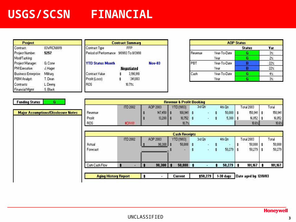
USGS/SCSN FINANCIAL
UNCLASSIFIED 4
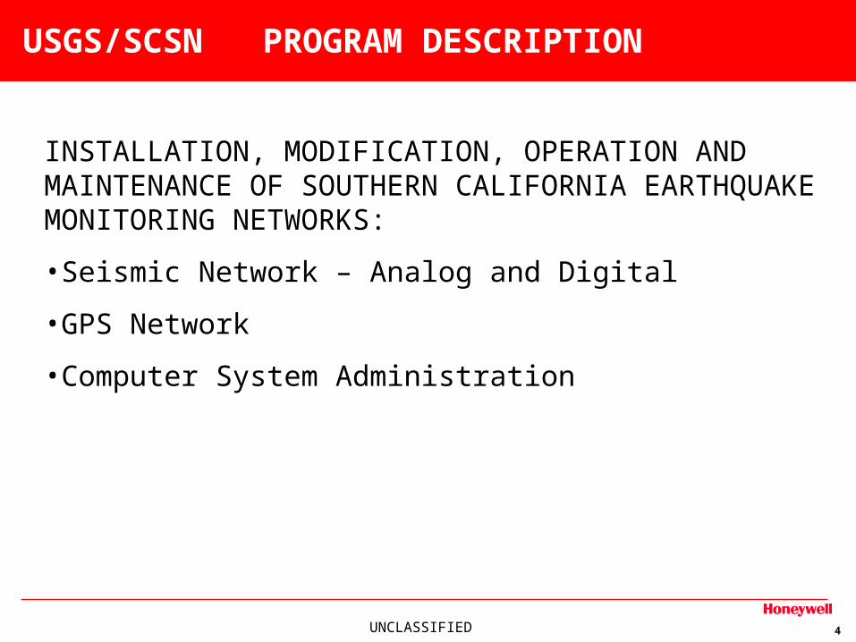
USGS/SCSN PROGRAM DESCRIPTION
INSTALLATION, MODIFICATION, OPERATION AND MAINTENANCE OF SOUTHERN CALIFORNIA EARTHQUAKE MONITORING NETWORKS:
•Seismic Network – Analog and Digital
•GPS Network
•Computer System Administration
UNCLASSIFIED 5
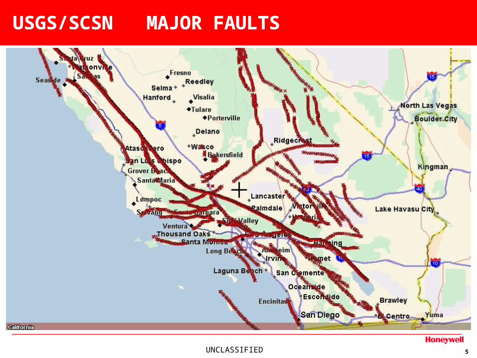
USGS/SCSN MAJOR FAULTSUSGS/SCSN MAJOR FAULTS
UNCLASSIFIED 6
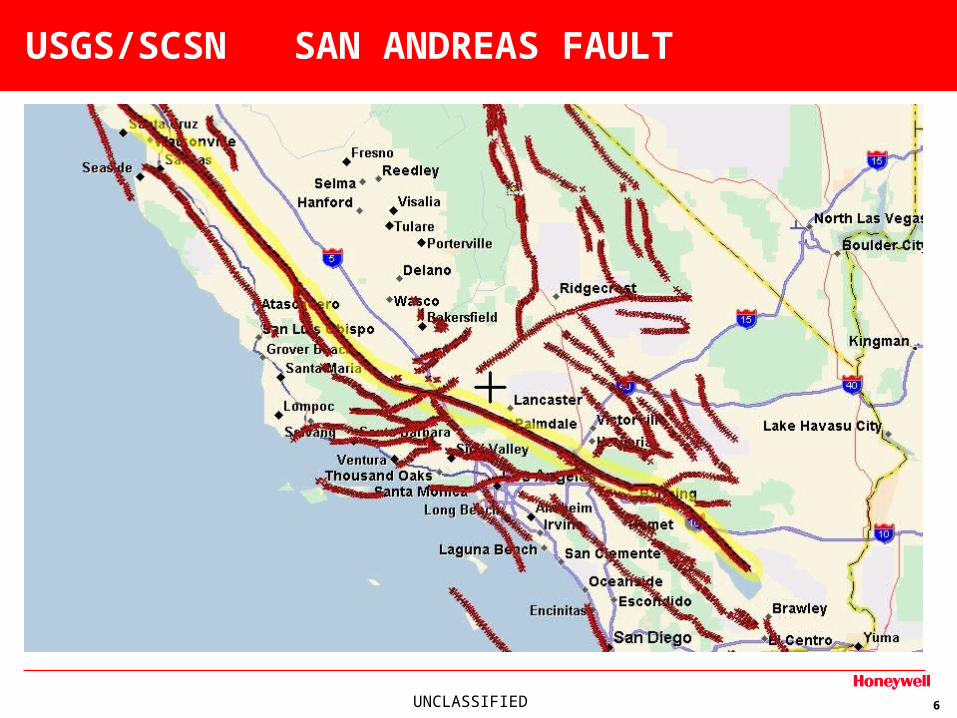
USGS/SCSN SAN ANDREAS FAULT
UNCLASSIFIED 7
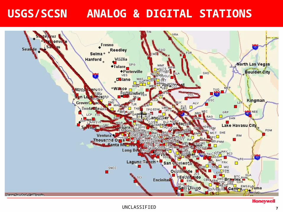
USGS/SCSN ANALOG & DIGITAL STATIONSUSGS/SCSN ANALOG & DIGITAL STATIONS
UNCLASSIFIED 8
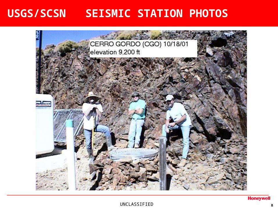
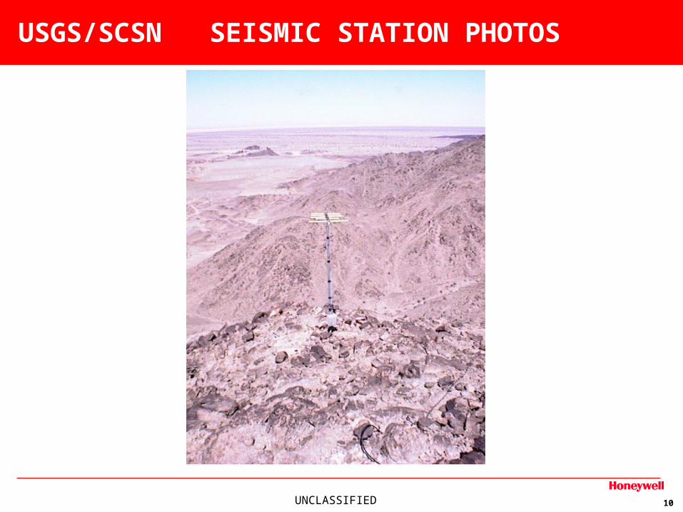
USGS/SCSN SEISMIC STATION PHOTOS
UNCLASSIFIED 9
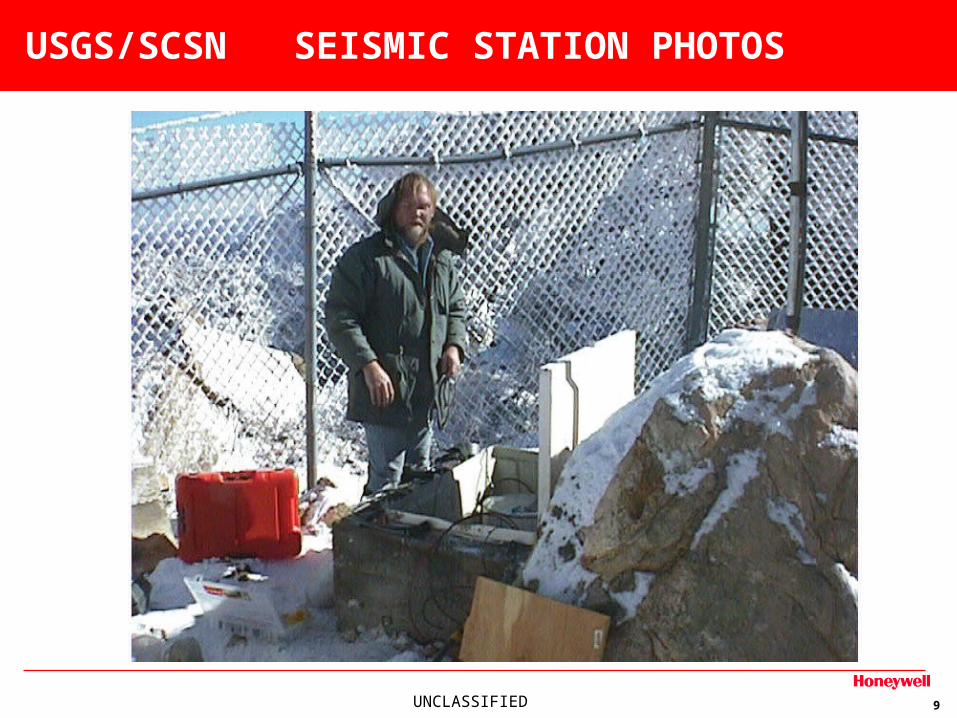
USGS/SCSN SEISMIC STATION PHOTOS
UNCLASSIFIED 10
USGS/SCSN SEISMIC STATION PHOTOS
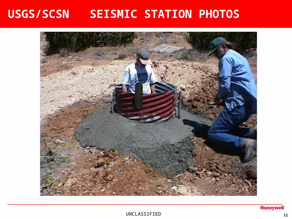
UNCLASSIFIED 11
USGS/SCSN SEISMIC STATION PHOTOS
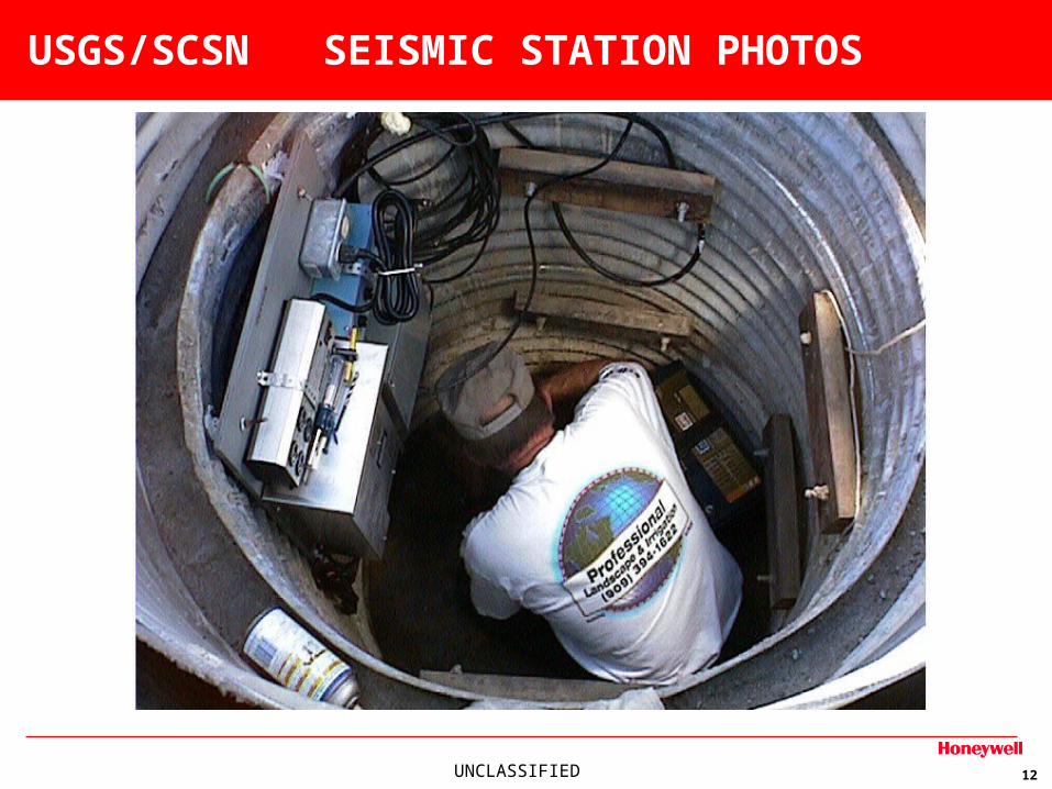
UNCLASSIFIED 12
USGS/SCSN SEISMIC STATION PHOTOS
UNCLASSIFIED 13
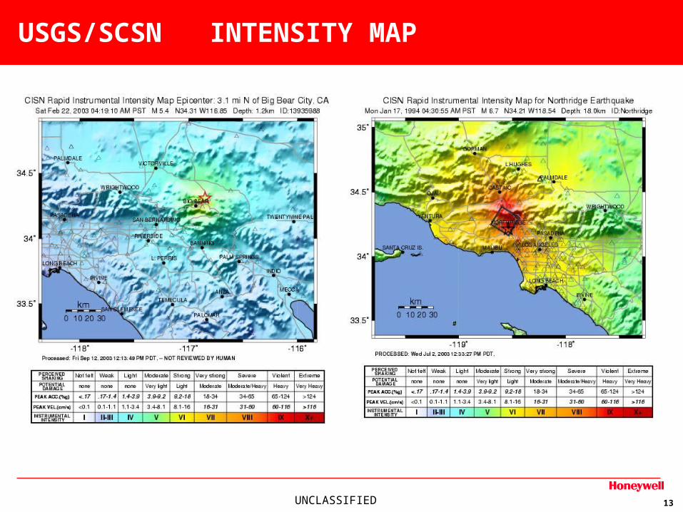
USGS/SCSN INTENSITY MAP
UNCLASSIFIED 14
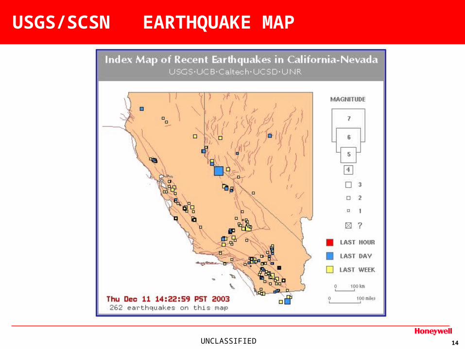
USGS/SCSN EARTHQUAKE MAP
UNCLASSIFIED 15
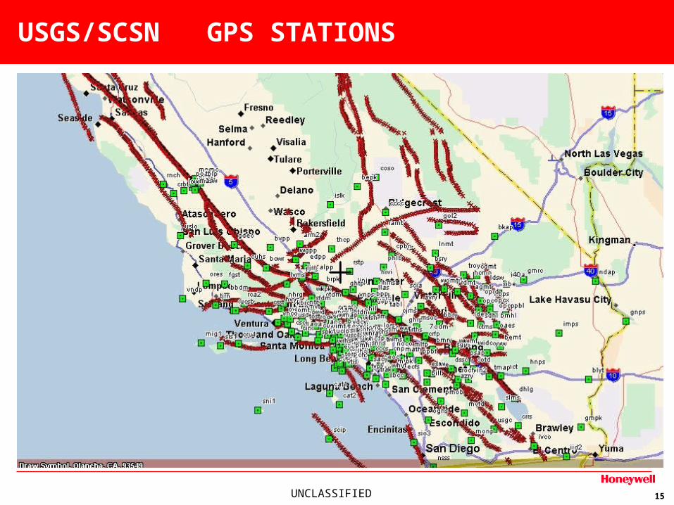
USGS/SCSN GPS STATIONS
UNCLASSIFIED 16
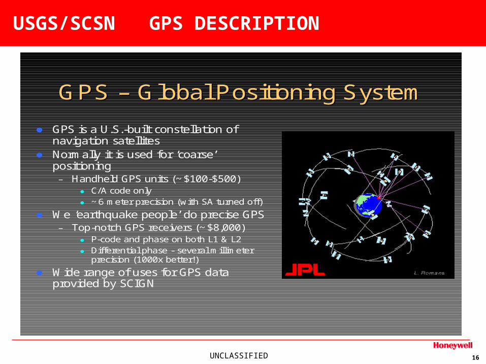
USGS/SCSN GPS DESCRIPTION
GPS GPS –– Global Positioning SystemGlobal Positioning System
GPS is a U.S.-built constellation of navigation satellites
Normally it is used for ‘coarse’ positioning– Handheld GPS units (~$100-$500)
C/A code only ~6 meter precision (with SA turned off)
We ‘earthquake people’ do precise GPS– Top-notch GPS receivers (~$8,000)
P-code and phase on both L1 & L2 Differential phase - several millimeter
precision (1000x better!)
Wide range of uses for GPS data provided by SCIGN
UNCLASSIFIED 17
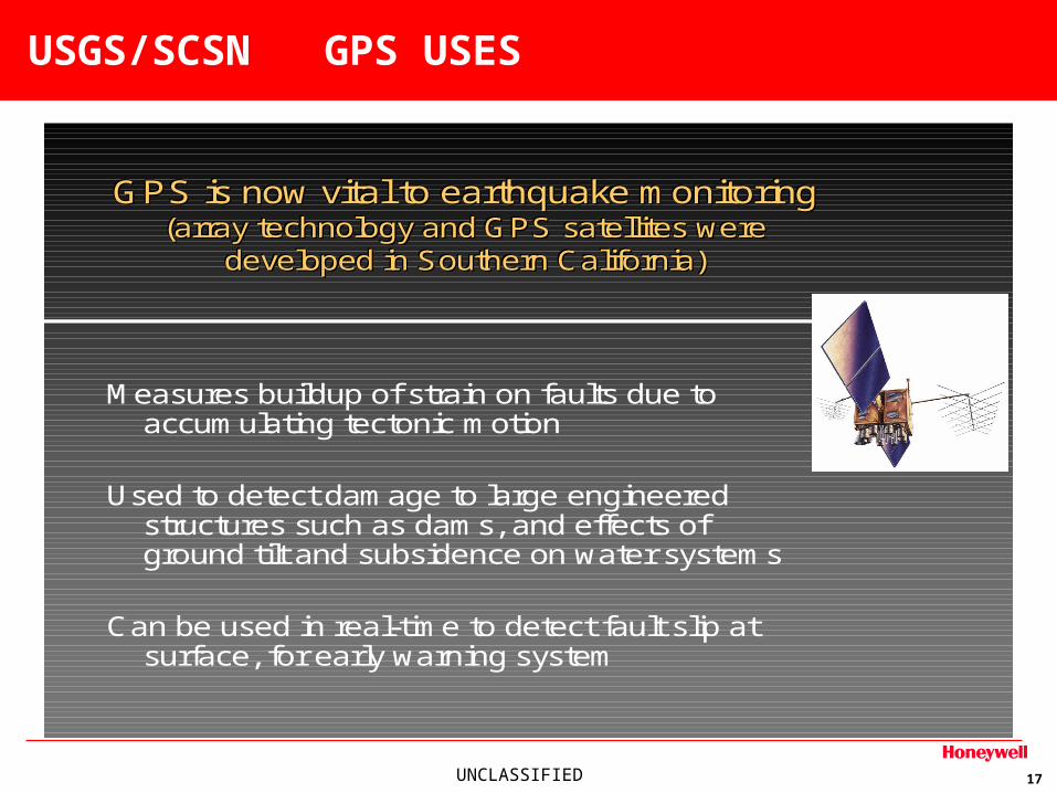
USGS/SCSN GPS USES
GPS is now vital to earthquake monitoring(array technology and GPS satellites were
developed in Southern California)
GPS is now vital to earthquake monitoringGPS is now vital to earthquake monitoring(array technology and GPS satellites were(array technology and GPS satellites were
developed in Southern California)developed in Southern California)
Measures buildup of strain on faults due to accumulating tectonic motion
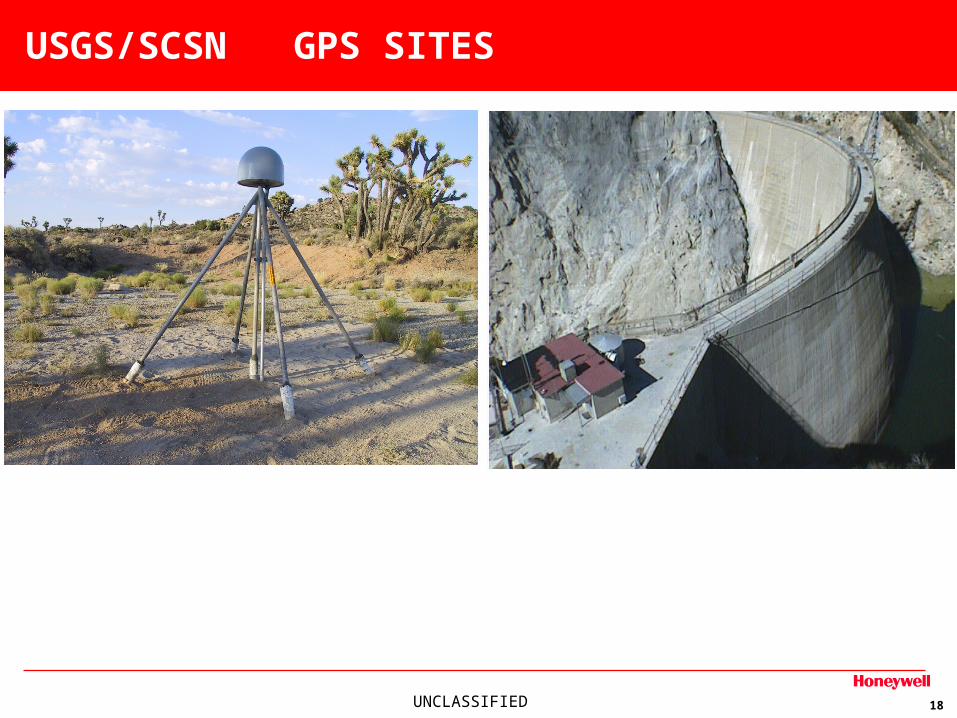
Used to detect damage to large engineered structures such as dams, and effects of ground tilt and subsidence on water systems
Can be used in real-time to detect fault slip at surface, for early warning system
UNCLASSIFIED 18
USGS/SCSN GPS SITES
UNCLASSIFIED 19
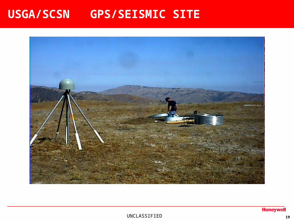
USGA/SCSN GPS/SEISMIC SITE
UNCLASSIFIED 20
USGS/SCSN COMPUTER SYSTEMS
SYSTEM ADMIMISTRATION FOR:
•Online systems
•Development and desktop machines
•Web servers for Pasadena
•Web servers for Western Region web site in Menlo Park
•Web servers for National Earthquake Hazards Program
•Mailing list servers