Embed Size (px)
Citation preview

schneider-electric.com
Unleash the Power of Your GISTransform your business by extending its power throughout your enterprise

You’ve invested considerable time and money to build and maintain your GIS, but are you
realizing its full potential? In this paper, we’ll explain how you can use it to transform your
business by extending its power throughout your enterprise, streamlining key operations, taking
advantage of its real-time data, and using it to bridge the gap between your IT and OT.
Ask five people at an electric utility what the term Geographic Information System (GIS) means to them, and you could get five different answers. The most common might be that GIS is a digital mapping system. Others might say it is a network documentation system, an as-built data processing system, or a tool to create network work orders.
Rarer answers include, “It is a platform that fosters the company mission,” “It is a decision support system,” or “It makes my job more productive.” The reason? Many utilities relegate GIS to their mapping departments, seldom exposing the full value of the information contained within the GIS.
Sure, GIS is a great network documentation system, but it can be so much more. While some use GIS as a data source for outage management and Smart Grid systems, many do not see it as a strategic solution. GIS is regularly cited as a mission critical system, yet it remains ironically underutilized for real business transformation.
Let’s take a fresh look at what a modern GIS should be. In doing so, we’ll outline some basic steps to help modernize your own GIS. We’ll also detail how you can achieve a modern GIS that goes beyond its status as a network repository to a true, transformative business driver.
Assess your GIS
It’s always helpful to take a hard look at your information systems. You may assume because they work, they must be doing their jobs, however, sometimes they can do more. Ask yourself these 10 questions about your GIS:
1. Is your GIS helping you address big problems?
2. Is your GIS living up to its original mission?
3. Is your GIS easy to work with? For example, is it based on proprietary software? Does it take forever to develop applications on it? Is it so customized that upgrades become a nightmare? Is integration with your IT and OT systems busting your budget?
September 2015 | 2schneider-electric.com
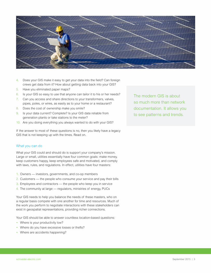
4. Does your GIS make it easy to get your data into the field? Can foreign crews get data from it? How about getting data back into your GIS?
5. Have you eliminated paper maps?
6. Is your GIS so easy to use that anyone can tailor it to his or her needs?
7. Can you access and share directions to your transformers, valves, pipes, poles, or wires, as easily as to your home or a restaurant?
8. Does the cost of ownership make you smile?
9. Is your data current? Complete? Is your GIS data reliable from generation plants or take stations to the meter?
10. Are you doing everything you always wanted to do with your GIS?
If the answer to most of these questions is no, then you likely have a legacy GIS that is not keeping up with the times. Read on.
What you can do
What your GIS could and should do is support your company’s mission. Large or small, utilities essentially have four common goals: make money, keep customers happy, keep employees safe and motivated, and comply with laws, rules, and regulations. In effect, utilities have four masters:
1. Owners — investors, governments, and co-op members
2. Customers — the people who consume your service and pay their bills
3. Employees and contractors — the people who keep you in service
4. The community at large — regulators, ministries of energy, PUCs
Your GIS needs to help you balance the needs of these masters, who on a regular basis compete with one another for time and resources. Much of the work you perform to negotiate interactions with these stakeholders can exist in geospatial representations, providing richer connections.
Your GIS should be able to answer countless location-based questions:
• Where is your productivity low?
• Where do you have excessive losses or thefts?
• Where are accidents happening?
The modern GIS is about
so much more than network
documentation. It allows you
to see patterns and trends.
September 2015 | 3schneider-electric.com

• Where is your system most vulnerable to storms, flooding, heat waves, cold snaps, and physical attacks?
• Where are customers satisfied or not satisfied, and what might you have done to affect their satisfaction?
• Where are there spills or emission issues?
• Where are there places in your infrastructure that could experience significant problems caused by a single event?
These are just a few examples of how using your GIS to take location into consideration can improve your business decisions.
The modern GIS helps you achieve this. It goes beyond network documentation and has at least five unique elements:
1. Asset management — collecting, organizing, and exchanging data. Since much of the data in an electric company is location based, using map-based data is natural and intuitive.
2. Planning and analysis — transforming data into actionable information. This is why the modern GIS is about so much more than network documentation. It allows you to see patterns and trends. For example, you can see on a map where your infrastructure is the most vulnerable. You can also visually understand what will be required of your infrastructure in the future, based on a map.
3. Field mobility — getting information into and out of the field. The vast majority of utility workers work outside of your headquarters or service centers. Field workers look for assets on a map and perform work at specific locations.
About the Authors Bill Meehan, P.E. heads Esri’s worldwide electric and gas utility marketing practice. Previously, he was the vice president of electric operations for a major electric and gas utility. Meehan is the author of four utility-focused books on GIS, and has lectured extensively and taught at Northeastern University and the University of Massachusetts. He holds a Bachelor of Science in electrical engineering from Northeastern University and a Masters of Science in electric power engineering from Rensselaer Polytechnic Institute. He is also a registered professional engineer in the Commonwealth of Massachusetts.
Matt Zimmerman is a director of product management at Schneider Electric. He is responsible for a portfolio of software ranging from outage management to line design and structural engineering. Zimmerman has more than 10 years of experience in the utility industry, and holds a Bachelor of Science in business and computer information systems from Colorado State University.
September 2015 | 4schneider-electric.com

4. Situational awareness — understanding the operational state of your network and disseminating information about geographically dispersed assets, when and where that information is needed. Your GIS can answer critical questions, such as what’s going on right now, and just as importantly, where is there trouble now. Seeing that information on a map is natural.
5. Citizen engagement — providing information and receiving feedback to help your company and customers make better informed decisions. People use maps everyday on their smartphones, tablets, and computers. Getting information to and from citizens strengthens the connection between you and your paying customers. Maps are one of the best ways to communicate back and forth.
Big problems
Utilities are facing big challenges as the industry changes. For starters, utilities are dealing with smaller budgets and revenue erosion. For the first time, electric utilities are facing competition in the delivery of electricity. The competition comes primarily from distributed generation, most often in the form of solar energy.
In 2011, the U.S. federal government predicted that by 2034, there would be 8.9 GW of solar energy. Yet, as of June 2014 — fewer than three years after that prediction — the United States had already had nearly 16 GW of solar energy. This growth pattern suggests that by 2034, the nation could see triple that production. At the same time, electric utilities have to manage a massive infrastructure, which is aging faster than they can hope to upgrade. Maintenance costs are increasing. In addition, utilities are asking the distribution system to do more. As customers install more and more distributed energy resources (DER), the grid becomes more complicated to operate.
Further complicating matters, utility workers are aging. As they retire, they take with them beneficial nuances younger workers will not have. Spatial analysis provided by GISs can help ease this transition. Utilities can create models that mirror the natural thought process of experienced workers by gathering data from many different sources and organizing it by location. In addition, all utilities have to deal with an increase in weather issues, including temperature extremes. Utilities must think differently as they encounter trends including lower revenues, increased costs, fewer and less experienced workers, more demanding customers, and increased regulations. You need more than a network documentation system. You need an information system that supports your company’s mission and decisions related to these issues.
What makes a GIS modern?
It’s a platform According to Phil Simon, the author of the highly acclaimed book, The Age of the Platform, a platform is a tool that allows people to connect with one another and obtain information. Facebook, the Apple® i-platform, and Amazon are common, popular platforms. They are destinations where people go to communicate with each other, share insights and information, collaborate, and get things done.
In 2011, the U.S. federal
government predicted that
by 2034, there would be
8.9 GW of solar energy.
As of June 2014 the U.S. had
already had nearly 16 GW
of solar energy. By 2034,
the nation could see triple
that production.
2011 2034
A platform allows people to
connect with one another and
obtain information.
September 2015 | 5schneider-electric.com

A modern GIS is a location platform. The difference between it and other platforms is that the GIS utilizes maps — a natural way for people to communicate. What better way exists for utilities to connect departments, field workers, regulators, the media, and their customers than a map-based platform — which each of these stakeholders already uses? Another characteristic of a platform is identity. Once you identify yourself to the platform, it follows you wherever you go — on any device, at any time. People tweet on their smartphones, tablets, and desktop computers. If you stop reading a book on your e-reader, you can pick up wherever you left off on your tablet or desktop computer. That’s because a platform understands your identity. It knows you.
Platforms can also interact with other platforms, and they carry that identity from one platform to another. People use Twitter and Facebook without having to re-establish their identities on the different platforms. Platforms attract third parties to extend the platform — thus we’ve seen the app revolution.
Simple scales, complex failsOne reason some utilities have been slow to move to modern GIS platforms is the perception that these platforms are complex. The concept of “simple scales, complex fails” highlights that a modern GIS must to be easy to use for most people. It should employ recognizable gestures and provide users with results in just a few clicks. Even advanced users should find modern GIS solutions straightforward, yet powerful.
A modern GIS is agile. Since it is a platform, only the direst of features need to be customized into it. The vast majority of features are available out of the box and are configurable — with a little to no expensive or risky customization. Specific apps focus on specific tasks that a worker needs to accomplish. By leveraging identity, the platform, with focused apps, can ensure that the user is presented with the right tools for the task at hand.
While the modern GIS solves
significant communication,
collaboration, and sharing
problems, it also enhances
decision making through
collaboration with
other applications.
September 2015 | 6schneider-electric.com

A system of recordUtilities often ask, “Which system should we use to house our asset data — our GIS, asset system, or work management system?” Certainly a modern GIS contains the location of the utility’s critical assets — yet, it is not the only system of record. It is a system of record that leverages the capabilities of the platforms it collaborates with. These can include other systems of records, such as material management systems, work management systems, and asset registers. The modern GIS is primarily the system of record for an asset’s location and its spatial relationship with other assets, features, and how it connects with them. That is, how one electric, gas, or water asset connects to others. In addition, the modern GIS should manage the physical attachment or containment of assets to other assets. For example, a transformer mounted on a pole or a valve contained within a buried box.
So, no one system contains all of the critical data concerning an asset. Real-time control systems or historians manage asset data in real time; for example, the current state of a switch or the voltage of a transformer at a terminal. The results of an infrared survey are also maintained in a raster imaging system. They keep work order information about maintenance of a valve, for example, in a work management system. A modern, platform-based GIS easily integrates with all of these systems. Just because a utility would like to view all of its reclosers built prior to 1990, on a map, using smartphones, it does not mean that the GIS has to manage asset purchase dates. The idea is to let the right system manage the right information. A modern GIS gives utilities the ability to visualize information about their assets, workers, vehicles, and finances within the context of locations on a map.
Communication, collaboration, and sharingGISs were initially built to help utilities track and manage increasingly complex networks of assets. For distributed assets, maps were used to document the location and characteristics of equipment. The mapping department supported a variety of tasks from outage management to inspections to designing network expansions. Over time, more and more data was added to the maps, crowding information and requiring additional map products at different scales for different purposes. Unfortunately, manual mapping became a serious bottleneck to communicating current asset details.
In addition, updating maps with information from the field required more and more staff. Backlogs continued to grow. As a result, workers began to lose trust in the accuracy of the mapping information. Marking up copies of the maps with handwritten notes further exacerbated the problem. Implementation of early digital mapping systems, called Automated Mapping/Facilities Management or AM/FM, was an attempt to fix this problem. It didn’t.
September 2015 | 7schneider-electric.com
A modern GIS is a location
platform that utilizes maps —
a natural way for people
to communicate.

AM/FM had two main problems. First, the system was costly. Second, it was fraught with inconsistences and errors. AM/FM replaced old manual mapping processes with multiple representations of the same data. These inconsistencies were carried forward into digital systems. Compounding the problem, the basemaps that the data was built on were also often inaccurate. Few were based on any consistent coordinate system, and they also predated GPS.
Most utilities simply carried over these woefully inaccurate basemaps into their digital systems. While the mapping systems were better to some degree, the workflows to keep the maps current were largely unchanged. Most utilities printed map products and mailed them to the field, just like in the old days.
The reality was that while the maps were better and the data was at least digitally captured, the mapping group’s productivity didn’t improve much. With reduced staff came increased backlogs of unposted work. Field personnel continued to maintain data on printed maps and the level of accuracy did not improve significantly. In fact, the timeliness of the data stayed about the same.
Ultimately, what utilities needed was the fundamental ability to communicate mapped-based information quickly to anyone who needed it. They needed a process to share information — not just from the office to the field, but back to the office again. They also need a way for workers at all levels to share map-based information amongst themselves, without having to go through the long queues in the mapping department.
What they needed was a collaboration platform. They need to do what other platforms, such as Facebook, Instagram, and Twitter do: give users a means to communicate immediately, to share and collaborate. Modern GISs do that.
Advanced decision makingWhile the modern GIS solves significant communication, collaboration, and sharing problems, it also enhances decision making through collaboration with other applications.
Historically, workers at all levels of the utility business have made decisions based on their collective knowledge of how things worked. This often resulted in inconsistent decisions, based both on the decision maker’s experience level and the quality of the information available to him or her. This process is not a sustainable one. First, the age of the average utility worker has exceeded 50 years old, which means many will retire within the next decade, taking their experience and knowledge with them. Second, utilities cannot afford to make inconsistent decisions based on incomplete or inaccurate information.
Unlike the old AM/FM systems, modern solutions deliver advanced analytics regarding the vulnerability of the network. They provide ways to optimize designs, improve planning, enhance data quality, and better manage outages. They allow utilities to be more proactive, breaking down barriers between internal departments, as well as with the communities and customers they serve.
Easily integrated with
other systems, today’s GIS
can improve your asset
management, planning
and analysis, field mobility,
situational awareness, and
citizen engagement through
enhanced communication,
collaboration, and sharing.
September 2015 | 8schneider-electric.com

Seven ways to modernize your GIS
In one form or another, utility GISs have been around since the mid-1970s. That is 40 years worth of maturity. That’s the good news. The bad news is that many utilities have become so comfortable with their legacy GISs that they don’t necessarily think about modern GISs and the considerable benefits of these systems. Here are seven ways to modernize your GIS.
1. Perform a self-evaluation of your GIS Ask yourself if your GIS does what you want. Does it just computerize your old operating maps faster and neater? Are you still printing those maps and mailing them to district offices? Maybe not. Maybe it allows you to create PDFs and email them. However, if that’s the case, are you also leveraging the latest technology, such as the cloud, imagery, smartphones, and tablets? Could you be streamlining your editing processes? Based on your answers, it might be time to change things.
2. Use your GIS to solve business problems As noted throughout this paper, many utilities still use GIS only in operations and perhaps for a few workflows, like outage management or distribution design. How many of your problems have to do with location? Have you asked yourself where your workers are most likely to get hurt?
Locational analytics can take data from tree-trimming programs, assets involved in previous injuries, crime data from the police department, and more, to help identify potential problem spots for crews. With this insight, your operations team can then create risk management plans. Imagine if you could map tweets from unhappy customers to help identify where your network may be under performing or where customer outreach is needed.
3. Start thinking about your GIS as a platformIn the past, GIS was a client-server system that was difficult to integrate with other systems. Modern GISs talk easily with other business systems; they’re platforms designed for integration. Today’s business systems need location information, and they get it from directly collaborating with the GIS — not by clunky data extraction, transfer, or load processes.
The modern GIS rethinks and simplifies the whole information technology architecture. It draws on fast, secure Web services to leverage the wealth of data available from the Web —whether the information was collected around the corner or around the world.
4. Stop building custom GIS applicationsMost people don’t understand that GIS is about configuration, not customization. Spatial and location analytics come out of the box. Today, there are a wealth of templates and applications available for many workflows. If you can’t find the one you need, it is easy to create your own with built-in configuration tools that come standard. Companies like ours pay special attention to include those tools in our systems.
September 2015 | 9schneider-electric.com
5. Simplify your asset data modelMost data models are too complicated. Don’t duplicate data; it should live in only one system. If you need the data in an application, reference it from somewhere else. Just because you want to display data in your GIS doesn’t mean it has to live in your GIS. Remember: simple scales; complex fails.
6. Stop building your own basemapsIn the early days of digital mapping, utilities built their own basemaps with relevant streets, landmarks, parcels, and bodies of water. However, these old maps lacked an accurate coordinate system; for the most part, they pre-dated GPS and won’t likely ever be accurate. Some companies, like Esri, freely provide basemaps. Use them. Sure, you’ll have to adjust your asset information, but in the end, a more accurate coordinate system will save you lots of time and aggravation. In addition, you won’t have to store, manage, or edit that data ever again. If you need to access data about a proposed new street plan, find it and store it in your GIS as a separate layer.
7. Implement relevant solutions that are accessible inside and outside of your company That means making your GIS content global, which is easy to do with modern solutions like our ArcGIS/ArcFM. New functionality should be accessible through Web services for faster, easier implementation. Solutions need to work just as well undocked and outside the walls of the organization.
Your modern GIS should focus on the concept of work and workflows. Information should flow seamlessly from person to person as jobs are moved through the workflow. Tools to support all areas of planning, analysis, design, construction, and operation share a common information model. And these tools live in industry-focused applications that are designed and dedicated to solving the challenges and imperatives the industry faces.

September 2015 | 10schneider-electric.com
Conclusion
Utilities are facing big challenges as the industry changes. These challenges include aging infrastructure and workforce and the competition for delivery of electricity from distributed generation. One way to meet these and other challenges is with a modern GIS.
A modern GIS is a location platform that moves beyond the mapping department to streamline and support your operations enterprise wide. Easily integrated with other systems, today’s GIS can improve your asset management, planning and analysis, field mobility, situational awareness, and citizen engagement through enhanced communication, collaboration, and sharing. Modern GISs work out of the box, providing the highest levels of accuracy and allowing easy customization through built-in configuration tools.
Both Esri and Schneider Electric offer solutions to meet your GIS needs. To learn more about them, please visit www.Esri.com\utilities and http://bit.do/gisinfo.

September 2015
©2015 Schneider Electric. All Rights Reserved. All trademarks are owned by Schneider Electric Industries SAS or its affiliated companies.
This document has beenprinted on recycled paper
Schneider Electric
4701 Royal Vista CircleFort Collins, CO 80528Tel: 1-866-537-1091 + (34) 9-17-14-70-02Fax: 1-970-223-5577
www.schneider-electric.com