Embed Size (px)
Citation preview
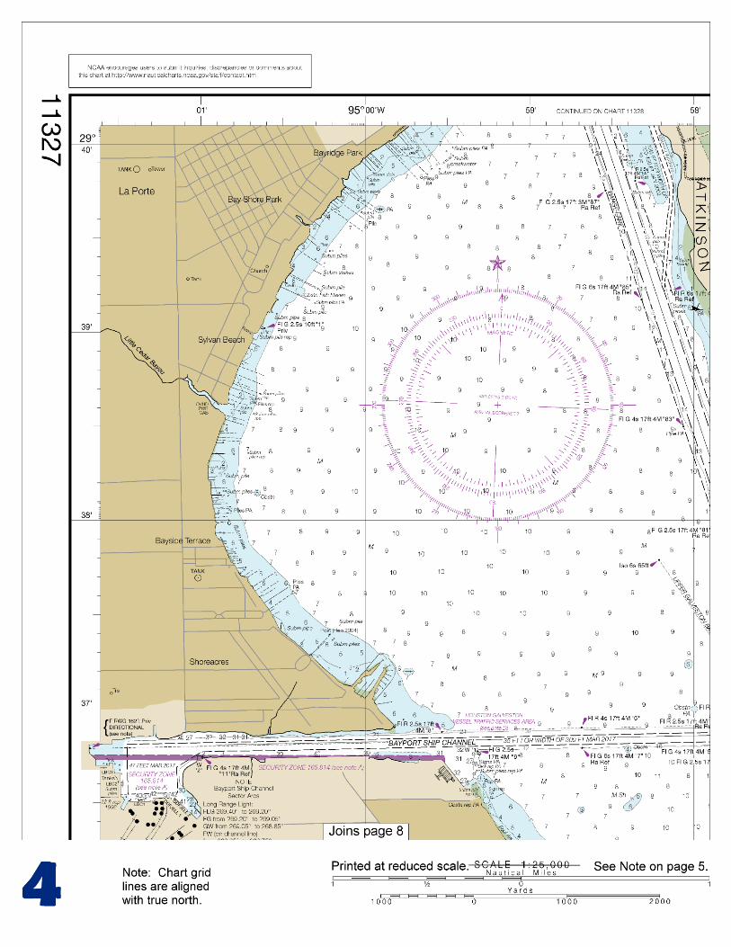
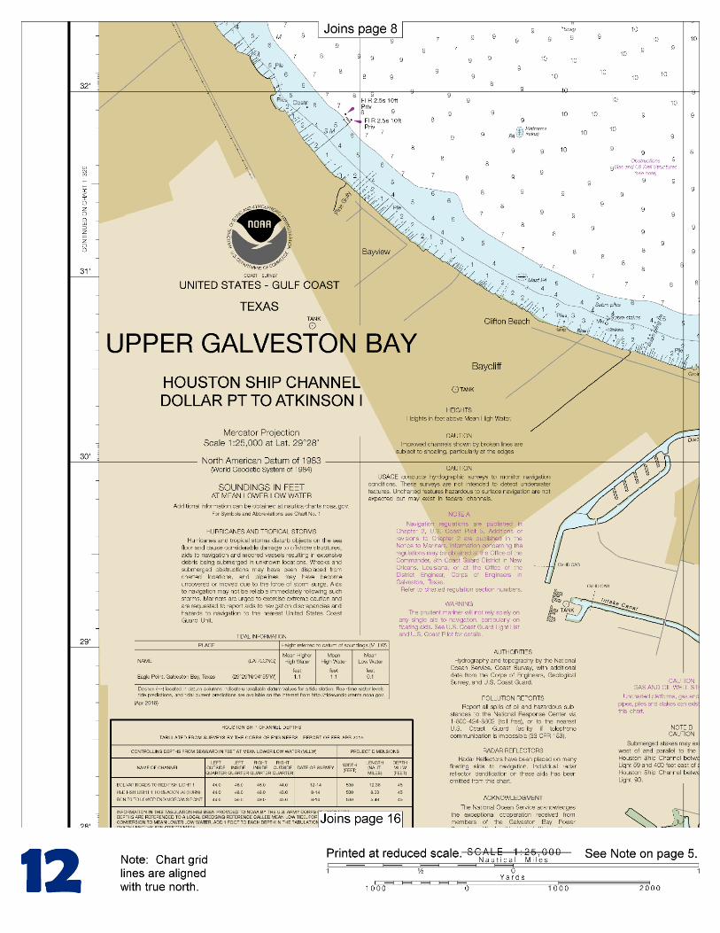
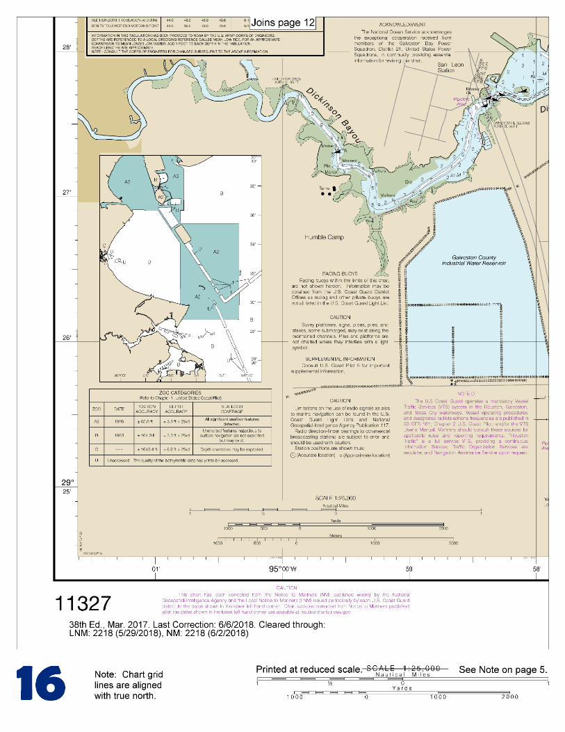
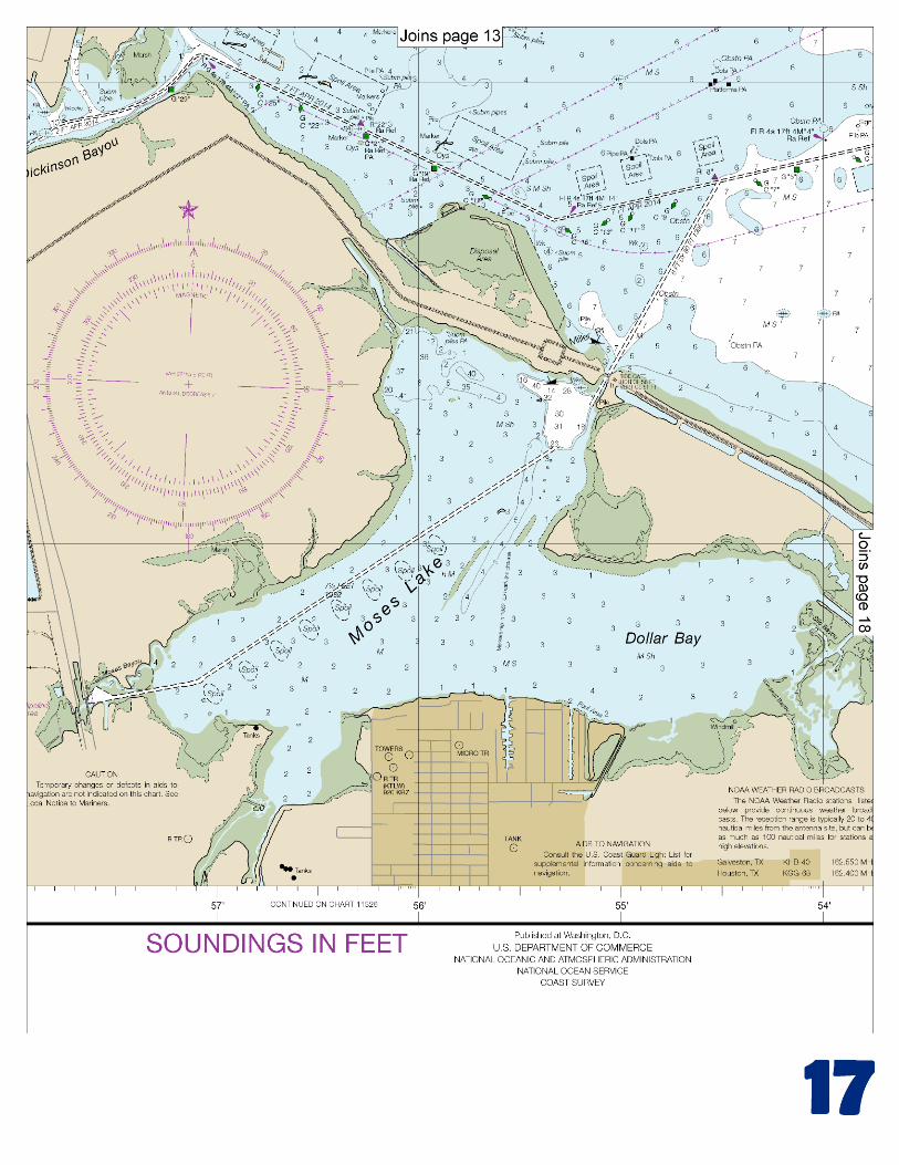
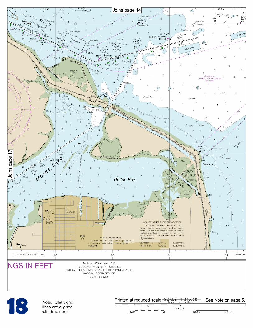
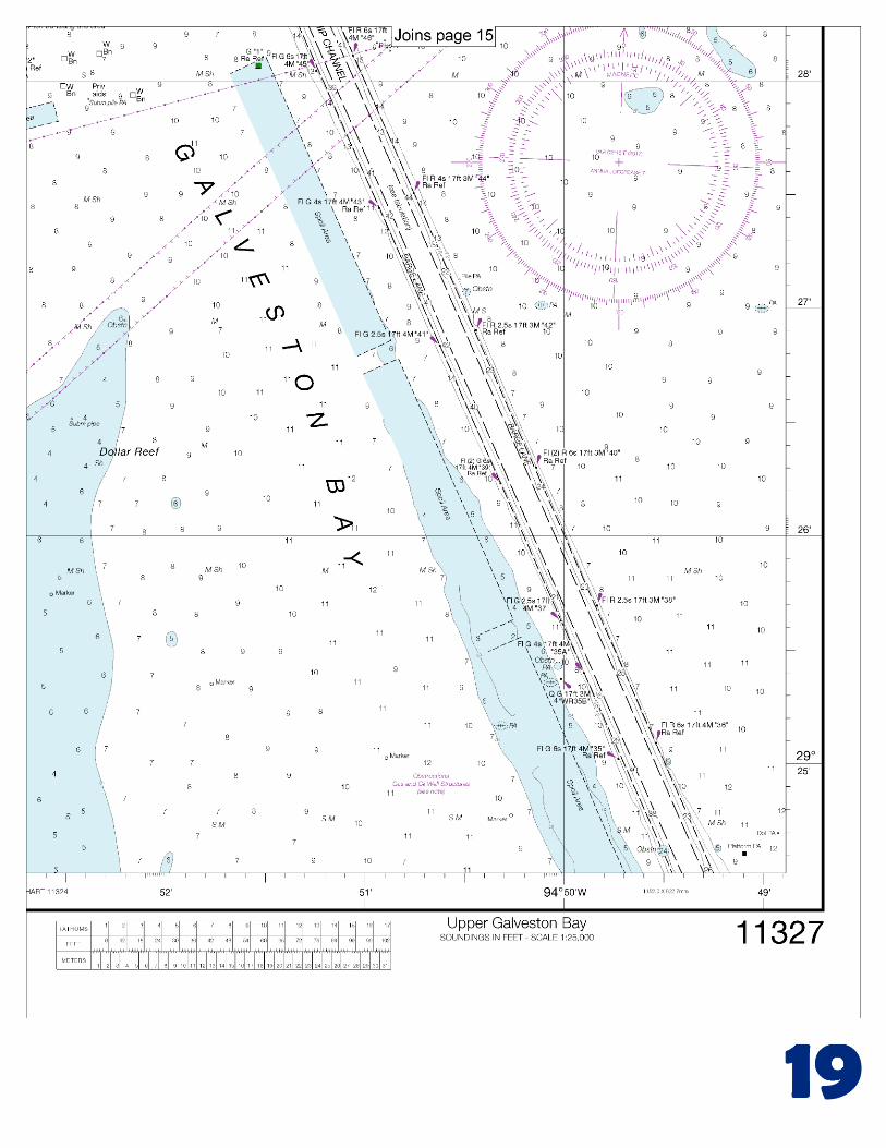
BookletChart™ Upper Galveston Bay – Houston Ship Channel NOAA Chart 11327
A reduced-scale NOAA nautical chart for small boaters When possible, use the full-size NOAA chart for navigation.
Included Area
2
Published by the National Oceanic and Atmospheric Administration
National Ocean Service Office of Coast Survey
www.NauticalCharts.NOAA.gov 888-990-NOAA
What are Nautical Charts?
Nautical charts are a fundamental tool of marine navigation. They show water depths, obstructions, buoys, other aids to navigation, and much more. The information is shown in a way that promotes safe and efficient navigation. Chart carriage is mandatory on the commercial ships that carry America’s commerce. They are also used on every Navy and Coast Guard ship, fishing and passenger vessels, and are widely carried by recreational boaters.
What is a BookletChart?
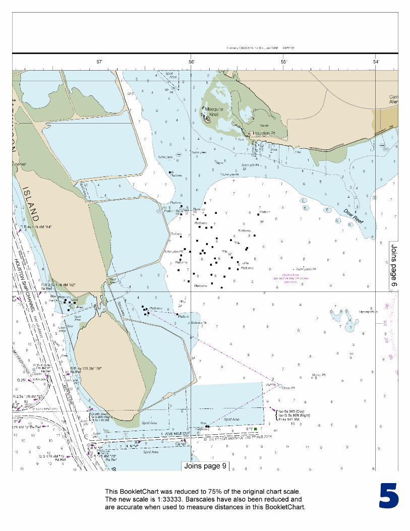
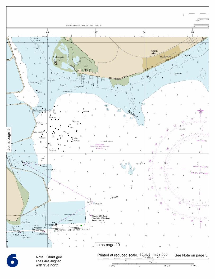
This BookletChart is made to help recreational boaters locate themselves on the water. It has been reduced in scale for convenience, but otherwise contains all the information of the full-scale nautical chart. The bar scales have also been reduced, and are accurate when used to measure distances in this BookletChart. See the Note at the bottom of page 5 for the reduction in scale applied to this chart.
Whenever possible, use the official, full scale NOAA nautical chart for navigation. Nautical chart sales agents are listed on the Internet at http://www.NauticalCharts.NOAA.gov.
This BookletChart does NOT fulfill chart carriage requirements for regulated commercial vessels under Titles 33 and 44 of the Code of Federal Regulations.
Notice to Mariners Correction Status
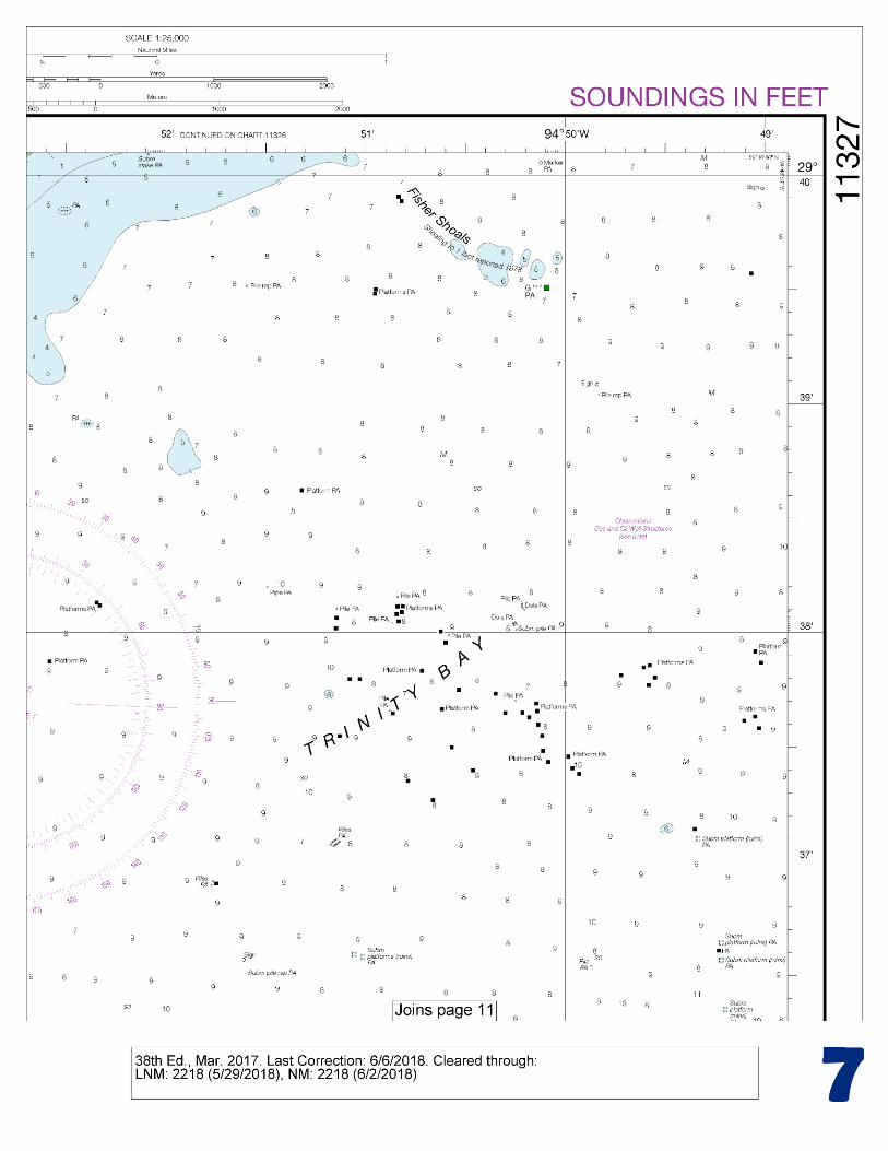
This BookletChart has been updated for chart corrections published in the U.S. Coast Guard Local Notice to Mariners, the National Geospatial Intelligence Agency Weekly Notice to Mariners, and, where applicable, the Canadian Coast Guard Notice to Mariners. Additional chart corrections have been made by NOAA in advance of their publication in a Notice to Mariners. The last Notices to Mariners applied to this chart are listed in the Note at the bottom of page 7. Coast Pilot excerpts are not being corrected. For latest Coast Pilot excerpt visit the Office of Coast Survey website at http://www.nauticalcharts.noaa.gov/nsd/searchbychart.php?chart=11327
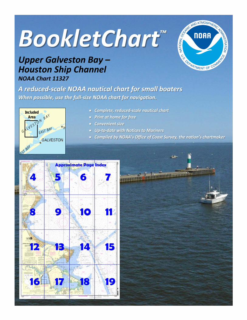
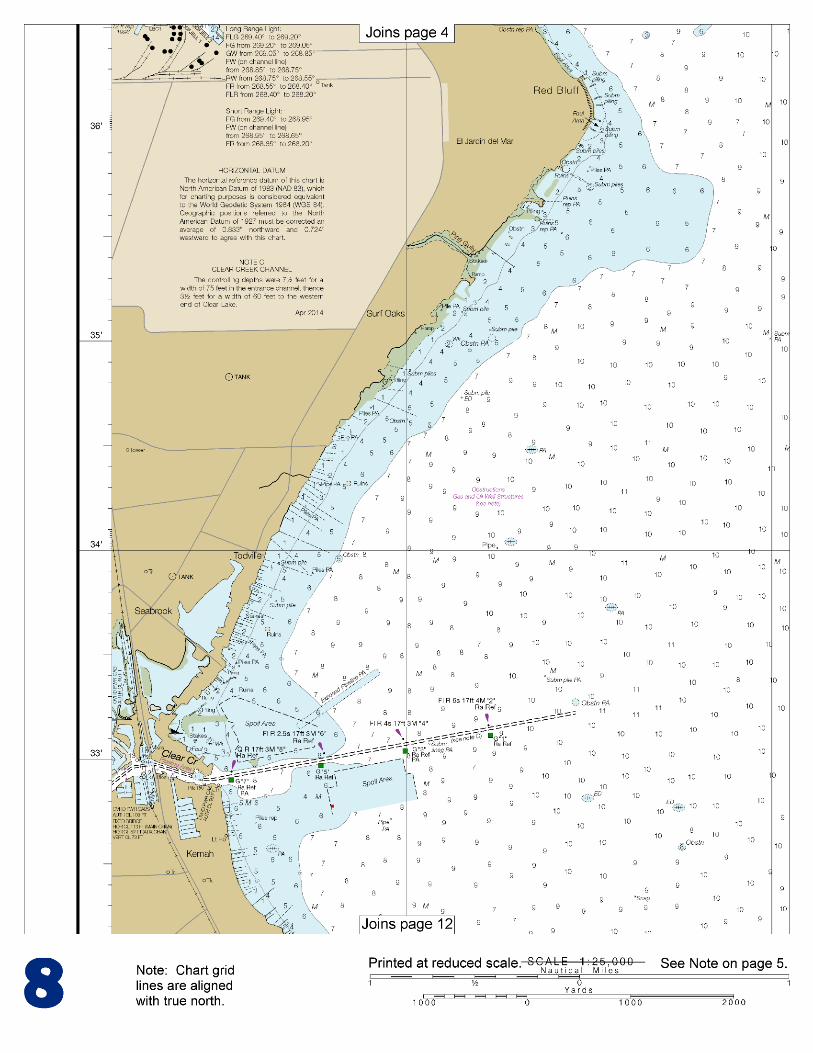
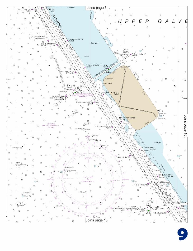
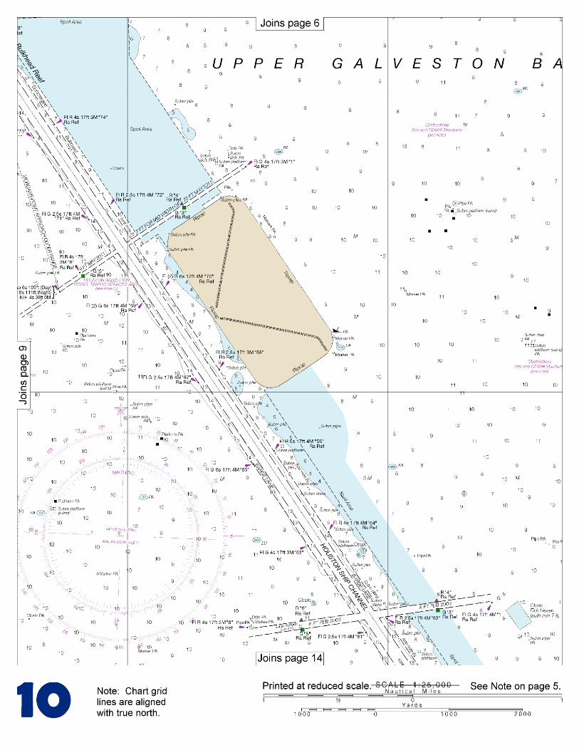
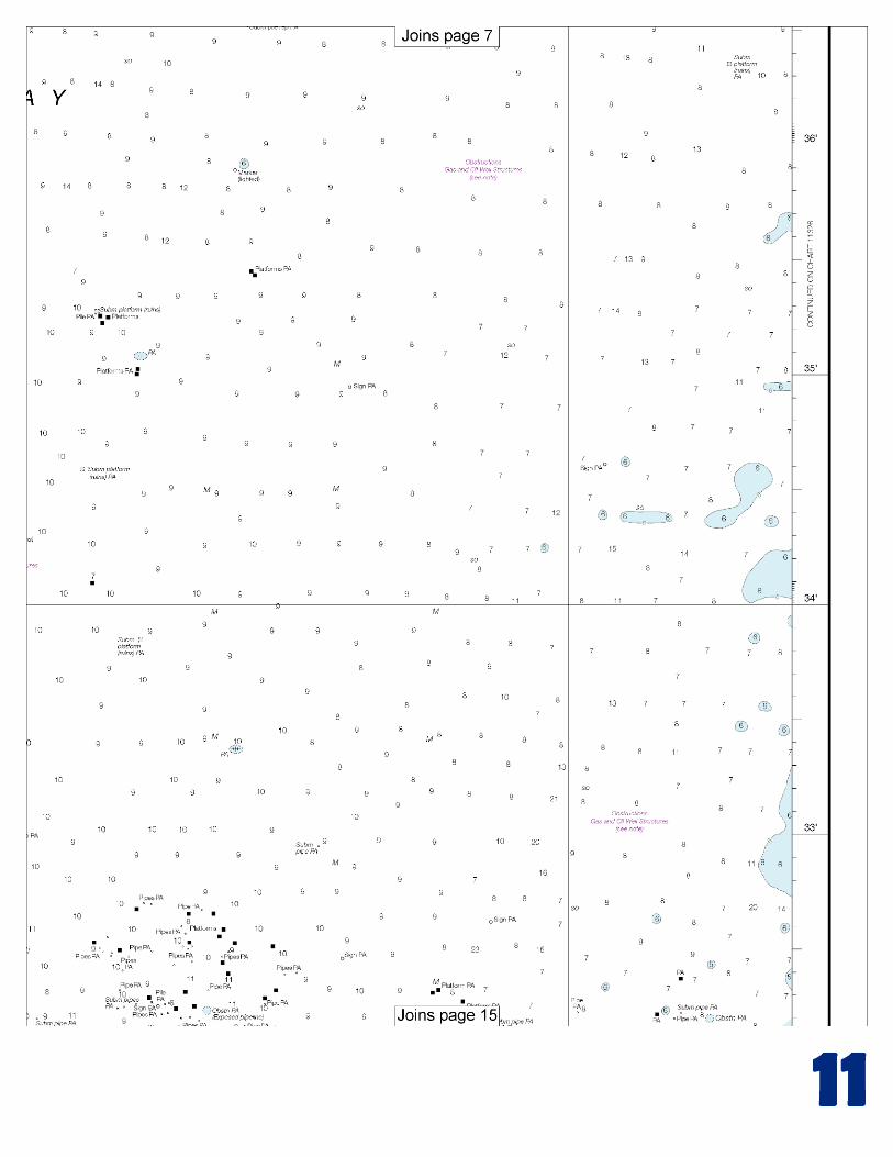
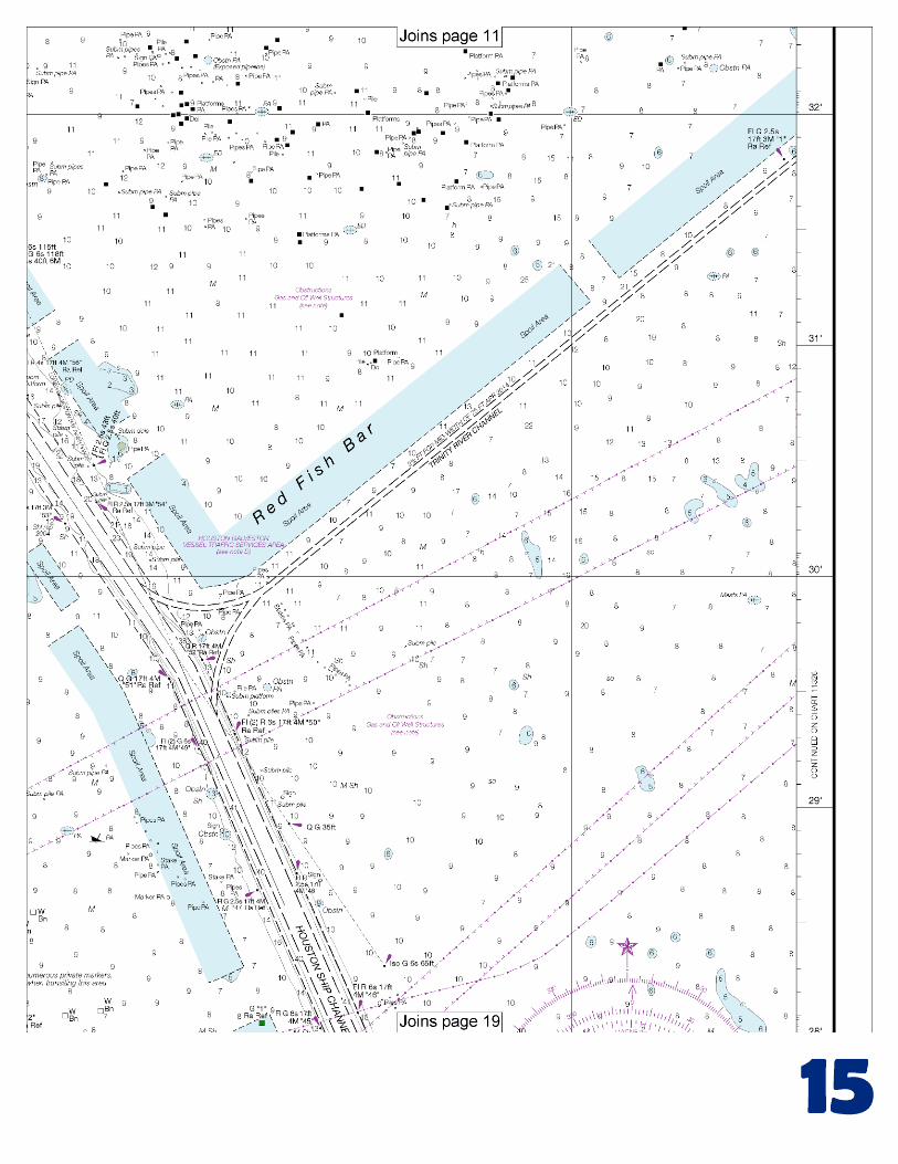
[Selected Excerpts from Coast Pilot] Galveston Bay is a large, irregularly shaped shallow body of water on the coast of Texas, about 285 miles W from Southwest Pass and 690 miles NW from Dry Tortugas. The bay is about 30 miles long in a general NNE and SSW direction, about 17 miles wide at its widest part, and has general depths of 7 to 9 feet. About midway of its length it is nearly divided into parts by Red Fish Bar, a chain of small islets and shoals, through which the Houston Ship Channel
has been dredged. N of Red Fish Bar the bay is known as the Upper Bay and S as the Lower Bay. The NE end of the upper bay is Trinity Bay.
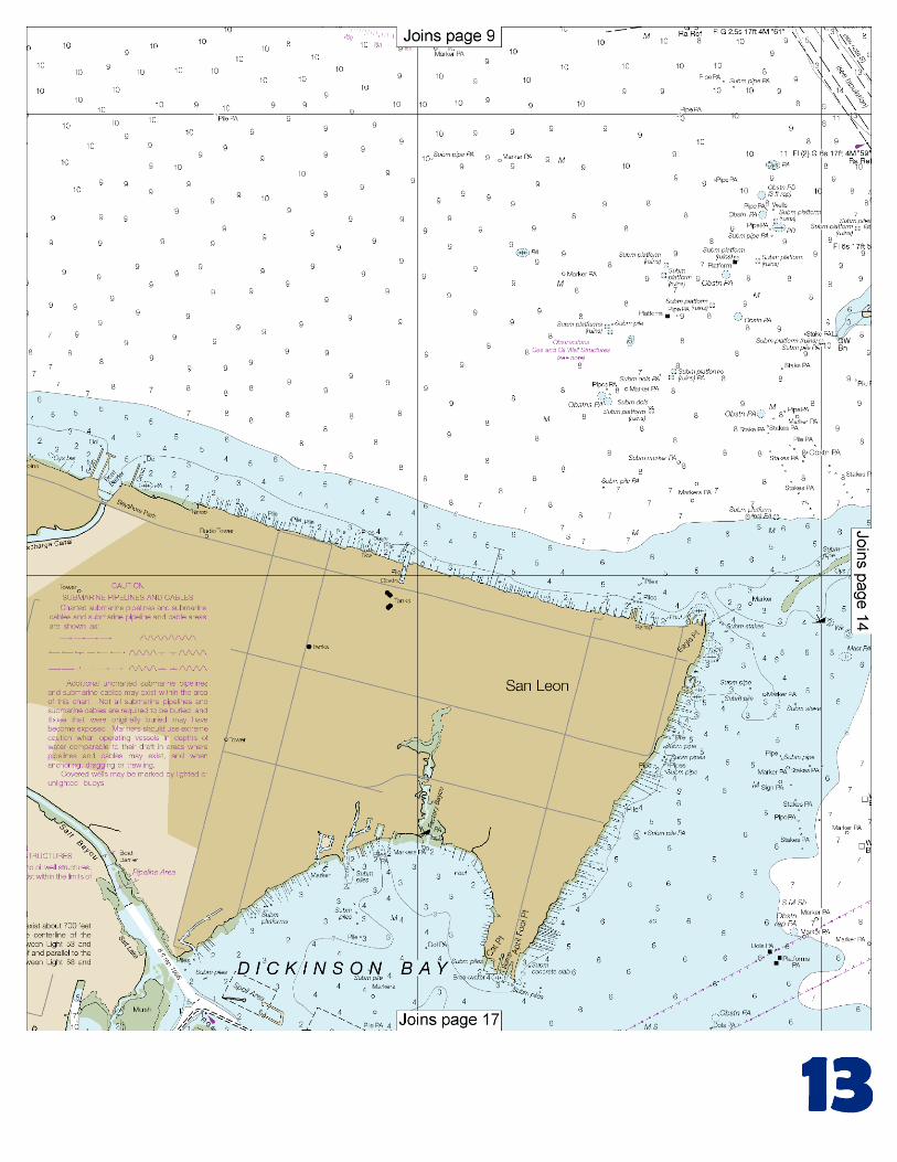
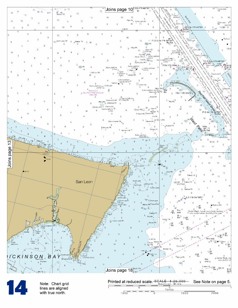
Galveston Entrance, the approach to Galveston Bay, lies between two converging stone-rubble jetties about 4 miles long and 1.3 miles apart at the outer ends. From deep water in the Gulf, the N jetty extends to Bolivar Peninsula and the S jetty extends to the N end of Galveston Island. Mariners should be alert to the possibility of strong cross-currents in the Galveston Bay Entrance Channel; caution is advised. Vessel Traffic Service Houston–Galveston became mandatory 13 October 1994. Detailed information on VTS Houston/ Galveston's operating requirements, designated frequencies, precautionary areas, and mandatory reporting points can be found in CFR Chapter 2 Part 161 Vessel Traffic Management, tables 161.12, 161.35(b), and 161.35(c). Mariners should obtain the latest edition of the U.S. Coast Guard's Houston/Galveston Vessel Traffic Service User’s Manual, available from the Commanding Officer, U.S. Coast Guard Vessel Traffic Houston/ Galveston, 9640 Clinton Drive, Houston, TX 77029. Website: www.uscg.mil/VTSHouston Anchorages.–Vessels may anchor off the bar in the Galveston Entrance Anchorages just inshore of the intersection of the Galveston Safety Fairway with the Coastwise Fairway. (See 166.100 through 166.200, chapter 2, for limits and regulations.) Small craft anchoring in the designated areas should find the shoaler water so as to leave the deeper areas clear for larger vessels. Dangers.–A considerable number of unmarked dangerous wrecks exist in the approaches to Galveston Bay Entrance. A spoil bank is S of the Outer Bar Channel, and an extensive shoal area is S of the channel between the jetties. Heald Bank and the offshore oil well structures are the principal hazards. Vessels navigating in the Houston Ship Channel from Bolivar Roads to Morgans Point are cautioned about the heavy breakers which result from the bow wakes of tankers and other large merchant vessels in the channel. Dangers.–Texas City Channel–A sunken wreck covered 10 feet is off the entrance to North Slip. The channel from Galveston Bay to Clear Lake is reported to be highly congested with light commercial and pleasure-craft traffic, especially on weekends; a speed limit of 5 miles per hour is posted. The Coast Guard advises vessels exercise particular caution where the channel intersects the Intracoastal Waterway, about 6.6 miles above the entrance jetties and just below Lighted Buoys 25 and 26. Situations resulting in collisions, groundings, and close quarters passing have been reported by both shallow and deep-draft vessels. The Coast Guard has requested vessels make a SECURITE call on VHF-FM channel 13 prior to crossing the Intracoastal Waterway, particularly during periods of restricted visibility. Moses Lake, a shallow lagoon S of Dickinson Bay, is used as a harbor of refuge by many small craft during hurricane warnings. There are several marinas, small-craft launching ramps, and fish camps on a slip on the S side of the entrance to Dollar Bay. Gasoline, diesel fuel, ice, and provisions are available. N of Bolivar Peninsula, spoil banks on both sides of the channel extend N to Red Fish Bar. About 1.5 miles below Red Fish Bar, a narrow channel marked at the entrance by Daybeacon 1, exits Houston Ship Channel to the W, leading to Dickinson Bayou. Along the NE side of Houston Ship Channel N of Red Fish Bar, several openings through the spoil bank permit passage into the NE portions of Galveston Bay.
U.S. Coast Guard Rescue Coordination Center 24 hour Regional Contact for Emergencies
RCC New Orleans Commander 8th CG District (504) 589-6225
New Orleans, LA
G
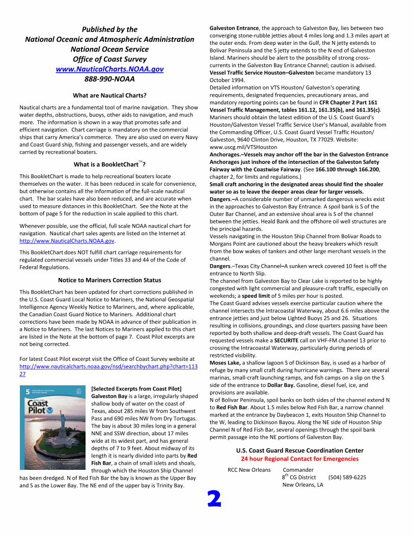
NOAA’s navigation managers serve as ambassadors to the maritime community. They help identify navigational challenges facing professional and recreational mariners, and provide NOAA resources and information for safe navigation. For additional information, please visit nauticalcharts.noaa.gov/service/navmanagers
To make suggestions or ask questions online, go to nauticalcharts.noaa.gov/inquiry. To report a chart discrepancy, please use ocsdata.ncd.noaa.gov/idrs/discrepancy.aspx.
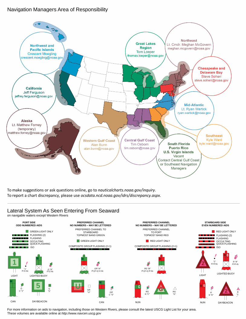
Lateral System As Seen Entering From Seaward on navigable waters except Western Rivers
PORT SIDE
ODD NUMBERED AIDS
GREEN LIGHT ONLY
FLASHING (2)
PREFERRED CHANNEL
NO NUMBERS – MAY BE LETTERED
PREFERRED CHANNEL TO
STARBOARD
TOPMOST BAND GREEN
PREFERRED CHANNEL
NO NUMBERS – MAY BE LETTERED
PREFERRED CHANNEL
TO PORT
TOPMOST BAND RED
STARBOARD SIDE
EVEN NUMBERED AIDS
RED LIGHT ONLY
FLASHING (2)
FLASHING FLASHING
OCCULTING GREEN LIGHT ONLY RED LIGHT ONLY OCCULTING QUICK FLASHING QUICK FLASHING
ISO COMPOSITE GROUP FLASHING (2+1) COMPOSITE GROUP FLASHING (2+1) ISO
"1"
Fl G 6s
G "9"
Fl G 4s
GR "A"
Fl (2+1) G 6s
RG "B"
Fl (2+1) R 6s
"2"
Fl R 6s
8
R "8"
Fl R 4s
LIGHT
G
C "1"
LIGHTED BUOY
G
"5"
GR
"U"
GR
C "S"
RG
N "C"
RG
"G"
LIGHT
6
R
N "6"
LIGHTED BUOY
R
"2
"
CAN DAYBEACON
CAN NUN NUN
DAYBEACON
For more information on aids to navigation, including those on Western Rivers, please consult the latest USCG Light List for your area.
These volumes are available online at http://www.navcen.uscg.gov
Navigation Managers Area of Responsibility
Northeast
Lt. Meghan McGovern
Northwest and
Pacific Islands
Crescent Moegling
Great Lakes Region
Tom Loeper
Chesapeake and
Delaware Bay
Steve Soherr
California
Jeff Ferguson
[email protected] Mid-Atlantic
Lt. Ryan Wartick
Alaska
Lt. Timothy M. Smith
Western Gulf Coast
Alan Bunn
Central Gulf Coast
Tim Osborn
[email protected] South Florida
Puerto Rico
U.S. Virgin Islands
Michael Henderson
Southeast
Kyle Ward
2
2 C U 5
1
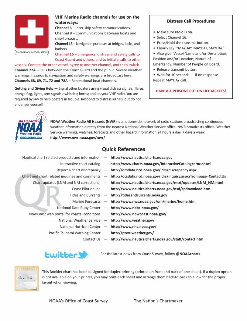
VHF Marine Radio channels for use on the waterways:Channel 6 – Inter-ship safety communications.Channel 9 – Communications between boats and ship-to-coast.Channel 13 – Navigation purposes at bridges, locks, and harbors.Channel 16 – Emergency, distress and safety calls to Coast Guard and others, and to initiate calls to other
vessels. Contact the other vessel, agree to another channel, and then switch.Channel 22A – Calls between the Coast Guard and the public. Severe weather warnings, hazards to navigation and safety warnings are broadcast here.Channels 68, 69, 71, 72 and 78A – Recreational boat channels.
Getting and Giving Help — Signal other boaters using visual distress signals (flares, orange flag, lights, arm signals); whistles; horns; and on your VHF radio. You are required by law to help boaters in trouble. Respond to distress signals, but do not endanger yourself.
EMERGENCY INFORMATION
Distress Call Procedures
• Make sure radio is on.• Select Channel 16.• Press/Hold the transmit button.• Clearly say: “MAYDAY, MAYDAY, MAYDAY.”• Also give: Vessel Name and/or Description;Position and/or Location; Nature of Emergency; Number of People on Board.• Release transmit button.• Wait for 10 seconds — If no responseRepeat MAYDAY call.
HAVE ALL PERSONS PUT ON LIFE JACKETS!
This Booklet chart has been designed for duplex printing (printed on front and back of one sheet). If a duplex option is not available on your printer, you may print each sheet and arrange them back-to-back to allow for the proper layout when viewing.
QR
Quick ReferencesNautical chart related products and information - http://www.nauticalcharts.noaa.gov
Interactive chart catalog - http://www.charts.noaa.gov/InteractiveCatalog/nrnc.shtmlReport a chart discrepancy - http://ocsdata.ncd.noaa.gov/idrs/discrepancy.aspx
Chart and chart related inquiries and comments - http://ocsdata.ncd.noaa.gov/idrs/inquiry.aspx?frompage=ContactUs
Chart updates (LNM and NM corrections) - http://www.nauticalcharts.noaa.gov/mcd/updates/LNM_NM.html
Coast Pilot online - http://www.nauticalcharts.noaa.gov/nsd/cpdownload.htm
Tides and Currents - http://tidesandcurrents.noaa.gov
Marine Forecasts - http://www.nws.noaa.gov/om/marine/home.htm
National Data Buoy Center - http://www.ndbc.noaa.gov/
NowCoast web portal for coastal conditions - http://www.nowcoast.noaa.gov/
National Weather Service - http://www.weather.gov/
National Hurrican Center - http://www.nhc.noaa.gov/
Pacific Tsunami Warning Center - http://ptwc.weather.gov/
Contact Us - http://www.nauticalcharts.noaa.gov/staff/contact.htm
NOAA’s Office of Coast Survey The Nation’s Chartmaker
For the latest news from Coast Survey, follow @NOAAcharts
NOAA Weather Radio All Hazards (NWR) is a nationwide network of radio stations broadcasting continuous weather information directly from the nearest National Weather Service office. NWR broadcasts official Weather Service warnings, watches, forecasts and other hazard information 24 hours a day, 7 days a week. http://www.nws.noaa.gov/nwr/