Embed Size (px)
Citation preview

UrbanSim: Informing Public Deliberation about Land Use and Transportation Decisions
using Urban Simulations Alan Borning
Dept of Computer Science & Engineering

Using Models in Urban Planning• What if …?
– We built a new light rail line, or a new bypass freeway?
– We established an urban growth boundary to contain development around the urban fringe?
– We adopted congestion pricing for the city center?
• Decisions regarding such questions are often highly controversial and politically charged
• Important to consider:– Long-term effects (not just short-term)– Land use and transportation interactions and environmental impacts, not just transportation in isolation

Puget Sound Freeway Plans from early 60s
Light Rail System voted down in 1968 and 1970

The UrbanSim System
• A simulation system for modeling the development of urban areas over periods of 20-30 years
• Written in Python; heavy use of efficient libraries for numerical computations, mapping, and so forth– Previous versions were in Java
• Open source (GNU Public License)• In operational use in Houston, Detroit; being transitioned to operational use in Puget Sound, Salt Lake City, Phoenix, Honolulu
• Research and pilot applications (in various stages) elsewhere in the U.S., Europe, and Australia

UrbanSim geographic data: 150 square meter grid cells& parcel data - Green Lake neighborhood, Seattle

UrbanSim – System Design• Modeling:
– Provide interacting component models that represent different agents and processes in the urban environment
– Dynamically simulate annual time steps
• Component models include:– Household Location Choice Model– Employment Location Choice Model– Real Estate Price Model– Building Construction Model– Travel (external model)
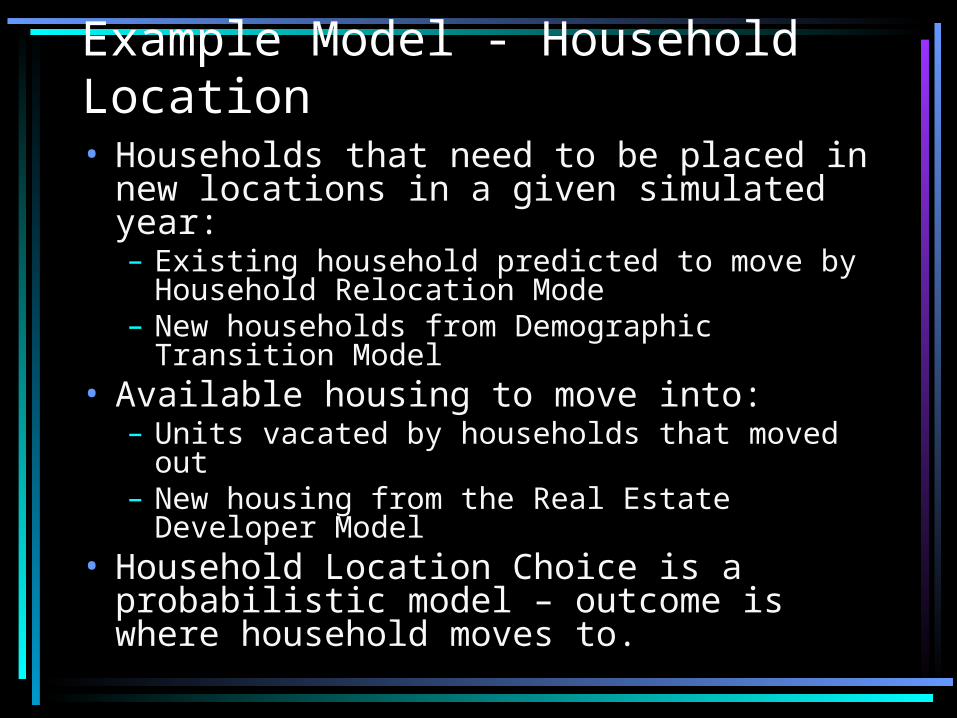
Example Model - Household Location• Households that need to be placed in new locations in a given simulated year:– Existing household predicted to move by Household Relocation Mode
– New households from Demographic Transition Model
• Available housing to move into:– Units vacated by households that moved out
– New housing from the Real Estate Developer Model
• Household Location Choice is a probabilistic model – outcome is where household moves to.

Household Location Model (2)
• UrbanSim computes the probability of a unplaced household moving to different possible locations
• Then use a random number generator to choose a specific location
• Variables used in computing these probabilities: characteristics both of the household and of the potential housing
• Estimated using observed data for the region being simulated
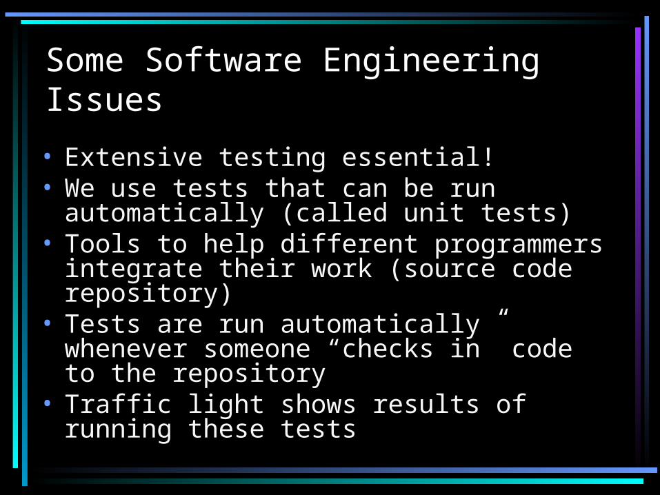
Some Software Engineering Issues
• Extensive testing essential!• We use tests that can be run automatically (called unit tests)
• Tools to help different programmers integrate their work (source code repository)
• Tests are run automatically whenever someone “checks in” code to the repository
• Traffic light shows results of running these tests

UrbanSim Indicators• Indicators provide the principal mechanism for summarizing results from the simulation. Examples:– Population density– Average household income– Acres of buildable land– Greenhouse gas emissions from transportation
• At stake: – Quantities that are modeled and presented using indicators have a privileged place in the deliberation

Example simulation output:
Map-based indicator display forPuget Soundregion

Indicator Perspectives (1)

Indicator Perspectives (2)

Indicator Perspectives (3)

Some Current Projects
• Modeling and presenting uncertainty in simulation results
• Using data from a congestion pricing study in the Seattle area to build better travel models
• Using OneBusAway data to build better travel models
• Indicator Perspectives meets Wikipedia
QuickTime™ and a decompressor
are needed to see this picture.
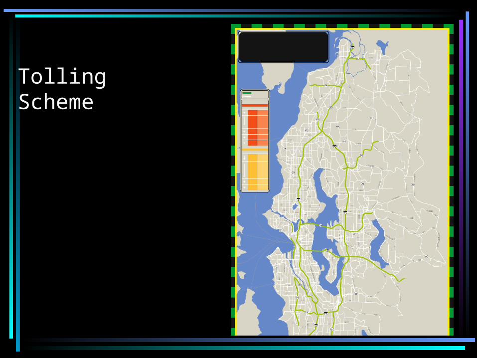
Tolling Scheme

Analyzing GPS Traces from Congestion Pricing Study

WikiCommons: Wikipedia-meets-UrbanSim• Extend Indicator Perspectives idea to allow participation by editing Wikipedia-style articles– Proposals for alternatives– Perspectives on alternatives– Links to simulation results to inform the discussion
• Some key aspects:– Unlike Indicator Perspectives, individual citizens can also form ad-hoc groups around a perspective
– Unlike Wikipedia, encourage multiple perspectives in the form of separate “position papers”
– Separate actions from reasons to support or oppose them
– Unlike current public comment process, goal is to have more cogent, useful positions that decision makers can use