Embed Size (px)
Citation preview
U.S. Department of the InteriorU.S. Geological Survey
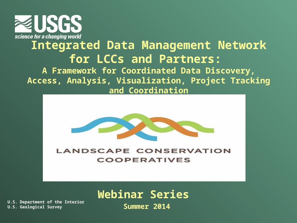
Integrated Data Management Network for LCCs and Partners:
A Framework for Coordinated Data Discovery, Access, Analysis, Visualization, Project Tracking and Coordination
Webinar Series Summer 2014

Statement of Need
LCCs have a critical need for information management processes that facilitate: science product (i.e., data, analysis and decision
tools, documents) sharing; data storage, security, and dissemination; and project tracking, communication and collaboration
tools
Effort must be interoperable with the USGS National Climate Change and Wildlife Science Center (NCCWSC) and other landscape‐level project management systems
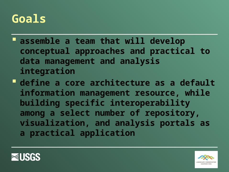
Goals
assemble a team that will develop conceptual approaches and practical to data management and analysis integration
define a core architecture as a default information management resource, while building specific interoperability among a select number of repository, visualization, and analysis portals as a practical application
Eventually…
The team will evolve into topic‐specific Communities of Practice that will jointly guide future integration pathways for LCCs and their partners
Planning and Doing
The IDMN will: facilitate efficient data sharing and technical
communication among the broadest possible partnerships
provide specific coordinated interoperability solutions requested by multiple federal and state guidance documents
create the guidance that defines multiple information transfer situations
foster LCC and CSC partnerships by federating their locally developed hardware and software solutions
Deliverables
1. Data, application, and documentation standards that align with national‐level LCC partner programs and underlie all deliverables of the IDMN and subsequent outcomes of the Communities of Practice.
2. Roadmap to Interoperability: Comprehensive strategic framework that guides the future
network.
Planning and doing will be paired with shared, creative problem solving and lessons learned documentation to generate the roadmap
Describe the present and future integrated network supporting LCC data management, analysis and delivery needs.
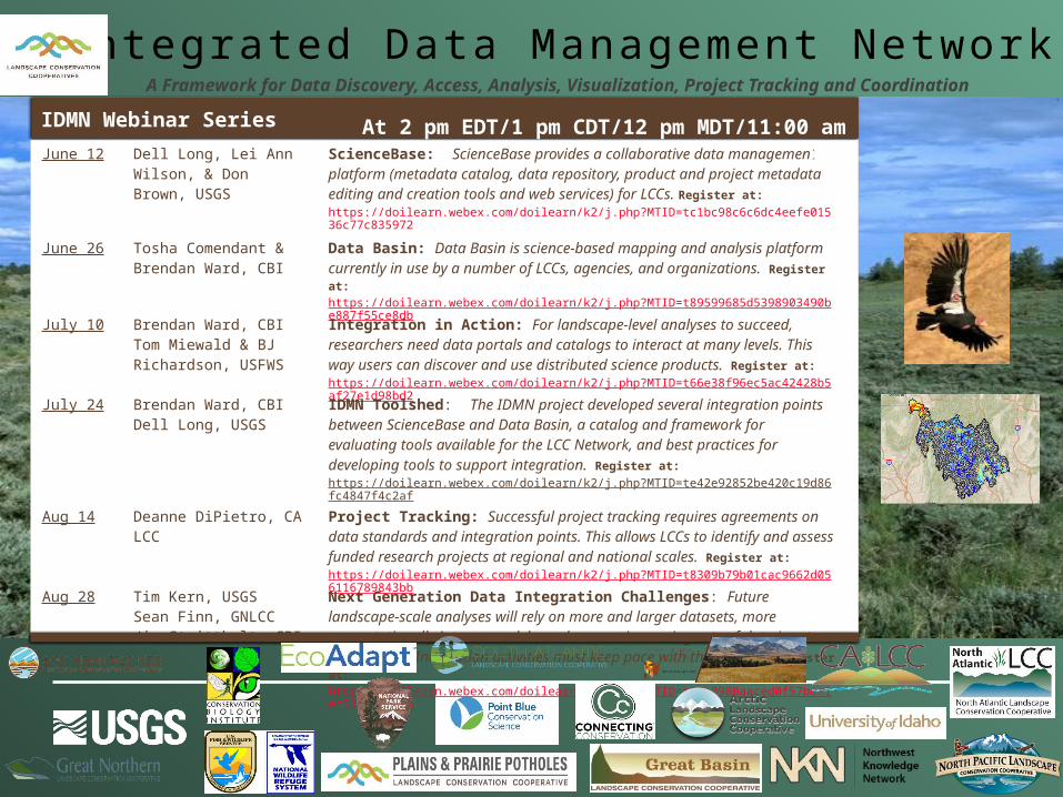
Integrated Data Management NetworkA Framework for Data Discovery, Access, Analysis, Visualization, Project Tracking and Coordination
June 12 Dell Long, Lei Ann Wilson, & Don Brown, USGS
ScienceBase: ScienceBase provides a collaborative data management platform (metadata catalog, data repository, product and project metadata editing and creation tools and web services) for LCCs. Register at: https://doilearn.webex.com/doilearn/k2/j.php?MTID=tc1bc98c6c6dc4eefe01536c77c835972
June 26 Tosha Comendant & Brendan Ward, CBI
Data Basin: Data Basin is science-based mapping and analysis platform currently in use by a number of LCCs, agencies, and organizations. Register at: https://doilearn.webex.com/doilearn/k2/j.php?MTID=t89599685d5398903490be887f55ce8db
July 10 Brendan Ward, CBI Tom Miewald & BJ Richardson, USFWS
Integration in Action: For landscape-level analyses to succeed, researchers need data portals and catalogs to interact at many levels. This way users can discover and use distributed science products. Register at: https://doilearn.webex.com/doilearn/k2/j.php?MTID=t66e38f96ec5ac42428b5af27e1d98bd2
July 24 Brendan Ward, CBIDell Long, USGS
IDMN Toolshed: The IDMN project developed several integration points between ScienceBase and Data Basin, a catalog and framework for evaluating tools available for the LCC Network, and best practices for developing tools to support integration. Register at: https://doilearn.webex.com/doilearn/k2/j.php?MTID=te42e92852be420c19d86fc4847f4c2af
Aug 14 Deanne DiPietro, CA LCC
Project Tracking: Successful project tracking requires agreements on data standards and integration points. This allows LCCs to identify and assess funded research projects at regional and national scales. Register at: https://doilearn.webex.com/doilearn/k2/j.php?MTID=t8309b79b01cac9662d056116789843bb
Aug 28 Tim Kern, USGSSean Finn, GNLCCJim Strittholt, CBI
Next Generation Data Integration Challenges: Future landscape-scale analyses will rely on more and larger datasets, more computationally intense models, and an ever increasing rate of data inputs and outputs. Integration activities must keep pace with these needs. Register at: https://doilearn.webex.com/doilearn/k2/j.php?MTID=t88b0980aaced0f57bee1ec512231bff6
IDMN Webinar Series At 2 pm EDT/1 pm CDT/12 pm MDT/11:00 am PDT
U.S. Department of the InteriorU.S. Geological Survey
ScienceBase/LC MAP
LCC Integrated Data Management Network
Dell Long, Don Brown, and Lei Ann Wilson USGS Fort Collins Science Center
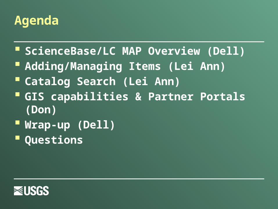
Agenda
ScienceBase/LC MAP Overview (Dell) Adding/Managing Items (Lei Ann) Catalog Search (Lei Ann) GIS capabilities & Partner Portals (Don) Wrap-up (Dell) Questions
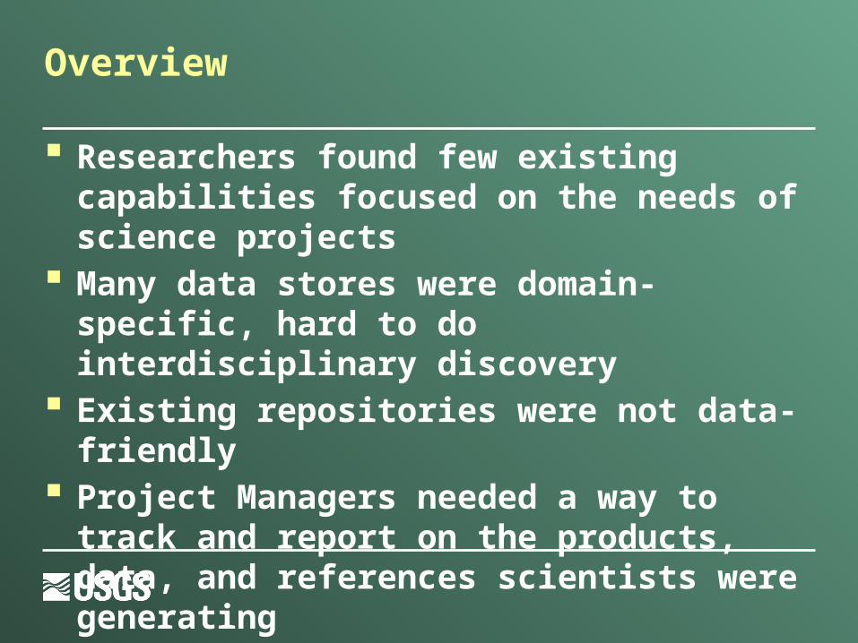
Overview
Researchers found few existing capabilities focused on the needs of science projects
Many data stores were domain-specific, hard to do interdisciplinary discovery
Existing repositories were not data-friendly Project Managers needed a way to track and
report on the products, data, and references scientists were generating
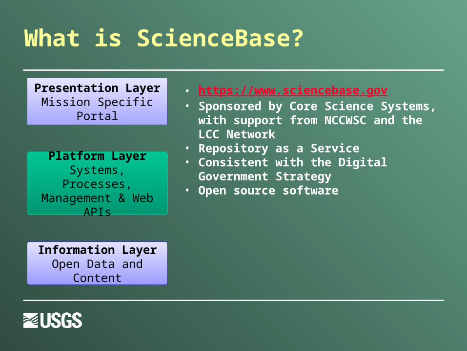
• https://www.sciencebase.gov• Sponsored by Core Science Systems, with
support from NCCWSC and the LCC Network
• Repository as a Service• Consistent with the Digital Government
Strategy• Open source software
What is ScienceBase?
Presentation LayerMission Specific Portal
Platform LayerSystems, Processes, Management & Web
APIs
Information LayerOpen Data and Content
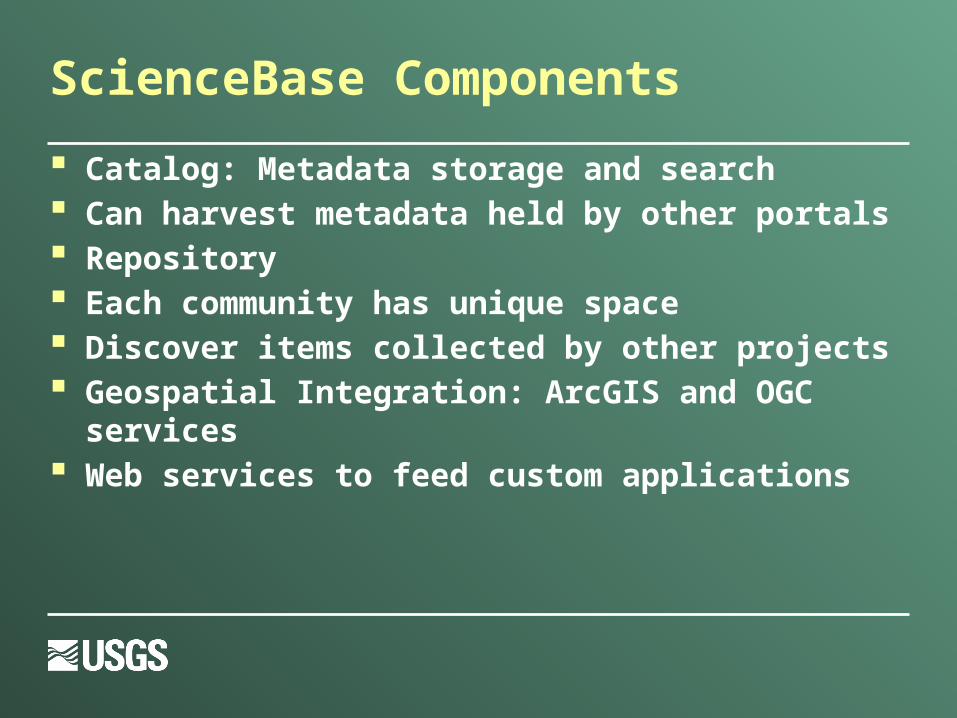
ScienceBase Components
Catalog: Metadata storage and search Can harvest metadata held by other portals Repository Each community has unique space Discover items collected by other projects Geospatial Integration: ArcGIS and OGC services Web services to feed custom applications
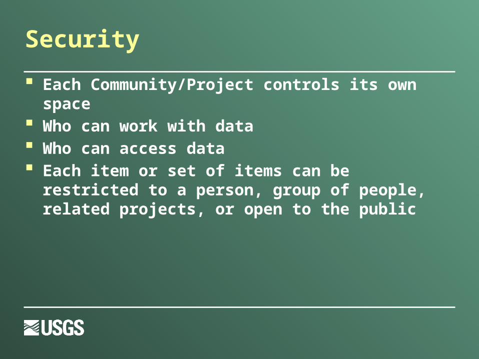
Security
Each Community/Project controls its own space Who can work with data Who can access data Each item or set of items can be restricted to a
person, group of people, related projects, or open to the public
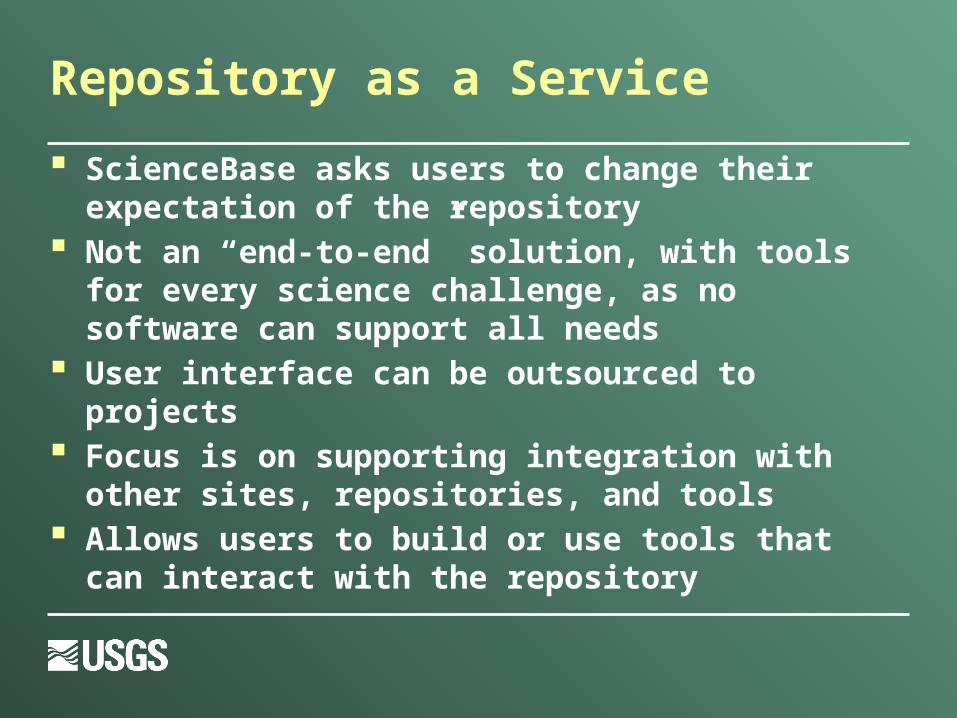
Repository as a Service
ScienceBase asks users to change their expectation of the repository
Not an “end-to-end” solution, with tools for every science challenge, as no software can support all needs
User interface can be outsourced to projects Focus is on supporting integration with other sites,
repositories, and tools Allows users to build or use tools that can interact
with the repository
Adding/Managing Items
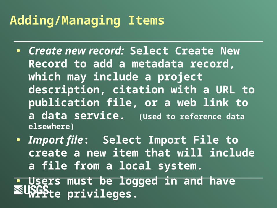
• Create new record: Select Create New Record to add a metadata record, which may include a project description, citation with a URL to publication file, or a web link to a data service. (Used to reference data elsewhere)
• Import file: Select Import File to create a new item that will include a file from a local system.
• Users must be logged in and have write privileges.
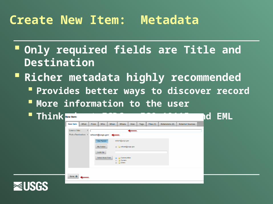
Create New Item: Metadata
Only required fields are Title and Destination Richer metadata highly recommended
Provides better ways to discover record More information to the user Think about FGDC, ISO 19115 and EML
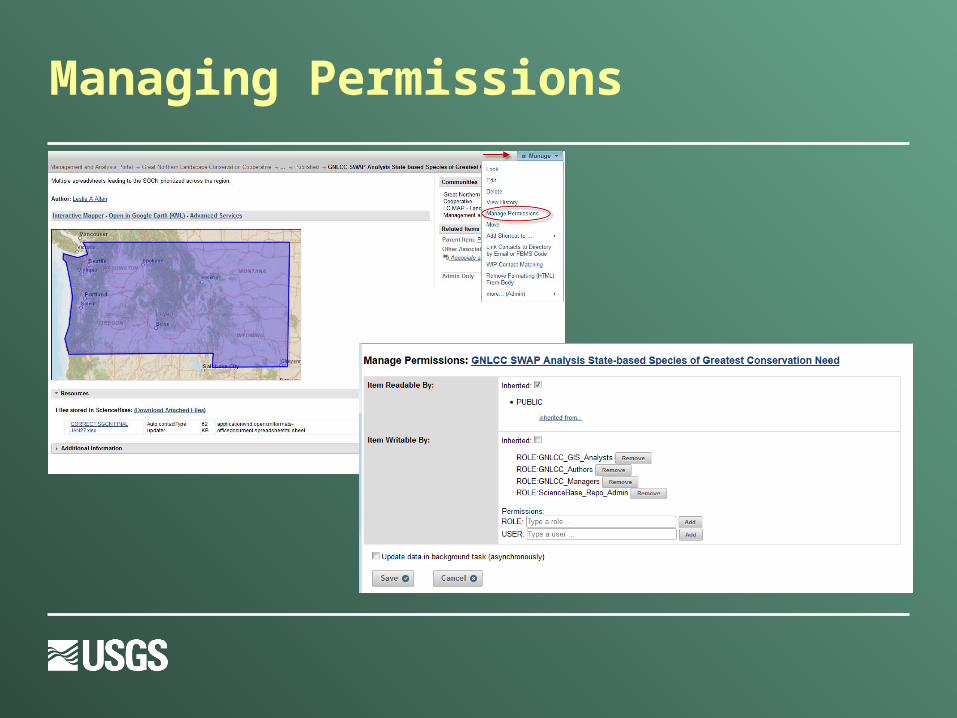
Managing Permissions
WAF Harvesting
ScienceBase items can be created from several standard metadata formats including FGDC, ISO-19115, and EML
An item with a reference to a web accessible folder (WAF) can be harvested, creating child items for each file
Original metadata is retained on the new items for future reference
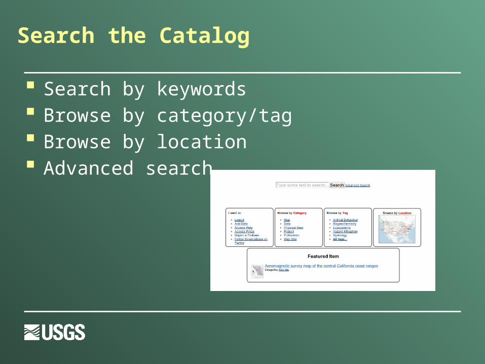
Search the Catalog
Search by keywords Browse by category/tag Browse by location Advanced search
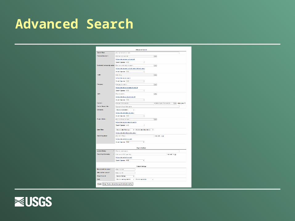
Advanced Search
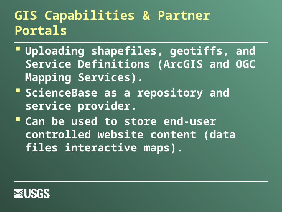
GIS Capabilities & Partner Portals
Uploading shapefiles, geotiffs, and Service Definitions (ArcGIS and OGC Mapping Services).
ScienceBase as a repository and service provider.
Can be used to store end-user controlled website content (data files interactive maps).
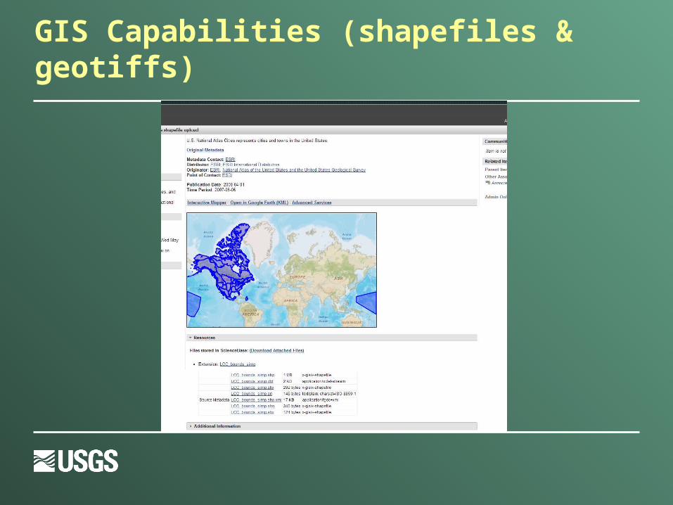
GIS Capabilities (shapefiles & geotiffs)
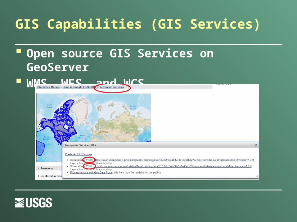
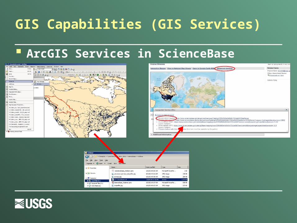
GIS Capabilities (GIS Services)
Open source GIS Services on GeoServer WMS, WFS, and WCS
GIS Capabilities (GIS Services)
ArcGIS Services in ScienceBase
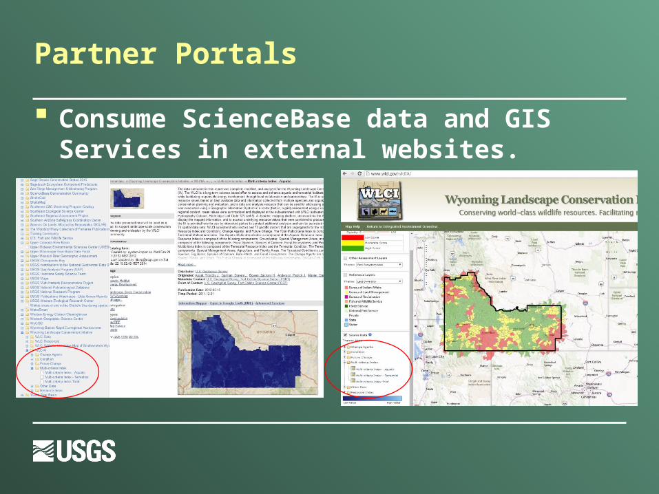
Partner Portals
Consume ScienceBase data and GIS Services in external websites.
Catalog Services
ScienceBase provides basic support for several standard harvesting methods
Each data collection has its own “end point” Catalog Services for the Web (CSW) Open Archives Initiative Protocol for
Metadata Harvesting (OAI-PMH)
What’s Next for ScienceBase?
Better handling of native metadata formats Improved support for uploading and downloading
large data sets Continued support for the storage of project data
and metadata from USGS projects and its partners
Wrap Up
ScienceBase Documentation https://www.sciencebase.gov/about
Email [email protected]
Give Feedback http://feedback.sciencebase.gov
/forums/73465-sciencebase
Questions