Embed Size (px)
Citation preview

U.S. Department of the InteriorU.S. Geological SurveyU.S. Department of the InteriorU.S. Geological Survey
USGS Presentations
ACEHR Meeting, Golden CO
USGS Presentations
ACEHR Meeting, Golden CO
October 23-24, 2007
Current USGS Performance Measures
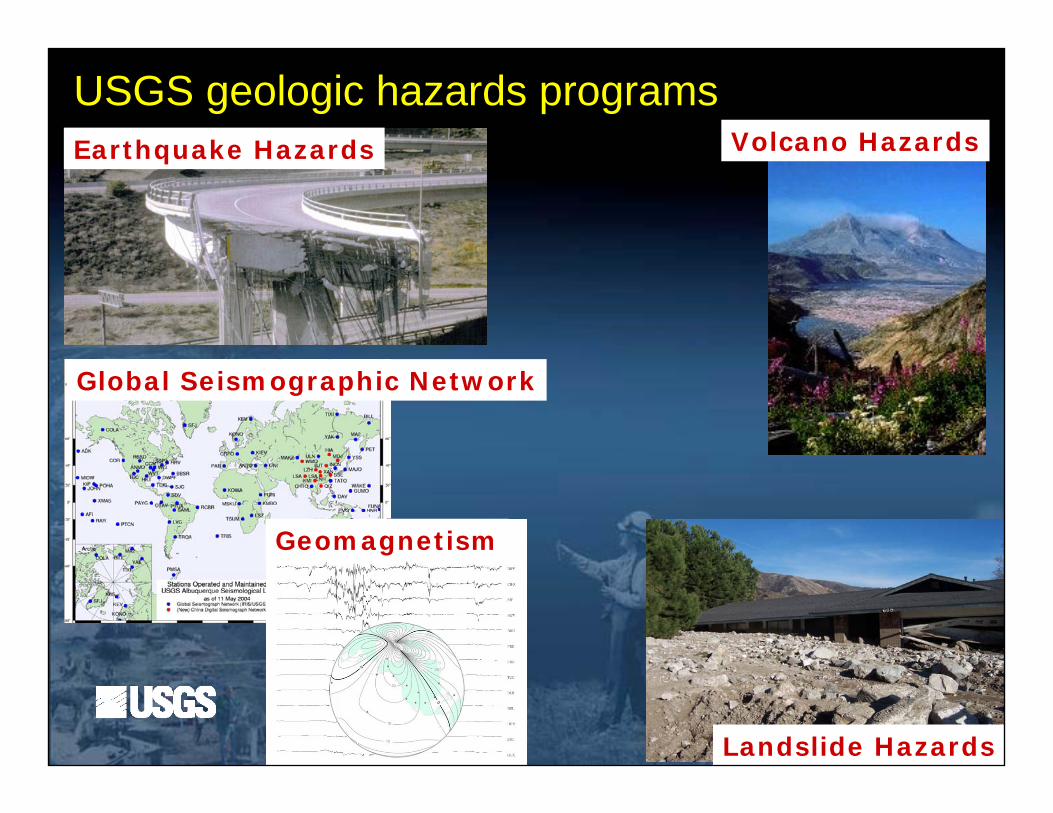
Earthquake Hazards
Global Seismographic Network
Geomagnetism
Volcano Hazards
Landslide Hazards
USGS geologic hazards programs
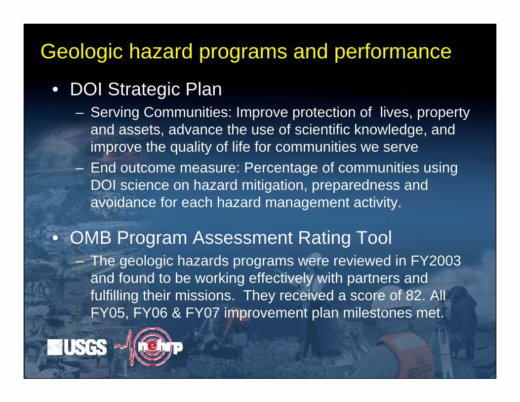
• DOI Strategic Plan– Serving Communities: Improve protection of lives, property
and assets, advance the use of scientific knowledge, and improve the quality of life for communities we serve
– End outcome measure: Percentage of communities using DOI science on hazard mitigation, preparedness and avoidance for each hazard management activity.
• OMB Program Assessment Rating Tool– The geologic hazards programs were reviewed in FY2003
and found to be working effectively with partners and fulfilling their missions. They received a score of 82. All FY05, FY06 & FY07 improvement plan milestones met.
Geologic hazard programs and performance
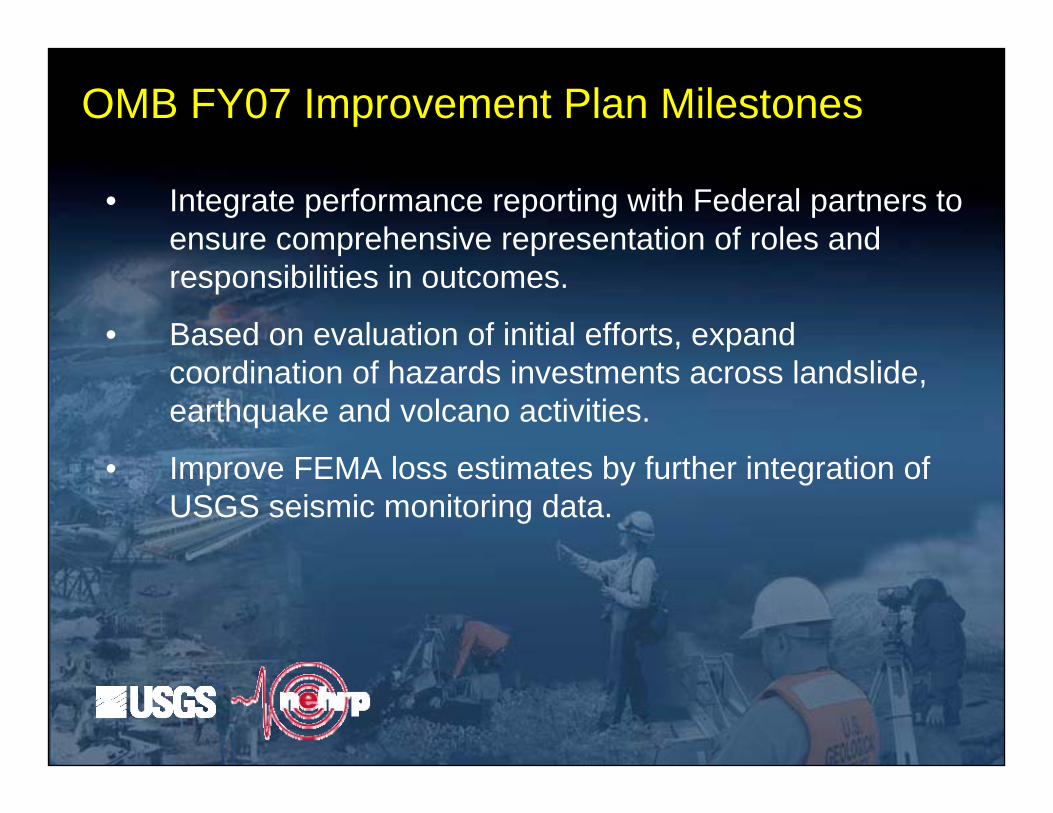
• Integrate performance reporting with Federal partners to ensure comprehensive representation of roles and responsibilities in outcomes.
• Based on evaluation of initial efforts, expand coordination of hazards investments across landslide, earthquake and volcano activities.
• Improve FEMA loss estimates by further integration of USGS seismic monitoring data.
OMB FY07 Improvement Plan Milestones
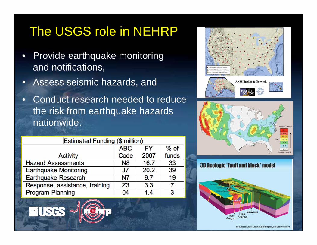
The USGS role in NEHRP
• Provide earthquake monitoring and notifications,
• Assess seismic hazards, and
• Conduct research needed to reduce the risk from earthquake hazards nationwide.
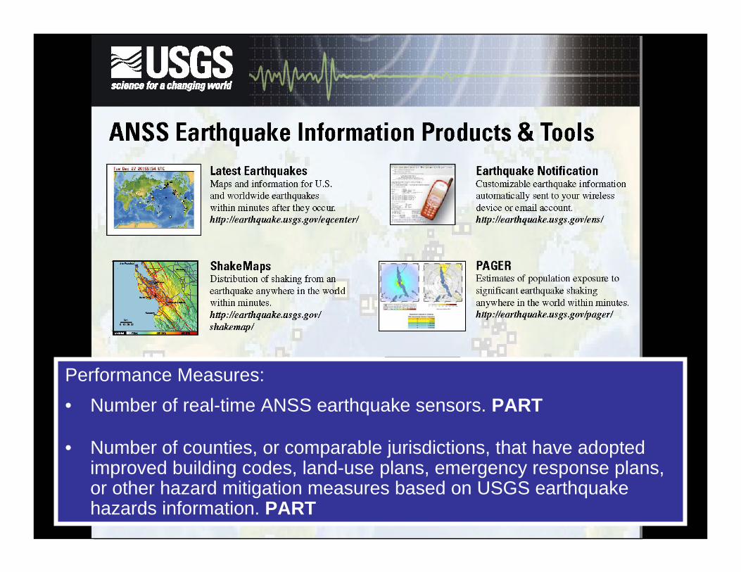
Performance Measures:• Number of real-time ANSS earthquake sensors. PART
• Number of counties, or comparable jurisdictions, that have adopted improved building codes, land-use plans, emergency response plans, or other hazard mitigation measures based on USGS earthquake hazards information. PART

Northridge ShakeMap in Google Earth (KML Format)
ShakeMap delivery
Performance Measure:• Number of metropolitan areas where ShakeMap is incorporated into
emergency procedures. PART
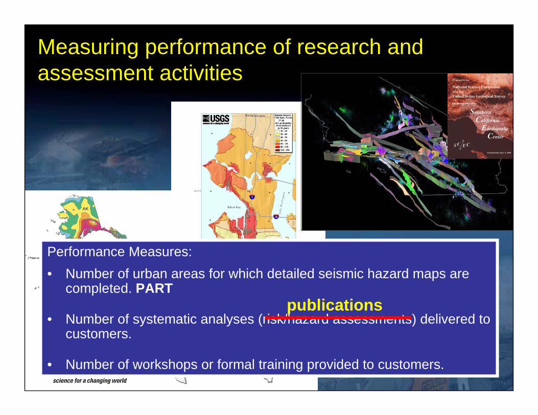
Performance Measures:• Number of urban areas for which detailed seismic hazard maps are
completed. PART
• Number of systematic analyses (risk/hazard assessments) delivered to customers.
• Number of workshops or formal training provided to customers.
publications
Measuring performance of research and assessment activities
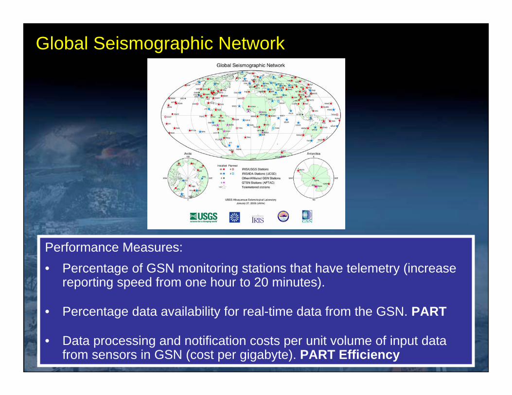
Global Seismographic Network
Performance Measures:• Percentage of GSN monitoring stations that have telemetry (increase
reporting speed from one hour to 20 minutes).
• Percentage data availability for real-time data from the GSN. PART
• Data processing and notification costs per unit volume of input data from sensors in GSN (cost per gigabyte). PART Efficiency