Embed Size (px)
Citation preview

USGS Wildland Fire Workshop EROS Data Center Sioux Falls, SD July 9-10, 1997
IP .1 l*'!*^"
tff| ' TIH . 'ISi
*"" DISTBIB'Jl KM STATE MEKT A
i- Approvc.c1 ;..,r -;«Mic .xlrxrs; f*:■•;, ■%'
1 ' Distn! _lli'l.~.-. iled
* '%
fl* j. f n . •*' W1'' * I8 |i fe"\ ijfl ijf 1» ijfi'' * ' If r .«jfc. i ^HHPy&%^i
'. J^\§tSi v *'- •T5'
1 f. ,** ■ -
* * «... * '
„ £ * ■■mMf s
' -mm.*. *
U.S. Department of the Interior U.S. Geological Survey
USGS science for a changing world
ro

REPORT DOCUMENTATION PAGE Form approved
OMB No. 0704-0188
Public reporting burden for this collection is estimated to average 1 hour per response, including time tor reviewing instructions, searching existing data sources, gathering and maintaining the data needed, and completing and reviewing the collection of information. Send comments regarding this burden estimate or any other aspect of this collection of information, including suggestions for reducing this burden, to Washington Headquarters Services, Directorate for Information Operations and Reports, 1215 Jefferson Davis Highway, Suite 1204, Arlington, VA 22202-4302, and to the Office of Management and Budget, Paperwork Reduction Project (0704-0188) Washington, DC 20503.
1. AGENCY USE ONLY (Leave Blank)
2. REPORT DATE
April 1998 3. REPORT TYPE AND DATES COVERED
4. TITLE AND SUBTITLE
USGS Wildland Fire Workshop, EROS Data Center, Sioux Falls, SD, July 9-10, 1997
5. FUNDING NUMBERS
6. AUTHOR(S)
S. G. Coloff, J. Findley, and R.L. Heiz
7. PERFORMING ORGANIZATION NAME(S) AND ADDRESSES
U.S. Department of the Interior U.S. Geological Survey
8. PERFORMING ORGANIZATION REPORT NUMBER
9. SPONSORING/MONITORING AGENCY NAME(S) AND ADDRESSES
U.S. Department of the Interior U.S. Geological Survey
10. SPONSORING MONITORING AGENCY REPORT NUMBER
11. SUPPLEMENTARY NOTES
12a. DISTRIBUTION/AVAILABILITY STATEMENT
Release unlimited. Available from the National Technical Information Service, 5285 Port Royal Road, Springfield, VA 22161 (1-800-553-6847 or 703-487-4650). Available to registered users from the Defense Technical Information Center, Attn: Help Desk, 8722 Kingman Road, Suite 0944, Fort Belvoir, VA 22060-6218 (1-800-225-3842 or 703-767-9050).
12b. DISTRIBUTION CODE
13. ABSTRACT (Maximum 200 words)
Report on the first workshop on USGS wildland fire expertise and capabilities. The workshop brought together opera- tional and research representatives of the Federal fire management agencies to initiate a more comprehensive assessment of the USGS's capabilities and the appropriate role(s) for USGS interaction and involvement with the fire community. The report discusses how the USGS can play a significant role in wildland fire research and offer the fire community several unique capabilities. Foremost capability is the role as data producer; fire detection, assessment, ecological modeling, and rehabilitation and restoration relying on digital elevation models, digital line-graphs, national technical means, and image data are also discussed. The bureau offers technical expertise using geographic information systems (GIS), image process- ing and analysis, data base management and clearinghouse experience, and access to national technical means data. The bureau must exploit the USGS's expertise and prominence in wildland fire research. The USGS is an experienced player in fire ecology, fire assessment, and fuels loading research. Finally, the USGS also offers strong interdisciplinary experi- ence in watershed and geologic landslide modeling, which is key for assessing postfire effects.
14. SUBJECT TERMS (Keywords)
wildfire, wildland fire, fire, USGS, EROS, ecology, chemistry, biology, land management policies, research
15. NUMBER OF PAGES
vi + 28 pp
16. PRICE CODE
17. SECURITY CLASSIFICATION I 18. SECURITY CLASSIFICATION OF | 19. SECURITY CLASSIFICATION OF OF REPORT THIS PAGE ABSTRACT
Unclassified Unclassified Unclassified
20. LIMITATION OF ABSTRACT
Unclassified
NSN 7540-01-280-5500 Standard Form 298 (rev. 2*9) Prescribed by ANSI Sid. Z39-18 298-102

USGS Wildland Fire Workshop EROS Data Center Sioux Falls, SD July 9-10,1997
By
S. G. Coloff, J. Findley, and R. L. Heiz
U.S. Department of the Interior U.S. Geological Survey Reston, VA 20192
WIG QUÄLET* INSPECTED i

Citation: Coloff, S. G, J. Findley, and R. L Heiz. 1998. USGS Wildland Fire Workshop, EROS Data Center, Sioux Falls, SD, July 9-
10,1997. U.S. Geological Survey, Reston,VA. vi + 28pp.

Contents Page
Executive Summary v
Introduction 1
Wildland Fire in the United States 1
Historical Perspective 1
Current Perspective 1
Reintroduction of Fire 2
Wildland Fire Management 2
Federal Wildland Fire Policy 2
Workshop Presentations from Fire Community Representatives 2
Departmental Overview - Fire Management Policy and Issues 2
Fire Management/Fire Suppression: Activities Overview 3
Forest Fire Science and Research Overview: U.S. Forest Service 3
Department of the Interior Fire Science and Research Overview 4
Workshop Panels 4
Fire Detection, Fire Warning, Fuels Assessment Panel 4
Fire Ecology and Fire Effects Panel 6
Modeling Panel 6
Postfire Rehabilitation/Restoration Panel 6
Workshop Discussions 7
USGS Strengths and Capabilities 8
Recommendations for Future Actions 9
Post-workshop Developments 9
Appendix A - Workshop Materials and Information 10
Appendix B - Wildland Fire Policy Topics and Issues 15
Wildland Fire Management 15
Interagency-Intergovernmental Partnerships 15
Wildland Fire Coordinating Organizations 16
Wildland Fire Facilities - National Centers and Research Stations 17
Appendix C - FY96 Progress Report to the Interior Fire Coordination Committee 18
Appendix D - USGS Wildland Fire Research Projects 20
ill
Figures Number Page
1 Greenness map of the United States 5
2 Debris flow at the Strontia Spring Reservoir as a result of the Buffalo Creek, Colorado, wildfire 7
3 A prescribed burn 8
IV

USGS Wildland Fire Workshop EROS Data Center
Sioux Falls, SD July 9-10,1997
Executive Summary
Catastrophic wildfire threatens millions of wildland acres, exerts serious and potentially permanent ecological deterioration, and endangers public and private lands and resources. Unlike earthquakes, tornados, and wind, fire is a disturbance that depends upon and is influenced by com- plex physical, chemical, and biological relationships. The development of sound land management policies depends upon research playing an active role in determining and understanding these relationships.
Federal Wildland Fire Policy
On December 30, 1994, the Secretaries of the Interior and Agriculture chartered the Federal Wildland Fire Man- agement Policy and Program Review to ensure that Federal policies are uniform and programs are cooperative and co- hesive.
The new Federal Fire Policy states that "fire, as a critical natural process, will be integrated into land and resource management plans on a landscape scale based upon best available science." Current and future U.S. Geological Sur- vey (USGS) wildland fire activities need to take this shift in policy, from one of predominantly firefighting to one of fire use and management, into account.
Key Research Issues
• What are the historic consequences of the altered fire regimes, the consequences of the reintroduction of fire, the condition of the relevant ecosystems, the severity of local conditions (to establish priorities for treatment), and the effectiveness of various treatments?
• What is the effect of expanded burning on air quality? Is fire the tool of choice for reducing fuel loads in a given situation? What needs to burn, where is it, and when should it be burned? What will the emissions be? Are there effective smoke reduction techniques?
• What are effective postfire rehabilitation techniques? How can treatments best be monitored and their effec- tiveness assessed?
Why the Workshop?
It has been recognized for some time that USGS has considerable expertise and capabilities related to wildland fire. Prior to this workshop, however, there had been no formal or specific effort to describe and document fire- related activities and capabilities within the Survey.
The workshop brought together operational and re- search representatives of the Federal fire management agen- cies to initiate a more comprehensive assessment of the USGS's capabilities and the appropriate role(s) for USGS interaction and involvement with the fire community.
Workshop Conclusions The USGS can play a significant role in wildland fire
research and offers the fire community several unique ca- pabilities. Foremost is our role as data producer. Fire detec- tion, assessment, ecological modeling, and rehabilitation and restoration rely upon digital elevation models (DEM), digital line-graphs (DLG), national technical means (NTM), and image data. Secondly, the bureau offers technical ex- pertise using geographic information systems (GIS), image processing and analysis, data base management and clear- inghouse experience, and access to national technical means data. Third, the bureau must exploit our biologi- cal science expertise in wildland fire research, especially in fire ecology, fire assessment, and fuels loading research. Finally, the USGS also offers strong interdisciplinary expe- rience in watershed and geologic landslide modeling, which is key for assessing postfire effects.
Workshop Recommendations
Fire science is appropriately classified as a theme within hazards, but it also has much broader implications for land management and cuts across many disciplines. There are many informal collaborations with fire scientists in the U.S. Forest Service, other agencies and academia, and with re- source managers. The initial barrier to expansion of USGS fire science is its relative lack of visibility. To improve our

overall visibility in the area of fire science, the bureau should:
• Raise the visibility of fire science within USGS.
• Develop relationships with U. S. Forest Service research personnel and Department of the Interior (DOI)AJ. S. Forest Service fire management personnel at the na- tional level. This includes:
1. Improving the relationship between the USGS and DOI fire management groups.
2. Developing formal collaboration between USGS and the Interior Fire Coordination Committee (IFCC) Fire Research Working Team.
3. Cultivating key partnerships with other groups in the fire community, as appropriate.
4. Communicating USGS fire science capabilities to all levels of land management agencies including key upper level management in districts and regions.
5. Participating in the development of an interagency strategic plan and capabilities statement with respect to fire science. Specifically, we are participating in the DOI/U. S. Department of Agriculture (USDA) Fire Science Plan Work Group that is producing the fire capabilities report to Congress (due 12/31/97).
Within the USGS we need to:
• Develop a process for determining fire research needs (in cooperation with resource managers), identifying viable research topics and optimizing funding alloca- tion.
• Optimize programs and funding through cooperation.
• Be responsive to short-term management needs of the fire community. To this end we should:
1. Participate in management planning efforts. 2. Contribute to fire suppression-related management
activities. 3. Participate in prescribed fire activities. 4. Utilize USGS capabilities in geographic information
systems.
Potential New Funding
Concern about the key research issues listed above has prompted the House Appropriations Committee to put lan- guage in the DOI and USDA bills for FY98 declaring that more scientific and technical support is needed for the proposed new fire policy and its proposal for a greatly expanded program of prescribed burning. The House of Representatives inserted language authorizing use of up to $4 million for a broader fire sciences capability to supple- ment current research in each agency. The Committee lan- guage calls for DOI and the U. S. Forest Service to submit a joint report to the Committee by January 1,1998, provid- ing an assessment of the current state of knowledge about fuels and proposing an integrated approach to improved fuels monitoring and inventory, as well as approaches for monitoring and evaluating the new fire management pro- gram and setting treatment priorities and methods for evalu- ating nonfuel (i.e., nonburning) treatments. Release of the funds is contingent on submission of an acceptable re- port. The USGS has been invited to participate in the prepa- ration of the DOI/U. S. Forest Service joint report and should seize the opportunity to do so in anticipation of this ex- panded fire science research effort.
VI

USGS Wildland Fire Workshop EROS Data Center
Sioux Falls, SD July 9-10,1997
Introduction This report summarizes the program and outcomes of
the Wildland Fire Workshop held by the USGS on July 9- 10, 1997 at the Earth Resources Observation Systems (EROS) Data Center in Sioux Falls, South Dakota.
The organizers of this workshop recognized that the USGS has considerable expertise and capabilities related to wildland fire. Prior to the workshop, however, there had been no formal or specific effort to describe and document fire-related activities and capabilities among the divisions of the USGS. The workshop and this report are the first steps toward enhancing the visibility and effectiveness of our fire-related activities.
The purposes of the workshop were (1) to review cur- rent USGS, DOI, and U. S. Forest Service wildland fire science activities, issues, and policies; (2) to increase our understanding of the science, technology, and the research needs of the fire management community; (3) to enhance communications among USGS researchers working on wildland fires; and (4) to open a more substantial dialog than has existed so far between the USGS and other Fed- eral agencies involved in fire management.
Workshop attendees included scientists and program managers from the USGS who have been involved in fire- related research as well as operational and research repre- sentatives of the Federal fire management agencies. Par- ticipants outlined their research or other activities during the morning and afternoon of the first day. The second day was spent in group discussion of how to enhance the effec- tiveness of USGS fire-related research in support of the needs of the fire management community. The full agenda and attendee list are included in Appendix A.
Wildland Fire in the United States The challenge of managing wildland fire in the United
States is increasing in complexity and magnitude. The po- tential for catastrophic wildfires now threatens millions of wildland acres, particularly where vegetation patterns have been altered by past land-use practices and a century of vigorous fire suppression and exclusion. Serious and po- tentially permanent ecological deterioration is possible where fuel loads exceed historical conditions. Enormous public and private resources are at high risk, and our nation's capability to respond to this threat is becoming
overextended. Wildland fire is inherently neither good nor bad, but it is the most powerful natural force that people have learned to use. Wildland fire is often unpredictable and potentially destructive and, along with human activi- ties, has helped shape ecosystems throughout time. Unlike earthquakes, tornados, and wind, fire is a disturbance that depends upon complex physical, chemical, and biological relationships.
Historical Perspective Prior to European settlement, Native Americans actively
used fire to alter vegetation patterns. In short, people and ecosystems coevolved in the presence of fire. This human influence shifted after European settlement in North America, when it was believed that fire, unlike other natu- ral disturbance phenomena, could and should be controlled. For many years fire was aggressively excluded to protect both public and private investments and to prevent what was considered the destruction of forests, savannahs, shrublands, and grasslands. While the destructive, poten- tially deadly side of fire was obvious and immediate, changes and risks resulting from these fire exclusion ef- forts were difficult to recognize and mounted slowly and inconspicuously over many decades.
Current Perspective There is growing recognition that past land-use prac-
tices, combined with the effects of fire exclusion, can re- sult in heavy accumulations of dead vegetation, altered fuel arrangement, and changes in vegetation structure and com- position. Fire exclusion in some fire-dependent areas or the occurrence of fires in other areas may encourage nonna- tive species. Fires in areas of altered vegetation and fuels can adversely affect other important forces within the eco- system, such as insects and diseases, wildlife populations, hydrologic processes, soil structure and mineralogy, and nutrient cycling. Any of these components, if altered greatly by unusually severe fire, can seriously diminish the long- term sustainability of the land. In addition, effective pro- tection from and control of large fire events will likely be much more difficult.
Paradoxically, rather than eliminating fire, exclusion efforts, combined with other land-use practices, have in many places dramatically altered fire regimes (i.e., circum- stances of fires, including frequency, intensity, and spatial extent) so that today's fires tend to be larger and

2 USGS WILDLAND FIRE WORKSHOP, JULY 9-10, 1997
more severe. No longer a matter of slow accumulation of fuels, today's conditions confront us with the likelihood of more rapid, extensive ecological changes beyond any we have experienced in the past. To address these changes and the challenge they present, we must first understand and accept the role of wildland fire and adopt land man- agement practices that integrate fire as an essential eco- system process.
Reintroduction of Fire The need to reintroduce wildland fire on an ecologi-
cally significant scale is increasingly being recognized and accepted by land managers, environmental regulators, and the public. However, in many instances, it takes years to reach agreement about appropriate treatments and to take action. Land managers often feel the need to wait for sci- entific certainty before acting. This hesitance favors the status quo, impedes progress, and deters investigation of new techniques. In some ecosystems, little or no informa- tion is available about disturbance regimes, historical fire patterns, fuel buildup, response to past management ac- tions, and likely future responses. Information needed to reintroduce fire includes a well-planned, large-scale sci- entific assessment of current ecosystem conditions and the consequences of various management strategies.
Wildland Fire Management
Wildland fire management encompasses a wide range of activities, including fire planning and preparedness, fuels management, fire suppression, postfire rehabilitation, and prescribed burning. While activities such as fire planning, suppression, and prescribed burning are largely self-ex- planatory, fuels management refers to the use of fire or other (e.g., mechanical, chemical) means to restore and maintain healthy ecosystems and/or to reduce the risks of catastrophic fire. Postfire rehabilitation includes actions taken after a fire to remove hazards, minimize effects of wind or water, stabilize lands, and minimize encroachment of invasive and nonnative species.
Federal Wildland Fire Policy On December 30, 1994, the Secretaries of the Interior
and Agriculture chartered the Federal Wildland Fire Man- agement Policy and Program Review to ensure that Fed- eral policies are uniform and programs are cooperative and cohesive. The final report was signed December 18,1995. The fire policy addresses five major topic areas, presents nine guiding principles that are fundamental to wildland fire management, and recommends a set of 13 Federal wild- land fire policies. While unique agency missions may re- sult in minor operational differences, for the first time, one set of "umbrella" Federal fire policies is in place to
provide effective and efficient operations across adminis- trative boundaries and to improve Federal capability to meet the challenges posed by current wildland fire conditions (Federal Wildland Fire Management - Policy and Program Review, Final Report, December 18, 1995).
The issues surrounding wildland fire management and policy are numerous and complex. Appendix B briefly sum- marizes information concerning interagency-intergovern- mental partnerships, wildland fire coordinating organiza- tions, such as the National Wildfire Coordinating Group (NWCG) and the IFCC, and wildland fire facilities.
Workshop Presentations from Fire Community Representatives
A vital purpose of the July 9-10 workshop was to hear from various representatives of the Federal fire commu- nity Speakers included Jim Douglas from the Office of Managing Risk and Public Safety of the DOI, Rodger Vorce of the Bureau of Land Management (BLM) from the Na- tional Interagency Fire Center (NIFC), David Weise of the Riverside Forest Fire Laboratory and Bob Burgan of the Intermountain Fire Sciences Laboratory, both from the U.S. Forest Service, and Bill Leenhouts of the U.S. Fish and Wildlife Service (USFWS) and NIFC, who chairs the IFCC Research Working Group.
Departmental Overview- Fire Management Policy and Issues
Jim Douglas gave the group a brief overview of DOI policy and issues in the area of fire management. He noted that fire management is intrinsically an interagency and intergovernmental endeavor. DOI bureaus involved include BLM, National Park Service (NPS), USFWS, and Bureau of Indian Affairs (BIA), which together with the U.S. For- est Service from the USDA make up the main Federal fire community. Other agencies with significant involvement include the National Weather Service, Federal Emergency Management Administration, and Department of Defense. The principal nonfederal partners are the states, mainly through the National Association of State Foresters. An important unifying factor in fire management is that there is a common budget structure, authorization language, and scope of funding for wildland fire management in the DOI and U.S. Forest Service budget and appropriations lan- guage. In addition, through the NWCG the agencies share common approaches to training and organization, use com- mon equipment, and mobilize jointly as needed.
The new Federal fire policy, endorsed by DOI and USDA at the end of 1995, states that "fire, as a critical natural process, will be integrated into land and resource management plans on a landscape scale . . . and will be

EROS DATA CENTER, SIOUX FALLS, SD 3
based upon [the] best available science." Current and fu- ture USGS wildland fire activities need to take this shift in policy, from one of predominantly firefighting to one of fire use and management, into account.
The new policy raises a number of key issues and ques- tions. First, in the area of fuels management and ecosys- tem health, we need to understand the historic consequences of the altered fire regimes that have prevailed, the conse- quences of the reintroduction of fire, the condition of the relevant ecosystems, the severity of local conditions (to establish priorities for treatment), and the effectiveness of various treatments. Another issue is the effect of expanded burning on air quality, where questions include: is fire the tool of choice for the situation? What needs to burn, where is it, and when should it be burned? What will the emis- sions be? Can we model and track those emissions? Are there effective smoke reduction techniques? A third area of concern is postfire rehabilitation efforts. We need to monitor treatments to assess their effectiveness and then collect and disseminate information regarding their effec- tiveness.
Concern about these issues has prompted the House Appropriations Committee to put language in the DOI and USDA bills for FY98 declaring that more scientific and technical support is needed for the new fire policy and its proposal for a greatly expanded program of prescribed burning. The House of Representatives inserted language authorizing use of up to $4 million for a broader fire sci- ences capability to supplement current research in each agency. The Committee language calls for DOI and the U.S. Forest Service to submit a joint report to the Commit- tee by January 1, 1998, providing an assessment of the current state of knowledge about fuels and proposing an integrated approach to improved fuels monitoring and in- ventory, as well as approaches for monitoring and evaluat- ing the new fire management program and setting treat- ment priorities and methods for evaluating nonfuel (i.e., nonburning) treatments. Release of the funds is contingent on submission of an acceptable report.
Fire Management/Fire Suppression: Activities Overview
Rodger Vorce, with the BLM at NIFC, gave an over- view of the more traditional fire suppression activities, which are still a very important component of the business of the fire community. Response activities are organized on a three-tier basis: local, regional, and national. The first response is local, and whatever agency or bureau has equip- ment closest to the fire responds, regardless of where the fire is so long as it is on Federal land. At the regional level, there are 11 established regions, and most fires not handled at the local level are suppressed with resources within a region. The national center, NIFC, is primarily a coordination
and training center, but it does provide general technical support, including the services of some National Weather Service experts. For exceptional major fire seasons, the military can be called on for support and will provide both people and equipment. Vorce noted in closing that we have become very good at fire suppression: he stated that 98% of fires targeted for suppression are put out on the first- pass response. Only 2% require more prolonged efforts. In response to questions about fire detection, he noted that the fires most likely to "get away" are those caused by human activity, since the normal monitoring techniques (oriented toward fires caused by lightning) are not designed to detect such fires. He also mentioned the ballooning prob- lem of urban/wildland interface fires and the continuing need for fire suppression in those circumstances.
Forest Fire Science and Research Overview: U.S. Forest Service
Following Vorce's presentation, David Weise provided an overview of the research activities of the U.S. Forest Service Riverside Fire Laboratory. Areas of interest there include (1) fire meteorology, (2) fire management research, development, and application, and (3) prescribed fire and fire effects. The first category includes high-resolution fire weather forecasts and the linkage of those forecasts with fire spread models in order to conduct real-time validation of those models. Fire management research, development, and application encompass wildfire situation analysis, modeling multiple fire occurrence, strategic fire planning, and cost/benefit analyses of fuel treatments and prescribed fires. The fire effects activities include studies of the ef- fects of fire on atmospheric chemistry, the character of smoke emissions, and the more long-term effects of fire on vegetation. The emphasis at the Riverside Fire Labora- tory is on Mediterranean-climate vegetation like the chap- arral of southern California.
Bob Burgan, from the Intermountain Research Center in Missoula, Montana, began by providing a brief over- view of research done at the U.S. Forest Service laborato- ries in East Lansing, Michigan and Seattle, Washington. He mentioned that the Seattle lab had been doing work on smoke emission models. In Missoula, the focus is on (1) fire effects and prescribed fires, (2) fire chemistry (the constituents of smoke), and (3) fire behavior, which is Burgan's own field. He has been working to develop the Wildland Fire Assessment System (WFAS) to replace the current assessment system, which dates from the 1960's. WFAS is intended to provide improved fire danger esti- mates on a national scale (WFAS-MAPS), as well as to improve methods to simulate fire behavior (the new FARSITE system) for local areas. FARSITE is a fire-growth simulation model used by the U.S. Forest Service that in- corporates existing models for surface fire, crown fire,
4 USGS WILDLAND FIRE WORKSHOP, JULY 9-10, 1997
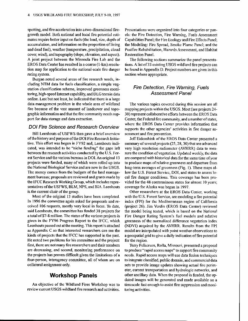
spotting, and fire acceleration into a two-dimensional fire- growth model. Both national and local fire potential esti- mates require better input on fuels (the load, size, depth of accumulation, and information on the proportion of living and dead fuel), weather (temperature, precipitation, cloud cover, wind), and topography (slope, elevation, and aspect). A joint project between the Missoula Fire Lab and the EROS Data Center has resulted in a coarse (1 -km) resolu- tion map for application to the national-scale fire danger rating system.
Burgan noted several areas of fire research needs, in- cluding NTM data for fuels classification, a simple veg- etation classification scheme, improved greenness moni- toring, high-speed Internet capability, and DLG terrain data online. Last but not least, he indicated that there is a large data management problem in the whole area of wildland fire because of the vast amount of landcover and topo- graphic information and that the fire community needs sup- port for data storage and data extraction.
DOI Fire Science and Research Overview Bill Leenhouts of USFWS then gave a brief overview
of the history and purpose of the DOI Fire Research Initia- tive. This effort was begun in FY92 and, Leenhouts indi- cated, was intended to be "niche funding" for gaps left between the research activities conducted by the U.S. For- est Service and the various bureaus in DOI. An original 13 projects were funded, many of which were rolled up into the National Biological Service and are now in the USGS. The money comes from the budgets of the land manage- ment bureaus; proposals are reviewed and grants made by the IFCC Research Working Group, which includes repre- sentatives of the USFWS, BLM, NPS, and BI A. Leenhouts is the current chair of the group.
Most of the original 13 studies have been completed. In 1996 the committee again asked for proposals and re- ceived 106 requests, mostly very local in focus. To date, said Leenhouts, the committee has funded 38 projects for a total of $7-8 million. The status of the various projects is given in the FY96 Progress Report to the IFCC, which Leenhouts passed out at the meeting. This report is attached as Appendix C so that interested researchers can see the kinds of projects that the IFCC has supported in the past. He noted two problems for his committee and the project: first, there are not many fire researchers and their numbers are decreasing, and second, monitoring performance on the projects has proven difficult given the limitations of a four-person, interagency committee, all of whom are on collateral assignment only.
Workshop Panels An objective of the Wildland Fires Workshop was to
review current USGS wildland fire research and activities.
Presentations were organized into four categories or pan- els: the Fire Detection, Fire Warning, Fuels Assessment Capabilities Panel; the Fire Ecology and Fire Effects Panel; the Modeling: Fire Spread, Smoke Plume Panel; and the Postfire Rehabilitation, Hazards Assessment, and Habitat Restoration Panel.
The following sections summarize the panel presenta- tions. A list of 33 existing USGS wildland fire projects can be found in Appendix D. Project numbers are given in this section where appropriate.
Fire Detection, Fire Warning, Fuels Assessment Panel
The various topics covered during this session are all mapping projects within the USGS. Most (see projects 24- 30) represent collaborative efforts between the EROS Data Center, the Federal fire community, and a number of states, where the EROS Data Center provides information that supports the other agencies' activities in fire danger as- sessment and fire prevention.
Jeff Eidenshink of the EROS Data Center presented a summary of several projects (25,28,30) that use advanced very high resolution radiometer (AVHRR) data to mea- sure the condition of vegetation. Updated weekly, the data are compared with historical data for the same time of year to produce maps of relative greenness and departure from long-term averages of greenness (Fig. 1). These maps al- low the U.S. Forest Service, DOI, and states to assess lo- cal fire danger conditions. This coverage has been pro- vided for the 48 conterminous states for almost 10 years; coverage for Alaska was begun in 1997.
Other researchers at the EROS Data Center, working with the U.S. Forest Service, are modeling a fire potential index (FPI) for the Mediterranean region of California (project 26). Jim Verdin (EROS Data Center) reviewed the model being tested, which is based on the National Fire Danger Rating System's fuel models and relative greenness of the normalized difference vegetation index (NDVI) acquired by the AVHRR. Results from the FPI model are interpolated with point weather observations to a geospatial grid to give a daily indication of fire potential for the region.
Terry Felkerson, Rolla, Missouri, presented a proposal to produce "rapid access maps" to support fire community needs. Rapid access maps will use data fusion techniques to integrate classified, public domain, and commercial data sets to provide image updates showing actual fire perim- eter, current transportation and hydrologic networks, and other ancillary data. When the proposal is funded, the up- dated images will be generated and made available on a timescale fast enough to assist fire suppression and moni- toring activities.

EROS DATA CENTER, SIOUX FALLS, SD 5
a z
'S x v
»'S <o OlC to
> _
(O (O
0> in
CM 10
o co co
to in CM ,-
CO i- CO 10 i- CM T- r-
w o
Q) ■o £ co c
TJ CO cial
1 bo
u
« ct c a CO 3 CO <o
e/p
rov
nd
ary
rnat
ior (A
a
CD ^S < CD
5 o .2" 0.0 S
tat
bou
- In
te
D
Si 2» • 8"> s
<E j
1 1
ill c c —~ O £ö£»
CE «°?o 11IZDI0
I E
a. +
II
si
S '? I s 1 8 E "" o L:
m § i § I s I I 2 a I !
(0 3
s. o
i I e & c "c
18. 81
a> </5
■§■&
IS
si s« II
OJ a T _ < s V o < P 8' ? c o £s r * 1 a
0) CO
£ SB
*" p

6 USGS WILDLAND FIRE WORKSHOP, JULY 9-10, 1997
Felkerson also provided background on Dr. Darrell Herd's Hazard Support System (HSS). The objective of HSS is to detect and report wildfires, as well as volcanic activity. The HSS will use remote sensing and other data from civil, military, and intelligence systems to develop unclassified information for use by civil agencies respon- sible for warning, mitigation, and response to forest fires and volcanic eruptions.
Fire Ecology and Fire Effects Panel USGS expertise in fire ecology and effects is exten-
sive. Twenty-two of the projects listed in Appendix D de- scribe work in this area. Presentations at the workshop could highlight only a few of these projects.
The new Federal fire policy calls for reintroduction of fire on an ecologically significant scale (see summaries above, also Appendix B). David Peterson (Seattle, Wash- ington) gave an overview of USGS efforts to develop tools for accurately assessing large-scale fire effects of vegeta- tion for the U.S. Forest Service. These efforts include the use of modeling approaches and decision support systems to predict changes in vegetation and fuels as the result of climatic regimes and planning/development scenarios. Peterson and others are using GIS to integrate fire history data with vegetation dynamics data in the Columbia River Basin (project 1) and other locations in western North America.
Craig Allen then presented a talk on his work on the ecological effects of past and present fires on the land- scape of northern New Mexico (project 7). Specific re- search includes developing landscape-scale fire histories across ecological gradients in the Jemez and Sangre de Cristo Mountains, collecting tree growth data to determine the seasonality of paleofires, and using GIS data on the extent of historic fires (1909-96) with lightning strike data (1985-95) to conduct landscape-scale spatial analyses of fire ignition and burn patterns. Such analyses enable us to assess the effects of fire (prescribed or natural) on nitro- gen cycling, vegetation and fuel structure, and high profile wildlife species.
Jim Snyder gave an overview of the ecology of fire in South Florida (project 3), where the effects of seasonal burning on vegetation are a very important fire ecology issue. Recent studies include the response of endemic pine forest herb to wet season and dry season burns and the impact of increased fuel loading due to hurricane-felled tree crowns on understory plants and seedbank. A major ongoing project is a long-term study of prescribed fire sea- son and frequency in pineland- associated cypress vegeta- tion.
Modeling Panel USGS modeling projects related to wildland fire and
its effects are very diverse. Consensus among panel members
is that existing models need to be integrated and that mod- els need better, more refined data. Earlier panels included several presentations with modeling components (e.g., the FPI modeling of project 26 and the regional-effects mod- eling of Peterson in project 1). This panel included pre- sentations summarizing several projects that relate to fire fuels buildup and a study of the hydrogeologic effects of fire in a small watershed (project 32). Smoke modeling (project 20) was not discussed at the workshop, though the USGS is collaborating with other agencies in this area.
The USGS Center for Biological Informatics (CBI) has been carrying on a long-term fire research effort in part- nership with the USGS field office and park staff at Yosemite National Park (projects 12-14). Ralph Root and Jan van Wagtendonk presented various aspects of this work, which involves examining the use of multi-temporal The- matic Mapper (TM) scenes for developing a technique of identifying fire fuel types based on differences in phenol- ogy. Six ortho-corrected and registered TM scenes repre- senting approximately 1-month intervals during the 1992 growing season are being examined by developing veg- etation indices from which contextual classifiers are being used to identify types with similar phenological character- istics. National technical means data will be used to verify correlations between phenological types and actual ground cover as a surrogate for on-the-ground surveys (supple- mented by data collected on-site).
USGS is also exploring the possibility of gathering fuels data in conjunction with plot sampling related to an ongo- ing program for mapping the vegetation of Yosemite Na- tional Park. These data, as well as previously collected fuels data, will serve as a base from which the accuracy of the temporal TM signatures can be assessed and quantified.
A very different area of wildfire effects has been inves- tigated by John Moody and coworkers (project 32). A de- structive fire in the Buffalo Creek watershed in Colorado was followed by a heavy rainstorm 2 months later that re- sulted in catastrophic erosion and debris flows (Fig. 2). This sequence of events offered an opportunity to study the short- and long-term responses of watersheds to wild- fire and prescribed fire. Water routing and water runoff models already exist, and Moody hopes to develop accu- rate water and sediment recovery models for watersheds.
Postfire Rehabilitation/Restoration Panel USGS activities in postfire rehabilitation and restora-
tion vary in their focus. Many projects in this area are stud- ies of the effects of fire (usually prescribed burns) on plants and animals (see projects 9-11, 15-19, and 22). Other ef- forts look at the effects on soils, slope stability, and hydro- logic regime in severely burned areas. These areas of re- search in postfire effects are relatively new.
In light of work described by John Moody as part of the previous panel, other hydrology researchers have become

EROS DATA CENTER, SIOUX FALLS, SD 7
Figure 2. Debris flow at the Strontia Spring Reservoir as a result of the Buffalo Creek, Colorado wildfire. The USGS and the U.S. Forest Service are assessing the long-term impact of wildfire effects in the Buffalo Creek watershed.
interested in studying postfire effects on the hydrological, biogeochemical, and ecological components of watersheds. Julio Betancourt outlined a proposal for a series of start- up activities focused at a variety of sites, including areas where large wildland fires occurred in 1996-97, where dif- ferent methods for mitigating postfire soil erosion (reseed- ing and contour felling) can be evaluated, where landscape restoration through prescribed burning is being pursued aggressively, and where opportunities exist for paired burned and unburned basin studies.
The connection between forest fires and major sedimen- tation events has been recognized for some time. Sue Can- non (project 23) presented an overview on how to assess the potential for destructive debris-flow activity following a wildfire, based on her work in the area of the deadly Storm King Mountain fire. The data obtained will lead to an assessment of the likelihood of debris-flow activity af- ter a fire.
Deborah Martin presented a talk on evaluating postfire rehabilitation measures being used in the Buffalo Creek watershed in Colorado. Available measures (contour fell- ing, rotoclear felling, bonded fiber matrix, and reseeding) are expensive and their effectiveness uncertain. As part of the investigation of the Buffalo Creek watershed (project 32), she is evaluating the effectiveness of these measures in helping land managers practice effective rehabilitation
to protect against loss of life from flooding and sediment movement and to protect natural resources.
The southeastern United States has a long history of prescribed fire as a preventive measure to reduce wildfire hazard. DOI fire management programs in this region burn over 100,000 acres annually (Fig. 3). Sue Grace reviewed a number of projects (9, 18, 19) that are investigating the effects of prescribed burns on endangered species and criti- cal biological habitats. Ongoing research also is evaluat- ing the influences of seasonal burns, frequency of burns, methods of burns, and alternatives to burning on restora- tion practices.
Workshop Discussions The second day was spent in a series of summary dis-
cussions and breakout sessions to discuss a number of top- ics, to help synthesize workshop presentations, and to for- mulate a plan of action for improving cooperation and co- ordination between the USGS and the wildland fire com- munity.
Fire science is appropriately classified as a theme within hazards, but it also has much broader, environmental im- plications as the land management bureaus seek to reintroduce fire into the landscape. For the USGS, fire-related issues cut across all of the major disciplines, and fire-related

8 USGS WILDLAND FIRE WORKSHOP, JULY 9-10,1997
J'
Figure 3. A prescribed burn. The USGS is conducting fire ecology research to guide land managers on the use of fire as a management tool.
research offers opportunities to all divisions. However, the USGS is viewed by the fire community as a new player in fire science. Most existing links are informal and on a per- son-to-person basis without formal agreements and rela- tionships. There are many informal collaborations with fire scientists in the U.S. Forest Service, other agencies, and academia and with resource managers. The initial barrier to cooperation and expansion of USGS fire science is lack of visibility.
USGS Strengths and Capabilities The USGS can play a significant role in wildland fire
research and offers the fire community several unique ca- pabilities that complement DOI and U.S. Forest Service fire management and fire research. The workshop provided an excellent forum to review our role in fire research and discuss existing USGS fire research activities. USGS ac- tivities help provide the scientific basis for integrating wild- land fire into land and resource management and for im- proving the predictive understanding of wildland fire and its relationship to local regimes and ecosystems. The re- sults of the workshop show that our wildland fire activities and roles are varied.
Foremost among these activities is our role as data pro- ducer. Fire detection, assessment, ecology modeling, and rehabilitation and restoration rely upon DEM, DLQ NTM and image data. The capability to assess fuel loading and vegetative conditions over large areas and the ability to detect wildland fires and provide early warning of fire dan- ger increasingly depend upon improved remote sensing and image data. The bureau also offers technical expertise with GIS, image processing and analysis, data base manage- ment and data base clearinghouse experience, and access to national technical means data.
Because of preexisting expertise in biological research, the USGS is an experienced player in fire ecology, fire assessment, and fuels loading research and in certain types of modeling related to these topics. USGS scientists are actively investigating fire effects and fire rehabilitation. Research results are improving the scientific understand- ing of direct fire effects and the ecological consequences of fire on wildlife habitat and the restoration and mainte- nance of biodiversity. USGS fire effects research includes investigating the effectiveness of posture treatments and their influence on ecosystem response, as well. In addition to studying fire effects, USGS scientists are also improving

EROS DATA CENTER, SIOUX FALLS, SD 9
existing fire behavior and fuel models. These models are being used to determine the most appropriate application of fire treatments and to provide better predictive capabil- ity at larger spatial scales.
USGS fire research helps provide the knowledge needed by land managers to understand the ecological conse- quences of the reintroduction of fire, responses of plant communities to fire, effects of fire on wildlife habitat and endangered species, and the ability of burned habitat to restore and maintain biodiversity. Also, postburn monitor- ing and the assessment of fire treatments are helping land managers to evaluate the effectiveness of fuel/vegetation treatment techniques for habitat restoration and erosion control.
The capabilities provided by USGS match the needs of the fire community for stronger research, science, and tech- nology transfer strategies as specified in the Federal Wild- land Fire Management Policy and Program Review's Implementation Action Plan referred to in Appendix B.
Recommendations for Future Actions 1. Raise the visibility of fire science within the USGS by
• identifying programs and processes for coordination of fire science and research across USGS divisions,
• developing communication tools (fact sheets, Web sites, etc.) within the USGS for conveying information about fire science and research opportunities,
• designating an individual(s) within each USGS division as a point of contact for fire science activities, and
• using seminars/speakers from different USGS divisions to publicize fire projects.
2. Develop relationships with U.S. Forest Service research personnel and DOI/U.S. Forest Service fire manage- ment personnel at the national level by • communicating USGS fire science capabilities to all
levels of land management agencies, including contacting key upper level management at districts, regions, etc.,
• improving our relationship with DOI fire management,
• cultivating key partnerships (e.g., seek USGS participation on the NWCG, IFCC, Fire Effects Working Team, etc., as appropriate), and
• developing formal collaboration between the USGS and IFCC Fire Research Working Team.
3. Develop a process for determining fire research needs (in cooperation with resource managers), identifying
viable research topics and optimizing funding alloca- tion.
4. Optimize programs and funding through cooperation. To do this, we must • identify who has the best skills in different disciplines, • present an organized plan that includes cooperation
with U.S. Forest Service researchers, and • establish a nationally coordinated interagency fire
science program that will identify priorities. 5. Be responsive to short-term management needs by
• participating in management planning efforts, • contributing to fire suppression-related management
activities, • participating in prescribed fire activities, and • utilizing USGS capabilities in GIS.
6. Develop strategic plans and capabilities statements with respect to fire science. The plans should • consider both high-level and specific initiatives, • reflect the current potential for new funding, and • address Federal Wildland Fire Management Policy
issues. 7. Participate in course development and instruction for
agency fire training.
Post-workshop Developments Since the workshop in July, USGS has moved toward
developing closer ties with the fire community. First, the USGS participated in the working group that developed the DOI/U.S. Forest Service Fire Sciences Work Plan re- quested by the House Appropriations Committee. The USGS representatives were Jan van Wagtendonk, with David Peterson (University of Washington) as an alternate, and Jeff Eidenshink (EDC). The report was due Decem- ber 31, 1997 to Congress.
Also, the USGS received a statement of work from Bill Leenhouts, chair of the IFCC Research Working Team, for a project to summarize information on the applicabil- ity of remote sensing technology to assess wildland fire. The document was forwarded to the EROS Data Center, where this opportunity for collaboration is being actively pursued.
More recently, Stan Coloff was named as USGS repre- sentative to the Governing Board of the newly developed Fire Science program, which is being administered jointly by DOI and USDA/U.S. Forest Service.

10 USGS WILDLAND FIRE WORKSHOP, JULY 9-10, 1997
Appendix A-Workshop Material and Information
U.S. Department of the Interior U.S. Geological Survey
Wildland Fire Workshop
July 9-10,1997 Sioux Falls, South Dakota
Objective: To review current USGS, DOI, and USDA-Forest Service wildland fire science activities, issues, and poli- cies. To open a dialog between bureau and agency activities leading to improved communications. To identify potential wildland fire activities and customers. To develop a plan of action leading to improved cooperation and coordination between bureau and agency wildland fire science, research and operational activities that effectively meets the needs of wildland fire customers.
July 9.1997
8:00 - 8:15 Introduction and Welcome to the EROS Data Center - Don Lauer
8:15- 8:30 Wildland Fire Workshop Introduction - Rosalind Heiz
8:30 - 9:00 Departmental Overview - Fire Management Policy-Fire Management Issues related to future needs and Departmental direction - James Douglas
9:00 - 10:00 Fire Community (Organization, Activities, Issues and Needs)
• Fire Management Operational Overview - Rodger Vorce • U.S. Forest Service Fire Science and Research Overview - Bob Burgan • DOI Fire Science and Research Overview - William Leenhouts
10:00 - 10:30 Open Discussion
10:30 - 10:45 BREAK
10:45 - 12:00 Panel Presentations on Current USGS Fire Activities and Research
• Fire Detection, Fire Warning, Fuels Assessment Capabilities • Panel Members: Jeffery Eidenshink - chairman, Terry Felkerson, Michael Hurt, and James Verdin
12:00-1:00 LUNCH
1:00 - 2:00 pm Tour EROS Data Center
2:00 - 4:00 pm Continue Panel Presentations on Current USGS Fire Activities and Research
• Fire Ecology and Fire Effects Panel Members: David Peterson - chairman, James Snyder, and Craig Allen
• Modeling: Fire Spread, Smoke Plume Panel Members: Ralph Root - chairman, Jan van Wagtendonk, and John Moody
• Postfire Rehabilitation, Hazards Assessment, and Habitat Restoration Panel Members: Julio Betancourt - chairman, Susan Grace, Susan Cannon, and Deborah Martin
4:00 - 4:30 Wrap-up
6:00 pm Ice Breaker/Dinner (local brew pub or restaurant)

EROS DATA CENTER, SIOUX FALLS, SD 11
U.S. Department of the Interior U.S. Geological Survey
Wildland Fire Workshop
July 9-10,1997 Sioux Falls, South Dakota
July 10.1997
8:00 - 8:30 Recap of Panel Presentations
Fire Detection, Fire Warning, Fuels Assessment - Jeffery Eidenshink Fires Ecology and Fire Effects - David Peterson Modeling: Fire Spread, Smoke Management - Ralph Root Postfire Rehabilitation and Restoration - Julio Betancourt Introduction to Breakout Sessions - Rosalind Heiz
8:30 - 12:00 BREAKOUT SESSIONS
Group l:What is the USGS relationship to current DOI and U.S. Forest Service wildland fire research?
• What are the current USGS efforts and partnerships with the wildland fire community? • Are there additional partnerships that the USGS should develop? • What unique research does the USGS offer the fire community?
Group 2: Are there gaps in USGS wildland fire research? • What are the priorities and wildland fire issues that need to be addressed? • What are the gaps, if any, that need to be filled? • How should the USGS better provide information/data needs to fire community users?
Group 3: How can the USGS develop better relationships with the fire community? • What are the current links? • How are the priorities and activities set? • How can the USGS improve linkages to the fire community?
12:00-1:00 LUNCH
1:00 - 2:00 Breakout Session Reports and Wrap-up Moderator - Stan Coloff

12 USGS WILDLAND FIRE WORKSHOP, JULY 9-10, 1997
Invited Attendees
Craig Allen Jemez Mountains Field Station Bandelier National Monument HCR-1, Box 1, Suite 15 Los Alamos, New Mexico 87544 505-672-3861 ext. 541 [email protected]
Julio Betancourt U.S. Geological Survey, WRD Desert Laboratory 1675 W.Anklam Road Tucson, Arizona 85745 520-670-6821 ext. 112
Bob Burgan Intermountain Fire Sciences Laboratory 5775 Highway 10 West P.O. Box 8089 Missoula, Montana 59812 Fax: 406-329-4825
Susan Cannon U.S. Geological Survey Box 25046, DFL, MS 966 Denver, Colorado 80225 303-273-8604
Lyle Carlile Bureau of Indian Affairs National Interagency Fire Center 3833 South Development Avenue Boise, Idaho 83705 208-387-5640 [email protected]
Stan Coloff U.S. Geological Survey 12201 Sunrise Valley Drive, MS-300 Reston, Virginia 20192 703-648-4083 [email protected]
James Douglas U.S. Department of the Interior Office of Managing Risk and Public Safety 1849 C Street, NW, MS-7355 Washington, D.C. 20240 202-208-7963; Fax: 202-208-5078 [email protected]
Jeffery Eidenshink U.S. Geological Survey Mundt Federal Building EROS Data Center 25198 479* Avenue Sioux Falls, South Dakota 57198 605-594-6028 [email protected]
Terry Felkerson U.S. Geological Survey 1400 Independence Road, MS-401 Rolla, Missouri 65401 573-308-3725 [email protected]
John Findley U.S. Geological Survey 12201 Sunrise Valley Drive, MS-500 Reston, Virginia 20192 703-648- 4529; Fax: 703-648-4706 [email protected]
Susan Grace U.S. Geological Survey National Wetlands Research Center 700 Cajundome Boulevard Lafayette, Louisiana 70506 318-266-8618 sue_grace@usgs. go v
Rosalind Heiz U.S. Geological Survey 12201 Sunrise Valley Drive, MS-107 Reston, Virginia 20192 703-648-6749; Fax: 703-648-5470 [email protected]
Michael Hutt U.S. Geological Survey Denver Federal Center BIdg. 810, MS-520 Denver, Colorado 80225 303-202-4296 [email protected]
Don Latham Intermountain Fire Sciences Laboratory 5775 Highway lOWest P.O. Box 8089 Missoula, Montana 59812 406-329-4848; Fax: 406-329-4825

EROS DATA CENTER, SIOUX FALLS, SD 13
Don Lauer U.S. Geological Survey Mundt Federal Building EROS Data Center 25198 479th Avenue Sioux Falls, South Dakota 57198 605-594-6123 [email protected]
Bill Leenhouts U.S. Fish and Wildlife Service National Interagency Fire Center 3833 South Development Avenue Boise, Idaho 83705 208-387-5584; Fax: 208 387-5668 [email protected]
Deborah Martin U.S. Geological Survey 3215 Marine Street Boulder, Colorado 80303-1066 303-541-3024 [email protected]
Melanie Miller National Interagency Fire Center 3833 South Development Avenue Boise, Idaho 83705 208-387-5165 [email protected]
John Moody U.S. Geological Survey Denver Federal Center Bldg. 810, MS413 Denver, Colorado 80225 303-236-0606 [email protected]
David Peterson U.S. Geological Survey Field Station for Protected Area Research University of Washington College of Forest Resources Box 352100 Seattle, Washington 98195-2100 206-543-1587 [email protected]
Phil Riggan Forest Fire Laboratory 4955 Canyon Crest Drive Riverside, California 92507 Fax: 909-680-1501
Ralph Root U.S. Geological Survey Denver Federal Center Bldg. 810, Room 8000 Denver, Colorado 80225 303-202-4232 [email protected]
James Snyder U.S. Geological Survey Big Cypress Field Station HCR61,Boxll0 Ochopee, Florida 34141 941-695-2000 ext. 21; Fax: 941-695-3007 [email protected]
June Thormodsgard U.S. Geological Survey Mundt Federal Building EROS Data Center 25198 479th Avenue Sioux Falls, South Dakota 57198 605-594-6111 [email protected]
James Verdin U.S. Geological Survey Mundt Federal Building EROS Data Center 25198 479th Avenue Sioux Falls, South Dakota 57198 605-594-6018 [email protected]
Rodger Vorce Bureau of Land Management National Interagency Fire Center 3833 South Development Avenue Boise, Idaho 83705 208-387-5415; Fax: 208-387-5914 [email protected]
Jan van Wagtendonk Yosemite Research Center P.O. Box 700 El Portal, California 95318 209-379-1885 [email protected]
David Weise Forest Fire Laboratory 4955 Canyon Crest Drive Riverside, California 92507 909-680-1543; Fax: 909-680-1501 dweise/[email protected]

14 USGS WILDLAND FIRE WORKSHOP, JULY 9-10, 1997
Tom Zimmerman National Park Service National Interagency Fire Center 3833 South Development Avenue Boise, Idaho 83705 208-387-5217 [email protected]

EROS DATA CENTER, SIOUX FALLS, SD 15
Appendix B - Wildland Fire Policy Topics and Issues
Wildland Fire Management
The DOI and USDA, together with Tribal govern- ments, States, and other jurisdictions, are responsible for the protection and management of natural resources on lands they administer. Because wildland fire respects no boundaries, uniform Federal policies and programs are essential.
The Federal Wildland Fire Management Policy and Program Review was chartered by the Secretaries of the Interior and Agriculture to ensure that Federal policies are uniform and programs are cooperative and cohesive. The Federal Wildland Fire Management Policy and Pro- gram Review final report was released December 18, 1995. Copies of this report may be obtained from the BLM's Office of Fire and Aviation at the National Inter- agency Fire Center's External Affairs Office (208-387- 5150). This final report presents fundamental wildland fire management guiding principles and recommends a set of Federal wildland fire policies. The report describes the following policy topics and elements:
Major Fire Policy Topics
1. Role of wildland fire in resource management 2. Use of wildland fire 3. Preparedness and suppression 4. Wildland/urban interface protection 5. Coordinated program management
Key Fire Policy Elements
1. Fire, as a critical natural process, will be integrated into land and resource management plans and activi- ties on a landscape scale, across agency boundaries, and will be based upon the best available science. All use of fire for resource management requires a formal prescription. Management actions taken on wildland fires will be consistent with approved fire management plans.
2. Wildland fire will be used to protect, maintain, and enhance resources and, as nearly as possible, be al- lowed to function in its natural ecological role.
3. Every area with burnable vegetation must have an approved fire management plan. Fire management plans must be consistent, providing for firefighter and public safety, values to be protected, and land and resource management plans, and must address pub- lic health issues. Fire management plans must also address all potential wildland fire occurrences and include the full range of fire management actions.
4. Fires are to be suppressed at minimum cost, consider- ing firefighter and public safety, benefits, values to be protected, and consistency with resource objectives.
5. Fire management planning and preparation, suppres- sion, fire use, monitoring, and research will be conducted on an interagency basis with the involvement of all part- ners.
Fire Policy Implementation Action Plan
The December 18, 1995 final report from the Federal Wildland Fire Management Policy and Program Review identifies 10 subject areas listing 83 action items to be implemented and recommends agencies, organizations, and subject matter experts. The subject area entitled Research, Science, and Technology Transfer identifies the former National Biological Service and thus links directly to the USGS.
• Subject Area: Research, Science and Technology Transfer
• Action Item 03 - Develop research programs that provide a sound scientific basis for the integration of wildland fire into land-use and resource management.
• Action Item 08 - Conduct a collaborative fire research program to improve the predictive understanding of wildland fire and its relationships to ecosystem dynamics and to strengthen the technological capabilities and organizational framework necessary to sustain the role of fire in natural resources.
• Action Item 18 - Conduct research and development on fuel treatment alternatives and techniques.
• Action Item 68 - Jointly develop a standard methodology for measuring and reporting fire management efficiency that includes commodity, non- commodity, and social values. This methodology should specifically address, among other considerations, the costs and benefits of large fire suppression.
Interagency-lntergovernmental Partnerships
The DOI and the U.S. Forest Service wildland fire man- agement activities, budgets, and appropriations are care- fully coordinated through a common structure, language, and terminology. Coordination of Federal agency fire ac- tivities occurs through the NIFC in Boise, Idaho, and co- ordination of Federal and state fire management activities occurs through the NWCG to assure common approaches to training, organization, equipment, mobilization, etc.

16 USGS WILDLAND FIRE WORKSHOP, JULY 9-10, 1997
Because wildland fire respects no boundaries, uniform Federal policies and programs are essential. As firefighting resources become increasingly scarce, it is more impor- tant than ever to strengthen cooperative relationships.
Wildland Fire Coordinating Organizations
The broad scope of and mutual interest in wildland fire issues has driven the establishment of several interagency organizations. These organizations coordinate and assist in policy and budget development, as well as share in op- erational costs. The USGS can serve an important role within the framework of these groups by providing data and technical expertise and conducting research for wild- land fire organizations.
The Wildland Fire Research Initiative was established in 1992 to address important Interior wildland fire research and information/technology transfer needs. The initiative is intended to compliment and broaden wildland fire re- search currently supported by the U.S. Forest Service and the individual bureaus within the DOI.
The initiative supports applied research that provides new knowledge and user friendly information/technology products that can be used to solve specific Interior wild- land fire management problems. All projects sponsored by the IFCC must address Interior wildland fire management problems but can be part of an overall resource manage- ment project which involves wildland fire. Research can address ecological as well as operational wildland fire management concerns. Work on IFCC-sponsored projects may be conducted by Interior bureaus, other Federal agen- cies, universities, and nonprofit or for-profit organizations.
The National Wildfire Coordinating Group
At the national level, the NWCG is made up of repre- sentatives from the USDA's U. S. Forest Service, four DOI agencies—BLM, NPS, BIA, and the USFWS—and nu- merous state forestry agencies through the NASF. The pur- pose of NWCG is to coordinate programs of the partici- pating wildfire management agencies so as to avoid waste- ful duplication and to provide a means of constructively working together. Its goal is to provide more effective ex- ecution of each agency's fire management program by stan- dardizing operational functions.
The NWCG operates through working teams which ex- change knowledge about all dimensions of fire manage- ment. Current teams are the Training Working Team, the Incident Command System Working Team, the Prescribed Fire and Fire Effects Working Team, the Fire Equipment Working Team, the Publication Management System Unit, and the Strategic Communications Task Group.
The Interior Fire Coordination Committee
The DOI has established the IFCC as part of its Wild- land Fire Research Initiative. The IFCC operates under the direction of the Directors of BLM, USFWS, and NPS and the Deputy Commissioner of Indian Affairs. The commit- tee provides the leadership and technical expertise for de- velopment of policy, programmatic and operational direc- tion, and resolution of issues as they affect DOI bureau fire programs. One IFCC responsibility is management of the Wildland Fire Research Initiative. Refer to Appendix C for the IFCC 1996 Progress Report.
IFCC Wildland Fire Research Working Team
The following people make up the Wildland Fire Re- search Working Team of the IFCC.
Bill Leenhouts, Fire Ecologist U.S. Fish and Wildlife Service National Interagency Fire Center 3833 South Development Avenue Boise, Idaho 83705 208-387-5584 [email protected]
Tom Zimmerman, Fire Management Specialist National Park Service National Interagency Fire Center 3833 South Development Avenue Boise, Idaho 83705 208-387-5217 [email protected]
Melanie Miller, Natural Resource Specialist Bureau of Land Management National Interagency Fire Center 3833 South Development Avenue Boise, Idaho 83705 208-387-5165 [email protected]
Lyle Carlile, National Fuel Management Specialist Bureau of Indian Affairs National Interagency Fire Center 3833 South Development Avenue Boise, Idaho 83705 208-387-5640 [email protected]
EROS DATA CENTER, SIOUX FALLS, SD 17
Wildland Fire Facilities—National Centers and Research Stations
There are three facilities established to deal with opera- tional issues and research related to wildland fires. These facilities are useful sources for information and points of contact.
The NIFC, in Boise, Idaho, is devoted to wildland fire operational issues. It includes the nation's primary logisti- cal support center for wildland fire suppression. The cen- ter is home to Federal wildland fire experts in fields as diverse as fire ecology, fire behavior, technology, aviation, and weather. Working together with state and local agen- cies, NIFC's role is to provide national response to wildfire and other emergencies and to serve as a focal point for wildland fire information and technology.
The BLM serves as the host agency at the NIFC for the NPS, BIA, USFWS, U.S. Forest Service, National Weather Service, and the DOI's Office of Aircraft Service. These bureaus and agencies form an interagency partnership aimed at providing efficiency and economy in the field of fire management, including preparedness, suppression, and fire use. For more information, contact:
National Interagency Fire Center 3833 South Development Avenue Boise, Idaho 83705 http://www.nifc.gov
Two other primary sources for wildland fire research are the U.S. Forest Service's Riverside Fire Laboratory and Intermountain Fire Sciences Laboratory. Both conduct extensive research on a variety of wildland fire issues. These laboratories can be reached at the following addresses:
USDA-Forest Service Pacific Southwest Research Station Riverside Forest Fire Laboratory 4955 Canyon Crest Drive Riverside, California 92507
USDA-Forest Service Rocky Mountain Research Station Intermountain Fire Sciences Laboratory P.O. Box 8089 Missoula, Montana 59807

18 USGS WILDLAND FIRE WORKSHOP, JULY 9-10, 1997
Appendix C - FY96 Progress Report to the Interior Fire Coordination Committee
Department of the Interior Fire Research Initiative
FY96 was the 5th year funds were available through the Initiative. A total of $5,749,638 has been expended on 33 projects by the Initiative for fire management research. In FY96, $1,320,000 were available and $397,000 were obligated to fund the one new and one continuing project. The $155,405 not obligated in FY95 was used to pay the BLM program and contracting costs.
This is a Departmental Initiative, and every effort has been made to retain that identity. Each bureau (BIA, BLM, USFWS, NPS) had an active role in project selection and oversight, and each project contains a mixture of responsi- bilities. A conscious effort has been made to select projects that are applicable to all DOI bureaus, and to assign Project coordinators who possess a strong background and/or an expressed interest in the project.
Work has been completed on 9 of the 13 original projects identified in the President's FY92 budget and 5 of the 6 additional projects. Extensions have been granted to 3 projects, and 2 projects are possibly hopelessly lost. Final progress reports have been received on 10 projects. Cop- ies of the final progress reports have been distributed to the IFCC fire directors as they arrived and are available from the IFCC Research Working Team: Mr. Bill Leenhouts, chairperson, (208) 387-5584.
• Project 92:1 Fuels Modification to Reduce Large Fire Probability. Project completed; a final report was received.
• Project 92:2 Fire Image Analysis System 4.0. Project completed; an updated Fire Image Analysis System was developed.
• Project 92:3 Enhanced Three-Dimensional Smoke Dispersion Model. Project completed; TSARS Plus system was delivered.
• Project 92:4 Correlation of NFDRS Indices and Weather Data with Fire Reports. Project completed; a final report was received.
• Project 92:5 Toxicity of Fire Retardant and Foam Suppressant Chemicals to Plant and Animal Communities. Project extension was requested and granted.
• Project 92:6 Heat Transfer into Duff and Organic Soil. Project extension was requested and granted.
• Project 92:7 Cost Effectiveness of Fire Prevention. Project completed; a final report was received.
• Project 92:8 Application of Satellite Technology to Fire Management. Project completed; a final report was received.
• Project 92:9 Determination of Optimum Fire Danger Index. Project completed; a final report was received.
• Project 92:10 Net Ecosystem Carbon Flux of Age Specific Subarctic Tussock Tundra Stands Following Fire: Implications for Alaska Inter agency Fire Management. All funds expended; no final report received and none expected.
• Project 92:11 Fire and Fuel Dynamics in Mixed Conifer Ecosystems. All funds expended; no final report received.
• Project 92:12 Fire Effects Information System. Project completed with 250 species of interest to the Department of the Interior added to the system.
• Project 92:13 Large Fire Growth Model: Fire Growth Simulation. Project completed; a final report was received.
• Project 92:14 Embedded Systems Fuel Moisture Study. Project canceled.
• Project 92:15 The Influence of Fire-Climate Interactions on the Growth of Giant Sequoia. Project completed; a final report was received.
• Project 92:16 Southwestern Fuel Consumption and Emissions Research Project. Project completed.
• Project 92:17 Red-Cockaded Woodpecker Behavioral Response to the Use of Fire Retardant Foaming Agents. Project completed; a final report was received.
• Project 93:1 Fire Monitoring Navigator. Project extension requested and granted.
• Project 93:2 Disturbance History and Establishment of Loblolly Pine in the Congaree Swamp. Project completed; a final report was received.
The following projects identified in a DOI customer assessment workshop in May 1994 began in FY95. Work was not able to begin on most projects until the fourth quar- ter of FY95 due to contracting problems.
• Project 95:1 Determining Efficient Mix of Fire Management Activities. The purpose of this project is to evaluate current fire management budget planning systems and suggest improvements in these systems that can assess both short and long term fire management costs. Project behind schedule.
• Project 95:2 Cost Effectiveness Analysis of Hazard Fuel Reduction Programs. The purpose of this project is to develop an assessment procedure(s) that will determine the cost effectiveness of hazard fuel reduction techniques relative to the overall unit's fire management program. Project behind schedule.
• Project 95:4 Assessment of Non-market Resources in Fire Management Planning and Operations. The purpose of this project is to develop a non-market

EROS DATA CENTER, SIOUX FALLS, SD 19
resource valuation system for use in fire management planning. Project on schedule.
• Project 95:5 Emissions Factor and Fuel Consumption Data Analysis and Development. The purpose of this project is to measure emission factors from a variety of fires in a variety of vegetation types. Project on schedule; FY96 funds obligated to continue work.
• Project 95:6 Fuel Loading Photo Series. The purpose of this project is to develop complete sets of fuel loading photo series for a maximum of 15 vegetation types. Project on schedule.
• Project 95:7 Safety Zones Standards. The purpose of this project is to assess the time-temperature relationship of human tolerance to heat. Project behind schedule.
• Project 95:8 Fire Detection Systems. The purpose of this project is to conduct a literature synthesis of existing wildfire detection equipment and systems available (including military) that can detect small wildland fires (10 sq. feet) through a vegetative canopy from a distance of greater than 10 miles and under varying meteorological and smoke conditions. Project behind schedule due to contracting difficulties and had to be readvertised.
• Project 95:10 Model and Monitor Change in Fuel Over Time. The purpose of this project is to determine the requirements for developing vegetation community models that can characterize the change in fuels over time as a result of various land management activities and treatments. Project behind schedule.
• Project 95:14 Role of Fire in Restoring and Maintaining Biodiversity of Southern Pine Grassland Savannas. The purpose of this project is to develop an information base to guide decisions on restoration and management of longleaf pine and grass savanna ecosystems. Project on schedule.
• Project 95:16 Desert Tortoise Habitat Fire Ecology. The purpose of this project is to quantify the interactions among fire, desert vegetation, and desert tortoises in southwestern desert ecosystems. Project on schedule.
• Project 95:18 Fire Ecology and Rehabilitation and Restoration Strategies of Arid and Semi-arid Ecosystems of the Western U.S. The purpose of this project is to provide quantifiable information regarding the interrelationships of fire, vegetation dynamics, and hydrologic dynamics. Project behind schedule.
• Project 95:19 Evaluation of Smoke Dispersion Models for Wildland Fire Impact Assessments. The purpose of this project is to assess existing smoke management model (e.g., PUFF, SASEM, etc.) capabilities for use in the next generation model. Project completed; final report received.
• Project 95:20 Development of the Fire Effects Information System in Hypertext. The purpose of this project is to convert the FEIS Lisp computer language into hypertext for inclusion on the World Wide Web. Project completed.
The following new project was undertaken this year. • Project 96:1 Firefighter Safety Awareness Contract.
The purpose of this project is to develop firefighter safety information transfer systems for use in the field.
Members of the IFCC Fire Research Working Team serve on the Federal Fire and Aviation Leadership Council Fire Science Team. The Fire Science Team has developed a proposal for implementing the fire research-related ac- tion items in the Federal Wildland Fire Policy and Pro- gram Review. This process will be used to identify FY97 project funding priorities.

20 USGS WILDLAND FIRE WORKSHOP, JULY 9-10, 1997
Appendix D - USGS Wildland Fire Research
1. Effects of Fire and Climatic Regimes on Vegetation In cooperation with the U.S. Forest Service's Pacific Northwest Research Station, USGS is developing tools for accurate assessment of large-scale fire effects on vegetation. This study includes the use of various modeling approaches and decision support systems to predict changes in vegetation and fuels as the result of various climatic regimes and planning scenarios. USGS scientists have also developed a conceptual approach for addressing the problems of scaling up small-scale fire-effects data to large-scale applications. The scientists are currently integrating GIS with fire history data to predict vegetation dynamics in the Columbia River Basin and other locations in western North America.
Contact: David L. Peterson, field station leader 206-543-1587; fax 206-685-0790 [email protected] http://weber.u.washington.edu/~cpsu
2. Charting a Fire's Path USGS biologists are studying the path of the Yellowstone fires of 1988 to determine how characteristics of various plant communities affected both the intensity and spread of the fires. In addition, they are examining how plant species' variety, abundance, and distribution in prefire conditions relate to postfire recovery. The objective is to assist future fire suppression efforts by better identifying hazardous zones and developing strategies that will not only improve control efforts but improve understanding of the positive as well as the negative effects of fire.
Contact: Don Despain, research biologist 307-344-2230 [email protected]
3. Fire in South Florida Wetlands Long-term research on the fire ecology of pinelands and associated cypress wetlands in south Florida is a continuing project within Big Cypress National Preserve. Because the Department of the Interior manages Big Cypress, the adjoining Everglades National Park, and several nearby national wildlife refuges, the findings are expected to guide Interior land managers in the timing and extent of the use of fire as a management device to perpetuate natural systems.
Contact: James Snyder, research biologist 941-695-2000 ext. 21 j im_snyder@nps .gov
4. Fighting the Fire, What Chemicals Do For 4 years, three USGS science centers have been evaluating the effects of firefighting chemicals on natural systems. Fire suppressants of the types commonly dumped from aircraft on wildland fires are a principal study focus. Testing was begun in the laboratory, then conducted at field sites in Midwestern prairie wetlands and the mountains of the Great Basin region. The project, undertaken with the cooperation of the IFCC and the U.S. Forest Service, suggests that the land-based natural community of plants and animals is only minimally affected. However, information indicates that the seasonal timing of application may be a decisive factor in estimating potential effects on fish populations and other water-based resources.
Contact: Susan Finger, supervisory fishery biologist
573-875-5399 [email protected]
5. Weeds and Fire Nonnative weed species are crowding out native vegetation in many areas of the West. At Malheur National Wildlife Refuge, Oregon, USGS biologists are investigating the effects of fire on perennial pepperweed. Managed burning of sample plots was completed last fall; those sites will be examined this spring for evidence that fire reduced pepperweed density and growth.
Contact: David Pyke, senior research forester 503-737-2056 [email protected]
6. Weed Control Agents and Fire Spreading leafy spurge, a European invader, today infests millions of acres throughout the northern Great Plains. It is toxic or distasteful to most livestock, and herbicide controls have proven to have limited effectiveness. Flea beetles, an approved, highly effective, and environmentally friendly control agent, may colonize more rapidly in recently burned areas. Studies now in progress are evaluating the role of fire in advancing this control method.
Contact: David Fellows, wildlife biologist 701-252-5363 [email protected]

EROS DATA CENTER, SIOUX FALLS, SD 21
7. Fire History in Southwestern Mountains USGS is studying fire scars on trees in Bandelier National Monument and the Santa Fe National Forest of New Mexico to reconstruct regional fire histories of the Jemez and Sangre de Cristo Mountains. The historical patterns can help scientists define the natural range of variability among fires, including their frequency, extent, seasonality (when fires are most likely to burn), and intensity. Related biological studies are examining the effects of modern fires on local ecological components and processes, ranging from Mexican spotted owls and salamanders to the nitrogen cycle.
Contact: Craig Allen, ecologist 505-672-3861 ext.541 [email protected]
8. Desert Fires In the Mojave Desert, USGS is studying the impacts of fire and normative plants on the native plant and animal diversity of this fragile environment. Nonnative plant stock has been introduced accidentally in some cases (in livestock feed, for example) and intentionally in others (to provide erosion control). But the presence of these plants can provide increased fuel for fires, making them potentially more devastating to native species that are already suffering the consequences of competition with the invasive plant life. Findings are expected to help land managers control the spread of nonnative species to the benefit of native plants and animals.
Contact: Todd Esque, ecologist 702-784-1703 [email protected]
9. Fire on the Coastal Plain Pine-dominant forests are common throughout the lowland plains of the Southeast. In northeastern Florida, USGS has been comparing the effects of burns in pine flatwoods and savannahs by seasons. Traditional fire management has used fall and winter burns in a belief that less harm would be done to the timber while the trees were dormant. Yet natural fire is generally caused by lightning, which is most prevalent in spring and summer. Accordingly, different plots have been exposed to fires of varying intensity and seasonality to determine which method provides the greatest support for a healthy forest system. The studies are being coordinated by the National Wetlands Research Center in Louisiana.
Contact: Thomas Doyle, research ecologist 318-266-8647 [email protected]
10. Burning Shrubs on the Great Plains At Wind Cave National Park, South Dakota, USGS scientists and National Park Service personnel are collaborating to study the effects of fire and grazing on the establishment and growth of shrub communities. Scientists have built exclosures around shrub communities to study differences among four types of treatment: unburned with grazing excluded; burned with grazing excluded; unburned, but grazed; and both burned and grazed. Prescribed burns were conducted in the fall of 1996 and spring of 1997.
Contact: Frank Singer, research biologist 970-491-7056 [email protected]
11. Fire Effects on Endangered Species At Point Reyes National Seashore, biologists are studying the effects of the Mount Vision fire on rare and endangered species, including the red-legged frog, the Point Reyes jumping mouse, and Myrtle's silverspot butterfly. Some species may have been harmed by the fire and its aftermath, while others may benefit from natural, postfire changes in habitat. These studies will examine the range of changes and effects.
Contact: Gary Fellers, research biologist 415-663-8522 [email protected]
12. Fire in the Big Trees Previous biological studies of fire scars in giant sequoia tree rings in Sequoia National Park have been used to develop the world's longest and most detailed fire histories, spanning two millennia. That information and other study data are now to be used to manage fire in the Sierra Nevada. Additionally, a 6-year, watershed- scale plan to use fire to restore ecosystem structure and remove a century of hazardous fuels (accumulated because of fire suppression) is moving into its second year. The strategy will employ fires over the 30,000- acre East Fork drainage of the Kaweah River in Sequoia and Kings Canyon National Parks from 1995 to 2000. Studies will be made of varied effects, including the impact of fire on stream chemistry and hydrology and the response of vegetation to fire.
Contact: Nate Stephenson, plant ecologist 209-565-3171 [email protected]
Contact: Jan van Wagtendonk, fire ecologist 209-379-1885 [email protected]
13. Mapping Fuels From the Sky In Yosemite National Park the focus is on fuels mapping, that is, identifying the distribution, amount, and

22 USGS WILDLAND FIRE WORKSHOP, JULY 9-10, 1997
combustibility of flammable materials on the ground. Satellite imagery, aerial photography, and field sampling provide the fuels information necessary to make real-time predictions of the spread and behavior of wildland fires. Land managers can use the predictions to decide which fires are potentially devastating and require prompt suppression or are meeting natural resources objectives and can be allowed to burn under prescribed conditions.
Contact: Jan van Wagtendonk, fire ecologist 209-379-1885 [email protected]
14. Fuels Piled Higher and Deeper Large accumulations of fuels in the Sierra Nevada have alarmed land managers concerned with the threat of wildland fire. No reliable data exist, however, on how quickly these fuels build up. USGS biologists at Yosemite National Park are studying Sierra Nevada conifer fuels to determine the natural variation in fuel accumulation rates and the relationship between fuel amount and fire frequency and intensity. This information will allow land managers to determine the number of prescribed burns necessary to bring fuels within the natural range and the appropriate fire behavior of those burns.
Contact: Jan van Wagtendonk, fire ecologist 209-379-1885 j an_van_wagtendonk@usgs. go v
15. Role of Fire in Shrubsteppe Ecosystems of South- western Idaho USGS scientists have developed a spatial model of fire spread for shrubsteppe rangelands. In the model, fires are spread from an ignition point based on wind directions and fuel loadings determined from a habitat map classified from satellite imagery, as well as underlying gradient modeling of important fine fuels, such as cheatgrass. By simulating fires, scientists can examine the role of fire in current shrubsteppe systems, in historical systems before cheatgrass invasion, and in future scenarios of habitat change as a result of global climate change.
Contact: Steve Knick USGS Snake River Field Station 208-331-5208, Fax: 208-331-5210 [email protected]
16. The Influence of Recent Fires on Landscape Struc- ture of the Rocky Mountain Ecosystem The proposed work (funding pending) will evaluate the effects of the current fire regime on landscape structure by summarizing existing GIS and ancillary data for focal national parks and forests in the southern, central, and northern Rocky Mountains. This project will help
evaluate current fire management practices and help in planning prescribed burns.
Contact: Tasha Kotliar, research wildlife biologist 970-226-9446; Fax: 970-226-9230 [email protected]
17. Habitat Selection of Olive-sided Flycatchers (Contopus borealis) Under Natural and Managed Disturbance Regimes Stand replacement fires provide critical habitat for a number of avian species, including olive-sided flycatchers. This species has suffered dramatic range- wide declines. USGS biologists are testing the hypothesis that forest clearcuts and prescribed understory fires provide suitable alternative habitats for olive-side flycatchers to those created by severe, stand- replacement fires. The results will help to balance forest management with protection of biological diversity.
Contact: Tasha Kotliar, research wildlife biologist 970-226-9446; Fax: 970-226-9230 [email protected]
18. Effects of Prescribed Burning on Habitat Use and Reproduction of Neotropical Migrants in Areas Managed for Red-cockaded Woodpeckers This study is being conducted at Piedmont National Wildlife Refuge, Georgia. Researchers are studying the effects that habitat management (burning) for endangered red-cockaded woodpeckers has on songbirds that nest in these same areas.
Contact: Donald H. White 706-542-1609; Fax: 706-542-1235 [email protected]
19. Value of a Nest Box Program for Hole-Nesting Neo- tropical Migrants Utilizing Areas Managed for Red- cockaded Woodpeckers This study is being conducted at Carolina Sandhills National Wildlife Refuge, South Carolina. Prescribed burning for endangered red-cockaded woodpeckers destroys dead snags that hole-nesting songbirds use. Scientists seek to determine if a nest box program for certain cavity nesters at the refuge is feasible by studying productivity of birds using boxes in various burn regimes (summer- vs. winter-burned sites).
Contact: Donald H. White 706-542-1609; Fax: 706-542-1235 [email protected]
20. Smoke Modeling for Prescribed Fire: Enhanced Three-dimensional Wind and Puff Dispersion Model for Smoke from Prescribed Burns A working modeling system with an internal terrain data base for the western states was developed under a FY92 agreement with the Interior Fire Coordination

EROS DATA CENTER, SIOUX FALLS, SD 23
Committee (IFCC) and delivered in 1996. This system includes the Topographic Air Pollution Analysis System (TAPAS) and the Tiered Smoke/Air Resources System (TSARS). A new user interface was also developed to make it easy for fire managers to use these very complicated programs. The system is now available for use and will be evaluated by the USGS Midcontinent Ecological Science Center and U.S. Forest Service Rocky Mountain Forest and Range Experiment Station during FY97/98 by comparing its performance against that of other smoke dispersion models and data collected from actual burns. This model may be used to determine the trajectory and concentration of smoke plumes from prescribed fire and assess the impact on ambient air quality standards.
Contact: A. R. Riebau 970-226-9480 [email protected]
21. Economic and Ecological Sustainability on the Colo- rado Plateau An ecological-economics systems analysis is being conducted for the San Juan National Forest in southwest Colorado. A stochastic model will use annual precipitation to predict fire probability, which in turn will be used to predict potential fire effects on endangered species habitat and economically important forest uses such as logging, grazing, and recreation. The economic impacts of alternative forest management practices will be evaluated in terms of costs versus benefits and regional income, employment, and taxes. Partners in this work include the U.S. Forest Service, Fort Lewis College, Colorado State University, and the Ponderosa Pines Project, a consortium that includes several regional interests, among others.
Contact: Richard L. Johnson, economist 970-226-9434; Fax: 970-226 9230 [email protected]
22. Postfire Studies at Bandelier National Monument, New Mexico In response to the Dome Fire of 1994, researchers are evaluating the potential for flash floods and debris-flow hazards and assessing the stability of deep-seated landslide deposits in Bandelier National Monument. This is a collaboration between USGS and the NPS.
Contact: Craig Allen 505-672-3861 ext. 541 [email protected]
23. Postfire Studies at Storm King Mountain, Colorado USGS scientists have evaluated the watershed response to the South Canyon wildfire (Storm King Mountain, Colorado) and are monitoring that response to subsequent rainfall events in order to assess potential
for debris-flow activity and reactivation of deep-seated landslide deposits. The project has included collecting observations of the presence of friable bedrock units and cohesionless soils, slope inclination, groundcover denudation, concentrations of dry-ravel material, development of a continuous layer of water-repellent soil, and the postfire condition of fibrous root mat. The data is fed into a debris-flow susceptibility data base. The data is used in a GIS to define hillslope, channel, and rainfall conditions, to assess the likelihood of debris-flow activity after a fire. This is a collaboration between the USGS Landslide Program and BLM.
Contact: Susan Cannon 303-273-8604 [email protected]
24. National Fire Fuels Map A fire fuels map of the conterminous United States is being developed from the 1-km resolution landcover characteristics data base produced by the USGS and ground truth information provided by DOI and U.S. Forest Service field personnel for use in the national fire danger rating system. This is a collaboration between the USGS and the U.S. Forest Service Intermountain Fire Sciences Laboratory in Missoula, Montana.
Contact: Donald Ohlen 605-594-6026 [email protected]
Contact: Bob Burgan Intermountain Fire Sciences Lab 5775 Highway lOWest P.O. Box 8089 Missoula, Montana 59812 406-329-4864
25. Monitoring Vegetation Greenness Maps of vegetation greenness of the conterminous United States are produced weekly from satellite data and are used for fire danger assessment. The USGS and U.S. Forest Service Intermountain Fire Sciences Laboratory in Missoula, Montana, cooperate to provide these maps.
Contact: Jeffery Eidenshink 605-594-6028 [email protected]
26. Fire Potential Index Map Research is underway to produce a 1-km resolution fire potential map derived from greenness information, fuels type, and dead vegetation moisture. Evaluation of the process using historical data for California indicates the feasibility of producing national fire potential maps on a daily basis.

24 USGS WILDLAND FIRE WORKSHOP, JULY 9-10,1997
Contact: Jacqueline Klaver 605-594-6961 [email protected]
Contact: Robert Klaver 605-594-6067 [email protected]
Contact: BobBurgan Intermountain Fire Sciences Lab 5775 Highway lOWest P.O. Box 8089 Missoula, Montana 59812 406-329-4864
27. Fire Fuels Map of Alaska A fire fuels map of Alaska is being developed by the Intermountain Fire Sciences Laboratory and the Alaska Fire Service using a 1-km resolution landcover characteristics data base produced by USGS for use in the fire danger rating system.
Contact: Robert Klaver 605-594-6067 [email protected]
28. Vegetation Greenness for Alaska Maps of vegetation greenness of Alaska are produced weekly from satellite data and used for fire danger assessment. This is a collaboration between the USGS, NPS, and BLM.
Contact: Jeffery Eidenshink 605-594-6028 [email protected]
29. Landcover Characteristics Data Base An interagency consortium including the U.S. Forest Service, USGS, and the Environmental Protection Agency is acquiring nationwide Landsat data to develop a high-resolution national landcover characteristics data base for fuel mapping and fire ecology.
Contact: J. Nicholas VanDriel 605-594-6007 [email protected]
30. Greenness Monitoring of Grasslands The USGS EROS Data Center, in cooperation with The Nature Conservancy, has developed a grassland map of the northern plains states that is being used to improve the grassland fire danger forecast programs for the states of Nebraska, Kansas, North Dakota, and South Dakota. Each week the greenness information for grasslands in these states is used in conjunction with
daily weather information to produce the grassland fire danger index.
Contact: Jeffery Eidenshink 605-594-6028 [email protected]
31. Worldwide Fire Occurrence As part of the Mission To Planet Earth Program, the USGS acquires daily global satellite land information. The information is provided to the National Aeronautics and Space Administration and their cooperators to produce daily summaries of fire occurrence. Scientists use the summaries to better understand natural and cultural fire activity and the effects of emissions on air quality.
Contact: G. Bryan Bailey 605-594-6001 [email protected]
32. Postfire Studies at Buffalo and Spring Creeks USGS scientists are evaluating the evolution and recovery of hydrogeologic variables following the Buffalo Creek wildfire and are constructing water and sediment budgets for the Spring Creek and Buffalo Creek watershed to assess the long-term impact of the fire. The study has divided watershed effects into hillslope and channel components. The hillslope component focuses on quantifying the amount of material moving down the slopes and out of minor tributaries to the main channel. The channel component measures sediment movement in both burned and unburned areas. This is a collaboration between USGS and the U.S. Forest Service.
Contact: John Moody 303-236-0606 [email protected]
Contact: Deborah Martin 303-541-3024 [email protected]
33. Postfire Studies in Idaho The USGS District Office in Boise, Idaho, is involved in partnerships with the U.S. Forest Service to supply stream gaging data and to evaluate the watershed impacts of specific fires.
Contact: John Moody 303-236-0606 [email protected]
Contact: Deborah Martin 303-541-3024 [email protected]
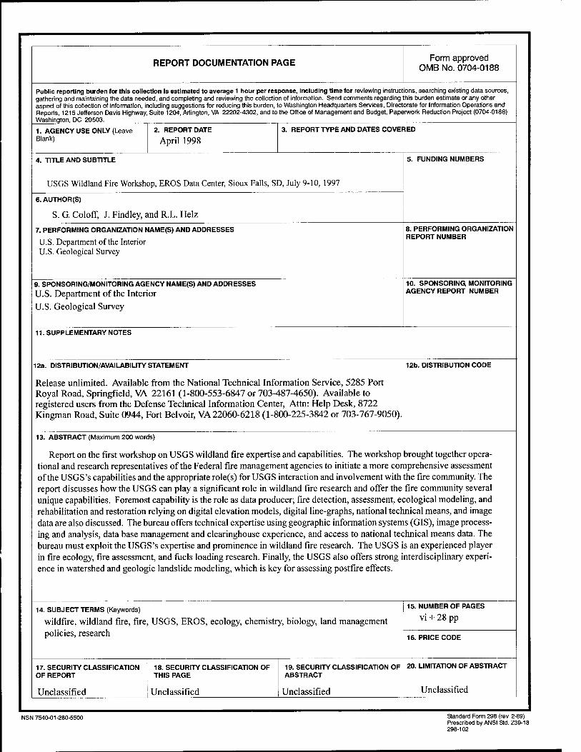
REPORT DOCUMENTATION PAGE Form approved OMB No. 0704-0188
Public reporting burden for this collection is estimated to average 1 hour per response, including time for reviewing instructions, searching existing data sources, gathering and maintaining the data needed, and completing and reviewing the collection of information. Send comments regarding this burden estimate or any other aspect of this collection of information, including suggestions for reducing this burden, to Washington Headquarters Services, Directorate for Information Operations and Reports, 1215 Jefferson Davis Highway, Suite 1204, Arlington, VA 22202-4302, and to the Office of Management and Budget, Paperwork Reduction Project (0704-0188) Washington, DC 20503.
1. AGENCY USE ONLY (Leave Blank)
2. REPORT DATE
April 1998 3. REPORT TYPE AND DATES COVERED
4. TITLE AND SUBTITLE
USGS Wildland Fire Workshop, EROS Data Center, Sioux Falls, SD, July 9-10, 1997
5. FUNDING NUMBERS
6. AUTHOR(S)
S. G. Coloff, J. Findley, and R.L. Heiz
7. PERFORMING ORGANIZATION NAME(S) AND ADDRESSES
U.S. Department of the Interior U.S. Geological Survey
8. PERFORMING ORGANIZATION REPORT NUMBER
9. SPONSORING/MONITORING AGENCY NAME(S) AND ADDRESSES
U.S. Department of the Interior U.S. Geological Survey
10. SPONSORING MONITORING AGENCY REPORT NUMBER
11. SUPPLEMENTARY NOTES
12a. DISTRIBUTION/AVAILABILITY STATEMENT
Release unlimited. Available from the National Technical Information Service, 5285 Port Royal Road, Springfield, VA 22161 (1-800-553-6847 or 703-487-4650). Available to registered users from the Defense Technical Information Center, Attn: Help Desk, 8722 Kingman Road, Suite 0944, Fort Belvoir, VA 22060-6218 (1-800-225-3842 or 703-767-9050).
12b. DISTRIBUTION CODE
13. ABSTRACT (Maximum 200 words)
Report on the first workshop on USGS wildland fire expertise and capabilities. The workshop brought together opera- tional and research representatives of the Federal fire management agencies to initiate a more comprehensive assessment of the USGS's capabilities and the appropriate role(s) for USGS interaction and involvement with the fire community. The report discusses how the USGS can play a significant role in wildland fire research and offer the fire community several unique capabilities. Foremost capability is the role as data producer; fire detection, assessment, ecological modeling, and rehabilitation and restoration relying on digital elevation models, digital line-graphs, national technical means, and image data are also discussed. The bureau offers technical expertise using geographic information systems (GIS), image process- ing and analysis, data base management and clearinghouse experience, and access to national technical means data. The bureau must exploit the USGS's expertise and prominence in wildland fire research. The USGS is an experienced player in fire ecology, fire assessment, and fuels loading research. Finally, the USGS also offers strong interdisciplinary experi- ence in watershed and geologic landslide modeling, which is key for assessing postfire effects.
14. SUBJECT TERMS (Keywords)
wildfire, wildland fire, fire, USGS, EROS, ecology, chemistry, biology, land management policies, research
15. NUMBER OF PAGES
vi + 28 pp
16. PRICE CODE
17. SECURITY CLASSIFICATION OF REPORT
Unclassified
18. SECURITY CLASSIFICATION OF THIS PAGE
Unclassified
19. SECURITY CLASSIFICATION OF ABSTRACT
Unclassified
20. LIMITATION OF ABSTRACT
Unclassified
NSN 7540-01-280-5500 Standard Form 298 (rev. 2-89) Prescribed by ANSI Std. Z39-18 298-102
The following staff members of the National Wetlands Research Center in Lafayette, Louisiana, contributed to production of this report: Rhonda F. Davis, Martha P. Hixon, Susan M. Lauritzen, Daryl S. McGrath, Shannon E. Price, and Beth A. Vairin.
NOTE: Mention of trade names or commercial products does not constitute endorsement or recommendation for use by the U.S. Government.

U.S. Department of the Interior U.S. Geological Survey
As the Nation's principal conservation agency, the De- partment of the Interior has responsibility for most of our nationally owned public lands and natural resources. This responsibility includes fostering the sound use of our lands and water resources; protecting our fish, wild- life, and biological diversity; preserving the environ- mental and cultural values of our national parks and historical places; and providing for the enjoyment of life through outdoor recreation. The Department assesses our energy and mineral resources and works to ensure that their development is in the best interests of all our people by encouraging stewardship and citizen partici- pation in their care. The Department also has a major responsibility for American Indian reservation commu- nities.
USGS