Embed Size (px)
Citation preview
8/2/2019 Using Advanced Spectral Analyses Techniques as Possible Means Of
http://slidepdf.com/reader/full/using-advanced-spectral-analyses-techniques-as-possible-means-of 1/10
Introduction
The current work focused on a small portion of theKüçük Menderes valley for the identification of themineralogy of clay samples. The study was in line with the
philosophy of remote sensing, which is based onidentifying objects or natural resources without physicalconnection remotely by the use of different sensors. Themain objective of the current work was a trial to
Turk J Agric For29 (2005) 19-28© TÜB‹TAK
19
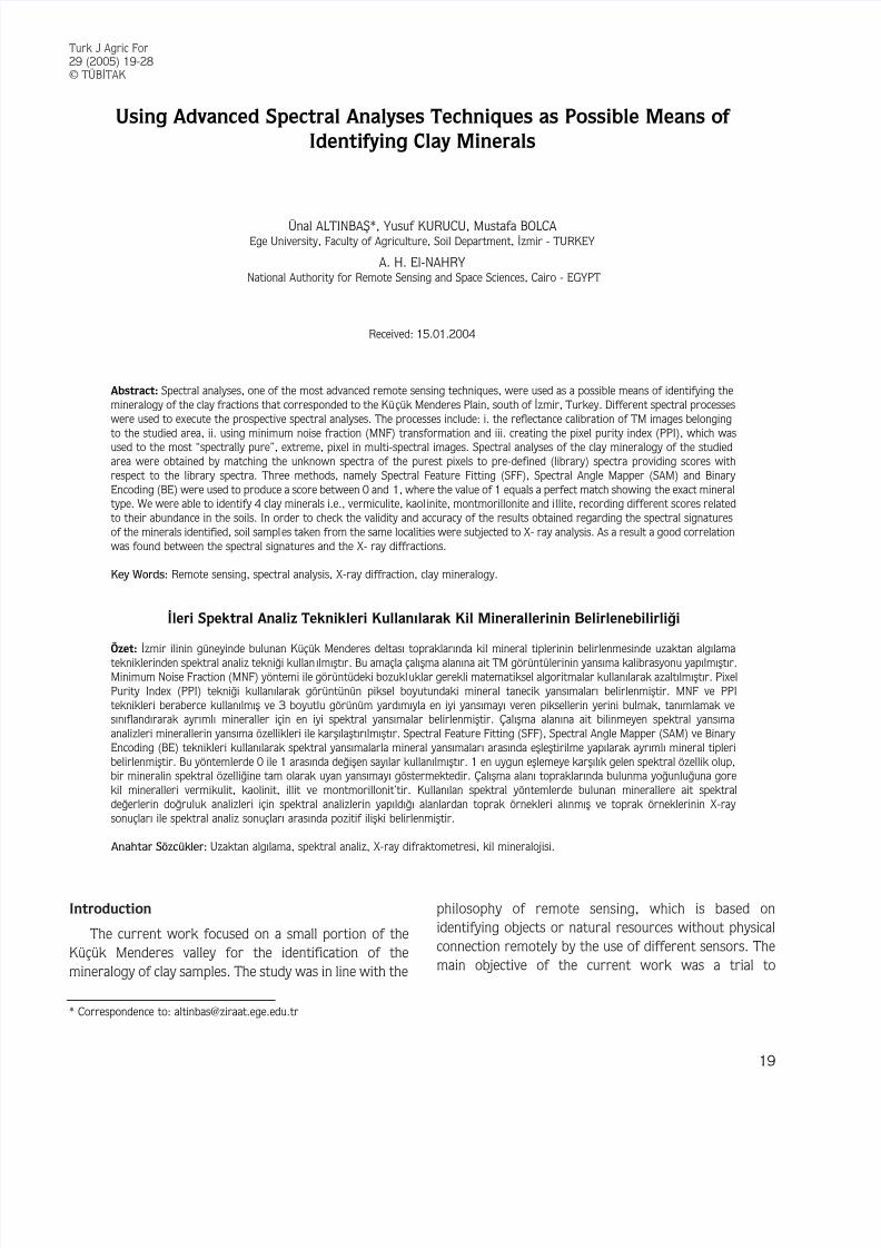
Using Advanced Spectral Analyses Techniques as Possible Means of Identifying Clay Minerals
Ünal ALTINBAfi*, Yusuf KURUCU, Mustafa BOLCAEge University, Faculty of Agriculture, Soil Department, ‹zmir - TURKEY
A. H. El-NAHRYNational Authority for Remote Sensing and Space Sciences, Cairo - EGYPT
Received: 15.01.2004
Abstract: Spectral analyses, one of the most advanced remote sensing techniques, were used as a possible means of identifying themineralogy of the clay fractions that corresponded to the Küçük Menderes Plain, south of ‹zmir, Turkey. Different spectral processes
were used to execute the prospective spectral analyses. The processes include: i. the reflectance calibration of TM images belonging
to the studied area, ii. using minimum noise fraction (MNF) transformation and iii. creating the pixel purity index (PPI), which wasused to the most “spectrally pure”, extreme, pixel in multi-spectral images. Spectral analyses of the clay mineralogy of the studiedarea were obtained by matching the unknown spectra of the purest pixels to pre-defined (library) spectra providing scores withrespect to the library spectra. Three methods, namely Spectral Feature Fitting (SFF), Spectral Angle Mapper (SAM) and Binary Encoding (BE) were used to produce a score between 0 and 1, where the value of 1 equals a perfect match showing the exact mineraltype. We were able to identify 4 clay minerals i.e., vermiculite, kaol inite, montmorillonite and i llite, recording different scores relatedto their abundance in the soils. In order to check the validity and accuracy of the results obtained regarding the spectral signaturesof the minerals identified, soil samples taken from the same localities were subjected to X- ray analysis. As a result a good correlation
was found between the spectral signatures and the X- ray diffractions.
Key Words: Remote sensing, spectral analysis, X-ray diffraction, clay mineralogy.
‹leri Spektral Analiz Teknikleri Kullan›larak Kil Minerallerinin Belirlenebilirli¤i
Özet: ‹zmir ilinin güneyinde bulunan Küçük Menderes deltas› topraklar›nda kil mineral tiplerinin belirlenmesinde uzaktan alg›lamatekniklerinden spektral analiz tekni¤i kullan›lm›flt›r. Bu amaçla çal›flma alan›na ait TM görüntülerinin yans›ma kalibrasyonu yap›lm›flt›r.Minimum Noise Fraction (MNF) yöntemi ile görüntüdeki bozukluklar gerekli matematiksel algoritmalar kullan›larak azalt›lm›flt›r. PixelPurity Index (PPI) tekni¤i kullan›larak görüntünün piksel boyutundaki mineral tanecik yans›malar› belirlenmifltir. MNF ve PPIteknikleri beraberce kullan›lm›fl ve 3 boyutlu görünüm yard›m›yla en iyi yans›may› veren piksellerin yerini bulmak, tan›mlamak ves›n›fland›rarak ayr›ml› mineraller için en iyi spektral yans›malar belirlenmifltir. Çal›flma alan›na ait bilinmeyen spektral yans›maanalizleri minerallerin yans›ma özellikleri ile karfl›laflt›r›lm›flt›r. Spectral Feature Fitting (SFF), Spectral Angle Mapper (SAM) ve Binary Encoding (BE) teknikleri kullan›larak spektral yans›malarla mineral yans›malar› aras›nda efllefltirilme yap›larak ayr›ml› mineral tipleribelirlenmifltir. Bu yöntemlerde 0 ile 1 aras›nda de¤iflen say›lar kullan›lm›flt›r. 1 en uygun efllemeye karfl›l›k gelen spektral özellik olup,bir mineralin spektral özelli¤ine tam olarak uyan yans›may› göstermektedir. Çal›flma alan› topraklar›nda bulunma yo¤unlu¤una gorekil mineralleri vermikulit, kaolinit, illit ve montmorillonit’tir. Kullan›lan spektral yöntemlerde bulunan minerallere ait spektralde¤erlerin do¤ruluk analizleri için spektral analizlerin yap›ld›¤› alanlardan toprak örnekleri al›nm›fl ve toprak örneklerinin X-ray sonuçlar› ile spektral analiz sonuçlar› aras›nda pozitif iliflki belirlenmifltir.
Anahtar Sözcükler: Uzaktan alg›lama, spektral analiz, X-ray difraktometresi, kil mineralojisi.
* Correspondence to: [email protected]

8/2/2019 Using Advanced Spectral Analyses Techniques as Possible Means Of
http://slidepdf.com/reader/full/using-advanced-spectral-analyses-techniques-as-possible-means-of 2/10
recognize the dominant clay minerals of the Küçük Menderes soils, by applying the highly advanced remotesensing techniques of spectral analyses.
Olsen et al. (2000) described research aimed at determining the feasibility of using reflectance
spectroscopy to identify and characterize the expansiveclays and clay-shales along the Colorado Front RangeUrban Corridor, both at the laboratory/field scale, and at the remote-sensing scale.
Chabrillat et al. (2001) established the correlation of clay mineralogy with swelling potential indices and theexpansion of existing correlations of laboratory reflectance spectra with clay mineralogy, examining alsodirect correlations between reflectance data and swellingpotential.
MaterialsThe Küçük Menderes valley occupies about 400 km2
in the western part of Turkey. It is located between 37º45´ and 38º 00´ N latitudes and between 27º 15´ and 28º30´ E longitudes. The valley represents the most important agricultural area, the south part of the city ‹zmir. The valley is surrounded by highlands actingtogether as catchments areas that supply the Küçük Menderes river tributaries with rainwater and weatheredmaterials. The valley is separated from the otherneighboring valleys by 2 mountainous chains, whichdefine its natural boundaries. Near the Aegean coast theKüçük Menderes penetrates a narrow valley, forming adelta near the city of Selçuk, where the meanders draininto the Aegean Sea.
Methods
Digital image processing
Image processing using ENVI 3.4 software includesthe following processes:
a) Calibration of a Landsat 7 (taken in 2003) ETMimage to reflectance. Filtering by the adaptive filters to
reduce noise by smoothing while preserving sharp edges.b) Stretching using Gaussian stretching methods using amean DN of 127 with the data values of 3 standarddeviations set to 0 and 255. c) Geometric correctionusing image to image methods for adding ground controlpoints with 3 m average RMSE and nearest method useas a resampling method, and image projection using theUniversal Transverse Mercator (UTM).
Fieldwork
A reconnaissance survey was conducted in theinvestigated area in order to gain an appreciation of thebroad soil patterns according to the obtained spectra endmembers. GPS Garmin12XL (+-,5-8 m) was used in the
field to recognize the accurate locations of the endmembers for soil sampling. Four surface soil samplesrepresenting the major soils in the area were collected for X-ray diffraction analyses.
Using USGS Spectral Library (Minerals)
The spectra that represent the USGS spectral library were measured on a custom-modified, computer-controlled Beckman spectrometer at the USGS DenverSpectroscopy Lab., U S A. Wavelength accuracy was in theorder of 0.0005 µm (0.5 nm) in the near-IR and 0.0002µm (0.2 nm) in visible light (http://speclab.cr.usgs.gov/
spectral-lib.html). X-Ray Diffraction Analyses
The clay fraction was separated after being pretreatedaccording to the procedure described by Jackson (1975).The clay samples were X-rayed after they had been Ca-saturated at 25 °C, Ca-saturated and glycolated, and K-saturated at 25 °C. Apart from the above treatment,sample no. 1 (Ca-saturated) was also heated to 300 °Cand 520 °C.
X-ray diffraction patterns were obtained with thePhilips P.W. (1060/100) X- ray diffractometer with Cu-αradiation and an iron filter. Identification of the clay minerals was carried out following the guidelinesprovided by Black (1965), MacEwan (1980), Carroll(1970) and Weed (1977).
Results and Discussion
Many obstacles and atmospheric and environmentalconditions (i.e., weathering processes) are still hamperingthe accurate identification of land resources due to theirinfluence on the accuracy of measured spectra. Thus, the
tool of spectral analyses is not foolproof. Nevertheless, it is meant to be used as a starting point for identifyingmaterials in an image scene. When used properly, spectralanalysis tools in conjunction with a good spectral library could provide excellent suggestions for identification of objects on the land surface. Spectral analyses were usedto identify the clay minerals of the Küçük Menderes soilsusing the following procedures.
Using Advanced Spectral Analyses Techniques as Possible Means of Identifying Clay Minerals
20

8/2/2019 Using Advanced Spectral Analyses Techniques as Possible Means Of
http://slidepdf.com/reader/full/using-advanced-spectral-analyses-techniques-as-possible-means-of 3/10
Display of Color Composite ETM Image
1. A color composite ETM image has been filtered toproduce output images in which the brightness value at agiven pixel is a function of some weighted average of thebrightness of the surrounding pixels.
2. Enhanced and stretched. The results obtained fromGaussian stretching improved the visual display of thespectra information as shown in Figure 1
3. Geometrically corrected and displayed using a bandcombination of 3 2 1 (RGB - true color) as shown inFigure 2.
Calibration of the ETM Image
A reflectance calibration was required for Landsat ETM data to compare image spectra with library reflectance spectra and to run some Minimum Noise
Fraction (MNF) and Pixel Purity Index (PPI) routines.ETM image calibration was been used with pre-launchgains and offsets calculated for Landsat sensors(Markham and Barker, 1986).
Minimum Noise Fraction
MNF transformation is a method similar to principalcomponents. It was used to determine the inherent dimension of the image data, to segregate noise in thedata, and to reduce the computational requirements forsubsequent processing (Boardman and Kruse, 1994). TheMNF is used as a preparatory transformation to put most of the essential components into just a few spectral bandsand to order those bands from the most interesting (that can segregate noise perfectly) to the least interesting.Two cascaded principal components transformations were implemented in the current work. The first
Ü. ALTINBAfi, Y. KURUCU, M. BOLCA, A. H. EL-NAHRY
21
Figure 1. Gaussian-stretching results of TM image.
Figure 2. The true color composite 3 2 1 of the investigated area.

8/2/2019 Using Advanced Spectral Analyses Techniques as Possible Means Of
http://slidepdf.com/reader/full/using-advanced-spectral-analyses-techniques-as-possible-means-of 4/10
transformation, based on an estimated noise covariancematrix, decorrelates and rescales the noise in the data.This first step results in transformed data in which thenoise has unit variance and no band-to-band correlations.The second step is a standard principal componentstransformation of the noise-whitened data. For thepurposes of further spectral processing, the inherent dimension of the data is determined by the examinationof the final eigenvalues (of noise segregation) and theassociated image bands. The data space could be dividedinto 2 parts: one part associated with large eigenvaluesand coherent eigenimages, and a complementary part with near unity eigenvalues and noise dominated images.By using only the coherent portions, the noise wasseparated from the data, thus improving spectralprocessing results. The decreasing eigenvalue withincreasing MNF band as shown in the eigenvalue plot in
Figure 3 shows how noise is segregated in the highernumber MNF bands and it was noted that there was adecrease in spatial coherency with increasing MNF bandnumber as shown in Figures 4 and 5.
Pixel Purity Index
The PPI function finds the most spectrally pure or“extreme” pixels in multispectral and hyperspectral data(Boardman and Kruse, 1994; Boardman et al., 1995).The extreme pixels correspond to the materials withspectra that combine linearly to produce all of the spectrain the image. The PPI was computed by using projectionsof n-dimensional scatter plots to 2-D space and markingthe extreme pixels in each projection. The extreme pixelsin each projection were recorded and the total number of times each pixel was marked as extreme was noted. Theoutput is an image (the PPI image) in which the digitalnumber (DN) of each pixel in the image corresponds tothe number of times that pixel was recorded as extreme.
Thus, bright pixels in the image showed the spatiallocation of spectral endmembers. Image thresholding wasused to select several thousand pixels for further analysis,thus significantly reducing the number of pixels to beexamined (Figure 6).
The PPI, as shown in Figure 7, indicated the totalextreme pixels for the studied area, whereas 5212 pixels were recorded throughout iteration no. equal to 4000times for a pixels threshold of 3.
Chabrillat et al. (2002) used AVIRIS and HyMapimages acquired recently with a high signal-to-noise ratio
(SNR) to detect clays. The results showed the extent to which laboratory spectra of swelling soils field samplescould be used to detect and discriminate different clays,smectite, illite and kaolinite, related to variable swellingpotential.
Goetz et al. (2001) and Olsen et al. 2000 used near-infrared reflectance spectroscopy to discriminate among
Using Advanced Spectral Analyses Techniques as Possible Means of Identifying Clay Minerals
22
N
o i s e s e g r e g a t i o n
1 2 3 4 5 6Band No.
Figure 3. Noise segregation plot.
Figure 4. MNF band 1.
Figure 5. MNF band 6.

8/2/2019 Using Advanced Spectral Analyses Techniques as Possible Means Of
http://slidepdf.com/reader/full/using-advanced-spectral-analyses-techniques-as-possible-means-of 5/10
pure smectite and mixed-layer I/S samples, based oncharacteristic absorption bands in the 1900–2400 nmspectral region.
The following single band images, as seen in Figures8 and 9, represent the PPI, where the extreme (purest)pixels are white in Figure 8. It is noted that the extremepixels occupied the region of interest, as shown in Figure9.
n-Dimensional Visualization and Extracted
Endmember Spectra
The n-D visualization was used in conjunction with theMNF and PPI tools to locate, identify and cluster thepurest pixels and the most extreme spectral responses ina data set. If spectral signatures are recorded properly and the curve shape is accurate they could be used forremote sensing applications (Salisbury et al., 1991).
Spectra can be thought of as points in a dimensionalscatter plot, where n is the number of bands (Boardman
et al.,1995). The coordinates of the points in n-spaceconsists of “n” values that are simply the spectral radianceor reflectance values in each band for a given pixel. Thedistributions of these points in n-space were used toestimate the number of spectral endmembers (4
Ü. ALTINBAfi, Y. KURUCU, M. BOLCA, A. H. EL-NAHRY
23
Pixel Purity Index (PPI) Select Data Discard Low MNFs
Process Data
Std. Deviation Threshold
Maximize Iterations
Evaluate PPI Results
Display and Histograms
5200
5100
5000
4800
4800
T o t a l p i x e l s
1000 2000 3000 4000Iteration no.
Pixel Purfty Index of soile
PPI Curve
Figure 7. PPI index. Figure 8. PPI map.
Figure 6. Flow chart of the PPI procedures.
Figure 9. Region of interest.

8/2/2019 Using Advanced Spectral Analyses Techniques as Possible Means Of
http://slidepdf.com/reader/full/using-advanced-spectral-analyses-techniques-as-possible-means-of 6/10
highlighted segmentations), as shown in Figure 10,producing 4 pure spectral signatures, which wereextracted and plotted in an n-D visualizer plot representing the selected endmembers, as shown inFigure 11.
Matching Unknown Spectra to Library Spectra
Spectral analyses and consequently clay mineralidentification could be obtained by matching the unknownspectra extracted from the 3-D visualizer to pre-defined(library) spectra, providing scores with respect to thelibrary spectra. Three weighting methods, i.e. SpectralFeature Fitting (SFF), Spectral Angle Mapper (SAM)
and/or Binary Encoding (BE), were used to identify mineral type, producing a score between 0 and 1, where1 equals a perfect match. As is known, some minerals aresimilar in one wavelength range, yet very different inanother. For the best results, a wavelength range that contains the diagnostic absorption features was used todistinguish among the minerals.
De Jong’s (1992) correspondence analysis of thespectral characteristics of soils revealed lime, clay, ironand organic matter as the important variables, and pHand the absorption features of Illite are generally broaderand less well defined compared with those of muscovite.Nevertheless, the illite, muscovite and montmorillonitespectra have similar absorption bands. Illite {(K,H,O)(AI,Mg,Fe), (Si,AI),O,,((OH),,H,O)} shows broad waterabsorption features near 1.4 and 1.9 ym, and additionalAl-hydroxyl features at 2.2, 2.3 and 2.4 pm. Illite andmuscovite have absorption bands near 2.35 and 2.45 pm,
that are lacking in the montmorillonite spectrum.The output of the spectral analysis is a ranked score
or weighted score for each of the materials in the input spectral library, as shown in Table 1. The highest scoreindicates the closest match and shows higher confidencein the spectral similarity, where illite/smectite andkaolinite, scored high values of 1.0 and 0.944,
Using Advanced Spectral Analyses Techniques as Possible Means of Identifying Clay Minerals
24
Table 1. Weighting methods and mineral type/score of the extracted spectra.
Weighting Method (Score 0-1.0)
SAM SFF BESpectra class
Mineral type Score Mineral type Score Mineral type Score
1 - 0 Kaolinite 0.944 Kaolinite 0.833
2 - 0 Vermiculite 0.833 Vermiculite 0.667
3 - 0 Illite/Smectite 1.000 Illite/Smectite 0.883
4 - 0 Montmorillonite 0.667 Montmorillonite 0.500
r e f l e c t a n c e %
( O f f s e t f o r c l a r i t y )
0.5 Wavelength
n-D class1
n-D class3
n-D class2
1.0 1.5 2.0 2.5
Figure 11. Classes of the selected spectra.
Figure 10. 3-D visualization.

8/2/2019 Using Advanced Spectral Analyses Techniques as Possible Means Of
http://slidepdf.com/reader/full/using-advanced-spectral-analyses-techniques-as-possible-means-of 7/10
respectively, while vermiculite and montmorillonitescored 0.833 and 0.667, respectively, using SFF weighting. The same clay minerals recorded scores of 0.833, 0.833, 0.667 and 0.500, respectively, using BE weighting. On the other hand, the SAM did not recognizeany kind of clay minerals (zero score).
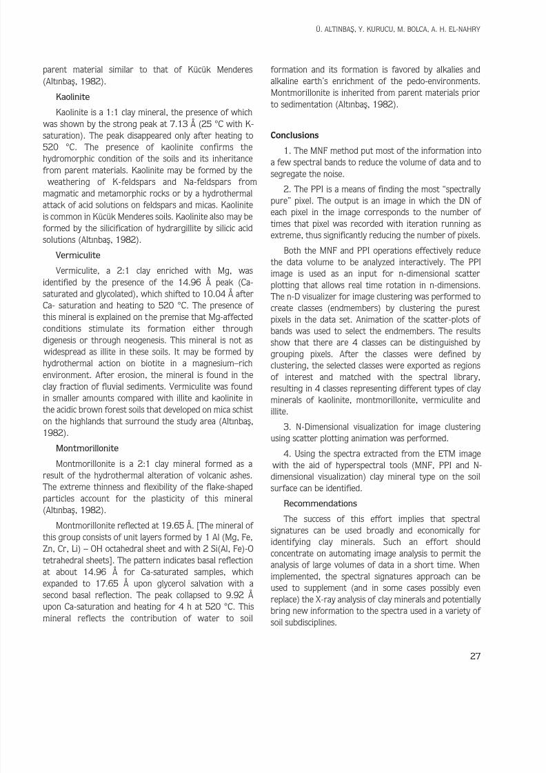
According to Alt›nbafl (1982), using X-ray analysis,illite and kaolinite were the dominant clay minerals in theacidic brown forest soils (Typic Dystrustrepts), followedby vermiculite and montmorillonite. Basically, the clay minerals found in these soil groups are products of thetransformation and decomposition of biotite, muscoviteand feldspars. In order to check the validity and accuracy of our results concerning spectral signatures and todefine perfectly, the existing clay minerals, X-ray diffraction analysis was the obvious choice. The resultsobtained from X-ray diffraction indicated that the clay
fraction contained mainly illite and kaolinite as the
dominant clay minerals, followed by vermiculite andmontmorillonite and small amounts of other minerals(Figures 12-16).
Mermut et al. (1997) found that the soil loss from asoil dominated by smectite was high. The splash and wash
erosion in 80 mm of rain were 23 and 2.1 Mg ha-1,respectively, in a loamy soil in which smectite, mica and vermiculite were the dominant clays, and 7.3 and 0.91Mg ha-1 respectively, in a silt loam soil in which vermiculite, mica and kaolinite were dominant.
Illite
Illite as a 2:1 clay mineral was recorded in the X-ray diffractogram at 10.04 Å. Illite is a widespread mineral inKücük Menderes soils (Alt›nbafl, 1982). It may be formedby the alteration of mica minerals. Illite was found as thedominant clay mineral by X-ray analysis in the acidic
brown forest soils, which were developed on mica schist
Ü. ALTINBAfi, Y. KURUCU, M. BOLCA, A. H. EL-NAHRY
25
R e f l e c t a n c e %
0.5 Wavelength µm
kaolinite 1spcn_D class 1
1.0 1.5 2.0 2.5
1.0
0.8
0.6
0.4
0.2
0.0
R
e f l e c t a n c e %
0.5 Wavelength µm
vermiculite 1 spcn_D class 2
1.0 1.5 2.0 2.5
1.0
0.8
0.6
0.4
0.2
0.0
R e f l e c t a n c e %
0.5 Wavelength µm
montmorillonite 5spcn_D class 4
1.0 1.5 2.0 2.5
1.0
0.8
0.6
0.4
0.2
0.0
R
e f l e c t a n c e %
0.5 Wavelength µm
1.0 1.5 2.0 2.5
1.0
0.8
0.6
0.4
0.2
0.0
illite 1. spc illiten_D class 3
Figure 12. ID of kaolinite, illite, montmorillonite and vermiculite.

8/2/2019 Using Advanced Spectral Analyses Techniques as Possible Means Of
http://slidepdf.com/reader/full/using-advanced-spectral-analyses-techniques-as-possible-means-of 8/10
Using Advanced Spectral Analyses Techniques as Possible Means of Identifying Clay Minerals
26
Ca.25°CCa.Glyc.25°C
K.25°C
θ 14 13 12 11 10 9 8 7 6 5 4 3
7 . 1
3 Å
7 . 1
3 Å
9 . 9
0 Å
1 0 . 0
0 Å
1 4 . 9
6 Å
1 9 . 6
5 Å
K.25°CCa.25°C
Ca.+Glyc.25°C
θ 14 13 12 11 10 9 8 7 6 5 4 3
7 . 1 5 Å
7 . 1
3 Å
9 . 8
1 Å
1 0 . 0
4 Å
Figure 13. X-ray diffraction of the clay fractions-sample no.1 (0-4 cm) with Ca++, K +, Ca+++Glyc. at 25 °C.
K.25°CCa.25°C
Ca.+Glyc.25°C
θ 14 13 12 11 10 9 8 7 6 5 4 3
7 . 1
5 Å
9 . 9
2 Å 1
4 . 0
1 Å
1 5 . 0
0 Å
9 . 9
2 Å
9 . 9
2 Å
Figure 15. X-ray diffraction of the clay fractions-sample no. 3 (0-5 cm) with Ca++, K +, Ca+++Glyc at 25 °C.
K.25°C
Ca.25°CCa.+Glyc.25°C
θ 14 13 12 11 10 9 8 7 6 5 4 3
7 . 1
3 Å
9 . 9
2 Å
1 4 . 0 1 Å
1 0 . 0
0 Å
9 . 9
0 Å
1 3 . 7
9 Å
Figure 16. X-ray diffraction of the clay fractions-sample no. 4 (0-7 cm) with Ca++, K +, Ca+++Glyc at 25 °C.
Figure 14. X-ray diffraction of the clay fractions-sample no. 2 (0-6 cm) with Ca++, K +, Ca+++Glyc at 25 °C.
8/2/2019 Using Advanced Spectral Analyses Techniques as Possible Means Of
http://slidepdf.com/reader/full/using-advanced-spectral-analyses-techniques-as-possible-means-of 9/10

8/2/2019 Using Advanced Spectral Analyses Techniques as Possible Means Of
http://slidepdf.com/reader/full/using-advanced-spectral-analyses-techniques-as-possible-means-of 10/10
Using Advanced Spectral Analyses Techniques as Possible Means of Identifying Clay Minerals
28
References
Alt›nbafl Ü. 1982. Potassium minerals in acidic brown forest soilsdeveloped on micaschist in Bozda¤ (Brown Mountains) and theirsources and their effects on the soil potassium reserves. Ege Univ.Faculty of Agriculture Press. No. 433. ‹zmir, Turkey.
Black, C.A. 1965. Methods of soil analyses Part 1. Physical and
mineralogical properties American Society Agronomy, Inc. Pub.Madison,Wisconsin U.S.A.
Boardman J. W. and F. A. Kruse, 1994. Automated spectral analysis: Ageologic example using AVIRIS data, north Grapevine Mountains,Nevada: in Proceedings, Tenth Thematic Conference on GeologicRemote Sensing, Environmental Research Institute of Michigan,Ann Arbor, MI, p.I-407-I-418.
Boardman J.W., F.A. Kruse and R.O. Green, 1995. Mapping target signatures via partial unmixing of AVIRIS data: in summaries,Fifth JPL Airborne Earth Science Workshop, JPL Publication 95-1, v.1p.23-26.
Carroll, D., 1970. Clay minerals. A guide to their X-ray identification.
Geological Society of America. Spec. page 126, Boulder,Colorado, U.S.A.
Chabrillat, S., A.F.H Goetz, H.W. Olsen,, L. Krosley and D.C. Noe,(2002). Near-infrared spectra of expansive clay soils and theirrelationships with mineralogy and swelling potential. Clays andClay Minerals (in revision).
De Jong, S.M. 1992. The analysis of spectroscopical data to map soiltypes and soil crusts of Mediterranean eroded soils. SoilTechnology 5: p 199-211.
Goetz, A.F.H., S. Chabrillat and Z. Lu, (2001). Field reflectancespectrometry for detection of swelling clays at construction sites.Field Analytical Chemistry and Technology, 5: 143–155.
Jackson, M.L. 1975. Soil chemical analyses advanced course, Pub. by author, Madison, Wisconsin.
MacEwan, D.M.C. and Wilson, M.J. (1980) Interlayer and intercalationcomplexes of clay minerals. In G.W. Brindley and G. Brown, Eds..,Crystal Structures of Clay Minerals and their X-ray Identification,chapter 3, Monograph 5 of Mineralogical Society, London.
Markham, B.L. and J.L. Barker, 1986, Landsat MSS and TM Post-Calibration Dynamic Ranges, Exoatmospheric Reflectances andAt-Satellite Temperatures, EOSAT Landsat Technical Notes,August 1986, p. 3-8, U S A.
Mermut, A.R., S.H. Luk, M.J.M. Romkens and J.W.A. Poesen, 1997.Soil loss by splash and wash during rainfall from two loess soils.Geoderma 75: 203–214.
Olsen, H.W., L. Krosley, K. Nelson, S. Chabrillat, , A.F.H. Goetz and
Noe, D.C. (2000). Mineralogy-swelling potential relationships forexpansive shales. In C.D. Shackelford, S.L. Houston and N.-Y.Chang (Eds.), Advances in unsaturated geotechnics (GeotechnicalSpecial Publication 99, pp. 361– 378). Reston, VA: ASCE.
Salisbury, J.W., L.S. Walter, N. Vergo and D.M. D'Aria, 1991. Infrared(2.1-25 micrometers) Spectra of Minerals” Johns HopkinsUniversity Press, Baltimore.
Weed, S.B., 1977. Minerals in soil environment. Soil Science Society of America Journal, 56: September-October 1977: 1640-1645.