Embed Size (px)
Citation preview
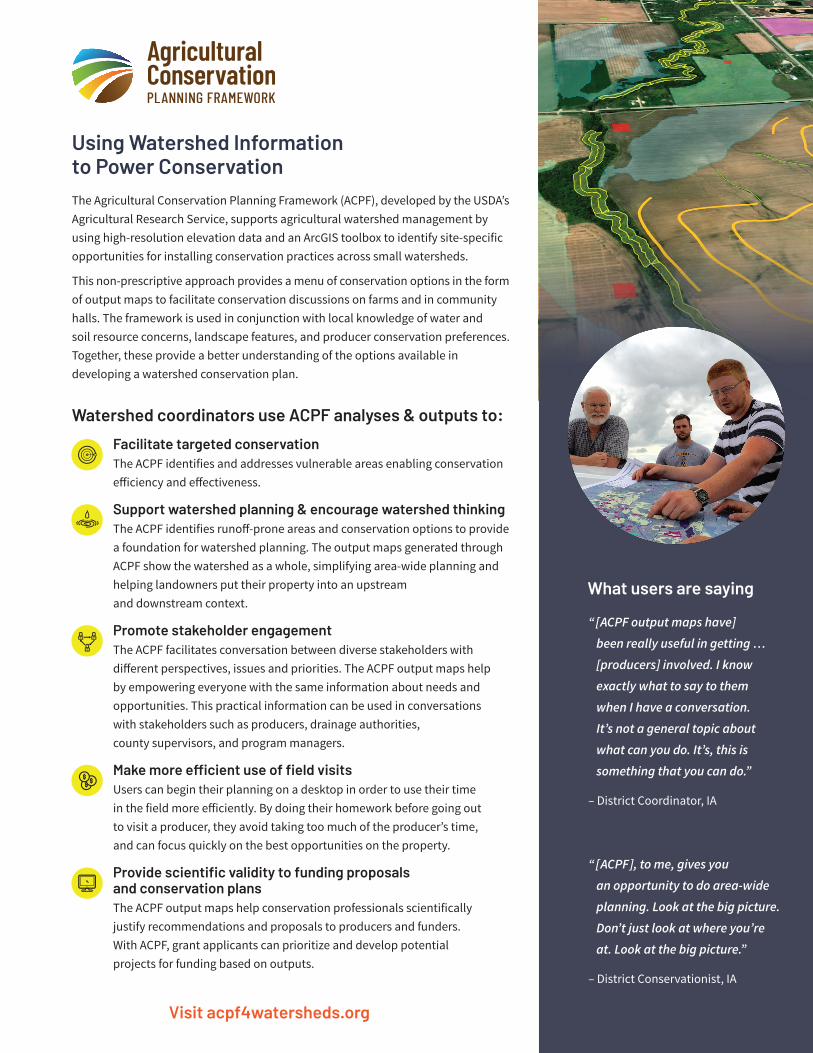
Using Watershed Information to Power ConservationThe Agricultural Conservation Planning Framework (ACPF), developed by the USDA’s Agricultural Research Service, supports agricultural watershed management by using high-resolution elevation data and an ArcGIS toolbox to identify site-specific opportunities for installing conservation practices across small watersheds.
This non-prescriptive approach provides a menu of conservation options in the form of output maps to facilitate conservation discussions on farms and in community halls. The framework is used in conjunction with local knowledge of water and soil resource concerns, landscape features, and producer conservation preferences. Together, these provide a better understanding of the options available in developing a watershed conservation plan.
Visit acpf4watersheds.org
Watershed coordinators use ACPF analyses & outputs to:
Facilitate targeted conservationThe ACPF identifies and addresses vulnerable areas enabling conservation efficiency and effectiveness.
Support watershed planning & encourage watershed thinkingThe ACPF identifies runoff-prone areas and conservation options to provide a foundation for watershed planning. The output maps generated through ACPF show the watershed as a whole, simplifying area-wide planning and helping landowners put their property into an upstream and downstream context.
Promote stakeholder engagementThe ACPF facilitates conversation between diverse stakeholders with different perspectives, issues and priorities. The ACPF output maps help by empowering everyone with the same information about needs and opportunities. This practical information can be used in conversations with stakeholders such as producers, drainage authorities, county supervisors, and program managers.
Make more efficient use of field visits Users can begin their planning on a desktop in order to use their time in the field more efficiently. By doing their homework before going out to visit a producer, they avoid taking too much of the producer’s time, and can focus quickly on the best opportunities on the property.
Provide scientific validity to funding proposals and conservation plansThe ACPF output maps help conservation professionals scientifically justify recommendations and proposals to producers and funders. With ACPF, grant applicants can prioritize and develop potential projects for funding based on outputs.
“[ACPF output maps have]
been really useful in getting …
[producers] involved. I know
exactly what to say to them
when I have a conversation.
It’s not a general topic about
what can you do. It’s, this is
something that you can do.”
– District Coordinator, IA
“[ACPF], to me, gives you
an opportunity to do area-wide
planning. Look at the big picture.
Don’t just look at where you’re
at. Look at the big picture.”
– District Conservationist, IA
What users are saying
Information based on Purdue University research interviewing ACPF users in the upper Midwest. Manuscript submitted for publication in the Journal of Environmental Management.
USING THE ACPF REQUIRES TWO SETS OF SKILLS:
• Technical GIS skills to run the ACPF toolset analyses (GIS-based training is available at acpf4watersheds.org)
• Watershed management skills to apply ACPF outputs to planning and implementing conservation practices.
ACPF toolsets produce output maps which can be shared either in group settings to gauge overall interest and involve diverse stakeholders in the planning process or one-on-one to enable a risk-free conversation about landowner options.
THE ACPF IS• Flexible
The ACPF doesn’t prescribe what to do, instead allowing landowners and local stakeholders to choose the options that are right for their land, their community, and their watershed.
• User-friendly The ACPF toolbox semi-automates several GIS processes including hydro-conditioning of elevation data and terrain analysis. This puts the capabilities of powerful hydrologic modeling into the hands of mid-level GIS specialists and local conservationists.
• Widely Applicable The parameters for running the tools can be adjusted to customize results for each watershed’s unique landscape.
REQUIREMENTSThe ACPF toolbox is run jointly by a GIS technician alongside a field conservationist. The GIS technician needs an advanced version of ArcGIS, and moderate proficiency using ArcGIS. It takes roughly two days to hydro-condition the elevation data, and roughly half a day to run the analyses for one HUC-12 watershed. The field conservationist will help the GIS technician interpret and adjust ACPF results to the local landscape, and apply the output to watershed planning and implementing conservation practices.
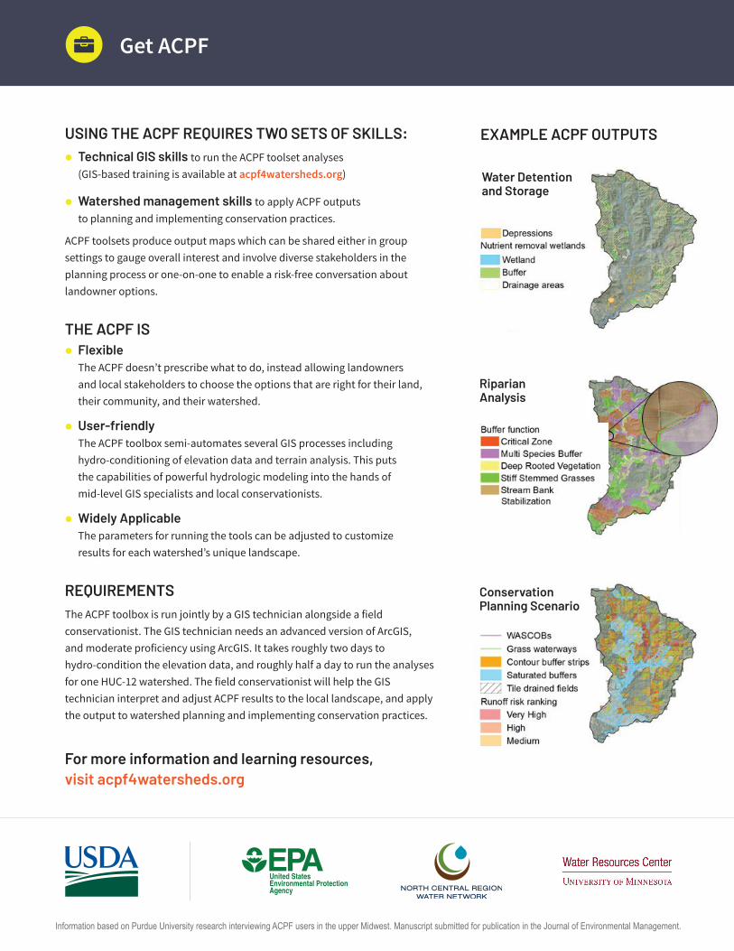
EXAMPLE ACPF OUTPUTS
Get ACPF
Water Detention and Storage
Conservation Planning Scenario
For more information and learning resources, visit acpf4watersheds.org
Riparian Analysis