Embed Size (px)
Citation preview
YORK ARCHAEOLOGICAL TRUST
UTILITY TRENCH,
LOW PETERGATE, MINSTER GATES
AND MINSTER YARD, YORK
WATCHING BRIEF REPORT
by David Evans
REPORT NUMBER 2008/75

YORK ARCHAEOLOGICAL TRUST
York Archaeological Trust undertakes a wide range of urban and rural archaeological consultancies,
surveys, evaluations, assessments and excavations for commercial, academic and charitable
clients. It can manage projects, provide professional advice and monitor archaeological works to
ensure high quality, cost effective archaeology. Its staff have a considerable depth and variety of
professional experience and an international reputation for research, development and maximising
the public, educational and commercial benefits of archaeology. Based in York its services are
available throughout Britain and beyond.
© 2008 York Archaeological Trust for Excavation and Research Limited
Registered Office: 47 Aldwark, York, UK, YO1 7BX
Phone: +44 (0)1904 663000 Fax: +44 (0)1904 663024
Email: [email protected] Internet: http://www.yorkarchaeology.co.uk
York Archaeological Trust is a Registered Charity No. 509060
A Company Limited by Guarantee Without Share Capital Registered in England No. 1430801
CONTENTS
page
ABSTRACT 1
1. INTRODUCTION 1
2. METHOD STATEMENT 4
3. LOCATION, GEOLOGY AND TOPOGRAPHY 4
4. ARCHAEOLOGICAL AND HISTORICAL BACKGROUND 5
5. RESULTS 10
6. DISCUSSION AND CONCLUSIONS 13
7 LIST OF SOURCES 13
8 ACKNOWLEDGEMENTS 14
APPENDIX 1: The Written Scheme of Investigation 15
List of Illustrations
Figures
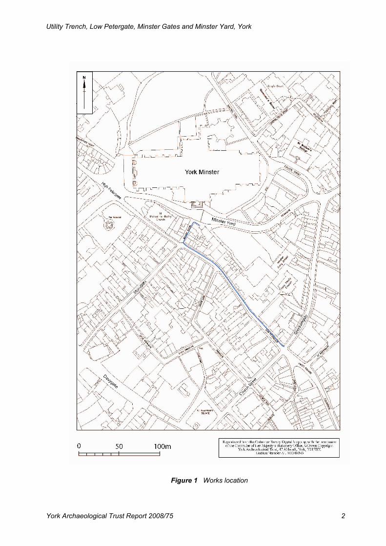
1. Works location 2
2. Legislative areas around York Minster 3
3. Location of observations, south-east 8
4. Location of observations, north-west 9
Plates
Cover: View of works in Low Petergate
1. Commencement of works Goodramgate / Low Petergate 10
2. Work in progress in Minster Gates 11
3. Modern deposits and gas main in Minster Gates 12
4. Modern deposits and gas main in Minster Yard 13

List of Abbreviations
YAT York Archaeological Trust
AOD Above Ordnance Datum
YORYM Yorkshire Museum, York
YM York Minster
NGR National Grid Reference
Utility Trench, Low Petergate, Minster Gates and Minster Yard, York
York Archaeological Trust Report 2008/75 1
ABSTRACT
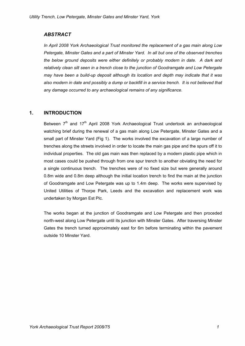
In April 2008 York Archaeological Trust monitored the replacement of a gas main along Low
Petergate, Minster Gates and a part of Minster Yard. In all but one of the observed trenches
the below ground deposits were either definitely or probably modern in date. A dark and
relatively clean silt seen in a trench close to the junction of Goodramgate and Low Petergate
may have been a build-up deposit although its location and depth may indicate that it was
also modern in date and possibly a dump or backfill in a service trench. It is not believed that
any damage occurred to any archaeological remains of any significance.
1. INTRODUCTION
Between 7th and 17
th April 2008 York Archaeological Trust undertook an archaeological
watching brief during the renewal of a gas main along Low Petergate, Minster Gates and a
small part of Minster Yard (Fig 1). The works involved the excavation of a large number of
trenches along the streets involved in order to locate the main gas pipe and the spurs off it to
individual properties. The old gas main was then replaced by a modern plastic pipe which in
most cases could be pushed through from one spur trench to another obviating the need for
a single continuous trench. The trenches were of no fixed size but were generally around
0.8m wide and 0.8m deep although the initial location trench to find the main at the junction
of Goodramgate and Low Petergate was up to 1.4m deep. The works were supervised by
United Utilities of Thorpe Park, Leeds and the excavation and replacement work was
undertaken by Morgan Est Plc.
The works began at the junction of Goodramgate and Low Petergate and then proceded
north-west along Low Petergate until its junction with Minster Gates. After traversing Minster
Gates the trench turned approximately east for 6m before terminating within the pavement
outside 10 Minster Yard.
Utility Trench, Low Petergate, Minster Gates and Minster Yard, York
York Archaeological Trust Report 2008/75 2
Figure 1 Works location
Utility Trench, Low Petergate, Minster Gates and Minster Yard, York
York Archaeological Trust Report 2008/75 3
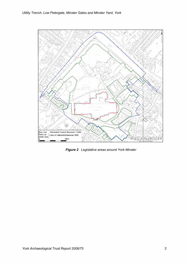
Figure 2 Legislative areas around York Minster
Utility Trench, Low Petergate, Minster Gates and Minster Yard, York
York Archaeological Trust Report 2008/75 4
2. METHOD STATEMENT
During the work in Low Petergate and Minster Gates the work was monitored by an
archaeologist on a regular basis, usually once or twice a day, and any appropriate written or
photographic records were made. Beyond the north end of Minster Gates, within Minster
Yard, the work took place inside the York Minster and Minster Precinct Scheduled Ancient
Monument (Fig 2), County SAM 13280, and an archaeologist was present at all times when
any digging took place in accordance with the Written Scheme of Investigation (Appendix 1)
as drawn up by City of York Council. The excavations in Low Petergate and Minster Gates
were a mixture of mini-digger excavation and hand excavation to avoid any damage to the
old main. Apart from the machine cutting of the tarmac surface in Minster Yard all digging
was by hand. Scheduled Ancient Monument Consent (Department for Culture, Media and
Sport, Architecture and Historic Environment Division ref HSD 9/2/10200) had been obtained
for this section of the work and the conditions stipulated within this consent were strictly
adhered to. To minimise disruption to the area and to allow access for delivery vehicles the
work was carried out between 2.00pm and 9.00pm, Mondays to Fridays. A small number of
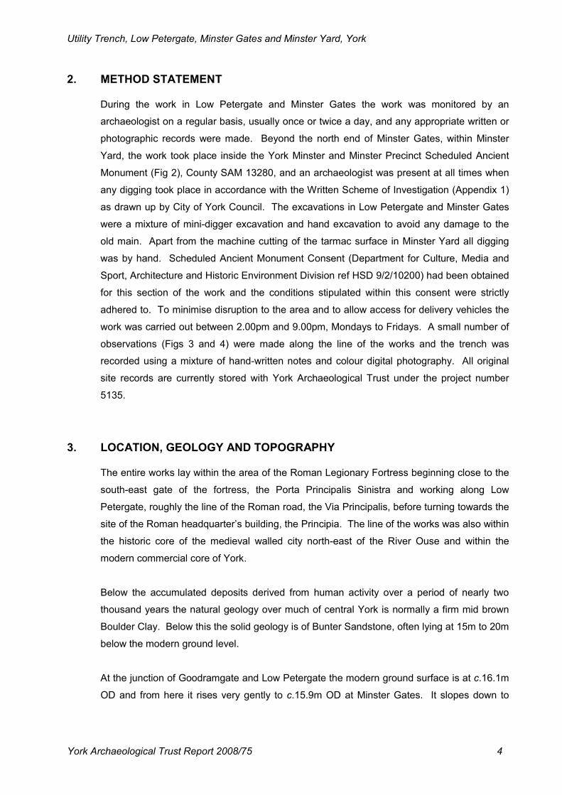
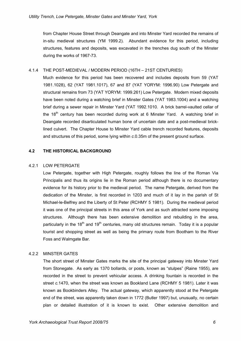
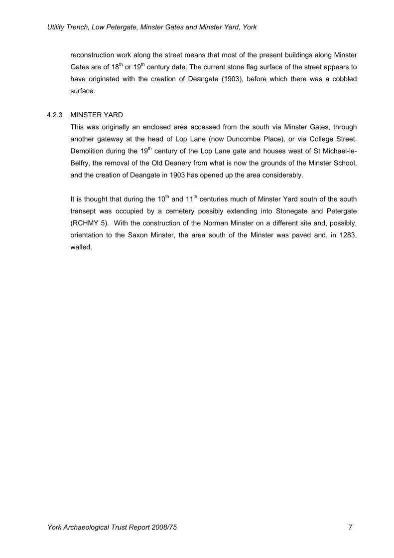
observations (Figs 3 and 4) were made along the line of the works and the trench was
recorded using a mixture of hand-written notes and colour digital photography. All original
site records are currently stored with York Archaeological Trust under the project number
5135.
3. LOCATION, GEOLOGY AND TOPOGRAPHY
The entire works lay within the area of the Roman Legionary Fortress beginning close to the
south-east gate of the fortress, the Porta Principalis Sinistra and working along Low
Petergate, roughly the line of the Roman road, the Via Principalis, before turning towards the
site of the Roman headquarter’s building, the Principia. The line of the works was also within
the historic core of the medieval walled city north-east of the River Ouse and within the
modern commercial core of York.
Below the accumulated deposits derived from human activity over a period of nearly two
thousand years the natural geology over much of central York is normally a firm mid brown
Boulder Clay. Below this the solid geology is of Bunter Sandstone, often lying at 15m to 20m
below the modern ground level.
At the junction of Goodramgate and Low Petergate the modern ground surface is at c.16.1m
OD and from here it rises very gently to c.15.9m OD at Minster Gates. It slopes down to
Utility Trench, Low Petergate, Minster Gates and Minster Yard, York
York Archaeological Trust Report 2008/75 5
c.15.6m OD at the north-eastern end of Minster Gates and then rises gently to the east to
c.15.8m where the works terminated outside 10 Minster Gates.
4. ARCHAEOLOGICAL AND HISTORICAL BACKGROUND
4.1 THE ARCHAEOLOGICAL BACKGROUND
4.1.1 THE ROMAN PERIOD (1ST – 4TH CENTURIES)
There is much evidence for this period along and close to the line of the works. Along Low
Petergate the Via Principalis has been recorded during watching briefs outside Nos 70 (YAT
YORYM: 1997.45), 72 (YAT YORYM: 1997.54), 81 (YAT YORYM: 1997.44) and 93 (YAT
YORYM: 1997.46). Outside No 59 Low Petergate a Roman wall, demolition deposits and
dumps have been recorded (YAT YORYM: 1997.50) and Roman demolition deposits have
been noted from outside No 93. No evidence of this period is currently known from Minster
Gates and Minster Yard although a number of trenches sunk to the south of the Minster in
the 1967-73 campaign produced complex features, structures and deposits of the Roman
period (Phillips and Heywood, 1995).
4.1.2 THE ANGLIAN AND ANGLO-SCANDINAVIAN PERIODS (5TH – 11TH CENTURIES)
Although remains of the Anglian period are relatively uncommon in York the Minster
excavations of 1967-73 did produce a moderate quantity including occupation and burials.
The Anglo-Scandinavian period is well represented in the area with deposits from 65 Low
Petergate (YAT 1984.1009) and 72 Low Petergate and deposits possibly of this period from
Nos 48 (YAT 1995.0262), 81, 93 and 59 Low Petergate. Much additional material, mainly in
the form of burials and deposits came from the Minster excavations of 1967-73.
4.1.3 THE MEDIEVAL PERIOD (11TH – 16TH CENTURIES)
Remains of the medieval period have come from, or close to, Nos 65, 67 (YAT 1980.1038),
70, 72, 87 (YAT 1988.1020), 93 and 97 (YAT 1993.1001) Low Petergate. Remains recorded
from these sites included a stone-lined well, foundations and road surfaces as well as
deposits. Work at 62-68 Low Petergate by YAT in 2002 and 2004 (YAT YORYM: 2002.421)
produced a complex sequence of features, deposits and structures, some with an industrial
usage, of the 13th – 15
th centuries. There has been no confirmed evidence for this period
from Minster Gates but architectural fragments of 12th – 15
th century date have come from
work at 6 Minster Yard (YAT 1990.1009) and 12 Minster Yard has produced substantial
limestone blocks, probably foundations, and disarticulated and semi-articulated human
bones of the period (YAT YORYM: 2003.305). A watching brief on a cable trench running
Utility Trench, Low Petergate, Minster Gates and Minster Yard, York
York Archaeological Trust Report 2008/75 6
from Chapter House Street through Deangate and into Minster Yard recorded the remains of
in-situ medieval structures (YM 1999.2). Abundant evidence for this period, including
structures, features and deposits, was excavated in the trenches dug south of the Minster
during the works of 1967-73.
4.1.4 THE POST-MEDIEVAL / MODERN PERIOD (16TH – 21ST CENTURIES)
Much evidence for this period has been recovered and includes deposits from 59 (YAT
1981.1028), 62 (YAT 1981.1017), 67 and 87 (YAT YORYM: 1996.90) Low Petergate and
structural remains from 73 (YAT YORYM: 1999.261) Low Petergate. Modern mixed deposits
have been noted during a watching brief in Minster Gates (YAT 1983.1004) and a watching
brief during a sewer repair in Minster Yard (YAT 1992.1010. A brick barrel-vaulted cellar of
the 18th century has been recorded during work at 6 Minster Yard. A watching brief in
Deangate recorded disarticulated human bone of uncertain date and a post-medieval brick-
lined culvert. The Chapter House to Minster Yard cable trench recorded features, deposits
and structures of this period, some lying within c.0.35m of the present ground surface.
4.2 THE HISTORICAL BACKGROUND
4.2.1 LOW PETERGATE
Low Petergate, together with High Petergate, roughly follows the line of the Roman Via
Principalis and thus its origins lie in the Roman period although there is no documentary
evidence for its history prior to the medieval period. The name Petergate, derived from the
dedication of the Minster, is first recorded in 1203 and much of it lay in the parish of St
Michael-le-Belfrey and the Liberty of St Peter (RCHMY 5 1981). During the medieval period
it was one of the principal streets in this area of York and as such attracted some imposing
structures. Although there has been extensive demolition and rebuilding in the area,
particularly in the 18th and 19
th centuries, many old structures remain. Today it is a popular
tourist and shopping street as well as being the primary route from Bootham to the River
Foss and Walmgate Bar.
4.2.2 MINSTER GATES
The short street of Minster Gates marks the site of the principal gateway into Minster Yard
from Stonegate. As early as 1370 bollards, or posts, known as “stulpes” (Raine 1955), are
recorded in the street to prevent vehicular access. A drinking fountain is recorded in the
street c.1470, when the street was known as Bookland Lane (RCHMY 5 1981). Later it was
known as Bookbinders Alley. The actual gateway, which apparently stood at the Petergate
end of the street, was apparently taken down in 1772 (Butler 1997) but, unusually, no certain
plan or detailed illustration of it is known to exist. Other extensive demolition and
Utility Trench, Low Petergate, Minster Gates and Minster Yard, York
York Archaeological Trust Report 2008/75 7
reconstruction work along the street means that most of the present buildings along Minster
Gates are of 18th or 19
th century date. The current stone flag surface of the street appears to
have originated with the creation of Deangate (1903), before which there was a cobbled
surface.
4.2.3 MINSTER YARD
This was originally an enclosed area accessed from the south via Minster Gates, through
another gateway at the head of Lop Lane (now Duncombe Place), or via College Street.
Demolition during the 19th century of the Lop Lane gate and houses west of St Michael-le-
Belfry, the removal of the Old Deanery from what is now the grounds of the Minster School,
and the creation of Deangate in 1903 has opened up the area considerably.
It is thought that during the 10th and 11
th centuries much of Minster Yard south of the south
transept was occupied by a cemetery possibly extending into Stonegate and Petergate
(RCHMY 5). With the construction of the Norman Minster on a different site and, possibly,
orientation to the Saxon Minster, the area south of the Minster was paved and, in 1283,
walled.
Utility Trench, Low Petergate, Minster Gates and Minster Yard, York
York Archaeological Trust Report 2008/75 8
Figure 3 Location of observations to south-east
Utility Trench, Low Petergate, Minster Gates and Minster Yard, York
York Archaeological Trust Report 2008/75 9
Figure 4 Location of observations to north-west
Utility Trench, Low Petergate, Minster Gates and Minster Yard, York
York Archaeological Trust Report 2008/75 10
5. RESULTS
5.1 SECTION 1
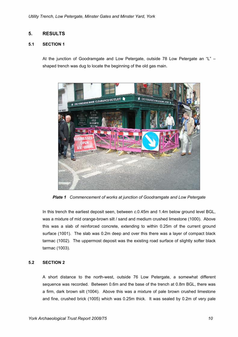
At the junction of Goodramgate and Low Petergate, outside 78 Low Petergate an “L” –
shaped trench was dug to locate the beginning of the old gas main.
Plate 1 Commencement of works at junction of Goodramgate and Low Petergate
In this trench the earliest deposit seen, between c.0.45m and 1.4m below ground level BGL,
was a mixture of mid orange-brown silt / sand and medium crushed limestone (1000). Above
this was a slab of reinforced concrete, extending to within 0.25m of the current ground
surface (1001). The slab was 0.2m deep and over this there was a layer of compact black
tarmac (1002). The uppermost deposit was the existing road surface of slightly softer black
tarmac (1003).
5.2 SECTION 2
A short distance to the north-west, outside 76 Low Petergate, a somewhat different
sequence was recorded. Between 0.6m and the base of the trench at 0.8m BGL, there was
a firm, dark brown silt (1004). Above this was a mixture of pale brown crushed limestone
and fine, crushed brick (1005) which was 0.25m thick. It was sealed by 0.2m of very pale
Utility Trench, Low Petergate, Minster Gates and Minster Yard, York
York Archaeological Trust Report 2008/75 11
brown crushed limestone (1006) and above this was the modern ground surface of black
tarmac (1007).
5.3 SECTION 3
Three small trenches dug outside 68 Low Petergate produced identical results. A typical
section contained only highly disturbed modern material (1008), mostly in the form of mid
brown sand, below the modern tarmac surface (1009). This, with very minor variations,
continued all the way up Low Petergate up to its junction with Minster Gates.
5.4 SECTION 4
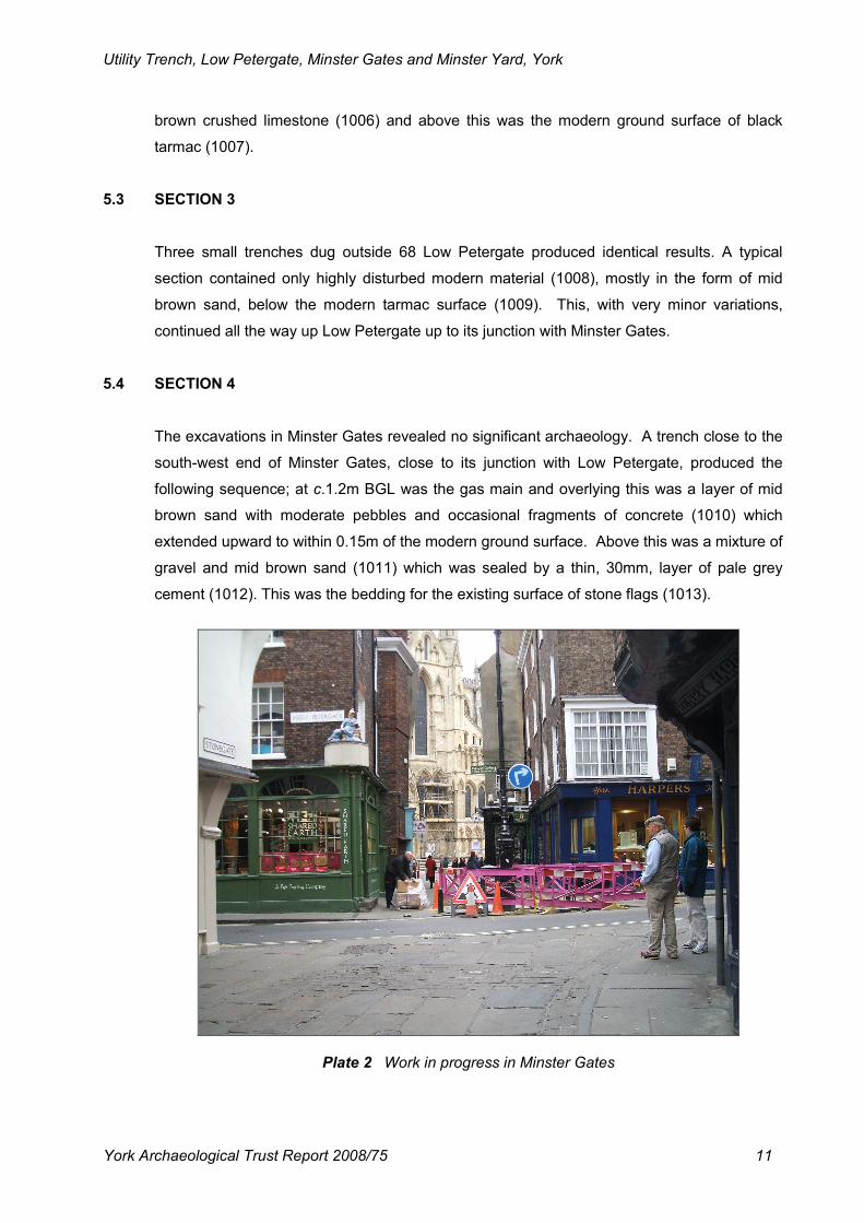
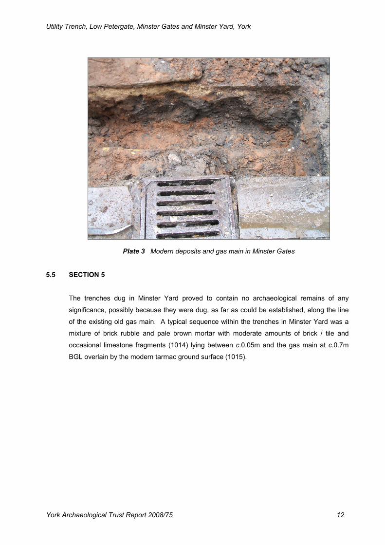
The excavations in Minster Gates revealed no significant archaeology. A trench close to the
south-west end of Minster Gates, close to its junction with Low Petergate, produced the
following sequence; at c.1.2m BGL was the gas main and overlying this was a layer of mid
brown sand with moderate pebbles and occasional fragments of concrete (1010) which
extended upward to within 0.15m of the modern ground surface. Above this was a mixture of
gravel and mid brown sand (1011) which was sealed by a thin, 30mm, layer of pale grey
cement (1012). This was the bedding for the existing surface of stone flags (1013).
Plate 2 Work in progress in Minster Gates
Utility Trench, Low Petergate, Minster Gates and Minster Yard, York
York Archaeological Trust Report 2008/75 12
Plate 3 Modern deposits and gas main in Minster Gates
5.5 SECTION 5
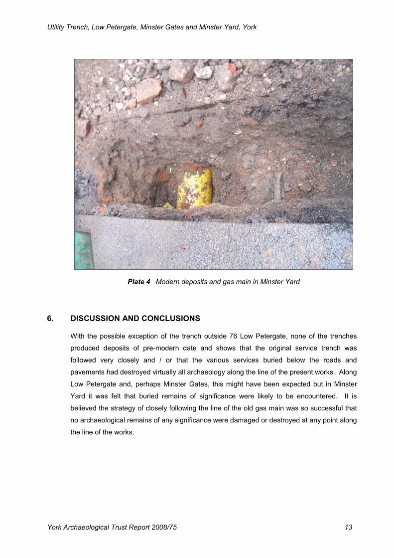
The trenches dug in Minster Yard proved to contain no archaeological remains of any
significance, possibly because they were dug, as far as could be established, along the line
of the existing old gas main. A typical sequence within the trenches in Minster Yard was a
mixture of brick rubble and pale brown mortar with moderate amounts of brick / tile and
occasional limestone fragments (1014) lying between c.0.05m and the gas main at c.0.7m
BGL overlain by the modern tarmac ground surface (1015).
Utility Trench, Low Petergate, Minster Gates and Minster Yard, York
York Archaeological Trust Report 2008/75 13
Plate 4 Modern deposits and gas main in Minster Yard
6. DISCUSSION AND CONCLUSIONS
With the possible exception of the trench outside 76 Low Petergate, none of the trenches
produced deposits of pre-modern date and shows that the original service trench was
followed very closely and / or that the various services buried below the roads and
pavements had destroyed virtually all archaeology along the line of the present works. Along
Low Petergate and, perhaps Minster Gates, this might have been expected but in Minster
Yard it was felt that buried remains of significance were likely to be encountered. It is
believed the strategy of closely following the line of the old gas main was so successful that
no archaeological remains of any significance were damaged or destroyed at any point along
the line of the works.
Utility Trench, Low Petergate, Minster Gates and Minster Yard, York
York Archaeological Trust Report 2008/75 14
7. LIST OF SOURCES
7.1 PRINTED SOURCES
Phillips, A. D., and Heywood, B., 1995. Excavations at York Minster, Vol 1. From Roman
Fortress to Norman Cathedral.
Raine. A., 1955. Medieval York; A Topographical Survey Based on Original Sources.
RCHMY 5. 1981. Royal Commission on Historical Monuments (England). An Inventory of the
Historical Monuments in the City of York. 5: The Central Area.
7.2 ONLINE SOURCES
York Archaeological Trust Archive Gazetteer
8. ACKNOWLEDGEMENTS
Research and author D. T. Evans
Illustrations M. Johnson
Photography D. T. Evans
Editor M. Stockwell
Utility Trench, Low Petergate, Minster Gates and Minster Yard, York
York Archaeological Trust Report 2008/75 15
APPENDIX 1: THE WRITTEN SCHEME OF INVESTIGATION
1. The purpose of the work is to record and recover archaeological remains which are affected by proposed development. The area of topsoil strip/foundation and service trench excavation is to be carried out under archaeological supervision and any features/deposits thus exposed should be recorded to professional archaeological standards.
2. The WSI represents a summary of the broad archaeological requirements needed to
comply with an archaeological planning condition or obligation. The scheme does not comprise a full specification or Bill of Quantities, nor is there any warranty that the works are fully or exactly described. No work on site should commence until the implementation of a contract between the Developer and the Archaeologist.
3. The Archaeologist should notify the City Archaeologist at least one week in advance of
the start of work. 4. The removal of overburden (that is vegetation, turf, loose stones, rubble, made ground,
tarmac, concrete, hardcore, building debris and topsoil) should be supervised by the Archaeologist contracted to carry out the WSI. The Archaeologist should be informed of the correct timing and schedule of overburden removal.
5. Removal of overburden by machine should be undertaken using a back-acting excavator
fitted with toothless or ditching bucket only. Where materials are exceptionally difficult to lift, a toothed bucket may be used temporarily. Subsoils or deep, uniform fills of features may also be removed by back-acting excavator but only in areas specified by the Archaeologist on site, and only with archaeological supervision. Bulldozers or wheeled scraper buckets should not be used to remove overburden above potential archaeological deposits.
6. Metal detecting within the development area, including the scanning of topsoil and spoil
heaps, should only be permitted subject to archaeological supervision and recording such that metal finds are properly located, identified, and conserved. All metal detection should be carried out following the Treasure Act 1996 Code of Practice.
7. Where structures, finds, soil features and layers of archaeological interest are exposed
or disturbed by construction works, the Archaeologist should be provided with the opportunity to observe, clean, assess, excavate by hand where appropriate, sample and record these features and finds. If the contractors or plant operators notice archaeological remains, they should immediately tell the Archaeologist. The sampling of deposits for palaeoenvironmental evidence should be a standard consideration and arrangements should be made to ensure that specialist advice and analysis are available if appropriate.
8. Heavy plant should not be operated in the near vicinity of archaeological remains until
they have been recorded, and the Archaeologist on site has allowed operations to recommence at that location. Sterile subsoils below archaeological deposits may be removed without archaeological supervision.
Utility Trench, Low Petergate, Minster Gates and Minster Yard, York
York Archaeological Trust Report 2008/75 16
9. Upon completion of fieldwork, samples should be processed and evaluated, and all finds identified, assessed, spot-dated, properly stored, and subject to investigative conservation as needed. A field archive should be compiled consisting of all primary written documents, plans, sections, and photographs. The Archaeologist should arrange for the transfer of the archive to an appropriate museum or records office.
10. A summary report should be produced containing planning or administrative details of
the project, a summary of works carried out, a description and interpretation of the findings, an assessment of the importance of the archaeology including its historical context where appropriate, and catalogues of finds, features, and primary records. All excavated areas should be accurately mapped with respect to nearby buildings, roads and field boundaries. All significant features should be illustrated with suitably scaled plans, sections, and photographs.
11. Copies of the summary report should be provided to the client, the City of York Council,
to the museum accepting the archive, and if the works are on or adjacent to a Scheduled Ancient Monument, to English Heritage. A licence should be granted to the accepting museum and the Council to use the documentation arising from the work for its statutory functions and to give to third parties as an incidental to those functions.
12. Upon completion of the work, the Archaeologist should make their work accessible to the
wider research community by submitting digital data and copies of reports online to OASIS (http://ads.ahds.ac.uk/project/oasis/). Submission of data to OASIS does not discharge the planning requirements for the Archaeologist to notify the City Archaeologist of the details of the work.
13. Under the Environmental Information Regulations 2005 (EIR) information submitted to
the HER becomes publicly accessible, except where disclosure might lead to environmental damage, and reports cannot be embargoed as 'confidential' or 'commercially sensitive'. Requests for sensitive information are subject to a public interest test and if this is met, then the information has to be disclosed. The Archaeologist should inform the client of EIR requirements, and ensure that any information disclosure issues are resolved before completion of the work. Intellectual property rights are not affected by the EIR.
14. The City Archaeologist should be informed as soon as possible of the discovery of any
unexpected archaeological remains, or changes in the programme of ground works on site. Any significant changes in the archaeological work should be specified in a variation to the WSI to be approved by the planning authority. lf there is a need to remove human remains, an exhumation licence should be obtained from the Department of Justice, or a faculty obtained where the remains are buried in land consecrated according to the rites of the Church of England.