Embed Size (px)
Citation preview
1
Vierra Reinforcement Project Data Request Set No. 3 – Additional PG&E Responses January 25, 2019
An initial set of responses to Data Request No. 3 was submitted on December 18, 2018. This set of responses addresses the remaining requests of AE‐1, CR‐2, CR‐3, PD‐11, PD‐13, PD‐14, and USS‐2.
Aesthetics
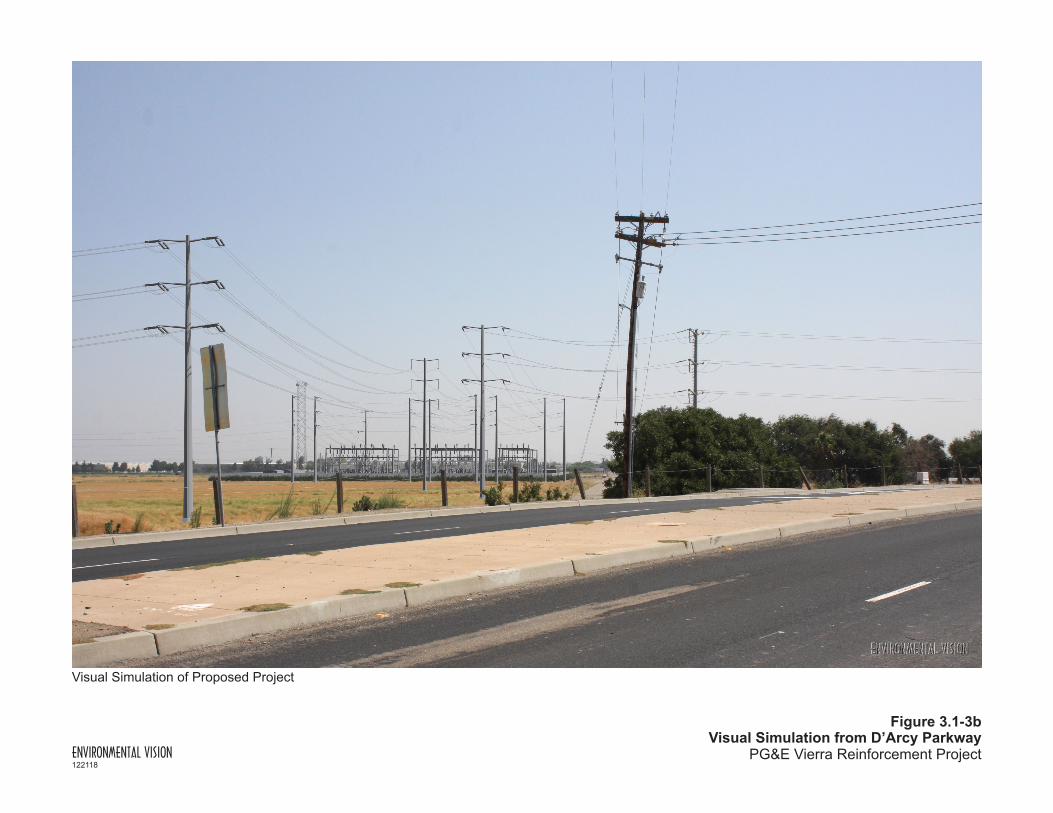
AE‐1 It does not appear that Figure 3.1‐3b in Section 3.1, Aesthetics of the PEA showing a photo simulation of the expanded Vierra Substation includes the new 100‐foot microwave tower (lattice) in proper proportion to the surrounding towers. Please update the photo simulation to include the new tower in proper comparison to the poles surrounding it. Also, Figure 2.0‐7 in Section 2, Project Description of the PEA showing a profile drawing of the expanded Vierra Substation does not appear to include the new 100‐foot microwave lattice tower. If the tower is not included in the profile drawing, please update to include the new tower.
PG&E Response: The revised simulation of the expanded Vierra Substation (Figure 3.1‐3b) is attached. Although substation profile drawings do not typically include microwave towers and transmission poles, we have added those components in a revised profile drawing (Figure 2.0‐7). The drawing and simulation show the height of the microwave tower as 120 feet. The tower is located at the northeast corner of the expansion area. A survey path analysis conducted in December 2018 identified that the tower would need to be approximately 120 feet in height due to the presence of a eucalyptus tree along the microwave path. If the landowner agrees the tree can removed or trimmed, the microwave tower could be reduced to approximately 100 feet.
Cultural and Paleontological Resources
CR‐2 PEA Section 2.3.2 Work at Other Substations lists eight substations where upgrades related to the project will be installed. In order to determine whether any of the facilities connected to the project are of historic age, and therefore historical resources might be impacted by the addition of new equipment, it is necessary to know their dates of construction and any modifications to the facilities made in the intervening years. Power plants and substations in the early 20th Century often featured buildings of architectural merit, designed to convey a “corporate image of permanence, utility and beauty in the public mind” (Baker 2003, p. 14). In addition, it is necessary for the cultural resources analysis to take into consideration potential impacts to historical resources within the footprint and in the vicinity of the remote upgrade projects, as well as assessing the potential for encountering as‐yet unknown buried archaeological resources. Please provide the following information for all eight locations:
1. For those substations or communications facilities less than 45 years old:
a. Dates of construction and subsequent modifications;

2
b. General description of the facility, including any on‐site buildings, and of the setting, including but not limited to: rural setting, commercial/industrial setting, inclusion of or adjacency to any historic structures or districts;
2. For those substations or communications facilities 45 years or older:
a. A DPR 523a Primary Record evaluation and related 523 forms (for example: 523j and 523l) are needed for the substation or communication facilities. Include a description of the facility, including any on‐site buildings, and of the setting, including but not limited to: rural setting, commercial/industrial setting, inclusion of or adjacency to any historic structures or districts;
3. Results of a literature search with a 0.5‐mile radius from the boundary of each substation site performed at the appropriate Information Center, either the California Central Information Center (CCIC) or Northwest Information Center (NWIC).
CR‐2 PG&E Response: The initial PG&E response submitted to the CPUC on December 18, 2018 indicated that a records search would be completed for Tesla, Tracy, Kasson, and Manteca substations, which are the other substations where ground‐disturbing work will occur. A records search was conducted of the Central California Information Center’s current files and a records search was also conducted by the Northwest Information Center. The results of the records search are attached (Cultural Resources Constraints Report, dated January 3, 2019; confidential data submitted separately). There are no previously recorded archaeological resources that overlap with any of the substation footprints where ground‐disturbing work will occur (Tesla, Kasson, Tracy, and Manteca substations). Due to extensive previous ground disturbances within the project area, the majority of which are paved/developed, there is a low potential to encounter surface prehistoric cultural resources within the project area. Additionally, based on an analysis of landform, soils, and historical distance to water sources, the buried site sensitivity at these locations is considered low. While there are several historic‐era, built environment resources that overlap with the Tesla Substation footprint, given the limited scope and nature of proposed activities at the substation location, none of the previously recorded built environment resources that have not been evaluated—many have been evaluated as ineligible for listing on the California Register—will be adversely impacted by modifications proposed at the substation. The substations themselves are considered historic in age; in a separate report (forthcoming) they will be considered in terms of project impact analysis and, when the scope and nature of the impacts warrant it, a California Register eligibility evaluation will also be produced for the pertinent substations.
CR‐3 PEA Section 2.1 Project Description Overview briefly describes remote end upgrades at eight substations that would occur as a result of the proposed project. These upgrades include construction of slab foundations at three substations, Kasson, Tracy, and Manteca, and it is unclear how this construction could impact as‐yet unknown buried archaeological resources given the 11’ x 11’ x 4’ foundation excavation that would occur (PEA section 2.5.4.1). To fully analyze the impacts to cultural resources from these remote end upgrades, please provide the following information:
1. A geotechnical report or other documentation that describes the depth of fill at the locations where the slab foundations will be constructed, i.e., the Kasson, Tracy, and Manteca substations.

3
2. A description of the horizontal and vertical extent of ground‐disturbance of the slab foundations in relation to any fill deposits, i.e., a determination if the construction will encounter intact native soils.
References:
Baker 2003 – Cindy L. Baker. The Lights Went On All At Once: The History of Electricity in California. Prepared for the California Energy Commission. February 2003.
PGE 2018a – Pacific Gas & Electric Company (PGE). Proponents Environmental Assessment. June 6, 2018. http://www.cpuc.ca.gov/environment/info/CEC/VierraReinforcement/PDFs/VierraPEA/00a%20Exhibit%20B%20‐%20Vierra%20PTC%20Application.pdf
PG&E Response: The depth of the existing fill at the locations of the slab foundations for the telecommunication poles at Kasson, Tracy, and Manteca substations is not known, as geotechnical investigations have not been conducted at these specific locations within the substation yards. While it is possible the construction will encounter intact native soils below the fill, the attached Cultural Resources Constraints Report indicates there is a low potential to encounter surface prehistoric cultural resources due to previous ground disturbance and a low to lowest potential to encounter subsurface prehistoric resources based on distance to water and analysis of landform and soils. Thus, it is unlikely that impacts to previously unidentified buried archeological resources would occur. In the unlikely event that such resources are encountered, PG&E would implement APM CUL‐2: Inadvertent Discovery of Previously Unidentified Cultural Resources.
Project Description
PD‐11 On page 2.0‐15, Section 2.5.4.1 of the Vierra PEA, it indicates that “One 4‐foot microwave dish will be installed on each tower.” However, on page 2.0‐24, Section 2.7.10 of the PEA, it indicates that “Construction personnel will climb the existing towers and install two 4‐foot microwave dishes at each tower location.” Please indicate the correct number of microwave towers to be installed on existing telecommunications towers at Mount Oso and Highland Park.
PG&E Response: The survey path analysis conducted in December 2018 concluded that three 6‐foot‐diameter microwave dishes will be required on the existing microwave tower on Mount Oso, and one 6‐foot‐diameter microwave dish will be required on the existing tower on Highland Peak.
PD‐13 All told, the PEA details the following new construction at the Vierra, Kasson, Manteca, and Tracy substations: one 100‐foot microwave tower (at Vierra), and three approximate 60‐foot microwave monopoles (at Kasson, Manteca, and Tracy). Eight microwave dishes will be placed on this new telecommunications infrastructure (microwave tower). When added to the one or two microwave dishes to be installed at Mount Oso and one or two microwave dishes at Highland Park’s existing telecommunications towers, the project would install a total of 10 or 12 4‐foot microwave dishes. Please provide the following information:
1. Please explain why are these 10 or 12 microwave dishes needed for the operation of the expanded Vierra Substation and new 115 kV power line?

4
2. Please explain why the four 12‐foot antennas on microwave facilities located at Ripon Cogen, Thermal Cogen, San Joaquin Cogen, and Howland Road Substations are needed?
PG&E Response: Telecommunications equipment sends signals between substations and carries data to the control center. Currently, Vierra Substation does not have telecommunications equipment and it will be installed as part of the expansion. The telecommunications equipment will relay signals to a microwave tower on Mount Oso, which, in turn, will relay signals to and from other facilities in the transmission system.
When the application for the Vierra Reinforcement Project was filed, a study (survey path analysis) to verify telecommunications equipment requirements had not yet been completed. The survey path analysis conducted in December 2018 determined the project will require a total of 8 microwave dishes and 1 antenna. The microwave dishes to be installed will be approximately 6 feet in diameter. A Yagi antenna, typically 3 feet long, will be installed on the new microwave tower at Vierra Substation.
Substation Approximate Number of Microwave Dishes/Antennas to be Installed
Highland Peak 1 dish
Mount Oso 3 dishes
Vierra 1 dish/1 antenna
Kasson 1 dish
Manteca 1 dish
Tracy 1 dish
Planned work will no longer be required at San Joaquin Cogen Substation and Thermal Cogen Substation, as the facilities are scheduled to be decommissioned.
PD‐14 With the exception of the Vierra Substation, there are few details in the PEA about the construction at the eight substations and Mount Oso and Highland Peak, where remote end upgrades and telecommunication equipment installations would be performed. Please provide the following information:
1. Please provide a description of the environment in the vicinity of each substation and the Mount Oso and Highland Peak sites. The description should include some discussion of the topography, land use patterns, and general biological environment.
2. Please provide a description of the regulatory environment/context (Federal, State, Local) for each substation and the Mount Oso and Highland Peak sites.
3. List all known permits required for remote end upgrades and telecommunication equipment installations at each substation and the Mount Oso and Highland Peak sites.
4. Please identify temporary staging areas, including size and land cover type (e.g. gravel, paved, soil, ruderal vegetation), that would be needed for any remote end work and telecommunication equipment installations.

5
5. Please provide a site map showing the location of construction disturbance, including new towers and all temporary staging areas.
6. Please identify and provide the estimated quantity of soil or other solid waste and wastewater to be generated during construction of remote end work, and where it will be disposed (e.g. Vasco Road Landfill).
7. For the Kason, Manteca, and Tracy substations, please identify any soil or water contamination that could be encountered during subsurface excavation and mitigation required, if any.
PG&E Response: This information is forthcoming.
1. Below is a description of the environment in the vicinity of each substation.
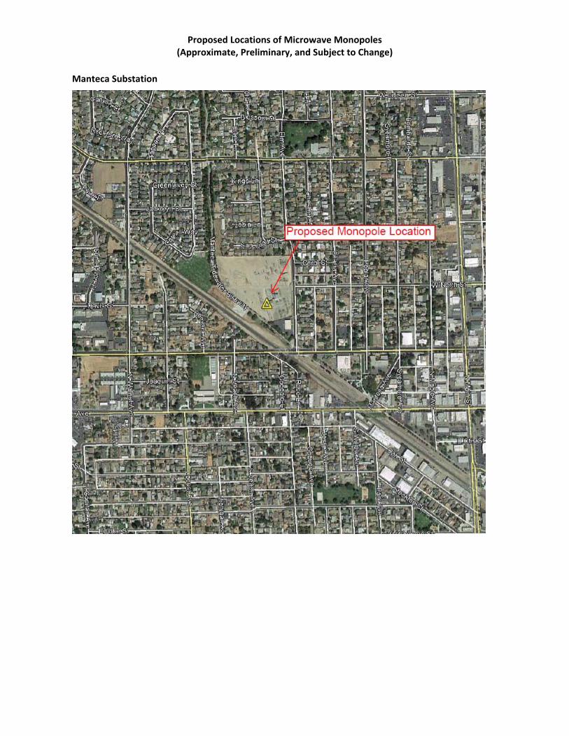
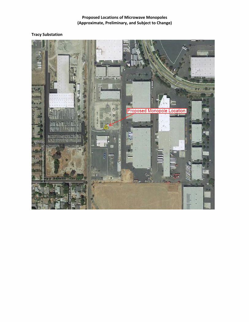
Manteca Substation Manteca Substation is located on land zoned Public/Quasi‐Public within the City of Manteca. Land uses surrounding the substation are zoned residential and the topography is generally flat. The substation can be accessed from surface streets off State Route 120. The substation yard is approximately 10 acres in size and triangular in shape. The yard is enclosed by a wall on the north side where residential yards abut the substation yard, a wall on the east side along Elm Avenue where there are residences and a small park on the other side of the street, and a fence on the southwest side that is bordered by the Manteca Tidewater Bikeway (paved trail), a skate park, and a stormwater basin. Railroad tracks parallel the southwest side of the substation approximately 175 feet away. Special‐status bat species may nest in residential palm trees adjacent to the eastern boundary of the site, and small water ponds within the golf course, less than 1 mile to the west, provide a suitable freshwater source for bat species. Residential trees that surround the site measure approximately 10 to 30 feet in height and may provide nesting sites for birds. There is potential for Swainson’s hawk (Buteo swainsoni, ST), a state‐listed threatened species, to forage within the surrounding trees or perch on tall utility poles. According to the December 2018 California Natural Diversity Database, a Swainson’s hawk nest was observed in a fallow field dominated by non‐native annual grassland species approximately 1.5 miles northeast of the site. Due to the construction activities occurring within the graveled substation yard, no impacts to special‐status or listed species are anticipated. Potential impacts to nesting birds will be addressed through implementation of APM Bio‐2. The residential palm trees that may provide nesting habitat for bats are in a front yard approximately 350 feet from the work area and separated from the work area by electrical equipment, the substation wall, and Elm Avenue. Because of the distance and intervening features, the project will have no potential impact on any nesting bats. Tracy Substation Tracy Substation location is within an industrial‐zoned area in the City of Tracy. The substation is bordered by railroad tracks on the west side and surrounded on all sides by industrial land uses and warehousing. Approximately 500 feet west of the substation, beyond the railroad tracks and industrial area, is a residential area. An open area approximately 500 feet south of the substation is zoned as Urban Reserve. The substation can be accessed on surface streets off Interstate 205. The topography is generally flat.
6
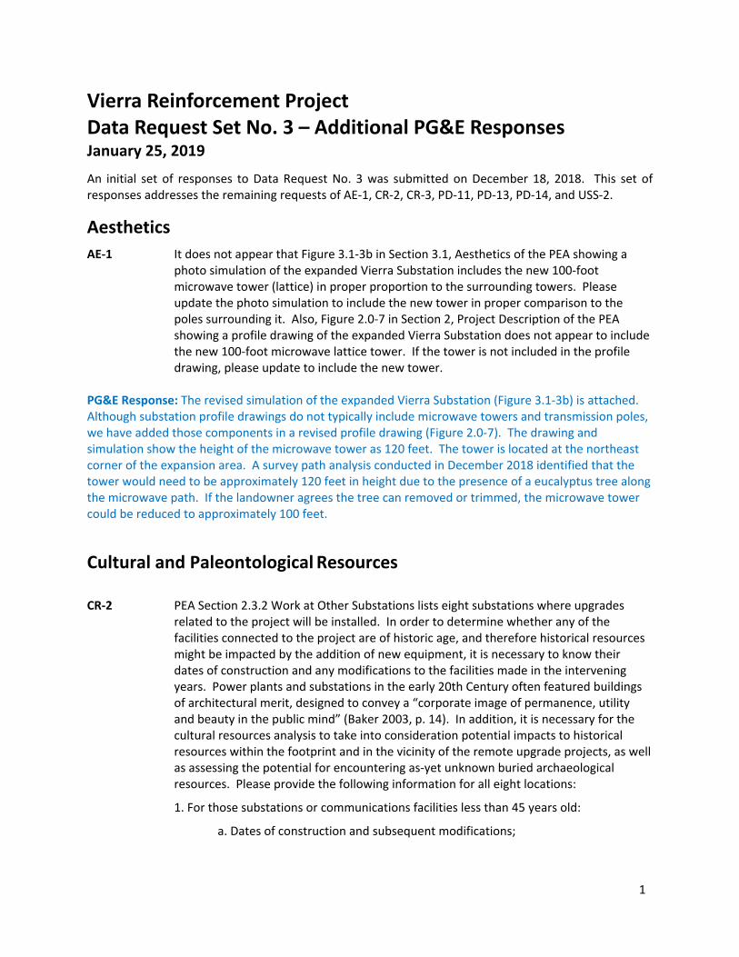
Because the site and surrounding 500‐foot buffer is highly developed, no special‐status plant species would occur on site. Ornamental trees, including palm trees, approximately 15 to 30 feet in height are sparsely distributed within 500 feet of the site. Such trees, coupled with a water source 2 miles north of the site, have the potential to house special‐status bat species such as pallid bat (Antrozous pallidus, SSC), Townsend’s big‐eared bat (Corynorhinus townsendii, SSC), and western mastiff bat (Eumops perotis californicus, SSC), as well as owls, other small raptors, and songbirds. Very marginal annual grassland habitat is located less than 80 feet to the west of the site across the railroad tracks. Grassland habitat has the potential to house smaller reptile species such as the California glossy snake (Arizona elegans occidentalis, SSC), San Joaquin coachwhip (Masticophis flagellum ruddocki, SSC), western spadefoot (Spea hammondii, SSC), and coast horned lizard (Phrynosoma blainvillii, SSC). Due to ground disturbance from the railroad tracks and a highly developed site, these species are unlikely to forage within the project area. A disturbed grassland area is located more than 500 feet south of the site, which may contain various special‐status species, such as reptiles, and select avian species, such as tricolored blackbird (Agelaius tricolor, SCE, SSC), Swainson’s hawk, burrowing owl (Athene cunicularia, SSC), California horned lark (Eremophila alpestris actia, SSC), American badger (Taxidea taxus, SSC), as well as the previously mentioned reptile species. However, these species are unlikely to forage within the project area. Therefore, impacts to special‐status or listed species as a result of construction activities are not expected. Kasson Substation Kasson Substation is located in San Joaquin County, surrounded by agricultural land uses. It is located adjacent to Interstate Highway 5 and can be accessed from South Kasson Road. Habitat on site and within the vicinity comprises disturbed grassland, developed, and agricultural land uses. The topography is generally flat, and the graveled substation yard is fenced. Species that may forage within grassland and agricultural habitat, or use the riparian habitat less than 1 mile to the north include tricolored blackbird, burrowing owl, Swainson’s hawk, California horned lark, merlin (Falco columbarius, WL), loggerhead shrike (Lanius ludovicianus, SSC), yellow‐headed blackbird (Xanthocephalus xanthocephalus, SSC), various migratory birds, and San Joaquin kit fox (Vulpes macrotis mutica, FE, ST). These species are unlikely to enter the fenced substation. According to the U.S. Fish and Wildlife Service December 17, 2018 Information for Planning and Consultation (IPaC) database search, this site intersects critical habitat for delta smelt (Hypomesus transpacificus, FT); however, there are no suitable habitat or aquatic water bodies within the project area. Thus, construction activities will not impact delta smelt populations. Therefore, impacts to special‐status or listed species as a result of construction activities are not expected. Highland Peak The Highland Peak site is surrounded by scrub habitat and valley needlegrass grassland habitat. Some highly mobile avian and mammal species (especially grassland mammal species) have the potential to forage within the disturbance zone or cross the access road. Vehicular traffic outside designated access roads has the potential to affect foraging species including Alameda whipsnake (Masticophis lateralis euryxanthus, FT, ST), golden eagle (Aquila chrysaetos, FP), burrowing owl, ferruginous hawk (Buteo regalis, WL), northern harrier (Circus hudsonius, SSC), white‐tailed kite (Elanus leucurus, FP), California horned lark, prairie falcon (Falco mexicanus, WL), American peregrine falcon (Falco peregrinus anatum, FP), American badger, and San Joaquin kit fox. However, impacts to special‐status or listed species as a result of construction activities are not expected due to the limited vehicular traffic on the access road. Mount Oso
7
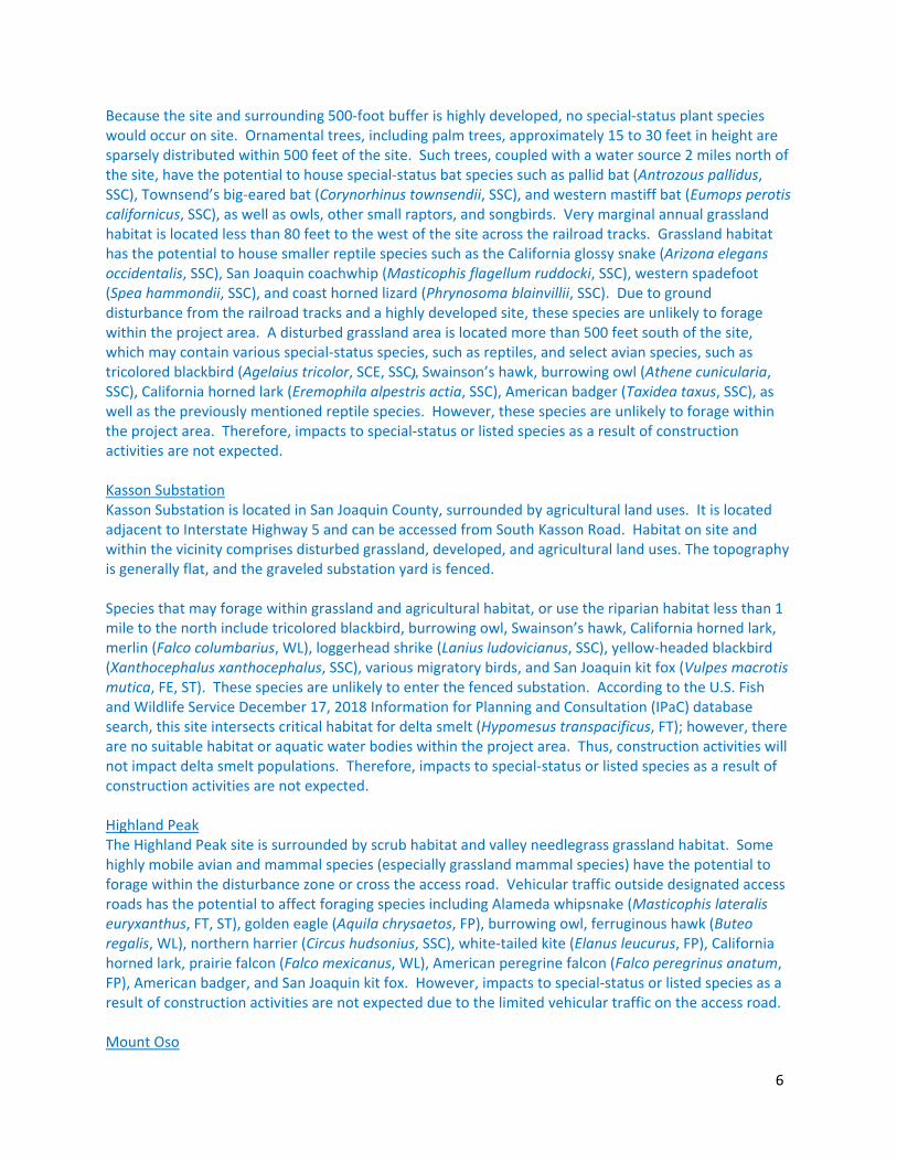
The Mount Oso site is surrounded by grassland habitat and sparse, tall, native trees. The site contains very marginal grassland habitat. Some highly mobile avian and mammal species (especially grassland reptile and mammal species) have the potential to forage adjacent to or cross the access road, including northern California legless lizard, Alameda whipsnake, coast horned lizard, western spadefoot (Spea hammondii, SSC), California horned lark, American badger, and San Joaquin kit fox. Vehicular traffic outside designated access roads has the potential to affect plant species including red‐flowered bird's‐foot trefoil (Acmispon rubriflorus, 1B.1), large‐flowered fiddleneck (Amsinckia grandiflora, FE, SE, SSC), big tarplant (Blepharizonia plumose, 1B.1), Lemmon's jewelflower (Caulanthus lemmonii, 1B.2), showy golden madia (Madia radiata, 1B.1), and Mt. Diablo phacelia (Phacelia phacelioides, 1B.2). However, as project activities consist of limited vehicular traffic on the access road and installing an antenna on the substation tower, impacts to special‐status or listed species are unlikely. REFERENCES
California Department of Fish and Wildlife. December 2018. California Natural Diversity Database. Records of Occurrence for U.S. Geological Survey’s Manteca 7.5‐minute topographical quadrangles. Sacramento, CA: California Department of Fish and Game, Natural Heritage Division.
California Department of Fish and Wildlife. December 2018. California Natural Diversity Database. Records of Occurrence for U.S. Geological Survey’s Tassajara 7.5‐minute topographical quadrangles. Sacramento, CA: California Department of Fish and Game, Natural Heritage Division.
California Department of Fish and Wildlife. December 2018. California Natural Diversity Database. Records of Occurrence for U.S. Geological Survey’s Lone Tree Creek, Solyo, and Copper Mountain 7.5‐minute topographical quadrangles. Sacramento, CA: California Department of Fish and Game, Natural Heritage Division.
California Department of Fish and Wildlife. December 2018. California Natural Diversity Database. Records of Occurrence for U.S. Geological Survey’s Tracy, Union Island 7.5‐minute topographical quadrangles. Sacramento, CA: California Department of Fish and Game, Natural Heritage Division.
California Department of Fish and Wildlife. December 2018. California Natural Diversity Database. Records of Occurrence for U.S. Geological Survey’s Lathrop, Vernalis 7.5‐minute topographical quadrangles. Sacramento, CA: California Department of Fish and Game, Natural Heritage Division.
California Native Plant Society, Rare Plant Program. 2018. Inventory of Rare and Endangered Plants of California (online edition, v8‐03 0.45). Website: http://www.rareplants.cnps.org. Accessed 17 December 2018.
U.S. Department of the Interior, Fish and Wildlife Service. Guidance on the recent M‐Opinion affecting the Migratory Bird Treaty Act. Memorandum. April 11, 2018
U.S. Fish and Wildlife Service. Information, Planning, and Conservation System. http://ecos.fws.gov/ipac. Accessed 17 December 2018.
U.S. Geological Service. Historical Maps. Website: http://historicalmaps.arcgis.com/usgs/. Accessed: December 17, 2018.
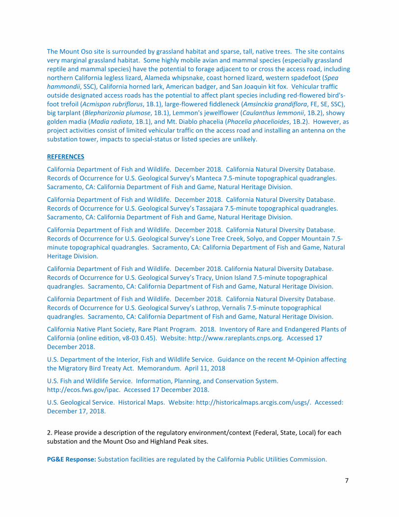
2. Please provide a description of the regulatory environment/context (Federal, State, Local) for each substation and the Mount Oso and Highland Peak sites.
PG&E Response: Substation facilities are regulated by the California Public Utilities Commission.
8
The microwave tower on Mount Oso is owned by PG&E. The location is in an unincorporated area of Stanislaus and is zoned General Agricultural. All surrounding land uses in the area are also zoned General Agricultural.
The microwave tower on Highland Peak is owned by Contra Costa County. Highland Peak is located in Contra Costa County, approximately 9 miles east of the City of San Ramon. The location is zoned Exclusive Agricultural.
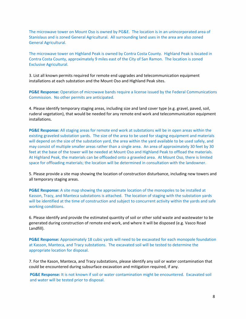
3. List all known permits required for remote end upgrades and telecommunication equipment installations at each substation and the Mount Oso and Highland Peak sites.
PG&E Response: Operation of microwave bands require a license issued by the Federal Communications Commission. No other permits are anticipated.
4. Please identify temporary staging areas, including size and land cover type (e.g. gravel, paved, soil, ruderal vegetation), that would be needed for any remote end work and telecommunication equipment installations.
PG&E Response: All staging areas for remote end work at substations will be in open areas within the existing graveled substation yards. The size of the area to be used for staging equipment and materials will depend on the size of the substation yard, the area within the yard available to be used safely, and may consist of multiple smaller areas rather than a single area. An area of approximately 30 feet by 30 feet at the base of the tower will be needed at Mount Oso and Highland Peak to offload the materials. At Highland Peak, the materials can be offloaded onto a graveled area. At Mount Oso, there is limited space for offloading materials; the location will be determined in consultation with the landowner.
5. Please provide a site map showing the location of construction disturbance, including new towers and all temporary staging areas.
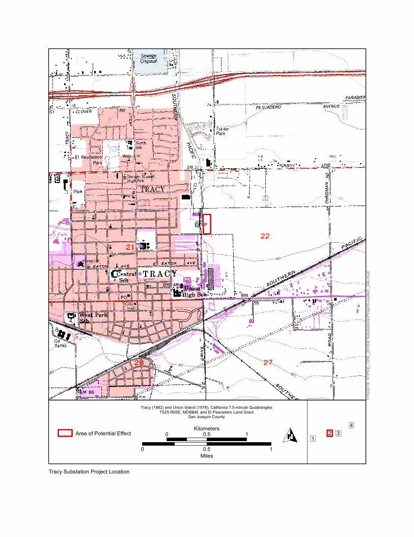
PG&E Response: A site map showing the approximate location of the monopoles to be installed at Kasson, Tracy, and Manteca substations is attached. The location of staging with the substation yards will be identified at the time of construction and subject to concurrent activity within the yards and safe working conditions.
6. Please identify and provide the estimated quantity of soil or other solid waste and wastewater to be generated during construction of remote end work, and where it will be disposed (e.g. Vasco Road Landfill).
PG&E Response: Approximately 18 cubic yards will need to be excavated for each monopole foundation at Kasson, Manteca, and Tracy substations. The excavated soil will be tested to determine the appropriate location for disposal.
7. For the Kason, Manteca, and Tracy substations, please identify any soil or water contamination that could be encountered during subsurface excavation and mitigation required, if any.
PG&E Response: It is not known if soil or water contamination might be encountered. Excavated soil and water will be tested prior to disposal.
9
Utilities and Service Systems
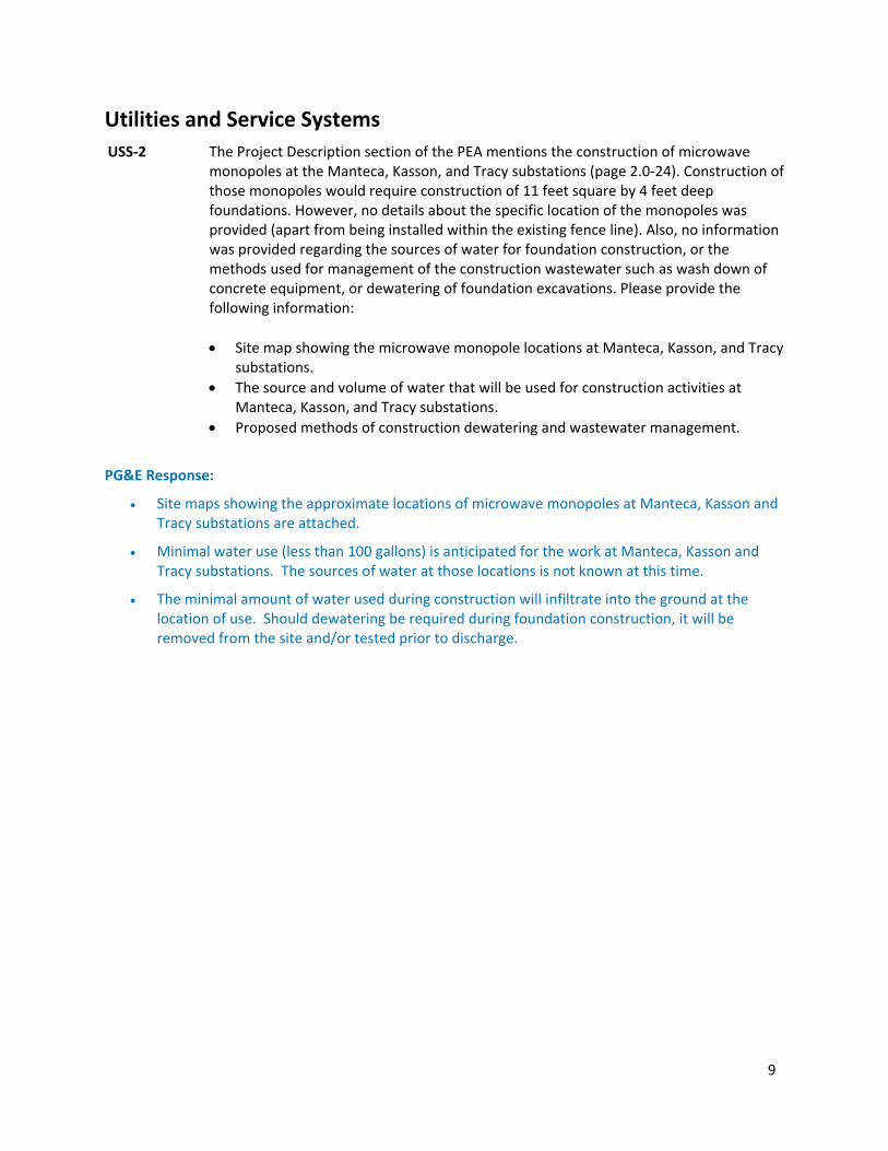
USS‐2 The Project Description section of the PEA mentions the construction of microwave monopoles at the Manteca, Kasson, and Tracy substations (page 2.0‐24). Construction of those monopoles would require construction of 11 feet square by 4 feet deep foundations. However, no details about the specific location of the monopoles was provided (apart from being installed within the existing fence line). Also, no information was provided regarding the sources of water for foundation construction, or the methods used for management of the construction wastewater such as wash down of concrete equipment, or dewatering of foundation excavations. Please provide the following information:
Site map showing the microwave monopole locations at Manteca, Kasson, and Tracy substations.
The source and volume of water that will be used for construction activities at Manteca, Kasson, and Tracy substations.
Proposed methods of construction dewatering and wastewater management.
PG&E Response:
Site maps showing the approximate locations of microwave monopoles at Manteca, Kasson and Tracy substations are attached.
Minimal water use (less than 100 gallons) is anticipated for the work at Manteca, Kasson and Tracy substations. The sources of water at those locations is not known at this time.
The minimal amount of water used during construction will infiltrate into the ground at the location of use. Should dewatering be required during foundation construction, it will be removed from the site and/or tested prior to discharge.

21
FO
LD
3 4 5
FO
LD
6 7 8
FO
LD
9 10
21
FO
LD
3 4 5
FO
LD 6 7 8
FO
LD
9 10
A
B
FOLD
FOLD
C
FOLD
D
E
B
FOLD
FOLD
C
FOLD
D
E
DR
AWI
NG
NU
MB
ER
A
ETEC4S (44x34)
SECTION
A
120'-0"
95'-0"
C\ B\ A\A\ B\ C\
0 20
SCALE: 1/8" = 1'-0"
60 FT40
PR
OF
VI
EW
PROFVIEW
NOTE:
TSP WITHIN THE YARD.
DO NOT REFLECT THE ACTUAL LOCATION OF THE TOWER OR THE
IN RELATION TO THE SUBSTATION EQUIPMENT IN THE PROFILE AND
MICROWAVE TOWER AND TSP ARE SHOWN TO DEPICT THEIR HEIGHT1.
TSP 0/2 C
85'-0"
CTOWER
MICROWAVE
RA
ST
ER:
NO
NE .
VE
CT
OR:
PR
OVI
EW
WO
TB.dgn
CA
D
US
ER:
A4
T0
DA
TE: 01-25-19
ENVIRONMENTAL VISION122118
PG&E Vierra Reinforcement Project
Visual Simulation of Proposed Project
Figure 3.1-3b Visual Simulation from D’Arcy Parkway

Area of Potential Effect
Midway, California 7.5-minute Quadrangle, 1981T02S R03E, T02S R04E, T03S R03E and T03S R04E MDB&M
Alameda and San Joaquin Counties
0 0.5 1Kilometers
0 0.5 1Miles
34
12
1/10/2
019
H:\PG
E_CR
S_20
19\6
Subs
tation
s\Proj
ectLo
catio
n_24
k.mxd
O
Tesla Substation Project Location
Area of Potential Effect
Tracy (1982) and Union Island (1978), California 7.5-minute QuadranglesT02S R05E, MDB&M, and El Pescadero Land Grant
San Joaquin County
0 0.5 1Kilometers
0 0.5 1Miles
34
12
1/10/2
019
H:\PG
E_CR
S_20
19\6
Subs
tation
s\Proj
ectLo
catio
n_24
k.mxd
O
Tracy Substation Project Location

Area of Potential Effect
Lathrop (1978) and Vernalis (1980), California 7.5-minute QuadranglesT02S R05E and T02S R06E MDB&M, and El Pescadero Land Grant
San Joaquin County
0 0.5 1Kilometers
0 0.5 1Miles
34
12
1/10/2
019
H:\PG
E_CR
S_20
19\6
Subs
tation
s\Proj
ectLo
catio
n_24
k.mxd
O
Kasson Substation Project Location

Area of Potential Effect
Manteca, California 7.5-minute Quadrangle, 1978T01S R07E and T02S R07E MDB&M
San Joaquin County
0 0.5 1Kilometers
0 0.5 1Miles
34
12
1/10/2
019
H:\PG
E_CR
S_20
19\6
Subs
tation
s\Proj
ectLo
catio
n_24
k.mxd
O
Manteca Substation Project Location
Proposed Locations of Microwave Monopoles (Approximate, Preliminary, and Subject to Change)
Manteca Substation

Proposed Locations of Microwave Monopoles (Approximate, Preliminary, and Subject to Change)
Kasson Substation
Proposed Locations of Microwave Monopoles (Approximate, Preliminary, and Subject to Change)
Tracy Substation