Embed Size (px)
Citation preview
A Toolkit for Assessing Pedestrian Access to Transit
The Last Mile: Can You Get There From Here?Rail-Volution 2010
Tuesday, October 19, 2010, 2-3:30 PM
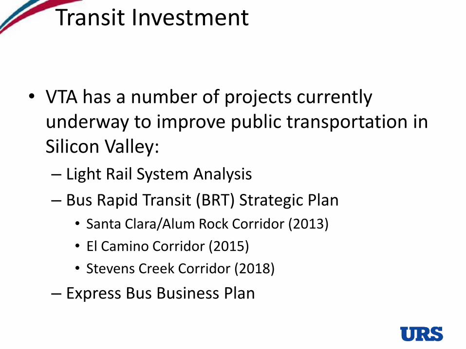
Transit Investment
• VTA has a number of projects currently underway to improve public transportation in Silicon Valley:
– Light Rail System Analysis
– Bus Rapid Transit (BRT) Strategic Plan
• Santa Clara/Alum Rock Corridor (2013)
• El Camino Corridor (2015)
• Stevens Creek Corridor (2018)
– Express Bus Business Plan
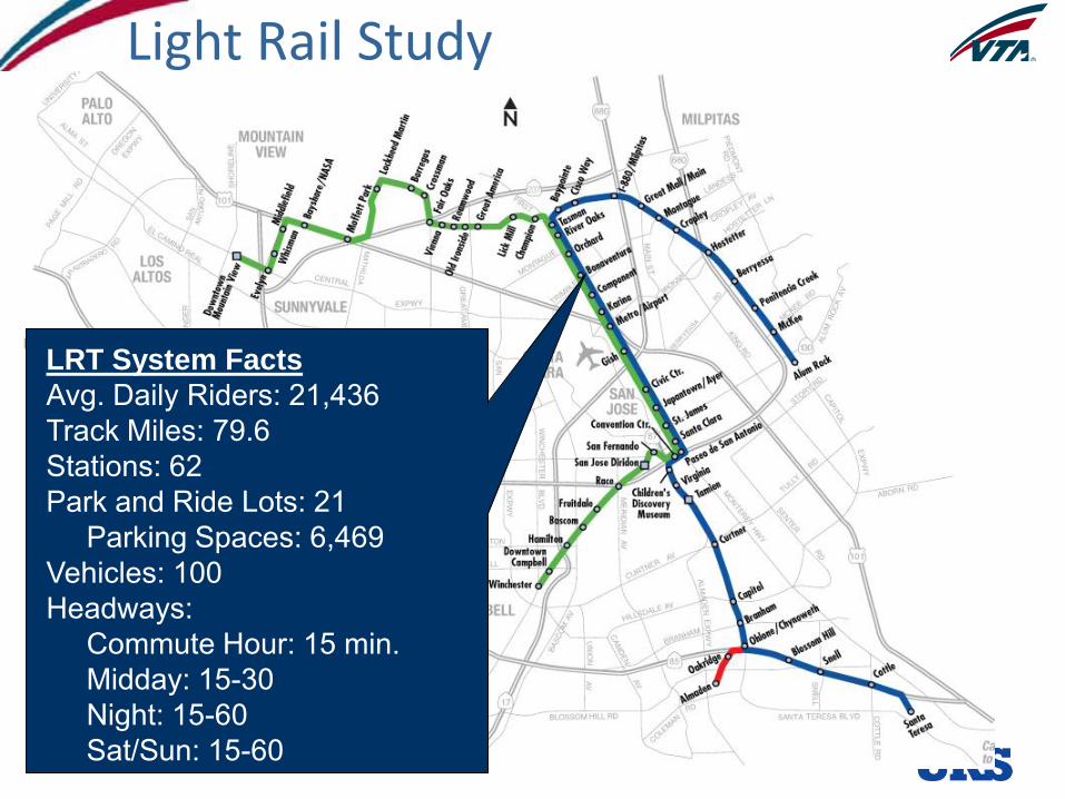
LRT System Facts
Avg. Daily Riders: 21,436Track Miles: 79.6Stations: 62Park and Ride Lots: 21
Parking Spaces: 6,469Vehicles: 100Headways:
Commute Hour: 15 min.Midday: 15-30Night: 15-60Sat/Sun: 15-60
Light Rail Study
4
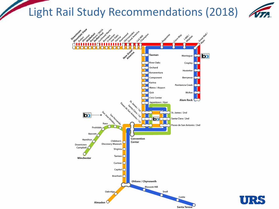
Light Rail Study Recommendations (2018)
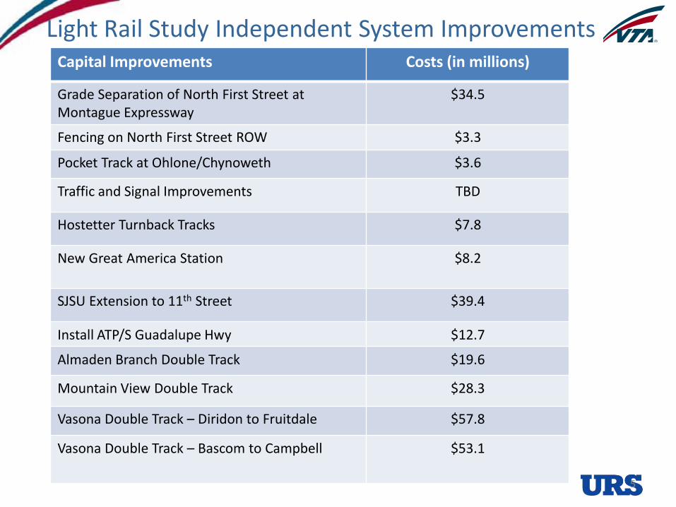
Capital Improvements Costs (in millions)
Grade Separation of North First Street at Montague Expressway
$34.5
Fencing on North First Street ROW $3.3
Pocket Track at Ohlone/Chynoweth $3.6
Traffic and Signal Improvements TBD
Hostetter Turnback Tracks $7.8
New Great America Station $8.2
SJSU Extension to 11th Street $39.4
Install ATP/S Guadalupe Hwy $12.7
Almaden Branch Double Track $19.6
Mountain View Double Track $28.3
Vasona Double Track – Diridon to Fruitdale $57.8
Vasona Double Track – Bascom to Campbell $53.1
5
Light Rail Study Independent System Improvements
6
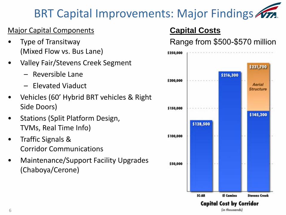
Capital Costs
Range from $500-$570 millionMajor Capital Components
• Type of Transitway(Mixed Flow vs. Bus Lane)
• Valley Fair/Stevens Creek Segment
– Reversible Lane
– Elevated Viaduct
• Vehicles (60’ Hybrid BRT vehicles & Right Side Doors)
• Stations (Split Platform Design,TVMs, Real Time Info)
• Traffic Signals &Corridor Communications
• Maintenance/Support Facility Upgrades (Chaboya/Cerone)
BRT Capital Improvements: Major Findings
7
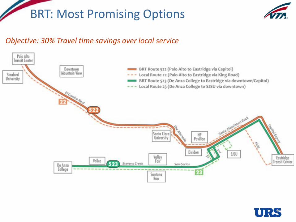
• Map of the two BRT corridors: 522 (including local 22) and 523 (including local 23)
Objective: 30% Travel time savings over local service
BRT: Most Promising Options
8
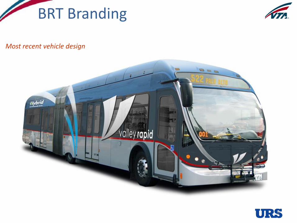
Most recent vehicle design
BRT Branding
Evaluating Pedestrian Access to Transit
Can our passengers reach this great new system safely on foot?
• Primary purpose of evaluation:
– Make sure pedestrians can reach the stops/stations
– Confirm that the stop (and/or station access point) is in the right place
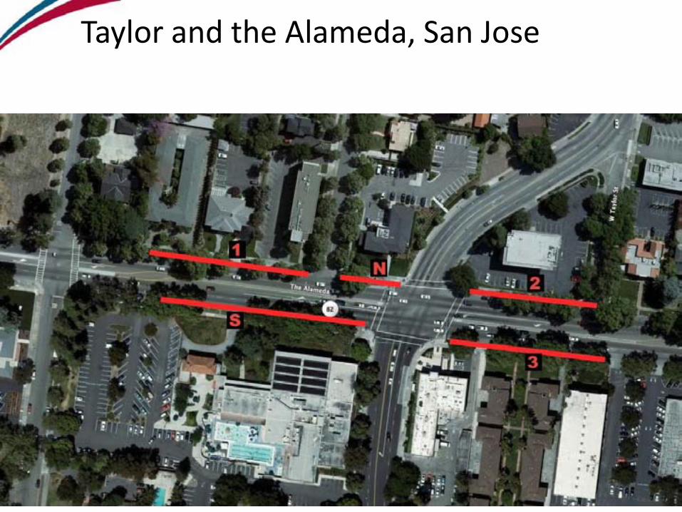
Taylor and the Alameda, San Jose
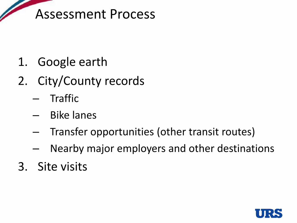
Assessment Process
1. Google earth
2. City/County records
– Traffic
– Bike lanes
– Transfer opportunities (other transit routes)
– Nearby major employers and other destinations
3. Site visits
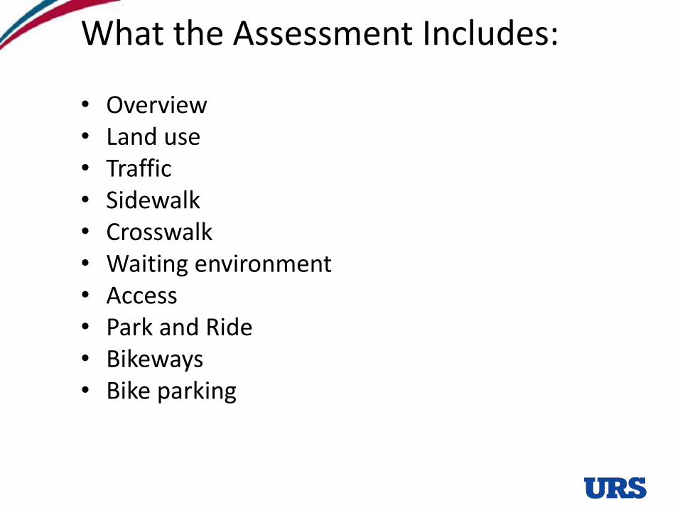
What the Assessment Includes:
• Overview• Land use• Traffic• Sidewalk• Crosswalk• Waiting environment• Access• Park and Ride• Bikeways• Bike parking
Assessment: Overview
• Existing or proposed
• Transit routes serving stop
• City
• Origin or/and destination bus stops (for commuters)
• Primary street
• Cross street
• Location of stop (near side, far side, or midblock, elevated or at grade)
• Park and Ride lot?
Field observation:
• Distance between directions (split platform for LRT)
Assessment: Land Use
Field observation:
• Types: residential (single, multi-family, etc.), commercial/retail, office, mixed use, industrial (circle all that apply)
– Retail uses % occupied?
• Density (unit, story or level of dev. and type.)
• Building setback (bring measuring tape)
• Pedestrian-oriented (or are the building surrounded with parking and the entries away from the street)?
• Transit supporting land uses (such as cafes, dry cleaners, etc. -- describe)?
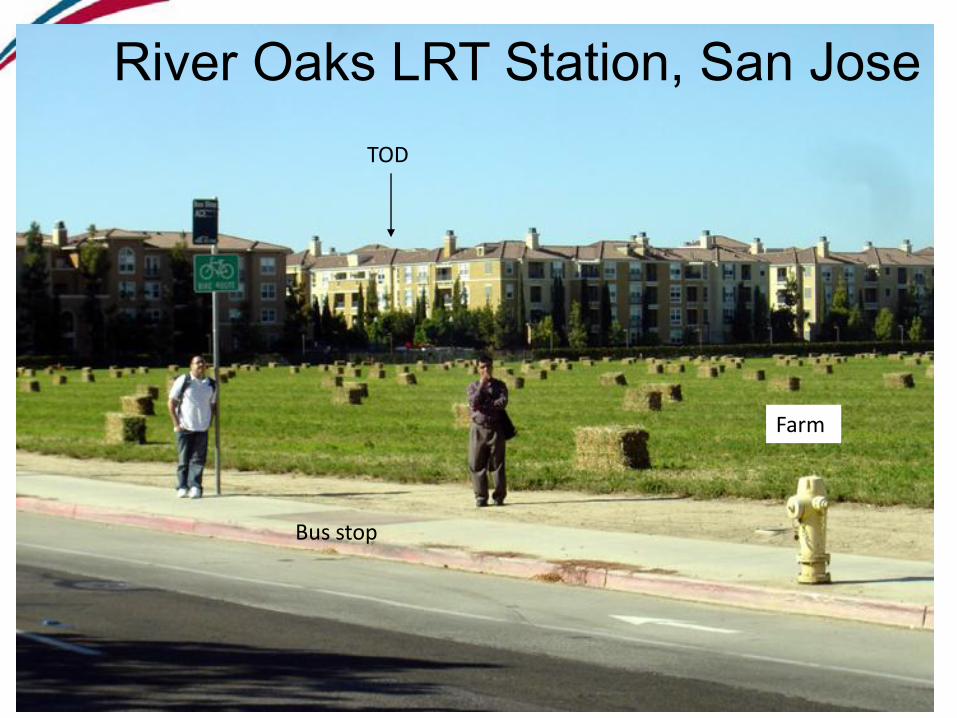
Land use contextTOD
Farm
Bus stop
River Oaks LRT Station, San Jose

Land use context
My office
Sea of Parking
Farm
River Oaks LRT
Assessment: Traffic
Check city/county records:
• Traffic volume
• Speed limit
• Type of street: local, collector, arterial
Field observations:
• Confirm # of lanes
• Additional comments
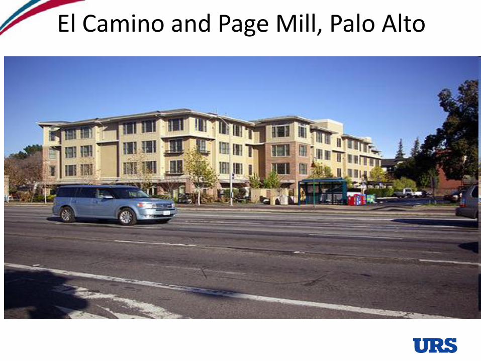
El Camino and Page Mill, Palo Alto
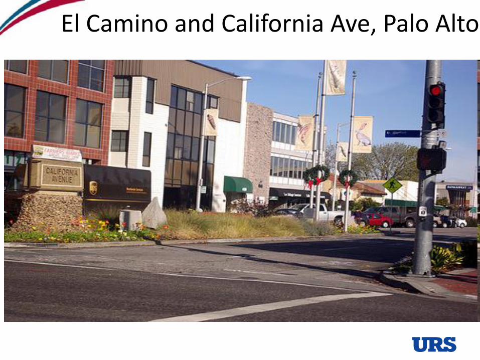
El Camino and California Ave, Palo Alto
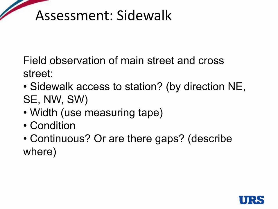
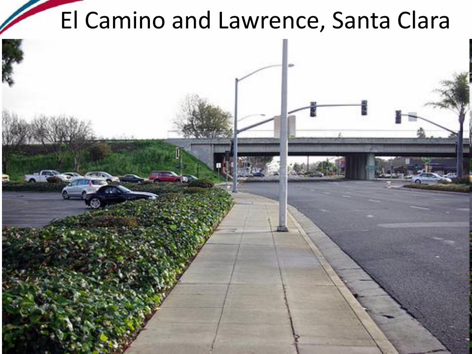
Assessment: Sidewalk
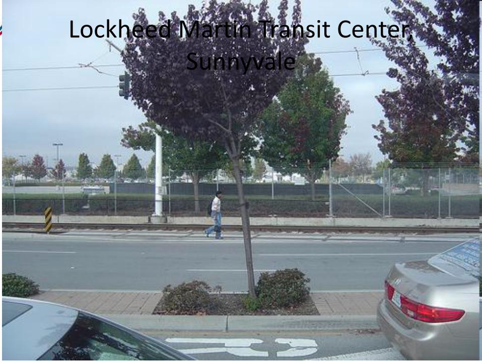
Field observation of main street and cross street:• Sidewalk access to station? (by direction NE, SE, NW, SW)• Width (use measuring tape)• Condition• Continuous? Or are there gaps? (describe where)
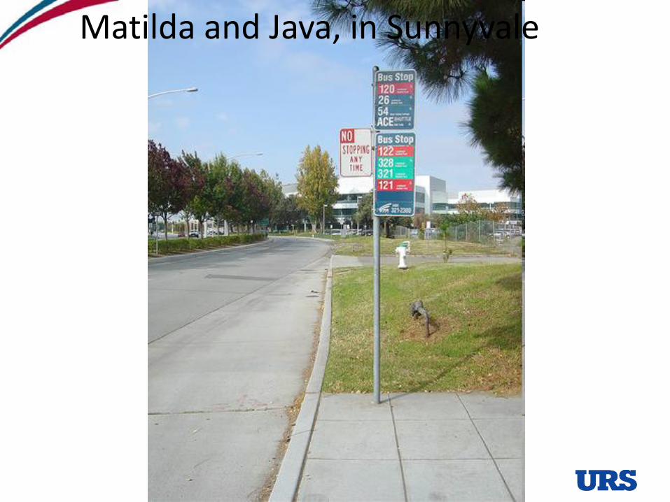
Matilda and Java, in Sunnyvale
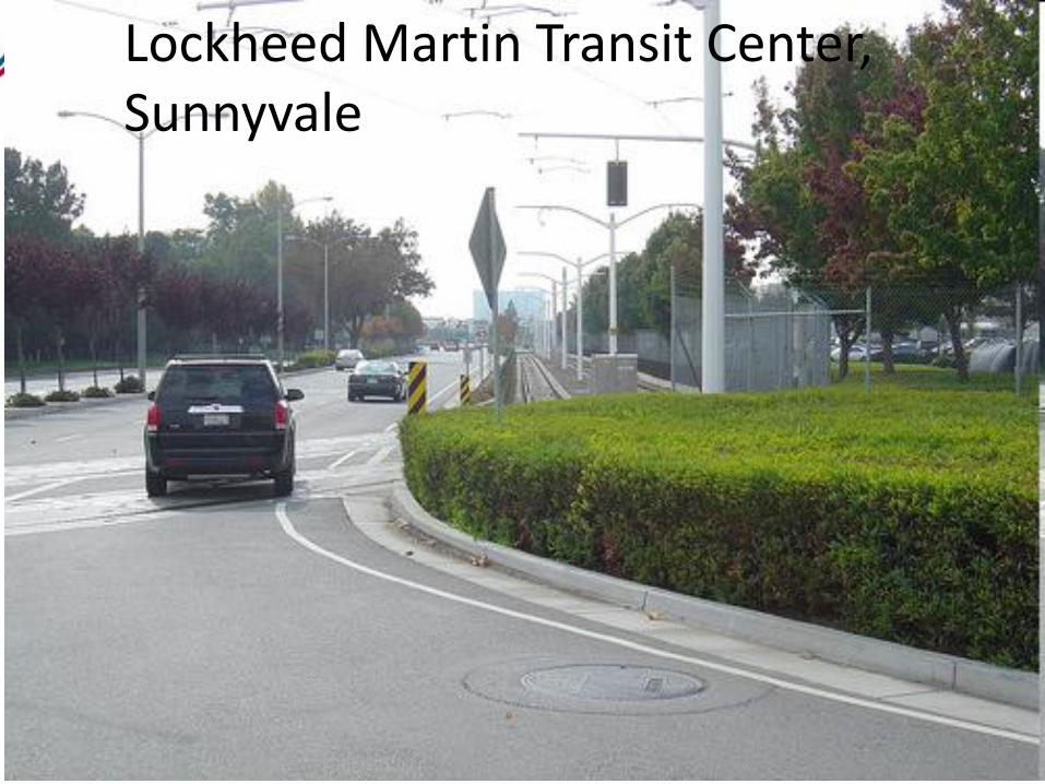
Lockheed Martin Transit Center, Sunnyvale
Lockheed Martin Transit Center, Sunnyvale
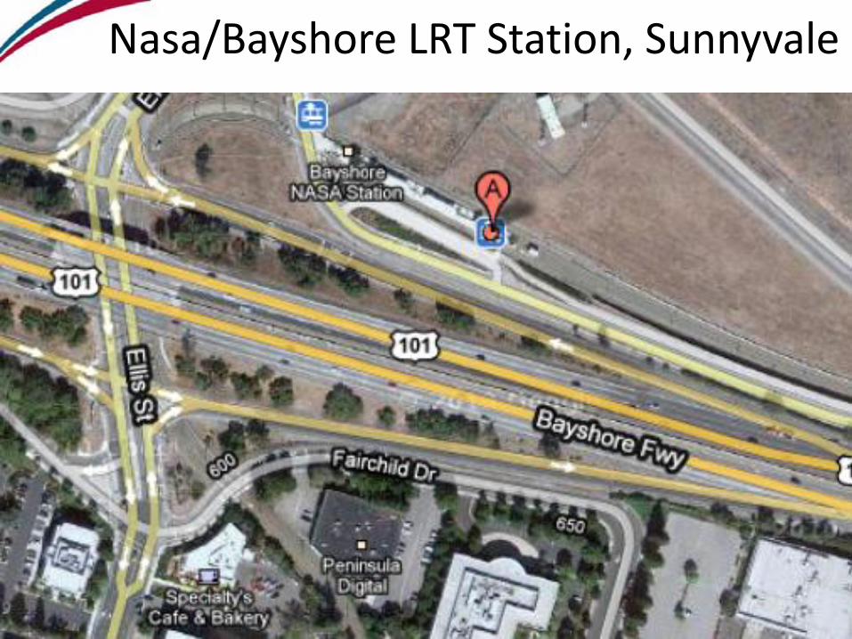
Nasa/Bayshore LRT Station, Sunnyvale
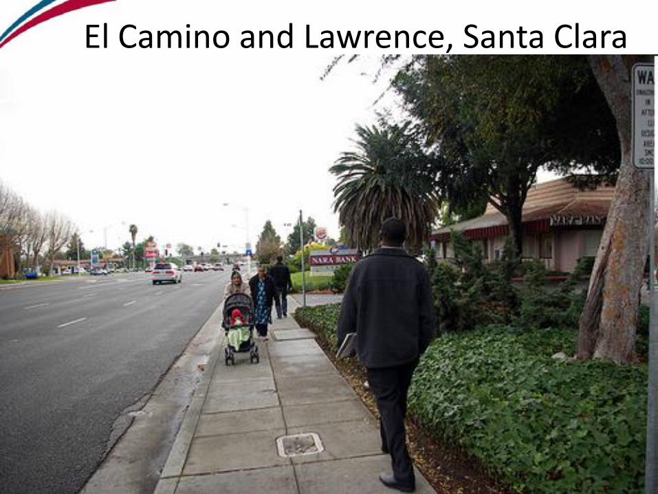
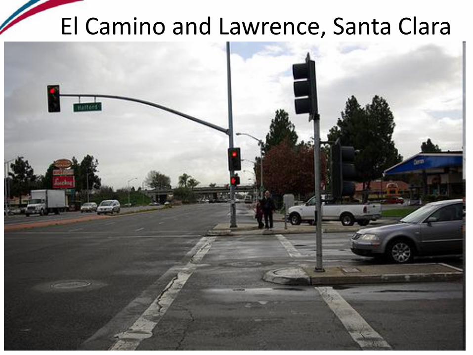
El Camino and Lawrence, Santa Clara
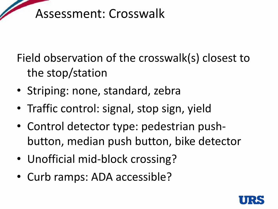
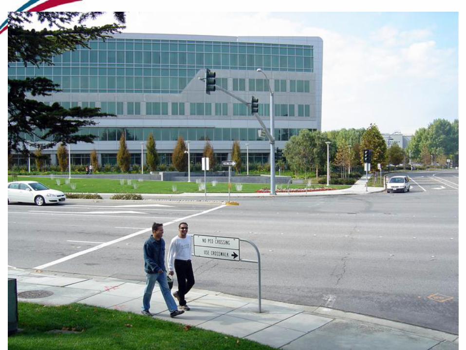
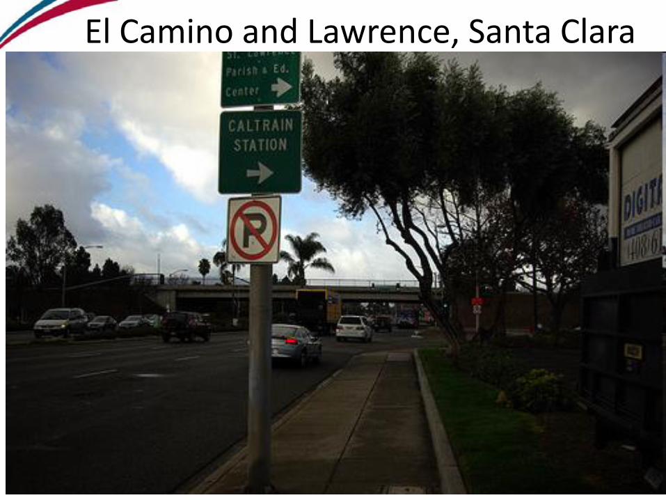
Assessment: Crosswalk
Field observation of the crosswalk(s) closest to the stop/station
• Striping: none, standard, zebra
• Traffic control: signal, stop sign, yield
• Control detector type: pedestrian push-button, median push button, bike detector
• Unofficial mid-block crossing?
• Curb ramps: ADA accessible?
Land use context
El Camino and Lawrence, Santa Clara
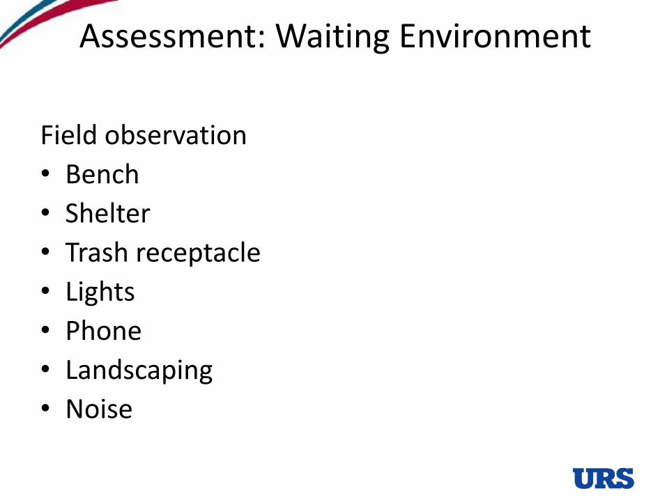
Assessment: Waiting Environment
Field observation
• Bench
• Shelter
• Trash receptacle
• Lights
• Phone
• Landscaping
• Noise
El Camino and Lawrence, Santa Clara
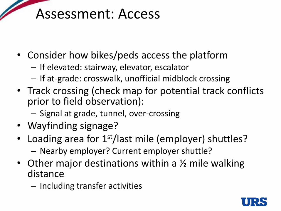
Assessment: Access
• Consider how bikes/peds access the platform– If elevated: stairway, elevator, escalator– If at-grade: crosswalk, unofficial midblock crossing
• Track crossing (check map for potential track conflicts prior to field observation):– Signal at grade, tunnel, over-crossing
• Wayfinding signage?• Loading area for 1st/last mile (employer) shuttles?
– Nearby employer? Current employer shuttle?
• Other major destinations within a ½ mile walking distance– Including transfer activities
El Camino and Lawrence, Santa Clara
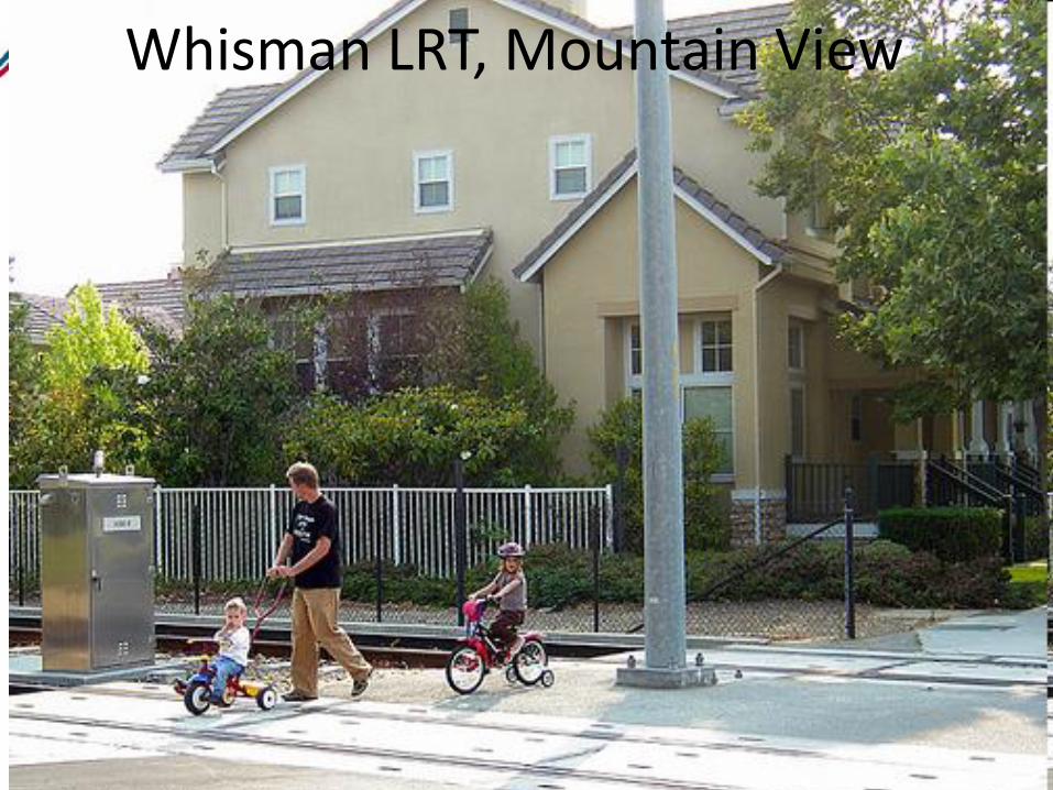
Whisman LRT, Mountain View
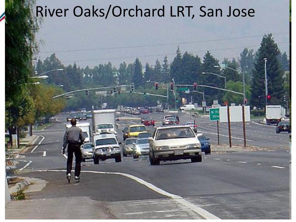
River Oaks/Orchard LRT, San Jose
Assessment: Park and Ride
• How does the stop/station connect with the Park and Ride lot
– Cross the street, cross the parking lot, walk through tunnel, go up/down stairs, cross an overpass
– Number of parking spaces?
– Occupancy %
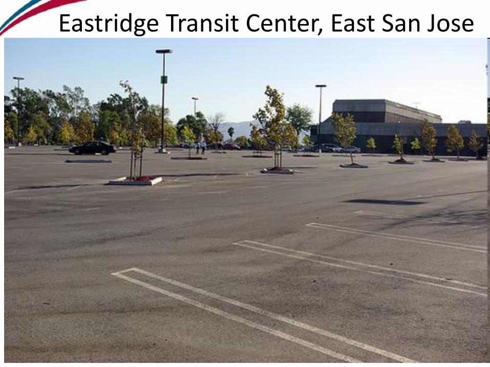
Eastridge Transit Center, East San Jose
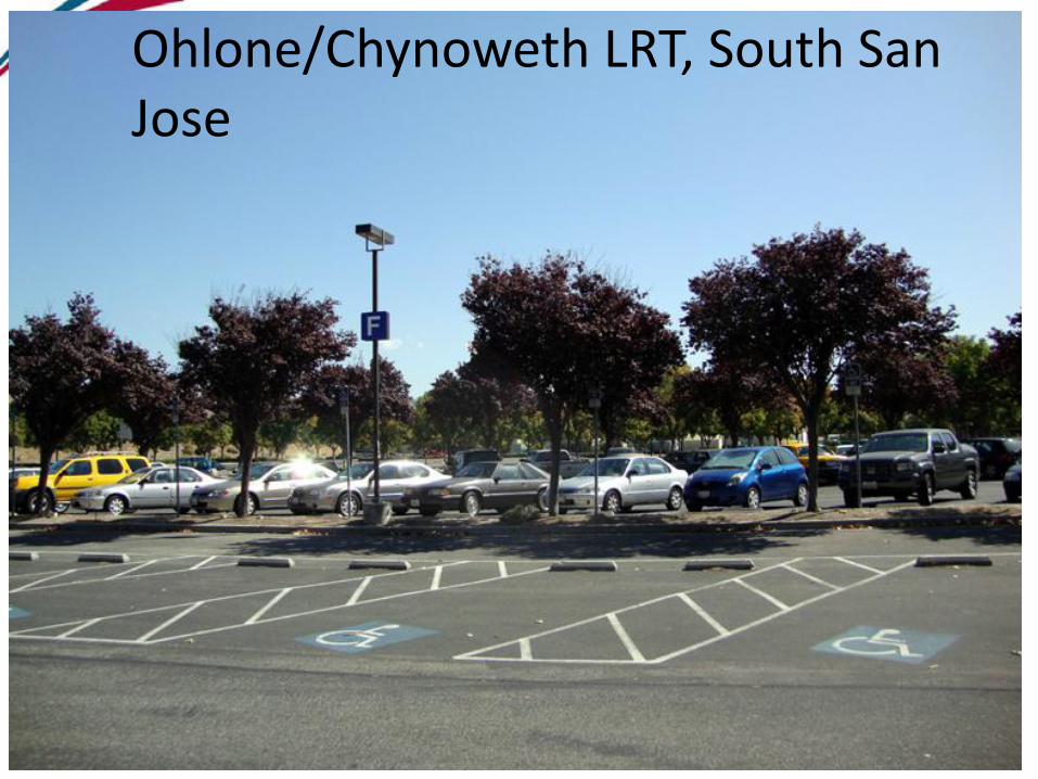
Ohlone/Chynoweth LRT, South San Jose
Assessment: Bikeways
• Street and cross street
– Bike lane, bike route, none
– Direction: NE, SE, NW, SW, All
– If none, shoulder width of 5-8 feet? (enough to accommodate a bike outside the traffic lane?
• Connectivity
– Near bike path/trails?• What trail?
• Nearest across barrier connection: railroad at grade, tunnel/undercrossing, bridge/overcrossing
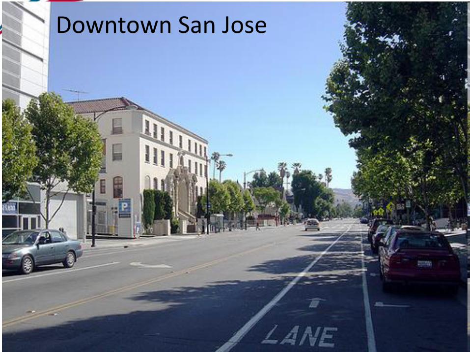
Downtown San Jose
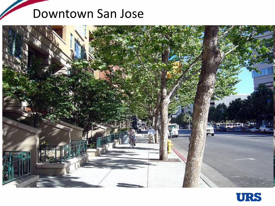
Downtown San Jose
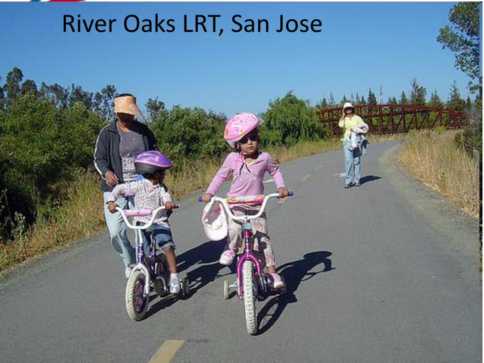
River Oaks LRT, San Jose
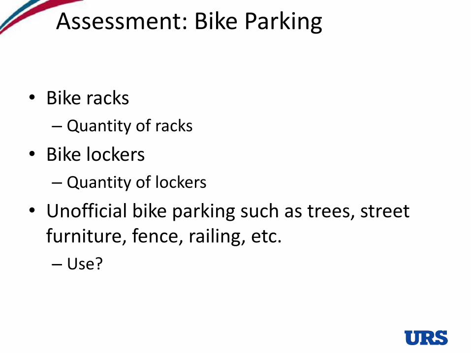
Assessment: Bike Parking
• Bike racks
– Quantity of racks
• Bike lockers
– Quantity of lockers
• Unofficial bike parking such as trees, street furniture, fence, railing, etc.
– Use?
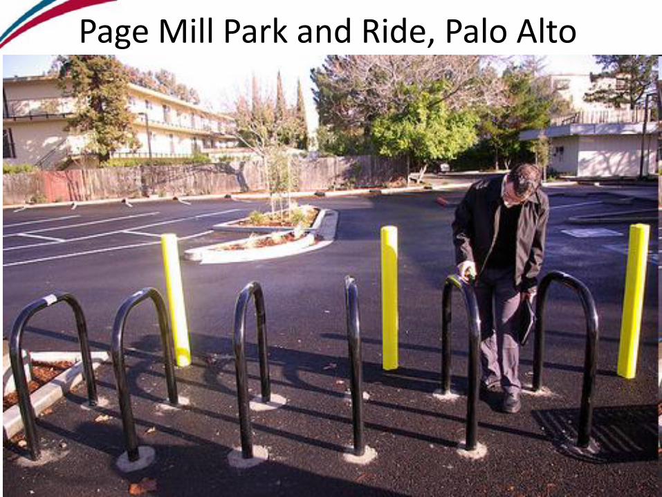
Page Mill Park and Ride, Palo Alto
44
• Follow us on Facebook at “VTA Planning”
• Follow us at twitter.com/vtaplanning
• Subscribe to our YouTube channel at www.youtube.com/user/SCVTA
Thank you!


![Volution, Fashion & Semiotics · Chapter 3: The Volution & Fashion 15 [The Volution in Fashion land] Chapter 4: The Volution & Semiotics 29 [You Can walk the (cat)walk but can you](https://img.pdfslide.net/doc/110x75/5f02118a7e708231d4026a98/volution-fashion-chapter-3-the-volution-fashion-15-the-volution-in.jpg)