Embed Size (px)
Citation preview

T h e I n s t i t u t e o f N a v i g a t i o n • 8 5 5 1 R i x l e w L a n e , S u i t e 3 6 0 • M a n a s s a s , V i r g i n i a 2 0 1 0 9
ION GNSS 2012 continued on page 20
ION GNSS 2012 - Back tO NaShvIlle, teNNeSSee
Newsletter
InsIdePresident’s Report: ..............................2
2012–2014 Satellite Division
Officers Nominated .............................3
ION Mini-Urban Challenge ..................4
Robotic Lawn Mower Competition .......6
Satelite Division - China ......................8
From the ION Historian .....................10
JNC 2012 ...........................................12
GNSS Program Updates ......................14
NASA Funds GNSS Bi-STATIC ..............15
Defense Matters ................................16
Corporate Profile ..............................17
New ION Corporate Members ............17
Navigation Novelties ..........................18
ION Calendar .....................................19
Pacific PNT ........................................21
Section News and Notes .....................23
ION GNSS 2012 ShareS the aIrwaveS wIth MuSIc cIty uSa
follow, augmented by a commercial exhibition with more than 70 exhibiting companies and organizations.
It is, as the late Ed Sullivan would say, “a really big show!” So, let’s deconstruct the weeklong event a bit and see what its constituent elements have to offer.
The PlenaryEven the broadening of the world’s largest and oldest satellite navigation conference from GPS to GNSS does not get its arms entirely around the scope of the ION event's content. Nowhere does this fact appear more promi-nently than in the plenary session, overseen by Satellite Division Chair Dr. John Raquet, General Chair Dr. Dorota Grejner-Brzezinska, and Program Chair Dr. Jade Morton.
Four speakers will share their insights into the present and future of Positioning, Navigation, and Timing (PNT): Tony Thelen,
Volume 22, Number 2 The Quarterly Newsletter of The Institute of Navigation Summer 2012
Navigation will share the stage with the center of American country music
as the ION GNSS 2012 conference returns to Nashville, Tennessee, September 17–21 — a dozen years after the event’s last appearance here.
And satellite navigation will be singing some new tunes and listening to a much larger chorus, as three robust GNSS programs have emerged to join the Global Positioning System in the interim. Indeed, in 2000 the Institute’s Satellite Division’s leading
conference was still known as ION GPS, Russia’s now restored GLONASS system was still in decline, Europe’s Galileo was in its infancy, and China’s Compass (BeiDou-2) was a mere glimmer in the eyes of the rising nation’s scientific and political leaders.
Following two days of tutorials (with 24 separate courses) and subcommittee and plenary sessions of the Civil GPS Service Interface Committee (CGSIC), the conference will open with a Tuesday evening plenary session under the theme, “Modern Navigation Serving the Information Society.” Three days of technical sessions and panel discussions
Nas
hvill
e im
age
cour
tesy
of
Nas
hvill
e Co
nven
tion
& V
isito
rs B
urea
u

IONNewsletter 2 Summer2012
FrOM the ION PreSIdeNt
dr. tOdd walter
ION REACHES OUT�From�Guangzhou�to�Colorado�Springs�andD.C.�to�Dayton�—�now�on�to�Nashville!
A large audience of GNSS professionals turned out for the Third Chinese Satellite
Navigation Conference in Guangzhou during May, eager to participate in the development of Compass and GNSS applications.
I had the opportunity to speak at the plenary session and, along with the other speakers, was asked a wide variety of questions from the programmatic to the deeply technical. I enjoyed interacting with so many highly motivated engineers. The enthusiasm for satellite navigation in China was infectious.
Prior to the conference, I also participated in a panel discussion on GNSS and PNT that was hosted by the ION’s Satellite Division. My thanks to Dr. Hunter Ding and Dr. Jade Morton for organizing this associated event in Guangzhou.
The ION Satellite Division’s graduate level Robotic Lawn Mower Competition hosted 12 teams that competed the first weekend in June. Students from this year’s winning team,
Wright State University in Ohio, will present a paper on their winning robotic lawn mower at ION GNSS 2012 in September. (Story on page 6.)
Many thanks to Mark Smearcheck, who served as Competition Chair; the Dayton Section members who worked countless
hours as volunteers; and the competition’s industry sponsors (AFRL, Honeywell, John Deere, Joint Services Data Exchange and Northrop Grumman) for making this competition possible.
The 2012 Mini-Urban Challenge (MUC) competition concluded with the national finals at the Smithsonian’s National Museum of American History, with the support of the Lemelson Center for the Study of Invention and Innovation.
Thank you to competition co-chairs USAF Capts. Caroline New and Casey Miller as well as all the local D.C. Section volunteers who helped support the May 26 event. Volunteers participated in coordination, publicity, judging and mentoring of student teams. (Story on page 4.)
The JSDE/ION Joint Navigation Conference attendees were drawn to Colorado Springs, Colorado, in June for expanded technical program and a dynamic warfighter panel discussion. Congratulations to the organizers on a successful event. Thank you to the hard-working members of the Joint Navigation Conference Executive Committee for hosting such an impressive DoD/DHS program.
Next year’s JNC conference will be sponsored by the ION’s newly formed Military Division with Jim Doherty as chair. (Story on page 13.)
A reminder: October 15 is the last day to submit Annual Award and Fellow nominations. Please consider submitting nominations for worthy individuals.
ION GNSS 2012 is coming up September 17-21, 2012 in Nashville, Tennessee. Please join us for a dynamic technical program and premiere pre-conference tutorials taught by an elite group of internationally recognized experts. The program is posted on-line at www.ion.org/gnss. You will also find many related meetings, workshops and panel discussions, new product introductions and
The Purpose of The ION®
Foundedin1945,TheInstituteofNavigationistheworld’spremiernon-profit
professionalsocietydedicatedtotheadvancementoftheartand
scienceofpositioning,navigationandtiming.
2012 Executive Committee
President:Dr.ToddWalter
Executive Vice President:Ms.PatriciaDoherty
Treasurer:Dr.FrankvanGraas
Eastern Region Vice President:Mr.DouglasTaggart
Western Region Vice President:Mr.ClydeEdgar
Satellite Division Chair:Dr.JohnRaquet
Military Division Chair:Mr.JamesT.Doherty
Immediate Past President:Dr.MikelMiller
How to Reach The ION®
Telephone:703-366-2723
Facsimile:703-366-2724
Web site:http://www.ion.org
E-mail:[email protected]
The ION® National Office8551 Rixlew Lane, Suite 360
Manassas, VA 20109
The ION® National Office StaffExecutive Director: LisaBeaty
Director of Information Technology:RickBuongiovanni
Director of Membership & Marketing: KennethP.Esthus
Program/Author Liaison/Executive Assistant: MiriamLewis
Meeting Planner: MeganAndrews
Publications: RachelStoker
Graphic Designer: FatimaAlly
Newsletter Editor: GlenGibbons
of course the opportunity to network and meet up with colleagues and friends.
I look forward to seeing you in September. u

IONNewsletter 3 Summer2012
2013 International Technical Meeting
Submit Your Abstract by October 5, 2012!www.ion.org
The Satellite Division Nominating Committee, chaired by Dr. Pratap Misra, has submitted the following
nominations for Satellite Division Officers:
Chair:Dr. Jade Morton, Miami University (Ohio)
Vice Chair:Dr. John Betz, The MITRE CorporationDr. Dorota Grejner-Brzezinska, The Ohio State University
Secretary:Dr. Anthea Coster, MIT Haystack ObservatoryDr. Frank van Diggelen, Broadcom
Treasurer:Dr. Grace Gao, Stanford UniversityDr. Mark Petovello, University of Calgary
Voting for the ION Satellite Division Officers takes place online through the ION website. An online ballot will be available on July 16. ION members eligible to vote in this election will receive e-mail notification with a link to the election webpage when voting is open. Completed ballots must be received at the ION office by August 10, 2012 in order to be counted.
Election results will be announced during ION GNSS 2012, the 25th International Technical Meeting of the ION Satellite Division, being held September 17-21, 2012, in Nashville, Tennessee. The newly elected officers will take office on September 21, 2012, at the conclusion of the meeting and will serve for two years. Election results will be reported in the ION Newsletter.
2012–2014 SatellIte dIvISION OFFIcerS NOMINated
SUBMIT YOUR ABSTRACTS BY OCTOBER 5, 2012!
www.ion.org
January 28-30, 2013 Plenary Session
Exploring the Frontiers of Navigation Unique & Exciting New Uses of
Navigation Technologies
Catamaran Resort Hotel • San Diego, California
The Institute of Navigation

IONNewsletter 4 Summer2012
Excitement ran high on May 26 as 10 student teams from high schools across
the United States competed for a grand prize of $2,500 in The Institute of Navigation’s 2012 Mini-Urban Challenge (MUC).
The annual event challenges teams to use a LEGO kit to build a robotic vehicle that can navigate a 420-square-foot competition course, stopping at locations assigned on the day of the race while obeying street signs and speed limits. Teams also have to explain their work in a short technical presentation to the judges.
After hours of intense competition, team “Legotron” from South Miami High School in Miami, Florida, emerged victorious, claiming both first place and the prize for Best Presentation. Finishing a close second was South Miami High School’s team “305.” Perry High School from Perry, Ohio took third place. Best in Show went to West High School from Torrance, California, who created an autonomous ambulance complete with working siren.
This was the fourth year for ION's com-petition, co-sponsored by the United States Air Force Research Laboratory. This year’s finals were held at the Smithsonian’s National
Museum of American History, with the sup-port of the Lemelson Center for Invention and Innovation.
The 2012 contest increased 25 percent in size from the 2011 MUC, with 80 high schools and more than 700 participants at regional contests in Florida, California, Ohio, Louisiana, and Virginia/Maryland/D.C.
Each team of young engineers used a donated LEGO Mindstorms NXT kit for their creations. The kits include a 32-bit micro-processor, interactive servomotors, built-in rotation sensors to align speed for precise control, and a variety of optional sensors, including a color light sensor, black and white light sensor, sonar sensor, touch
sensor, and sound sensor.Up to ten students may form
a team and enter their regional contest. Students spend the en-tire school year on the robotic vehicles, working with their own teachers and engineers from their community who serve as mentors. The top two winning teams from each regional competition advance to the national competition.
The MUC challenges stu-dents in problem solving, optimization theory, code writing, path planning,
create, BuIld, INveNt
ION Mini-Urban Challenge Encourages Teenage Engineers
National Competition Grand Prize Wining Team, "Legotron" South Miami High School, Miami, Florida and ION's MUC staff
IONNewsletter 5 Summer2012
Track the competition all year at
www.MiniUrbanChallenge.com Follow us on Facebook – ION Mini-Urban Challenge
technical speaking, vehicle design, efficient programming, and test and evaluation planning.
For 29 percent of participants, the MUC marks their first experience in working with robotics, and 68 percent indicated that they were extremely interested in pursuing a career in robotics after their MUC experience.
The MUC strives to include groups that historically get less exposure to the STEM fields of science, technology, engineering, and math. The 2012 competition included 19 percent female and more than 40 per-cent non-Caucasian participants.
The MUC is further motivated by Presi-dent Obama’s request of the National Acad-emy of Sciences and the National Academy of Engineering, to “think about new and creative ways to engage young people in
science and engineering, like science festivals, robotics competitions, and fairs that encour-age young people to create, build, and invent – to be makers of things.”
Interested in mentoring future engi-neers? Would your company like to sponsor a team? Know a high school student who is intrigued by robotics?
The 2013 Mini-Urban Challenge opens for entries this September. More information: <www.miniurbanchal-lenge.com> or contact Carrie New, <[email protected]>.
Thank You!The ION and the MUC would like to extend our sincere gratitude to the Smithson-ian’s National Museum of American History and the Lemelson Center for Inven-tion and Innovation for their
continued support of the competition, and the competition’s donors. Our deep appre-ciation also goes out to all of the regional and national competition volunteers who put in long hours to ensure the success of this excellent educational program for high school students. u
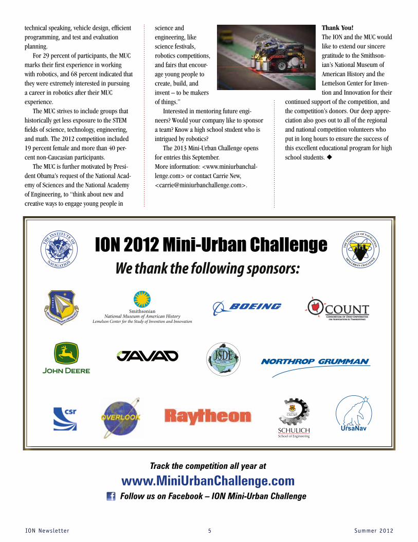
ION 2012 Mini-Urban Challenge

6 Summer2012
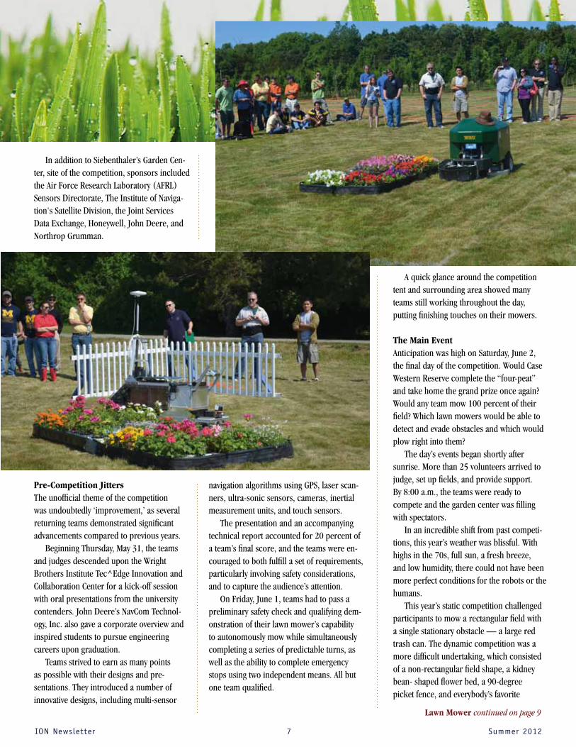
Eleven teams participated in the Ninth Annual Institute of Navigation Robotic
Lawn Mower Competition in June in an attempt to once again dethrone the defending champion, Case Western Reserve University.
This year’s competition was as fierce as ever, with more than $35,000 in prize money available for winners at the annual event held in Beavercreek, Ohio near Wright-Patterson Air Force Base.
In the dynamic competition, Wright State University earned the Grand Prize of $15,000, mowing their field nearly completely, without a single obstacle strike or restart. They really put on a show in their hometown, fulfilling the potential they had displayed in previous years. It was a nearly flawless performance from last year’s third place finisher, and they even tra-versed the tricky flower bed obstacle multiple times, a “victory lap” as some called it.
Second place and $10,000 was awarded to Miami University who would have given Wright State a run for their money had they
not been forced to use an early restart on what they admitted was a preparation oversight.
Third place and $5,000 was awarded to Case Western Reserve University who cut a significant percentage of the field but was ultimately doomed by obstacle collisions from an ornery robot.
The static competition was a close race, but the California State University, Fullerton earned first place and $2,500. They may have had a more convincing victory with their smooth-mowing robot but their LiDAR was pitched too high, mistaking spectators for the static obstacle, and causing confusion for their lawn mower.
Second place, and $1,500, went to new-comer Syracuse University. Syracuse demon-strated resourcefulness in making on-the-fly changes to their design to comply with safety regulations. The University of Michigan, Dear-born returned this year and laid claim to third place and $1,000.
Home ImprovementTop Robo Mower Team from Wright State University Wins $15,000 Prizeby Eric Vinande and Tom Pestak
2012 COMPETITORS
GRAND PRIZE WINNERWright State University
DyNAMIC (ADvANCED) COuRSE TEAMS
Second PrizeMiami University (Ohio)
Third PrizeCase Western Reserve University
STATIC (BASIC) COuRSE TEAMS
FirST PrizeCalifornia State University, Fullerton
Second PrizeSyracuse University*
Third PrizeUniversity of Michigan, Dearborn
DyNAMIC COuRSE ENTRIES
Auburn University
Case Western Reserve University
University of Florida (Team 2)
Miami University (Ohio)
Wright State University
BASIC COuRSE ENTRIES
California State University, Fullerton
University of Florida (Team 1)
University of Michigan, Dearborn
University of North Florida
Southern Polytechnic University*
Syracuse University*
* First time competitor
See you again next year!
www.automow.comGrand Prize Winner, Wright State University
IONNewsletter
IONNewsletter 7 Summer2012
In addition to Siebenthaler’s Garden Cen-ter, site of the competition, sponsors included the Air Force Research Laboratory (AFRL) Sensors Directorate, The Institute of Naviga-tion's Satellite Division, the Joint Services Data Exchange, Honeywell, John Deere, and Northrop Grumman.
Pre-Competition JittersThe unofficial theme of the competition was undoubtedly ‘improvement,’ as several returning teams demonstrated significant advancements compared to previous years.
Beginning Thursday, May 31, the teams and judges descended upon the Wright Brothers Institute Tec^Edge Innovation and Collaboration Center for a kick-off session with oral presentations from the university contenders. John Deere’s NavCom Technol-ogy, Inc. also gave a corporate overview and inspired students to pursue engineering careers upon graduation.
Teams strived to earn as many points as possible with their designs and pre-sentations. They introduced a number of innovative designs, including multi-sensor
navigation algorithms using GPS, laser scan-ners, ultra-sonic sensors, cameras, inertial measurement units, and touch sensors.
The presentation and an accompanying technical report accounted for 20 percent of a team’s final score, and the teams were en-couraged to both fulfill a set of requirements, particularly involving safety considerations, and to capture the audience’s attention.
On Friday, June 1, teams had to pass a preliminary safety check and qualifying dem-onstration of their lawn mower’s capability to autonomously mow while simultaneously completing a series of predictable turns, as well as the ability to complete emergency stops using two independent means. All but one team qualified.
A quick glance around the competition tent and surrounding area showed many teams still working throughout the day, putting finishing touches on their mowers.
The Main EventAnticipation was high on Saturday, June 2, the final day of the competition. Would Case Western Reserve complete the “four-peat” and take home the grand prize once again? Would any team mow 100 percent of their field? Which lawn mowers would be able to detect and evade obstacles and which would plow right into them?
The day’s events began shortly after sunrise. More than 25 volunteers arrived to judge, set up fields, and provide support. By 8:00 a.m., the teams were ready to compete and the garden center was filling with spectators.
In an incredible shift from past competi-tions, this year’s weather was blissful. With highs in the 70s, full sun, a fresh breeze, and low humidity, there could not have been more perfect conditions for the robots or the humans.
This year’s static competition challenged participants to mow a rectangular field with a single stationary obstacle — a large red trash can. The dynamic competition was a more difficult undertaking, which consisted of a non-rectangular field shape, a kidney bean- shaped flower bed, a 90-degree picket fence, and everybody’s favorite
Lawn Mower continued on page 9

IONNewsletter 8 Summer2012
10. “Challenges and Opportunities for GNSS and Location Technology in Mobile Eco-system,” Cormac Conroy, Qualcomm
11. “What is Achievable with the Current COMPASS Constellations?” Maorong Ge, German Research Center for Geosciences
Following the presentation, the panel engaged in a very lively question and answer session with the audience and touched on many topics of interest to the GNSS commu-nity. These ranged from such issues as how Compass can provide international services and the importance of international access to a functional Compass ICD, to the effects of regulatory processes on technology develop-ment and the role of commercial industries in the advancement of GNSS.
3. “Global Positioning System for FAA,” Deborah Lawrence, FAA; Dr. Todd Walter and Dr. Grace Gao, Stanford University
4. “GNSS Interoperability — Status, Benefits, and Opportunities,” Thomas Stansell, Stansell Consulting
5. “International GNSS Monitoring and Assessment System,” Xurong Dong, In-ternational Cooperation Research Center, China Satellite Navigation Office
6. “GNSS International Cooperation in Interference Management,” Weimin Zhen, China Research Institute of Radiowave Propagation
7. “The Use of GNSS and Complementary Technologies to Provide PNT in Hostile Environments,” Steve Duncombe, NovAtel.
8. “Advantages from GNSS Receiver Compat-ible with Beidou,” Shaowei Han, Unicore Communications
9. “Making GPS/GNSS Theory Real,” James Torley, University of Colorado.
The Satellite Division Goes on the Road…TO CHINA!On May 15, 2012, The Institute of
Navigation’s Satellite Division sponsored a cooperative ION/Compass panel during the Chinese Satellite Navigation Conference (CSNC) in Guangzhou, China.
More than 200 enthusiastic Chinese at-tendees participated in the event. The panel was organized and led by Dr. Jade Morton of Miami University (Ohio). who currently serves as vice-chair of the Satellite Division, and Dr. Xianchen “Hunter” Ding, the Satellite Division’s Compass Representative from the Chinese Beidou Management Office. The panel’s presentations covered a wide range of important current topics in GNSS and positioning, navigation, and timing and included the following subjects and speakers: 1. “An Overview of the Purpose of The
Institute of Navigation and Panel Introduction,” Dr. Jade Morton, Miami University (Ohio)
2. “The Modernized GPS Civil Signals,” Dr. Chris Hegarty, The MITRE Corporation
ION Delegates in Guangzhou
ION Delegates and CSNC Organizing Committee in Guangzhou

IONNewsletter 9 Summer2012
During the CSNC conference, David Turner, deputy director of the Office of Space and Advanced Technology at the U.S. Department of State, delivered a keynote presentation titled, “U.S. Update on GNSS Program, Plans, and International Activi-ties.” CSNC-ION panel member and ION president Dr. Todd Walter also spoke at the plenary session on the subject, “Satellite Navigation for Aviation.” Several panel members — including Dr. Jade Morton, Tom Stansell, Maorong Ge, Shaowei Han, and Xurong Dong — also served as session chairs at the event.
In particular, the Satellite Division would like to thank Dr. Ding, who was a gracious host during the panel’s visit. Commenting on the conference’s significance and the ION’s growing ties with the Chinese GNSS program, Dr. Morton noted, “With Com-pass’ rapid progress in recent years, we are anxious to continue our working relation-ship during ION GNSS 2012 this September, when Compass experts will again address the international community.”
Dr. Ding and Dr. Yuanxi Yang, of the China National Administration of GNSS and Applications, and their organized panel of Compass experts and authorities are scheduled to address an ION GNSS 2012 audience on the subject of China’s plans to transition Compass from a regional naviga-tion satellite system to a global system in 2013.
The Compass panel discussion, sched-uled to begin at 8:30 a.m. on September 20 at the Nashville Convention Center, will share recent progress made during the transition effort. We can expect to hear more about such issues as Compass Phase II open signals, BeiDou text messaging, transition from Phase II to III, the benefits and issues of future BeiDou international services, and interoperability and compat-ibility of Compass with other existing and emerging RNSS and GNSS. For more infor-mation see: http://www.ion.org/meetings/session.cfm?meetingID=38&t=P&s=3 u
moving obstacle, Pierre (a stuffed poodle on a remote control truck chassis).
Multiple teams mowed more than half of the grass and all qualifying teams mowed at least a portion of their field.
Many obstacles were left untouched, as suites of integrated sensors detected them and guided the mowers safely around them. But not always — teams lost points every time their mower struck an obstacle. They could end their cutting run prematurely and continue later if faced with a “misbehaving” mower, but with a significant restart penalty. As has often been the case in past robo-mower contests, many teams struggled with these strategic decisions during the heat of competition.
Going Above and BeyondIn addition to prize money, there was an addi-tional awarding of “achievements” this year. It had not gone unnoticed that many teams were going above and beyond in these competi-tions without being formally recognized. The achievements were awarded as certificates and in most cases presented with gag gifts. Some of the more laudable achievements were: • The SAFETY Dance achievement awarded
to Miami University for their dedication and documentation of safety consider-ations, designs, and operations.
• The Brand Recognition achievement awarded to the University of Florida for their relentless use of polo shirts, paint jobs, and logos throughout the competi-tion.
• The Electrician achievement awarded to the University of North Florida for their clean, secure, and professional wiring job.
• The iPioneer achievement awarded to Auburn University for incorporating next generation technologies (including smart phones) into their design.All told, over 20 achievements were
awarded and may become a hallmark of future competitions.
Distinguished VisitorsUniversity teams presented before a panel of judges from the AFRL and the Air Force Institute of Technology (AFIT) as well as an
audience of students, faculty, sponsors and distinguished visitors.
Neeraj Pujara, chief of the AFRL Sensors Directorate, Reference System Branch provided tremendous support in organizing the competition, securing sponsorship, and arranging for distinguished visitors.
Col. Adam Remaly, Deputy Director of the AFRL Sensors Directorate, kicked off the competition with opening remarks on Thursday, addressed the teams at the start of the competition on Saturday, and distributed the awards at the conclusion of the competition. In his closing remarks, he commended Wright State and California State University, Fullerton on their notable improvements from the previous year, and encouraged all the other teams to get in on the leapfrogging act next year.
Also in attendance was Dr. Michael Deis, director of the AFRL Sensors Directorate .
Wild Ride AheadIn light of many teams’ stellar perfor-mances, the robotic lawnmower judges are already dreaming up ways to make the 10th annual competition even more intense.
Next year will undoubtedly bring excit-ing changes and additions, possibly GPS signal obstructions, incentives for lower cost solutions, or even undisclosed field geometry. No one knows for sure what new challenges are coming, but the 2013 competition is guaranteed to be one wild ride. u
Lawn Mower continued from page 7
For making this
year’s competition a success, special thanks goes out to all the volunteers from the ion's dayton Section.
The 2013 competition is tentatively scheduled to be held May 30-June 1, 2013.
For more information visit www.automow.com

IONNewsletter 10 Summer2012
FrOM the ION hIStOrIaN, MarvIN May
Early GPS SimulationIt All Began on Yuma's Desert Floor
GNSS signal simulators are everywhere today, and their manufacturers
represent a large — and, with expanding numbers of satellite-based systems coming into existence, an increasingly important — part of today's GNSS community.
Growing numbers of manufacturers have entered this market segment, provid-ing navigation product designers and system integrators a wide selection of tools
for design, analysis, test, and evaluation of GNSS-related equipment.
But it wasn’t always so. Before the launch of the Global Positioning System in the 1970s, no need existed for such sophis-ticated satnav analysis and design tools. Using GNSS signal simulators, engineers gain full control over such key variables as satellite availability, signal power levels, Doppler shifts, ephemeris errors, multi-
path fading, ionospheric effects, electro-magnetic interference, and many other phenomena found in real-world GNSS signals.
By simulating the navigation satel-lite signals, one can introduce into a laboratory setting any of these and other phenomena, individually or in scenario-specific combinations, for focused research and development of receiver hardware and software design issues. The following applications for simulators have been particularly important: • side-by-side competitive evaluations • testing under jamming or spoofing
conditions
• receiver characterization and trouble-shooting with precise repeatability
• simulation of marginal signal conditions and outages
• evaluation of receiver responses to con-trol and space segment anomalies
But these powerful GPS constellatio simulation tools were not available to the early GPS designers and testers.
Inverted Range Testing at YumaTesting of Phase I GPS user equipment began in March 1977 before any satellites were in place. A network of solar-powered ground transmitters was set up on the desert floor at the Army’s Yuma Proving Ground (YPG) in Arizona to simulate GPS satellites.
These transmitters, known as pseu-dolites (a shortened version of the term pseudosatellites), broadcasted a signal with a structure similar to that of a GPS satellite. Although the signals were coming from the ground rather than from space, they provided a geometry that approximated that of the satellites.
SEVS (Simulation and Evaluation System), 1980. Collins Avionics & Communications Division of Rockwell International built one of the first satellite simulators to test early GPS user equipment when there were only four satellites in the sky.
Yuma Proving Grounds Water Tower

IONNewsletter 11 Summer2012
The Yuma testing, often referred to as inverted range testing, was also employed in the GPS Phase II Full-Scale Engineering Development Phase to make up for inad-equate on-orbit satellite signals that would have hindered special tests associated with Selective Availability/anti-spoofing (SA/AS), and for real time differential tests. Indeed, the orbits of the first six NAVSTAR GPS satel-lites were primarily configured to enable two to four hours each day of acceptable geometry at the YPG location.
GPS II Growing PainsThe fledging GPS Phase II effort, originally planned for the 1979-1983 timeframe, suffered growing pains. An almost lethal combination of budget cuts, service support difficulties, and the 1986 Space Shuttle Challenger disaster delayed the program. This hindered demonstrations of GPS capa-bilities that required a robust constellation of satellites.
This lack of a populated live constella-tion in the 1980s probably help stimulate the development and use of satellite simula-tors. As part of their Phase II activities but not as part of their contract deliverables, both Rockwell Collins and Magnavox devel-oped simulators for their in-house receiver development and testing.
Be a part of the Third Annual
ION Autonomous Snowplow
CompetitionHow much snow can you move
using state of the art navigation and control technologies?
Challenge your team to design, build and operate a fully
autonomous snowplow, which will remove snow from a designated path rapidly, accurately, and safely.
January 24 – 27, 2013St. Paul, MN
Application Deadline: September 14, 2012
Open to both academic institutions and the general public.
To learn more visit:
www.autosnowplow.com
Stanford Telecommunications was the first company to offer a satellite signal gen-erator (SSG) for sale. Iconic figures in the early history of GPS, such as GPS pioneers and ION fellows A.J. Van Dierendonck and James Spilker were instrumental in its development.
The Naval Air Development Center (NA-VAIRDEVCEN) procured the Stel SSG Model 7012, Serial Number 1, in 1987-1988. At that time, NAVAIRDEVCEN hosted the lead activity in the Defense Department's GPS Central Engineering Activity.
The SSG 7012 generated a real-time GPS satellite signal environment on L1 and L2 that could be modulated by the P, C/A, and W codes along with data message modula-tion. The SSG generated six satellites and could be “daisy-chained” with another SSG. At that time, military GPS receivers could simultaneously track up to five satellites.
Control of the SSG at NAVAIRDEVCEN, which included user equipment trajectory generation and satellite message genera-tion, was done with a Digital Equipment Corporation VAX 1100 computer through an IEEE 488 bus. Most of the early military receivers, and many commercial receivers, were tested using the SSG Serial No. 1.
The SSG’s source code was made avail-able to NAVAIRDEVCEN engineers in the early 1990s, leading to such innovations as the first simulation of differential integer carrier phase generation/tracking and co-ordinated GPS/inertial testing of embedded GPS inertial systems.
In the 1995 round of base relocations and closures, the SSG and the entire GPS Central Engineering Activity in Warminster, transitioned to the NRaD laboratory facility in San Diego, California in preparation for the final closing of NAVAIRDEVCEN in 1996.By 2005, the SSG was superseded by more capable satellite simulators and honorably retired to the Johnsville Aviation Museum.Today, the universe of GNSS signal simula-tors have expanded beyond GPS to provide capabilities that mimic the operations of Russia’s GLONASS, China’s Compass/Bei-Dou, and Europe’s Galileo systems. CAST, Spirent, Rohde-Schwartz, National Instru-ments, Averna, Spectracom, Racelogic’s LabSat, IFEN, and others have joined the field of GNSS simulator suppliers. u
The Stel Signal Generator (SSG), made by Stanford Telecommunications, enabled the Naval Air Development Center (NADC) to test any time while exactly simulating the live sky satellite constellation. It was also a useful tool in being able to re-run a test by recreating the exact same test conditions as the previous test. The SSG was used from 1989-2000.
Marvin B. May is Chief Navigation Tech-nologist at Pennsylvania State Univer-sity’s Navigation Research and Develop-ment Center in Warminster, Pa. His email is <[email protected]>. Portions of this article were taken from GPS World magazine’s October 1994 Innovation column entitled “GPS Simulation”, edited by Dr. Richard Langley and written by Marvin May.

IONNewsletter 12 Summer2012
More than 600 U.S. defense, homeland security, and other professionals in
military Positioning, Navigation and Timing (PNT) attended this year’s Joint Navigation Conference (JNC) in Colorado Springs.
By all measures and feedback, the June 12–15 meeting represented a major success for the event co-hosted by the Joint Services Data Exchange (JSDE) and The Institute of Naviga-tion (ION) with the support of the Joint Naviga-tion Warfare Center (JNWC). It also showed the way forward for an upcoming transition in the organization and sponsorship, which will be led by the ION’s newly formed Military Division. (See accompanying article for details on this.)
VIPs who addressed the JNC 2012 crowd included General Martin Whelan, Air Force Space Command, Rear Admiral Jonathan White, commander of the Naval Meteorology and Oceanography Command, Stephen Cornelius,
U.S. Army AMRDEC, and Maj. Gen. (ret) Robert Rosenberg, chair of the GPS Independent Review Team (IRT).
One of the primary focuses of the JNC has been to provide a forum and inspiration for new military navigation technologies that support the warfighter. IRT
members Jim Doherty and Don Jewell co-chaired the conference’s popular Warfighter Crosstalk Panel that was held during the conference’s classified session on June 15. Both men are retired career military officers and currently serving as research staff members of the Science and Technology Division of the Institute for Defense Analyses.
This year’s panel included Soldiers, Marines, Airmen, and a Customs and Border Patrol agent from the Department of Homeland Security (DHS). Crosstalk panel members shared candid remarks focusing on operational use of PNT ser-vices — what worked well, what didn’t work so well, and, most importantly, what they wished they could have had. In all three areas, particularly the last, they didn’t pull any punches.
Panelists included: • U.S. Air Force Major Joshua “Brownie”
Brown, a senior pilot with more than 4,100 flying hours, more than 2,000 of them in com-bat and combat support during 390 sorties
(in the KC-135, C-21, and MC-12 aircraft). Maj. Brown has completed 14 deployments and is currently stationed at Los Angeles Air Force Base, California, as the Chief, Air Inte-gration Branch, GPS Directorate.
• U.S. Army Major Donald Brooks, whose troop command and staff assignments included service as a multiple launch rocket system (MLRS) platoon leader, battery executive of-ficer, and Battalion S1 at Fort Sill, Oklahoma; and cavalry squadron fire support officer, Paladin fire direction officer, Battalion S3, and battery commander at Fort Stewart, Georgia. Maj. Brooks has had operational deployments to Operation Desert Spring and Operation Iraqi Freedom I, III, and IV. He is currently serving at the JNWC.
VIPs & Warfighters
JNC 2012 in Review
For JNC classified sessions, attendees’ mobile phones were relocated to a secure facility
IONNewsletter 13 Summer2012
• U.S. Customs and Border Protection’s Mr. Richard Forlastro, who served in opera-tional assignments on both the northern and southern borders of the United States before his current assignment at Customs and Border Protection headquarters, Washington, D.C., U.S.A.
• Air Force Major Matthew “Cowboy” Garrison, an F-16 instructor pilot with more than 1,750 hours in the F-16, including almost 300 combat hours. His previous operational flying assignments include three deployments in support of Operation Iraqi Freedom and Operation Enduring Freedom. In addition to holding an instructor pilot rating, Maj. Garrison has also been qualified as an F-16 evaluator and operational test & evaluation pilot.
• U.S. Army Cavalry Scout Section Leader Staff Sergeant Kevin Sentieri, who for the panel donned his full combat gear to show where various pieces of critical gear, including PNT equipment, are carried. This gave a most clear indication of what works, what doesn’t work, and what is really needed when all this equipment is integrated as a system onto a Dismounted Soldier.
• U.S. Marine Corps Captain Jeff Wright, an artillery officer, joint terminal attack control-ler (JTAC), and weapons and tactics instruc-tor, currently serving with the Second Air Naval Gunfire Liaison Company (ANGLICO),
JNC 2012 Executive Committee Members; back row from left to right: Eddy Emile, Jalal Mapar, Greg Kohls, Dr. Mikel Miller,John Del Colliano; front row: Neeraj Pujara, Paul Olson, James Doherty, Ron Beard, and Jan AnszpergerNot Pictured: Bill Bollwerk and Greg Graham
New ION Military Division to Sponsor JNC 2013
Over the past four years, the association of the JNC’s two sponsoring organizations,
the Joint Services Data Exchange and The Institute of Navigation, has become much closer. During the past year, principals from the JSDE and the ION worked together to blend the mission of the two organizations. The result was the creation of the ION’s newly formed Military Division.
The purpose of the Military Division will be to further the guidance, navigation and control (GN&C) capabilities of the U. S. Department of Defense (DOD) and the Department of Home-land Security (DHS) by sponsoring, organizing and directing conferences for government, industry, and academia. The primary activity of
the ION’s Military Division will include the organi-zation of the annual Joint Navigation Conference.
The JNC will continue to be organized with joint service and government participation, and will continue to focus on: 1) Technical advances in Positioning, Naviga-tion and Timing (PNT) with emphasis on joint development, test and support of affordable PNT systems, logistics and integration; 2) Advances in battlefield and homeland security applications of GPS; 3) Critical strengths or weaknesses of fielded navigation devices; 4) Warfighter PNT requirements and solutions; and 5) Navigation warfare. Perhaps JNC 2012 chair Paul Olson put it best, “same monkeys, just in a different tree.”
The JSDE Board of Directors nominated and the ION’s Executive Committee unanimously appointed Jim Doherty, Institute for Defense Analyses, as the Military Division’s first chair; Jan Anszperger, C.S. Draper Laboratory, has been appointed as the vice chair. Addition-ally, the division will continue to be supported by a familiar group of DoD/DHS government liaisons.
Future Military Division programs that are defense- and security-oriented in nature are in the concept stage at this point. For updated information on the ION’s Military Division please see: http://www.ion.org/military/ u
as the training platoon commander who provides firepower control teams (FCT) in support of Joint, Allied, and Coalition units adjacent to Marine Corps forces. Capt. Wright is a veteran of combat in Afghanistan and Iraq and has deployed with the 26th Marine Expeditionary Unit. He is qualified as a JTAC evaluator, tactical air control party (TACP) instructor, and precision strike system for special operations forces (PSS-SOF) instructor.
• U.S. Marine Corps Chief Warrant Officer 5 (CWO5) William “Gunner” Dagenhart, whose service has included 29 years in the artillery with extensive experience training military
personnel in operation and use of PNT equip-ment, particularly the DAGR in both handheld and embedded applications. He is currently officer in charge, Target Acquisition Branch, Fort SillMarine Detachment, where he is guid-ing the training of marines and soldiers in counterfire radars and as scout observers.
Next year’s JNC will be held at theRenaissance Orlando at SeaWorld in Orlando, Florida, June 10–13, 2013. u

IONNewsletter 14 Summer2012
It wasn’t exactly a summer vacation, but the pace of the world’s GNSS programs grew more sedate in recent months.
U.S. Department of Transportation illustration of vehicle-to-vehicle communications in the agency's Connected Vehicles program
Global Positioning System
Against the background of Congress’s self-imposed threat of “sequestration,”
which would automatically impose across-the-board reductions on Department of Defense and most civil agency budgets, every civil GPS program is facing budgetary reductions — although the cuts are not final and could be rescinded.
If they are not rescinded, this would be the second year in a row that Congress has hollowed out civil GPS funding. The request for $50.3 million for fiscal year 2012, which ends on September 30, was reduced to just $19 million. The Senate offered no explana-tion, but at the time the House appropriators cited “a significant unobligated balance in this program” at the Department of Defense.
Both the House and Senate downsized the FY13 civil contribution to the GPS program, citing a backlog of unobligated funds. The White House had asked for $40.0 million for fiscal year 2013 — a request that was already $15 million less than what was anticipated in the funding profile still in place just a year and a half ago. The House slashed the FY13 budget to $15 million and the Senate approved just $19 million. A final number will be negotiated by budget conferees later this summer.
In the longer term, sequestration would cut $1.2 trillion off the top of federal spending beginning with the FY13 budget. Although the reductions will be spread over nine years and be split evenly between defense and domestic spending, they would still result in the loss of
about $55 billion each for defense and for non-mandatory civil programs in 2013.
Specific GPS-based projects, however, did survive the initial budget trashing better than the overall GPS program. The Senate approved the entire $96 million requested for the Federal Aviation Administration’s Wide Area Augmentation System (WAAS), although the House shaved $4 million from the program. The Nationwide Differential GPS (NDGPS) appears also poised to receive its full request of $5.6 million.
The Senate removed $11.5 million from the $30.5 million requested for the FAA’s Facilities & Equipment Budget Item 1A12, "NextGen: Flexible Terminals and Airports." This is the parent account for the Ground Based Augmentation Systems (GBAS) and for Alternative Positioning, Navigation, and Timing (APNT). GBAS provides GPS augmen-tation around airports to enable precision approaches while APNT is an effort to create an aviation-focused backup system to provide service should GPS become unavailable.
The House funded the full amount of $3 million for GBAS and $4 million for APNT. If the Senate’s 1A12 reductions are accepted by budget conferees, the consequences for these FAA programs are currently uncertain.
Congress also approved funding for the Department of Transportation’s Connected Vehicle program, which is working on developing GPS-enabled crash avoidance technology for vehicles. The technology uses WiFi-like radio transmitter/receivers to en-able vehicles to share information, including location, speed, acceleration, and steering
GNSS Program Updates continued on page 17

IONNewsletter 15 Summer2012
NASA Funds GNSS continued on page 22
Hurricane Carlotta shown here in a June 15, 2012 image from the NOAA GOES-13 satellite on approaches the Mexican Pacific coastline.
Measuring surface Winds in Ocean storms
NASA Funds GNSS Bi-Static Scatterometry Project
NASA has selected an ocean wind study proposal led by the University
of Michigan that will use GNSS bi-static scatterometry techniques based on data from spaceborne receivers to make accurate measurements of ocean surface winds throughout the life cycle of tropical storms and hurricanes.
The Cyclone Global Navigation Satellite System (CYGNSS) is led by principal inves-tigator Dr. Chris Ruf, a professor of atmo-spheric, oceanic and space sciences who also directs the University of Michigan Space Physics Research Laboratory. CYGNSS project partners include the Southwest Research Institute (SRI), based in San Antonio, Texas; Surrey Satellite Technology US LLC (SST-US), a wholly owned subsidiary of the Guildford,
England–based company building the Galileo satellites; and NASA Ames Research Center.
The project will receive $151.7 million over the next five years to develop and build a constellation of eight low Earth orbiting (LEO) microsatellites that will be launched on a single Pegasus launch vehicle, with launch scheduled for September 10, 2016. CYGNSS data will enable scientists, for the first time, to probe key air-sea interaction processes that take place near the inner core of the storms, which are rapidly changing and play large roles in the genesis and inten-sification of hurricanes.
Tropical cyclones develop over warm bodies of water and typically feature an “eye” — a center of low pressure — and intense, rotating thunderstorms that produce strong
winds and heavy rains. Heat drawn up from the water produces energy through a com-plex process that can feed and strengthen the storm, spawning tornadoes and causing significant damage as it moves over land.
CYGNSS will study the relationship between ocean surface properties, moist atmospheric thermodynamics, radiation, and convective dynamics to determine how a tropical cyclone forms and if and by how much it will strengthen.
The CYGNSS measurements may pro-vide information to the hurricane forecast community, which could help lead to better weather forecasting and better storm tracking methods. “The system will allow us to probe

Defense Matters GPS — Too Big to Fail?
Once a hard-won success is achieved, there is always the danger that
complacency may set in, creating blind spots to the need for continued innovation. Should this occur, necessary institutional, environmental, and technical changes may not be implemented and continued success will be stymied.
GPS was conceived in the late 1960s and required more than two decades of tena-cious support by hundreds, if not thousands, of people before achieving broad success and acceptance in the early 1990s. Even then, it took another decade or more before GPS-quality position, navigation, and timing (PNT) information became embedded in the national security enterprise, national eco-nomic fabric, and global commercial activity.
Now its signals and applications are so integrated into global infrastructure, one could argue that GPS is foundational to all human activity involving PNT. As such, any reduction in its availability or fidelity could be disastrous to today’s electronically en-abled societies. Certainly such an important service is protected against future disrup-tions of service — or is it?
The phrase, "too big to fail," has been used to describe financial institutions that are so large and so interconnected that their
failure would be disastrous to the economy and therefore must be supported by govern-ment when they encounter difficulties. Is this a phrase that could be applied to GPS?
GPS certainly faces many threats, not only those experienced and overcome in the recent past, but also many looming in the not too distant future.
The most recent threat was the Federal Communications Commission’s (FCC) actions in November of 2010 granting a condi-tional waiver for LightSquared Inc. to offer terrestrial-only wireless broadband services. This waiver allowed for deployment of a system that would not need to incorporate a satellite-based component as part of a nation-wide mobile broadband service transmitting in Mobile Satellite Services L-band spectrum
near GPS L1. The FCC’s February 2012 deci-
sion to vacate LightSquared's waiver was based on the National Tele-communications and Information Administration’s (NTIA) conclusion that no practical way currently existed to mitigate potential GPS in-terference from LightSquared’s high-powered terrestrial transmitters.
So, that threat now appears to be behind GPS — but spectrum remains a very valuable resource.
What steps are being taken to ensure future spectrum issues do not again become prob-lematic for GPS?
Another looming threat affects emerging initiatives for GPS-only operations — spoof-ing, or the broadcast of false GPS-like signals to fool a receiver. This was recently highlight-ed in national news reports of a GPS spoofing demonstration conducted at the White Sands Missile Range (WSMR) in New Mexico by a group of researchers from the University of Texas. Their demonstration showed the abil-
ity to deceive a GPS-guided drone by expos-ing it to a coordinated spoofing attack using sophisticated software and what was reported to include approximately $1,000 of hardware.
The focus of the WSMR tests, which were organized by the Department of Homeland Security (DHS), was to better understand nd characterize vulnerabilities in systems where GPS is used as a single source of PNT information.
Awareness of vulnerabilities inherent in GPS reliance is the first step. The next step is to reduce or eliminate the vulnerabilities. Where does that responsibility rest for achiev-ing that?
Beyond the electronic threats to GPS, a near-term political and economic challenge is found in “budget sequestration.” Unless Congress changes the legislative mandates currently contained in the Budget Control Act, additional spending cuts of $1.2 trillion will be imposed over the next decade, roughly half of which will fall on the Defense Department.
To think that the Air Force GPS budget lines will not be affected by sequestration budget cuts is naive. Sequestration cuts, described by Secretary Panetta as a "meat ax" approach to reducing defense spending, would almost assuredly further delay neces-sary investments in GPS modernization.
Even without sequestration, schedule delays and cost problems are affecting the ongoing programmatic execution of GPS. Ac-cording to recent announcements by the Air Force, the launch of the first GPS-III satellite is now forecast for 2015 and the next genera-tion GPS Operational Control System (OCX), needed to fully operate the GPS III satellites, is now forecast for 2016 or maybe even 2017.
To the degree that U.S. and Allied military policy, planning, procurement, and opera-tions depend on GPS-quality PNT, the effort to ensure its availability should be commen-
sequestration cuts, described by
secretary Panetta as a "meat ax"
approach to reducing defense
spending, would almost assuredly
further delay necessary investments
in GPs modernization.
IONNewsletter 16 Summer2012
By doug Taggart, President, Overlook systems Technologies, Inc., with Jules Mcneff, VP strategy and Programs, and Chet Arnold, Analyst.

IONNewsletter 17 Summer2012
surate with the level of dependence. Given that PNT-enabled command and control (C2) and weapon precision are at the heart of 21st century warfighting, it seems that consider-able effort should be expended to ensure the necessary PNT information is available.
Modernized GPS capabilities are being developed to better serve U.S. and allied warfighters, and to increase the civil PNT utility of GPS. New space and ground systems will provide higher power military signals, increased signal and time transfer accuracy,
Corporate Profile
JAVAD GNSS designs and manufactures GNSS receivers for high precision applications. Its product portfolios include OEM boards, communication boards, complete receivers, antenna, handheld controllers and application software. JAVAD GNSS provides protection against interferences such is LightSquared 10L, 10H, and 10R (handhelds) as well as detailed interference awareness features in GNSS receivers. Some other unique product features are “Lift & Tilt” survey and Visual Stakeout. JAVAD GNSS has its own manufacturing facilities in San Jose, California that also provides manufacturing services to other companies.
The Institute of Navigation is pleased to welcome these new ION corporate members:
ISI, a subsidiary of Pragmatics Transportation Groupwww.pragmatics.com/isi
Vectronix, Inc.www.vectronix.com
For more information on corporate membership in The Institute of Navigation, please contact Kenneth P. Esthus at 703-366-2723, ext 1004, or visit us at www.ion.org.
improved aviation signal integrity, new civil signals meeting international commitments, adaptable spacecraft designs to facilitate low-risk and affordable capability inser-tion, and net-centric, flexible, and evolvable control system enhancements.
Realizing the benefits from these improvements will continue to require the same tenacity and resolve that it took to bring GPS into reality in the first place. The public and the national leadership must be aware that, for the foreseeable future,
GPS-quality PNT is only available via GPS. The constellation and its control and user segments require constant vigilance and improvement to overcome threats to GPS.
The consequences of not having access to GPS-quality PNT would be devastating to both military and economic infrastructures that have come rely on the efficiencies that GPS enables. u
angle, with other nearby vehicles roughly 10 times every second. The information is pro-cessed and used to alert drivers to such things as approaching stop lights and on coming vehicles hidden by terrain or structures.
The GPS-based devices, which can be built in at the factory or added after the vehicle is purchased, could prevent up to 82 percent of the crashes between vehicles with unimpaired drivers, according to DoT’s Research and Innovative Technology Administration (RITA), which is developing the different elements of the system.
Regardless of the outcomes of the budget battles, the launch of the first GPS III satel-
lite will slip to 2015 and completion of the ground control system is now expected to be delayed by up to two years, according to the chief of the Air Force’s space operations
“We’ll be ready to launch the first GPS III in 2015, but it now appears the next genera-tion GPS Operational Control System, or OCX, won’t be ready for about a year or two after that,” General William L. Shelton, commander of Air Force Space Command (AFSPC) told attendees at the 28th Annual National Space Symposium.
The first GPS III satellite had been expected to launch sometime in 2014. The slip in the satellite’s launch date is not due
to development problems with the space-craft, according to the program’s primary contractor. Several sources familiar with the program suggested that the launch delay might be due to a shortage of launch capacity at Cape Canaveral.
Next launch for the program, the third Block IIF satellite, is scheduled for October 4.
GalileoWith the first two operational satellites of the Galileo constellation working well in orbit, the European Space Agency (ESA) has ended
GNSS Program Updates continued from page 14
GNSS Program Updates continued on page 19

IONNewsletter 18 Summer2012
Timing is EverythingWildlife Acoustics, a small Massachusetts maker of sound monitoring systems for endangered bats, birds, and marine animals has 8,000 units in the field in 50 countries on all of the continents.
The Lamprey SolutionLampreys, the marvelous 450-million-year-old finned creatures who have been the inspiration for countless monster special effects, are in trouble. The population of the U.S. native Pacific Northwest variety plunged from 400 thousand to 20,000 in 60 years. But there's no problem social media can't fix, right?
The U.S. Fish and Wildlife Service is trying to win awareness and support for Ento-sphenus tridentata, the snakelike fish with two rings of teeth on a parasitic suction cup mouth, via Facebook and Twitter.
Luna The Lamprey, an actual creature, wears an internal GPS tracking device and concerned citizens and engineers, such as ourselves, can follow her spawning progress at <http://www.facebook.com/PacificLam-prey>.
We wish her well, and hope that the effort to build lamprey ladders — really, lamprey walls because the creatures crawl upwards using their mouths — goes forward quickly.(P.S. These aren't the troublesome Great Lakes lampreys or the ones in the Queen's pie. These are the good guys.)
NavigatioN Novelties
ION SUMMER 2012
Blue-eyed Pacific Lamprey (Photo by Jeremy Monroe, NAIAD, Non-Profit Aquatic Image Archive and Depository)
Brown bear in Glacier Bay near Juneau, Alaska. (Photo by NPS T. Lewis, Glacier Bay National Park and Preserve)
Portland, Oregon's Geoloqi team at the ESRI annual user conference in July (Geoloqi photo).
The little meters don't have an easy life — the company features a trail camera snap of a bear chewing off the microphone and pulling it out of a tree, for example.
The company offers a GPS time synchroni-zation option for their line of products when simply listening isn't enough.Sometimes, they say, a researcher needs to know where a sound originates — for example, when they are counting individual animals or perhaps even trying to locate poachers.
Crystal oscillators used in the acoustic monitor have frequencies that can vary by hundreds of parts per million over their operating temperature range. This can result in a clock drift of several milliseconds for ev-ery minute of elapsed time. The optional GPS accessory schedules and synchronizes these recordings to within one millisecond.
With an array of time-synchronized recorders in the field, the source can be tri-angulated by measuring the relative time-of-arrival of the sound wave as it travels across multiple microphones.
Dead BatteryAll these wonderful electronic devices and location-based services — what's the limiting factor? Battery life.
User tracking sucks device batteries dry and sometimes forces their owners to disable GPS, which defeats the purpose of LBS soft-ware. Now a Portland, Oregon, startup thinks they may have a solution.
Geoloqi uses a language-agnostic software development kit (SDK) and their own pro-prietary application programming interface (API) to enable persistent, background location awareness efficiently. The platform manages battery use by switching smoothly between Wi-Fi, GPS, RF carrier signals, and other location sources.
For example, geofences, big deals in the LBS world, are power-drainers. Those software boundaries around a retailer or at-traction enable coupons and messages to be delivered to your smartphone at exactly the right moment
Geoloqi's algorithms improve the preci-sion and extend battery life by knowing when to turn GPS on and off — off when you're far away from a geofence, on when you get close.
The company will be at the Open Street Map (OSM) conference, State of the Map, in Portland, Oregon in October. OSM — billed as the "Free Wiki World Map" — uses geospatial data from GPS devices all over the world to make a user-edited collaborative map. u
IONNewsletter 19 Summer2012
NavigatioN Novelties
ION SUMMER 2012
CaleNDaRAUGUST 201230-31: International Symposium Information on Ships ISIS 2012,Hotel Hafen Hamburg, Hamburg, GermanyContact: German Institute of NavigationTel: +49 – 228-20197-0Fax: +49 – 228-20197-19Web: www.isis2012.org
SEPTEMBER 2012 18-21: ION GNSS 2012, Nashville Convention Center, Nashville, Tennessee Contact: The ION Tel: +1 703-366-2723 Fax: +1 703-366-2724 Web: www.ion.org23-28: The 2012 RTCM Annual Assembly Meeting and Conference, Loews Royal Pacific Hotel, Orlando, Florida Contact: RTCM Tel: +1 703-527-2000 Fax: +1 703-351-9932 Web: www.rtcm.org24-27: The 18th Ka & 30th ICSSC 2012 Joint Conference Satellites in the Service of Humanity, The Westin Ottawa, Ottawa, Canada Contact: Ms. Clotilde Canepa Fertini E-mail: [email protected]: www.kaconf.org
OCTOBER 2012 1-3: 14th IAIN World Congress 2012, Concorde El Salam Hotel, Cairo, Egypt Contact: Dr. R. Rashad Tel: +2 03 550 9824 Fax: +2 03 550 9686 Web: www.iaincongress2012.org
JANUARY 201328-30: ION International Technical Meeting (ITM) 2013, Catamaran Resort Hotel, San Diego, California Contact: ION Tel: +1 703-366-2723 Fax: +1 703-366-2724 Web: www.ion.org
APRIL 201322-25: ION Pacific PNT 2013, Marriott Waikiki Beach Resort & Spa, Honolulu, Hawaii Contact: ION Tel: +1 703-366-2723 Fax: +1 703-366-2724 Web: www.ion.org
JUNE 2013 12-14: JSDE/ION JNC 2013, Renaissance Orlando at SeaWorld, Orlando, Florida Contact: The ION Tel: +1 703-366-2723 Fax: +1 703-366-2724 Web: www.ion.org19-21: 10th International Navigational Conference on Marine Navigation and Safety of Sea Transportation "TransNav 2013", Gdynia, Poland Contact: Faculty of Navigation, Gdynia Maritime University Tel: +48 58 690-1129 Fax: +48 58 661-69-55 Web: http://transnav2013.am.gdynia.pl
Popovkin should give up his position because of “illegal audits” and “creating uncontrolled structures.” A short time later, RSS removed the letter, saying that it had been intended for internal use and was released by mistake.
The RSS allegations apparently came in response to Popovkin’s Monday comments accusing “space industry contractors” of disseminating false rumors about him be-cause they were dissatisfied with his attempt to reform the industry.
Subsequently, Roscosmos and the Russian Interior Ministry launched investiga-tions into $17 million in GLONASS develop-ment work, which the agencies allege was paid to dummy corporations but actually performed by RSS-JSC staff, with money flow-ing back to company officials. RSS-JSC has denied the charges.
However, Yuri Urlichich, RSS general director and general designer of GLONASS, has reportedly been denied the right to travel outside of the country until January 2017.
Indeed, Urlichich was selected as the recipient of this year’s Duke Of Edinburgh's Navigation Award for Technical Achievement. However, at the July 11 presentation of the award during the United Kingdom’s Royal Institute of Navigation annual meeting, the award was accepted by Nikolai Testoedov, general designer of the Information Satellite Systems Company–Reshetnev, the company that builds the GLONASS spacecraft.
Compass/BeiDou-2China will launch another three satellites for the BeiDou-2 (Compass) system by the end of the year, according to officials speaking at the China Satellite Navigation Conference (CSNC 2012) in Guangchou, China, in May.
Other sources suggest the following launch schedule for the remainder of the year: August, a dual launch of two middle Earth orbiting (MEO) satellites; October BeiDou-2 GEO; and in December the fifth Beidou-2 inclined geosynchronous stationary orbit (IGSO) satellite. u
the mission of the Galileo In-Orbit Validation Element (GIOVE) satellites.
GIOVE-A, launched in December 2005, was turned off at the end of June, although it will go on being operated for now by prime contractor Surrey Satellite Technol-ogy Ltd of Guildford, UK, to gather radiation data and performance results from a GPS receiver. With an original design life of only 27 months, the spacecraft built by Surrey Satellite Technology Limited (SSTL) and ended up operating for nearly three times as long — 78 months. After more than four years of service, GIOVE-B’s payload was turned off on July 23.
The two IOV satellites in space have entered a phase of routine operations with continuous signal transmission on E1, E5, and E6 signals. Earlier this summer they transmitted dummy signals for the European version of the multiplexed binary offset car-rier (MBOC) signal standard agreed with the United States to enhance the interoperability of Galileo and GPS.
The European version of the common civil signal is the composite binary offset carrier (CBOC) modulation, which is being transmit-ted on the E1 Open Service signal. The CBOC modulation is the result of multiplexing a wideband signal, BOC(6,1), with a narrow band signal, BOC(1,1), in such a way that 1/11 of the power is allocated, on average, to the high-frequency component.
The launch date for the next pair of In-Orbit Validation (IOV) Galileo satellites is September 28.
GLONASSWith a full constellation of satellites now in orbit and operational as perhaps the most notable activity in the GLONASS program in recent weeks has been the continuation of a low-level dispute between the Russian Fed-eral Space Agency (Roscosmos) and Russian Space Systems (RSS), the public-private joint stock company (JSC) responsible for leading design, development, and use of GLONASS.
According to Russian news reports, RSS posted a letter on its website in March, signed by RSS deputy head Ivan Golub, suggesting that Roscosmos head Vladimir
GNSS Program Updates continued from page 17

IONNewsletter 20 Summer2012
ION GNSS 2012 continued from page 1
director of John Deere’s Intelligent Solutions Group, addressing the theme of “High Preci-sion Agriculture;” consultant and Professor Emeritus David Last of the UK’s University of Bangor, with a homily entitled “Crime, Punishment, and the Global Positioning System;” Dr. David Whelan, vice-president for strategic innovation at the Boeing Company’s Phantom Works and chief scientist for its defense, space, and security business, who will describe “Boeing’s Timing and Location Technology for Indoor Geolocation;” and Dr. Mark Kasevich, professor of applied physics at Stanford University, speaking on “Precision Navigation Sensors Based on Atom Interfer-ometry.”
The TutorialsEven before the plenary takes place, however, the “GNSS and beyond” principle is reflected first in the tutorials, which include courses on such issues as inertial navigation, sensor integration for personal navigation, the Federal Aviation Administration’s alterna-tive PNT program, and image-aided inertial navigation.
Of course, plenty of courses reflect the GNSS focus of the overall conference, rang-ing from the fundamental (including a new “GNSS for Non-Engineers” course) to the advanced (RTK positioning, integrity and continuity, and high-sensitivity GNSS). In be-tween these appears a diverse mix with such themes as receiver design, space weather, GNSS signals, Kalman filter applications for integrated navigation, and two courses on a subject of growing concern: GNSS interfer-ence and spectrum issues.
The courses, taught by some of the world’s leading subject matter experts, are held in a classroom setting at the Nashville Convention Center or adjacent Renaissance Nashville hotel. Registration for tutorials can be accomplished on-line <www.ion.org/gnss> at the same time that attendees sign up for the conference itself.
The Technical SessionsThe ION’s world-renowned traffic lights — the green, yellow, red lights that keep speakers on track and conference sessions synchronized — will be working overtime in Nashville.
This year, 288 papers will be offered in 39 sessions scheduled for Wednesday through Friday, backed up by 120 accepted alternate papers. Session categories cover a range of design and engineering, applications, pro-gram, alternate technology, and operational topics.
Papers were selected by 70 co-chairs — yes, 8 co-chairs actually signed up to handle both sides of four two-part, 16-paper sessions. The leaders come from 16 different nations, underlining the event’s billing as an international technical meeting.
Six track chairs are charged with shepherding the overall session and paper selection process: Dr. Grace Gao, Stanford University; John Nielson, Rockwell Collins; Dr. Thomas Pany, IFEN GmbH; Berhard Richter, Leica Geosystems; Dr. Frank van Diggelen, Broadcom Corporation; and Prof. Marek Ziebart, University College London.
While foundational subject areas — such as receiver design, signal processing, and algorithm development — traditionally cov-ered at ION GNSS conferences reappear this year, emerging trends in technology, design, and applications have led to innovative topics being introduced. For example, new this year are sessions on “Consumer Products & Ser-vices,” “Modern Applications: Sports, Robots, Health,” and two sets of papers addressing microelectromechanical system (MEMS) technology and integration.
Reflecting a cyclical interest in space weather with the imminent arrival of the “solar max” next year, 16 papers will be of-fered in a two-part session on “GNSS and the Atmosphere.” Similarly, increased incidents of actual or threatened interference and jamming, including the LightSquared wireless broadband controversy of recent years, has produced another two-part session on “Inter-ference & Spectrum Management.”
The Panel DiscussionsIntroduced four years ago at ION GNSS 2008 in Savannah, Georgia, to complement the technical sessions, the series of more policy- and program-oriented panel discussions has become deeply embedded in the conference’s content infrastructure as a parallel track with separate morning and afternoon tracks throughout the conference.
Overseen by Dr. John Betz of the MITRE Corporation, this year’s panel discussions in-clude the following topics: Program Updates, with speakers representing GPS, GLONASS, Galileo, Compass, Japan’s Quasi-Zenith Satel-lite System (QZSS), and the Indian Regional Navigation Satellite System (IRNSS); Program Updates for High Integrity Systems such as the Wide Area Augmentation System (WAAS), the European Geostationary Navigation Over-lay Service (EGNOS), and the GLONASS Sys-tem of Differential Correction and Monitoring (SCDM); and four “workshops” on BeiDou/COMPASS, Galileo, GLONASS, and QZSS.
The ExhibitionWhen the cumulative immersion in equations and algorithms begins approaching toxic lev-els and conference attendees just want to visit with people who make things and do stuff — an oasis is nearby: the exhibit hall.
The World's largest commercial showcase of GNSS and related products and services, the ION GNSS exhibition draws companies and technology-related organizations from around the world. Nearly a dozen new exhibi-tors will appear in the hall this year during the two and a half days the venue is open.
Luncheons are served there on Wednes-day and Thursday, and Wednesday night’s exhibitor-hosted reception is a networking highlight of the conference. (On Friday, the luncheon moves to the Grand Ballroom of the Renaissance Nashville Hotel, featuring the announcement of ION’s Johannes Kepler and Bradford W. Parkinson awards.)
The CGSIC MeetingAlthough formally a separate event run by the U.S. Department of Transportation Research
IONNewsletter 21 Summer2012
and Innovative Technologies Administration and the U.S. Coast Guard Navigation Center, the CGSIC has traditionally held one of its regular meetings in the days immediately preceding and near the same venue as ION GNSS conferences.
In recent years, the CGSIC event — leading international forum for informa-tion exchange about GPS, which this year in Nashville is holding its 52nd meeting — has become more closely aligned with and sup-ported by the ION.
Four CGSIC subcommittees — on timing, international information, U.S. states and local government, and surveying, mapping, and geosciences — will meet at the conven-tion center on Monday, September 17. On Tuesday, the plenary session will feature speakers from the U.S. National Coordination Office for Space-Based PNT (Tony Russo, director), the GPS Directorate (USAF Col. Bernard Gruber, director), and other U.S. departments and agencies providing updates on a wide range of GPS-related programs.
A complete agenda is printed in the ION GNSS 2012 program guide that was mailed out earlier this year or available on-line at <http://www.ion.org/meetings/gnss2012/cgsic.pdf>.
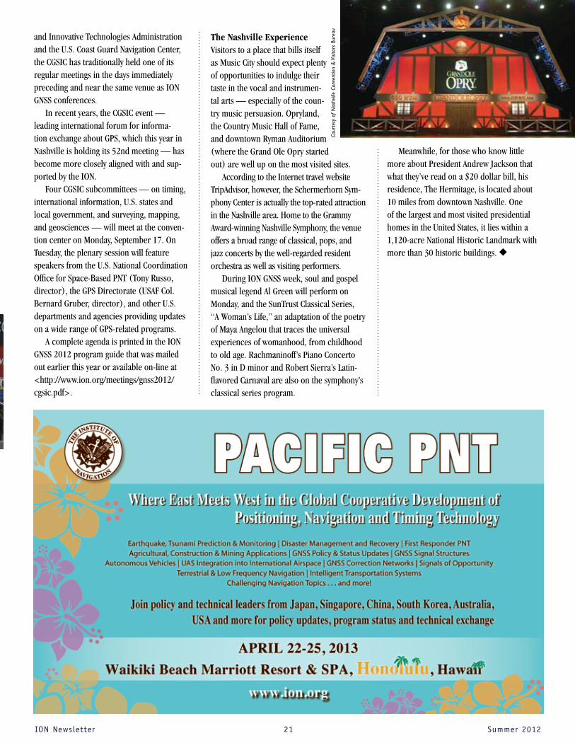
The Nashville ExperienceVisitors to a place that bills itself as Music City should expect plenty of opportunities to indulge their taste in the vocal and instrumen-tal arts — especially of the coun-try music persuasion. Opryland, the Country Music Hall of Fame, and downtown Ryman Auditorium (where the Grand Ole Opry started out) are well up on the most visited sites.
According to the Internet travel website TripAdvisor, however, the Schermerhorn Sym-phony Center is actually the top-rated attraction in the Nashville area. Home to the Grammy Award-winning Nashville Symphony, the venue offers a broad range of classical, pops, and jazz concerts by the well-regarded resident orchestra as well as visiting performers.
During ION GNSS week, soul and gospel musical legend Al Green will perform on Monday, and the SunTrust Classical Series, “A Woman’s Life,” an adaptation of the poetry of Maya Angelou that traces the universal experiences of womanhood, from childhood to old age. Rachmaninoff’s Piano Concerto No. 3 in D minor and Robert Sierra’s Latin-flavored Carnaval are also on the symphony’s classical series program.
Meanwhile, for those who know little more about President Andrew Jackson that what they’ve read on a $20 dollar bill, his residence, The Hermitage, is located about 10 miles from downtown Nashville. One of the largest and most visited presidential homes in the United States, it lies within a 1,120-acre National Historic Landmark with more than 30 historic buildings. u
Cour
tesy
of
Nas
hvill
e Co
nven
tion
& V
isito
rs B
urea
u

IONNewsletter 22 Summer2012
Annual Award Nominations
Fellow Nominations
Members are encouraged to submit nominations for one or more of the following annual awards given by The Institute of Navigation for excellence in navigation.
u Early Achievement Award — for an individual early in his or her career who has made an outstanding achievement in the art and science of navigation.
u Superior Achievement Award—for individuals making outstanding contributions to the advancement of navigation.
u Captain P.V.H. Weems Award — for continuing contributions to the art and science of navigation.
u Norman P. Hays Award — for outstanding encouragement, inspiration and support leading to the advancement of navigation.
u Tycho Brahe Award— for outstanding achievement in space navigation.
u Thomas Thurlow Award — for outstanding contributions to the science of navigation.
Nominations for ION fellows may be submitted for currently active Institute of Navigation members. All nominations must conform to ION nomination guidelines as outlined on the nomination form. Nominations must include a brief biography and proposed citation.
Details of the nomination process and forms are available at www.ion.org. Nominations must be received by October 15 to qualify.
Official nomination forms, along with brochures on the background and purpose of each award, are available from the ION National office by phone, 703-366-2723, or via the Web site at www.ion.org. Nominations must be received by October 15.
The awards and accompanying engraved bronze plaques will be presented at the ION International Technical Meeting, January 28-30, 2013, in San Diego, California. The ION urges you to participate in the nomination process so deserving individuals from the navigation community will receive appropriate recognition.
In addition to the above awards, the winner of the Samuel M. Burka Award — for outstanding achievement in the preparation of papers advancing navigation and space guidance — as chosen by the editorial panel of ION’s Journal, NAVIGATION, will be honored.
Address correspondence to Awards Committee, The Institute of Navigation, 8551 Rixlew Lane, Suite 360, Manassas, VA 20109, phone: 703-366-2723; fax: 703-366-2724; e-mail: [email protected].
Election to Fellow membership recognizes the distinguished contribution of ION members to the advancement of the technology, management, practice and teaching of the arts and sciences of navigation, and/or for lifetime contributions to the Institute.
Kindly address any correspondence to Fellow Selection Committee, The Institute of Navigation, 8551 Rixlew Lane, Suite 360, Manassas, VA 20109, fax: 703-366-2724, e-mail: [email protected].
the inner core of hurricanes in greater detail to understand their rapid intensification,” says Ruf.
Once in their 35-degree inclination orbits, CYGNSS's eight LEO observatories will receive both direct and reflected GPS signals. Each laboratory is capable of measuring four simul-taneous GPS reflections, resulting in 32 wind measurements per second across the globe. The direct signals will pinpoint the orbiting CYGNSS observatories’ positions, while the reflected sig-nals will help measure ocean surface roughness, from which wind speed is retrieved.
SST-US will build the delay Doppler map-ping instrument that will record and map the wind data, SRI will build the spacecraft and lead mission operations, NASA Ames has responsibil-ity for the CYGNSS deployment module, and the Michigan Exploration Laboratory will provide constellation and small satellite orbit design, L1 GPS positioning data, and antenna pointing determination.
“The CYGNSS mission is both a scientific and a programmatic advance for NASA’s Earth science and applications program,” said John Grunsfeld, NASA’s Science Mission Directorate associate administrator in Washington, D.C. “CYGNSS will provide vital science data on tropical cyclones, and the CYGNSS team will advance our ability to obtain high-quality Earth science data through smaller, more affordable space systems.”
NASA selected the proposed mission from among 19 submitted to the agency's Announce-ment of Opportunity for small spaceflight investi-gations of the Earth system. The Earth Venture missions are part of NASA’s Earth System Science Pathfinder program— smaller, targeted science investigations that complement the agency’s larger research missions. u
NASA Funds GNSS continued from page 15

IONNewsletter 23 Summer2012
ION Member News and Notes
Section News and NotesIn February, the Dayton section hosted a lun-cheon at Wright-
Patterson AFB that included guest speaker 2d Lt Joseph Curro, a graduate student at the Air Force Institute of Technology. Lt Curro spoke about his research that uses a scanning LIDAR for relative aircraft positioning in support of Air Force Research Laboratory’s Automated Aerial Refueling program. The March section meeting was attended by guest speaker Christopher Lomanno, a gradu-ate student at The University of Dayton, who discussed his research into the control of mul-tiple unmanned ground vehicles. In April, the Ohio University (OU) Avionics Engineering Center hosted an all-day event in Athens, OH. The event included tours of the OU Airport and
Engineering building as well research presentations from OU students and faculty.
At the May meeting, Capt. Marshall Haker, a PhD candidate at the Air Force Institute of Tech-nology, presented his research on multipath parameter modeling using GNSS signal processing.
In early June, many section members supported the 9th annual ION/AFRL Robotic Lawn Mower Competition. The competition was supremely entertaining this year, and the Dayton Section was proud to see students from far and wide descend on the birthplace of aviation to demonstrate their ingenuity, resourcefulness, and teamwork.
The annual June banquet concluded the 2011-2012 year, as the Dayton Section enjoyed a fine catered dinner and elected offi-cers for the 2012-2013 year.
The newly elected Section Chair is Jared Kresge, a Research Engineer for the Advanced Navigation Technology (ANT) Center at the Air Force Institute of Technology (AFIT). Jared brings years of service and expe-rience within ION to the position. The new Vice Chair is Dr. Eric Vinande of the Air Force Research Laboratory’s Sensors Directorate. Dr. Vinande was last year’s Executive Secretary and served as the Chair of the Robotic Lawn Mower Competition. Filling Dr. Vinande’s vacancy as Executive Secretary is Tom Pestak, also a
Kevin Johnson, a research engineer with the Ohio University Avionics Engineering Center, shows off one of the many planes owned by the center at the April meeting of the Dayton Section.
Research Engineer for the ANT Center. Tom was the enthusiastic voice of this year’s Robotic Lawn Mower Competition, working as the MC for the event. Boyd Holsapple, long time ION con-tributor and former Dayton Section Chair, was re-elected to the position of Treasurer for the fifth consecutive year. Monthly meetings will resume in September. These typically include a luncheon fol-lowed by a presentation from a guest speaker on a navigation-related topic. u
Congratulations
Mr. Charles J. Hill, Chairman of the USMMA Association and Foundation, presenting Cadet Riley Scott McQuiston with The Institute of Navigation Award at the United States Merchant
Marine Academy 2012 Award Ceremony. This award is given each year in recognition of the deck graduate attaining the highest grade point aver-age in navigation. u

THE INSTITUTE OF NAVIGATION8551 Rixlew Lane, Suite 360Manassas, VA 20109-3701
Nonprofit Org.U.S. Postage
PAIDPermit No. 425 Southern, MD
The 25th International Technical Meeting of the Satellite Division of The Institute of Navigation
September 17–21, 2012 Show Dates: Sept. 19 – 21
Tutorials: Sept. 17 & 18Nashville Convention Center
Nashville , Tennessee
N A S H V I L L E
H H H H H H H H H H H H H H
Register now!