Embed Size (px)
Citation preview

8/3/2019 Volunteer Technology Communities - Open Development
http://slidepdf.com/reader/full/volunteer-technology-communities-open-development 1/20
Global Facility or Disaster Reduction and Recovery – GFDRR Labs | A |
Volunteer TechnologyCommuntes:
THE
WORLD
BANK
OPENDEVELOPMENT

8/3/2019 Volunteer Technology Communities - Open Development
http://slidepdf.com/reader/full/volunteer-technology-communities-open-development 2/20
Contributors:
Heather Blanchard, Crisis Commons
Kate Chapman, Humanitarian OpenStreetMap Team
Ares Zulan Nunes da Conceção, The World Bank, Latin American and CaribbeanRegion
John Crowley, The Harvard Humanitarian Initiative
Ronald T. Eguch, ImageCat, Inc.
Francs Ghesquere, The World Bank, Latin American and Caribbean Region
Stuart Gll, The World Bank, Global Facility or Disaster Reduction and Recovery Labs(GFDRR Labs)
France Lamy, Google Inc.
Patrck Meer, Ushahidi
Wll Pate, The World Bank, Global Facility or Disaster Reduction and Recovery Labs(GFDRR Labs)
Emma Phllps, The World Bank, Global Facility or Disaster Reduction and RecoveryLabs (GFDRR Labs)
Joaqun Toro, The World Bank, Latin American and Caribbean Region
Elzabeth Walker Sabet, SecondMuse
Cover photo: RHoK Zambia

8/3/2019 Volunteer Technology Communities - Open Development
http://slidepdf.com/reader/full/volunteer-technology-communities-open-development 3/20
“The use of Volunteer Technology Communities
(VTCs) made possible by new Web 2.0 technologies
present a fundamental shift in how we can support
Disaster Risk Management programs and intervene
in disaster situations. We are only at the beginning
of this story. The seeds planted through initiatives
like the Crisis Commons and Random Hacks of
Kindness hold great promise for the future.”
— Saroj Kumar Jha, GFDRR Manager
8/3/2019 Volunteer Technology Communities - Open Development
http://slidepdf.com/reader/full/volunteer-technology-communities-open-development 4/20
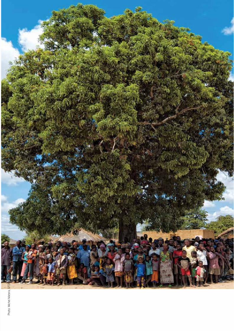
P h o t o : M i c h e l M a t e r a ,
G F D R R

8/3/2019 Volunteer Technology Communities - Open Development
http://slidepdf.com/reader/full/volunteer-technology-communities-open-development 5/20
Global Facility or Disaster Reduction and Recovery – GFDRR Labs | 3 |
Working inside communities like OpenStreetMap and Ushahidi, thousands o technologists
responded to earthquakes in Haiti, Chile and ooding in Pakistan. Volunteers processed im-
agery, created detailed maps, and geolocated posts made by the aected population to amyriad o channels in social media. Some deployed under the United Nations Disaster Assess-
ment and Coordination (UNDAC), The World Bank, and International Organization o Migra-
tion (IOM), trained Haitians how to use simple tools or remapping their communities. Others
provided reachback support to the United Nations (UN), the European Union, United States
and across the globe, making their supercomputers and large storage arrays available or pro-
cessing imagery, managing translation workows, and serving large data sets.
The rise o the Volunteer Technology Communities (VTC) brought a new set o organizational
designs to problems that have oten become snagged in bureaucracy. Instead o working in
hierarchies, VTCs used attened, decentralized structures with decision-making and conictresolution mechanisms that were adapted rom online communities like Wikipedia and open-
source sotware development projects. As a result, the VTCs moved ar aster than larger play-
ers in nearly all circumstances—and perhaps aster than established protocols will allow. It is
here—in the politics and tempo o this new volunteer capability—that the bottom-up, grassroots
structures need protocols to work with the top-down systems within large organizations.
This paper provides an introduction to some o the Volunteer Technology Communities (VTC)
that made their mark during 2010. It is meant to provide a starting point or discussions o how
UN agencies, The World Bank and other organizations might better integrate/use the best
parts o these VTCs going orward. Critical to their evolution will be or these communities to
move beyond the situation o immediate response and early recovery towards the ull disaster
risk management cycle including; reconstruction, risk reduction and preparedness.
OVERViEW
2010 redefned the role o volunteers durng humantaran emergen-
ces and dsaster rsk management. Tradtonally, cvl socety organ-
zatons—rangng n sze rom small communty organzatons to the
internatonal Federaton o Red Cross—moblzed volunteers to per-
orm a wde range o actons, n order to: manage logstcs, provde
medcal care, and perorm communty based rsk assessments n ad-
dton to other orms o drect acton. Durng 2010, a new orm o vol-
unteer emerged rom the background: the humantaran technologst.These experts—who are most oten techncal proessonals wth deep
expertse n geographc normaton systems, database management,
socal meda, and/or onlne campagns—appled ther sklls to some o
the hardest elements o the dsaster rsk management process.

8/3/2019 Volunteer Technology Communities - Open Development
http://slidepdf.com/reader/full/volunteer-technology-communities-open-development 6/20
| 4 | Volunteer Technology Communities: Open Development
This paper reviews seven key VTCs and how they operate in three broad areas to assist in
emergency response and disaster risk management, including:
Mappng Collaboratons
u International Network of Crisis Mappers is an inormal collective o mapping proes-
sionals that use their expertise to establish the operational use o maps in times o crisis.
u OpenStreetMap (OSM) is an online application that allows volunteers to collaborate on
geographical data and download that data. It is oten called the “Wikipedia o Maps”.
u The Global Earth Observation -Catastrophe Assessment Network (GEO-CAN)
consists o hundreds o volunteer engineers and scientists catalyzed by The World Bank’s
remote damage assessment in Haiti. Immediately ollowing the earthquake, these experts
utilized high resolution imagery to develop an initial building-by-building damage analysis.
u Google Map Maker allows people to collaboratively create maps using dierent mapping
tools. Some o these maps have been later published in Google Maps.
Onlne and on-ste contrbuton and collaboraton
u Ushahidi is an open-source crowd sourcing crisis inormation platorm, easily deployable
to suit local needs.
u Crisis Commons is an international network o proessionals drawn together by a call to
service. Members aggregate during Crisis Camps in dierent cities around the world and
work collaboratively on online inormation sharing tools.
Publc-Prvate-People-Partnershps
u Random Hacks of Kindness (RHoK) is a partnership between Google, Microsot, Ya-
hoo! NASA, and The World Bank which organizes and hosts biannual two-day events where
volunteer technology experts develop sotware solutions or disaster risk management.
This list is not meant to be comprehensive. Many other communities made signifcant contri-
butions to operations during the past year, including Sahana, FrontlineSMS, InSTEDD, the
Thompson-Reuters Foundation, STAR-TIDES, and Synergy Strike Force. These will be dis-
cussed in other orums.
VTCs have caught the attention o disaster risk management proessionals. They have dem-
onstrated resourceulness, agility, depth o response, and measurable results in their actions.
This led The World Bank and other organizations to begin development o an inormal platorm
or engagement between their institutions and the VTCs. Our challenge now is how to bestenable continued measurable results rom these new groups with multiple layers o knowledge,
creativity and passion.
OVERViEW

8/3/2019 Volunteer Technology Communities - Open Development
http://slidepdf.com/reader/full/volunteer-technology-communities-open-development 7/20
Global Facility or Disaster Reduction and Recovery – GFDRR Labs | 5 |
internatonal Network o Crss Mappers
The International Network o Crisis Mappers is a global hub or Crisis Mapping and humani-
tarian response. The network brings together a diverse set o individuals rom the humanitar-
ian, development, human rights, policy, technology, and academic communities. They catalyze
communication and collaboration between a wide range o dierent communities with the pur-
pose o advancing the study and application o crisis mapping worldwide.
The Crisis Mappers network was launched in October 2009 at the frst International Coner-
ence on Crisis Mapping (ICCM 2009) in Cleveland, Ohio. These annual conerences acilitate
collective engagement and dialogue that helps construct the boundaries o this emergent new
discipline. At the conerence, participants also brainstorm how to solve real problems and initi-
ate projects that help advance this new feld.
Throughout the year, the network acilitates continuing virtual interaction among its members1.
Participants engage through webcasts, create and browse profles, email their needs through
the dedicated mailing list, write blogs, and share other announcements with the group. The
group believes that the network and conerence series is just the start o many new collabora-
tive ideas that only emerge when dierent organizations come together rather than work in
isolation rom one another.
The ICCM triggered into action within minutes o the Haiti earthquake. Conversations that
began only three months earlier in Cleveland orged a culture o sharing, trust, openness,
dialogue, and a commitment among members that helped enable a remarkable volunteer com-
munity response. Initial eorts ocused on connecting the ICCM with organizations and indi-
viduals to respond to the crisis eorts and concrete action began almost immediately.
Members shared the very latest aerial and satellite imagery, contributed their proessional and
technical expertise, and committed thousands o hours o volunteer labor. They processed over
9 Terabytes (TB) o raw imagery, integrated OpenStreetMap data with data rom the UN’s Vir-
tual On-Site Operations Coordination Centre (OSSOC), and created workows or machine
translation o data. I someone requested help o the network, within less than an hour some-
one in the community would oer their assistance. Thousands o emails, tweets, blog posts,and Skype chats directly helped acilitate the humanitarian response on the ground.
MAPPiNGCOLLABORATiONS
1 http://www.crisismappers.net/

8/3/2019 Volunteer Technology Communities - Open Development
http://slidepdf.com/reader/full/volunteer-technology-communities-open-development 8/20
| 6 | Volunteer Technology Communities: Open Development
Since Haiti, the community has demonstrated its continuing capacity to contribute to eective
disaster response in the wake o destructive oods, typhoons, conict, chronic poverty, a chol-
era epidemic, snowstorms and devastating oil spills.
ICCM sponsors include Humanity United, the Open Society Institute, the United States Insti-
tute o Peace, the Knight Foundation, Google, ESRI, Ushahidi, The World Bank, the Hitachi
Center, the Fletcher School at Tuts University, and GeoTime.
OpenStreetMap
OpenStreetMap (OSM) was created in response to the act that maps in many parts o the
world are not ree and easily accessible. Instead, geographic data is oten locked up by com-
mercial vendors or within governments, or in some cases the data does not even exist. Otencalled “the Wikipedia o Maps” OSM allows anyone to edit, add missing inormation or correct
mistakes. OpenStreetMap currently has over 300,000 members and thousands o regular
contributors.
Founded in 2004, the original impetus or OSM was that data rom the UK Ordnance Survey
was costly and came with restrictions on use. Citizens started collecting data through surveys
with GPS units and OSM was born. Since then, OSM has evolved into a large community
that houses a variety o interests. The Humanitarian OpenStreetMap Team (HOT) is just such
a community within the larger OSM ecosystem. The group started as an inormal collaborationbetween interested individuals, was active during the Haiti earthquake response, and ormal-
ized into an incorporated organization in August 2010.
Almost immediately ater the 2010 Haiti earthquake, OSM contributors began tracing road in-
ormation rom pre-earthquake satellite imagery and within 24 hours, imagery providers began
releasing raw imagery. In the frst month ater the earthquake over 600 global volunteers helped
add inormation to the raw imagery that was being released. Volunteers created geographic
products such as fles or loading onto GPS units, maps to be printed, online maps and com-
ponents or map-making in GIS systems. Inormation created on the OSM platorm was then
integrated into systems created by other VTCs. For example, Sahana and OSM coordinatedthe geolocation o hospital inormation between their systems and Ushahidi utilized OSM in
locating o SMS message sources. OSM data was also used across the organizational spec-
trum; including by search and rescue teams, the UN, The World Bank and Pan American
Health Organization.2
Ater the initial response the Humanitarian OSM Team began traveling to Haiti to train people
in data collection and utilization. Supported by the Educational Concerns or Hunger Organiza-
tion (ECHO), The World Bank and the International Organization or Migration (IOM), the HOT
group hosted training in many areas within Haiti. Over 400 people were trained rom diverse
2 Accessed rom http://wiki.openstreetmap.org/wiki/WikiProject_Haiti#Uses_o_OpenStreetMap_data_by_crisis_responders
MAPPiNG COLLABORATiONS

8/3/2019 Volunteer Technology Communities - Open Development
http://slidepdf.com/reader/full/volunteer-technology-communities-open-development 9/20
Global Facility or Disaster Reduction and Recovery – GFDRR Labs | 7 |
groups such as workers rom the UN Cluster System, local Haitian NGOs, and members o
Haitian civil society. While the OSM team was in Haiti, additional uses o the inormation
collected were developed. For example, IOM is responsible or registering the over a millioninternally displaced persons within Haiti, when an individual is registered that record is linked to
road inormation within OSM. In addition IOM has begun placing inormation kiosks within the
camps and are in the process o including an OSM within the kiosks. HOT plans to continue
capacity building in Haiti and eventually transition all OSM work to Haiti.
Beyond Haiti there are broader goals or the Humanitarian OSM Team. Largely a capacity
building organization, the group plans to continue to provide training in countries that need
a mechanism or collecting ree geographic data. To increase global penetration, HOT will
continue to ormalize relationships between response agencies and serve as a bridge between
those groups and the larger OSM community. The group will also continue obtaining com-patible licenses or already existing data or import into the OSM platorm. Finally, HOT will
deepen and increase their partnerships with international development organizations such as
The World Bank to explore how OSM data can be used in risk assessment.
Global Earth Observaton — Catastrophe AssessmentNetwork (GEOCAN)
In the hours ollowing the Haiti earthquake, the ull scope o damage was only beginning to
be understood. Governments and multi-lateral organizations realized the level o damage was
dramatic; however, they were unable to obtain the complete picture o damage and its eect
on the people o Haiti. It was clear that an impact assessment using remote sensing was the
most viable option to achieve this, due to the spatial scale and magnitude o the Haiti disaster.
In response to this challenge the Global Earth Observation - Catastrophe Assessment Net-
work (GEO-CAN) ormed around The World Bank, Global Facility or Disaster Reduction and
Recovery (GFDRR) remote damage assessment. GEO-CAN consisted o expert volunteers
that individually analyzed small assigned segments o imagery that were acquired through the
WB-ImageCat-RIT and the Google aerial remote sensing campaigns. Via meticulous visualcomparison o this post-event imagery with pre-event satellite imagery within a week GEO-
CAN produced a building-by-building assessment o the damage caused by the earthquake.
The damage assessment assessed both collapsed and heavily damaged (Grades 4 and 5,
EMS-98) buildings in Port-au-Prince, Carreour, Delmas, Léogâne, Jacmel, Grand Goave and
Petit Goave. The analysis identifed corresponding pre-earthquake building ootprints digitized
into a GIS database o nearly 30,000 building ootprints.
The data was independently verifed using feld ground surveys and remote surveys by organi-
zations including the United Nations Institute or Training and Research (UNITAR)/Operational
Satellite Applications Programme (UNOSAT), the European Commission Joint Research Cen-
tre (JRC), the Centre National d’Inormation Géo-Spatial (CNIGS) representing the govern-

8/3/2019 Volunteer Technology Communities - Open Development
http://slidepdf.com/reader/full/volunteer-technology-communities-open-development 10/20
| 8 | Volunteer Technology Communities: Open Development
ment o Haiti, and other teams rom Cambridge University, Stanord University and Betero-
Fierro-Perry, Inc.
Facilitated by ImageCat Inc., GEO-CAN quickly grew to over 600 volunteers representing 131
private and academic institutions in 23 dierent countries. Several strategic organizations
participate in orming the community, each with their own established expertise in engineering
or remote sensing, including the Earthquake Engineering Research Institute (EERI), the UK-
based Earthquake Engineering Field Investigation Team (EEFIT), MCEER and LESAM at the
State University o New York at Bualo, Georgia Tech University, Cambridge University (UK),
the University College London (UK), and Rochester Institute o Technology (RIT).
The global response to the Haiti earthquake was remarkable in many ways. Within days, the
most recently collected satellite and aerial imagery was publicly available through Google,Yahoo! and Bing searches and by the end o January, anyone could access up to hal a dozen
post-event images or any one area around greater Port-au-Prince. Data rom dierent mis-
sions, including: The World Bank-ImageCat-RIT Remote Sensing Mission (15cm optical and
2 pt/m2 LiDAR); Google (15cm optical); NOAA (25cm optical); Pictometry; and satellite im-
agery rom GeoEye and Digitalglobe, allowed damage rom the Haiti earthquake to be viewed
through multiple sensors and at dierent times. It was through these international understand-
ings and the dedication o time and resources by GEO-CAN afliates that a comprehensive
and scientifcally rigorous damage assessment was achieved via this VTC.
Google Map Maker
It’s a unique challenge to provide maps and local inormation to users in countries where there
has never been any detailed digital map. This was the motivation behind the launch o Google
Map Maker in May 2008. Google Map Maker empowers people to share their local knowledge
and expertise in 59 languages, which represents the primary or secondary languages o more
than a hal a billion people in over 180 countries and territories.
Google Map Maker supports user-generated online map-making by allowing anyone to add
or edit roads, businesses, parks, schools and more. People can visually mark places and adddetailed inormation about these locations, or edit contributions by others. These edits reach
millions o people worldwide through integration in Google Maps and Google Earth. Mappers
rom around the world have contributed local knowledge with everything rom mapping entire
countries to adding details like one-way streets to make maps drivable.
In times o disaster, relie activities are carried out in chaotic and dynamic conditions in which
multiple groups need to interact. First responders need to quickly build a picture o where
people are, what condition they are in, what their needs are, and what services are still avail-
able. This helps responders target their eorts and mobilize their equipment, personnel, and
supply resources. Unortunately, basic map and geographic data that may be a key component
to response is oten not readily available in the onset o a disaster, which leads to duplication
o eorts—organizations collect the same data in the same area, city or region.
MAPPiNG COLLABORATiONS

8/3/2019 Volunteer Technology Communities - Open Development
http://slidepdf.com/reader/full/volunteer-technology-communities-open-development 11/20
Global Facility or Disaster Reduction and Recovery – GFDRR Labs | 9 |
For this purpose Google Map Maker was frst put to use in June or the Cyclone Nargis in
Myanmar, a disaster or which data accessibility was limited3. There were no publicly acces-
sible maps o roads, hospitals, or cities to guide response eorts. At Google, 40 volunteersmapped 100,000 km o roads and 3,000 points o interest, in just our days. This was just the
beginning o many more powerul applications.
Only two years ater its launch, Google Map Maker has made important contributions to the
disaster response community4,5. Relie organizations and communities are able to produce
helpul composite maps or areas where detailed inormation is usually unavailable by leverag-
ing the high-quality, up-to-date inormation provided by users in Google Map Maker. In addition,
the “crowd community” was tasked with targeted mapping to meet the most pressing needs
in aected areas. Fast and accurate mapping data provided by Google Map Maker volunteers
has not only raised the utility o high quality maps in times o humanitarian need, but also dem-onstrated the ability o this tool to be a source o quality maps in the developing world6.
3 http://google-latlong.blogspot.com/2008/05/myanmar-maps-update.html4 Reuters interview with UNOSAT, http://www.relieweb.int/rw/rwb.ns/db900sid/ASHU-
867P99?OpenDocument5 Blog post about disaster volunteer eorts, http://google-latlong.blogspot.com/2010/06/map-makers-
respond-to-pakistan.html6 https://sites.google.com/site/mapyourworldcommunity/map-your-world

8/3/2019 Volunteer Technology Communities - Open Development
http://slidepdf.com/reader/full/volunteer-technology-communities-open-development 12/20
| 10 | Volunteer Technology Communities: Open Development
Ushahd
Ushahidi, which means “testimony” in Swahili, was launched during the post-election violence
in Kenya in January 2008. Ushahidi is a ree and open-source platorm or collaborative live
mapping that integrates inormation collected by email, voicemail, SMS, Twitter, web orms,YouTube, Flickr, Facebook, Skype, and other social media. The purpose o the Ushahidi plat-
orm is to democratize mapping by creating a live map o needs.
The Ushahidi platorm is used by proessional organizations and volunteer-networks around the
world to create more transparency and accountability across multiple sectors. Since its launch,
Ushahidi has been used in over 30 countries, or uses including:
u Community mapping o social services in slums
u Documenting armed conict
u Monitoring election raud
u Assessing the impact o major environmental disasters
u Tracking crime in metropolitan areas
These maps have proven to be invaluable tools or frst responders. Ater the 2010 Haiti earth-
quake, the U.S. Marine Corps used the Ushahidi mapped inormation and stated that the data
helped them save hundreds o lives. The U.S. Coast Guard also used the inormation mapped
on Ushahidi-Haiti or operational response. FEMA Administrator Craig Fugate called the Ush-ahidi-Haiti map the most comprehensive and up-to-date map available to the humanitarian
community.
It is worth noting that student volunteers, not disaster response proessionals, were behind
the Ushahidi-Haiti map. The same is true o the Ushahidi maps created or Chile and Pakistan.
Ushahidi is supporting the launch o a Standby Volunteer Task Force to provide humanitarian
organizations with a surge capacity in crisis mapping ollowing a disaster. In addition, Ushahidi
is also launching the Universities or Ushahidi (U4U) initiative to train teams o students at uni-
versities around the world on how to use the Ushahidi platorm.
ONLiNE AND ON-SiTECONTRiBUTiON AND COLLABORATiON
©
B e j h a n J u s u f i | D r e a m s t i m e . c
o m

8/3/2019 Volunteer Technology Communities - Open Development
http://slidepdf.com/reader/full/volunteer-technology-communities-open-development 13/20
Global Facility or Disaster Reduction and Recovery – GFDRR Labs | 11 |
CrssCommons
CrisisCamp began as an idea to bring together people who were interested in using technol-ogy and telecommunications systems to assist communities in times o crisis. In June 2009, the
frst CrisisCamp was held in Washington D.C. as an open orum or an interdisciplinary group
o practitioners. First responders, humanitarian aid workers, technology experts, academia and
the private sector all participated. CrisisCamps have since ‘gone viral’ and over 50 events have
been held since in direct response to earthquakes in Haiti and Chile, ooding in Pakistan, and
the Gul Coast oil spill.
Within minutes o the Haiti earthquake, the inormal networks that supported the frst Crisis-
Camp event began to connect with organizations and individuals to orm new crisis camps or
response. Within 24 hours o the earthquake, CrisisCamps were announced in two cities totake place the ollowing Saturday, ollowed by cities in Caliornia, New York and Colorado. A
week later, 13 other cities around the world created their own CrisisCamps.
Technology volunteers o all levels work together during CrisisCamps. They build tools, search
and translate data, and solve unique challenges brought orth by the particular crisis. For ex-
ample, projects supporting Haiti included: i) creation o a sotware solution to expand long
distance Wi-Fi connectivity; ii) development o the frst Kreyol mobile translation application; iii)
establishment o an online social network to connect the Haitian diaspora.
CrisisCamps also provided support or the already existing volunteer technological com-munities whose projects or volunteers were supporting the Haiti response eorts, such as:
i) CrisisMappers; ii) OpenStreetMap; iii) Sahana Foundation; iv) Ushahidi. CrisisCamps or
Haiti hosted mapping sessions to contribute edits to the frst post-earthquake base map o
Port au Prince. Many o these volunteers had never contributed to a mapping project beore;
so tools were created rom scratch to help CrisisCamp volunteers to quickly learn how to map
crisis data or the OpenStreetMap community.
Once the crisis had passed, several lessons learned were identifed and addressed to im-
prove upon the perormance, relevance, efciencies, capacities and capabilities o CrisisCampevents. Several disaster risk management organizations (e.g. The World Bank, United Nations
and International Federation o Red Cross/Red Crescent (IFRC)) suggested that the time to
create relationships, explore potential problem defnitions and share lessons learned was dur-
ing non-crisis mode. This signaled the need or a more permanent and long-term coordination.
CrisisCommons was established to improve capacity to work with crisis response organiza-
tions on a long-term basis. The ocus o the organization is to improve and grow the capability
o CrisisCamp events and volunteer contributions to better meet the needs o disaster aected
actors.
CrisisCommons provides a orum to bring together communities, advance innovation in bothtechnology and business processes, create capability, and greater situational awareness or
crisis response organizations, diasporas and inormal networks who seek to aid people in
8/3/2019 Volunteer Technology Communities - Open Development
http://slidepdf.com/reader/full/volunteer-technology-communities-open-development 14/20
| 12 | Volunteer Technology Communities: Open Development
ONLiNE AND ON-SiTECONTRiBUTiON AND COLLABORATiON
crisis. These objectives are achieved through the incorporation o lessons learned rom the
VTCs, dialogue and exercises, collaborative prototypes and toolsets, best practices, data and
technical standards development.
The organization builds upon and supports the crisis ocused CrisisCamps to create a par-
ticipatory culture o innovation supporting crisis management and global development. At the
same time, CrisisCommons seeks to connect volunteer technology communities to crisis man-
agement structures such as the UN system.

8/3/2019 Volunteer Technology Communities - Open Development
http://slidepdf.com/reader/full/volunteer-technology-communities-open-development 15/20
Global Facility or Disaster Reduction and Recovery – GFDRR Labs | 13 |
Random Hacks o Kndness (RHoK)
Random Hacks o Kindness (RHoK) is a collaboration between Google, Microsot, Yahoo!,
NASA and The World Bank dedicated to building a volunteer community o innovation ocused
on creating sotware solutions to disaster risk management challenges.
RHoK was conceived in June 2009 at the inaugural CrisisCamp Bar Camp held in Wash-
ington D.C. At that camp, an industry panel spoke about sotware and disaster risk manage-
ment, agreeing that certain issues o global importance take precedence over competitive
business concerns. That panel included representatives rom Microsot, Google, and Yahoo!,
who agreed to work together and to collaborate with The World Bank and NASA in mobilizing
their developer communities to volunteer to create practical sotware solutions to real world
problems.
A RHoK event is an intensive weekend marathon o brainstorming and programming, drawing
together the talent and initiative o some o the best and brightest developers in the world. They
volunteer their time to collaborate with subject matter experts in disaster risk management to
develop sotware solutions that can have concrete impact.
RHoK held its inaugural event in Mountain View, Caliornia in November 2009, resulting in
sotware solutions that were used on the ground ollowing the devastating earthquakes in Haiti
and Chile in early 2010. One winning application allowed mobile phone users to send a mes-
sage to a broad network o contacts through email, SMS, and social networking tools letting
amily and riends know that they were OK, with the click o a single button. Another solutionallowed earthquake responders in Chile to crowdsource inormation about the earthquake’s
impact using a community-developed Twitter syntax.
In June, 2010 the initiative went global, with a main stage event in Washington D.C. and
simultaneous satellite events in Kenya, Brazil, Indonesia, Australia and Chile. Hundreds o
volunteers around the world, spread across fve time zones and working in multiple languages,
collaborated or orty-eight hours o intense brainstorming and programming. The winning hack
rom the Washington D.C. event, a visual tool to map and calculate landslide risk, is already
being piloted by The World Bank in landslide-aected areas, and other hacks have received
interest and support rom governments and risk management specialists worldwide.
PUBLiC-PRiVATE-PEOPLE-PARTNERSHiPS
© Rockstarimages| Dreamstime.com

8/3/2019 Volunteer Technology Communities - Open Development
http://slidepdf.com/reader/full/volunteer-technology-communities-open-development 16/20
| 14 | Volunteer Technology Communities: Open Development
Since its inception, the RHoK community has been expanding to incorporate an ever-grow-
ing number o developers, subject matter experts and organizational partners. The December
2010 RHoK event took place in over 20 cities around the world in collaboration with hackergroups, NGOs, civil society organizations, private companies, multinationals and local, state
and ederal governments.
As the community grows, RHoK will continue to collaborate with other VTCs to work together
in creating a new development model that can eectively harness the talents, expertise and
volunteer initiative o technology experts on a global level, while connecting their community to
the governments, agencies and vulnerable populations who need immediate solutions.
PUBLiC-PRiVATE-PEOPLEPARTNERSHiPS

8/3/2019 Volunteer Technology Communities - Open Development
http://slidepdf.com/reader/full/volunteer-technology-communities-open-development 17/20
Global Facility or Disaster Reduction and Recovery – GFDRR Labs | 15 |
When Thomas Kuhn defned paradigm change in The Structure o Scientifc Revolu-
tions, he described a state where a traditional ramework and several experimental
approaches existed in parallel—a period when the explanatory power o the old sys-
tem wanes while some inchoate new system explores and codifes the methods that are strong
enough to begin replacing the old ones. While VTCs will never replace the current institutional
rameworks, crisis response and other elements o the disaster risk management cycle are ap-
proaching a state resembling a shit in paradigm.
When dealing with the challenges o mapping and coordination in post disaster Haiti, decentral-
ized VTCs were aster and more adaptable than centralized bureaucracies. Instead o publishing
a request to build a new map o Haiti to be delivered in a ew months as a traditional institution
would, OpenStreetMap simply went about making maps. It negotiated intellectual property li-
censes with commercial satellite providers to trace aerial imagery and scoured map libraries to
build a new map in a matter o days. In similar ashion, Ushahidi perormed its role o aggregatingsocial media reports. Instead o waiting to see i it could deploy sta under UN Disaster Assess-
ment and Coordination (UNDAC) to support the urban search and rescue teams, Ushahidi coor-
dinated with the emergency shortcode 4636 initiative to aggregate SMS reports rom Haiti and
created an RSS eed that the US Coast Guard and UNDAC integrated into their own protocols.
For all the exciting possibilities that exist or VTCs to accelerate the tempo o humanitarian re-
sponse and disaster risk management, they ace important challenges that will shape their abil-
ity to defne a new paradigm. It is an open moment or the traditional operators to ensure that
we make best use o this rich resource. There are at least fve questions that need to be asked:
1. How wll the new VTCs ensure that the lessons learned rom decades o nter-
natonal development and humantaran operatons wll be ntegrated nto the
tools and practces that they are creatng? Many o the technologists that are building
new platorms or imagery, mapping, and inormation sharing have limited feld experience,
and have an engineer’s approach o “just do it.” Traditional players will need to ensure that
these technologists are exposed to the wisdom o old hands and that these communities
are developing tools that meet the direct needs o the ‘clients’.
2. How wll VTCs ntegrate wth both tradtonal development and humantaran
organzatons and the aected populatons? Most international operations occur
within the ofcial context o government to government or government to international
CONCLUSiON
Photo:RHoKSãoPaulo

8/3/2019 Volunteer Technology Communities - Open Development
http://slidepdf.com/reader/full/volunteer-technology-communities-open-development 18/20
| 16 | Volunteer Technology Communities: Open Development
institution interaction. I VTCs link citizens to citizens directly and mobilize assets across
borders, they may run aoul o the national and international systems that are already in
place. Combined with the tendency o engineers to “just do it,” this paradigm shit may bewelcome in some areas and not in others.
3. How do we broaden the agenda o the VTCs to encompass the ull dsaster rsk
management cycle and thus ncrease ther mpact? While it is obvious to say that
risk reduction is a more eective strategy than a better response to save lives, it is not obvi-
ous how to put the right incentives in place to engage these communities during ‘peace’
time to leverage their capabilities. There is great potential to include these communities
and technologies within the preparation stage. VTCs like RHoK, MapMaker and OSM are
achieving this, but it is only the beginning.
4. How wll these VTCs become sustanable partners? Humanitarian operations re-
quire substantial resources, especially or teams that deploy to the feld. Many VTCs have
budgets less than $100K per annum to run communities that serve purposes beyond cri-
sis response. For example, OpenStreetMap also maps bike routes and enables territories
like Palestine to build completely ree and open maps. The question o how these institu-
tions will be reliable partners to response operations without a signifcant increase to their
resources is a key area o inquiry that all partners must explore.
5. How wll the VTCs scale? Along with the question o sustainability, VTCs need to de-
termine how they will scale as decentralized organizations. While it is generally easy torecruit new technologists, building durable decision-making processes and dispute reso-
lution mechanisms that scale rom hundreds o volunteers to tens o thousands o people
requires careul planning (it has been done: one need only look at Wikipedia). Discussions
among some VTCs about how to adapt these existing methods are in their inancy.
VTCs have quickly become a critical asset. In Haiti, Chile, Pakistan, and beyond, they devel-
oped creative solutions to inormational and technological challenges. The output rom their
work continues to directly beneft vulnerable populations, response agencies and govern-
ments. Their “maps and apps” are helping to save lives and property. Moreover, their solutionscan be leveraged to inspire the international community to introduce a new modality o work-
ing, “Development 2.0” or “Open Development.” Following the established notion o Web
2.0, Open Development is also built on the central premise that mass collaboration changes
everything. It is community not technology that distinguishes this new modality and VTCs are
a wonderul example.
The international community stands at the beginning o this partnership with the VTCs, and we
are just beginning to understand how to eectively harness their energies. A process is under-
stood not by stopping it, but by moving and owing with it. Thus, to realize the ull potential o
the VTC community, it is imperative that we enter into the process as a committed partner andmember o this community.
CONCLUSiON

8/3/2019 Volunteer Technology Communities - Open Development
http://slidepdf.com/reader/full/volunteer-technology-communities-open-development 19/20
Community is centralto OpenStreetMap.Central to that spirit ofcommunity is the runningmeme of cake slicing
at its Mapping Parties.This cake was shared atthe Marikina, PhilippinesMapping Party.

8/3/2019 Volunteer Technology Communities - Open Development
http://slidepdf.com/reader/full/volunteer-technology-communities-open-development 20/20
Global Facility for Disaster Reduction and Recovery
1818 H Street, NW
Washington, DC 20433, USA
Telephone: 202-458-0268
E-mail: [email protected]
Facsimile: 202-522-3227
Special thanks and appreciation are extended to the partners who support GFDRR’s work to protect
livelihood and improve lives: ACP Secretariat, Arab Academy for Science,Technology and Maritime
Transport, Australia, Bangladesh, Belgium, Brazil, Canada, China, Colombia, Denmark, Egypt,
European Commission, Finland, France, Germany, Haiti, India, International Federation of Red Cross
and Red Crescent Societies, Ireland, Italy, Japan, Luxembourg, Malawi, Mexico, the Netherlands,
New Zealand, Norway, Portugal, Saudi Arabia, Senegal, South Africa, South Korea, Spain, Sweden,
Switzerland, Turkey, United Kingdom, United Nations Development Programme, United States, UN
International Strategy for Disaster Reduction, Vietnam, The World Bank, and Yemen.
AUSTRALIA BAngLAdeSh BeLgIUM BRAZIL CAnAdA ChInA COLOMBIA denMARK egYPT FInLAnd FRAnCe geRMAnY
IndIAhAITI IReLAnd ITALY JAPAn LUXeMBOURg MALAwI MeXICO The neTheRLAndS new ZeALAnd nORwAY PORTUgAL
SAUdI ARABIA SenegAL SOUTh AFRICA SOUTh KOReA SPAIn Sweden SwITZeRLAnd TURKeY UnITed KIngd OM UnITed STATeS VIeTnAM YeMen