Embed Size (px)
Citation preview
6 circular walks Discovering the countryside around Yeovil
Walking the hills & vales around Yeovil
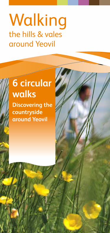
This walk visits the villages of West Coker and East Coker with spectacular views of the Hardington villages and valley. You will also pass West Coker Manor House, North Coker Mill and Parkland and Hardington Moor Nature Reserve. The walk is on quiet country lanes and across fields with one steep ascent and descent for Coker Ridge.Start in the Square of West Coker. Buses stop here near the post office there is car parking at the Church.
START From the Square walk along East Street. Pass Manor Street on the left. A 15th century Manor House can be found along here on the right, this is worth stopping to have a look at but it is not open to the public. Continue along East Street, past the Almshouses and West Coker House.
West Coker Parish Walk
1 Pass the recreation ground, turn left, over a stone stile or through the adjacent gate and follow the signposted footpath across the field and over a
footbridge in the far right hand corner of the field (not the bridge in the centre of the hedge); this has the remains of a weir incorporated in to it. Bear left, along the lane into Holywell. Thomas Hardy mentions this small hamlet in one of his short stories.
2 Cross the road and follow the signposted footpath to the left of the Foresters Arms to Skinners Hill Farm. Look for wildfowl in the large pond on the right
before the farm. At the farm turn left along the road and follow this around to the right to East Coker.
3 Go past the recreation ground then follow the signposted footpath on the right. Cross the field following the left field boundary. Cross the stile next to
the mill on to a tarmac lane.
4 miles
7 km
5
6
7
START
1
2 3
4
4 Turn right and follow the lane to a crossroads. Cross straight over and follow the lane for just under 1km (_ mile). You will pass the lodge and the grounds
of Coker Court on the left, look at the Harts Tongue fern growing on the damp hedge bank on the right of the lane. To the left are views over Coker Court Park/North Coker Park with its majestic parkland trees.
5 Pass Sleights Cottage on the left, and turn right, over a stile, along the signposted footpath. There are views of Pen Wood and Coker Wood in the
distance and Moors Plantation on the far side of the valley. In the middle of the valley nestles the hamlet of Lyatts at the start of the Hardington Vale. Follow the ridge through a hunt gate, then over a stile to a track. Go straight on along the track to Primrose Hill.
6 At the Primrose Hill crossroads cross over into the lane opposite. Bear left at the first junction and follow the ridge lane for 1 km. From this lane there are
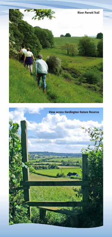
outstanding views to the left across the Hardington Valley. The hamstone cottages of Hardington Moor can be seen in the valley bottom and Hardington Mandeville can be seen on the ridge. On the left of this lane you will find the meadows which make up Hardington Moor National Nature Reserve. This nature reserve is managed for wildlife by Natural England using a local grazier and is characteristic of pre-war Somerset. It’s a rich hay meadows are abundant with wildflowers and butterflies; it is well worth a visit in the spring and summer.
7 Past the nature reserve turn right into a lane and down a steep slope into West Coker. The lane is called Chur Lane after the song of the Nightjars that
once inhabited the area. This sunken lane in a hollow is characteristic of this part of Somerset with its steep smooth hamstone banks. At the bottom of the lane turn right along the A30 and back to the Square in the village centre.
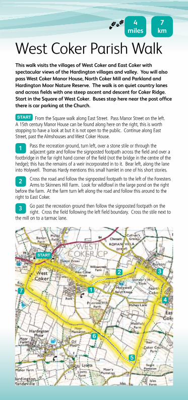
Walkers on the Parrett Trail
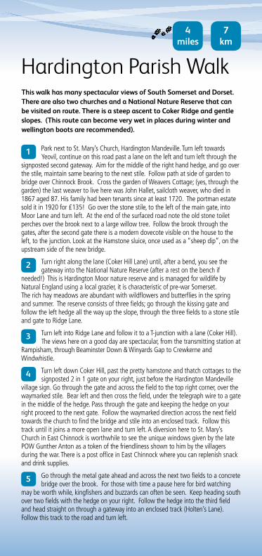
This walk has many spectacular views of South Somerset and Dorset. There are also two churches and a National Nature Reserve that can be visited on route. There is a steep ascent to Coker Ridge and gentle slopes. (This route can become very wet in places during winter and wellington boots are recommended).
Hardington Parish Walk
1 Park next to St. Mary’s Church, Hardington Mandeville. Turn left towards Yeovil, continue on this road past a lane on the left and turn left through the
signposted second gateway. Aim for the middle of the right hand hedge, and go over the stile, maintain same bearing to the next stile. Follow path at side of garden to bridge over Chinnock Brook. Cross the garden of Weavers Cottage; (yes, through the garden) the last weaver to live here was John Hallet, sailcloth weaver, who died in 1867 aged 87. His family had been tenants since at least 1720. The portman estate sold it in 1920 for £135! Go over the stone stile, to the left of the main gate, into Moor Lane and turn left. At the end of the surfaced road note the old stone toilet perches over the brook next to a large willow tree. Follow the brook through the gates, after the second gate there is a modern dovecote visible on the house to the left, to the junction. Look at the Hamstone sluice, once used as a “sheep dip”, on the upstream side of the new bridge.
2 Turn right along the lane (Coker Hill Lane) until, after a bend, you see the gateway into the National Nature Reserve (after a rest on the bench if
needed!) This is Hardington Moor nature reserve and is managed for wildlife by Natural England using a local grazier, it is characteristic of pre-war Somerset. The rich hay meadows are abundant with wildflowers and butterflies in the spring and summer. The reserve consists of three fields; go through the kissing gate and follow the left hedge all the way up the slope, through the three fields to a stone stile and gate to Ridge Lane.
3 Turn left into Ridge Lane and follow it to a T-junction with a lane (Coker Hill). The views here on a good day are spectacular, from the transmitting station at
Rampisham, through Beaminster Down & Winyards Gap to Crewkerne and Windwhistle.
4 Turn left down Coker Hill, past the pretty hamstone and thatch cottages to the signposted 2 in 1 gate on your right, just before the Hardington Mandeville
village sign. Go through the gate and across the field to the top right corner, over the waymarked stile. Bear left and then cross the field, under the telegraph wire to a gate in the middle of the hedge. Pass through the gate and keeping the hedge on your right proceed to the next gate. Follow the waymarked direction across the next field towards the church to find the bridge and stile into an enclosed track. Follow this track until it joins a more open lane and turn left. A diversion here to St. Mary’s Church in East Chinnock is worthwhile to see the unique windows given by the late POW Gunther Anton as a token of the friendliness shown to him by the villagers during the war. There is a post office in East Chinnock where you can replenish snack and drink supplies.
5 Go through the metal gate ahead and across the next two fields to a concrete bridge over the brook. For those with time a pause here for bird watching
may be worth while, kingfishers and buzzards can often be seen. Keep heading south over two fields with the hedge on your right. Follow the hedge into the third field and head straight on through a gateway into an enclosed track (Holten’s Lane). Follow this track to the road and turn left.
4 miles
7 km
6 At the crossroads turn right; after about 100m turn left onto a surfaced track. After the second (white) house bear left and follow a signposted footpath
between a copse and a ditch. Go over the stile and walk along the top of the next field and through the gate at Townsend Farm onto Coldharbour Lane. Views to the south are superb, with Pen Wood opposite (restricted access now allowed).
7 Turn left up the farm drive to a road (Penn Lane) and follow the signposted path across the road to the right of the buildings. Pass next to the buildings
and over the next two fields. If you use the pole in the second field as a bearing you will find the stile and steps down to a lane.
8 Turn right, then left after the stone cottages and walk along the enclosed path to the tarmac lane. Turn left here, at the bottom of the hill turn right up some
steps to a gate onto a path that leads to a small field with a narrow pinch gate into the churchyard on the opposite side. Apart from the tower this church burnt down in the last century and was rebuilt. Have a rest on the bench by the tower and admire the view – a good portion of your walk can be seen.
5
6
7
START
1
3
2
4
8
River Parrett Trail
View across Hardington Nature Reserve
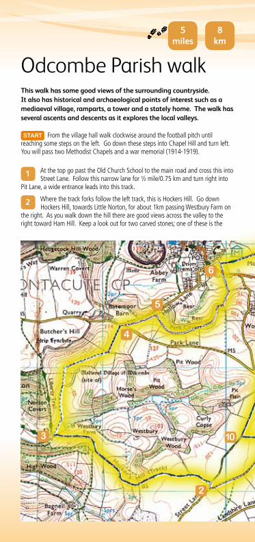
This walk has some good views of the surrounding countryside. It also has historical and archaeological points of interest such as a mediaeval village, ramparts, a tower and a stately home. The walk has several ascents and descents as it explores the local valleys.
START From the village hall walk clockwise around the football pitch until reaching some steps on the left. Go down these steps into Chapel Hill and turn left. You will pass two Methodist Chapels and a war memorial (1914-1919).
Odcombe Parish walk
1 At the top go past the Old Church School to the main road and cross this into Street Lane. Follow this narrow lane for ½ mile/0.75 km and turn right into
Pit Lane, a wide entrance leads into this track.
2 Where the track forks follow the left track, this is Hockers Hill. Go down Hockers Hill, towards Little Norton, for about 1km passing Westbury Farm on
the right. As you walk down the hill there are good views across the valley to the right toward Ham Hill. Keep a look out for two carved stones; one of these is the
5 miles
8 km
5
6
2
4
103
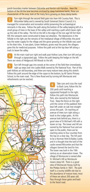
parish boundary marker between Odcombe and Norton-sub-Hamdon. Near the bottom of the hill the lane becomes enclosed by steep hamstone banks, these are characteristic of the area, look at the many ferns growing on these damp banks.
3 Turn right through the second field gate into Ham Hill Country Park. This is Witcombe Valley and is owned by South Somerset District Council; it is
managed for conservation and recreation whilst preserving the archaeological remnants in the area. Follow the path along the bottom of the valley keeping left of a small group of trees in the base of the valley until reaching a path which bears right up the side of the valley. The hill on the left is the edge of the iron age hill fort Ham Hill; the ramparts were constructed to keep out attackers. The depressions in the hillside to the right are the remains of the mediaeval village of Witcombe; the pond was the water supply for the village and the gorse growing on the hillside was used to fire their kilns. A rare plant, Green Helibore, grows near the pond, the villagers grew this for medicinal purposes. Follow this path and at the top bear left along a track to leave the valley.
4 At the main road turn right and walk past Hollow Lane, then turn left and go through a signposted gap. Follow the path keeping the hedge on the left.
There are views of Hedgecock Hill Woods to the left.
5 Turn left through gap into woods at the corner of the field then immediately right up steps over into Ladies Walk owned by The National Trust. Part of this
path follows an old boundary, and there are many mature trees along this stretch. Follow this path around the edge of the copse to the bottom, by All Saints Primary School, to the main road. This is New Road and by turning left Montacute and refreshments can be reached.
6 Take care and cross the road to Back Lane, follow this for
200 yards until reaching a signposted footpath to the right. Follow this path into Montacute Park, also owned by the National Trust. Keep the fence on the right until the corner of the paddock then bear left under an oak tree straight across the park. On reaching an avenue of trees turn right along a track to the Lodge gates. At this avenue look behind you, there is a good view of St Michael’s Hill with a tower on top. The tower and hill are owned by the National Trust and are open to the public, there are far reaching views to four counties from the top on a clear day. The hill used to be a Norman Mott & Bailey Castle, and it is thought that the laird of the castle owned Witcombe and that the villagers farmed the land for him. The tower was built in the 19th century as an observation tower. The village of Montacute is named after St. Michael’s Hill as Montacute means steep hill. There is a good view of Montacute House, built by the Phelips family in 1601. The park itself is a county wildlife site due to the abundance of mature trees; most of these are about 200 years old. Pass through these gates and back to the Yeovil road.
7
8
START1
7 Bear left and follow the road for about 200 yards to the turning on the right to Odcombe. Take care crossing the road and follow the lane to Odcombe for
about 50 yards before bearing right, up a steep bank and through signposted gate.
8 Follow the path to the right keeping the hedge on the right and follow the yellow arrows. Cross the stile into Woodhouse Covert. The woodland path is
about ¼ mile/ ½ km long and ends with a steep ascent up a series of steps. At the top cross a stile into a field and keep to the left of this field. You will pass a long wall; this is for the Old Burial Ground said to date from time of the Civil War. At the walls end cross a stile to a track and turn right to Ham Hill Road.
9 On reaching Ham Hill Road, take care and cross over into signposted bridleway known as Pit Lane. There are views to the right of Pit Wood
and ponds.
10 After ¼ mile/ ½ km turn left along another less well-defined lane. There are active badger setts here as the Yeovil sands soil is easy for them to dig.
Follow this path past the Manor Farm buildings to the Ham Hill Road and turn right. Turn left next to the Old School House and retrace your steps to the village hall and the car park.
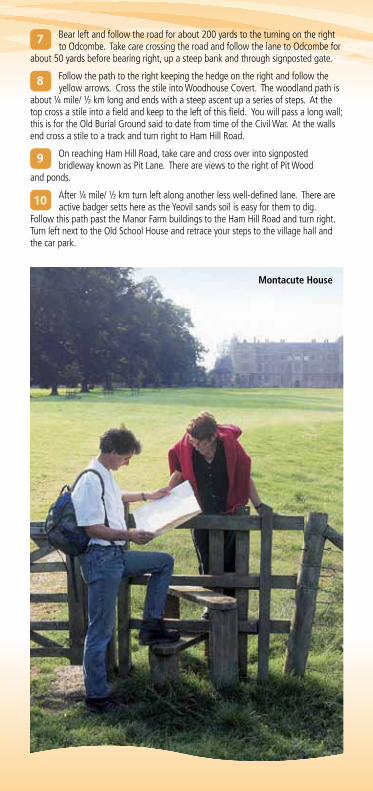
Montacute House
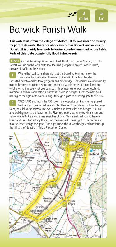
This walk starts from the village of Stoford. It follows river and railway for part of its route, there are also views across Barwick and across to Dorset. It is a fairly level walk following country lanes and across fields. Parts of this route occasionally flood in heavy rain.
START Park at the Village Green in Stoford. Head south out of Stoford, past the Royal Oak Pub on the left and follow the lane (Hooper’s Lane) for about 500m, beware of traffic on this stretch.
Barwick Parish Walk
1 Where the road turns sharp right, at the boarding kennels, follow the signposted footpath straight-ahead to the left of the farm buildings.
Cross the next two fields through gates and over bridge. These fields are enclosed by mature hedges and contain scrub and longer grass, this makes it a good area for wildlife watching; see what you can spot. Three quarters of our native, lowland, mammals and birds and half our butterflies breed in hedges. Cross the next field bearing to the right of the outbuildings through a gate to a kissing gate to the A37.
2 TAKE CARE and cross the A37, down the opposite bank to the signposted footpath and over a bridge and stile. Bear left to a stile and follow the lower
slope, parallel to the railway line over 4 fields and over stiles and bridges. You are also walking next to a tributary of the River Yeo. otters, water voles, kingfishers and yellow wagtails live along these stretches of river. This is an ideal spot to have a break and see what activity there is on the riverbank. Bear right to the corner and into the lane through the gate. Turn right under the railway bridge and continue up the hill to the T-Junction. This is Pincushion Corner.
3 miles
5 km
START
5
6
1
3
2
4
3 Turn right and follow the road for about 500 metres past Darvole Farm on the left.
4 Pass the cottages on the left and a barn on the right then turn right along a signposted footpath over a stile turn left and follow the left hedge to a double
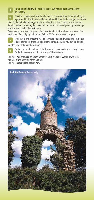
stile. To the left a tall, stone, pinnacle is visible; this is the Obelisk, one of the four Barwick Follies. Locals say they were built about two hundred years ago by George Messiter who lived at Barwick House. They mark out the four compass points near Barwick Park and are constructed from local stone. Bear slightly right across field to A37 to a stile next to a gate.
5 TAKE CARE and cross the A37 to Fairhouse Road and walk along Fairhouse Road. From here there are good views across Barwick, you may be able to
spot the other Follies in the distance.
6 At the crossroads and turn right down the hill and under the railway bridge. At the T-junction turn right back to the Village Green.
This walk was produced by South Somerset District Council working with local volunteers and Barwick Parish Council. This walk uses public rights of way.
Jack the Treacle Eater folly
This walk explores Yeovil Country park, including the wooded Southwoods in Ninesprings and the Valley gardens with springs, waterfalls and lake. Then follows the old railway line to Wyndham Hill where there are stunning views across Yeovil and the surrounding countryside. There are some steep climbs on this route but no stiles and plenty or benches for taking a break on your walk.
START Park next to Goldenstones; this is a pay and display car park. Turn right and follow the main cycleway to a path junction with a tarmac path, turn left here and walk up the hill into the woods.
Yeovil Country Park Walk
1 At the woodland edge turn right and follow the edge of the wood. There are many veteran trees in this area of woodland; English Oaks, Beech and Sweet
Chestnut. Some of these house bird and bat boxes to improve their wildlife value. Follow this path to the top of the woodland and then bear left to follow a row of veteran oaks and beech trees, this area is called Beech Walk. Continue to follow this path all the way around the top of the woodland. You will pass the woodland playzone with carved benches and seats and a stunning view across to Wyndham Hill, which you will ascend later in your walk. You may see evidence of the rangers hard at work removing invasive laurel in the woodland. The laurel is non-native and reduces biodiversity in the woods, the areas where it has been removed are replanted with native trees.
2 Here you will descend a flight of wooden steps which lead down to the source spring. Follow these steps down to follow the springs. Keep the springs,
waterfalls and ponds to your left as you descend through the gardens.
3 You will pass through an archway, turn left here and cross a small ford between a pond and waterfall, then turn right and go down some steps next
to the waterfall. Follow this path as it winds alongside the stream. You will cross a small arched bridge, then come to another wooden bridge on your right, go over this and follow the path. You will pass through a gate, turn left here and follow the path down to the lake. Many bird species use this lake as their home, you might see Heron, Kingfishers or mandarin ducks.
3miles
5 km
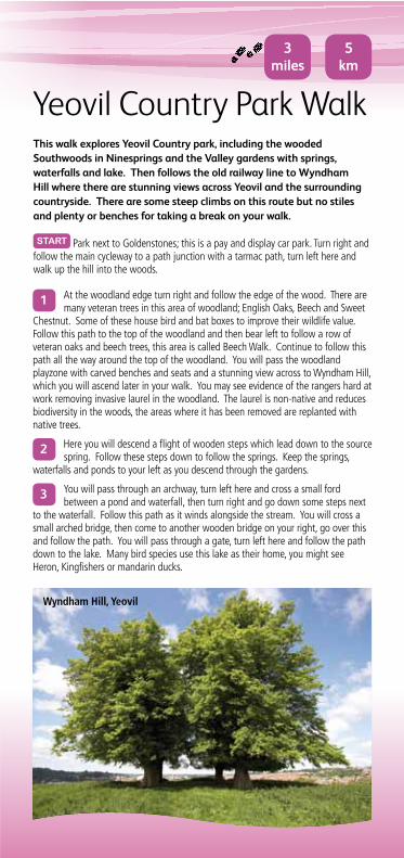
Wyndham Hill, Yeovil
4 Follow the main track around to a small parking area next to a childrens’ play area. Follow the path around the edge of the play area, keeping the play area
on your left, then turn right at the corner of the play area and follow the cycleway, straight across the access track along the enclosed cycleway. This is the old railway line. Follow this alongside and over the brook. You will walk along the bottom of Summerhouse hill to your right, with the Yeo Vale Leisure complex to your left. Continue to follow the path around the edge of the car park. You will then enter a wooded section of path, this is part of Wyndham Hill. The river Yeo is on your right.
5 You will reach a sharp left hand bend, where the path can cross a toucan crossing to lead to Pen Mill station. Don’t cross the road, but instead turn to
look up Wyndham Hill behind you. Go through the wooden gate and follow the path
1
2
3
4START
to the top of the hill where there are four mature lime trees. These are nearing the end of their life, you can see right through a couple of them, so young lime trees have been planted nearby. There are views from here across Yeovil and the surrounding countryside.
6 Descend the hill and bear left to a wooden gate, which leads to a flight of steps down to the cycleway. Here retrace your route around the edge of the
car park and through the enclosed cycleway, until you reach the play area access track, go straight across here and follow the cycleway through Ninesprings to your start point at Goldenstones.
5
6
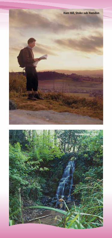
Ham Hill, Stoke sub Hamdon
Ninesprings, Yeovil
This walk explores Yeovil Marsh. There are good views across Somerset to the Poldens and Glastonbury Tor. The walk passes several small woodlands and if you are quiet you may see some of the many Roe Deer that live in this area. The walk can be very muddy as it crosses the marsh and it is advisable to wear appropriate footwear. Some of the stiles (on the longer route) are difficult for dogs to tackle.
START Park at Yeovil Recreation Centre Car Park, Chilton Grove, off Mudford Road. Walk to the playing fields. Follow the surfaced footpath to the right. At the fence at the edge of the playing field turn left for a short distance then turn right through the gate and cross the road. (BEWARE OF TRAFFIC)
Yeovil Marsh Parish Walkor 4 mile short walk
1 Go straight along a track between two houses. On a clear day from the track there are views across to the Poldens and the Mendips. As the old Somerset
saying goes “If you can see Glastonbury Tor it’s going to rain and if you can’t see Glastonbury Tor it is raining”. Go over the stiles and downhill. Cross two stiles and two sleeper bridges keep straight on, slightly to the left of the farm buildings. (Marsh Hill Farm)
2 Go over more stiles toward the buildings (Marsh Farm), keep the hedge on your right. Go over the stile to the right of the metal gate and turn right onto
the tarmac road. Follow this road until you reach a T-junction.
3 Turn left here, signposted ‘Limington’, and follow this road straight on at the next junction. Just after the road curves round to the right, there is a track to
the left and a signposted footpath through a gate.
4 Go through the gate and cross the field, slightly to the left of the corrugated buildings. Go through the next 2 fields and head slightly right, to the
left-hand side of the wood. This is Ashington Woods which are privately owned but you may catch glimpses of wildlife among the trees. Go over a stile and pass through a gateway next to the wood. Head across the field to the right of the farmhouse (Keeper’s House) toward a small clump of trees, partly visible over a small rise.
5 When you reach a track go straight on, follow the row of trees and go through a gateway straight ahead. Turn left and follow the hedge on
your left. At the corner turn right, still following the hedge until you reach a gap on the left.
6 Go through this and then head slightly right, over the stile, to a gap in the hedge on your right. Forty-Acre Plantation can be seen straight ahead.
Continue following the waymarks to the right edge of the wood on the brow of the hill. Stop here, turn and face the way you’ve just come and then head diagonally right across the same field to a stile and sleeper bridge near the corner. Go over this to a bridleway. Turn left along this bridleway for the short walk (Point 16) or head straight across the bridleway and into a field for the main walk. This bridleway follows part of Hook Drove, an old drove, which crosses Green Moor. This area is low and flat with many streams, this is why they are so damp.
7 Head diagonally across this field to the opposite corner, keep to the left of a small clump of trees that can be seen on the opposite field boundary. Go
over a bridge over a stream to the corner of the field. Go over a sleeper bridge and stile and turn left to the gate at the bottom of the field, keep the hedge on your left.
7 or 4 miles
11 or 7 km
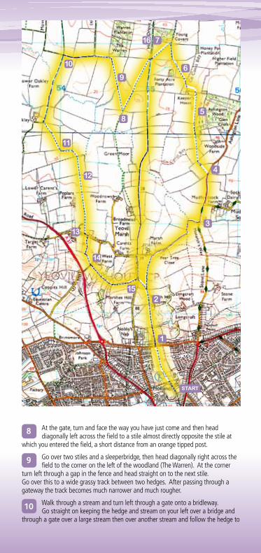
8 At the gate, turn and face the way you have just come and then head diagonally left across the field to a stile almost directly opposite the stile at
which you entered the field, a short distance from an orange tipped post.
9 Go over two stiles and a sleeperbridge, then head diagonally right across the field to the corner on the left of the woodland (The Warren). At the corner
turn left through a gap in the fence and head straight on to the next stile. Go over this to a wide grassy track between two hedges. After passing through a gateway the track becomes much narrower and much rougher.
10 Walk through a stream and turn left through a gate onto a bridleway. Go straight on keeping the hedge and stream on your left over a bridge and
through a gate over a large stream then over another stream and follow the hedge to
START
1
3
2
4
5
6
7
9
8
10
11
12
13
14
15
16
the corner of the field, the buildings on your right are New Oakley Farm. Go through a gate then turn immediately left across a footbridge and head diagonally across the field to the opposite corner and a gateway. (When maize is planted in these fields a permissive path will be in place around the edge of the filed to avoid walking through the crop.)
11 Go through this gateway and continue straight on for a short distance, past another gateway on the left, then turn right, keep the hedge on your left.
Go over a footbridge and stiles and head diagonally right across the field to footbridge and stiles. Cross the stream and head straight on keeping a smaller stream on your right.
12 Go through a gate and head slightly left across the field to the left of a large farm building (Poplars Farm). Go over a stile and footbridge and follow the
hedge on your right and continue along a track to the road.
13 At the road turn left through the village of Yeovil Marsh. After a short distance turn right into the mobile homes park. Follow the road through the
mobile homes park, to a signposted grass pathway; follow this. At a footbridge, head diagonally left across the field to a stile, go over this onto a road.
14 Cross the road and follow the signposted footpath opposite. Keep an evergreen hedge on your left until it bends to the left. Head diagonally right
across the field down the hill. Go over a stream and head diagonally left across the field to a gateway. Go through the double gates and straight up the hill, up a flight of steps across a stretch of field and over a stile. Turn left and keep the hedge on your left. Near a large oak tree in the hedge go through a gap in the hedge on the left, cut across the corner of the field to a stile on the left of a white house. Go over this stile and along a path to a road (Marsh Lane).
15 Turn right and almost immediately turn left in front of a garage signposted ‘Public Footpath’. Go through a gate and head diagonally right across the
field. At the top of the rise, turn right over two stiles and retrace the walk back to Mudford Recreation Centre. SHoRT Walk
16 After turning left, follow the track until reaching an enclosed track on the right. Go through a wooden gate onto this track with a stream on the right.
At the end of the enclosed track go straight on over a bridge to follow another track. Once you have passed the entrance to Broadmead Farm on the right, the track becomes more solid. At the crossroads go straight on along a lane (Marsh Lane). Turn left at a garage signposted ‘Public Footpath’ to rejoin the long walk at point 15.
This map is based upon Ordnance Survey material with the permission of Ordnance Survey on behalf of the Controller of Her Majesty’s Stationery Office © Crown copyright. Unauthorised reproduction infringes Crown copyright and may lead to prosecution or civil proceedings. South Somerset District Council. Licence No. LA/100019471-2011
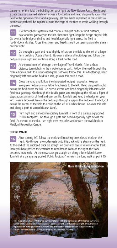
Ham Hill looking to Norton
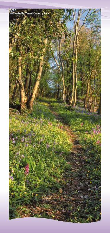
Bluebells, Yeovil Country Park

If you need this information in large print, Braille, audio or another language, please contact 01935 462228
Este documento encontra – se didpanÍen portugîs, a pedido. Dokument tem jest na yczenie udost pniany w jzyka polskim.
Published by: Tourism Service, South Somerset District Council, Brympton Way, Yeovil, Somerset. Telephone: 01935 462462 Email: [email protected]
Photo credits: South Somerset District Council Designed by: bean-creative.co.uk ©SSDC 2011
For 24 hour information visit our website:
www.southsomerset.gov.uk/countryside
YEOVIL
YEOVIL MARSH
ODCOMBE
HARDINGTON WEST COKER
BARWICK
A3088
A30
A30
A37
A37
1 mile
2 km
A30
3
Please follow the Countryside Code:Be safe, plan ahead, follow any signs.
Leave gates and property as you find them
Protect plants and animals and take your litter home
Keep dogs under close control
Consider other people
These routes follow public rights of way if you encounter any problems please contact: www.somerset.gov.uk/rightsofway