Embed Size (px)
Citation preview

WALKINGAROUND
HADLEIGH
Six Walkswith Maps

Walking Around Hadleigh
Produced byHadleigh Town CouncilThe Guildhall, Hadleigh
Suffolk IP7 5DN
Tel: 01473 823884E.mail: [email protected] page: www.hadleigh.suffolk.gov.uk

THE TOWN
Hadleigh has been designated an Historic Town by The Council for British Archaeology and isincluded on a short list of 51 towns throughout the country considered to be of national importance.The town has a wealth of old buildings and a few hours spent exploring will prove fruitful for thoseinterested.
Hadleigh is 10 miles west of Ipswich (A1071), 12 miles east of Sudbury (A1071),14 miles south ofStowmarket (B115/A1141) and 15 miles north of Colchester (A12/B1070).
How To Get There
By BusFor the most up to date timetable contact Suffolk County Council via their website:www.suffolk.gov.uk or phone Traveline 0871 200 2233
By RoadA1071 from Ipswich. A1141 from Bury St Edmunds. A12/B1070 from Colchester. A1071 fromSudbury.
ParkingThe main car park is situated in Magdalen Road. Short stay parking is free, but limited to 3 hours anda ticket must be displayed. Long stay car parks are in Magdalen Road and Stonehouse Road off GeorgeStreet.
RefreshmentsThere are several places to eat and stay in the town, most of which are listed in our ‘Where to Eat,Drink and Stay’ Leaflet which can be found in St. Mary’s Church, the Library, 29 High Street (openTuesday to Sunday) or on Hadleigh Town Council’s website.
B1115
B1115
B1070
B1115
B1071
B1113
B1113
A14
A12
A12A14
B1080
A137
A134
A134
A1092
B1068
A131B1058
A1071
B1068B1087
A134
A134
A1071
B1505
A1214
B1078
SUDBURY
LAVENHAM
HADLEIGH
to COLCHESTER
to BURY St EDMUNDS
LONG MELFORD
HALSTEAD
A14 to BURY St EDMUNDS
IPSWICH
to LOWESTOFT
FELIXSTOWE
HARWICH
STOWMARKET
AltonWater
1

Circular Walk Number 1 - Hadleigh
Length of walk: 4½ milesTime taken: 2½ hours
The route is clearly marked by green public foot path signs and waymark arrows displaying a circularwalk symbol.
THE WALK
From Magdalen Road turn left into George Street. Noting the many half timbered houses and thealmshouses chapel, continue to Tower Mill Lane. Follow the farm track to Durrant’s Farm, fork leftjust before the house and keeping close to the hedge to the left walk through the garden into the fieldbeyond. Continue east with a shallow ditch to the left and pass through a gap in the next hedge.Follow a good headland path around the next field, then cross two sleeper bridges to join a grass bridleway. Turn right through the farm yard past Valley Farm and continue along Valley Farm Lane to joinPond Hall Road near an engineering works. Turn left along the road and around some bends – carefulhere – to the entrance to Pond Hall Farm. Pond Hall, to the right of the farm was the home in theeighteenth century of John Harvey, a farmer and member of a group of smugglers known as TheHadleigh Gang. Turn right and follow a green lane for 600 yards then cross two pleasant meadows to astile alongside a large tree at the foot of the railway embankment. The last few yards are always boggy!Cross the stile and a bridge over a stream and follow a well worn path through some undergrowth tosome steps leading up the embankment. The definitive path continues over a stile and into the fruitfarm, but climb the steps to enjoy some extensive views south west towards Layham. The railway linewas opened in 1847 and was originally intended to continue past Hadleigh to Lavenham and Bury St.Edmunds. Follow the old track bed towards the town for about a mile, eventually passing the oldstation in Station Road. Return to the start via Magdalen Road.
2
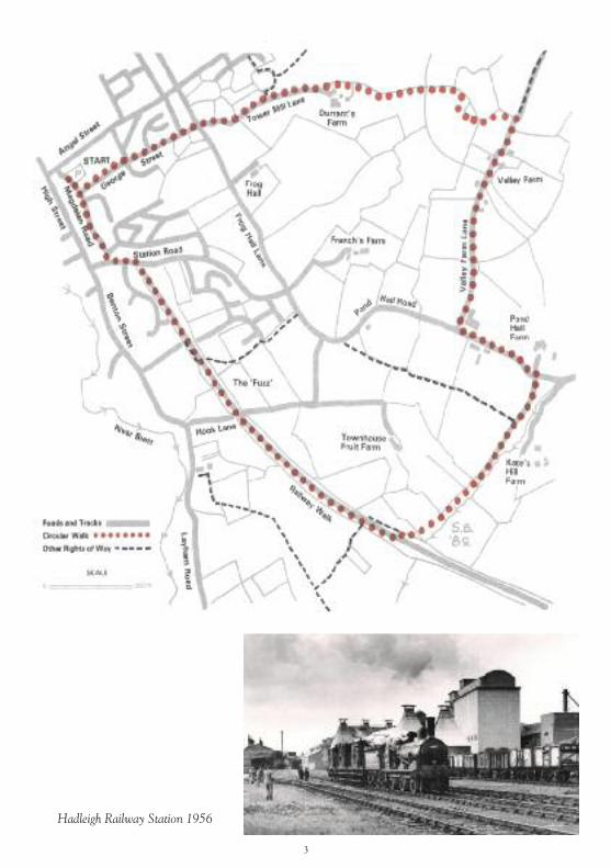
Hadleigh Railway Station 1956
3
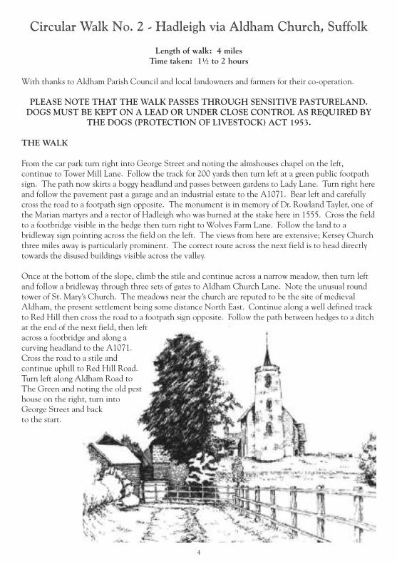
Circular Walk No. 2 - Hadleigh via Aldham Church, Suffolk
Length of walk: 4 milesTime taken: 1½ to 2 hours
With thanks to Aldham Parish Council and local landowners and farmers for their co-operation.
PLEASE NOTE THAT THE WALK PASSES THROUGH SENSITIVE PASTURELAND.DOGS MUST BE KEPT ON A LEAD OR UNDER CLOSE CONTROL AS REQUIRED BY
THE DOGS (PROTECTION OF LIVESTOCK) ACT 1953.
THE WALK
From the car park turn right into George Street and noting the almshouses chapel on the left,continue to Tower Mill Lane. Follow the track for 200 yards then turn left at a green public footpathsign. The path now skirts a boggy headland and passes between gardens to Lady Lane. Turn right hereand follow the pavement past a garage and an industrial estate to the A1071. Bear left and carefullycross the road to a footpath sign opposite. The monument is in memory of Dr. Rowland Tayler, one ofthe Marian martyrs and a rector of Hadleigh who was burned at the stake here in 1555. Cross the fieldto a footbridge visible in the hedge then turn right to Wolves Farm Lane. Follow the land to abridleway sign pointing across the field on the left. The views from here are extensive; Kersey Churchthree miles away is particularly prominent. The correct route across the next field is to head directlytowards the disused buildings visible across the valley.
Once at the bottom of the slope, climb the stile and continue across a narrow meadow, then turn leftand follow a bridleway through three sets of gates to Aldham Church Lane. Note the unusual roundtower of St. Mary’s Church. The meadows near the church are reputed to be the site of medievalAldham, the present settlement being some distance North East. Continue along a well defined trackto Red Hill then cross the road to a footpath sign opposite. Follow the path between hedges to a ditchat the end of the next field, then leftacross a footbridge and along acurving headland to the A1071.Cross the road to a stile andcontinue uphill to Red Hill Road.Turn left along Aldham Road toThe Green and noting the old pesthouse on the right, turn intoGeorge Street and backto the start.
4
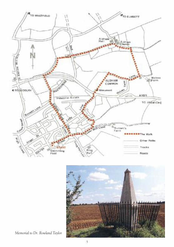
Memorial to Dr. Rowland Taylor
5
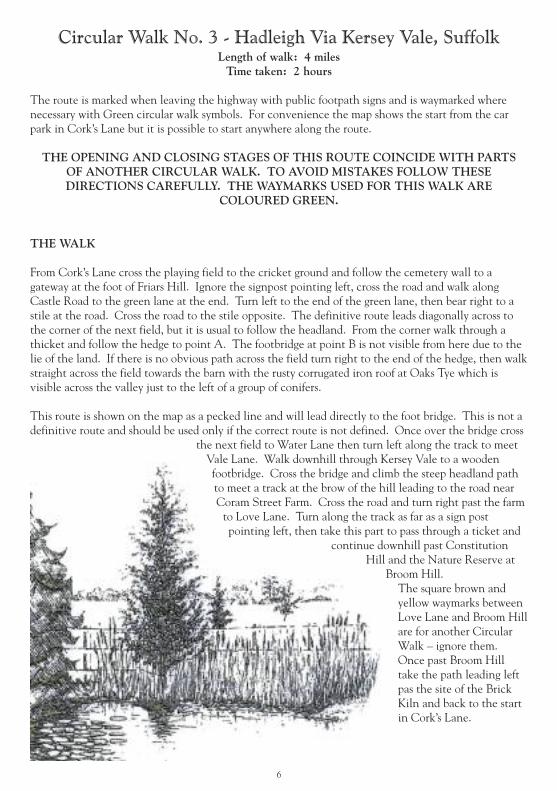
Circular Walk No. 3 - Hadleigh Via Kersey Vale, SuffolkLength of walk: 4 milesTime taken: 2 hours
The route is marked when leaving the highway with public footpath signs and is waymarked wherenecessary with Green circular walk symbols. For convenience the map shows the start from the carpark in Cork’s Lane but it is possible to start anywhere along the route.
THE OPENING AND CLOSING STAGES OF THIS ROUTE COINCIDE WITH PARTSOF ANOTHER CIRCULAR WALK. TO AVOID MISTAKES FOLLOW THESEDIRECTIONS CAREFULLY. THE WAYMARKS USED FOR THIS WALK ARE
COLOURED GREEN.
THE WALK
From Cork’s Lane cross the playing field to the cricket ground and follow the cemetery wall to agateway at the foot of Friars Hill. Ignore the signpost pointing left, cross the road and walk alongCastle Road to the green lane at the end. Turn left to the end of the green lane, then bear right to astile at the road. Cross the road to the stile opposite. The definitive route leads diagonally across tothe corner of the next field, but it is usual to follow the headland. From the corner walk through athicket and follow the hedge to point A. The footbridge at point B is not visible from here due to thelie of the land. If there is no obvious path across the field turn right to the end of the hedge, then walkstraight across the field towards the barn with the rusty corrugated iron roof at Oaks Tye which isvisible across the valley just to the left of a group of conifers.
This route is shown on the map as a pecked line and will lead directly to the foot bridge. This is not adefinitive route and should be used only if the correct route is not defined. Once over the bridge cross
the next field to Water Lane then turn left along the track to meetVale Lane. Walk downhill through Kersey Vale to a woodenfootbridge. Cross the bridge and climb the steep headland pathto meet a track at the brow of the hill leading to the road nearCoram Street Farm. Cross the road and turn right past the farmto Love Lane. Turn along the track as far as a sign postpointing left, then take this part to pass through a ticket and
continue downhill past ConstitutionHill and the Nature Reserve at
Broom Hill.The square brown andyellow waymarks betweenLove Lane and Broom Hillare for another CircularWalk – ignore them.Once past Broom Hilltake the path leading leftpas the site of the BrickKiln and back to the startin Cork’s Lane.
6

View of Hadleigh across theRiver Brett at Corks Lane
circa 1910
7

Circular Walk No. 4 - Hadleigh Via Bullocky Fen, SuffolkLength of walk: 4 miles
Time taken: 1½ to 2 hours
The route is signposted when leaving the highway with public footpath signs and is also waymarkedalong the route where necessary with posts displaying Blue circular walk symbols.
PLEASE NOTE THAT THE WALK PASSES THROUGH SENSITIVE PASTURELAND.DOGS MUST BE KEPT ON A LEAD OR UNDER CLOSE CONTROL AS REQUIRED BY
THE DOGS (PROTECTION OF LIVESTOCK) ACT 1953.
THE WALK
From the car park near Toppesfield Bridge follow Holbecks Lane as far as Holbecks Farm. Once pastthe red brick barn turn left over a stile, then cross a meadow to another stile and continue up the hillto a lane. Cross to a footpath sign and take the path through arable fields. At the end of the third fieldcross to the hedge opposite and bear left as far as a stile leading into a rough meadow.Climb the stile and descend the steep slope to a footbridge over a stream. Ensure the gate here is shutplease. Once over the bridge climb up to a stile and cross the next field in the direction of a clump ofbushes visible in the distance. This is a large field but the route should be marked out by the farmer.At the road turn left for a matter of yards then left again into the green lane leading to Rands Farm.Follow the land to the farm and turn left into the farm drive. Keeping to the right of the farm yardenter a sunken lane which leads to Bullocky Fen. The Fen is always wet – waterproof footwear must beworn! Follow the path downhill to the stream and cross a wooden bridge. Turn almost immediatelyleft over another bridge which leads via a marshy path to steps cut into the hillside. The second bridgecan become overgrown and difficult to find – take care here. Climb the steps to the stile and follow thheadland path up to a track leading to Hill Farm. Follow the track past a reservoir, then to the left as
far as a hedge which runs past the farm house. Followthe right hand side of the hedge to the farm drivethen continue to the road. The views over the Brettvalley are particularly extensive from around HillFarm. The route crosses the road and the cornerof the field ahead and follows the left side of ahedge ending at Layham Road. It is possible totake the land down to Layham Road as analternative if desired. Follow the road back
to the startingpoint atToppesfieldBridge.
8

9

Countryside Walks- Love Lane Walk & Benton End WalkLength of walk – 2 to 3 milesTime taken: 1 to 2 hours
These two walks start close to the town centre and provide good opportunities to walk in the countryside to thewest (3 miles) and south (2 miles) of the town. The routes have been developed on public rights of way and onother land owned by the Town Council and Babergh District Council; their co-operation is gratefullyacknowledged. Each path is clearly marked with green footpath signs and yellow waymark arrows displaying acircular walk symbol. Although the routes can be easily walked, waterproof footwear should be worn, except in thedriest of weather.
The following Ordnance Survey sheet shows other rights of way in the area: Pathfinder series, Sheet 1030 TM04/14 Ipswich.
LOVE LANE WALK
From the start at Toppesfield Bridge follow the Riverside Walk to Corks Lane.
Turn left along the wall of the Cemetery and the edge of the Cricket Ground to Coram Street and up Friars Hill100 metres to the brick steps giving access to the fields on the left. Good views of the town can be seen from thissection of the path which follows the right side of the hedge to Broom Hill Nature Trail, an area that can beexplored to extend your walk.
Continue on through the trees down the steep path to the field, turning right on the rising cross field path and thenthe left side of the hedge to join Love Lane. Turn left in the lane for 500 metres and then left again into HolbecksLane, downhill all the way to the start.
BENTON END WALK
From Toppesfield Bridge walk along Tinkers Lane to the footbridge over the River Brett where a mill once stood.On the other side of the river turn left in Benton Street and then right up Station Road to the Railway Walk LocalNature Reserve.
The circular walk leaves the old railway after ¾ mile at the Hook Lane bridge but a pleasant extension of 3 milesthrough Raydon Great Wood can be achieved by continuing to Raydon Station and return.
Descend to Hook Lane via steps in the embankment and turn right to the B1070 road. Cross to the roadsidefootway and left for 100 metres to the public footpath which recommences on the right.
Cross the River Brett via the footbridge next to the ford and turn right on the cross field section of path to the stile.After the second stile the path follows the field headland to the Layham Road, turn right for 400 metres and justpas the bends, enter the Playing field on the right.
Follow the roadside hedge to the car park and across to the steps at the rear giving access to the steel gate behindthe pavilion. This path returns to Tinkers Lane and the start.Access to the Walks
The walk descriptions start from the Toppesfield Bridge situated at the end of Duke Street but the routes can bejoined at several other points close to the town.
10

11

The Railway Walk and Pond HallLength of walk: 4½ milesTime taken: 2 – 2½ hours
Terrain: Railway track-bed, roads, meadows, field-edge paths; 3 stiles; 3 uphill sections. Can be muddyin places.
Turn left out of Magdalen Road car park and walk to the end of the road. At the junction turn leftthen cross the road at the zebra crossing. Continue uphill, and turn right at a sign “P – Railway Walk”.
The Hadleigh Branch of the Eastern Union Railway was opened in 1847with the intention of continuing to Bury St Edmunds via Lavenham, butthis never happened and Hadleigh remained the end of the line. Passengertraffic ceased in 1932 and the line was finally closed in 1965. The originalstation, now a private house surrounded by modern development, can beseen on the left. Pass alongside a metal barrier onto a tarmac path whichjoins the former railway track-bed by a National Cycle Route sign. Walkfor about one mile, sometimes in a cutting and sometimes on anembankment with wide views on both sides, until you reach a four-waysignpost. Go left here through the hedge and turn right along a field-edgepath. At the end of the field pass through a gap in a fence and follow anobvious winding path through an area of scrub.
A Romano-British building with a hypocaust was excavated here in 1954.
Cross a sleeper bridge over a stream and climb a stile into a marshy meadow. Follow the well-usedroute to drier ground and aim for a gate at the far side of the field. Climb a stile into the next meadowand walk across it to another gate and stile giving onto a track between hedges. Follow the track untilyou reach an electricity pylon. Turn left at the pylon and walk along a field edge path with a ditch onthe right. Pass behind some industrial units and at a footpath sign turn right and walk along a gardenhedge and fence to Pond Hall Road. Cross with care, turn left and in a few metres turn right at a postbox into Valley Farm Lane.
At the end of the lane turn right into the farmyard, then immediately left onto a cinder track. Whenthis bears right, keep straight ahead, now on grass, until the track goes right, through a hedge gap by asignpost. Turn left here and follow the field-edge path with a ditch on the right. Stay on this pathuntil it goes through a gap in the hedge. Cross a track and continue ahead again along a field-edgepath by a ditch. As you reach the top of the rise you can see Hadleigh spread out below. Walkdownhill, aiming for a gap in the hedge ahead, and pass through. The footpath continues ahead
through the garden of Durrant’s Farm, keepingclose to the hedge on the right. Turn right onto anunmade road which then becomes tarmacked.
The houses on the left (Tower Lodge) as you crestthe rise are on the site of a tower windmill whichceased working in 1905.
At a crossroads continue ahead down GeorgeStreet, passing The Row Chapel and numerous veryold houses.
12

When a T-junction is reached you are back atMagdalen Road. Turn right for the startingpoint at the main car park, or carry on aheadalong the pedestrianised area to the High Streetand historic town centre for sightseeing andrefreshments.
The circular routes cross several open fields andas many people are reluctant to walk overgrowing crops a few words of explanation may beof use to walkers. All the paths included in thiswalk have been checked against the DefinitiveMaps held by Suffolk County Council; thepublic have a right to use them. Use the mapand the text to determine the route if in doubtor as an alternative it is often possible to followa tractor wheelmark to the desired point.
13
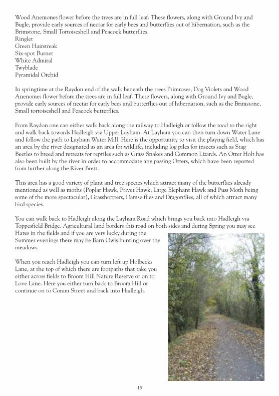
The Nature of HADLEIGH & Surrounding AreaThe Railway Walk
Length of walk: 2 miles to RaydonTime taken: 1 hour to Raydon and back to Hadleigh
Terrain: Railway track-bed, roads, meadows, field-edge paths; 3 stiles; 3 uphill sections. Can be muddyin places.
Most of the walk is bordered by trees either on raised banks oron downward slopes, and the surrounding landscape is apatchwork of fields, copses and hedgerows. Towards Raydon thepath cuts through a small area of light woodland creating adifferent type of habitat much preferred by Badgers and Deer.The walk starts on Station Road where the original stationbuilding (now converted into a private dwelling) still stands andcan also be accessed at several points – one in Clopton Gardens,one at the end of Cranworth Road and one by the bridge onHook Lane. Just beyond Hook Lane, next to the stables, a
pathway leads across fields eventually meeting the railway walk about halfway.
Adjacent to the beginning of the Railway Walk is a small area of mixed woodland and heath known asThe Fuzz. This is a local nature reserve managed by Babergh District Council and can be accessed fromthe Railway Walk, Stockton Close, Carlton Walk and Cranworth Road. It has a variety of tree speciesequal to those found on Broom Hill Nature Reserve, and this provides a rich habitat for wildlife. Theopen heath areas are especially good for reptiles such as Slow-Worms, Common Lizards and GrassSnakes, which prefer the loose sandy soil when digging holes in which to lay their eggs.It is here, in early Spring, where you can hear the distinctive song of the Nightingale, where it arriveson migration before steadily spreading out further along the walk and into the surroundingcountryside.
In late Spring keep a sharp look out for the small Green Hairstreak butterfly, flitting around the Gorsebushes. Its green underside matching the leaves so well it is very hard to spot. Also look out for thevery scarce Purple Hairstreak butterfly, the male marking out his territory around the tops of the oaktrees at the edge of the Fuzz. Also common to the Fuzz are the Ringlet butterfly and the Burnet andCinnabar. The Six-spot Burnet moth is a day flying moth whose colouration of black and red serve as awarning to would-be predators that it is distasteful.
Along the railway walk there are a wide variety of flowers, woodland birds and insects to see. Many ofthe species to be found along the river walk are also found here. Jays are amongst the largest birds to befound, but are generally secretive and hard to observe. If you are patient you may be rewarded by thesight of a bullfinch or two. Although fairly common in orchards, especially at flowering time, they arenot as prolific here.
One insect to look out for – or listen for! – from July onwards is the large (2.5”) Great Green Bush-Cricket. This insect is found on low bushes and in the trees, its song sounding like a loud sewingmachine! Other crickets found here include the Oak Bush-Cricket, Speckled Bush-Cricket and theDark Bush-Cricket.
The Pyramidal Orchid and the Twyblade Orchid are two of the more unusual flowers to be found alongthe walk. In springtime at the Raydon end of the walk beneath the trees, Primroses, Dog Violets and
14
Wood Anemones flower before the trees are in full leaf. These flowers, along with Ground Ivy andBugle, provide early sources of nectar for early bees and butterflies out of hibernation, such as theBrimstone, Small Tortoiseshell and Peacock butterflies.RingletGreen HairstreakSix-spot BurnetWhite AdmiralTwybladePyramidal Orchid
In springtime at the Raydon end of the walk beneath the trees Primroses, Dog Violets and WoodAnenomes flower before the trees are in full leaf. These flowers, along with Ground Ivy and Bugle,provide early sources of nectar for early bees and butterflies out of hibernation, such as the Brimstone,Small tortoiseshell and Peacock butterflies.
From Raydon one can either walk back along the railway to Hadleigh or follow the road to the rightand walk back towards Hadleigh via Upper Layham. At Layham you can then turn down Water Laneand follow the path to Layham Water Mill. Here is the opportunity to visit the playing field, which hasan area by the river designated as an area for wildlife, including log piles for insects such as StagBeetles to breed and retreats for reptiles such as Grass Snakes and Common Lizards. An Otter Holt hasalso been built by the river in order to accommodate any passing Otters, which have been reportedfrom further along the River Brett.
This area has a good variety of plant and tree species which attract many of the butterflies alreadymentioned as well as moths (Poplar Hawk, Privet Hawk, Large Elephant Hawk and Puss Moth beingsome of the more spectacular), Grasshoppers, Damselflies and Dragonflies, all of which attract manybird species.
You can walk back to Hadleigh along the Layham Road which brings you back into Hadleigh viaToppesfield Bridge. Agricultural land borders this road on both sides and during Spring you may seeHares in the fields and if you are very lucky during theSummer evenings there may be Barn Owls hunting over themeadows.
When you reach Hadleigh you can turn left up HolbecksLane, at the top of which there are footpaths that take youeither across fields to Broom Hill Nature Reserve or on toLove Lane. Here you either turn back to Broom Hill orcontinue on to Coram Street and back into Hadleigh.
15
The Countryside Code
Enjoy the Countryside and respect its life and work
Guard against all risk of fire
Fasten all gates
Keep your dogs under close control
Keep to public paths across farmland
Use gates and stiles to cross fences, hedges and walls
Leave livestock, crops and machinery alone
Take your litter home
Help to keep all water clean
Protect wildlife plants and trees
Take special care on country roads
Make no unnecessary noise.
16

17
Keith Avis Printers (01473) 823366