Embed Size (px)
Citation preview
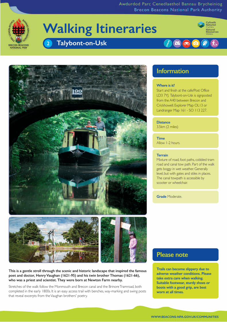
This is a gentle stroll through the scenic and historic landscape that inspired the famouspoet and doctor, Henry Vaughan (1621-95) and his twin brother Thomas (1621-66),who was a priest and scientist. They were born at Newton Farm nearby.
Stretches of the walk follow the Monmouth and Brecon canal and the Brinore Tramroad, bothcompleted in the early 1800s. It is an easy access trail with benches, way-marking and swing poststhat reveal excerpts from the Vaughan brothers' poetry.
Where is it? Start and finish at the cafe/Post OfficeLD3 7YJ. Talybont-on-Usk is signpostedfrom the A40 between Brecon andCrickhowell. Explorer Map OL13 orLandranger Map 161 - SO 113 227.
Distance3.5km (2 miles)
TimeAllow 1-2 hours.
TerrainMixture of road, foot paths, cobbled tramroad and canal tow path. Part of the walkgets boggy in wet weather. Generallylevel, but with gates and stiles in places.The canal towpath is accessible byscooter or wheelchair.
Grade Moderate.
Trails can become slippery due toadverse weather conditions. Pleasetake extra care when walking.Suitable footwear, sturdy shoes orboots with a good grip, are bestworn at all times.
WWW.BEACONS-NPA.GOV.UK/COMMUNITIES
Walking ItinerariesTalybont-on-Usk 2
Information
Please note

WWW.BEACONS-NPA.GOV.UK/COMMUNITIES
10
The Route
star
tcy
chw
yn
© Brecon Beacons National Park Authority. © Crown copyright and database rights 2016 Ordnance Survey 0100019322.

Activities suitable on this routeGeocaching, BMC 1 - white corner GC2EC5V, journey sticks, colour palettes, bird watching, photography.
WWW.BEACONS-NPA.GOV.UK/COMMUNITIES
The Route
1
2
Cross the road from the café/Post Office and walk over thecanal swing bridge. Follow the road as it bears left then right,past the old school house. Continue walking until you cross a bridge. Climb the stone stile next to it on your left.
••••••••••••••••••••••••••••••••••••••••••••••••
Walk through the field, towards the river following the waymarkers. This field often has horses in it -they are part of theCui Stud of Welsh Mountain ponies. Go through the kissinggate and through another field, keeping in close, but safedistance from the river on the left (River Caerfanell). Continuethrough another kissing gate, and look for a tall post. Pull thehandle and read the poetry. You are now on the HenryVaughan Walk.
••••••••••••••••••••••••••••••••••••••••••••••••
Walk through the field and cross the bridge. Go through thegate immediately on your right, following the path, with theriver now on your right. Look out for another Vaughan post.After a short distance the path then divides. Take the path tothe left which slopes gently upwards.
••••••••••••••••••••••••••••••••••••••••••••••••
Turn right under the railway bridge then bear left. Carry onalong the track a short distance and go through a gate andthen a kissing gate into a field. Bear right and follow thedistinct way marked path that runs up hill alongside the fence.Go through the kissing gate onto a wide path (the BrinoreTramroad) where you will find another Vaughan post.
••••••••••••••••••••••••••••••••••••••••••••••••
Turn left and follow the Brinore Tramroad down towardsTalybont. The total tramroad runs for 8 miles (13 km) fromTalybont-on-Usk to Trefil near Merthyr Tydfil. It was usedbetween 1815-1865 to carry coal from the Rhymney Valleyand limestone from Trefil to the Monmouthshire and Breconcanal at Talybont.
3
4
5
Look out for a notice board on your left and the HenryVaughan garden. This garden is sown with herbs and otherplants Henry would have used in his scientific and medicalexperiments. It is a good spot to stop for a picnic.
••••••••••••••••••••••••••••••••••••••••••••••••
At the end of the tramroad turn left over the old railwaybridge and follow the road down to the White Hart Inn andthe canal. Turn left and walk along the canal tow path until youarrive back at the swing bridge and the café.
Variation Can be walked in reverse.
To shortenWalk in reverse from the White Hart pub alongthe Brinore tramroad to the Henry Vaughan garden andreturn. Turn right at the White Hart on return and follow thecanal to the remains of the lime kilns, the tram and BrinoreTramroad information board. Walk back along the canal.(1m/2km).To lengthen At 3. Instead of taking the path to the leftcontinue on with the river on your right. Cross a stile andhead uphill across a field to a gate. Turn right here. You are onthe old Brecon to Merthyr railway track. After 100m youreach a path junction. *Turn sharp left and head uphill forapproximately 200m. This takes you to the Brinore Tramroad.Turn left to join the original walk after about 0.5 mile /1km.* Continue straight on to reach Talybont Reservoir (another0.5 mile/1 km) Retrace steps back to *
6
7

InformationParking Roadside parking is available through the village-please parkresponsibly. Alternatives include the village hall car park (HendersonHall).There is no charge but there is a donation box available.
••••••••••••••••••••••••••••••••••••••••••••••••••••••
Refreshments and toilets There is a shop/post office with a café(Open Mon-Sun 9-4 Ring: 01874 676663 to check) and several pubsin the village. There are toilets at the village hall (20p charge) and alsofor customers at the cafe. The closest disabled access toilets are at theLlansantffraed lay-by on the A40.
••••••••••••••••••••••••••••••••••••••••••••••••••••••
Public Transport www.traveline.cymruBy train - nearest mainline station is Abergavenny (15 miles away)By bus- X 43 Abergavenny to Brecon via Talybont.
••••••••••••••••••••••••••••••••••••••••••••••••••••••
Nearest TownsBrecon. All facilities.
••••••••••••••••••••••••••••••••••••••••••••••••••••••
Websiteswww.breconbeacons.org www.Geocaching.comwww.talybontonusk.comwww.brinore-tramroad.powys.org.ukwww.breconbeacons.org/explore/things_to_do/walking/where_to_walk/short_walks/talybont_valley
Dogs Suitable for dogs. Should be on a lead near livestock.
Talybont-on-Usk
Sample Itinerary
10.30 Arrive. Tea/coffee at the café
11.00-12.30 Follow the route to the Henry Vaughan Garden
12.30-1.00 Picnic lunch (or lunch at local café or pubs)
11.00 Finish walk. Visit the Talybont lime kilns (see shorter walk overleaf) or visit Henry Vaughan’s grave at Llansantffraed Church at the A40 junction http://www.breconbeacons.org/ church-st-ffraed-llansantffraed
2
110
4
8
5
6
9
3
7
Talybont2
Taf Fechan3 Llanfoist8
Sugar Loaf Mountain9
Llangorse5
Pen-y-crug6
Pontneddfechan4
Craig-y-nos1
Cribarth10Twyn-y-gaer7
WWW.BEACONS-NPA.GOV.UK/COMMUNITIES
The purpose of this booklet is to promote tourism. The maps in this booklet are covered by © Crown copyright and database rights 2016 Ordnance Survey 0100019322. You are not permittedto copy, sub-licence, distribute or sell any of this data to third parties in any form.
© Brecon Beacons National Park Authority. © Crown copyright and database rights 2016 Ordnance Survey 0100019322.