Embed Size (px)
Citation preview
8/14/2019 Ward Charleston Disaster Preparedness
http://slidepdf.com/reader/full/ward-charleston-disaster-preparedness 1/20
1
Disaster Preparedness Considerations in Long Term Planning Efforts withCase Studies Highlighting Experiences in and around Charleston, SC
James L. Ward, Landscape Architect and Assistant Professor HistoricPreservation and Community Planning
Norman Levine, Geologist and Assistant Professor Department ofGeography and Environmental SciencesCharles Kaufman (Lab Manager Santee Copper GIS LAB)
Introduction
When I first suggested that I might team with Norm Levine a geologist
working teaching in the GIS lab in Charleston, I felt that it was definitely time that
I, as a practicing Landscape Architect and preservationist involved on very
practical problems on a field level, work on a larger scale. I have been
enlightened by this collaboration and grateful to this organization for giving me a
reason to do so.
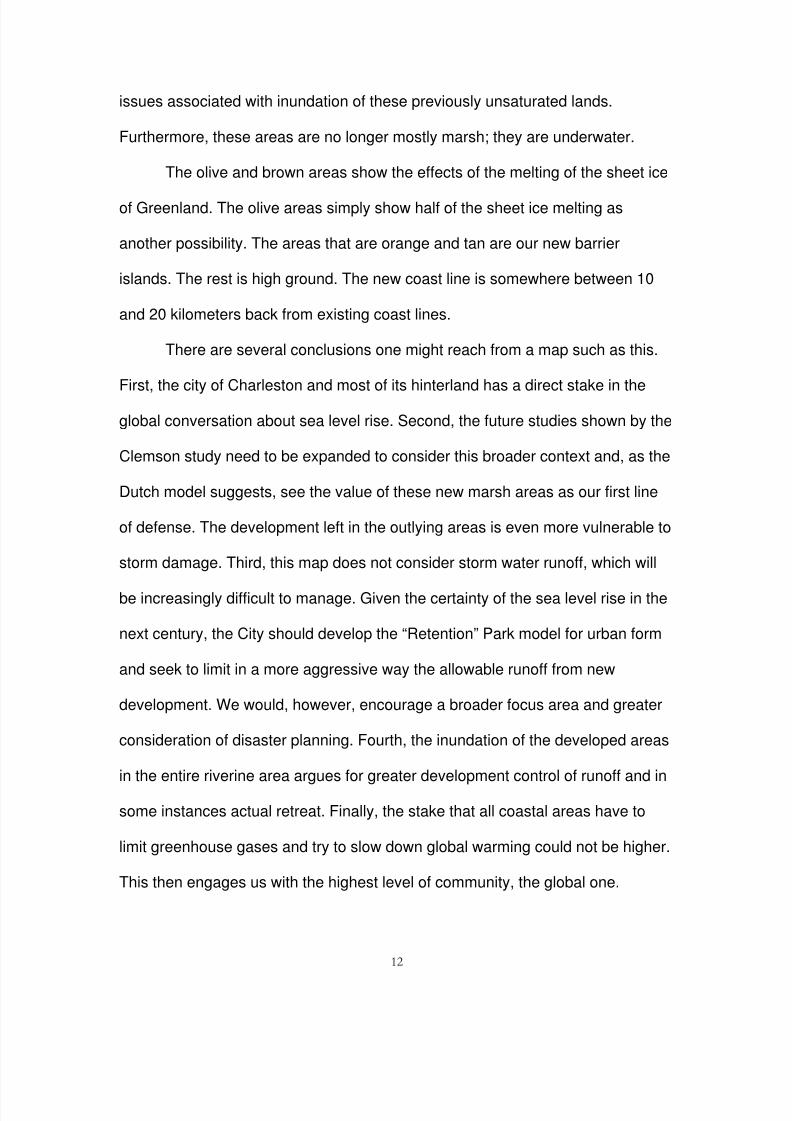
The premise for this paper is that coastal, historic places like Charleston
and New Orleans will need special planning efforts to face disasters and a
perhaps dramatic, new vision of how to manage those threats. This vision should
also make a contribution to the urban aesthetic and manage to cope with
preservation needs to be effective. This is the tonic for the current lack of
engagement, apathy, even denial that seems to permeate the popular discussion
so far (See Figure 1).
We further make the case that planning for the next disaster is a way
forward to think more creatively about how to deal with the day-to-day problems
of infrastructure in an historic city like Charleston. Disaster preparation offers a
less polarizing context in which to address some aspects of a longer-term
situation directly and with some shared sense of urgency. To this end, we have
8/14/2019 Ward Charleston Disaster Preparedness
http://slidepdf.com/reader/full/ward-charleston-disaster-preparedness 2/20
2
developed several maps reflecting the best information available to clarify the
futures we face and the status of the historic resources we seek to protect. If we
must retreat from the ocean and plan for rising waters, let us do so in a planned
and careful way, basing what we do on what we know of a broader
environmental context and broader notion of setting and of place.
Study area and proposal
The focus of this study is the tidal and riverine system that is the setting
for Charleston. In fact, these rivers merge indistinguishably with the Stono,
Edisto, Peedee complex held in check by Lakes Moultrie and Marion slightly
upcountry and bounded by the Atlantic on the south and east. The proposal I am
offering is based on the conflation of ideas from Clemson’s recent study to think
about the urban form of Charleston in the face of rising sea levels and the so-
called “Dutch” ideas that are being discussed for the New Orleans area - that is
the notion of a tiered level of coastal reinforcement in support of the current levee
system. Our combined research and practical perspectives seem well suited to
address this issue under the general idea of planning for disasters.
Background
It is not the point here to engage in an historical discussion about
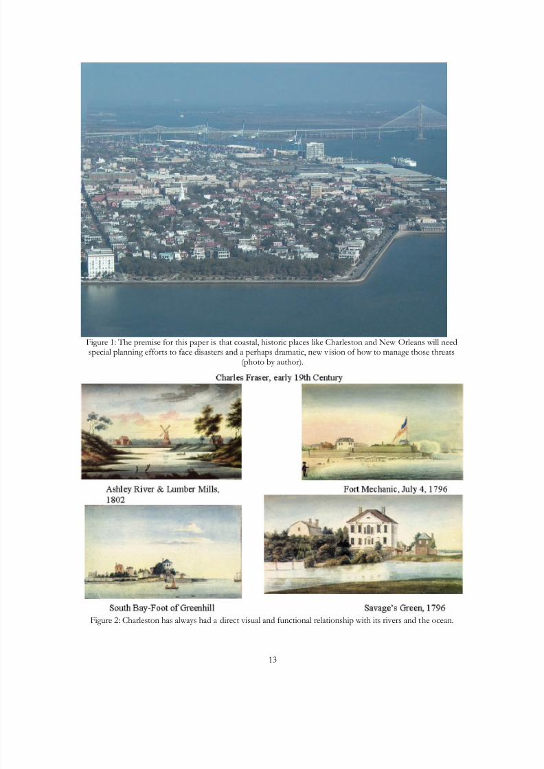
Charleston, but it is worth making a few points about this historic city. From its
outset, Charleston has always had a direct visual and functional relationship with
its rivers and the ocean. It is, thus, formed as much from its marsh and riverine
landscape as from its celebrated 300 + year history of architectural forms (See
Figure 2).
8/14/2019 Ward Charleston Disaster Preparedness
http://slidepdf.com/reader/full/ward-charleston-disaster-preparedness 3/20
3
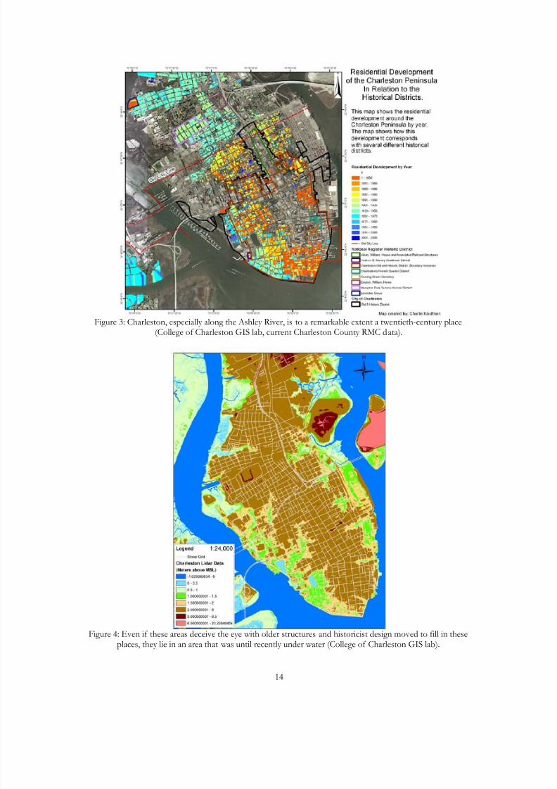
As one looks closely at much of the urban settlement of Charleston, it is to
a remarkable extent a twentieth-century place (See Figure 3). With the advent of
“industrialization” in the post-Civil War period of Reconstruction, Charleston
“reclaimed” much of its land from the rivers for expansion. This illustration
dramatically describes the recent development of these low lying areas. Even if
these areas deceive the eye with older structures and historicist design moved to
fill in these places, they lie in an area that was until recently under water (See
Figure 4).
I am not proposing an overly “preservationist” outlook that might
recommend discarding such “unhistoric” places, but rather the recognition of the
cultures that created these places and move forward based on a more suitable
vision—to place history in the uncomfortable role of informing and analyzing the
future. Such a vision presumably would value open spaces if for no other reason
than that they act as a protection from development.
Case Studies
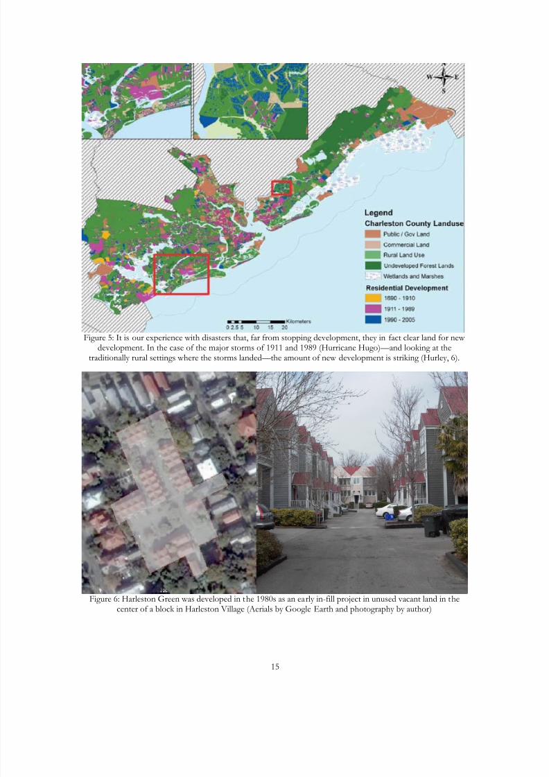
Attempting to stop or slow development in these vulnerable areas, the
regulatory environment is neither coordinated nor successful. It is our experience
with disasters that, far from stopping development, they in fact clear land for new
development. In the case of the major storms of 1911 and 1989 (Hurricane
Hugo)—and looking at the traditionally rural settings where the storms landed—
the amount of new development is striking (See Figure 5). This presentation of
construction data also reflects - indirectly perhaps - the social costs.
8/14/2019 Ward Charleston Disaster Preparedness
http://slidepdf.com/reader/full/ward-charleston-disaster-preparedness 4/20
4
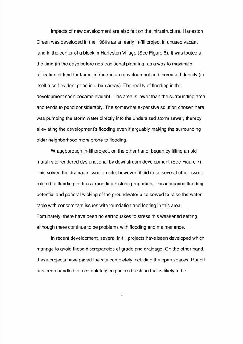
Impacts of new development are also felt on the infrastructure. Harleston
Green was developed in the 1980s as an early in-fill project in unused vacant
land in the center of a block in Harleston Village (See Figure 6). It was touted at
the time (in the days before neo traditional planning) as a way to maximize
utilization of land for taxes, infrastructure development and increased density (in
itself a self-evident good in urban areas). The reality of flooding in the
development soon became evident. This area is lower than the surrounding area
and tends to pond considerably. The somewhat expensive solution chosen here
was pumping the storm water directly into the undersized storm sewer, thereby
alleviating the development’s flooding even if arguably making the surrounding
older neighborhood more prone to flooding.
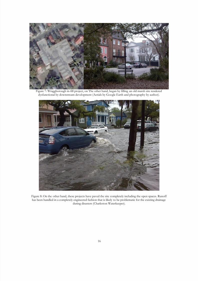
Wraggborough in-fill project, on the other hand, began by filling an old
marsh site rendered dysfunctional by downstream development (See Figure 7).
This solved the drainage issue on site; however, it did raise several other issues
related to flooding in the surrounding historic properties. This increased flooding
potential and general wicking of the groundwater also served to raise the water
table with concomitant issues with foundation and footing in this area.
Fortunately, there have been no earthquakes to stress this weakened setting,
although there continue to be problems with flooding and maintenance.
In recent development, several in-fill projects have been developed which
manage to avoid these discrepancies of grade and drainage. On the other hand,
these projects have paved the site completely including the open spaces. Runoff
has been handled in a completely engineered fashion that is likely to be
8/14/2019 Ward Charleston Disaster Preparedness
http://slidepdf.com/reader/full/ward-charleston-disaster-preparedness 5/20
5
problematic for the existing drainage during disasters (See Figure 8). The
rationale for these projects has been based on the future presence of
underground drainage structures, only one of which was built in the 1990s as a
$12 million tunnel, around 70 feet underground, pumped out during and after
storm events. Unfortunately, the practical problem of water hammer and siltation
has resulted in underperforming and costly facilities. This system, while allowing
a dense urban pattern without reference to site, does not seem to be the answer
to sea level rise and disaster mitigation.
Current Planning
City of Charleston Preservation Plan
The current oversight of the future of development works within a matrix of
regulations laid out at a state and national level, but the plan’s vision lies
principally with the City itself. As such, the City has recently completed a
Preservation Plan entitled Vision, Community, Heritage that seeks to curb
sprawl, recognize rural value, and develop new village centers to provide both
more urbanity and a way to continue to grow while holding the line of an urban
growth boundary. Central tenets of this plan are something called “in fill”
development and village centers. These are all well established neo-traditional
methods that our city has whole-heartedly embraced and that work within today’s
formulations of livable, urban centers. Rather than a prescription of methods, as
in past zoning methods, the Preservation Plan seeks to build a vision for the
future (Page and Turnbull, 6).
8/14/2019 Ward Charleston Disaster Preparedness
http://slidepdf.com/reader/full/ward-charleston-disaster-preparedness 6/20
6
While the report does mention the need to plan for disasters and global
sea level rise, it stops short, it seems to us, of actively engaging the issue.
Disaster preparation is a matter of documentation of history and prepositioning
assets to rebuild after the event (Page and Turnbull, 124). As to the question of
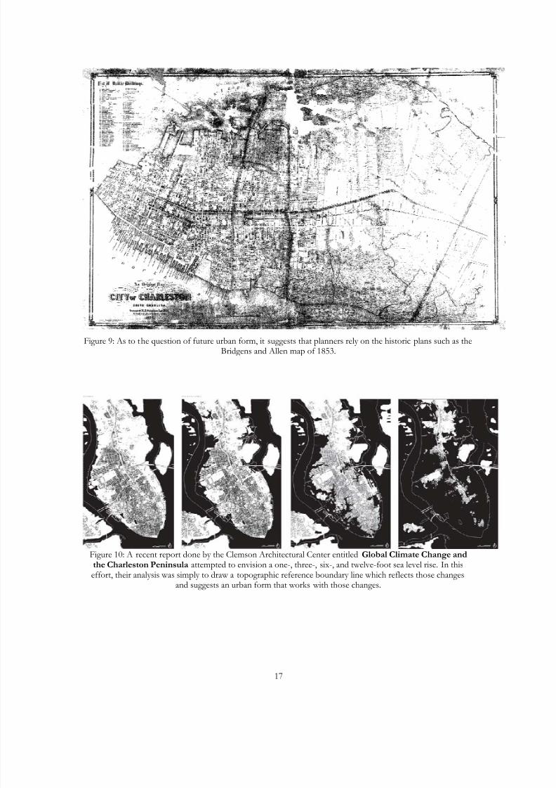
future urban form, it suggests that planners rely on the historic plans such as the
Bridgens and Allen map of 1853 (See Figure 9). Therein lies the difficulty. Many
of the areas that are most at risk are shown on this historic plan as
impoundments and open water. It might be more useful to understand the
difficulties we face dealing with the existing development in more detail and focus
on those problems such new infill development might cause or exacerbate.
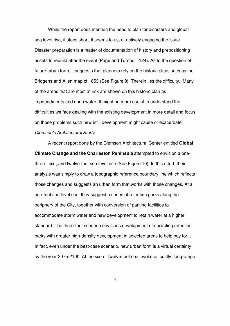
Clemson’s Architectural Study
A recent report done by the Clemson Architectural Center entitled Global
Climate Change and the Charleston Peninsula attempted to envision a one-,
three-, six-, and twelve-foot sea level rise (See Figure 10). In this effort, their
analysis was simply to draw a topographic reference boundary line which reflects
those changes and suggests an urban form that works with those changes. At a
one-foot sea level rise, they suggest a series of retention parks along the
periphery of the City, together with conversion of parking facilities to
accommodate storm water and new development to retain water at a higher
standard. The three-foot scenario envisions development of encircling retention
parks with greater high-density development in selected areas to help pay for it.
In fact, even under the best-case scenario, new urban form is a virtual certainty
by the year 2075-2100. At the six- or twelve-foot sea level rise, costly, long-range
8/14/2019 Ward Charleston Disaster Preparedness
http://slidepdf.com/reader/full/ward-charleston-disaster-preparedness 7/20
7
commitment to engineered solutions need to be made, including armoring the
harbor and development of canals in the fashion of Venice (Clemson Architecture
Center in Charleston). While the emphasis of this study was primarily
architectural, it does highlight the problem of considering these solutions in
isolation from the entire watershed and its processes. In fact, even a cursory
consideration of these scenarios in the area up and down the tidal and riverine
systems points to the need to place any proposed buildings in a more
comprehensive, multi-jurisdictional frame of reference. Each scenario would
need to be accompanied by watershed-wide accommodations even at the one-
and three-foot sea level rise scenarios. At the larger estimates of sea-level rise, it
is deeply problematic that the city might exist cut off completely from its
hinterland. The size and configuration not just of downtown but of the coast
would be severely altered. The protection for urban resources would need to be
greatly enhanced, and the size of the effected areas would expand exponentially.
The latter scenarios would call for expanded measures all the way to Lakes
Marion and Moultrie, and along the entire coastal zone. Given the lack of
resources and the manner in which such works would likely be undertaken (that
is, under duress in response to specific crises) saving the coastline would be
hard to imagine. It seems likely that we would need to retreat from the coast
altogether.
“Dutch” Model
In this discussion of apocalyptic change, I am ever more drawn to talk
about what we can comprehend and predict based on historical models. In New
8/14/2019 Ward Charleston Disaster Preparedness
http://slidepdf.com/reader/full/ward-charleston-disaster-preparedness 8/20
8
Orleans, the Dutch consultants recommend that storm protection be conceived
as a tiered series of defenses beginning with the barrier islands, extending
through the natural and man-made features that reduce storm runoff and deal
with the need to elevate properties and maintain clear local evacuation in major
events (New Orleans Times Picayune). How much we can depend on the natural
defenses is uncertain; however, New Orleans has dramatically reminded us of
the unreliability of purely engineered solutions (Hernandez).
A Practical Suggestion
The need for a broader context and vision
This paper suggests that the area of study must expand to include the
entire watershed and those regulations and policies must cross political and
jurisdictional boundaries. As sea level rises, the effected areas increase in size.
As a practical matter, the less dire scenarios are likely to be the bases of
planning our way forward. As such, we need to expand the vision of required
changes to include the area of the entire watershed. Even that becomes slightly
problematic as various riverine systems cross circulate in the flat swampy terrain
of the low country. The way forward seems to me to involve not only expanding
the frame of reference as seen in the Dutch model, but also a greater attention to
environmental change at a landscape level—that is a “holistic” approach
wrapped into smaller scale site analysis. In this matter at least, the heightened
concerns associated with storm planning are coincident with concerns about
global sea level rise.
8/14/2019 Ward Charleston Disaster Preparedness
http://slidepdf.com/reader/full/ward-charleston-disaster-preparedness 9/20
9
The new City Preservation Plan does reference this Clemson study and
suggests some post disaster preparations, but it does not address the
preplanning efforts in any substantive way (Page and Turnbull, 124-127). It whole
heartedly approves in-fill development for its benefits to the urban environment
and the efficiency it creates (Page and Turnbull, 36-41). It also refers to the need
to maintain historical block morphology as well as building typology (Page and
Turnbull, 258). Certainly, this level of planning has the increased environmental
benefits associated with diminished per capita loading but it does beg the
question of sustainability and the carrying capacity of an already strained
infrastructure.
Furthermore, the city plan deals with disaster planning almost exclusively
from a post-event status, which leaves much to be desired. It seems that there is
still considerable unwillingness to accept much less to act on the scientific
certainty of global sea level rise. As such, the conclusion that is postulated here
for your consideration is to unite the two approaches: a tiered system of defenses
suggested by the Dutch consultants for New Orleans and a newer vision of urban
form suggested by the Clemson study.
Futures
In order to isolate the areas of the entire coast that are most vulnerable,
the USGS has compiled geomorphology, historical shoreline changes, coastal
slope, mean tidal range, and wave height to assemble a large scale model
(Theiler). The presentation shows the Charleston area with considerable areas at
high risk (See Figure 11). Trying to understand that risk on a more local level is
8/14/2019 Ward Charleston Disaster Preparedness
http://slidepdf.com/reader/full/ward-charleston-disaster-preparedness 10/20
10
problematic. Information is scarce on a more localized area except in a
generalized format such as this.
The City of Charleston, FEMA, the State, and others are all engaged in
planning for a changing relationship with the water. The need to plan for storms
and earthquakes, global sea level rise and the associated changing geomorphic
setting - together with continuing development pressures on the historic fabric -
calls for some type of collective discussion. The City of Charleston has just
finalized a Preservation Plan. FEMA and the county government are in the
process of clarifying the flood insurance rate maps, the state is in charge of
shoreline change policy and the home of the “takings” legislation is now looking
for a return bout to prohibit repair in coastal situations where the damage to
structures has exceeded 50% (Kolnitz). They are also adamant about prohibiting
armament of the coastline which reflects their general policy of retreat rather than
of fighting the rising tide (Dyckman). Academic institutions are engaged in the
discussion as well. They are taking a rather different view of protecting places,
showing the development of alternatives for a place that we all want to save
which does envision armament (Clemson Architecture Center).
We conclude for now with a consideration of this vision for the peninsula.
The sea level rise shown here threatens directly the new development along the
periphery of the City (see Figure 12). Armoring the edge is, of course,
problematic as there would be no end to it going up the coast. Furthermore, even
the retention ponds expressed in the Clemson Report would provide minimal
8/14/2019 Ward Charleston Disaster Preparedness
http://slidepdf.com/reader/full/ward-charleston-disaster-preparedness 11/20
11
protection given the high water table and low lying nature of the area. Thus, we
need to expand the area and scope of consideration.
These maps do not, however, present several important components of
disaster preparation. First, we do not deal with tidal surge associated with
hurricanes for the higher base elevations. This is an obvious consideration
especially in the zone of development subject to the direct action of wind and
waves, known as the “V” zone. Next, the map does not consider the elements of
the geomorphology of the area. Certainly, this type of analysis would also
suggests liquefaction of the soils and generally unstable foundation conditions
during earthquakes and should certainly be part of a site suitability analysis for
these retention ponds as well as buildings’ foundations.
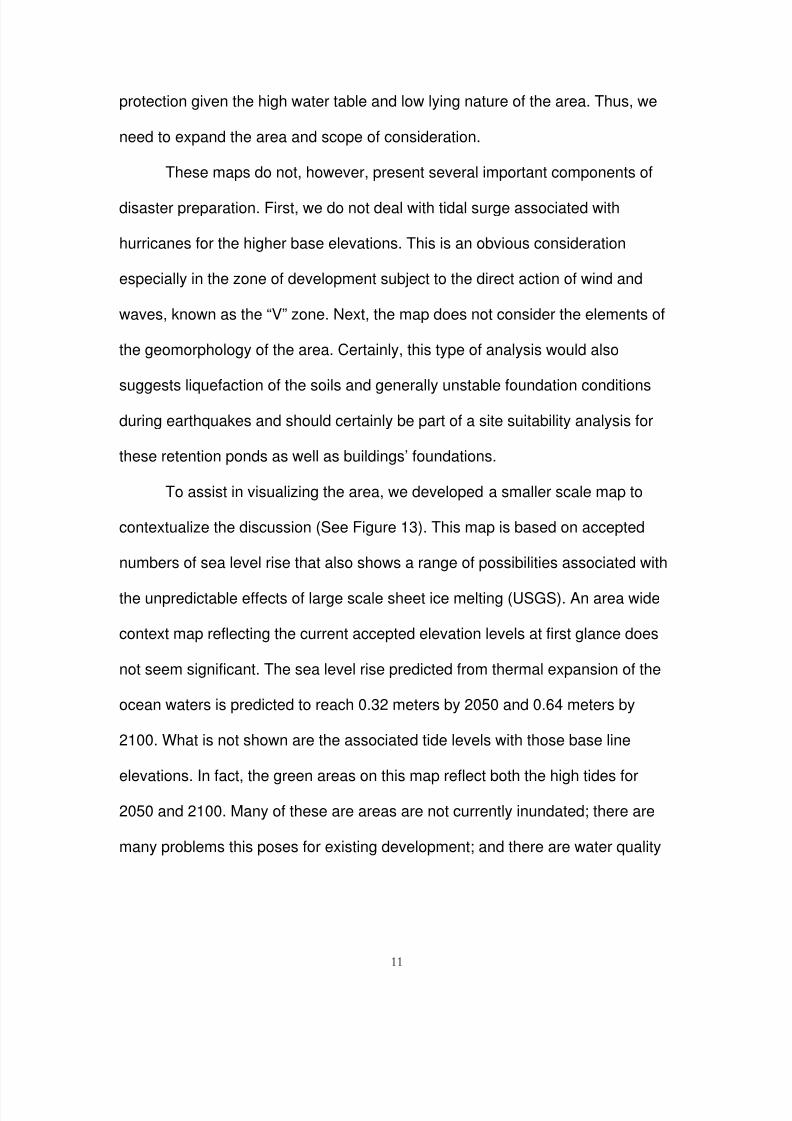
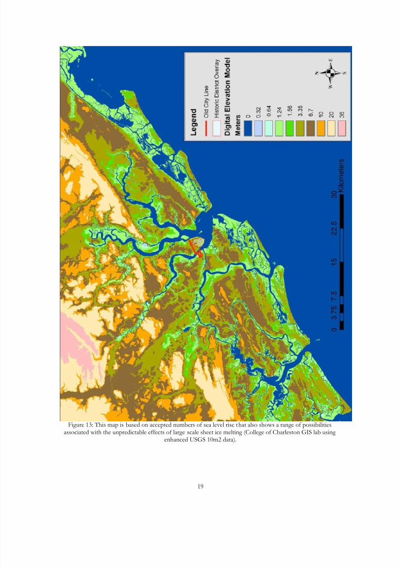
To assist in visualizing the area, we developed a smaller scale map to
contextualize the discussion (See Figure 13). This map is based on accepted
numbers of sea level rise that also shows a range of possibilities associated with
the unpredictable effects of large scale sheet ice melting (USGS). An area wide
context map reflecting the current accepted elevation levels at first glance does
not seem significant. The sea level rise predicted from thermal expansion of the
ocean waters is predicted to reach 0.32 meters by 2050 and 0.64 meters by
2100. What is not shown are the associated tide levels with those base line
elevations. In fact, the green areas on this map reflect both the high tides for
2050 and 2100. Many of these are areas are not currently inundated; there are
many problems this poses for existing development; and there are water quality
8/14/2019 Ward Charleston Disaster Preparedness
http://slidepdf.com/reader/full/ward-charleston-disaster-preparedness 12/20
12
issues associated with inundation of these previously unsaturated lands.
Furthermore, these areas are no longer mostly marsh; they are underwater.
The olive and brown areas show the effects of the melting of the sheet ice
of Greenland. The olive areas simply show half of the sheet ice melting as
another possibility. The areas that are orange and tan are our new barrier
islands. The rest is high ground. The new coast line is somewhere between 10
and 20 kilometers back from existing coast lines.
There are several conclusions one might reach from a map such as this.
First, the city of Charleston and most of its hinterland has a direct stake in the
global conversation about sea level rise. Second, the future studies shown by the
Clemson study need to be expanded to consider this broader context and, as the
Dutch model suggests, see the value of these new marsh areas as our first line
of defense. The development left in the outlying areas is even more vulnerable to
storm damage. Third, this map does not consider storm water runoff, which will
be increasingly difficult to manage. Given the certainty of the sea level rise in the
next century, the City should develop the “Retention” Park model for urban form
and seek to limit in a more aggressive way the allowable runoff from new
development. We would, however, encourage a broader focus area and greater
consideration of disaster planning. Fourth, the inundation of the developed areas
in the entire riverine area argues for greater development control of runoff and in
some instances actual retreat. Finally, the stake that all coastal areas have to
limit greenhouse gases and try to slow down global warming could not be higher.
This then engages us with the highest level of community, the global one.
8/14/2019 Ward Charleston Disaster Preparedness
http://slidepdf.com/reader/full/ward-charleston-disaster-preparedness 13/20
13
Figure 1: The premise for this paper is that coastal, historic places like Charleston and New Orleans will needspecial planning efforts to face disasters and a perhaps dramatic, new vision of how to manage those threats
(photo by author).
Figure 2: Charleston has always had a direct visual and functional relationship with its rivers and the ocean.
8/14/2019 Ward Charleston Disaster Preparedness
http://slidepdf.com/reader/full/ward-charleston-disaster-preparedness 14/20
14
Figure 3: Charleston, especially along the Ashley River, is to a remarkable extent a twentieth-century place(College of Charleston GIS lab, current Charleston County RMC data).
Figure 4: Even if these areas deceive the eye with older structures and historicist design moved to fill in theseplaces, they lie in an area that was until recently under water (College of Charleston GIS lab).
8/14/2019 Ward Charleston Disaster Preparedness
http://slidepdf.com/reader/full/ward-charleston-disaster-preparedness 15/20
15
Figure 5: It is our experience with disasters that, far from stopping development, they in fact clear land for new development. In the case of the major storms of 1911 and 1989 (Hurricane Hugo)—and looking at the
traditionally rural settings where the storms landed—the amount of new development is striking (Hurley, 6).
Figure 6: Harleston Green was developed in the 1980s as an early in-fill project in unused vacant land in thecenter of a block in Harleston Village (Aerials by Google Earth and photography by author)
8/14/2019 Ward Charleston Disaster Preparedness
http://slidepdf.com/reader/full/ward-charleston-disaster-preparedness 16/20
16
Figure 7: Wraggborough in-fill project, on The other hand, began by filling an old marsh site rendereddysfunctional by downstream development (Aerials by Google Earth and photography by author).
Figure 8: On the other hand, these projects have paved the site completely including the open spaces. Runoff has been handled in a completely engineered fashion that is likely to be problematic for the existing drainage
during disasters (Charleston Waterkeeper).
8/14/2019 Ward Charleston Disaster Preparedness
http://slidepdf.com/reader/full/ward-charleston-disaster-preparedness 17/20
17
Figure 9: As to the question of future urban form, it suggests that planners rely on the historic plans such as theBridgens and Allen map of 1853.
Figure 10: A recent report done by the Clemson Architectural Center entitled Global Climate Change andthe Charleston Peninsula attempted to envision a one-, three-, six-, and twelve-foot sea level rise. In thiseffort, their analysis was simply to draw a topographic reference boundary line which reflects those changes
and suggests an urban form that works with those changes.
8/14/2019 Ward Charleston Disaster Preparedness
http://slidepdf.com/reader/full/ward-charleston-disaster-preparedness 18/20
18
Figure 11: In order to isolate the areas of the entire coast that are most vulnerable, the USGS has compiledgeomorphology, historical shoreline changes, coastal slope, mean tidal range, and wave height to assemble alarge scale model. The presentation shows the Charleston area with considerable areas at high risk (USGS
Open-File Report).
Figure 12: The sea level rise threatens directly the new development along the periphery of the City (College of Charleston GIS lab using enhanced USGS 10m2 data).
Charleston
Area
8/14/2019 Ward Charleston Disaster Preparedness
http://slidepdf.com/reader/full/ward-charleston-disaster-preparedness 19/20
19
Figure 13: This map is based on accepted numbers of sea level rise that also shows a range of possibilitiesassociated with the unpredictable effects of large scale sheet ice melting (College of Charleston GIS lab using
enhanced USGS 10m2 data).
8/14/2019 Ward Charleston Disaster Preparedness
http://slidepdf.com/reader/full/ward-charleston-disaster-preparedness 20/20
20
REFERENCES
Charleston Waterkeeper, Flooding in the Streets of Charleston,. April 2, 2009http://charlestonwaterkeeper.wordpress.com/2009/04/02/flooding-in-the-streets-of-charleston/.
Clemson Architecture Center in Charleston, Global Climate Change and theCharleston Peninsula, An Exhibit at the Charleston Civic Design Center from 24May-19 July, 2007.
Dyckman, Caitlin, London, Jim, and Allen, Jeff, Shoreline Change AdvisoryCommittee, An Assessment of Shoreline Change Options in South Carolina:A Progress Report, Findings: Takings Section, August 20, 2008.
Fraser, Charles, A Charleston Sketchbook: 1796-1806, Carolina ArtAssociation, 1971.
Hernandez, Debra, National Research Council of the National Academies,Mitigating Shore Erosion Along Sheltered Coasts, The National AcademiesPress, 2007.
Hurley , Patrick T., Halfacre , Angela C., Levine, Norm S., Burke, MarianneK.(2008), Finding a “Disappearing” Nontimber Forest Resource: UsingGrounded Visualization to Explore Urbanization Impacts on SweetgrassBasketmaking in Greater Mt. Pleasant, South Carolina, The ProfessionalGeographer, Volume 60, Number 4, November 2008.
Page and Turnbull, Vision, Community, Heritage: A Preservation Plan forCharleston, South Carolina, January, 2008.http://www.charlestoncity.info/dept/content.aspx?nid=1247.
Schleifstein, Mark, Coastal proposal is a two-for-one idea - hurricane defense,restoration Combined , New Orleans Times Picayune, January 10, 2006,Section national, retrieved from Westlaw 2/20/2009.
Thieler, E. Robert and Hammar-Klose, Erika S. National Assessment ofCoastal Vulnerability to Sea-Level Rise: Preliminary results for the U.S.Atlantic Coast, U. S. Geological Survey Open-File Report 99-593, 1999 ,http://pubs.usgs.gov/dds/dds68/reports/eastrep.pdf.
USGS, Sea Level and Climate, http://pubs.usgs.gov/fs/fs2-00/, January 2000.
Von Kolnitz, Elizabeth and Kiernan, Shawn, Beach Management Plans: AnOverview of State and local Planning, 40 year retreat options , presentation byDHEC-OCRM, provided by Norm Levine.