Embed Size (px)
Citation preview
WATER DATA EXCHANGES
ESIP Summer Meeting
July 21, 2010
Nate Booth, USGS
THE USGS-USEPA WATER-QUALITY DATA EXCHANGE
USGS: Nate Booth, Jon Scott, Dorrie Gellenbeck, Tom Kunicki, John Hollister, I-Lin Kuo, Jessica Thompson, Lorraine Murphy
USEPA: Kristen Gunthardt, Kevin Christian
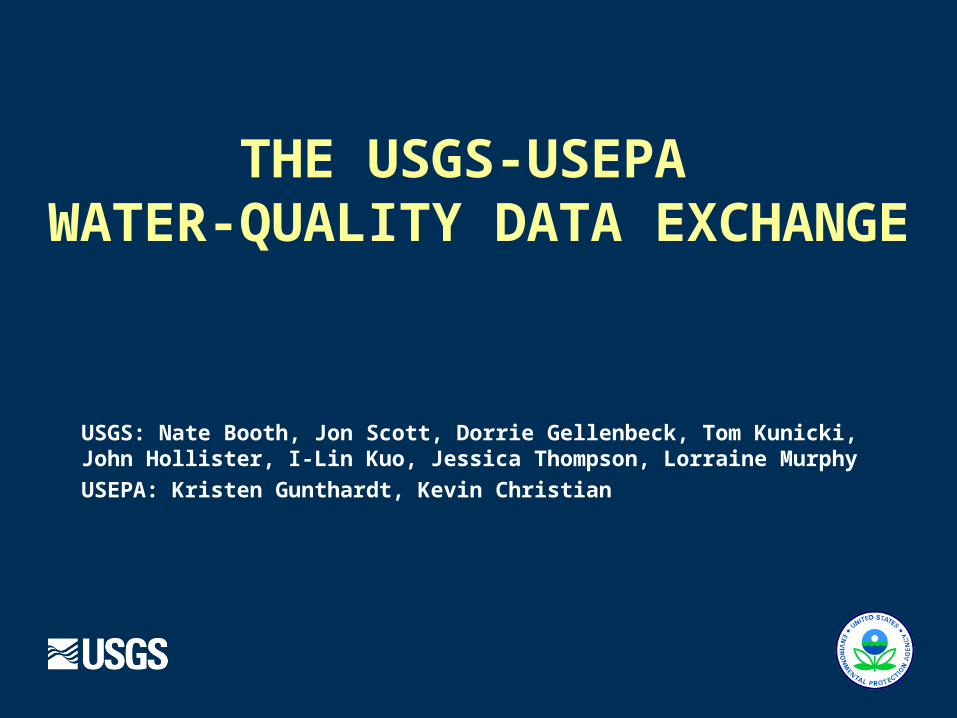
USGS NWIS & STORET Over Time
1999: Modern STORET**
2003:USGS / EPAAgreement 2007:
Water-QualityData Exchange
1960s: NWPCA(WATSTORE)
NWIS*
LegacySTORET**
Data copied from NWIS to STORET
1972EPA created
* USGS National Water Information System** USEPA Storage and Retrieval System

Water-Quality Data Exchange
Data format based on USEPA Water Quality Exchange (WQX) (NWQMC WQ Data Elements)
Common definitions and semantics EPA’s Substance Registry System for chemicals Chemical groups Site types Sampling media Taxonomy
Common web services for serving Monitoring Locations and Water-Quality Results
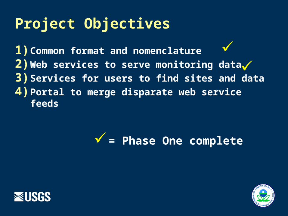
Project Objectives
1) Common format and nomenclature
2) Web services to serve monitoring data
3) Services for users to find sites and data
4) Portal to merge disparate web service feeds
✓✓
✓= Phase One complete
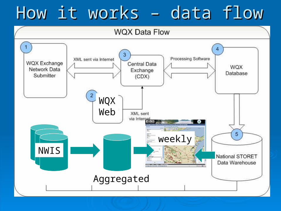
WQXWeb
NWIS
Aggregated
weekly
How it works – data flowHow it works – data flow
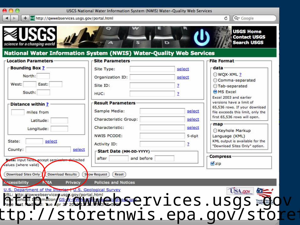
http://qwwebservices.usgs.govhttp://storetnwis.epa.gov/storetqw
USGS NWIS EPA STORET
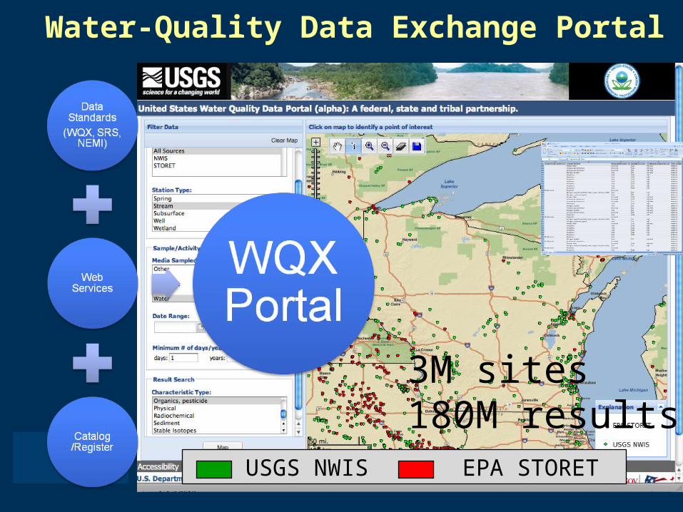
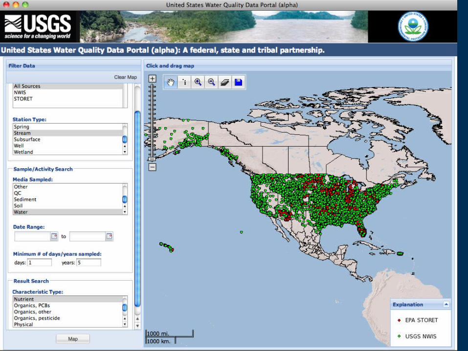
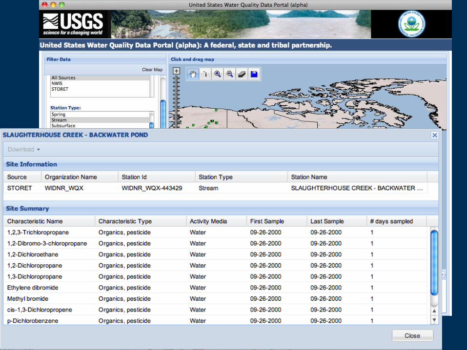
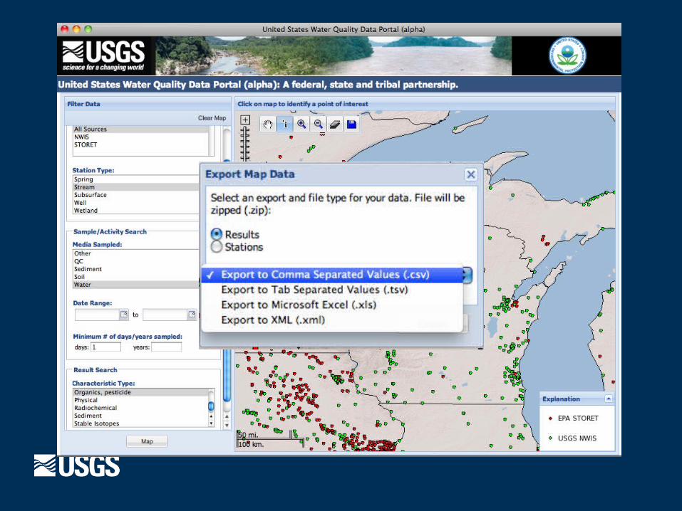
Water-Quality Data Exchange Portal
3M sites180M results
Further Integration Common spatial frameworks (NHD, Aquifers) Common analytical method metadata (NEMI)
Data cleanup New Collaborations
NOAA IOOS USDA CUAHSI
Future Work
Catalog of monitoring locations across agencies, organizations and scientific disciplines
Common spatial frameworks (NHD, Aquifers) and analytical method metadata (NEMI)
Development of an international water data transfer standard within OGC / WMO: WATERML2
American Committee on Water Information (ACWI)
Future Work
Helping the World to CommunicateGeographically
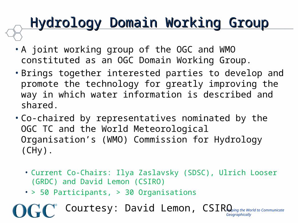
Hydrology Domain Working GroupHydrology Domain Working Group
• A joint working group of the OGC and WMO constituted as an OGC Domain Working Group.
• Brings together interested parties to develop and promote the technology for greatly improving the way in which water information is described and shared.
• Co-chaired by representatives nominated by the OGC TC and the World Meteorological Organisation’s (WMO) Commission for Hydrology (CHy).
• Current Co-Chairs: Ilya Zaslavsky (SDSC), Ulrich Looser (GRDC) and David Lemon (CSIRO)
• > 50 Participants, > 30 Organisations
Courtesy: David Lemon, CSIRO

Helping the World to CommunicateGeographically
© 2009 Open Geospatial Consortium, Inc.
15
Expected OutcomesExpected Outcomes• An agreed feature model (ie. what are the features of the
hydrosphere (from an information perspective) and how are they related.)
• An agreed observation model. • Agreed vocabularies, endorsed by the community, and by
WMO in particular. Agreeing on semantics is a long process, but we should be able to recommend some vocabularies
• Also: services carrying the above
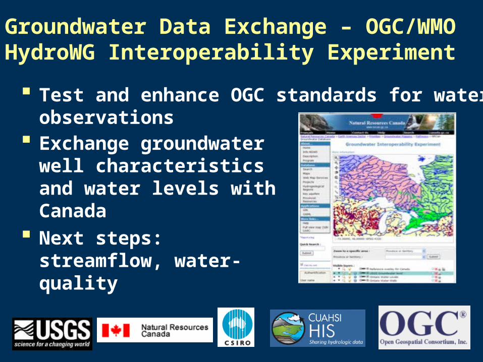
Groundwater Data Exchange – OGC/WMO HydroWG Interoperability Experiment
Test and enhance OGC standards for water observations
Exchange groundwater well characteristics and water levels with Canada
Next steps: streamflow, water-quality

National Groundwater Monitoring Network
American Committee on Water Information Subcommittee on Groundwater
Pilot portal under development for 6 states: MT, MN, TX, IL, IN, NJ
Built on open standards and leverages interoperability experiment within HydroWG
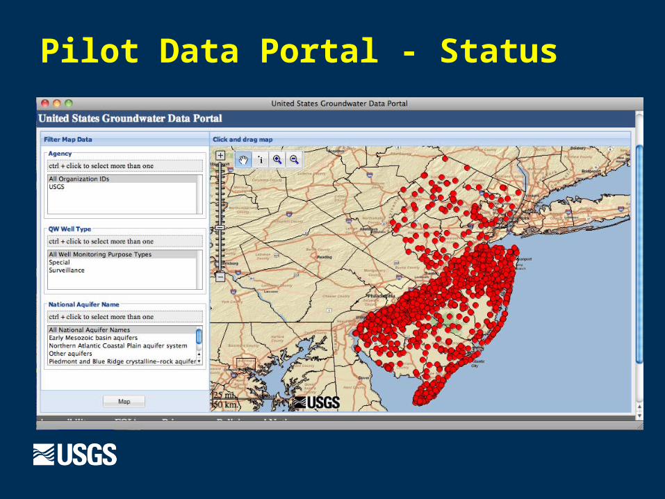
Pilot Data Portal - Status
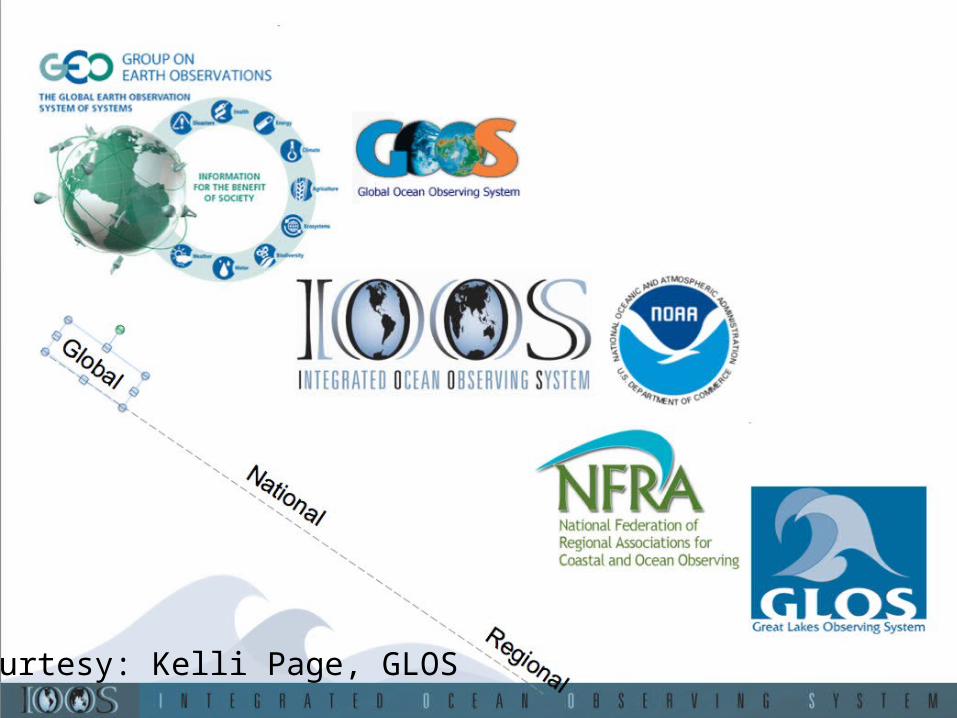
Courtesy: Kelli Page, GLOS
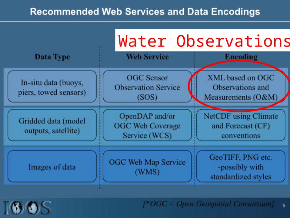
Water Observations
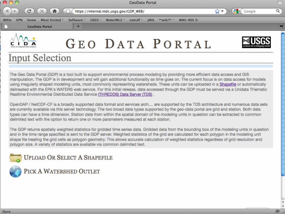
THE GEO DATA PORTAL
Nate Booth, Lauren Hay, Rich Signell, Tom Kunicki, Roland Viger, Steve Markstrom, Ivan Suftin, Dave Blodgett, Ryan Zoerb
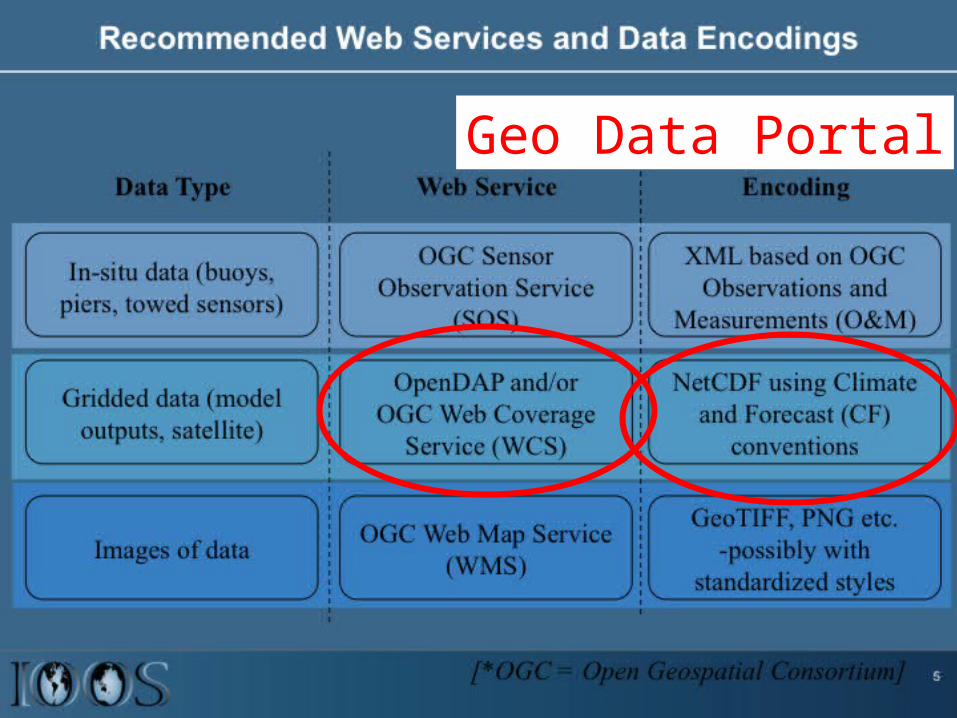
Geo Data Portal
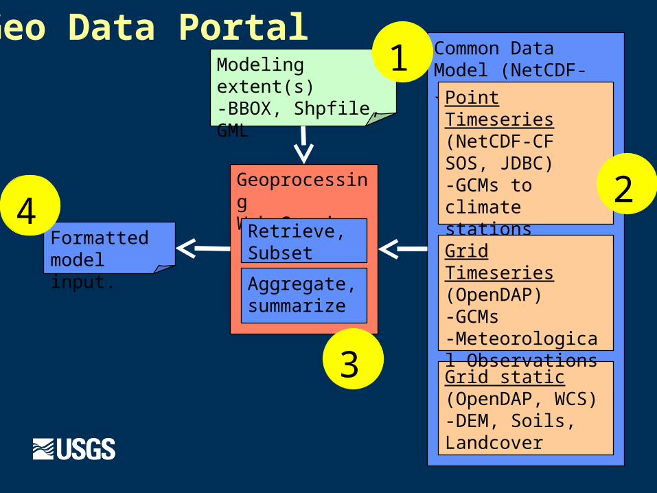
Common Data Model (NetCDF- Java)
Point Timeseries(NetCDF-CF SOS, JDBC)-GCMs to climate stations-Streamflow, Buoys
Grid static(OpenDAP, WCS)-DEM, Soils, Landcover
Grid Timeseries(OpenDAP)-GCMs-Meteorological Observations
GeoprocessingWeb Service
Retrieve, Subset
Aggregate, summarize
Geo Data Portal
Formatted model input.
Modeling extent(s)-BBOX, Shpfile, GML
1
2
3
4
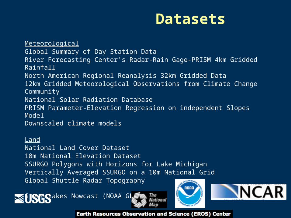
MeteorologicalGlobal Summary of Day Station DataRiver Forecasting Center's Radar-Rain Gage-PRISM 4km Gridded RainfallNorth American Regional Reanalysis 32km Gridded Data 12km Gridded Meteorological Observations from Climate Change CommunityNational Solar Radiation DatabasePRISM Parameter-Elevation Regression on independent Slopes ModelDownscaled climate models
LandNational Land Cover Dataset10m National Elevation DatasetSSURGO Polygons with Horizons for Lake Michigan Vertically Averaged SSURGO on a 10m National Grid Global Shuttle Radar Topography
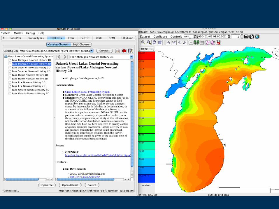
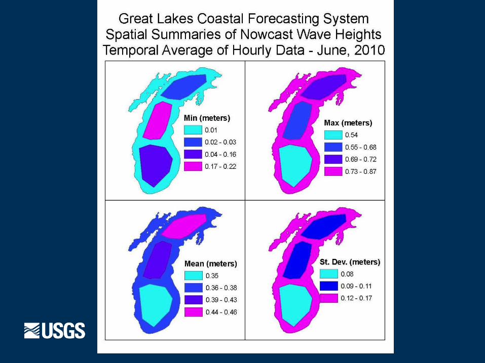
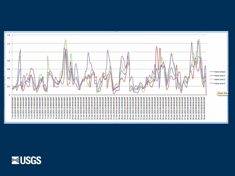
Great Lakes Nowcast (NOAA GLERL)
Datasets
Demo
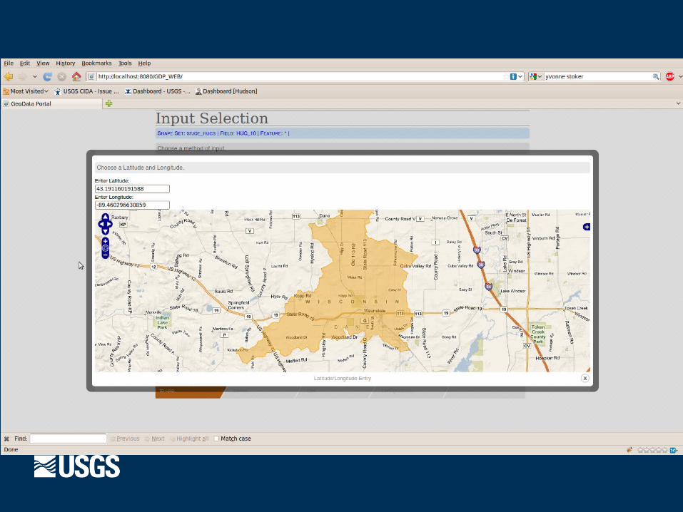
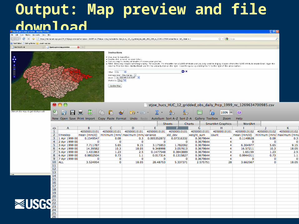
Output: Map preview and file download

Tool development to reformat and upload models into common repository Wizard walks through reformatting process to common standard that
interfaces with Geo Data Portal (loose coupling) Catalog will store lineage of data and model inputs
Model Archive
Questions?