Embed Size (px)
Citation preview

Weather
Weather is the state or condition of the atmosphere at a particular location for a short period of time. Different weather is created by changes in the amount of heat energy in the atmosphere due to incoming solar radiation.
Weather can be measured and observed with many variables, such as:
Atmospheric Energy • The Sun is the main source of energy on
Earth for the weather. The energy from the sun travels to earth in electromagnetic waves, some of which we can see and some of which we cannot see.
• Incoming solar radiation has a specific wave length (ESRT p.14)
• Wave energy can do 2 things once it hits a surface:
1. Be absorbed2. Be reflected
Weather
• Most of the energy from the sun is reflected off of the earth.
• This energy does not go back into space, it is trapped by the atmosphere.
• This process keeps our planet warm and how energy is stored for the creation of weather.

Energy Transfer in the Atmosphere
Review: What are the 2 methods of energy transfer?
1. Radiation
2. Convection
Radiation – is the transfer of electromagnetic energy through space in the form of electromagnetic waves. (no medium needed)
• Energy radiated from the sun reaches the earth• Energy from the Sun in the form of
electromagnetic waves is reflected from the earth and radiated back into the atmosphere.
Energy Transfer in the Atmosphere
Convection – is the transfer of heat energy by movements of liquids and gases, caused by differences in density.
• Convection causes warm air to rise and cold air to sink and will be a major principle in the formation of many weather events (wind, rain, thunderstorms)
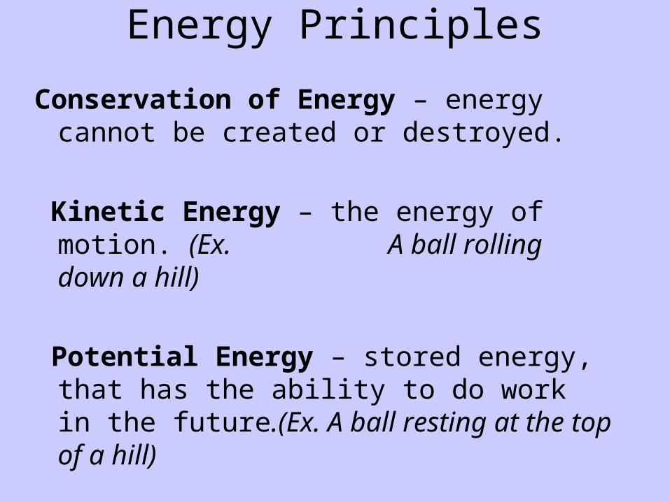
Energy Principles
Conservation of Energy – energy cannot be created or destroyed.
Kinetic Energy – the energy of motion. (Ex. A ball rolling down a hill)
Potential Energy – stored energy, that has the ability to do work in the future.(Ex. A ball resting at the top of a hill)
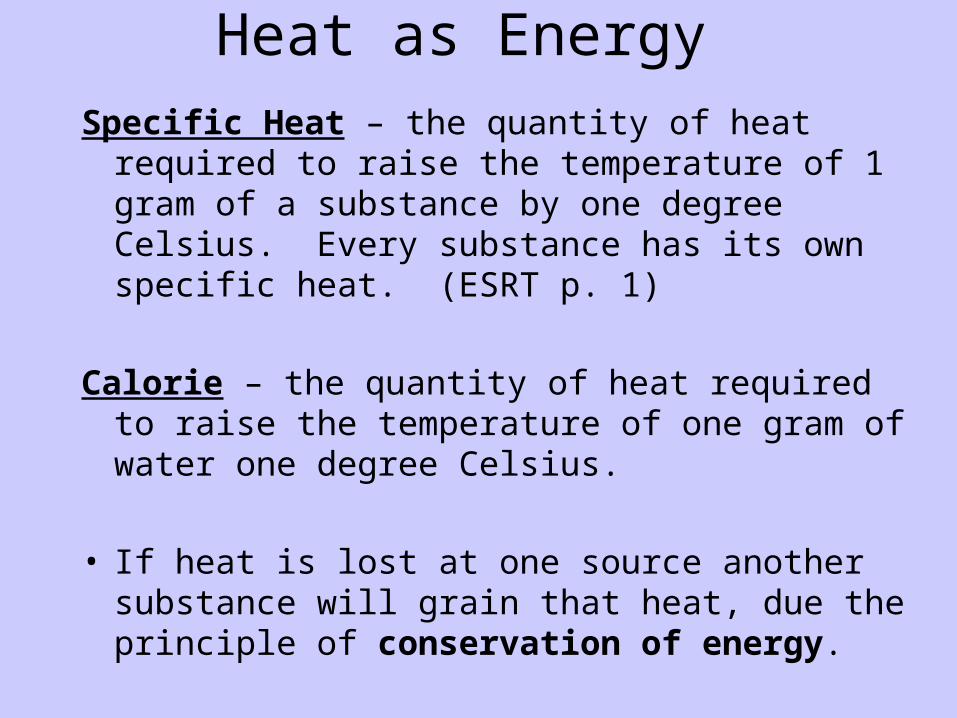
Heat as Energy
Specific Heat – the quantity of heat required to raise the temperature of 1 gram of a substance by one degree Celsius. Every substance has its own specific heat. (ESRT p. 1)
Calorie – the quantity of heat required to raise the temperature of one gram of water one degree Celsius.
• If heat is lost at one source another substance will grain that heat, due the principle of conservation of energy.
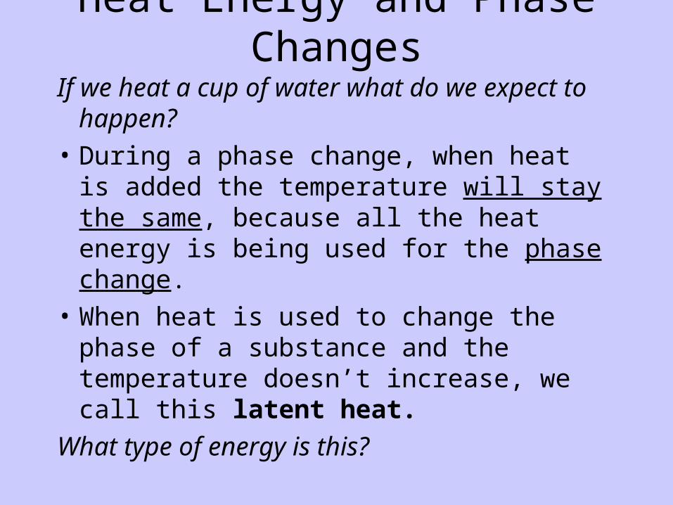
Heat Energy and Phase Changes
If we heat a cup of water what do we expect to happen?
• During a phase change, when heat is added the temperature will stay the same, because all the heat energy is being used for the phase change.
• When heat is used to change the phase of a substance and the temperature doesn’t increase, we call this latent heat.
What type of energy is this?
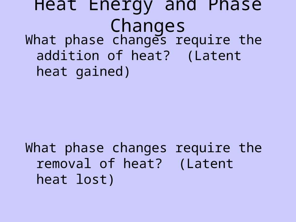
Heat Energy and Phase ChangesWhat phase changes require the addition of
heat? (Latent heat gained)
What phase changes require the removal of heat? (Latent heat lost)

Atmospheric Variables (ESRT p.13)

Station Model Practice
Temp: 27°F
Weather: snow
Visibility: ¼ mile
Dewpoint: 25°F
Wind speed: 25 knots
Wind direction: northeast
Cloud cover: 100%
Barometric pressure: 925 mb
Pressure trend: -18
Precipitation: .68 inches
Temp: 87°F
Weather: haze
Visibility: 4 miles
Dewpoint: 67°F
Wind speed: 5 knots
Wind direction: southeast
Cloud cover: 25%
Barometric pressure: 1018.5 mb
Pressure trend: +10
Precipitation: .08 inches
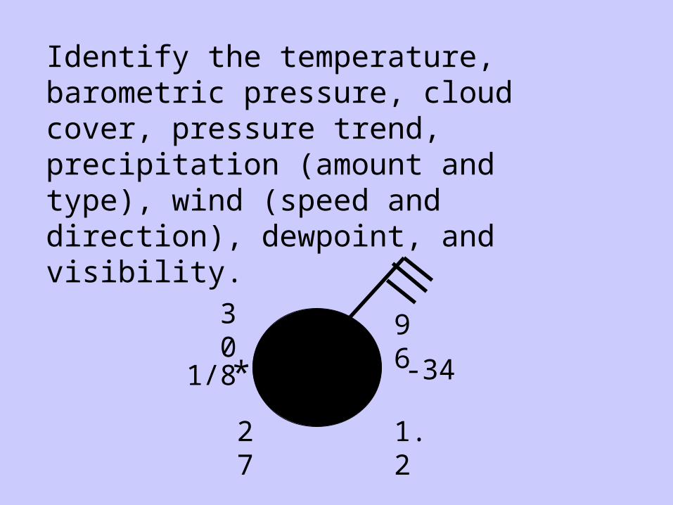
30
1/8
27 1.2
-34
96
*
Identify the temperature, barometric pressure, cloud cover, pressure trend, precipitation (amount and type), wind (speed and direction), dewpoint, and visibility.
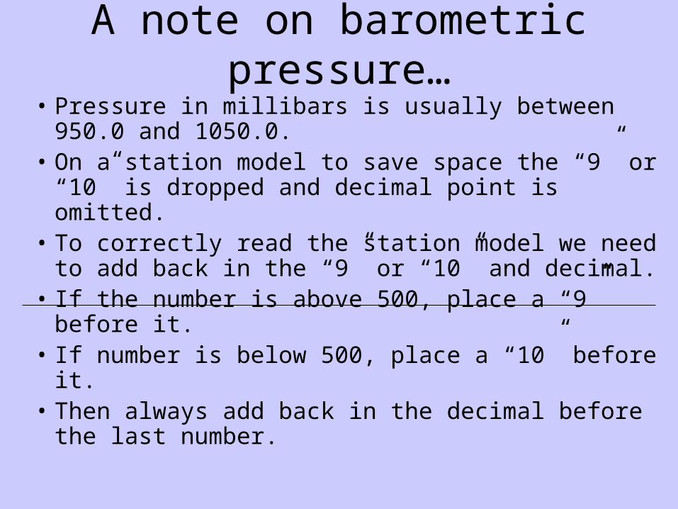
A note on barometric pressure…
• Pressure in millibars is usually between 950.0 and 1050.0.
• On a station model to save space the “9” or “10” is dropped and decimal point is omitted.
• To correctly read the station model we need to add back in the “9” or “10” and decimal.
• If the number is above 500, place a “9” before it.• If number is below 500, place a “10” before it.• Then always add back in the decimal before the
last number.
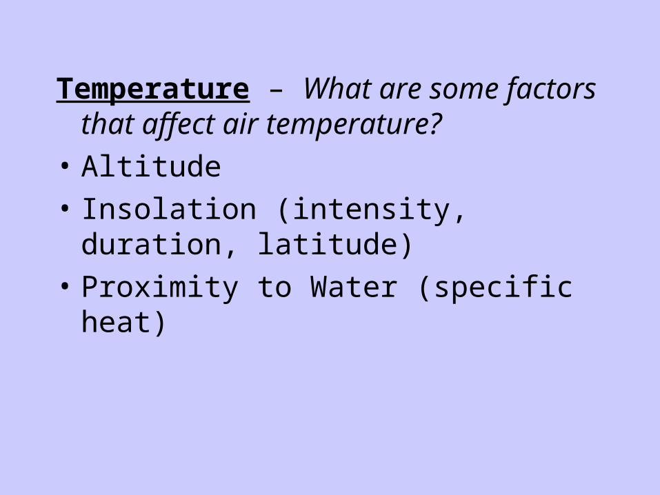
Temperature – What are some factors that affect air temperature?
• Altitude
• Insolation (intensity, duration, latitude)
• Proximity to Water (specific heat)
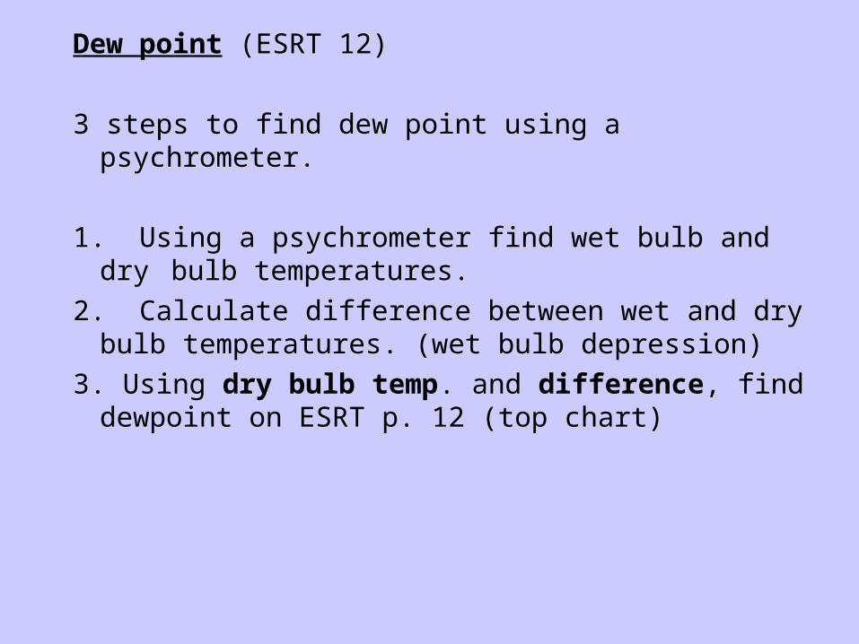
Dew point (ESRT 12)
3 steps to find dew point using a psychrometer.
1. Using a psychrometer find wet bulb and dry bulb temperatures.
2. Calculate difference between wet and dry bulb temperatures. (wet bulb depression)
3. Using dry bulb temp. and difference, find dewpoint on ESRT p. 12 (top chart)
Steve LaPoint explains...
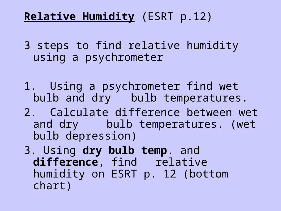
Relative Humidity (ESRT p.12)
3 steps to find relative humidity using a psychrometer
1. Using a psychrometer find wet bulb and dry bulb temperatures.
2. Calculate difference between wet and dry bulb temperatures. (wet bulb depression)
3. Using dry bulb temp. and difference, find relative humidity on ESRT p. 12 (bottom chart)

Atmospheric Pressure – the force or the weight of the air pushing down on a surface. “A column of air above the surface.”
Isobars – lines connecting points of equal atmospheric pressure.
How does altitude affect atmospheric pressure?
“As altitude increases, atmospheric pressure decreases.”
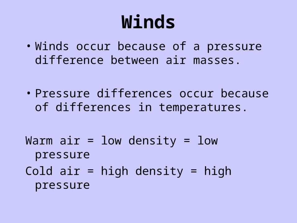
Winds• Winds occur because of a pressure
difference between air masses.
• Pressure differences occur because of differences in temperatures.
Warm air = low density = low pressure
Cold air = high density = high pressure

• Sea breeze (onshore breeze) – occurs during the day.
• Land breeze (offshore breeze) – occurs during the night.
Winds
Winds
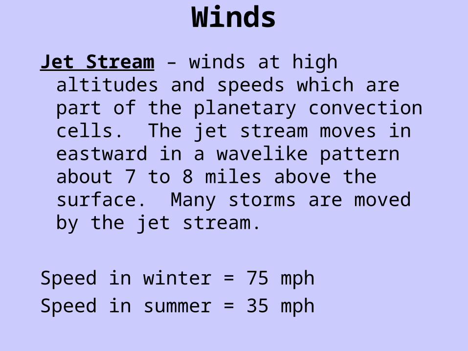
Jet Stream – winds at high altitudes and speeds which are part of the planetary convection cells. The jet stream moves in eastward in a wavelike pattern about 7 to 8 miles above the surface. Many storms are moved by the jet stream.
Speed in winter = 75 mph
Speed in summer = 35 mph

Polar and Sub-Tropical Jet Stream
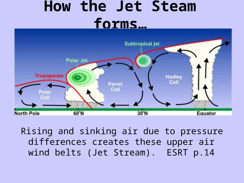
How the Jet Steam forms…
Rising and sinking air due to pressure differences creates these upper air wind belts (Jet Stream). ESRT p.14

Clouds and Rain (Condensation)
How does condensation form clouds? What else helps?
• Water vapor in the air cools when it rises, condenses into liquid water droplets that make up clouds.
• Dust particles in the air help to form droplets, they act as a nucleus around which water can condense.
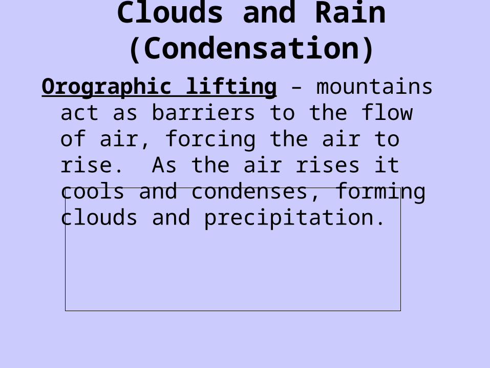
Clouds and Rain (Condensation)
Orographic lifting – mountains act as barriers to the flow of air, forcing the air to rise. As the air rises it cools and condenses, forming clouds and precipitation.
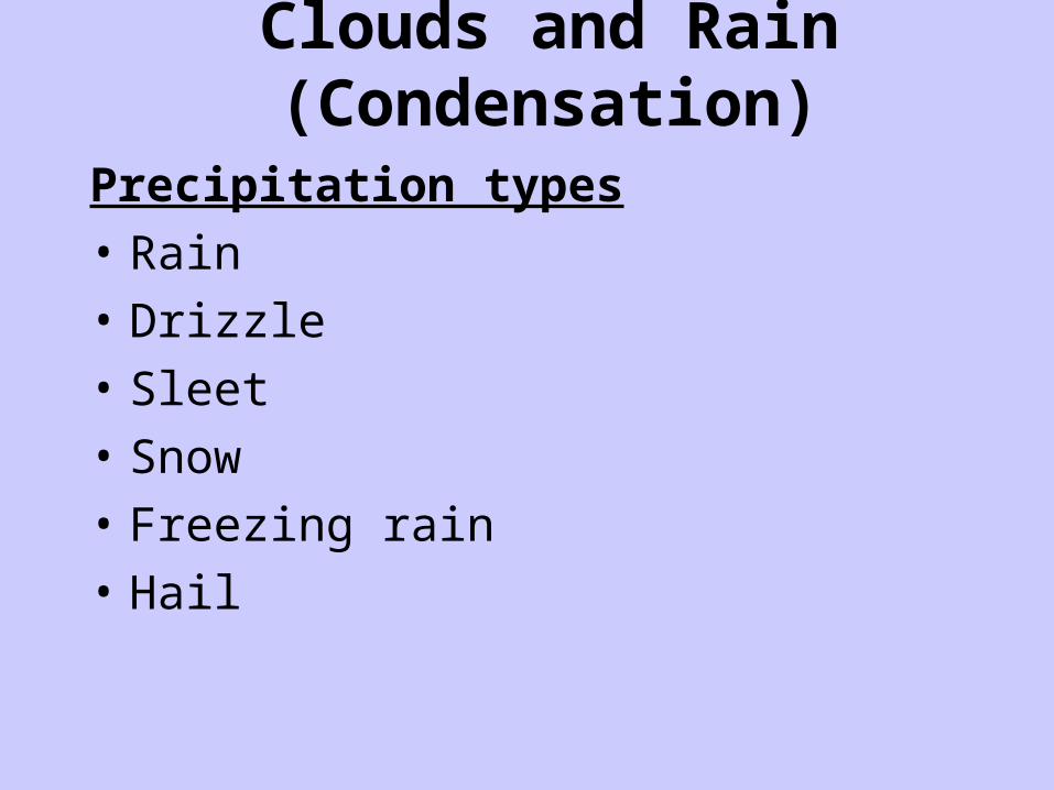
Clouds and Rain (Condensation)
Precipitation types
• Rain
• Drizzle
• Sleet
• Snow
• Freezing rain
• Hail

Air Masses
Air-mass – huge body of air in the troposphere having similar pressure, moisture, wind, and temperature. (ESRT p.13)
• Maritime – air-mass that develops over water (moist)
• Continental – air-mass that develops over land (dry)

Air Masses Continued…• Polar – air-masses that develop in higher
latitudes (cool)
• Tropical – air-masses that develop in lower latitudes (warm)
Air Mass Symbols (ESRT p.13)
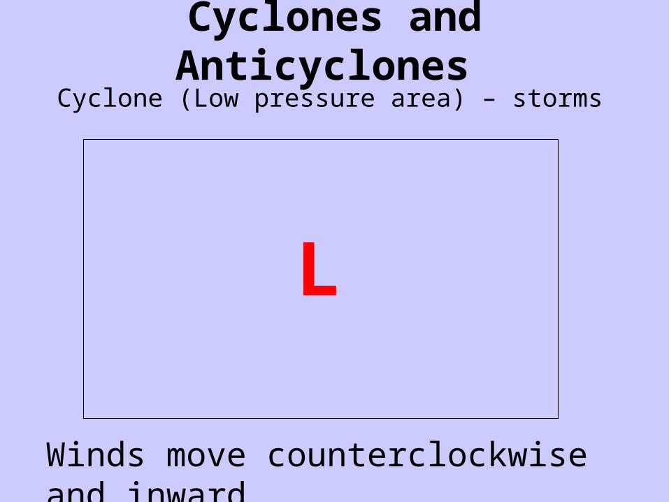
Cyclones and Anticyclones Cyclone (Low pressure area) – storms
L
Winds move counterclockwise and inward.

Cyclones and Anticyclones Anticyclone (High pressure area) – nice weather
H
Winds move clockwise and outward.
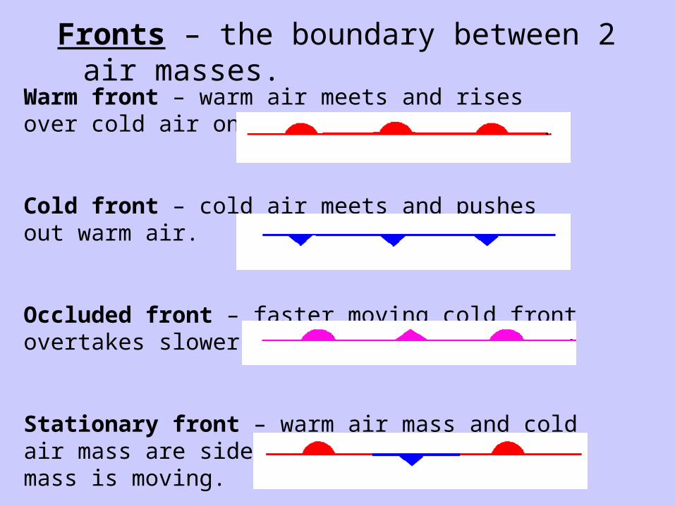
Fronts – the boundary between 2 air masses.
Warm front – warm air meets and rises over cold air on the ground.
Cold front – cold air meets and pushes out warm air.
Occluded front – faster moving cold front overtakes slower moving warm front.
Stationary front – warm air mass and cold air mass are side by side, neither air mass is moving.
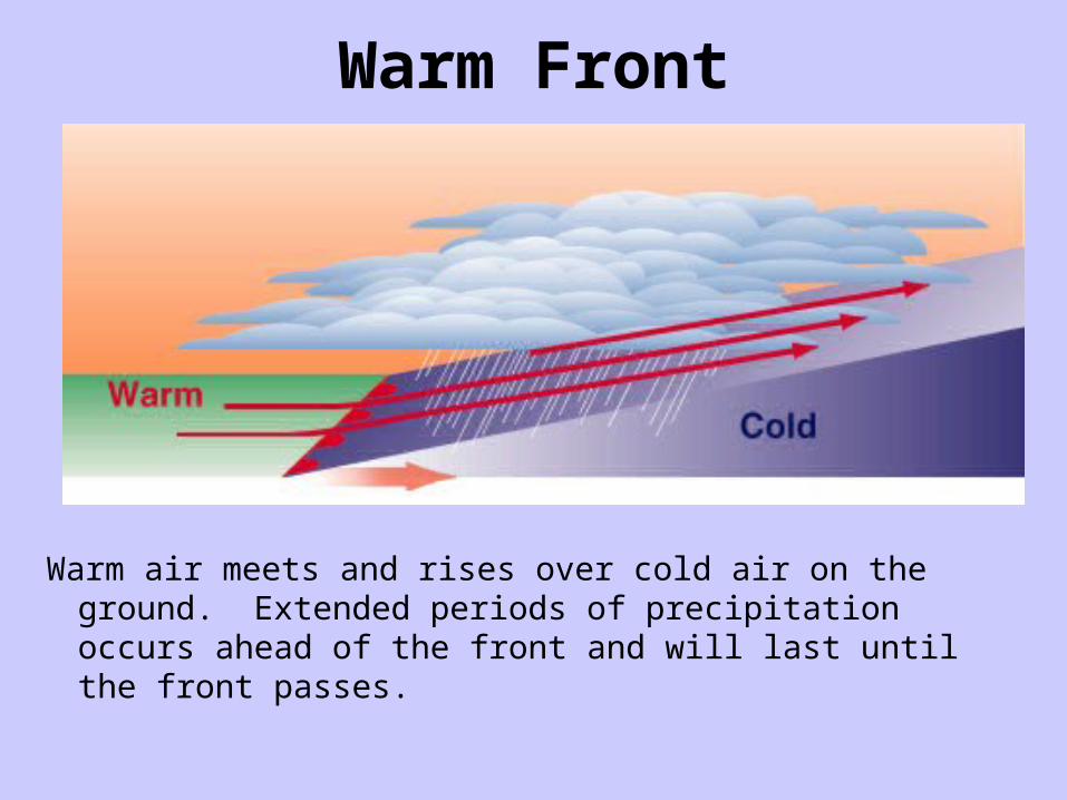
Warm Front
Warm air meets and rises over cold air on the ground. Extended periods of precipitation occurs ahead of the front and will last until the front passes.

Cold Front
Cold air meets and pushes out warm air. Short but heavy period of precipitation. Wind shift and rapid change in weather conditions once the front has passed. Violent thunderstorms can occur at the front.

Occluded front
Faster moving cold front overtakes slower moving warm front (cooler air). Overcast and light precipitation may occur.
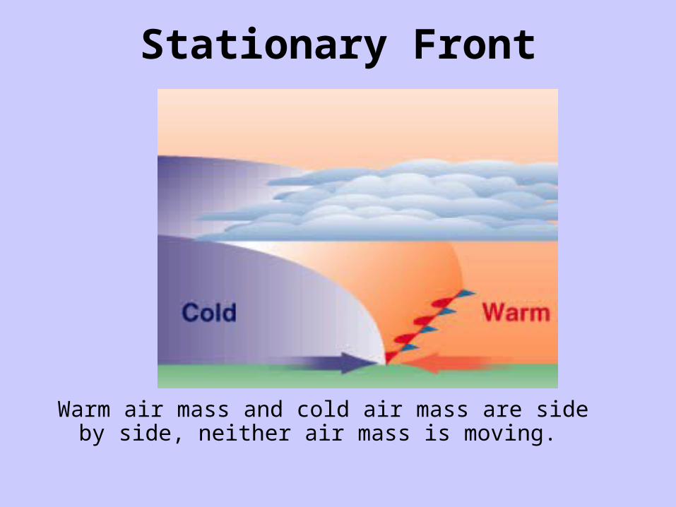
Stationary Front
Warm air mass and cold air mass are side by side, neither air mass is moving.
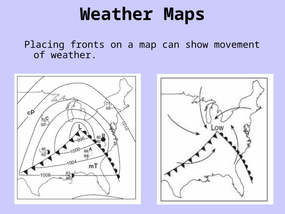
Weather Maps
Placing fronts on a map can show movement of weather.
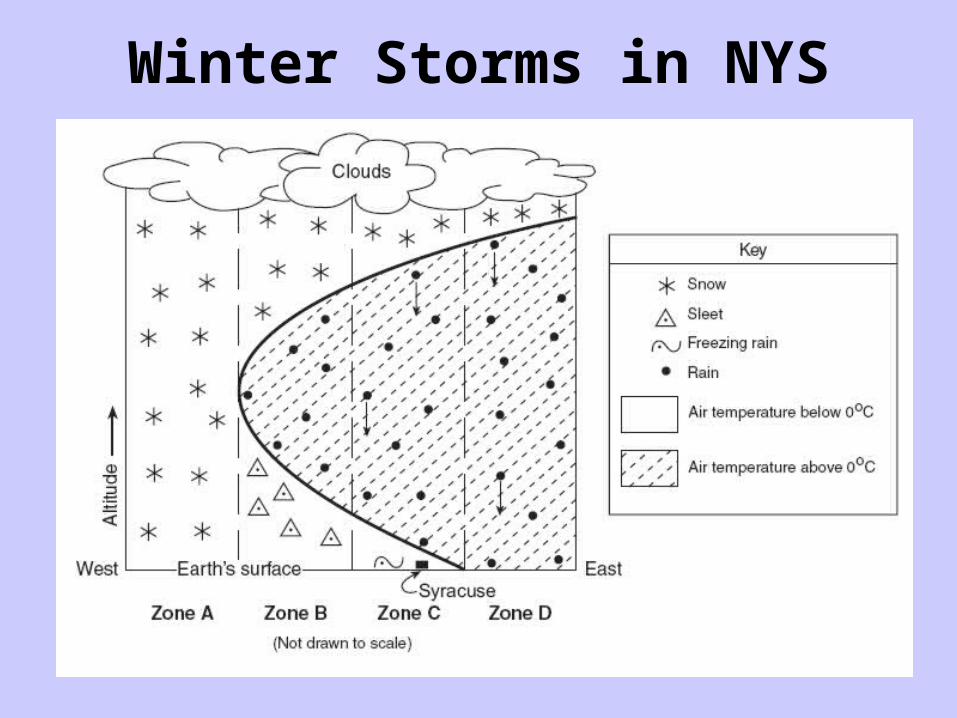
Winter Storms in NYS