Embed Size (px)
Citation preview

Map Skills Unit Review
1. On the map of Canada provided, label all the provinces, territories, capital cities and major water bodies (including lakes, major rivers, and oceans).
2. What is a mental map?3. What is a thematic map?4. What is a topographic map?5. What is the bearing of NNE?6. What is the bearing of S?7. What is the bearing of W?8. What is the bearing of SSW?9. What is the bearing of E?10. Define latitude11. Define Longitude12. What degree of latitude ist he equator?13. What degree of latitude is the Antarctic circle?14. What degree of longitude is the International Date Line?15. What degree of longitude is GMT?16. Who invented time zones?17. How many degrees are there between each time zone?18. Why is Newfoundland different?19. Which time zone are we in?20. What is daylight savings time?21. What time zone is Edmonton in?22. What time zone is Vancouver in?23. If it is 6pm in Toronto, what time is it in NFLD?24. If it is 3pm in Vancouver, what time is it in Winnipeg?25. What is a horizontal control point?26. What is a spot height?27. What is a bench mark?28. Define elevation29. Define contour lines30. How would you recognize a gentle slope on a map?31. How would a river valley appear on a map?32. Define scale33. 1cm = 1Km is an example of what type of map scale?34. What is a representative fraction and why is it the most accurate?35. What are the 2 types of scale?36. If 1:250 000 what does 1cm equal?37. Convert 1cm to 160km to a representative fraction.38. How are mountains represented on a map?39. How do you label a river on a map?
1
2

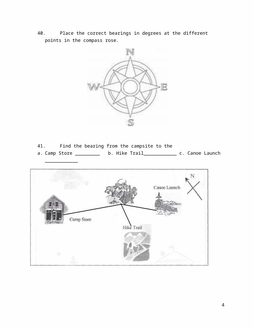
40. Place the correct bearings in degrees at the different points in the compass rose.
41. Find the bearing from the campsite to thea. Camp Store _________ b. Hike Trail____________ c. Canoe Launch ____________
3
42. Label the oceans and continents on the world map.
4

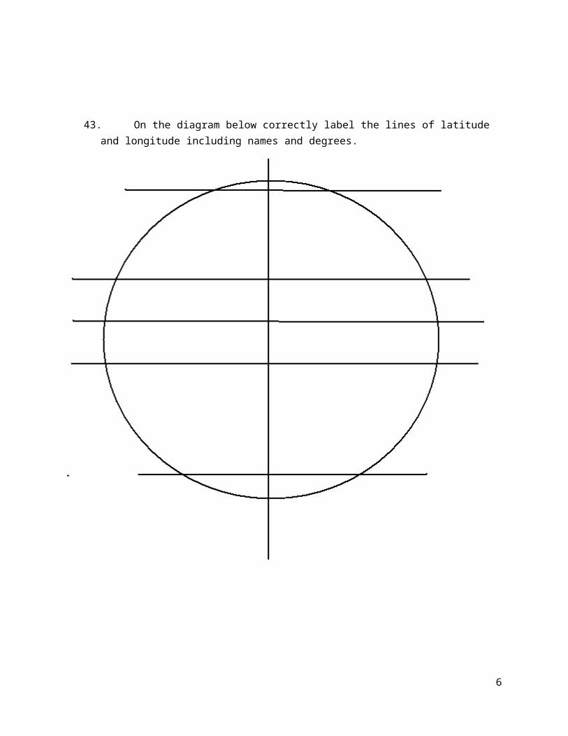
43. On the diagram below correctly label the lines of latitude and longitude including names and degrees.
5
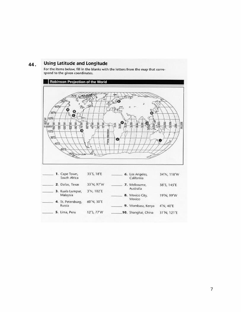
44.
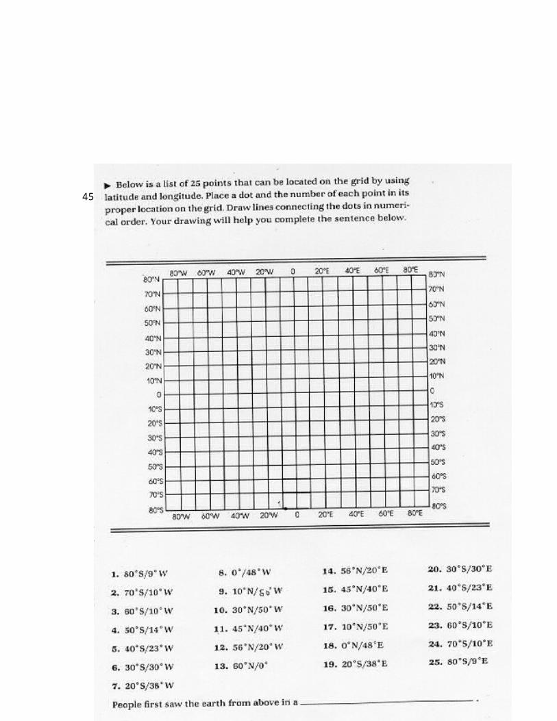
45.
6
46. Matching – Put the appropriate letter by the word.
7
1. ______ Longitude A. Measured in degree, north and south of the equator
2. ______ Parallel B. Distance, measured in degrees east and west of the Prime Meridian. They pass through the poles
3. ______ Meridian C. Latitude lines
4. ______ Latitude D. Longitude Lines
5. ______ Prime Meridian E. 0 Degree Latitude Line
6. ______ Equator F. 0 Degree Longitude Line
47. Map Scales
Convert the following map scales
1. 1:100 000 = 1cm to ____km2. 1cm to 5km = 1:___________________
How far are the following distances using a map scale of 1:100 000
8