Embed Size (px)
Citation preview

Threatened Species Survey Standard
Leadbeater’s Possum April 2015
Authorised and published by the Victorian Government, Department of Environment, Land, Water and Planning, April, 2015.
© The State of Victoria Department of Environment, Land, Water and Planning 2015
This work is licensed under a Creative Commons Attribution 3.0 Australia licence. You are free to re-use the work under that licence, on the condition that you credit the State of Victoria as author. The licence does not apply to any images, photographs or branding, including the Victorian Coat of Arms, the Victorian Government logo and the Department of Environment, Land, Water and Planning logo. To view a copy of this licence, visit http://creativecommons.org/licenses/by/3.0/au/deed.en
AccessibilityIf you would like to receive this publication in an alternative format, please telephone the DELWP Customer Service Centre on 136186, email [email protected], or via the National Relay Service on 133 677 www.relayservice.com.au. This document is also available on the internet at www.delwp.vic.gov.au
DisclaimerThis publication may be of assistance to you but the State of Victoria and its employees do not guarantee that the publication is without flaw of any kind or is wholly appropriate for your particular purposes and therefore disclaims all liability for any error, loss or other consequence which may arise from you relying on any information in this publication.
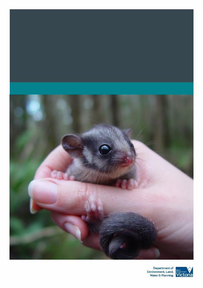
AcknowledgementsCover photo showing Leadbeater’s possum. Photo credit: D Harley (Zoos Victoria)

1.

Contents1. Purpose 3
1.1 Submitting reports to DELWP 3
2. Background 5
3. Part A – Surveys for Leadbeater's Possums 6
3.1 Process for the verification of reports 63.2 Requirements to demonstrate presence of Leadbeater’s Possum 63.3 Requirements to demonstrate absence of Leadbeater’s Possum 11
4. Part B – Requirements for identifying high quality Leadbeater’s Possum habitat 15
4.1 Management of Leadbeater’s Possum in State Forest 154.2 Methods for identifying Leadbeater's Possum habitat zones in State forests
within the Central Highlands Forest Management Area 15
References 18
Appendix 1. Process for submission and verification of Leadbeater’s Possum colony records to DELWP 20
Appendix 2. The main techniques used for detecting Leadbeater’s Possums 21
Appendix 3. Photographs of Leadbeater's Possum nests 23
Appendix 4. The area within the Central Highlands that is considered to have the potential to support colonies of Leadbeater's Possums, used for assessing if verification surveys will be undertaken 24
Appendix 5. Maturity assessment of Mountain Ash, Alpine Ash and Shining Gum (adapted from document first published by DEPI in May 2013). 25
Appendix 6. Photographs of mature, senescent and dead trees. 28
Appendix 7. Photos of trees containing obvious hollows. 29
Appendix 8. An example of the area to be searched for live mature or senescent or dead, hollow-bearing Mountain Ash, Alpine Ash or Shining Gum trees and how polygons are to be drawn around these trees 30
Threatened Species Survey Standard Leadbeater’s Possum
1

Threatened Species Survey Standard Leadbeater’s Possum
2

2. Purpose
This document is one of a series produced by the Department of Environment, Land, Water and Planning (DELWP) to outline requirements for the surveying of threatened species subject to protective prescriptions under the Code of Practice for Timber Production 2014 and the associated timber harvesting regulatory framework.
The DELWP survey standards detail the acceptable survey methods and the minimum level of survey effort necessary to determine the presence or absence of a species (or key threatened species habitat) in State forests, and the appropriate record keeping and reporting requirements that should be used.
The two main purposes for the survey standards are:
I. to document the information required to determine if a record of the species or habitat is valid; and
II. to describe the acceptable level of survey effort required to infer presence/absence of the species or habitat at a specific site.
These standards should be used by any organisation, group or individual undertaking a presence/absence or relative abundance survey. Subject to DELWP’s approval, alternative survey methods may be applied where the proponent can provide an evidence-based rationale for the alternative approach and a detailed description of the survey technique(s). It will be up to the proponent to describe why the method used is considered to be equivalent to or exceed the standards set out in this document.
This survey standard covers requirements for both Leadbeater's Possum colonies (Section 3 – Part A) and high quality Leadbeater's Possum habitat (Section 4 – Part B), as defined in the Leadbeater’s Possum Flora and Fauna Guarantee Action Statement (DELWP 2014).
DELWP will work with VicForests to modify planned timber harvesting operations when verified records of a threatened species and/or habitat are recorded in timber harvesting locations. This will be done in accordance with the regulatory requirements outlined in the Code of Practice for Timber Production 2014.
Please note that only validated (accepted) records will trigger the application of site specific timber harvesting prescriptions for the protection of threatened species and/or habitat.
This document details how DELWP will verify reports that are received. Guidance is provided on the type of information that will best allow DELWP to conduct an efficient and timely assessment and verification of reports.
In some circumstances where plausible reports are assessed to not contain sufficient information and evidence, DELWP may also choose to conduct further survey work to verify the presence or absence of Leadbeater’s Possum at a particular location (when available resources permit).
This version of the standard replaces the previous Survey Standards: Leadbeater’s Possum Habitat Zones (Central Highlands Forest Management Plan) published by the former Department of Environment and Primary Industries (DEPI) in January 2013. DELWP will update this standard as further information about the species and survey techniques becomes available.
1.1 Submitting reports to DELWPInvitation to submit records DELWP invites all stakeholders undertaking survey work for Leadbeater’s Possum colonies or key habitat to submit their records to ensure the proper identification, registration and protection of these values.
Threatened Species Survey Standard Leadbeater’s Possum
3

The preferred process for submitting Leadbeater’s Possum records is outlined on the department’s website at www.depi.vic.gov.au/forestry-and-land-use/timber-production/timber-harvesting-regulation/threatened-species-reports.
This process is administered by the DELWP Land Management Policy Division (LMP). For further advice on the process, please email [email protected].
Victorian Biodiversity Atlas – alternative processLeadbeater's Possum records have also previously been submitted to DELWP’s Victorian Biodiversity Atlas (VBA) and assessed through the VBA expert review process.
Leadbeater’s Possum reports can be submitted to DELWP via either process. Records that are located in State forest will be forwarded to LMP for assessment under the threatened species reporting process (see above).
An overview of the assessment process for submission and assessment of Leadbeater's Possum colony records is illustrated in Appendix 1.
Threatened Species Survey Standard Leadbeater’s Possum
4
3. BackgroundLeadbeater's Possum (Gymnobelideus leadbeateri) is a small, nocturnal, arboreal marsupial. It has grey fur above with paler grey fur below, a prominent dark mid-dorsal stripe and dark facial stripe. The tail is distinctively club-shaped in appearance (Smith and Harley 2008).
Leadbeater’s Possum is confined to an area of approximately 70 x 80 km in the Central Highlands to the northeast of Melbourne, plus a small, lowland area east of Melbourne in the Yellingbo Nature Conservation Reserve (Menkhorst and Lumsden 1995; Harley et al. 2005). Within its range, the species is patchily distributed, occurring in areas of suitable habitat, largely influenced by previous disturbance history. The 2009 Kilmore-Murrindindi fire had a significant negative impact on the distribution and abundance of the species. Leadbeater’s Possum is listed under the Victorian Flora and Fauna Guarantee Act 1988 (FFG Act) and recognised as Endangered. An Action Statement was prepared in 1995 and revised in 2014 (DELWP 2014).
There are a range of regulatory requirements that guide the planning of timber harvesting operations conducted in Victoria’s native forests. VicForests reviews all proposed harvesting sites through assessment of DELWP’s current biodiversity data and also checks to determine if certain environmental values are present in the field. This includes checking for potential high-quality Leadbeater's Possum habitat which is then excluded from harvesting when present.
In April 2014, the former Victorian Government responded to the recommendations of the Leadbeater's Possum Advisory Group (2014) and committed to implementing a range of actions to support the recovery of the Leadbeater's Possum, while maintaining a sustainable timber industry.
These actions included establishing a requirement in the Code of Practice for Timber Production 2014 for creating timber harvesting exclusion zones of 200 m radius to protect known Leadbeater's Possum colonies.
Leadbeater’s Possum is known to occur in three distinct habitat types: montane ash forests (Mountain Ash Eucalyptus regnans, Alpine Ash E. delegatensis and Shining Gum E. nitens and adjacent areas of Cool Temperate Rainforest and riparian thickets); sub-alpine woodland (Snow Gum E. pauciflora); and lowland floodplain forest (dominated by Mountain Swamp Gum E. camphora in the Yellingbo Nature Conservation Reserve) (Lindenmayer et al. 1989, Harley 2004a). The key habitat requirements of Leadbeater’s Possum across all forest types are: hollow-bearing trees (for nest sites and refuge), predominance of smooth-barked eucalypts with exfoliating bark (providing shelter for insect prey and material for nests), a structurally dense interlocking canopy or secondary tree layer (to facilitate movement), and a wattle understory (providing food) (Smith and Lindenmayer 1988, Menkhorst and Lumsden 1995, Harley 2004a).
Leadbeater’s Possum typically form social groups of 2-12 individuals (Smith and Harley 2008). The colony dens in a large, communal nest of shredded bark in the hollow trunks of large, mature eucalypts, often in decaying dead stags (Smith and Lindenmayer 1988). Each social group typically makes use of several nest trees within an exclusive territory of 1-3 ha which is defended from neighbouring colonies (Lindenmayer and Meggs 1996, Smith and Harley 2008).
Threatened Species Survey Standard Leadbeater’s Possum
5

4. Part A – Surveys for Leadbeater's Possums
3.1 Process for the verification of reports
New record verification Different verification pathways apply depending on the location of the record and the potential requirement to establish a 200 m protection zone around the verified Leadbeater’s Possum colony.
Records located within National Parks, other crown land reserves or private land:
There is no requirement to establish protective zones in National Parks, other crown land reserves or private land. The standard VBA verification process will continue to apply, using expert review to assess the record. The record will then be classified as either ‘unconfirmed’ or ‘accepted’ as a record for publishing in the VBA, based on the information provided and the location and habitat of the record. If there is insufficient information to accept the record, the observer will be asked for more details. Records that provide supporting information (e.g. photographs) could be given the higher classification of ‘confirmed’.
Records where any part of the potential 200 m exclusion zone occurs in State forest:
If the record point is located within an existing 200 m timber harvesting exclusion zone for Leadbeater’s Possum, this will be recorded as a duplicate record in the DELWP register (unless there is clear evidence provided to suggest it represents a different colony), and will be assessed through the standard VBA expert review process. No additional exclusion zone will be established.
If the record point falls outside an existing timber harvesting exclusion zone for Leadbeater’s Possum, the following process will apply:
o If the record is submitted by a recognised scientific organisation (e.g. CSIRO, Zoos Victoria or universities) that has specific ecological expertise and can demonstrate a rigorous internal quality assurance (QA) process, the record will generally be considered acceptable. DELWP may seek to review and endorse the QA processes for
these organisations. This process will be developed separately and communicated to key scientific organisations involved in research on the Leadbeater's Possum.
o For reports provided by other groups, organisations or individual members of the community (referred to in these standards as ‘community-generated reports’):
- if insufficient information on when, where and how the animal was observed (as outlined in section 3.2.1), the record will not be verified unless further information can be provided.
- if suitable supporting evidence (as outlined in section 3.2.2) is provided that enables verification through a desktop assessment, the record will be verified.
- if no supporting photographic images or video footage of the animal is provided, or if any photographic images or video footage is inconclusive, but there is detailed information on when, where and how the animal was observed, the location will be assessed as to if it has the potential to support Leadbeater’s Possums (see criteria in section 3.2.3). If the detection report is plausible and sufficiently detailed, DELWP will arrange field verification surveys (subject to safety considerations and resource availability) to determine the presence/absence of Leadbeater’s Possum.
DELWP will notify VicForests of all new reports received relating to the presence or absence of Leadbeater’s Possum in State forest.
DELWP will also notify VicForests when such records are verified and require the creation of timber harvesting exclusion zones.
DELWP will work with VicForests to establish any required timber harvesting exclusion zone in accordance with the forest zoning procedure.
All verified Leadbeater’s Possum records will be published by DELWP in the VBA.
Threatened Species Survey Standard Leadbeater’s Possum
6

3.2 Requirements to demonstrate presence of Leadbeater’s Possum
As Leadbeater’s Possum is a cryptic, nocturnal, arboreal species it is often difficult to obtain evidence that can be used to verify that the animal occurs at a particular location. It can be detected using a range of mammal survey techniques, notably stag (tree)-watching, recorded call playbacks, remote cameras, spotlighting, nest-box surveys, live capture in cage or Elliott traps, or by vocalizations. Each technique has its advantages and disadvantages.
Stag-watching has long been the established technique for surveying for Leadbeater's Possum (Smith et al. 1989) and while effective, it is very labour-intensive. More recently call playback (sometimes done in conjunction with thermal imaging cameras) has proved an effective technique (Lumsden et al. 2013; Harley in press). Remote cameras are also effective (Harley et al. 2014), although it can be difficult to place the cameras at heights in the forest where Leadbeater’s Possums often forage without the assistance of experienced/qualified tree climbers or arborists. The effectiveness of these techniques may vary within the three major Leadbeater’s Possum habitat types (montane ash forest, sub-alpine woodland, lowland swamp forest). Appendix 2 provides detailed information on the recognised survey techniques.
Permits, consent and timber harvesting safety zonesPlease note that permits and consent may be required to conduct certain activities aimed at gathering evidence of Leadbeater’s Possums. Research permits may be required to undertake surveys using trapping, nest boxes, call playback and baited remote cameras under the Wildlife Act 1975 (please contact [email protected]). Approval from a registered Animal Ethics Committee may also be required for surveys using these techniques (refer to www.depi.vic.gov.au/animalwelfare). A permit may also be required under the National Parks Act 1975 if working within a park managed by Parks Victoria (contact [email protected]). For surveys undertaken in State forest a Forest Research Permit may be required under Section 52
of the Forests Act 1958 – for further information contact [email protected].
Please also note for surveys conducted near active timber harvesting operations, a timber harvesting safety zone (THSZ) may be in place. THSZs aim to ensure the safety of workers, authorised persons and the public during timber harvesting activities. Only authorised persons (see Schedule 2 to the Sustainable Forests (Timber) Act 2004) are authorised to enter THSZs. Such zones feature notices clearly displayed on or near roads that act as entry points to the zone. VicForests also publishes notices on its website (www.vicforests.com.au/timber-harvesting-safety-zones).
3.2.1 Information and data required for all reports submitted to DELWP
The following data is required for Leadbeater’s Possum reports provided to DELWP for verification:
the name and contact details of the observer(s) submitting the report;
a detailed description of the method used to obtain the record;
any associated photographic images or video footage evidence (see section 3.2.2);
the date and time of the record, with evidence of this date and time (see section 3.2.2), and
the precise geographic location of each record (GPS coordinates) and supporting evidence of the location (see section 3.2.2).
Please note that if verifiable locational data is not provided, the person submitting the report must be willing to escort the DELWP verification team to the site to locate the area of interest. If this is unable to be completed within a reasonable timeframe then the record may not be able to be verified by DELWP.
The following information would also be appreciated by the scientific staff working in DELWP:
a description of the forest type at the location of the observation
weather conditions at the time of the observation; and
an indication of the sampling effort undertaken, (e.g. number of visits made to the site).
Threatened Species Survey Standard Leadbeater’s Possum
7

Victorian Biodiversity Atlas People submitting Leadbeater’s Possum records are also encouraged to self-register their records in the VBA so that the record can be correctly attributed and controlled by the observer. If relevant, please include the “VBA survey identification number” as a part of any submission provided to avoid possible duplication.
Information on how to lodge a record in the VBA is available at www.depi.vic.gov.au/environment-and-wildlife/biodiversity/victorian-biodiversity-atlas.
DELWP will input verified Leadbeater’s Possum records on behalf of persons who are unable or unwilling to lodge their information in the VBA but such records cannot be directly attributed.
3.2.2 Supporting evidence required to verify community-generated records
Supporting evidence is required to verify all community generated records. This may include a range of information, but should generally include photographic images or video footage. Verification of records that are provided to DELWP with high-quality supporting evidence can generally be completed more quickly through desktop analysis, which will allow timely protective zones to be established around Leadbeater’s Possum colonies. The following guidance is provided on the submission of supporting evidence.
1. Photographic images or video footage The best way to cover off on the date and time
requirements is to ensure that all photo and video evidence includes a date/time stamp to show when the photo was taken. Care should be used to ensure that date and time in your camera settings is accurate at the time of the survey.
Photographic images or video footage must be sufficiently clear to enable identification of the animal and to distinguish it from other similar species. The small size, club-shaped tail, dark mid-dorsal stripe, lack of gliding membrane (see figure 1) and darting movements are all key features used to identify Leadbeater's Possum, although it is recognised that not all of these features can be clearly seen in all situations. Field guides (e.g. Menkhorst 2010) can be used to assist in identification and help differentiate Leadbeater’s Possum from other species of possums and gliders that may be encountered.
Figure 1 – A juvenile Leadbeater's Possum photographed using white light during a call playback survey. Photograph: Tamara Leitch and Claire McCall.
Images can be captured using infrared or white light. These are typically collected in the forest at night by directly observing the animals.
Thermal imaging cameras are useful to locate animals, but photographs using these cameras are not typically clear enough to conclusively identify a Leadbeater's Possum. Infrared or white light images are usually required.
2. Evidence of the location Evidence of the detection location is also
required. A date and time stamped photograph of a GPS device showing the coordinates of the detection location is the preferred method to enable desktop verification (see figure 2).
The date and time stamp on the photograph of the GPS should match the date and time stamp of the animal image/footage (e.g. within a space of minutes). DELWP will generally consider this acceptable for desktop verification. The GPS should display the satellite/ GPS coordinate information (see figure 2) to show the location.
Threatened Species Survey Standard Leadbeater’s Possum
8

Figure 2 – Image of a GPS device showing a date and time stamp and the satellite/ GPS coordinate information that need to be provided to DELWP to verify detection locations.
In the event that the location is recorded as a “GPS waypoint” (which could potentially be recorded elsewhere) or if the photograph of the reported location is not clear, further verification of the location may be required to match the features in the photos or video footage containing the Leadbeater’s Possum to the actual location. The person submitting the record must also be willing and available to escort the verification team to the detection location if required.
When using video, it is preferable to pan down after filming the animal to show the location on the GPS device, so that the animal and the GPS location are presented within the same video sequence.
It is recognised that this type of information will often be difficult to obtain, and DELWP appreciates the efforts made by community members willing to provide information in a format that will assist in efficient and timely verification.
3. Photographic evidence using remote cameras Remote cameras may be set at nest trees or in
foraging habitat to capture photos of the animals. Typically images of Leadbeater’s Possum captured using these cameras are taken using infrared light.
The best method for verifying the location of the remote cameras will be to take a photo of a GPS, displaying the satellite/coordinate page (see figure 2) using the remote camera once it is set in place. All subsequent photos will then have the same distinguishing background as the initial photo showing the GPS device.
A photo of the location showing a clearly relocatable fixed feature (a characteristic tree or rock formation) may also be suitable, but this may be difficult to obtain if the camera is set up at height.
4. Live trapped animal (e.g. cage or Elliott trap) Please ensure you hold necessary permits and
approvals (see Section 3.2).
Clear images or video footage of the animal should be obtained, and contain a photo of the location that includes a relocatable fixed feature, and to also provide appropriate GPS evidence (see figure 2).
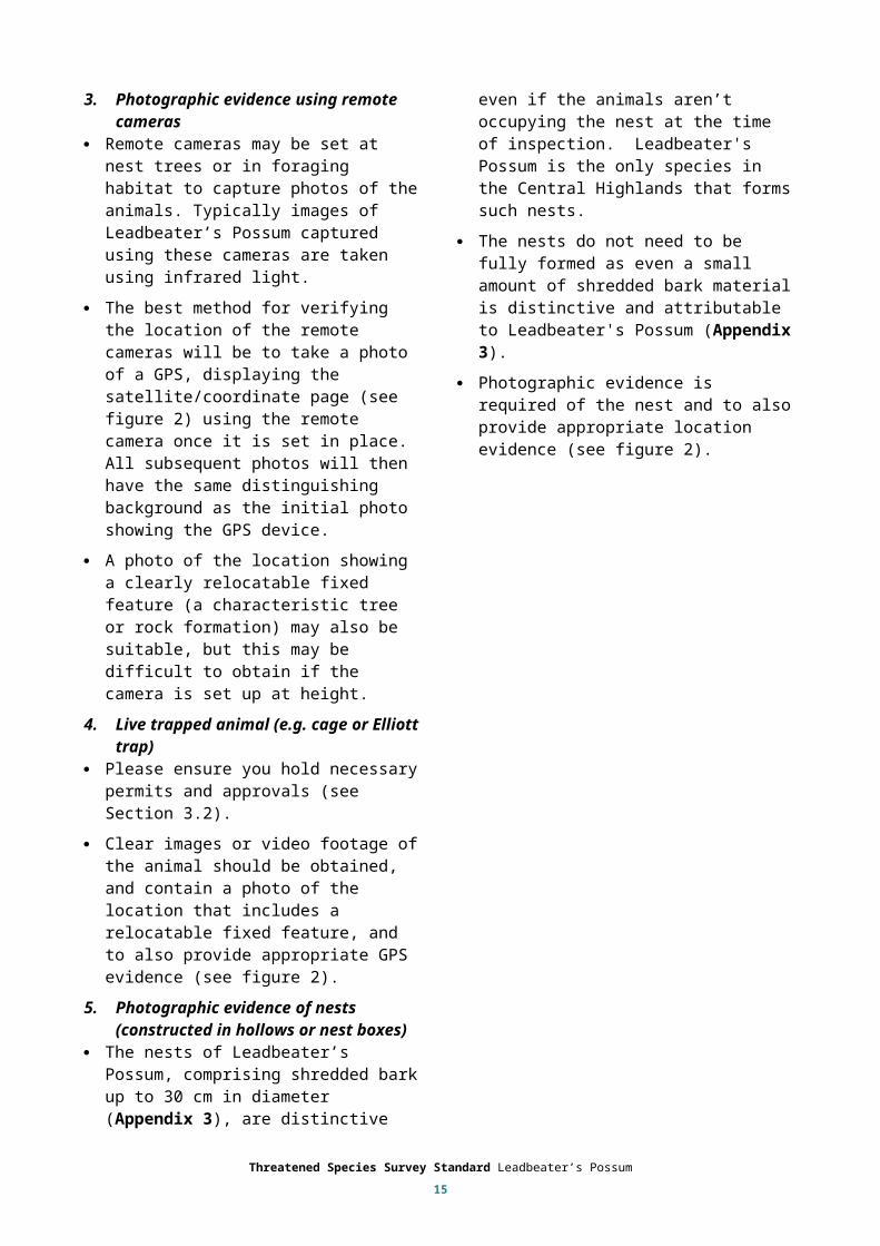
5. Photographic evidence of nests (constructed in hollows or nest boxes)
The nests of Leadbeater’s Possum, comprising shredded bark up to 30 cm in diameter (Appendix 3), are distinctive even if the animals aren’t occupying the nest at the time of inspection. Leadbeater's Possum is the only species in the Central Highlands that forms such nests.
The nests do not need to be fully formed as even a small amount of shredded bark material is distinctive and attributable to Leadbeater's Possum (Appendix 3).
Photographic evidence is required of the nest and to also provide appropriate location evidence (see figure 2).
Threatened Species Survey Standard Leadbeater’s Possum
9

6. DNA evidence Where the location of the source of the material is not in doubt (e.g. from hair in a nest hollow) with appropriate photographic and location evidence (see figure 2).
7. Sonogram recordings Recorded Leadbeater's Possum calls that show the same acoustic pattern and frequency range as reference Leadbeater’s Possum calls will be accepted where the location of the call can be verified using appropriate location evidence (see figure 2). Any relevant Leadbeater’s Possum record (and associated protective zone) will be established near the location where the sound recording was captured, after assessing the most suitable surrounding habitat. A bioacoustics recorder and spectrogram viewing software (e.g. Song Meter Song Scope Analysis Software by Wildlife Acoustics) are required to assess any sonogram results.
3.2.3 Reports that may trigger further investigation
Where no supporting evidence (as outlined in section 3.2.2) is provided, or in instances where the evidence provided is inconclusive (e.g. animals in photos too far away, or not clear), DELWP is unable to verify the records using a desktop assessment.
In general, where a detailed report is provided and considered plausible by DELWP, a verification survey will be conducted (see below).
Priority will be given to reports containing information and observations considered most likely to represent colonies of Leadbeater's Possum.
Two types of community-generated reports may trigger verification surveys by DELWP. These are:
I. Reports where supporting evidence is submitted but is insufficient to be verified through desktop assessment (e.g. photographic images or video footage are blurry or unclear).
II. Where animals are observed during field sampling (e.g. stag-watching or spotlighting), but where no supporting photographic images or video footage is obtained. DELWP requires that stag-watching and spotlighting reports are submitted by observers with appropriate experience in this type of activity (i.e. those
who have previously participated in spotlighting or stag-watching surveys and can confidently distinguish the Leadbeater’s Possum from other similar arboreal mammals) and/or provide sufficient written evidence of the process that was used to identify the animal. If the observation is obtained by stag-watching, a description of the stag where the Leadbeater’s Possum was observed is required, with a photograph of the tree showing the estimated location of the hollow entrance. A description of the forest type and structure (e.g. Mountain Ash forest with a sparse wattle understorey) is also requested. A photograph (preferably displaying a date/time stamp) of the location, including a relocatable fixed feature, or a photograph of a GPS displaying the satellite/ GPS coordinates must be included in the report to allow DELWP to identify the relevant location. The technique used by the observer to detect the animal needs to be described along with an indication of survey effort (e.g. hours, number of nights, etc). The person submitting the report must be willing to escort the verification team to the detection site where DELWP cannot easily determine the location.
Timing of reportsThe timing of a report in relation to planned timber harvesting operations will be considered by DELWP. DELWP will prioritise reports that require verification surveys in areas that may be impacted by scheduled timber harvesting operations. Such reports should be submitted as early as possible to enable DELWP sufficient time to conduct its assessment. A minimum of two months before the scheduled harvesting commencement date is recommended. Maps of VicForests’ planned timber harvesting coupes can be accessed through the VicForests website at www.vicforests.com.au/approved-timber-release-plan/current-timber-release-plan.
DELWP also provides a “Forest Explorer” website outlining the location of planned timber harvesting operations at www.depi.vic.gov.au/forestry-and-land-use/forest-management/maps.
A planned forward harvesting schedule of VicForests timber harvesting coupes is available through the “Rolling Operations Plan” published on the VicForests website www.vicforests.com.au/supplying-our-industry.
Threatened Species Survey Standard Leadbeater’s Possum
10
DELWP will aim to commence verification surveys within a month of receiving such reports, so as to not hold up scheduled harvesting activities longer than necessary. DELWP will not be able to undertake surveys where there are safety concerns relating to a particular activity (e.g. at any sites where timber harvesting operations have already commenced).
Location of reportsDELWP will undertake an assessment of the location of all reports before conducting surveys to determine the potential of the location to support Leadbeater's Possum. A map showing the distribution of known forest types within the range of the Leadbeater’s Possum is provided in Appendix 4.
The following criteria need to be met for a verification survey to be conducted.
The location is within the area encompassed by the established Leadbeater's Possum Management Units (which equates roughly to the Central Highlands Regional Forest Agreement (RFA) area), and
The location falls within the following forest types:
o montane ash forests (Mountain Ash, Alpine Ash and Shining Gum and adjacent areas of Cool Temperate Rainforest and riparian thickets) either as pure stands or along an ecotone with mixed species forest, where elements of both forest types are present;
o sub-alpine woodland (Snow Gum); or
o lowland floodplain forest (Mountain Swamp Gum).
Report locations that do not meet these criteria will not trigger verification surveys by DELWP. DELWP recognises that it is possible that Leadbeater's Possums may occur outside the specified area and habitat types, but will limit field verification work to higher-probability areas to most effectively use the resources available for verification surveys. Reports of Leadbeater’s Possum occurring outside the area indicated in the map in Appendix 4 will only be considered where sufficient supporting evidence is provided (see section 3.2.2).
3.2.4 Non-acceptable recordsThe following types of records are not considered to be sufficiently reliable to be accepted as records and will not trigger verification surveys by DELWP.
I. A report of a Leadbeater's Possum that contains no supporting evidence (e.g. photographic images or video footage), and insufficient information on the date, time, location, forest type, method of observation, the amount of sampling effort, the contact details of the observer, and in situations where the observer is unwilling to assist DELWP in the verification process by providing further information or participating in a site visit.
II. The identification of hair from Leadbeater’s Possum, e.g. from hair-tubes, as identification can be unreliable using standard hair analysis techniques (Lobert et al. 2001).
III. Records from predator scats or owl pellets, even if containing identifiable remains (e.g. DNA), due to uncertainty with the colony location. The location of the colony may be some distance from the site where the remains were found.
3.3 Requirements to demonstrate absence of Leadbeater’s Possum
While it can be relatively straightforward to document if a species is present, it is more difficult to determine when a species is truly absent. If the species was not recorded during a survey, it can be difficult to determine if the species is absent or if the survey was not adequate to reliably record the species (Wintle et al. 2005). While there is no regulatory requirement to undertake field surveys for Leadbeater’s Possum colonies before the commencement of harvesting, there may be situations where surveys are undertaken.
Achieving complete certainty about a species’ absence from a forest location is not realistically attainable. The following factors will be taken into consideration by DELWP to ensure confidence that the species is “effectively absent” if not recorded during a survey.
Threatened Species Survey Standard Leadbeater’s Possum
11

3.3.1 Survey effort and resulting level of certainty
Leadbeater’s Possum is nocturnal, shy, fast-moving and usually confined to the forest canopy, sub-canopy or understorey (Smith and Harley 2008). This can make it very difficult to observe. A range of techniques can be used to survey for Leadbeater's Possum (see section 3.2 and Appendix 2). Each method has different levels of confidence for detecting the species, depending on the forest structure and environmental conditions. The most effective methods are outlined below. To increase the probability of detecting the species, a combination of these approaches is likely to be required.
Technique 1 – Stag-watchingStag-watching involves positioning an observer at dusk under each hollow-bearing tree on the site, and identifying all possums or gliders that emerge. It is essential that all hollow-bearing trees within the area being investigated are monitored on a single night, as Leadbeater's Possums regularly move between tree hollows within their home range and could therefore be missed if not all potential sites are watched. As a result, this process is highly intensive on human resources. All trees on the site need to be assessed during the day for potential hollows, with dead trees searched for signs of typical entrances to Leadbeater's Possum nests (‘keyhole entrances’). Examine any larger live trees for potential hollows. It is more difficult to observe animals emerging from live trees due to obscuring vegetation, and hence if the site contains live hollow-bearing trees, more visits to the site would be required than if just dead trees are present. Individual trees with multiple hollows that cannot be observed simultaneously will require multiple observers. Irrespective of the number of observers, there is still a risk that animals emerging from obscured hollows, or after the dusk period, may be missed.
As Leadbeater's Possum has a home range of up to 3 ha (e.g. a circular area 200 m in diameter) (Lindenmayer and Meggs 1996, Smith and Harley 2008), individuals could be nesting in an area that is adjacent to where they forage. For example, if there are large hollow-bearing trees along a gully with younger regrowth in the adjacent area, the home range of the colony could include both the gully and the nearby slope. Therefore if stag-watching was used as the main technique to assess
if a site is occupied, any hollow-bearing trees within the surrounding area also need to be watched. If stag-watching is used in conjunction with call playback or remote cameras, there would be less need to survey the surrounding area up to 200 m from the edge of the site as these techniques can detect animals foraging away from their nesting sites.
As it is possible that not all animals will be observed every night, the full suite of hollow-bearing trees in the area, and up to 200 m distance from this area, need to be observed on multiple occasions. If all potential hollow-bearing trees are dead and there is clear visibility around them, and observers are experienced in identifying the species, two nights of watching every tree should be sufficient. If there are live hollow-bearing trees, or inexperienced observers are used, each tree should be watched on at least four nights. If not all potential hollow-bearing trees can be watched on the one night, more nights of observations will be required.
Note that these standards are to be used when the purpose is to have a high level of confidence that the species is absent if not recorded. Surveys undertaken for different purposes may use a different sampling regime and factor into the design the cost-effectiveness of repeated visits to the one site vs fewer visits to multiple sites.
Technique 2 – Call playback Playback of recorded Leadbeater’s Possum calls through a megaphone to attract resident possums during surveys (often incorporating the use of thermal imaging cameras) has recently been used in broad-scale surveys for the species (Lumsden et al. 2013). Thermal cameras can also be used to detect heat signatures of animals, making them easier to locate, particularly in dense vegetation. Analysis of the survey data from 180 randomly selected sites estimated that, provided surveys were conducted when there was little or no wind, the mean likelihood of detecting a Leadbeater’s Possum on sites where it occurred after two visits to the site was 81%, with a confidence interval of 46 – 97% (i.e. probability of detection within this range is equally likely). However, detection probability was strongly influenced by wind, and was substantially lower when wind strength increased. Detection probability may also be influenced by the model of thermal imaging camera used, the age-class and structure of the
Threatened Species Survey Standard Leadbeater’s Possum
12

forest surveyed, the time of year and whether surveys are conducted on or off established tracks.
Even under ideal survey conditions (e.g. no wind and surveys conducted on tracks with optimum visibility), the uncertainty around the detectability estimate indicates that additional visits to survey sites are likely to be required to ensure a high level of confidence of detecting Leadbeater's Possums. For example, the results from the broad-scale surveys indicated that after five visits, the likelihood of detection in ideal conditions was 98% with a confidence interval of 79 – 99%, reducing the likelihood of a false negative record, i.e. incorrectly concluding the species is absent. This however may be variable and further testing of the likelihood of detection is required. When conducting multiple surveys at a site, a period of at least five days between surveys is recommended to reduce any habituation to the call playback.
The detection rate and response of Leadbeater's Possum to call imitation was studied in lowland swamp forest (Harley in press). This showed that there was no response at 31% of surveys at sites occupied by the possum. In 32% of situations where Leadbeater's Possum was detected, they were not recorded at the first calling location within the home range. It is noted that no thermal camera was used in this study and the call was made by human vocalization mimicking the Leadbeater's Possum call. These findings highlight the benefit of testing at multiple survey locations in an area, especially where no megaphone is used to broadcast the call over long distances. There is also benefit in re-visiting survey sites on multiple survey nights before absence can be reliably inferred.
As there is variability in the effectiveness of this technique, the amount of survey effort required for verification surveys will be decided on a case by case basis, factoring in the time of year and the amount of sampling that is conducted using other survey techniques.
Technique 3 – Remote camerasBaited remote cameras are an efficient means of collecting data over long periods of time (e.g. weeks), assuming that the cameras can be installed close to where the animals are moving or foraging. Detection probability estimates using remote cameras have not yet been fully explored for Leadbeater's Possum and it is not known what density of cameras is optimal. Until this is clarified,
it is recommended that four rapid fire infrared digital cameras with a passive infrared motion detector are used per 3 ha area (i.e. equivalent to the home range of a colony) and left in place for a minimum of 3-4 weeks. Creamed honey has been found to be attractive bait for Leadbeater's Possum (Holland et al. 2012; Harley et al. 2014). The distance between the bait and camera should be 1-2 m.
Cameras need to be placed in the forest stratum where the animals are likely to be moving and foraging. For example, in 1983 regrowth where there is a dense understorey, setting cameras at 3-4 m above the ground is effective (Harley et al. 2014). In 1939 regrowth or older forest, cameras usually need to be set much higher (e.g. in the wattle layer above 15 m) or along gully lines where dense vegetation occurs at lower heights. Setting cameras at heights above two meters may involve the use of ladders or tree climbing. DELWP advises that such work should only be performed by appropriately trained professionals such as qualified tree climbers or arborists.
Cameras can also be established facing potential nest entrances. As colonies use multiple nest sites, the cameras should be left in place for a period of weeks to increase efficacy. In these situations bait is not required but may be beneficial.
3.3.2 Reporting standards for survey reports Proper documentation of survey effort is essential to assist DELWP in assessing presence/absence reports. This is particularly the case where data concerning survey effort (e.g. number of survey devices and survey duration) is essential for assessing survey adequacy.
The core data needed for reporting the location of a Leadbeater's Possum (refer section 3.2.1) is also required when reporting a survey, with the addition of the data outlined below. It would be useful if this information was provided for all survey locations, including where the species was not detected.
Technique 1 – Stag-watching number and location of hollow-bearing trees on
the site including within 200 m of the boundary of the site, including notes on which trees were dead versus alive;
the number of nights stag-watching was undertaken;
Threatened Species Survey Standard Leadbeater’s Possum
13

number of dead and alive hollow-bearing trees watched per night and overall;
number of observers used per night;
experience of the observers; and
environmental conditions (weather) at the time of the stag-watches.
Technique 2 – Call playback the nature and sequence of the call playback
recording(s) used;
model details for any thermal imaging or other cameras used;
environmental conditions at the time of each survey (wind, rain, temperature) as these factors may influence detection probability; and
sampling effort – number of nights surveyed, dates of surveys and number of hours surveyed per night.
Technique 3 – Remote cameras number and model details of cameras
deployed;
description of the height and position of the cameras;
GPS coordinates of each camera location;
camera settings used;
type of bait used; and
evidence of the length of time the cameras remained operational (which may be less than the full duration of the deployment in cases of camera malfunction, battery exhaustion or camera storage media exhaustion).
Threatened Species Survey Standard Leadbeater’s Possum
14

5. Part B – Requirements for identifying high quality Leadbeater’s Possum habitat
4.1 Management of Leadbeater’s Possum in State Forest
A zoning system for managing Leadbeater’s Possum habitat in State forest was first proposed in the Action Statement that was published in 1995. The recent Leadbeater's Possum Advisory Group recommendations resulted in changes to the Action Statement for Leadbeater’s Possum (DEPI 2014) with changes to the density of hollow-bearing trees required for Zone 1A habitat.
This revised Action Statement outlines that the best examples of Leadbeater’s Possum habitat occurring outside the reserve system be protected as follows:
Zone 1A HabitatEstablish a special protection zone (SPZ) over areas of Zone 1A habitat where there are more than 10 live mature or senescent hollow-bearing ash trees per 3 ha in patches greater than 3 ha. In Zone 1A habitat hollow bearing trees are defined as live mature or senescent trees of Mountain Ash, Alpine Ash or Shining Gum containing hollows. During salvage harvesting after fire Zone 1A habitat is assessed as if all the trees were live.
Zone 1B HabitatExclude timber harvesting operations from areas of Zone 1B habitat where there are more than 12 hollow-bearing trees per 3 ha in patches greater than 10 ha and wattle density exceeds 5 m2/ ha. In Zone 1B habitat hollow-bearing trees are dead, mature or senescent living trees of Mountain Ash, Alpine Ash or Shining Gum containing hollows. This prescription applies until either of the Zone 1B attributes (the presence of dead, mature or senescent living trees containing hollows, or wattle understorey) no longer exist.
4.2 Methods for identifying Leadbeater's Possum habitat zones in State forests within the Central Highlands Forest Management Area
Outlined below is the procedure for identifying Leadbeater’s Possum habitat in State forest within the Central Highlands Forest Management Area to determine if the area meets the criteria for zoning.
Field ProceduresSurvey AreaEstablish an initial survey area noting that all parts will need to be inspected during the field assessment. The final extent of the survey area will be determined after locating all relevant hollow-bearing trees.
Locate and inspect all relevant trees, including all live mature or senescing Mountain Ash (Eucalyptus regnans), Alpine Ash (Eucalyptus delegatensis) or Shining Gum (Eucalyptus nitens) trees and dead trees that are within the survey area.
Relevant Live TreesIV. Identify all live mature or senescent Mountain
Ash, Alpine Ash and Shining Gum trees within the survey area. “Relevant live trees” are defined as mature or senescent Mountain Ash, Alpine Ash and Shining Gum that are live rooted trees with enough foliage to keep them alive (live cambium is present).
Mature trees are distinguished from younger growth stages by the presence of persistent branches within the crown. The pole stage is characterised by a well-developed main stem, where lower branches are attached to the main stem but are subordinate to it and to the top of the crown which is still putting on height.
In the mature growth stage semi-permanent branches grow from the main stem and large permanent branches help form the crown of the tree. These branches are referred to as “shaping branches” as they dictate the shape of the tree crown. The height that forest
Threatened Species Survey Standard Leadbeater’s Possum
15
eucalypts develop these maturity defining shaping branches can vary and is dependent on site conditions. In between the pole stage and full maturity stage there is a transition stage that will be referred to here as the ‘Early Mature’ stage. Ashton (1975) also identified a stage between pole and mature, calling it the ‘Spar stage’.
Using Ashton’s terminology, the transition stage ‘Early Mature’ equates approximately to ‘late Spar stage’. DELWP does not consider a tree in this Early Mature stage to be a candidate to form Leadbeater’s Possum Zone 1A or 1B habitat. This is because the Central Highlands Forest Management Plan (1998) defines Leadbeater’s Possum Zone 1A habitat as living older trees and Zone 1B habitat attributes as dead mature or senescing trees with wattle understorey. Detailed instructions on how to assess tree maturity in the field are provided in Appendix 5.
Senescing trees are characterised by dead branches and declining crown leaf area, with the trunk of the tree typically containing burls and bumps (although these may be absent), and the top of the tree is invariably broken off. The remaining crown is >95% secondary, being composed of branches of epicormic origin.
Examples of mature and senescent trees are shown in Appendix 6.
II. For each relevant live tree, also identify and record the tree species and the development phase (mature or senescent).
Relevant Dead TreesI. Identify all relevant dead trees within the
survey area.
Dead trees are obviously (physiologically) dead. They are self supporting (rooted into the ground) and would remain standing should any supporting material be removed. Dead trees must be more than 6 m in height and greater than 1.5 m in diameter at breast height. Dead trees should be Mountain Ash, Alpine Ash or Shining Gum, however, it is not always possible to determine the species of a tree once it is dead. Therefore all dead eucalypt trees where species cannot be determined are assumed for the purposes of this standard to be Mountain Ash, Alpine Ash
or Shining Gum. Record the species if known or if not, as ‘unknown’. Examples of dead trees are shown in Appendix 8.
Determine if relevant live trees contain hollows
II. For each relevant tree, record the height and location of the most prominent hollow, recording the height of the bottom of the most prominent hollow to the nearest metre. Record the closest cardinal direction that the hollow is facing (North, East, South and West).
Hollows are cavities formed in the trunk or branches of a live or dead tree. They are formed in ash eucalypt trees through a variety of processes but are generally related to ageing and decay, although physical injury and insect damage may also contribute. They vary in size, both in cavity opening diameter and cavity depth and volume, from small openings of 3 – 8 cm to very large with entrance diameters of 18 – 30 cm or more. Experience in detecting tree hollows may be necessary as assessors not familiar with this kind of observation may underestimate the number of hollows in an area. Examples of trees containing hollows are shown in Appendix 7.
III. Estimate and record wattle density of understorey surrounding the tree location using a basal wedge. At each live mature or senescent or dead hollow-bearing Mountain Ash, Alpine Ash and Shining Gum tree, record the basal area of the wattle to the nearest 0.5 m2.
IV. Record the GPS location of the relevant hollow-bearing trees. Collect the GPS point of each tree. Record the waypoint number created or the easting and northing coordinates.
V. Ensure that there are no live mature or senescent or dead hollow-bearing Mountain Ash, Alpine Ash and Shining Gum trees within 100 m of the survey boundary. If any such trees are found to be within 100 m, increase the size of the survey perimeter. Finalise and document the GPS location of the survey area perimeter.
Threatened Species Survey Standard Leadbeater’s Possum
16

Office Procedures (spatial analysis)A - Identifying Leadbeater’s Possum Zone 1A
habitatI. Create a “tree map” using the GPS
coordinates for all hollow-bearing live mature or senescing Mountain Ash, Alpine Ash or Shining Gum trees.
II. Create a closed polygon(s) around the tree locations where the vertices of the polygon coincide with tree locations. Ensure that no side of the polygon is greater than 100 m and its perimeter is as short as possible. If a tree is more than 100 m from another tree, then create a new polygon. Buffer each polygon by ten metres. Each polygon now represents a separate patch of hollow-bearing trees (Appendix 8 provides an example). Measure the size of each polygon.
III. Assign polygons to Leadbeater’s Possum Zone 1A habitat if the area of the polygon is > 3 ha and the number of trees inside the polygon is > (3.3333 x polygon area in ha). For example, if the polygon area = 4 ha and the number of hollow-bearing trees inside the polygon is 24, the polygon is Leadbeater’s Possum Zone 1A habitat, as 24 > 13.3 (3.3333 x 4).
B - Identifying Leadbeater’s Possum Zone 1B habitat
I. Create a “tree map” using the GPS coordinates for all hollow-bearing live mature or senescing or dead Mountain Ash, Alpine Ash or Shining Gum trees or dead hollow-bearing trees.
II. Create a closed polygon(s) around the tree locations where the vertices of the polygon coincide with tree locations. Ensure that no side of the polygon is greater than 100 m and its perimeter is as short as possible. If a tree is more than 100 m from another tree, then create a new polygon. Buffer each polygon at each tree by ten metres (as shown in Appendix 8). Each polygon now represents a separate patch of hollow-bearing trees. Measure the size of each polygon.
Assign polygons to Leadbeater’s Possum Zone 1B habitat if the area of the polygon is > 10 ha and the number of trees inside the polygon is > (4 x polygon area in ha) and the arithmetic average of wattle density for all tree locations within the patch is greater than 5 m2 per hectare.
Threatened Species Survey Standard Leadbeater’s Possum
17

ReferencesAshton, D.H. (1975). The root and shoot development of Eucalypts regnans F. Muell. Australian Journal of Botany 23:
867-887.Beyer, G.L., and Goldingay, R.L. (2006). The value of nest boxes in the research and management of Australian hollow-
using arboreal marsupials. Wildlife Research 33: 161-174.Choquenot, D. (2002). Leadbeater’s possum Gymnobelideus leadbeateri. Comparison of survey techniques.
Unpublished report to Parks Victoria. Arthur Rylah Institute for Environmental Research, Heidelberg.Davey, S. (1990). Methods for surveying the abundance and distribution of arboreal marsupials in a south coast forest
of New-South-Wales. Wildlife Research 17: 427-445.De Bondi, N., White, J.G., Stevens, M., and Cooke, R. (2010). A comparison of the effectiveness of camera trapping and
live trapping for sampling terrestrial small-mammal communities. Wildlife Research 37: 456-465.Department of Natural Resources and Environment (DNRE) (1998) Forest Management Plan for the Central Highlands.
DNRE, East Melbourne, Victoria.DELWP (2014). Action Statement No. 62 Leadbeater's Possum Gymnobelideus leadbeateri. East Melbourne, Victoria.
Note – published by former Department of Environment and Primary Industries (DEPI).DELWP (2014). Code of Practice for Timber Production. East Melbourne, Victoria. Note – published by former
Department of Environment and Primary Industries (DEPI).DELWP (2013). Advisory List of Threatened Vertebrate Fauna in Victoria – 2013. East Melbourne, Victoria. Note –
published by former the Department of Sustainability and Environment (DSE).Durant, R., Luck, G.W., and Matthews, A. (2009). Nest-box use by arboreal mammals in a peri-urban landscape.
Wildlife Research 36: 565-573.Goldingay, R.L., Grimson, M.J., and Smith, G.C. (2007). Do feathertail gliders show a preference for nest box design?
Wildlife Research 34: 484-490.Harley, D.K.P. (2004a). A review of recent records of Leadbeater’s Possum (Gymnobelideus leadbeateri). Pp. 330–338
in R. Goldingay and S. Jackson eds. The Biology of Australian Possums and Gliding Possums. Surrey Beatty and Sons, Sydney.
Harley, D.K.P. (2004b). Patterns of nest box use by Leadbeater's possum Gymnobelideus leadbeateri: applications to research and conservation. Pages 318-329 In Goldingay, R. and Jackson, S.M. (eds) The Biology of Australian Possums and Gliders. Surrey Beatty & Sons Pty Ltd, Chipping Norton.
Harley, D.K.P. (2006). A role for nest boxes in the conservation of Leadbeater's possum (Gymnobelideus leadbeateri). Wildlife Research 33: 385-395.
Harley, D. (In press). The use of call imitation to establish territory occupancy by Leadbeater’s Possum Gymnobelideus leadbeateri. Australian Mammalogy.
Harley, D.K.P., Holland, G.J., Hradsky, B.A.K., and Antrobus, J.S. (2014). The use of camera traps to detect arboreal mammals: lessons from targeted surveys for the cryptic Leadbeater’s Possum Gymnobelideus leadbeateri. In: Camera Trapping in Wildlife Research and Management (Eds P. Meek and A. W., Fleming), pp. 233-243. CSIRO Publishing, Melbourne, Australia.
Harley, D.K.P., Worley, M.A. and Harley, T.K. (2005). The distribution and abundance of Leadbeater’s Possum Gymnobelideus leadbeateri in lowland swamp forest at Yellingbo Nature Conservation Reserve. Australian Mammalogy 27: 7–15.
Hayes, R.A., Nahrung, H.F., and Wilson, J.C. (2006). The response of native Australian rodents to predator odours varies seasonally: a by-product of life history variation? Animal Behaviour 71: 1307-1314.
Holland, G.J., Harley, D.K.P., Hradsky, B.A.K., and Antrobus, J.S. (2012). The effectiveness of remote cameras for detecting the endangered Leadbeater’s Possum Gymnobelideus leadbeateri. Unpublished Report to the Black Saturday Victoria 2009 – Natural values fire recovery program. Department of Sustainability and Environment, Heidelberg, Victoria.
Jacobs, M.R. (1955). Growth Habits of the Eucalypts. Forestry and Timber Bureau, Commonwealth of Australia, Canberra.
Leadbeater’s Possum Advisory Group (2014). Leadbeater’s Possum Recommendations Report. Report to the Minister for Environment and Climate Change and the Minister for Agriculture and Food Security. DEPI, East Melbourne, Victoria.
Threatened Species Survey Standard Leadbeater’s Possum
18

Lindenmayer, D.B. (1997). Differences in the biology and ecology of arboreal marsupials in forests of southeastern Australia. Journal of Mammalogy 78: 1117-1127.
Lindenmayer, D.B., Tanton, M.T. and Cunningham, R.B.(1991). A critique of the use of next boxes for the conservation of Leadbeater’s Possum, Gymnobelideus leadbeateri McCoy. Wildlife Research 18: 619-624.
Lindenmayer, D.B., Cunningham, R.B., Donnelly, C.F., Incoll, R.D., Pope, M.L., Tribolet, C.R., Viggers, K.L., and Welsh, A.H. (2001). How effective is spotlighting for detecting the greater glider (Petauroides volans)? Wildlife Research 28: 105-109.
Lindenmayer, D.B., MacGregor, C., and Gibbons, P. (2002). Comment — Economics of a nest-box program for the conservation of an endangered species: a re-appraisal. Canadian Journal of Forest Research 32: 2244-2247.
Lindenmayer, D.B., MacGregor, C.I., Cunningham, R.B., Incoll, R.D., Crane, M., Rawlins, D., and Michael, D.R. (2003). The use of nest boxes by arboreal marsupials in the forests of the Central Highlands of Victoria. Wildlife Research 30: 259-264.
Lindenmayer, D.B. and Meggs, R.A. (1996). Use of den trees by Leadbeater’s Possum (Gymnobelideus leadbeateri). Australian Journal of Zoology 44: 625–638.
Lindenmayer, D.B., Smith, A.P., Craig, S.A. and Lumsden, L.F. (1989). A survey of the distribution of Leadbeater’s Possum, Gymnobelideus leadbeateri McCoy in the Central Highlands of Victoria. Victorian Naturalist 106: 174–178.
Lindenmayer, D.B., Welsh, A., Donnelly, C., Crane, M., Michael, D., Macgregor, C., McBurney, L., Montague-Drake, R., and Gibbons, P. (2009). Are nest boxes a viable alternative source of cavities for hollow-dependent animals? Long-term monitoring of nest box occupancy, pest use and attrition. Biological Conservation 142: 33-42.
Lumsden, L.F., Nelson, J.L., Scroggie, M.P., McNabb, E.G., Raadik, T.A., Smith, S.J., Todd, C.R., Acevedo, S., Cheers, G., Jemison, M.L., and Nicol, M.D. (2013). A New Strategic Approach to Biodiversity Management – Research Component. Arthur Rylah Institute for Environmental Research Unpublished Client Report for the Department of Primary Industries, and Department of Sustainability and Environment, Heidelberg, Victoria. <www.depi.vic.gov.au/__data/assets/pdf_file/0008/192932/DEPI_ARI_web.pdf>
MacKenzie, D.I., Nichols, J.D., Lachman, G.B., Droege, S., Royle, J.A., and Langtimm, C.A. (2002). Estimating site occupancy rates when detection probabilities are less than one. Ecology 83: 2248-2255.
Menkhorst, P. (2010). A Field Guide to the Mammals of Australia. Oxford University Press, South Melbourne. Menkhorst, P. and Lumsden, L. (1995). Leadbeater's Possum. Pp 104–107 in Menkhorst, P. (ed.). Mammals of Victoria:
Distribution, Ecology and Conservation. Oxford University Press, Melbourne.Nelson, J.L., and Scroggie, M.P. (2009). Remote cameras as a mammal survey tool - survey design and practical
considerations. Arthur Rylah Institute for Environmental Research Unpublished report number 2009/36. Department of Sustainability and Environment, Heidelberg, Victoria.
Smith, A. and Harley, D. (2008). Leadbeater’s Possum Gymnobelideus leadbeateri. Pp. 226–228 in Van Dyck, S.M. (Ed). The Mammals of Australia. New Holland Press, NSW.
Smith, A.P. and Lindenmayer, D.B. (1988). Tree hollow requirements of Leadbeater's Possum and other possums and gliders in timber production ash forests of the Victorian Central Highlands. Australian Wildlife Research 15: 347–362.
Smith, A.P., Lindenmayer, D., Begg, R.J., Macfarlane, M.A., Seebeck, J.H., and Suckling, G.C. (1989). Evaluation of the stag-watching technique for census of possums and gliders in tall open forest. Australian Wildlife Research 16: 575–580.
Spring, D.A., Bevers, M., Kennedy, J.O.S, and Harley, D. (2001) Economics of a nest box program for the conservation of an endangered species: A reappraisal. Canadian Journal of Forest Research. 31: 1992-2003.
van der Ree, R., and Loyn, R.H. (2002). The influence of time since fire and distance from fire boundary on the distribution and abundance of arboreal marsupials in Eucalyptus regnans-dominated forest in the Central Highlands of Victoria. Wildlife Research 29: 151-158.
Wayne, A.F., Cowling, A., Rooney, J.F., Ward, C.G., Wheeler, I.B., Lindenmayer, D.B., and Donnelly, C.F. (2005). Factors affecting the detection of possums by spotlighting in Western Australia. Wildlife Research 32: 689-700.
Wintle, B.A., Kavanagh, R.P., McCarthy, M.A. and Burgman, M.A. (2005). Estimating and dealing with detectability in occupancy surveys for forest owls and arboreal marsupials. Journal of Wildlife Management 69(3): 905-917.
Wood, S. (2013). Tree Ring Research. Using tree rings and fire scars to better understand fire regimes and ecological processes in Tasmania’s forests. The Forester – A publication of the Institute of Foresters of Australia. 56 (1): 22-24
Woodgate, P.W. et al. (1996). Study of old-growth forest in Victoria’s Central Highlands. Department of Conservation and Natural Resources, Victoria.
Threatened Species Survey Standard Leadbeater’s Possum
19

Appendix 1. Process for submission and verification of Leadbeater’s Possum colony records to DELWP
Threatened Species Survey Standard Leadbeater’s Possum
20

Appendix 2. The main techniques used for detecting Leadbeater’s PossumsStag-watchingStag-watching involves direct counts of possums emerging from tree hollows at dusk (Smith et al. 1989). All mature, hollow-bearing trees within each site are mapped. Observers are then positioned under hollow-bearing trees, 10-30 minutes before dusk. Observers scan the canopy around them until 40-60 minutes after sunset (Lindenmayer et al. 1989, Smith et al. 1989). It is critical that the entire site is surveyed on a single night, given the propensity of possums to move regularly between tree hollows within their home range.
Observers count Leadbeater’s Possums as they emerge from hollows in the trees they are observing. Possums emerging from hollows are observed using natural light, with distinctive morphological and behavioural characteristics used to identify the species (i.e. overall body size is small, club-like tail shape, lack of gliding membranes, rapid-darting movements on emergence). The mean time of emergence is 20 minutes after dusk, but varies seasonally (Lindenmayer 1997). Stag-watching yields an estimate of the number of possums emerging from individual hollow-bearing trees on an individual night.
Although stag-watching is an effective method for surveying Leadbeater’s Possum, it is labor intensive making it difficult to implement in broad-scale surveys covering a large number of sites.
Call playback The response of Leadbeater’s Possum to imitations of its call, or to playback of recordings of its call, has previously been used to successfully detect the species in a range of forest types (Lindenmayer et al. 1989, Choquenot 2002, Harley in press). Recently, a new technique has been developed that combines call playback to attract any Leadbeater’s Possums present on survey sites, with thermal imaging cameras which detect the heat signature of animals (Lumsden et al. 2013). The thermal cameras greatly increase the likelihood of observers locating and identifying any Leadbeater’s Possums investigating the broadcast calls, particularly in dense vegetation.
During call playback, two recorded alarm calls of Leadbeater’s Possum are played through a megaphone, followed by recordings of the call of the Southern Boobook Ninox novaeseelandiae (a potential predator) with each call interspersed with two minute listening periods. During the call playback and listening periods the surrounding vegetation is scanned with a thermal imaging camera. White light torches or spotlights are used to verify the identity of animals encountered during the survey. If there is no response from any Leadbeater’s Possums, the sequence is repeated. Overall, up to one hour is spent surveying each site.
Providing that each site is surveyed on multiple occasions in suitable weather conditions (i.e. little wind) this method can provide a viable alternative to stag-watching, particularly for surveys over a large numbers of sites (Lumsden et al. 2013). Surveying sites on multiple occasions also allows statistical methods to be used to estimate the likelihood of ‘false negative errors’, i.e. failing to detect the species on sites where it actually occurs (MacKenzie et al. 2002).
Remote camera surveysRemote cameras are an efficient means of collecting data over long periods of time (e.g. weeks) with minimal input of labour, they are minimally invasive and surveys can be conducted throughout the year (Nelson and Scroggie 2009). Remote camera surveys are known to provide a cost-effective and reliable survey technique for small terrestrial vertebrates (Hayes et al. 2006, Nelson and Scroggie 2009, De Bondi et al. 2010), especially where presence data are required, although information on their use in arboreal situations is limited. Baited remote cameras have recently been trialled for their effectiveness for Leadbeater’s Possum (Holland et al. 2012, Harley et al. 2014). High detection rates in occupied territories were achieved when cameras were installed on trees approximately 3-4 meters above the ground and set facing a bait of creamed honey in an open feeder. Because Leadbeater’s Possums rarely descend to the
Threatened Species Survey Standard Leadbeater’s Possum
21

ground, camera traps need to be placed at the heights of movement pathways and/or where the possums are foraging. In young forest with a dense understory, or along gully lines in more open forest, cameras can be installed at heights up to 4 meters using extension ladders. In older forest high detection rates have been recorded by using tree climbers to install the cameras between 5 and 20 m above ground. Camera trap data can be readily analysed using statistical methods developed by MacKenzie et al. (2002) to estimate the probability of detecting the target species on occupied sites. This estimate provides a basis for assessing the likelihood that the target animals may be present at some survey sites but not detected during the survey.
Spotlight-countsSpotlighting is the most commonly employed field technique for surveying arboreal marsupials (e.g. Lindenmayer et al. 2001). However, detection efficiency can be low, particularly for taxa that have low eye-shine, are cryptic or fast-moving, or don’t vocalise (Wayne et al. 2005). Other factors, such as vegetation structure and weather conditions (e.g. Davey 1990), may also influence detectability. Although Leadbeater's Possum can be detected during spotlight surveys (e.g. van der Ree and Loyn 2002), few studies have relied on this technique due to poor reliability and repeatability when compared to stag-watching (Smith et al. 1989). Smith et al. (1989) found that nearly ten times more possums were observed on 32 x 3 ha sites using stag-watching compared with spotlight counts. Stag-watching also detected the presence of Leadbeater’s Possum on a site approximately three times more often than spotlight counts. The height of the montane ash forest and dense vegetation in parts of the understorey and midstorey contribute to the difficulty in spotlighting the animal, and enhance the species’ cryptic behavior.
Nest boxesNest boxes can be valuable research or management tools in certain circumstances; they can be useful for recording arboreal marsupials that are less detectable by conventional survey techniques, potentially providing information on a species’ ecology, providing additional habitat for endangered species, or enhancing existing habitat connectivity (Lindenmayer et al. 2003, Beyer and Goldingay 2006). Nest boxes have been employed to monitor arboreal marsupials, including Leadbeater’s Possum, over medium-long term time-frames (e.g. Beyer and Goldingay 2006, Harley 2004b, Harley 2006, Goldingay et al. 2007, Durant et al. 2009). Their effectiveness as a monitoring tool has been questioned however, because of the effort required to install and maintain them (especially for locations away from tracks or roads), the low rates of use by Leadbeater’s Possum in some situations, the delayed occupation by Leadbeater’s Possum (in montane ash forest), the apparent attrition of their suitability for occupancy, and the inconsistency of their effectiveness with forest age (Lindenmayer et al. 1991, Lindenmayer et al. 2002, Lindenmayer et al. 2003, Lindenmayer et al. 2009; see also Spring et al. 2001, Harley 2006 ). Nest boxes have however been effective in lowland forest and sub-alpine woodland (Harley 2004b, Harley 2006). More recently, high colonisation rates have also been achieved in nest boxes installed at select sites in montane ash forest with dense vegetation structures below 6 m in height (e.g. regrowth fires from 1983, and gullies in older forests) (D. Harley pers. comm. 2014).
Leadbeater’s Possums do not need to be present in the nest box at the time of inspection on account of the distinctive nest characteristics of the possum. Harley (2006) has discussed the differences in nest-box use by Leadbeater’s Possum between two extended nest-box studies (in montane ash forest and lowland swamp forest). Extensive data are also available on nest box use by the species in sub-alpine woodland (D. Harley and J. Antrobus, unpublished data).
Threatened Species Survey Standard Leadbeater’s Possum
22
Appendix 3. Photographs of Leadbeater's Possum nestsPhotos: Joanne Antrobus (Parks Victoria)
A3a) A fully formed Leadbeater's Possum nest in a nest box. The nest is constructed from eucalypt or tea tree bark that is finely shredded into long thing strips and woven into a dense ball with an internal denning chamber.
A3b) The start of a Leadbeater's Possum nest showing several tail loads of shredded bark. Although not fully formed, bark shredded in this manner is diagnostically Leadbeater's Possum and can be used for a positive identification of the species.
Threatened Species Survey Standard Leadbeater’s Possum
23

Appendix 4. The area within the Central Highlands that is considered to have the potential to support colonies of Leadbeater's Possums, used for assessing if verification surveys will be undertakenThe geographic area is based on the “Leadbeater's Possum Management Units”, and potential habitat is based on known habitat preferences.
Threatened Species Survey Standard Leadbeater’s Possum
24

Appendix 5. Maturity assessment of Mountain Ash, Alpine Ash and Shining Gum (adapted from document first published by DEPI in May 2013).Crown characteristics of early mature trees‘Shaping branches’ form more rounded crown shapes that are typical of the mature Ash eucalypts. Understanding the role of shaping branches in defining maturity requires an additional reference to apical dominance. Trees in the pole and spar stage continue to express apical dominance, given they continue to grow and add height. Apical dominance is a hormonal (auxin) response (Jacobs 1955), whereby the development of lower branches in the crown is actively suppressed and so they remain subordinate. Such subordination results in branches with smaller diameters and limiter lateral growth, such that their length is largely confined the crown position from which they original (i.e. upper, middle or lower third of crown depth). Branching structure at the crown tip is simple, with a clear single leader (Figure a).
As a tree transitions from pole into spar stage, then into late spar (Early Mature) stage, the process of apical dominance will begin to reduce and the role of shaping branches in defining crown shape gradually increase. This usually occurs in conjunction with the natural attrition and self-thinning of surrounding trees within the stand, creating more space for lateral brand development as remaining trees mature.
The tree depicted in Figure A5a is an example of this transition phase – apical dominance remains, while lateral branches are only just beginning to develop ‘shaping’ characteristics. Although the tree in Figure A5a has a bole diameter (dbhob) of about 180cm, it retains the crown characteristics of Early Mature.
Figure A5a) An early Mature mountain Ash showing apical dominance and simple branch structures. lateral crown shaping branches are just beginning to form.
Threatened Species Survey Standard Leadbeater’s Possum
25

Crown and Stand characteristics of mature treesOnce it is clear that apical dominance has ceased, a Mountain Ash tree can no longer be considered to be Early Mature. Lateral branching is free to develop within the constraints of wider stand characteristics, such as available space and proximity to neighbouring trees. Branches will become permanent within the crown (rather than being shed), develop their diameter (Figure A5b), and extend their length away from the main trunk and upwards, further than previously capable (Figure A5c). Lower branches can being to compete equally for height dominance with what was the previous growing tip, producing a more rounded upper crown shape. In this way they add lateral shape and cause the visual disappearance of apical dominance. Branching structure at the crown’s top becomes complex (Figure A5b).
Figure A5b. Two fully mature Mountain Ash trees, showing a lack of upper crown apical dominance, rounded crown shaping with complex branching, larger diameter permanent shaping branches, and broken branch elements in lower crown.
Figure A5c. A mature Mountain Ash tree, showing significant branch extension and diameter growth. Lower branches extend out and upwards, competing for height position and creating the round crown shape.
Such shaping branches are permanent within the crown, and as a guide, develop diameters in excess of 1/3rd of bole diameter at the point of their origin (clear of the collar). This branch size characteristic does not define maturity on its own (especially within the lower half of a crown), but needs to be considered alongside other factors such as the absence of apical dominance and the complexity of upper branch structures (Figures A5a and A5b).
The crown of a mature tree also typically has a number of branches which are epicormic in origin (Woodgate et al. 1994), usually originating in response to previous crown damage (maintaining photosynthetic capacity), or due to lack of apical dominance at the branch level coupled with an ongoing need for additional photosynthetic capacity. Broken branches are often located in the lower crown (Figure A5b).
Threatened Species Survey Standard Leadbeater’s Possum
26

Mature trees are often associated with clear growing space, such that distances of at least 15-25 metres exist between individuals, equivalent to a stand density 20-40 stems/ha. However, multiple age classes (if present, and due usually to a complex fire history) will mask stand density as an indicator, although mature trees will have a suppressive effect on surrounding younger trees in an attempt to maintain their advantage of superior crown position and lateral growing space.
Other indicators of maturity are age, diameter and height. The best indicator of age comes from knowing fire history. However, knowing from which fire a tree originated is difficult in the Central Highlands (apart from 1939 age). In the absence of stand replacing bushfire, Mountain Ash can obtain ages of up to 500 years old (Wood 2013), and crown structure and development can be used to approximate a proportion of this upper age limit. Research indicates that full maturity is attained at some stage beyond 120 years old, but site factors may produce sustained Early Mature characteristics. Diameter is not a consistent indicator of maturity, given this parameter can differ significantly between forest sites on the basis of site quality. Height is the least dependable indicator of maturity.
Other Stand influencesCrown development, including the growth of lower branches below a dominant crown apex, can be significantly influenced by the presence of natural gaps in the forest canopy. Typically, brand development will occur sooner, and be more conspicuous in appearance, adjacent to the natural gap. Such branches will tend to grow into or towards the available space (increased light level), and appear only on one side of the tree (the gap side). Apical dominance will be expressed less than if the tree has neighbouring individuals on all sides, due to the loss of requirement for competitive height position. This factor needs to be considered during assessments of maturity.
In summary Mature Ash species (Mountain Ash, Alpine Ash and Shining Gum) have the following characteristics, in order of assessment priority. Note that no single characteristic defines maturity on its own, although the first characteristic (apical dominance) holds the most significant assessment weight:
1. Lack of clear apical dominance within the upper crown
2. Presence of permanent shaping branches with diameters at least 1/3rd of the bole diameter at their junction with the bole (clear of collar)
3. Shaping branches are not related either to the presence of long term natural gap in the canopy, or to an open grown tree position. In the case of a natural gap, such branches often occur only on one side of the tree, and the ‘assessment weight’ given to this characteristic may need to be downgraded (i.e. the need for other indicators increases as part of the overall assessment)
4. The shaping branches contribute significantly to lateral crown shape and may be competing with other shaping branches for tree height position, creating a rounded crown appearance (related to (1) above)
5. Apical dominance will also cease at the shaping branch level (having reached maximum length), and can induce secondary (epicormic) branch development along shaping branches
6. Some branch death (dieback) and breakage is typical, but not a dominant feature. This loss of leaf area (photosynthetic capacity) can also induce secondary (epicormic) growth to replace lost photosynthetic capacity, and
7. Diameters of Early Mature trees may occur between 90 to 200 cm dbhob, with typical heights of 50-80 m. Diameters of full Mature trees may occur between 150 to 300 cm, with typical heights of 60-100 m. This overlap of ranges between trees in different stages indicates why diameter and height are not good indicators of growth stage.
Threatened Species Survey Standard Leadbeater’s Possum
27

Appendix 6. Photographs of mature, senescent and dead trees.
A6a) Mature tree
A6c) Dead tree (stag).
A6b) Senescent tree
A6d) Dead tree (stag)
Threatened Species Survey Standard Leadbeater’s Possum
28

Appendix 7. Photos of trees containing obvious hollows.
A7a
A7c
A7b
A7a-c) A range of hollow-bearing trees
Threatened Species Survey Standard Leadbeater’s Possum
29

Appendix 8. An example of the area to be searched for live mature or senescent or dead, hollow-bearing Mountain Ash, Alpine Ash or Shining Gum trees and how polygons are to be drawn around these trees
A8a) The survey area is the full extent of the area searched which is established initially based on the area of interest, and then finalised once all live mature or senescent or dead trees are located, with no tree closer than 100 m to perimeter of the survey area. A polygon is then created around a cluster of trees, where the distance between perimeter trees is no more than 100 m in length.
Threatened Species Survey Standard Leadbeater’s Possum
30
Distance from tree to edge of survey area is to be greater than 100 m.
Polygon surrounding cluster of hollow-bearing trees. As this polygon contains less than 10 hollow-bearing trees, it does not meet Zone 1 criteria.
Polygon surrounding a cluster of >10 hollow-bearing trees for Zone 1A (or >12 for Zone 1B)
Dead or live mature or senescent hollow-bearing tree
Survey area

A8b) An enlarged view of the survey area and polygon.
Threatened Species Survey Standard Leadbeater’s Possum
31
10 m buffer to edge of polygon
Minimum distance of 100 m to edge of survey area
Distance between perimeter trees is < 100 m
Buffered polygon (used to calculate size of patch)

Threatened Species Survey Standard Leadbeater’s Possum
32