Embed Size (px)
Citation preview
ContentsCPPSIS4036A Operate spatial software applications................................................................2CPPSIS4037A Produce computer-aided drawings....................................................................8CPPSIS4038A Prepare and present GIS data..........................................................................15CPPSIS5060A Use complex spreadsheets for spatial information..........................................21CPPSIS5061A Locate underground services in surveying practice........................................29CPPSIS5062A Conduct photogrammetric mapping................................................................37CPPSIS5063A Produce GIS data.............................................................................................42CPPSIS5064A Manipulate and analyse GIS data....................................................................50CPPSIS6041A Compile mine survey plans.............................................................................56CPPSIS6042A Coordinate information gathering and GIS development...............................64CPPSIS6043A Develop, monitor and maintain geographic information systems...................72CPPSIS6044A Manage GIS data.............................................................................................79
CPPSIS6044A Manage GIS data
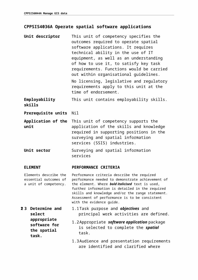
CPPSIS4036A Operate spatial software applications
Unit descriptor This unit of competency specifies the outcomes required to operate spatial software applications. It requires technical ability in the use of IT equipment, as well as an understanding of how to use it, to satisfy key task requirements. Functions would be carried out within organisational guidelines.No licensing, legislative and regulatory requirements apply to this unit at the time of endorsement.
Employability skills This unit contains employability skills.
Prerequisite units Nil
Application of the unit This unit of competency supports the application of the skills and knowledge required in supporting positions in the surveying and spatial information services (SSIS) industries.
Unit sector Surveying and spatial information services
ELEMENT PERFORMANCE CRITERIA
Elements describe the essential outcomes of a unit of competency.
Performance criteria describe the required performance needed to demonstrate achievement of the element. Where bold italicised text is used, further information is detailed in the required skills and knowledge and/or the range statement. Assessment of performance is to be consistent with the evidence guide.
123 Determine and select appropriate software for the spatial task.
1.1 Task purpose and objectives and principal work activities are defined.
1.2 Appropriate software application package is selected to complete the spatial task.
1.3 Audience and presentation requirements are identified and clarified where necessary with relevant personnel.
1.4 OHS requirements to be followed are planned.
456 Select and apply methodology to conduct spatial task.
2.1 Methodology for work activities that support task objectives is selected.
2.2 Resources are identified to support methodology selection.
2.3 Required control structures are applied.
2.4 Technical functions, other data and formatting are used to complete the spatial task, and are recorded according to the task objectives.
2.5 Checks are completed according to organisational practices.

CPPSIS6044A Manage GIS data
ELEMENT PERFORMANCE CRITERIA
789 Finalise the task. 3.1 Documents are named and stored in appropriate directories or folders.
3.2 Required documentation is completed according to organisational guidelines.
REQUIRED SKILLS AND KNOWLEDGE
This section describes the essential skills and knowledge and their level, required for this unit.
Required skills• communication skills to:
• determine the software requirements of a spatial project• discuss software issues effectively with colleagues• impart knowledge and ideas through oral, written and visual means• seek assistance and expert advice
• literacy skills to:• assess and use workplace information• interpret user manuals and help functions• process workplace documentation• read, record data, and write technical reports• research and access routine sources of spatial data
• numeracy skills to:• enter simple formulas into spreadsheets• undertake computations
• spatial skills to solve basic problems relating to height, depth, breadth, dimension, direction and position in operational activity and virtual representation
• technology skills to:• operate a personal computer (PC) and printer• operate a keyboard to enter text and numerical data• use software packages

CPPSIS6044A Manage GIS data
REQUIRED SKILLS AND KNOWLEDGE
Required knowledge• features and functions of commercial software packages• import and export software functions• OHS principles and responsibilities for ergonomics, such as those relating to work
periods and breaks• procedures for the use of input and output devices• procedures for linking documents• purpose, use and functions of applications• software packages used by the organisation• spatial practices relating to using software• technical terminology relating to reading help files and responding to system help
RANGE STATEMENTThe range statement relates to the unit of competency as a whole. It allows for different work environments and situations that may affect performance. Bold italicised wording in the performance criteria is detailed below. Add any essential operating conditions that may be present with training and assessment depending on the work situation, needs of the candidate, accessibility of the item, and local industry and regional contexts.
Objectives may include: • agreed client requirements• written spatial data specifications.
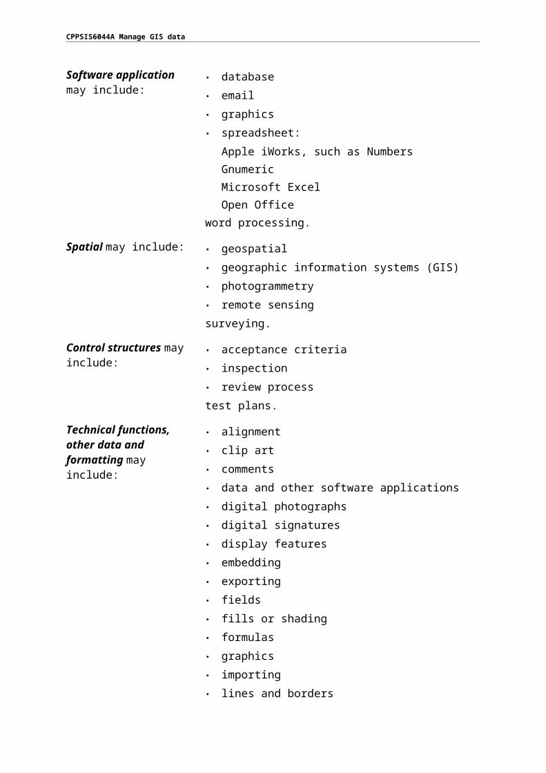
Software application may include:
• database• email• graphics• spreadsheet:
• Apple iWorks, such as Numbers• Gnumeric• Microsoft Excel• Open Office
• word processing.
Spatial may include: • geospatial• geographic information systems (GIS)• photogrammetry• remote sensing• surveying.
CPPSIS6044A Manage GIS data
Control structures may include:
• acceptance criteria• inspection• review process• test plans.
Technical functions, other data and formatting may include:
• alignment• clip art• comments• data and other software applications• digital photographs• digital signatures• display features• embedding• exporting• fields• fills or shading• formulas• graphics• importing• lines and borders• linking• merge cells• page and section breaks• permissions• reviewing• sharing• sort criteria• split cell• table of contents• templates• text direction• versioning.
Organisational guidelines may include:
• code of ethics• company policy• legislation relevant to the work or service function
manuals• OHS policies and procedures relating to:
• avoiding radiation from computer screens• chair height, seat and back adjustment

CPPSIS6044A Manage GIS data
• document holder• equipment that is reasonably adjusted to meet
personal needs• exercise breaks• footrest• lighting• posture• screen position• workstation height and layout
• practices and guidelines outlining work roles and responsibilities.
EVIDENCE GUIDE
The evidence guide provides advice on assessment and must be read in conjunction with the performance criteria, required skills and knowledge, the range statement and the Assessment Guidelines for this Training Package.
Overview of assessment This unit of competency could be assessed on its own or in combination with other units relevant to the job function.
Critical aspects for assessment and evidence required to demonstrate competency in this unit
A person who demonstrates competency in this unit must be able to provide evidence of:• producing spatial documents using selected
methodology and software packages• using help manuals and online help• applying knowledge of software packages to spatial
tasks.
Specific resources for assessment
Resource implications for assessment include access to:• assessment instruments, including personal planner and
assessment record book• assignment instructions, work plans and schedules,
policy documents and duty statements• registered training provider of assessment services• relevant guidelines, regulations and codes of practice• suitable venue and equipment.
Access must be provided to appropriate learning and assessment support when required.Where applicable, physical resources should include equipment modified for people with disabilities.
Context of assessment Holistic: based on the performance criteria, evidence guide, range statement, and required skills and knowledge.

CPPSIS6044A Manage GIS data
EVIDENCE GUIDE
Method of assessment Demonstrated over a period of time and observed by the assessor (or assessment team working together to conduct the assessment).Demonstrated competency in a range of situations, which may include customer/workplace interruptions and involvement in related activities normally experienced in the workplace.Obtained by observing activities in the field and reviewing induction information. If this is not practicable, observation in realistic simulated environments may be substituted.
Guidance information for assessment
Assessment requires that the clients’ objectives and industry expectations are met. If the clients’ objectives are narrowly defined or not representative of industry needs, it may be necessary to refer to portfolio case studies of a variety of SIS requirements to assess competency.Oral questioning or written assessment and hypothetical situations (scenarios) may be used to assess underpinning knowledge (in assessment situations where the candidate is offered a preference between oral questioning or written assessment, questions are to be identical).Supplementary evidence may be obtained from relevant authenticated correspondence from existing supervisors, team leaders or specialist training staff.All practical demonstration must adhere to the safety and environmental regulations relevant to each State or Territory.

CPPSIS6044A Manage GIS data
CPPSIS4037A Produce computer-aided drawings
Unit descriptor This unit of competency specifies the outcomes required to use a range of computer-aided design and drafting (CADD) program functions and features to produce drawings. The skills and knowledge required in this unit focus on the technical skills required to operate CADD, as well as the design skills required to support the needs of employees in surveying and spatial information services (SSIS).No licensing, legislative and regulatory requirements apply to this unit at the time of endorsement.
Employability skills This unit contains employability skills.
Prerequisite units Nil
Application of the unit This unit of competency supports the application of the skills and knowledge required in technical supporting positions in the SSIS industries.
Unit sector Surveying and spatial information services
ELEMENT PERFORMANCE CRITERIA
Elements describe the essential outcomes of a unit of competency.
Performance criteria describe the required performance needed to demonstrate achievement of the element. Where bold italicised text is used, further information is detailed in the required skills and knowledge and/or the range statement. Assessment of performance is to be consistent with the evidence guide.
1 Determine drawing requirements.
1.1 Relevant documentation or information used to determine requirements and processes is accessed and analysed.
1.2 End users, clients and colleagues are consulted to clarify requirements of the SSIS project.
2 Select and set up CADD package.
2.1 Hardware, software, tools and equipment are selected for the project.
2.2 Hardware and software are set up according to operating instructions and organisational procedures.
2.3 Digitised information relevant to the project is identified and retrieved.
3 Gather object parameters and measurements.
3.1 Critical dimensions and data for the required design are established and recorded.
3.2 Quality requirements are identified and applied to design.

CPPSIS6044A Manage GIS data
ELEMENT PERFORMANCE CRITERIA
4 Prepare plots or drawings.
4.1 CADD functions and features are accessed and used according to organisational policies.
4.2 Peripheral equipment required for the CADD project is accessed and used.
4.3 Preliminary drawings are prepared and reviewed with relevant personnel.
5 Check drawings and save files.
5.1 Designs are checked against the project objectives and specifications.
5.2 Required adjustments to designs are made, reflecting consultation with relevant personnel, end user or client.
5.3 Data files are stored according to operating instructions and organisational procedures.
REQUIRED SKILLS AND KNOWLEDGE
This section describes the essential skills and knowledge and their level, required for this unit.
Required skills• analytical skills to analyse data layout and design• communication skills to:
• consult effectively with clients and colleagues• impart knowledge and ideas through oral, written and visual means
• initiative and enterprise skills to:• interpret project requirements• translate requirements into design
• literacy skills to:• interpret and use digital information• understand the instructions required to produce computer-aided drawings• understand datums and projections
• numeracy skills to perform calculations and measurements to produce computer-aided drawings
• planning and organising skills to:• manage information• plan and prioritise activities to meet contractual requirements• conduct project activity
• self-management skills to maintain attention to detail• technology skills to use computers to develop computer-aided drawings

CPPSIS6044A Manage GIS data
REQUIRED SKILLS AND KNOWLEDGE
Required knowledge• display principles, including:
• colour• composition• font type• legends• media• scale• size• text and line style
• CADD basic principles• copyright issues, including:
• intellectual property• legislation associated with the use of CADD
• database structures, including the relationship of spatial features of database• requirements relevant to producing computer-aided drawings:
• accuracy and precision requirements• Australian drawing standards• data formats
• SSIS reference systems• SSIS data capture and data set-out methodologies• use of CADD tools, including:
• drawing function• edit functions• plotting and printing• view displays• working with layers

CPPSIS6044A Manage GIS data
RANGE STATEMENT
The range statement relates to the unit of competency as a whole. It allows for different work environments and situations that may affect performance. Bold italicised wording in the performance criteria is detailed below. Add any essential operating conditions that may be present with training and assessment depending on the work situation, needs of the candidate, accessibility of the item, and local industry and regional contexts.
Information may include:
• creative objectives• measurements and dimensions for objects and space• relevant statutory requirements• scope for making adjustments• technical objectives.
End users may include: • elected members• general public• land information authorities• local government• real estate agents• residents• state and federal government departments• statutory bodies, including land titles office• transport companies• utilities.
Client may include: • customers with routine or special requests• external to organisation• internal to organisation• regular and new customers, including:
• business enterprises• government agencies• members of the public• suppliers.
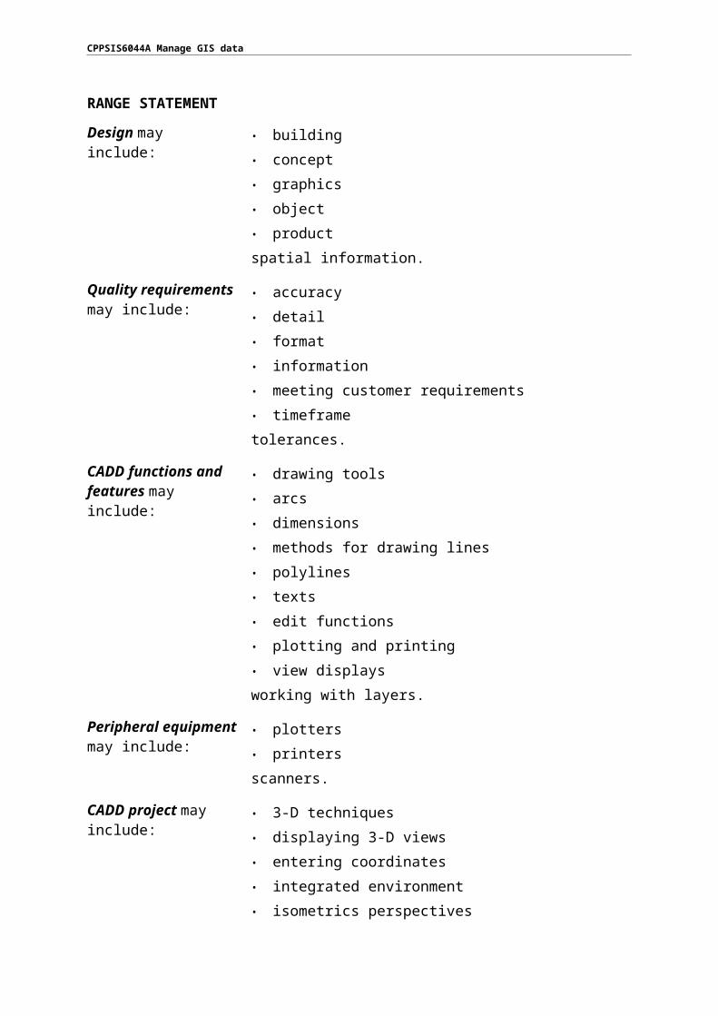
Design may include: • building• concept• graphics• object• product• spatial information.

CPPSIS6044A Manage GIS data
RANGE STATEMENT
Quality requirements may include:
• accuracy• detail• format• information• meeting customer requirements• timeframe• tolerances.
CADD functions and features may include:
• drawing tools• arcs• dimensions• methods for drawing lines• polylines• texts• edit functions• plotting and printing• view displays• working with layers.
Peripheral equipment may include:
• plotters• printers• scanners.
CADD project may include:
• 3-D techniques• displaying 3-D views• entering coordinates• integrated environment• isometrics perspectives• macros• use of attributes to make project reports.

CPPSIS6044A Manage GIS data
EVIDENCE GUIDE
The evidence guide provides advice on assessment and must be read in conjunction with the performance criteria, required skills and knowledge, the range statement and the Assessment Guidelines for this Training Package.
Overview of assessment This unit of competency could be assessed on its own or in combination with other units relevant to the job function.
Critical aspects for assessment and evidence required to demonstrate competency in this unit
A person who demonstrates competency in this unit must be able to provide evidence of:• producing drawings that meet technical and client
specifications• using the standard features and functions of a CADD
program to produce drawings• knowledge of CADD capabilities and uses in relation to
the SSIS industry.
Specific resources for assessment
Resource implications for assessment include access to:• assessment instruments, including personal planner and
assessment record book• assignment instructions, work plans and schedules,
policy documents and duty statements• registered training provider of assessment services• relevant CADD program• relevant guidelines, regulations and codes of practice• suitable venue and equipment.
Access must be provided to appropriate learning and assessment support when required.Where applicable, physical resources should include equipment modified for people with disabilities.
Context of assessment Holistic: based on the performance criteria, evidence guide, range statement, and required skills and knowledge.
Method of assessment Demonstrated over a period of time and observed by the assessor (or assessment team working together to conduct the assessment).Demonstrated competency in a range of situations, which may include customer/workplace interruptions and involvement in related activities normally experienced in the workplace.Obtained by observing activities in the field and reviewing induction information. If this is not practicable, observation in realistic simulated environments may be substituted.

CPPSIS6044A Manage GIS data
EVIDENCE GUIDE
Guidance information for assessment
Assessment requires that the clients’ objectives and industry expectations are met. If the clients’ objectives are narrowly defined or not representative of industry needs, it may be necessary to refer to portfolio case studies of a variety of SIS requirements to assess competency.Oral questioning or written assessment and hypothetical situations (scenarios) may be used to assess underpinning knowledge (in assessment situations where the candidate is offered a preference between oral questioning or written assessment, questions are to be identical).Supplementary evidence may be obtained from relevant authenticated correspondence from existing supervisors, team leaders or specialist training staff.All practical demonstration must adhere to the safety and environmental regulations relevant to each State or Territory.
CPPSIS6044A Manage GIS data
CPPSIS4038A Prepare and present GIS data
Unit descriptor This unit of competency specifies the outcomes required to prepare and present geographic information systems (GIS) data to meet user requirements.No licensing, legislative and regulatory requirements apply to this unit at the time of endorsement.
Employability skills This unit contains employability skills.
Prerequisite units Nil
Application of the unit This unit of competency supports the application of the skills and knowledge required in technical supporting positions in the surveying and spatial information services (SSIS) industries.
Unit sector Surveying and spatial information services
ELEMENT PERFORMANCE CRITERIA
Elements describe the essential outcomes of a unit of competency.
Performance criteria describe the required performance needed to demonstrate achievement of the element. Where bold italicised text is used, further information is detailed in the required skills and knowledge and/or the range statement. Assessment of performance is to be consistent with the evidence guide.
1 Identify presentation deliverables.
1.1 Presentation requirements are determined in consultation with end users or clients.
1.2 Extent, content and intended use of output are considered in recommending presentation format and medium.
2 Format data. 2.1 Relevant data elements are assembled.
2.2 Data formats are selected to meet customer and quality requirements using suitable media.
2.3 Procedures are designed for formatting data into compatible format.
3 Present data, and review outcomes.
3.1 Information is presented in a manner that meets customer requirements and organisational practices and policies.
3.2 Feedback is sought from the customer regarding satisfaction with information and presentation.
3.3 Customer feedback is analysed and used as a quality improvement tool.

CPPSIS6044A Manage GIS data

CPPSIS6044A Manage GIS data
REQUIRED SKILLS AND KNOWLEDGE
This section describes the essential skills and knowledge and their level, required for this unit.
Required skills• analytical skills to analyse data layout and design• communication skills to:
• consult effectively with clients and colleagues• impart knowledge and ideas through oral, written and visual means
• initiative and enterprise skills to:• negotiate with clients• interpret project requirements• translate requirements into design
• literacy skills to:• assess, develop and use workplace information• prepare and manage documentation and information flow• research and access information in order to source geographic information
• planning and organising skills to:• plan and prioritise activities to meet contractual requirements• conduct project activity• manage information
• self-management skills to maintain attention to detail• technology skills to use computers to develop business documentation
Required knowledge• display principles, including:
• colour• composition• font type• legends• media• scale• size• text and line style
• database structures, including the relationship of spatial features of database• procedures for the use of the following applications:
• computer-aided design (CAD)• graphic animation• desktop mapping• desktop publishing• multimedia• plotters

CPPSIS6044A Manage GIS data
REQUIRED SKILLS AND KNOWLEDGE
• printers and terminals• requirements relevant to preparing and presenting GIS data:
• accuracy and precision requirements• Australian drawing standards• data formats
RANGE STATEMENT
The range statement relates to the unit of competency as a whole. It allows for different work environments and situations that may affect performance. Bold italicised wording in the performance criteria is detailed below. Add any essential operating conditions that may be present with training and assessment depending on the work situation, needs of the candidate, accessibility of the item, and local industry and regional contexts.
End users may include: • elected members• general public• land information authorities• local government• real estate agents• residents• state and federal government departments• statutory bodies, including land titles office• transport companies• utilities.
Clients may include: • customers with routine or special requests• external to organisation• internal to organisation• regular and new customers, including:
• business enterprises• government agencies• members of the public• suppliers.
Data may include: • computer records• graphical• user application programs, such as:
• accounting packages• databases• spreadsheets
• hard copy documents, such as:
CPPSIS6044A Manage GIS data
RANGE STATEMENT
• books• maps• plans• work registers
• information, such as:• census data• community facilities• demographic data• local government facilities• organisational locations• property classifications• property boundaries• property ownership• transport routes• utilities• zonings
• spatial• textual.
Data formats may include:
• databases• desktop published documents• digital graphic output• hard copy• labels• maps• PowerPoint presentations• spreadsheets• word processing documents.
Quality requirements may include:
• accuracy• detail• format• information• meeting customer requirements• timeframe.
CPPSIS6044A Manage GIS data
RANGE STATEMENT
Presentation of information may include:
• use of the following mediums:• case study• distance learning• e-learning• information pack• information to enable self-paced learning• interactive• mobile learning• PowerPoint• service-based information• work experience.
EVIDENCE GUIDE
The evidence guide provides advice on assessment and must be read in conjunction with the performance criteria, required skills and knowledge, the range statement and the Assessment Guidelines for this Training Package.
Overview of assessment This unit of competency could be assessed on its own or in combination with other units relevant to the job function.
Critical aspects for assessment and evidence required to demonstrate competency in this unit
A person who demonstrates competency in this unit must be able to provide evidence of:• formatting data into a compatible format• presenting GIS data in a manner that meets organisational
and client needs• knowledge of presentation methods.
Specific resources for assessment
Resource implications for assessment include access to:• assessment instruments, including personal planner and
assessment record book• assignment instructions, work plans and schedules, policy
documents and duty statements• registered training provider of assessment services• relevant GIS• relevant guidelines, regulations and codes of practice• suitable venue and equipment.
Access must be provided to appropriate learning and assessment support when required.Where applicable, physical resources should include equipment modified for people with disabilities.
Context of assessment Holistic: based on the performance criteria, evidence guide, range statement, and required skills and knowledge.

CPPSIS6044A Manage GIS data
EVIDENCE GUIDE
Method of assessment Demonstrated over a period of time and observed by the assessor (or assessment team working together to conduct the assessment).Demonstrated competency in a range of situations, which may include customer/workplace interruptions and involvement in related activities normally experienced in the workplace.Obtained by observing activities in the field and reviewing induction information. If this is not practicable, observation in realistic simulated environments may be substituted.
Guidance information for assessment
Assessment requires that the clients’ objectives and industry expectations are met. If the clients’ objectives are narrowly defined or not representative of industry needs, it may be necessary to refer to portfolio case studies of a variety of SIS requirements to assess competency.Oral questioning or written assessment and hypothetical situations (scenarios) may be used to assess underpinning knowledge (in assessment situations where the candidate is offered a preference between oral questioning or written assessment, questions are to be identical).Supplementary evidence may be obtained from relevant authenticated correspondence from existing supervisors, team leaders or specialist training staff.All practical demonstration must adhere to the safety and environmental regulations relevant to each State or Territory.

CPPSIS6044A Manage GIS data
CPPSIS5060A Use complex spreadsheets for spatial information
Unit descriptor This unit of competency specifies the outcomes required to use spreadsheet software to complete spatial tasks using complex spatial data. The skills and knowledge required in this unit focus on creating complex spreadsheets to store and retrieve spatial data.No licensing, legislative and regulatory requirements apply to this unit at the time of endorsement.
Employability skills This unit contains employability skills.
Prerequisite units Nil
Application of the unit This unit of competency supports the application of planning, organising, problem-solving, error analysis and accuracy; designing and interpreting technical documentation; and a practical understanding of technology. Those undertaking the unit may work in an administrative support role in an enterprise, or may work independently in designing and working with spreadsheets.
Unit sector Surveying and spatial information services
ELEMENT PERFORMANCE CRITERIA
Elements describe the essential outcomes of a unit of competency.
Performance criteria describe the required performance needed to demonstrate achievement of the element. Where bold italicised text is used, further information is detailed in the required skills and knowledge and/or the range statement. Assessment of performance is to be consistent with the evidence guide.
1 Prepare the task. 1.1 Personal work environment is organised in line with ergonomic requirements.
1.2 End users, clients or colleagues are consulted to clarify mathematical formulas, task requirements and spreadsheet specification requirements, which may involve trigonometrical functions.
1.3 Organisational and task requirements for spatial data entry, storage, output, reporting and presentation are identified.
1.4 Work organisation strategies and energy and resource conservation techniques are applied when planning work activities.
2 Evaluate and standardise spreadsheet operation.
2.1 Tasks are evaluated to identify where automation would increase efficiency.
2.2 Templates are developed and edited to ensure consistency of design and layout for forms and reports according to organisational requirements.

CPPSIS6044A Manage GIS data
ELEMENT PERFORMANCE CRITERIA
3 Develop a linked worksheet solution.
3.1 Spreadsheet design software functions and formulas are used to meet identified requirements.
3.2 Worksheets are linked according to software procedures.
3.3 Worksheets are formatted in a manner that incorporates cells and data attributes, as well as angles and graphs with labels and titles.
3.4 Formulas are tested to confirm that output meets task requirements.
4 Use spreadsheets. 4.1 Data is entered, checked and amended according to task and organisational requirements.
4.2 Data is imported and exported between compatible spreadsheets and host documents are adjusted according to software and systems procedures.
4.3 Manuals, user documentation and online help are used to overcome problems with spreadsheet design and production.
4.4 Spreadsheets are previewed, adjusted and printed according to organisational and task requirements.
4.5 Spreadsheets are named and stored according to organisational requirements and the application is exited without data loss or damage.
4.6 Completed spreadsheet is protected to prevent accidental corruption.
4.7 Graphs are saved, viewed and printed.
5 Finalise the task. 5.1 Completed spreadsheets are archived according to project specifications.
5.2 Required documentation is completed according to organisational guidelines.
5.3 Relevant personnel are informed of the results according to organisational guidelines.

CPPSIS6044A Manage GIS data
REQUIRED SKILLS AND KNOWLEDGE
This section describes the essential skills and knowledge and their level, required for this unit.
Required skills• communication skills to:
• consult effectively with relevant personnel• impart knowledge and ideas through oral, written and visual means
• initiative and enterprise skills to:• apply logic to interpret and analyse spatial tasks• interpret project requirements
• literacy skills to:• evaluate the purposes and uses of various features of spreadsheets• use a variety of strategies for planning and reviewing own work
• numeracy skills to:• apply trigonometrical functions when using spreadsheets• collate and present data, graphs and related references• solve spatial and surveying computations
• planning and organising skills to:• plan and prioritise activities to meet contractual requirements• conduct project activity• manage information
• proofreading and editing skills to check for accuracy and consistency of information, consulting additional resources where required
• technology skills to use computers for spreadsheet operations
Required knowledge• advanced functions of spreadsheet software applications• display principles, including:
• colour• composition• font type• legends• media• scale• size• text and line style
• database structures, including the relationship of spatial features of database• formatting and design of spreadsheets and their impact on the presentation and
readability of data• surveying and spatial information services (SSIS) reference systems
CPPSIS6044A Manage GIS data
RANGE STATEMENT
The range statement relates to the unit of competency as a whole. It allows for different work environments and situations that may affect performance. Bold italicised wording in the performance criteria is detailed below. Add any essential operating conditions that may be present with training and assessment depending on the work situation, needs of the candidate, accessibility of the item, and local industry and regional contexts.
Ergonomic requirements may include:
• avoiding radiation from computer screens• chair height, seat and back adjustments• document holder• footrest• keyboard and mouse position• lighting• noise minimisation• posture• screen position• workstation height and layout• measurements and dimensions for objects and space• relevant statutory requirements• scope for making adjustments.
End users may include: • elected members• general public• land information authorities• local government• real estate agents• residents• state and federal government departments• statutory bodies, including land titles office• transport companies• utilities.
Clients may include: • customers with routine or special requests• external to organisation• internal to organisation• regular and new customers, including:
• business enterprises• government agencies• members of the public• suppliers.
CPPSIS6044A Manage GIS data
RANGE STATEMENT
Work organisation strategies may include:
• exercise breaks• mix of repetitive and other activities• rest periods.
Energy and resource conservation techniques may include:
• paper use, including:• double-sided printing• re-using paper for rough drafts, while observing
confidentiality requirements• shredding paper
• recycling resources• using power-save options for equipment.
Templates may include: • font types and sizes• forms• headers and footers• headings• page formats• reports.
Spreadsheet design may include:
• analysis of data• appropriateness• avoiding blank rows and columns• cell protection• embedding cell references in formulas• formulas, including linked formulas• formatting and reformatting• functions• headers and footers• headings and labels• identification and parameters• import and export of data• multi-page documents• pivot tables• relative and absolute cell references• split screen operation• use of colour.
CPPSIS6044A Manage GIS data
RANGE STATEMENT
Functions may include: • date• logical:
• choose• conditions• if• lookup• true/false
• mathematical:• absolute• integer• round• square root• value• simple nested
• statistical:• count• standard deviation• maximum• minimum• time• trigonometrical.
Formulas may include: • addition• average• comparison• complex formula using trigonometrical functions• division• exponentiation• multiplication• percentage• subtraction• combinations of the above.
Graphs may include: • bar• line• pie• scatter• stack• 3-D.

CPPSIS6044A Manage GIS data
RANGE STATEMENT
Naming and storing of spreadsheets may include:
• authorised access• file naming conventions• filing locations• organisational policy for backing up files• organisational policy for filing hard copies of spreadsheets• security• storage in folders and sub-folders• storage on:
• disk drives• tape back-up• server.
EVIDENCE GUIDE
The evidence guide provides advice on assessment and must be read in conjunction with the performance criteria, required skills and knowledge, the range statement and the Assessment Guidelines for this Training Package.
Overview of assessment
This unit of competency could be assessed on its own or in combination with other units relevant to the job function.
Critical aspects for assessment and evidence required to demonstrate competency in this unit
A person who demonstrates competency in this unit must be able to provide evidence of:• developing spreadsheets using complex mathematical
formulas involving trigonometrical functions• developing graphical representation of data contained in
spreadsheets• knowledge of spreadsheet software application.
Specific resources for assessment
Resource implications for assessment include access to:• assessment instruments, including personal planner and
assessment record book• assignment instructions, work plans and schedules, policy
documents and duty statements• registered training provider of assessment services• relevant GIS data• relevant guidelines, regulations and codes of practice• suitable venue and equipment.
Access must be provided to appropriate learning and assessment support when required.Where applicable, physical resources should include equipment modified for people with disabilities.

CPPSIS6044A Manage GIS data
EVIDENCE GUIDE
Context of assessment Holistic: based on the performance criteria, evidence guide, range statement, and required skills and knowledge.
Method of assessment Demonstrated over a period of time and observed by the assessor (or assessment team working together to conduct the assessment).Demonstrated competency in a range of situations, which may include customer/workplace interruptions and involvement in related activities normally experienced in the workplace.Obtained by observing activities in the field and reviewing induction information. If this is not practicable, observation in realistic simulated environments may be substituted.
Guidance information for assessment
Assessment requires that the clients’ objectives and industry expectations are met. If the clients’ objectives are narrowly defined or not representative of industry needs, it may be necessary to refer to portfolio case studies of a variety of SIS requirements to assess competency.Oral questioning or written assessment and hypothetical situations (scenarios) may be used to assess underpinning knowledge (in assessment situations where the candidate is offered a preference between oral questioning or written assessment, questions are to be identical).Supplementary evidence may be obtained from relevant authenticated correspondence from existing supervisors, team leaders or specialist training staff.All practical demonstration must adhere to the safety and environmental regulations relevant to each State or Territory.
CPPSIS6044A Manage GIS data
CPPSIS5061A Locate underground services in surveying practice
Unit descriptor This unit of competency specifies the outcomes required to locate underground services in surveying practice. It requires the ability to plan approaches in order to meet geophysics contingencies and management requirements. Functions would be carried out within organisational guidelines.No licensing, legislative and regulatory requirements apply to this unit at the time of endorsement.
Employability skills This unit contains employability skills.
Prerequisite units Nil
Application of the unit This unit of competency supports the application of managing teams, and sound communication, as well as the sound use of technology, understanding of geophysics concepts in relation to location of services, and the implementation of specifications. The skills and knowledge acquired on completion of this unit would support the needs of employees in surveying and spatial information services (SSIS).
Unit sector Surveying and spatial information services
ELEMENT PERFORMANCE CRITERIA
Elements describe the essential outcomes of a unit of competency.
Performance criteria describe the required performance needed to demonstrate achievement of the element. Where bold italicised text is used, further information is detailed in the required skills and knowledge and/or the range statement. Assessment of performance is to be consistent with the evidence guide.
12 Plan processes to locate underground service.
1.1 Objectives, principal work activities and constraints are defined and documented with written survey specifications.
1.2 Details of instruments and basic techniques to be used are evaluated and determined.
1.3 Geophysics methods to locate services and surveying data requirements are determined.
1.4 Pertinent legal and statutory standards and requirements, and OHS standards are considered and adhered to.
1.5 Work is scheduled to be completed within time available.
1.6 Equipment required for the location of services is checked to be in good working order.
CPPSIS6044A Manage GIS data
ELEMENT PERFORMANCE CRITERIA
345 Implement plan to locate underground service.
2.1 Project management mechanisms are implemented to measure, record and report progress of activities in relation to agreed schedule and plans.
2.2 Required components relating to underground services are measured, managing the impact of contingencies and problems as they arise.
2.3 Data collected is scrutinised to determine targets on lines of radar.
2.4 Measured survey data is reduced to the project reference system for comparison with design.
2.5 Measurements are validated and recorded according to specifications.
2.6 Checks are completed according to organisational guidelines.
2.7 Processes are followed that comply with manufacturer specifications for equipment use, relevant legislation and company policy.
678 Finalise the location of underground service.
3.1 Relevant personnel are informed of the results according to organisational guidelines.
3.2 Required documentation is completed according to organisational guidelines.
3.3 Survey data is archived according to project specifications.
3.4 Review of achievements against objectives is undertaken.
REQUIRED SKILLS AND KNOWLEDGE
This section describes the essential skills and knowledge and their level, required for this unit.
Required skills• analytical skills to identify underground survey project specifications• communication skills to:
• consult effectively with colleagues• impart knowledge and ideas through oral, written and visual means
• initiative and enterprise skills to translate requirements into design• literacy skills to:
• assess and use workplace information• locate and interpret legislation and other written documentation• prepare and manage documentation
CPPSIS6044A Manage GIS data
REQUIRED SKILLS AND KNOWLEDGE
• read and write technical reports• research and evaluate project requirements
• numeracy skills to:• analyse errors• conduct image analysis• interpret and analyse statistics• perform mental calculations• record with accuracy and precision• undertake high-level computations
• planning and organising skills to:• coordinate technical and human resource inputs in research activities• prioritise activities to meet contractual requirements• plan and manage information
• spatial skills to:• archive and retrieve spatial data, and train others in this task• demonstrate proficiency with geophysics methods• manage and manipulate spatial data, and train others in this task• manage files, and train others in this task• solve problems relating to height, depth, breadth, dimension, direction and position
in operational activity and virtual representation• technology skills to:
• use computers to complete business documentation• use instruments for geophysics processes
Required knowledge• data formats• data management processes• data reduction and manipulation techniques• guidelines of projects being undertaken, and limitations relating to equipment,
measuring and analysis• legislative, statutory and industry requirements and standards relating to underground
surveying standards• organisational policies and guidelines relating to locating underground services, such
as OHS guidelines• procedures for calibrating specialised surveying equipment• project planning and control processes• project review procedures• requirements relevant to locating underground services:
• accuracy and precision requirements
CPPSIS6044A Manage GIS data
REQUIRED SKILLS AND KNOWLEDGE
• data capture and data set-out procedures• surveying reference systems• methods for locating underground services, including associated computations
RANGE STATEMENTThe range statement relates to the unit of competency as a whole. It allows for different work environments and situations that may affect performance. Bold italicised wording in the performance criteria is detailed below. Add any essential operating conditions that may be present with training and assessment depending on the work situation, needs of the candidate, accessibility of the item, and local industry and regional contexts.
Objectives may include: • agreed client requirements• written survey specifications.
Constraints may include: • coverage of project• datum• environmental factors• industry requirements• legal and statutory• financial• resource availability• time available.
Techniques may include: • field procedures• office procedures.
Geophysics methods may include:
• ground penetrating radar (GPR) acquisition• interpretation of the data presented• spraying targets on the ground.
Surveying data may include:
• depth• dimension• direction• flow rates• position• slope.
Legal and statutory standards may include:
• local government requirements• national standards• federal and state statutes and regulations.
OHS may include: • Australian standards• developing site safety plan

CPPSIS6044A Manage GIS data
• identifying potential hazards• inspecting work sites• training staff in OHS requirements• using personal protective equipment and clothing• using safety equipment and signage.
Equipment required for the location of services may include:
• GPR• global navigation satellite system (GNSS)• level• tape• theodolite• total station.
Project management mechanisms may include:
• communicating with stakeholders• resolving disputes• monitoring and adjusting key milestones.
Contingencies may include:
• equipment failure• injury to personnel• personnel turnover• observation errors• obstructions to project plan• weather.
Targets on lines of radar may include:
• collecting, interpreting and reporting on location of services:• detection using GPR and cable, locating where to
spray the targets on the ground• mapping the location• mapping multiple types of features, such as services,
rebar and voids• mapping types of features in the one area using
surveying equipment and outputting data in GIS or computer-aided design (CAD).
Measurements may include use of:
• current meter• echo sounder• GNSS• level• tape• tide gauge• total station.

CPPSIS6044A Manage GIS data
Specifications may include:
• detailed technical descriptions of survey data and its requirements
• preparation of cross-sections and plans, with all information included.
Organisational guidelines may include:
• appropriate timelines• code of ethics• company policy• final product formats• formal design parameters• legislation relevant to the work or service function• operational and equipment manuals• OHS policies and procedures• personnel practices and guidelines outlining work roles
and responsibilities• requirements for data processing.
Manufacturer specifications may include:
• equipment specifications• operator manuals.
Legislation may include: • Australian standards• award and enterprise agreements• certification requirements• codes of practice• quality assurance requirements.
Company policy may include:
• internal and external communication guidelines• company OHS standards• customer service standards• company goals, such as mission statement• governance guidelines• guidelines on the use of equipment• operational manuals• operational plan• strategic plan.
Required documentation may include:
• electronic or paper-based correspondence with client• field records• final report• records of conversation• survey plots• organisational work activity sheets.

CPPSIS6044A Manage GIS data
EVIDENCE GUIDE
The evidence guide provides advice on assessment and must be read in conjunction with the performance criteria, required skills and knowledge, the range statement and the Assessment Guidelines for this Training Package.
Overview of assessment This unit of competency could be assessed on its own or in combination with other units relevant to the job function, for example CPPSIS5048A Conduct an engineering survey, CPPSIS5049A Conduct an engineering surveying project, and CPPSIS5057A Carry out a precision survey.
Critical aspects for assessment and evidence required to demonstrate competency in this unit
A person who demonstrates competency in this unit must be able to provide evidence of:• matching objectives with resources to meet project
deadlines• applying geophysics processes to survey practices• measuring a range of components relating to
underground services• knowledge of geophysics methods.
Specific resources for assessment
Resource implications for assessment include access to:• assessment instruments, including personal planner and
assessment record book• assignment instructions, work plans and schedules,
policy documents and duty statements• registered training provider of assessment services• relevant guidelines, regulations and codes of practice• suitable venue and equipment.
Access must be provided to appropriate learning and assessment support when required.Where applicable, physical resources should include equipment modified for people with disabilities.
Context of assessment Holistic: based on the performance criteria, evidence guide, range statement and required skills and knowledge.
Method of assessment Demonstrated over a period of time and observed by the assessor (or assessment team working together to conduct the assessment).Demonstrated competency in a range of situations, which may include customer/workplace interruptions and involvement in related activities normally experienced in the workplace.Obtained by observing activities in the field and reviewing induction information. If this is not practicable, observation in realistic simulated environments may be substituted.
CPPSIS6044A Manage GIS data
EVIDENCE GUIDE
Guidance information for assessment
Assessment requires that the clients’ objectives and industry expectations are met. If the clients’ objectives are narrowly defined or not representative of industry needs, it may be necessary to refer to portfolio case studies of a variety of SIS requirements to assess competency.Oral questioning or written assessment and hypothetical situations (scenarios) may be used to assess underpinning knowledge (in assessment situations where the candidate is offered a preference between oral questioning or written assessment, questions are to be identical).Supplementary evidence may be obtained from relevant authenticated correspondence from existing supervisors, team leaders or specialist training staff.All practical demonstration must adhere to the safety and environmental regulations relevant to each State or Territory.

CPPSIS6044A Manage GIS data
CPPSIS5062A Conduct photogrammetric mapping
Unit descriptor This unit of competency specifies the outcomes required to interpret information from various types of image data to conduct photogrammetric mapping. It requires the ability to identify, analyse and evaluate image data to fulfill project requirements. Functions would be carried out within organisational guidelines.No licensing, legislative and regulatory requirements apply to this unit at the time of endorsement.
Employability skills This unit contains employability skills.
Prerequisite units Nil
Application of the unit This unit of competency supports the application of accuracy, problem-solving and self-management skills, and an understanding of technological images. The skills and knowledge acquired on completion of this unit would apply to the needs of employees in cartography, mapping and geographic information systems (GIS).
Unit sector Surveying and spatial information services
ELEMENT PERFORMANCE CRITERIA
Elements describe the essential outcomes of a unit of competency.
Performance criteria describe the required performance needed to demonstrate achievement of the element. Where bold italicised text is used, further information is detailed in the required skills and knowledge and/or the range statement. Assessment of performance is to be consistent with the evidence guide.
123 Apply photogrammetric data to project.
1.1 Principles of photogrammetric data are identified and applied to the project plan and project survey area.
1.2 Possible sources of image data for mapping purposes are identified.
1.3 Properties of different types of image data are identified.
1.4 Constraints of different types of image data are identified.
1.5 Spatial reference systems are accessed as required.
1.6 Process of obtaining ground control for photogrammetric mapping is reviewed.
456 Calculate information from image data.
2.1 Scale of digital and hard copy image data is determined.
2.2 Problems involving acquired image data are solved according to organisational policies and principles.

CPPSIS6044A Manage GIS data
ELEMENT PERFORMANCE CRITERIA
789 Interpret and store image data.
3.1 Information from acquired photogrammetric data is used to fulfil project objectives.
3.2 Data image problems are resolved where possible.
3.3 Required documentation is completed according to organisational policies.
3.4 Captured data is stored according to organisational policies.
REQUIRED SKILLS AND KNOWLEDGE
This section describes the essential skills and knowledge and their level, required for this unit.
Required skills• analytical skills for image and data analysis• literacy skills to:
• access and use workplace information• interpret and understand procedural requirements• interpret technical task requirements• process workplace documentation• read, record data and write technical reports• research and access routine sources of spatial data
• numeracy skills to:• record and interpret statistics with accuracy and precision• undertake computations
• planning and organising skills to:• prepare and administer documentation• prioritise activities to meet contractual requirements• apply quality assurance practices to own work
• spatial skills to:• archive and retrieve spatial data• interpret basic data imagery• manage and manipulate spatial data• solve basic problems relating to height, depth, breadth, dimension, direction and
position in operational activity and virtual representation• understand the requirements for ground control in the photogrammetric process
• technology skills to use computers to complete business documentation

CPPSIS6044A Manage GIS data
REQUIRED SKILLS AND KNOWLEDGE
Required knowledge• basic data formats• basic image data• organisational policies and guidelines relating to photogrammetric mapping, including
those relating to safe work practices• procedures for information management• quality assurance principles relating to:
• planning• relevant industry requirements and standards relating to photogrammetric mapping
• spatial reference systems relating to photogrammetric mapping• photogrammetric control requirements• photogrammetric operational processes• surveying requirements for capturing various sources of basic data
RANGE STATEMENTThe range statement relates to the unit of competency as a whole. It allows for different work environments and situations that may affect performance. Bold italicised wording in the performance criteria is detailed below. Add any essential operating conditions that may be present with training and assessment depending on the work situation, needs of the candidate, accessibility of the item, and local industry and regional contexts.
Photogrammetric data may include:
• 3-D data acquisition and object reconstruction• aerial survey• computer vision• GeoPhoto• geoinformatics• geomatics engineering images• hard copy• stereoplotter• videogrammetry.
Project plan may include: • evaluation criteria• milestones• performance indicators• project implementation methodology• quality standards• return on investment• risk management strategies• targets.

CPPSIS6044A Manage GIS data
Project survey area may include:
• aerial photographs• other forms of digital data in the horizontal or vertical
plane.
Constraints may include: • resource availability• specific survey requirements• time available.
Control for photogrammetric mapping may include:
• pre-marked targets• primary ground control• post-marked targets• secondary control.
Organisational policies and principles may include:
• code of ethics• legislation relevant to the work or service function• operational and equipment manuals• OHS practices, policies and procedures• personnel practices and guidelines outlining work roles
and responsibilities• quality assurance principles.
Required documentation may include:
• final product report• project reports.
EVIDENCE GUIDE
The evidence guide provides advice on assessment and must be read in conjunction with the performance criteria, required skills and knowledge, the range statement and the Assessment Guidelines for this Training Package.
Overview of assessment This unit of competency could be assessed on its own or in combination with other units relevant to the job function, for example CPPSIS5034A Determine spatial data requirements.
Critical aspects for assessment and evidence required to demonstrate competency in this unit
A person who demonstrates competency in this unit must be able to provide evidence of:• accessing and interpreting information to identify the
components of image data to be measured and monitored
• managing quality processes• planning photogrammetric resources• performing photogrammetric measurements• writing reports and completing documentation.

CPPSIS6044A Manage GIS data
EVIDENCE GUIDE
Specific resources for assessment
Resource implications for assessment include access to:• assessment instruments, including personal planner and
assessment record book• assignment instructions, work plans and schedules,
policy documents and duty statements• registered training provider of assessment services• relevant guidelines, regulations and codes of practice• suitable venue and equipment.
Access must be provided to appropriate learning and assessment support when required.Where applicable, physical resources should include equipment modified for people with disabilities.
Context of assessment Holistic: based on the performance criteria, evidence guide, range statement, and required skills and knowledge.
Method of assessment Demonstrated over a period of time and observed by the assessor (or assessment team working together to conduct the assessment).Demonstrated competency in a range of situations, which may include customer/workplace interruptions and involvement in related activities normally experienced in the workplace.Obtained by observing activities in the field and reviewing induction information. If this is not practicable, observation in realistic simulated environments may be substituted.
Guidance information for assessment
Assessment requires that the clients’ objectives and industry expectations are met. If the clients’ objectives are narrowly defined or not representative of industry needs, it may be necessary to refer to portfolio case studies of a variety of SIS requirements to assess competency.Oral questioning or written assessment and hypothetical situations (scenarios) may be used to assess underpinning knowledge (in assessment situations where the candidate is offered a preference between oral questioning or written assessment, questions are to be identical).Supplementary evidence may be obtained from relevant authenticated correspondence from existing supervisors, team leaders or specialist training staff.All practical demonstration must adhere to the safety and environmental regulations relevant to each State or Territory.
CPPSIS6044A Manage GIS data
CPPSIS5063A Produce GIS data
Unit descriptor This unit of competency specifies the outcomes required to develop and apply data management and analytical tools to produce specified data outcomes for geographic information.No licensing, legislative and regulatory requirements apply to this unit at the time of endorsement.
Employability skills This unit contains employability skills.
Prerequisite units Nil
Application of the unit This unit of competency supports the application of planning, organising, problem-solving, error analysis and accuracy; designing and interpreting technical documentation; and a practical understanding of technology. The skills and knowledge acquired on completion of this unit would support the needs of employees in surveying and spatial information services (SSIS).
Unit sector Surveying and spatial information services
ELEMENT PERFORMANCE CRITERIA
Elements describe the essential outcomes of a unit of competency.
Performance criteria describe the required performance needed to demonstrate achievement of the element. Where bold italicised text is used, further information is detailed in the required skills and knowledge and/or the range statement. Assessment of performance is to be consistent with the evidence guide.
123 Analyse request to develop solution.
1.1 Specified problem or question is clarified in consultation with end users to establish end result specifications.
1.2 Information required to achieve result is defined and required data sets are determined.
456 Assess data availability.
2.1 Availability of required data sets is determined through research of internal and external sources.
2.2 Custodianship of data is confirmed, and access and pricing are determined.
2.3 New data is captured and existing data obtained in line with industry standards and statutory requirements.
2.4 Organisational procedures to capture data are followed.
789 Assess data quality. 3.1 Data is assessed for integrity to determine suitability for task.
3.2 Disparities between data sets are investigated and resolved to ensure integrity of data used.
3.3 Appropriate procedures for data management or the manipulation of data sets are selected.

CPPSIS6044A Manage GIS data
ELEMENT PERFORMANCE CRITERIA
101112Run standard query. 4.1 Appropriate standard query is selected.
4.2 Selected query is run to achieve required outcome.
131415Validate outcome. 5.1 Appropriate data validation procedures are determined.
5.2 Outcome is validated in line with predetermined procedures.
5.3 Procedures to refine model or analytical procedures are developed.
5.4 End users are consulted regarding suitability of outcome and amendments are negotiated according to organisational requirements.
REQUIRED SKILLS AND KNOWLEDGE
This section describes the essential skills and knowledge and their level, required for this unit.
Required skills• analytical skills to analyse data development options• communication skills to:
• consult effectively with clients and colleagues• impart knowledge and ideas through oral, written and visual means
• initiative and enterprise skills to:• negotiate with clients• interpret project requirements• translate requirements into design
• literacy skills to:• assess, develop and use workplace information• prepare and manage documentation and information flow• read and write specification reports, including technical reports• research and access information in order to source geographic information
• numeracy skills to:• analyse errors• estimate costs• perform mental calculations• record with accuracy and precision
• planning and organising skills to:• plan and prioritise activities to meet contractual requirements• conduct project activity• manage information
• spatial skills to:• archive and retrieve spatial data

CPPSIS6044A Manage GIS data
REQUIRED SKILLS AND KNOWLEDGE
• capture geographic information• manage and manipulate spatial data
• technology skills to use computers to develop business documentation
Required knowledge• data management processes• data reduction and manipulation techniques• database structures, including the relationship of spatial features of database• generic query language, such as structured query language (SQL)• geographic information systems (GIS) software, such as:
• ArcInfo• GenaMap• MapInfo
• legislation relating to:• appropriate Acts• copyright• freedom of information• intellectual property• trade practices
• line instructions and programming for GIS data• organisational and industry policies and practices relating to:
• custodianship of data• industry practices, policies and standards• access to organisational and industry documentation• statutory requirements
• potential inaccuracies and problems• requirements relevant to producing GIS data:
• accuracy and precision requirements• data formats

CPPSIS6044A Manage GIS data
RANGE STATEMENT
The range statement relates to the unit of competency as a whole. It allows for different work environments and situations that may affect performance. Bold italicised wording in the performance criteria is detailed below. Add any essential operating conditions that may be present with training and assessment depending on the work situation, needs of the candidate, accessibility of the item, and local industry and regional contexts.
End users may include: • elected members• general public• land information authorities• local government• real estate agents• residents• state and federal government departments• statutory bodies, including land titles office• transport companies• utilities.
End result specifications may include:
• equations• graphs• maps• parameters• time available to complete the task• tables.
Data may include: • computer records• graphical• user application programs, such as:
• accounting packages• databases• spreadsheets
• hard copy documents, such as:• books• maps• plans• work registers
• information, such as:• census data• community facilities• demographic data• local government facilities• organisational locations• property classifications
CPPSIS6044A Manage GIS data
RANGE STATEMENT
• property boundaries• property ownership• transport routes• utilities• zonings
• spatial• textual.
Internal and external sources may include:
• internal:• aerial photographs• deed books• plans• surveys• transaction books
• external:• government departments or authorities• land titles office• local government• orthophotography• private industry• property agencies• street directory companies• surveys• telecommunications industry• water authorities• utility organisations
• technical descriptions of survey data• preparation of cross-sections and plans, with all
information included.
Industry standards may include:
• confidentiality• informal practices not detailed in manuals or standard
operating procedures• privacy• protocols.

CPPSIS6044A Manage GIS data
RANGE STATEMENT
Integrity of data may include:
• accuracy• completeness• confidence limits• currency• quality depending on factors, such as:
• age of hard copy• condition of hard copy• condition of photography
• resolution• scale.
Data management may include:
• digital image processing packages• ecological models• economic models• geographical analysis techniques• map algebra• relational database management system (RDBMS) and
global database management system (GDMS)• statistical packages• survey computations.
Manipulation of data sets may include:
• command lines• general query language, such as SQL• programming language• scripts.
Required outcome may include:
• building up elements of database• creating map layers• developing information for internal or external clients.

CPPSIS6044A Manage GIS data
EVIDENCE GUIDE
The evidence guide provides advice on assessment and must be read in conjunction with the performance criteria, required skills and knowledge, the range statement and the Assessment Guidelines for this Training Package.
Overview of assessment This unit of competency could be assessed on its own or in combination with other units relevant to the job function, for example CPPSIS5064A Manipulate and analyse GIS data.
Critical aspects for assessment and evidence required to demonstrate competency in this unit
A person who demonstrates competency in this unit must be able to provide evidence of:• producing geographic information data systems that
meet the integrity of data standards and client needs• validating data in line with organisational and industry
procedures• knowledge of data systems and data capture and
manipulation techniques.
Specific resources for assessment
Resource implications for assessment include access to:• assessment instruments, including personal planner and
assessment record book• assignment instructions, work plans and schedules,
policy documents and duty statements• registered training provider of assessment services• relevant GIS data• relevant guidelines, regulations and codes of practice• suitable venue and equipment.
Access must be provided to appropriate learning and assessment support when required.Where applicable, physical resources should include equipment modified for people with disabilities.
Context of assessment Holistic: based on the performance criteria, evidence guide, range statement and required skills and knowledge.
Method of assessment Demonstrated over a period of time and observed by the assessor (or assessment team working together to conduct the assessment).Demonstrated competency in a range of situations, which may include customer/workplace interruptions and involvement in related activities normally experienced in the workplace.Obtained by observing activities in the field and reviewing induction information. If this is not practicable, observation in realistic simulated environments may be substituted.
CPPSIS6044A Manage GIS data
EVIDENCE GUIDE
Guidance information for assessment
Assessment requires that the clients’ objectives and industry expectations are met. If the clients’ objectives are narrowly defined or not representative of industry needs, it may be necessary to refer to portfolio case studies of a variety of SIS requirements to assess competency.Oral questioning or written assessment and hypothetical situations (scenarios) may be used to assess underpinning knowledge (in assessment situations where the candidate is offered a preference between oral questioning or written assessment, questions are to be identical).Supplementary evidence may be obtained from relevant authenticated correspondence from existing supervisors, team leaders or specialist training staff.All practical demonstration must adhere to the safety and environmental regulations relevant to each State or Territory.

CPPSIS6044A Manage GIS data
CPPSIS5064A Manipulate and analyse GIS data
Unit descriptor This unit of competency specifies the outcomes required to manipulate and analyse data in geographic information systems (GIS).No licensing, legislative and regulatory requirements apply to this unit at the time of endorsement.
Employability skills This unit contains employability skills.
Prerequisite units Nil
Application of the unit This unit of competency supports the application of planning, organising, and error analysis; designing and interpreting technical documentation; and a practical understanding of technology. The skills and knowledge acquired on completion of this unit would support the needs of employees in surveying and spatial information services (SSIS).
Unit sector Surveying and spatial information services
ELEMENT PERFORMANCE CRITERIA
Elements describe the essential outcomes of a unit of competency.
Performance criteria describe the required performance needed to demonstrate achievement of the element. Where bold italicised text is used, further information is detailed in the required skills and knowledge and/or the range statement. Assessment of performance is to be consistent with the evidence guide.
1 Develop procedures for manipulating and analysing data.
1.1 Desired data format is specified, based on job and client requirements.
1.2 Parameters are specified for manipulating data sets.
1.3 New procedures for manipulating and analysing data are documented clearly, explaining the procedure and rationale for development.
2 Establish models required to provide outcome.
2.1 Applicability of existing tools, models, theories, applications and solutions is reviewed.
2.2 Feasible parameters, equations and assumptions are specified.
2.3 Models required to provide specified outcomes are established.
CPPSIS6044A Manage GIS data
ELEMENT PERFORMANCE CRITERIA
3 Analyse data. 3.1 Processes to be undertaken to analyse and manipulate data are specified.
3.2 Source data limitations and other restricting factors are taken into account when selecting techniques for analysis to ensure integrity of data used.
3.3 Data is isolated and retrieved from its source, interrogated to ensure reliability and prepared for presentation media to ensure that required outcome is achieved.
REQUIRED SKILLS AND KNOWLEDGE
This section describes the essential skills and knowledge and their level, required for this unit.
Required skills• analytical skills to analyse data manipulation options• communication skills to:
• consult effectively with clients and colleagues• impart knowledge and ideas through oral, written and visual means
• initiative and enterprise skills to:• negotiate with clients• interpret project requirements• translate requirements into design
• literacy skills to:• assess, develop and use workplace information• read and write specification reports, including technical reports• research and access information in order to source geographic information
• numeracy skills to:• analyse errors• estimate costs• perform mental calculations• record with accuracy and precision
• planning and organising skills to:• plan and prioritise activities to meet contractual requirements• conduct project activity• manage information
• spatial skills to:• archive and retrieve spatial data• capture geographic information• manage and manipulate spatial data• read external data sets
• technology skills to use computers to develop business documentation
CPPSIS6044A Manage GIS data
REQUIRED SKILLS AND KNOWLEDGE
Required knowledge• computer systems to manipulate GIS data• data management processes• data reduction and manipulation techniques• database structures, including the relationship of spatial features of database• geographic information systems software• legislation relating to:
• appropriate Acts• copyright• freedom of information• intellectual property• trade practices
• line instructions and programming• organisational and industry policies and practices relating to:
• custodianship of data• industry practices, policies and standards relating to manipulating GIS data• access to organisational and industry documentation
• potential inaccuracies and problems with GIS data• requirements relevant to manipulating GIS data:
• accuracy and precision requirements• data formats
RANGE STATEMENT
The range statement relates to the unit of competency as a whole. It allows for different work environments and situations that may affect performance. Bold italicised wording in the performance criteria is detailed below. Add any essential operating conditions that may be present with training and assessment depending on the work situation, needs of the candidate, accessibility of the item, and local industry and regional contexts.
Data may include: • computer records• graphical• user application programs, such as:
• accounting packages• databases• spreadsheets
• hard copy documents, such as:• books• maps• plans• work registers

CPPSIS6044A Manage GIS data
RANGE STATEMENT
• information, such as:• census data• community facilities• demographic data• local government facilities• organisational locations• property classifications• property boundaries• property ownership• transport routes• utilities• zonings
• spatial• textual.
Client may include: • customers with routine or special requests• external to organisation• internal to organisation• regular and new customers, including:
• business enterprises• government agencies• members of the public• suppliers.
Parameters may include: • customers with routine or special requests• command line operation• menu driver options• organisational processes and procedures• time available.
Manipulating data sets may include:
• command lines• general query language, such as structured query language
(SQL)• programming language• scripts.
Source data limitations may include:
• accuracy• currency• source of data• structure.

CPPSIS6044A Manage GIS data
RANGE STATEMENT
Integrity of data may include:
• accuracy• completeness• confidence limits• currency• quality depending on factors, such as:
• age of hard copy• condition of hard copy• condition of photography
• resolution• scale.
Interrogation may include:
• command lines• general query language, such as SQL• programming language• scripts.
Required outcome may include:
• building up elements of database• creating map layers• developing information for external or internal clients.
EVIDENCE GUIDE
The evidence guide provides advice on assessment and must be read in conjunction with the performance criteria, required skills and knowledge, the range statement and the Assessment Guidelines for this Training Package.
Overview of assessment This unit of competency could be assessed on its own or in combination with other units relevant to the job function, for example CPPSIS5063A Produce GIS data.
Critical aspects for assessment and evidence required to demonstrate competency in this unit
A person who demonstrates competency in this unit must be able to provide evidence of:• producing geographic information data systems that meet
the integrity of data standards and client needs• interrogating data to ensure reliability• knowledge of data systems and data capture and
manipulation techniques.
Specific resources for assessment
Resource implications for assessment include access to:• assessment instruments, including personal planner and
assessment record book• assignment instructions, work plans and schedules, policy
documents and duty statements

CPPSIS6044A Manage GIS data
EVIDENCE GUIDE
• registered training provider of assessment services• relevant guidelines, regulations and codes of practice• suitable venue and equipment.
Access must be provided to appropriate learning and assessment support when required.Where applicable, physical resources should include equipment modified for people with disabilities.
Context of assessment Holistic: based on the performance criteria, evidence guide, range statement, and required skills and knowledge.
Method of assessment Demonstrated over a period of time and observed by the assessor (or assessment team working together to conduct the assessment).Demonstrated competency in a range of situations, which may include customer/workplace interruptions and involvement in related activities normally experienced in the workplace.Obtained by observing activities in the field and reviewing induction information. If this is not practicable, observation in realistic simulated environments may be substituted.
Guidance information for assessment
Assessment requires that the clients’ objectives and industry expectations are met. If the clients’ objectives are narrowly defined or not representative of industry needs, it may be necessary to refer to portfolio case studies of a variety of SIS requirements to assess competency.Oral questioning or written assessment and hypothetical situations (scenarios) may be used to assess underpinning knowledge (in assessment situations where the candidate is offered a preference between oral questioning or written assessment, questions are to be identical).Supplementary evidence may be obtained from relevant authenticated correspondence from existing supervisors, team leaders or specialist training staff.All practical demonstration must adhere to the safety and environmental regulations relevant to each State or Territory.

CPPSIS6044A Manage GIS data
CPPSIS6041A Compile mine survey plans
Unit descriptor This unit of competency specifies the outcomes required to compile mine survey plans to meet legislative requirements.No licensing, legislative and regulatory requirements apply to this unit at the time of endorsement.
Employability skills This unit contains employability skills.
Prerequisite units Nil
Application of the unit This unit of competency supports the application of the planning, organisational, communication, sound problem-solving and accuracy skills; error analysis; designing and interpreting technical documentation; and a high-level understanding of technology. The skills and knowledge acquired on completion of this unit would support the needs of a mine surveyor.
Unit sector Surveying and spatial information services
ELEMENT PERFORMANCE CRITERIA
Elements describe the essential outcomes of a unit of competency.
Performance criteria describe the required performance needed to demonstrate achievement of the element. Where bold italicised text is used, further information is detailed in the required skills and knowledge and/or the range statement. Assessment of performance is to be consistent with the evidence guide.
1 Determine project deliverables.
1.1 Organisational priorities are determined to identify project activity.
1.2 Design information is accessed and interpreted to identify the spatial data requirements and the components to be measured and monitored.
1.3 Project specifications are presented to relevant personnel.
1.4 Agreed communication processes between project members, client and other stakeholders are implemented and maintained.
2 Organise processes to compile mine survey plans.
2.1 Surveying requirements essential for compiling mine survey plans are checked for currency and validity.
2.2 Survey database, file structures and conventions, and metadata are created.
2.3 Project management mechanisms are implemented to measure, record and report progress of planned activities in relation to the agreed schedule and plans.
2.4 Quality assurance processes are implemented based on the project plan.

CPPSIS6044A Manage GIS data
ELEMENT PERFORMANCE CRITERIA
3 Standardise plot requirements.
3.1 Requirements for plan lodgement are identified.
3.2 OHS and legislative requirements are incorporated into project risk management.
3.3 Requirements of legislative framework are identified and incorporated into project risk management.
3.4 Standard mine plan drawing requirements are researched.
3.5 Mine plans are developed according to legislation, organisation and project plotting specifications.
3.6 Contingencies and constraints are managed to ensure project meets specifications.
4 Produce mine plans. 4.1 Measured spatial data is reduced to project reference system.
4.2 Mine drawings are created to meet legislative and statutory project plotting specifications.
4.3 Measurements are validated and recorded according to project specifications.
5 Finalise the project. 5.1 Relevant personnel are informed of the results according to organisational guidelines.
5.2 Required documentation is completed according to organisational guidelines.
5.3 Spatial data is archived according to project specifications.
REQUIRED SKILLS AND KNOWLEDGE
This section describes the essential skills and knowledge and their level, required for this unit.
Required skills• analytical skills to analyse the feasibility of survey plans• communication skills to:
• consult effectively with clients and colleagues• impart knowledge and ideas through oral, written and visual means
• initiative and enterprise skills to:• interpret project requirements• translate requirements into design
• literacy skills to:• assess, develop and use workplace information• locate and interpret legislation and other written documentation• prepare and manage documentation and information flow
CPPSIS6044A Manage GIS data
REQUIRED SKILLS AND KNOWLEDGE
• read and write key performance reports, including technical reports• numeracy skills to:
• analyse errors• estimate costs• perform mental calculations• record with accuracy and precision
• planning and organising skills to:• manage information• plan and coordinate technical and human resource inputs to research activities• plan and prioritise activities to meet contractual requirements
• project management skills to compile survey plans• spatial skills to:
• archive and retrieve spatial data• manage and manipulate spatial data• manage files• solve complex problems relating to height, depth, breadth, dimension, direction and
position in operational activity and virtual representation• technology skills to:
• use computers to develop business documentation• use instruments
Required knowledge• abilities of work teams• mine grid coordinate systems• surface and underground baselines relevant to a mine grid coordinate system• requirements for check surveys• calibration, maintenance and servicing scheduling of specialised surveying equipment• concept of mining in terms of the objectives, types, classifications and purpose• data management processes• data reduction and manipulation techniques• guidelines of projects being undertaken, and limitations relating to equipment,
measuring and analysis• industry standards for mining survey plans• mining survey legislative, statutory and industry requirements and standards• limitations of the guidelines relating to equipment, measuring and analysis• project management principles• project review procedures• requirements relevant to compiling mine survey plans:
• accuracy and precision requirements

CPPSIS6044A Manage GIS data
REQUIRED SKILLS AND KNOWLEDGE
• data formats• spatial reference systems
RANGE STATEMENT
The range statement relates to the unit of competency as a whole. It allows for different work environments and situations that may affect performance. Bold italicised wording in the performance criteria is detailed below. Add any essential operating conditions that may be present with training and assessment depending on the work situation, needs of the candidate, accessibility of the item, and local industry and regional contexts.
Organisational priorities may include:
• client focus• external influence and focus• financial priorities• internal influence and focus• operational plan• strategic plan.
Spatial data requirements may include:
• reduction• manipulation.
Project specifications may include:
• detailed technical descriptions of survey data and its requirements
• preparation of cross-sections and plans, with all information included.
Relevant personnel may include:
• colleagues• company personnel• staff or employee representatives• supervisors or line managers• suppliers.
Client may include: • customers with routine or special requests• external to organisation• internal to organisation• regular and new customers, including:
• business enterprises• government agencies• members of the public• suppliers.
Stakeholders may include:
• human resource personnel: internal or external• procurement agency: internal or external management.

CPPSIS6044A Manage GIS data
RANGE STATEMENT
Surveying requirements must include:
• mine grid coordinate systems• personnel practices and guidelines outlining teamwork,
work roles and responsibilities• requirements for data processing• surface and underground baselines.
Project management mechanisms may include:
• communication with stakeholders• dispute resolution guidelines• monitoring and adjusting key milestones.
Quality assurance processes may include:
• internal and external• monitoring activity against set targets• product or service measurement against set criteria• standard verification.
Risk management may include:
• adhering to budget• anticipating external influences• contingency planning• guidelines for the selection of contractors• effective communication and consultation• effective project management• internal and external audit processes• milestone review and evaluation• realistic timelines• targeted activity.
Mine plan drawing requirements may include:
• map legends• plot symbols.
Mine plans may include: • accident plans• emergency plans• open cut mine plans• surface infrastructure plans• underground level plans• ventilation plans.

CPPSIS6044A Manage GIS data
RANGE STATEMENT
Legislation, organisation and project plotting specifications may include:
• endorsements• grid convergence• legends• long and cross-section plot requirements• OHS• quality assurance requirements• sheet surround.
Contingencies may include:
• equipment failure• injury to personnel• personnel turnover.
Measurements may include:
• use of:• global navigation satellite system (GNSS)• gyro-theodolite• laser technologies• level• remote sensing• tape• total station.
Required documentation may include:
• electronic or paper-based correspondence with client• field records• final report• records of conversation• survey plots• organisational work activity sheets.

CPPSIS6044A Manage GIS data
EVIDENCE GUIDE
The evidence guide provides advice on assessment and must be read in conjunction with the performance criteria, required skills and knowledge, the range statement and the Assessment Guidelines for this Training Package.
Overview of assessment This unit of competency could be assessed on its own or in combination with other units relevant to the job function, for example CPPSIS6021A Conduct open mine pit surveying and CPPSIS6033A Conduct underground mine surveying.
Critical aspects for assessment and evidence required to demonstrate competency in this unit
A person who demonstrates competency in this unit must be able to provide evidence of:• conducting an accurate collection and validation process
based on thorough assessment of all relevant considerations
• matching objectives with resources to ensure project proceeds in an organised and timely manner
• recording and reporting non-conformity aspects• displaying knowledge of underground mining operations• taking responsibility for team outputs in work and
learning.
Specific resources for assessment
Resource implications for assessment include access to:• assessment instruments, including personal planner and
assessment record book• assignment instructions, work plans and schedules, policy
documents and duty statements• registered training provider of assessment services• relevant guidelines, regulations and codes of practice• suitable venue and equipment.
Access must be provided to appropriate learning and assessment support when required.Where applicable, physical resources should include equipment modified for people with disabilities.
Context of assessment Holistic: based on the performance criteria, evidence guide, range statement, and required skills and knowledge.
Method of assessment Demonstrated over a period of time and observed by the assessor (or assessment team working together to conduct the assessment).Demonstrated competency in a range of situations, which may include customer/workplace interruptions and involvement in related activities normally experienced in the workplace.Obtained by observing activities in the field and reviewing induction information. If this is not practicable, observation in realistic simulated environments may be substituted.
CPPSIS6044A Manage GIS data
EVIDENCE GUIDE
Guidance information for assessment
Assessment requires that the clients’ objectives and industry expectations are met. If the clients’ objectives are narrowly defined or not representative of industry needs, it may be necessary to refer to portfolio case studies of a variety of SIS requirements to assess competency.Oral questioning or written assessment and hypothetical situations (scenarios) may be used to assess underpinning knowledge (in assessment situations where the candidate is offered a preference between oral questioning or written assessment, questions are to be identical).Supplementary evidence may be obtained from relevant authenticated correspondence from existing supervisors, team leaders or specialist training staff.All practical demonstration must adhere to the safety and environmental regulations relevant to each State or Territory.

CPPSIS6044A Manage GIS data
CPPSIS6042A Coordinate information gathering and GIS development
Unit descriptor This unit of competency specifies the outcomes required to coordinate information gathering and develop geographic information systems (GIS) to produce specified data outcomes for geographic information.No licensing, legislative and regulatory requirements apply to this unit at the time of endorsement.
Employability skills This unit contains employability skills.
Prerequisite units Nil
Application of the unit This unit of competency supports the application of planning, organising, monitoring, problem-solving, error analysis and accuracy; designing and interpreting technical documentation; and a practical understanding of technology. The skills and knowledge acquired on completion of this unit would support the needs of employees in surveying and spatial information services (SSIS).
Unit sector Surveying and spatial information services
ELEMENT PERFORMANCE CRITERIA
Elements describe the essential outcomes of a unit of competency.
Performance criteria describe the required performance needed to demonstrate achievement of the element. Where bold italicised text is used, further information is detailed in the required skills and knowledge and/or the range statement. Assessment of performance is to be consistent with the evidence guide.
12 Provide information to users and monitor usage.
1.1 Work is planned to ensure information is provided to end users in a timely manner.
1.2 Use of information and data is audited and changes to procedures and output are recommended to maximise benefits from use of GIS.
1.3 Information on availability of data is disseminated to appropriate personnel according to industry standards.
34 Coordinate use of GIS.
2.1 User input into system is monitored to ensure data is not duplicated.
2.2 Data directories are developed and maintained so that current information is readily available to end users.
56 Provide technical support, advice and assistance.
3.1 Technical support and advice on data content and suitability for particular use are provided on request.
3.2 Individuals or teams are assisted to achieve results within timeframe.
3.3 Opportunities are identified to improve systems and processes, and suggestions are provided to relevant personnel.
CPPSIS6044A Manage GIS data
ELEMENT PERFORMANCE CRITERIA
3.4 GIS expertise is used to provide technical support to other systems.
78 Assist with provision of training.
4.1 Assistance is provided in determining technical training needs of personnel.
4.2 Input is given in developing courses and teaching materials for education and training.
4.3 Work procedures and work instructions are prepared as required within areas of technical competence.
9 Participate in policy and standards development.
5.1 Contribution is made to the development of policy relating to use of GIS within an organisation.
5.2 Appropriate information from internal and external sources and networks is accessed to maintain awareness of industry standards, industry developments and quality improvement processes.
5.3 Contributions are made to further development of appropriate standards across the organisation and the industry.
5.4 Information sources are shared with other individuals and organisations to assist in negotiating solutions to common problems.
5.5 Joint projects are conducted as appropriate to improve validity of data.
REQUIRED SKILLS AND KNOWLEDGEThis section describes the essential skills and knowledge and their level, required for this unit.
Required skills• analytical skills to analyse GIS system options and application architecture• communication skills to:
• consult effectively with clients and colleagues• impart knowledge and ideas through oral, written and visual means• train personnel and end users
• initiative and enterprise skills to:• negotiate with clients• interpret project requirements• translate requirements into design
• literacy skills to:• assess, develop and use workplace information• prepare and manage documentation and information flow
CPPSIS6044A Manage GIS data
REQUIRED SKILLS AND KNOWLEDGE
• read and write specification reports, including technical reports• research and access information in order to source geographic information
• numeracy skills to:• analyse errors• perform mental calculations• record with accuracy and precision
• planning and organising skills to:• organise input into training• plan and prioritise activities to meet contractual requirements• conduct project activity• manage information
• self-management skills to:• maintain attention to detail• manage project activity• meet deadlines
• spatial skills to:• archive and retrieve spatial data• capture geographic information• manage and manipulate spatial data
• technology skills to use computers to develop business documentation
Required knowledge• data management processes• database structures, including the relationship of spatial features of database• GIS software, such as:
• ArcInfo• GenaMap• MapInfo
• GIS information-gathering processes• legislation relating to:
• appropriate Acts• copyright• freedom of information• intellectual property• trade practices
• organisational and industry policies and practices relating to:• custodianship of data• industry practices, policies and standards• pricing and access

CPPSIS6044A Manage GIS data
REQUIRED SKILLS AND KNOWLEDGE
• statutory requirements• potential inaccuracies and problems relating to GIS• requirements relevant to coordinating information gathering and GIS development:
• accuracy and precision requirements• data formats
RANGE STATEMENT
The range statement relates to the unit of competency as a whole. It allows for different work environments and situations that may affect performance. Bold italicised wording in the performance criteria is detailed below. Add any essential operating conditions that may be present with training and assessment depending on the work situation, needs of the candidate, accessibility of the item, and local industry and regional contexts.
End users may include: • elected members• general public• land information authorities• local government• real estate agents• residents• state and federal government departments• statutory bodies, including land titles office• transport companies• utilities.
Data may include: • computer records• graphical• user application programs, such as:
• accounting packages• databases• spreadsheets
• hard copy documents, such as:• books• maps• plans• work registers
• information, such as:• census data• community facilities• demographic data• local government facilities• organisational locations

CPPSIS6044A Manage GIS data
RANGE STATEMENT
• property classifications• property boundaries• property ownership• transport routes• utilities• zonings
• spatial• textual.
Industry standards may include:
• confidentiality• informal practices not detailed in manuals or standard
operating procedures• privacy• protocols.
Technical support may include:
• GIS support in importing and analysing raster imagery• user support.
Training may include: • demonstration• formal internal or external• in-house• mentoring• online• specified reading.
Input may include: • accessing appropriate competency standards or curriculum• assisting with fieldwork• preparing draft instructions or support material• reading manuals• using drawings and teaching aids.
Internal and external sources and networks may include:
• internal:• aerial photographs• deed books• plans• surveys• transaction books
• external:• GIS sites• GIS vendors• government departments or authorities

CPPSIS6044A Manage GIS data
RANGE STATEMENT
• land titles office• local government• orthophotography• private industry• products• property agencies• street directory companies• surveys• telecommunications industry• water authorities• user groups• utility organisations
• preparation of cross-sections and plans, with all information included
• professional or technical literature• survey data demographic requirements.
Validity of data may include:
• completeness• currency• integrity• relationship to project• trueness to its intent• use to end user.

CPPSIS6044A Manage GIS data
EVIDENCE GUIDE
The evidence guide provides advice on assessment and must be read in conjunction with the performance criteria, required skills and knowledge, the range statement and the Assessment Guidelines for this Training Package.
Overview of assessment This unit of competency could be assessed on its own or in combination with other units relevant to the job function, for example CPPSIS6043A Develop, monitor and maintain geographic information systems and CPPSIS6044A Manage GIS data.
Critical aspects for assessment and evidence required to demonstrate competency in this unit
A person who demonstrates competency in this unit must be able to provide evidence of:• accessing information relating to GIS policy and networks,
from internal and external sources• monitoring and reviewing use of GIS• training end users and GIS personnel• providing technical support and advice• knowledge of GIS systems.
Specific resources for assessment
Resource implications for assessment include access to:• assessment instruments, including personal planner and
assessment record book• assignment instructions, work plans and schedules, policy
documents and duty statements• registered training provider of assessment services• relevant guidelines, regulations and codes of practice• suitable venue and equipment.
Access must be provided to appropriate learning and assessment support when required.Where applicable, physical resources should include equipment modified for people with disabilities.
Context of assessment Holistic: based on the performance criteria, evidence guide, range statement, and required skills and knowledge.
Method of assessment Demonstrated over a period of time and observed by the assessor (or assessment team working together to conduct the assessment).Demonstrated competency in a range of situations, which may include customer/workplace interruptions and involvement in related activities normally experienced in the workplace.Obtained by observing activities in the field and reviewing induction information. If this is not practicable, observation in realistic simulated environments may be substituted.
Guidance information for assessment
Assessment requires that the clients’ objectives and industry expectations are met. If the clients’ objectives are narrowly

CPPSIS6044A Manage GIS data
EVIDENCE GUIDE
defined or not representative of industry needs, it may be necessary to refer to portfolio case studies of a variety of SIS requirements to assess competency.Oral questioning or written assessment and hypothetical situations (scenarios) may be used to assess underpinning knowledge (in assessment situations where the candidate is offered a preference between oral questioning or written assessment, questions are to be identical).Supplementary evidence may be obtained from relevant authenticated correspondence from existing supervisors, team leaders or specialist training staff.All practical demonstration must adhere to the safety and environmental regulations relevant to each State or Territory.

CPPSIS6044A Manage GIS data
CPPSIS6043A Develop, monitor and maintain geographic information systems
Unit descriptor This unit of competency specifies the outcomes required to develop, monitor and maintain geographic information systems (GIS) to produce specified data outcomes for geographic information.No licensing, legislative and regulatory requirements apply to this unit at the time of endorsement.
Employability skills This unit contains employability skills.
Prerequisite units Nil
Application of the unit This unit of competency supports the application of planning, organising, monitoring, problem-solving, error analysis and accuracy; designing and interpreting technical documentation; and a practical understanding of technology. The skills and knowledge acquired on completion of this unit would support the needs of employees in surveying and spatial information services (SSIS).
Unit sector Surveying and spatial information services
ELEMENT PERFORMANCE CRITERIA
Elements describe the essential outcomes of a unit of competency.
Performance criteria describe the required performance needed to demonstrate achievement of the element. Where bold italicised text is used, further information is detailed in the required skills and knowledge and/or the range statement. Assessment of performance is to be consistent with the evidence guide.
1 Develop applications.
1.1 Client needs and constraints in relation to GIS are identified and clarified in consultation with end users to establish end result specifications.
1.2 Information required to achieve result is defined and required data sets are determined.
1.3 Service options are evaluated and application requirements are determined via internal and external sources.
1.4 Pilot applications are tested and production systems are implemented in consultation with relevant personnel and according to industry standards.
1.5 Applications are customised to meet the needs of the client.
2 Monitor effectiveness of applications.
2.1 Applications are monitored and evaluated against end user requirements.
2.2 Applications are modified as appropriate to meet client and end user requirements.

CPPSIS6044A Manage GIS data
ELEMENT PERFORMANCE CRITERIA
3 Customise processes to improve the efficiency of GIS environments.
3.1 Appropriate macros and scripts are designed for customising software applications to meet client needs.
3.2 Customisations are automated where appropriate.
3.3 Graphical user interfaces (GUI) are created and customised to meet requirements of end users.
4 Manage and store spatial data sets.
4.1 New source data is updated and inserted into a digital base using appropriate hardware and software.
4.2 Appropriate links are created between spatial and textual databases.
4.3 Spatial and attribute data is interrogated to achieve required outcome.
4.4 Applications for spatial data sets are maintained.
REQUIRED SKILLS AND KNOWLEDGE
This section describes the essential skills and knowledge and their level, required for this unit.
Required skills• analytical skills to analyse GIS system options and application architecture• communication skills to:
• consult effectively with clients and colleagues• impart knowledge and ideas through oral, written and visual means
• initiative and enterprise skills to:• negotiate with clients• interpret project requirements• translate requirements into design
• literacy skills to:• assess, develop and use workplace information• prepare and manage documentation and information flow• read and write specification reports, including technical reports• research and access information in order to source geographic information
• numeracy skills to:• analyse errors• estimate costs• perform mental calculations• record with accuracy and precision
• planning and organising skills to:• plan and prioritise activities to meet contractual requirements• conduct project activity• manage information
CPPSIS6044A Manage GIS data
REQUIRED SKILLS AND KNOWLEDGE
• self-management skills to:• maintain attention to detail• manage project activity• meet deadlines
• spatial skills to:• archive and retrieve spatial data• capture geographic information• manage and manipulate spatial data
• technology skills to use computers to develop business documentation
Required knowledge• data management processes• data reduction and manipulation techniques• database structures, including the relationship of spatial features of database• generic query language, such as structured query language (SQL)• GIS software, such as:
• ArcInfo• GenaMap• MapInfo
• GIS application development methods• hardware, including:
• digitisers• local and wide area networks• multimedia technology• plotters• printers• scanners• servers• workstations
• key features of line instructions and programming• legislation relating to:
• appropriate Acts• copyright• freedom of information• intellectual property• trade practices
• organisational and industry policies and practices relating to developing, monitoring and maintaining GIS:• custodianship of data

CPPSIS6044A Manage GIS data
REQUIRED SKILLS AND KNOWLEDGE
• industry practices, policies and standards• pricing and access• statutory requirements
• potential inaccuracies and problems with GIS data• principles of database theory• relationship between user needs and the application development cycle• requirements relevant to developing, monitoring and maintaining geographic
information systems:• accuracy and precision requirements• data formats
• scripting techniques• system analysis and design in relation to GIS• use of macros
RANGE STATEMENT
The range statement relates to the unit of competency as a whole. It allows for different work environments and situations that may affect performance. Bold italicised wording in the performance criteria is detailed below. Add any essential operating conditions that may be present with training and assessment depending on the work situation, needs of the candidate, accessibility of the item, and local industry and regional contexts.
End users may include: • elected members• general public• land information authorities• local government• real estate agents• residents• state and federal government departments• statutory bodies, including land titles office• transport companies• utilities.
End result specifications may include:
• equations• graphs• maps• parameters• time available to complete the task• tables.
Data may include: • computer records• graphical

CPPSIS6044A Manage GIS data
RANGE STATEMENT
• user application programs, such as:• accounting packages• databases• spreadsheets
• hard copy documents, such as:• books• maps• plans• work registers
• information, such as:• census data• community facilities• demographic data• local government facilities• organisational locations• property classifications• property boundaries• property ownership• transport routes• utilities• zonings
• spatial• textual.
Internal and external sources may include:
• internal:• aerial photographs• deed books• plans• surveys• transaction books
• external:• government departments or authorities• land titles office• local government• orthophotography• private industry• property agencies• street directory companies• surveys

CPPSIS6044A Manage GIS data
RANGE STATEMENT
• telecommunications industry• water authorities• utility organisations
• preparation of cross-sections and plans, with all information included
• survey data demographic requirements.
Industry standards may include:
• confidentiality• informal practices not detailed in manuals or standard
operating procedures• privacy• protocols.
Scripts may include: • Java• Perl• Perl hypertext pre-processor (PHP)• visual basic (VB).
Customising software applications may include:
• creating applications for the following purposes:• cartography• counting visitors to website• keeping statistics• querying databases• processing information or forms.
Required outcome may include:
• building up elements of database• creating map layers• developing information for external or internal clients.
EVIDENCE GUIDE
The evidence guide provides advice on assessment and must be read in conjunction with the performance criteria, required skills and knowledge, the range statement and the Assessment Guidelines for this Training Package.
Overview of assessment This unit of competency could be assessed on its own or in combination with other units relevant to the job function, for example CPPSIS6042A Coordinate information gathering and GIS development and CPPSIS6044A Manage GIS data.
Critical aspects for assessment and evidence required to demonstrate competency in this unit
A person who demonstrates competency in this unit must be able to provide evidence of:• developing GIS applications in line with organisational
and client needs• monitoring and maintaining GIS applications

CPPSIS6044A Manage GIS data
EVIDENCE GUIDE
• knowledge of GIS systems.
Specific resources for assessment
Resource implications for assessment include access to:• assessment instruments, including personal planner and
assessment record book• assignment instructions, work plans and schedules,
policy documents and duty statements• registered training provider of assessment services• relevant guidelines, regulations and codes of practice• suitable venue and equipment.
Access must be provided to appropriate learning and assessment support when required.Where applicable, physical resources should include equipment modified for people with disabilities.
Context of assessment Holistic: based on the performance criteria, evidence guide, range statement, and required skills and knowledge.
Method of assessment Demonstrated over a period of time and observed by the assessor (or assessment team working together to conduct the assessment).Demonstrated competency in a range of situations, which may include customer/workplace interruptions and involvement in related activities normally experienced in the workplace.Obtained by observing activities in the field and reviewing induction information. If this is not practicable, observation in realistic simulated environments may be substituted.
Guidance information for assessment
Assessment requires that the clients’ objectives and industry expectations are met. If the clients’ objectives are narrowly defined or not representative of industry needs, it may be necessary to refer to portfolio case studies of a variety of SIS requirements to assess competency.Oral questioning or written assessment and hypothetical situations (scenarios) may be used to assess underpinning knowledge (in assessment situations where the candidate is offered a preference between oral questioning or written assessment, questions are to be identical).Supplementary evidence may be obtained from relevant authenticated correspondence from existing supervisors, team leaders or specialist training staff.All practical demonstration must adhere to the safety and environmental regulations relevant to each State or Territory.

CPPSIS6044A Manage GIS data
CPPSIS6044A Manage GIS data
Unit descriptor This unit of competency specifies the outcomes required to capture, store, validate and upgrade geographic information data and systems, and to ensure their integrity for specified outcomes.No licensing, legislative and regulatory requirements apply to this unit at the time of endorsement.
Employability skills This unit contains employability skills.
Prerequisite units Nil
Application of the unit This unit of competency supports the application of planning, organising, monitoring, problem-solving, error analysis and accuracy; designing and interpreting technical documentation; and a practical understanding of technology. The skills and knowledge acquired on completion of this unit would support the needs of employees in surveying and spatial information services (SSIS).
Unit sector Surveying and spatial information services
ELEMENT PERFORMANCE CRITERIA
Elements describe the essential outcomes of a unit of competency.
Performance criteria describe the required performance needed to demonstrate achievement of the element. Where bold italicised text is used, further information is detailed in the required skills and knowledge and/or the range statement. Assessment of performance is to be consistent with the evidence guide.
12 Determine data requirements.
1.1 Organisational needs are identified in consultation with functional areas of an organisation.
1.2 Data requirements are defined according to organisational and end user needs and industry standards.
34 Implement data standards.
2.1 Appropriate data standards are implemented consistent with industry standards.
2.2 Opportunities for continuing improvement are investigated, assessed and implemented.
56 Coordinate data capture and conversion.
3.1 Data acquisition strategies are developed to meet defined requirements, and appropriate information is accessed from internal and external sources and networks.
3.2 Range of data input technologies for data acquisition is used.
3.3 Data is converted using appropriate technical interfaces.
3.4 Effects of spatial and temporal resolution of the information content of remote-sensed data are taken into account in assessing the data.
CPPSIS6044A Manage GIS data
ELEMENT PERFORMANCE CRITERIA
78 Implement data maintenance and validation procedures.
4.1 Routines for data validation and maintenance are developed and implemented.
4.2 Versions of data and related systems are documented to ensure reliable historical tracking and accessibility.
4.3 Appropriate data is collated into one system for transfer and integration into other systems.
9 Develop and implement data quality and security assurance procedures.
5.1 Quality procedures for data acquisition, storage and supply are developed and implemented.
5.2 Meta-data standards are developed and implemented in line with industry best practice.
5.3 Regular audits of data quality are preformed and followed up with appropriate advice.
5.4 Systems for archiving and backing up the data resource are implemented.
10Provide input into organisational systems development.
6.1 Timely advice and forecasting of data storage capacity, processing capability and other requirements are provided to ensure organisational geographic information system (GIS) requirements are recognised and considered.
6.2 Input is provided to consideration of new, upgraded or maintained GIS in the organisation.
REQUIRED SKILLS AND KNOWLEDGE
This section describes the essential skills and knowledge and their level, required for this unit.
Required skills• analytical skills to analyse GIS system options and application architecture• communication skills to:
• consult effectively with clients and colleagues• impart knowledge and ideas through oral, written and visual means
• initiative and enterprise skills to:• apply judgement relating to suitability of data• interpret project requirements• negotiate with clients
• literacy skills to:• assess, develop and use workplace information• prepare and manage documentation and information flow• read and write specification reports, including technical reports• research and access information in order to source geographic information
• numeracy skills to:

CPPSIS6044A Manage GIS data
REQUIRED SKILLS AND KNOWLEDGE
• analyse errors• estimate costs• perform mental calculations• record with accuracy and precision
• planning and organising skills to:• plan and prioritise activities to meet contractual requirements• conduct project activity• manage information
• self-management skills to:• maintain attention to detail• manage project activity• meet deadlines
• spatial skills to:• archive and retrieve spatial data• capture geographic information• conduct quality audit• manage and manipulate spatial data
• technology skills to use computers to develop business documentation
Required knowledge• complex spatial information technologies• data management processes• data output and distribution technologies, including:
• graphic interfaces• macro development• networks• query languages• remote access• scripting
• database structures, including the relationship of spatial features of database• effects of spatial and temporal resolution of the information content of remote-sensed
data• GIS software, such as:
• ArcInfo• GenaMap• MapInfo
• information management techniques• legislation relating to:
• appropriate Acts
CPPSIS6044A Manage GIS data
REQUIRED SKILLS AND KNOWLEDGE
• copyright• freedom of information• intellectual property• trade practices
• organisational and industry policies and practices relating to:• custodianship of data• industry practices, policies and standards
• requirements relevant to managing GIS data:• accuracy and precision requirements• data formats
• statutory requirements relating to managing GIS data• potential inaccuracies and problems relating to GIS data• quality standards, including quality improvement practices• remote sensing technologies, including:
• aerial photography• coordinate geometry• digitising• scanning
• spatial phenomena
RANGE STATEMENT
The range statement relates to the unit of competency as a whole. It allows for different work environments and situations that may affect performance. Bold italicised wording in the performance criteria is detailed below. Add any essential operating conditions that may be present with training and assessment depending on the work situation, needs of the candidate, accessibility of the item, and local industry and regional contexts.
Data may include: • computer records• graphical• user application programs, such as:
• accounting packages• databases• spreadsheets
• hard copy documents, such as:• books• maps• plans• work registers
• information, such as:• census data• community facilities

CPPSIS6044A Manage GIS data
RANGE STATEMENT
• demographic data• local government facilities• organisational locations• property classifications• property boundaries• property ownership• transport routes• utilities• zonings
• spatial• textual.
End users may include: • elected members• general public• land information authorities• local government• real estate agents• residents• state and federal government departments• statutory bodies, including land titles office• transport companies• utilities.
Industry standards may include:
• confidentiality• informal practices not detailed in manuals or standard
operating procedures• privacy• protocols.
Data standards may include:
• standards determined by the end user relating to:• acquisition• quality• storage.
Internal and external sources and networks may include:
• internal:• aerial photographs• deed books• plans• surveys• transaction books
CPPSIS6044A Manage GIS data
RANGE STATEMENT
• external:• GIS sites• GIS vendors• government departments or authorities• land titles office• local government• orthophotography• private industry• products• property agencies• street directory companies• surveys• telecommunications industry• water authorities• user groups• utility organisations
• preparation of cross-sections and plans, with all information included
• professional or technical literature• survey data demographic requirements.
Data input technologies may include:
• hard copy material• remote sensing, including:
• aerial photography• coordinate geometry• digitising• scanning
• surveys.
EVIDENCE GUIDE
The evidence guide provides advice on assessment and must be read in conjunction with the performance criteria, required skills and knowledge, the range statement and the Assessment Guidelines for this Training Package.
Overview of assessment This unit of competency could be assessed on its own or in combination with other units relevant to the job function, for example CPPSIS6042A Coordinate information gathering and GIS development and CPPSIS6043A Develop, monitor and maintain geographic information systems.
Critical aspects for assessment and evidence
A person who demonstrates competency in this unit must be able to provide evidence of:

CPPSIS6044A Manage GIS data
required to demonstrate competency in this unit
• managing GIS tasks and organisational data requirements• monitoring and reviewing use of GIS systems• knowledge of organisational GIS data requirements.
Specific resources for assessment
Resource implications for assessment include access to:• assessment instruments, including personal planner and
assessment record book• assignment instructions, work plans and schedules, policy
documents and duty statements• registered training provider of assessment services• relevant guidelines, regulations and codes of practice• suitable venue and equipment.
Access must be provided to appropriate learning and assessment support when required.Where applicable, physical resources should include equipment modified for people with disabilities.
Context of assessment Holistic: based on the performance criteria, evidence guide, range statement, and required skills and knowledge.
Method of assessment Demonstrated over a period of time and observed by the assessor (or assessment team working together to conduct the assessment).Demonstrated competency in a range of situations, which may include customer/workplace interruptions and involvement in related activities normally experienced in the workplace.Obtained by observing activities in the field and reviewing induction information. If this is not practicable, observation in realistic simulated environments may be substituted.
Guidance information for assessment
Assessment requires that the clients’ objectives and industry expectations are met. If the clients’ objectives are narrowly defined or not representative of industry needs, it may be necessary to refer to portfolio case studies of a variety of SIS requirements to assess competency.Oral questioning or written assessment and hypothetical situations (scenarios) may be used to assess underpinning knowledge (in assessment situations where the candidate is offered a preference between oral questioning or written assessment, questions are to be identical).Supplementary evidence may be obtained from relevant authenticated correspondence from existing supervisors, team leaders or specialist training staff.All practical demonstration must adhere to the safety and environmental regulations relevant to each State or Territory.