Embed Size (px)
Citation preview

Welcome to the
World of Geography! Unit 1: An Introduction

I. Definition A. Historical
B. Our definition
Geography is the study of
Earth and the living things
on Earth,
especially
human beings.

II. Purpose or Aim
1. You are thinking about what you would like to do
“When I grow up….” What subjects in school will help you
prepare for this?
Card

English and Speech—communication
Science and Math—technology
Athletics—teamwork
Social Studies—Sense of History, Responsible Voters, etc.
Foreign Language—communication/understanding of other cultures
Career Technology—skills
Geography—an awareness of our differences and similarities to help us communicate and understand the people we work for (bosses) and with (colleagues) and the people we work for (customers). It gives us an understanding of our world and the problems we are facing. No one lives in isolation anymore. We are all connected.

2. Why is it important to
recycle aluminum?
Card
Finite resource. We will run out.
What then?
Think of all the things made of
aluminum. Could we live without this?
Yes, but how would our lives be
different?
What does this have to do with Geography?
– What is aluminum made from?
– Where do we import bauxite from?

• Where does the trash go?
• Because of environmental laws can we
still throw trash anywhere?
• What happens when the landfills fill
up?
• What happens if we have to truck our
trash to West Texas? Who will pay to
transport it?

3. How does what is
happening in the Middle
East influence our lives?
What about
Europe?
What about
Africa?
Card

Oil prices—gas prices,
economy,
our troops’ lives,
present and potential trading partners/allies/ enemies.
terrorism
We are not isolated from the rest of the world.

4. After you have
graduated from
college and are
looking for a location
to settle down in, what
factors do you take
into consideration?
Card

Air conditioner sales person in Alaska? Snow ski
shop in Florida? Pediatrician in Sun City
Arizona (a retirement community)?
What businesses would be successful in College
Station?—most people are between the ages of
18-25 for 9 to 10 months out of the year.
Willing to live with hazards?
Rural vs. Urban?
If you want to live in a particular
environment or area you need to think
about what career would allow you to
be successful there—or be willing to
go where you can be successful.

5. What are some
issues facing American
voters either directly
or indirectly, local,
nationally or
internationally in
scope?
Card

War on terrorism,
War in Iraq, War in Afghanistan, War
in Liberia,
Troops in Korea,
the economy,
taxes (all levels—city, state, nation),
school board issues? School funding?
Abortion, rape laws, etc.

6. If the United States was
cut off from the rest of the
world for a period of time,
what would the effects be?
Think about food, clothes,
transportation, money
(investment capital),
shelter, etc.
Card

Yes, we could survive but at what cost? Think
about foods—bananas, coffee, etc. Can they be
grown in Florida? Texas? California?
Have the students look at their watches, check out
each others tags of their shirts, check their shoes.
Where were they assembled? (Mexico, Asia, Made
in Taiwan, China, India) -- Why? Couldn’t we
make them in the USA? Yes, but think about the
cost—more expensive. Labor is cheaper in many
other countries.
What would happen to the cost of gas
without the Middle East petroleum?
Think about the gas lines in the 70’s and
the cost of gas today.
B. Possible Values
1. Understanding of the world
2. Voting responsibility
3. To make better “life” decisions
4. To help solve problems
5. For personal enjoyment
and appreciation
[Get a credit toward graduation?]

III. National Standards
The geographically
informed person
knows and
understands:

The 6 essential
elements of Geography
A. The World in Spatial Terms
B. Places & Regions
C. Physical Systems
D. Human Systems
E. Environment & Society
F. Uses of Geography

Six
Essential
Elements of
Geography
World in Spatial Terms Places & Regions Physical Systems
Human Systems
Environment & Society
The Uses of Geography

A. The World in Spatial
Terms 1. How to use maps and other geographic
representations, tools, and technologies to
acquire, process, and report information.
2. How to use mental maps to organize
information about people places, and
environments.
3. How to analyze the spatial organization of
people places, and environments on Earth's
surface.

Ex.
Satellites
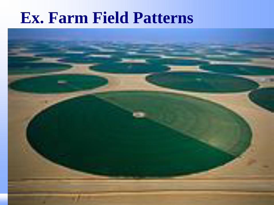
Ex. Farm Field Patterns

1. Absolute Location
a. exact location
b. the address

2. Relative Location
•a. How a place is related, or connected to other places
•b. The interdependence of places.
Houston Port

B. Places and Regions 4. The physical and human
characteristics of places.
5. That people create regions to
interpret Earth's complexity.
6. How culture and experience
influence people's perceptions
of places and regions.

PLACE Human and Physical
Characteristics
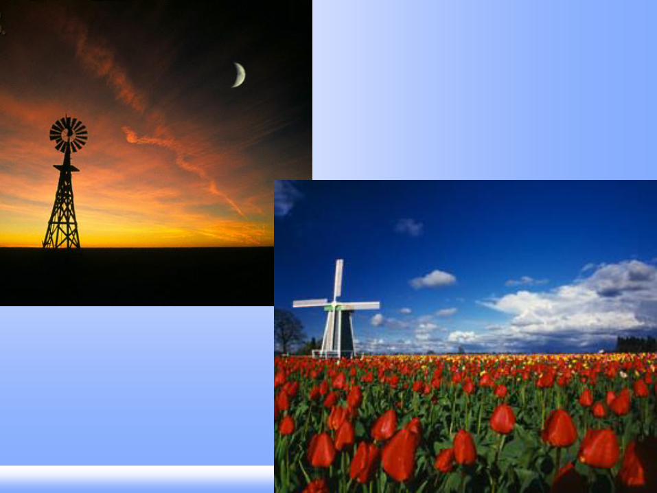
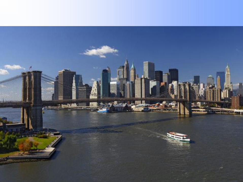
Identify the locations of the following
pictures. What physical and human
characteristics helped you make your
decision?


What is a Region?
A region is an area with one or more
common features that make it different
from surrounding areas.


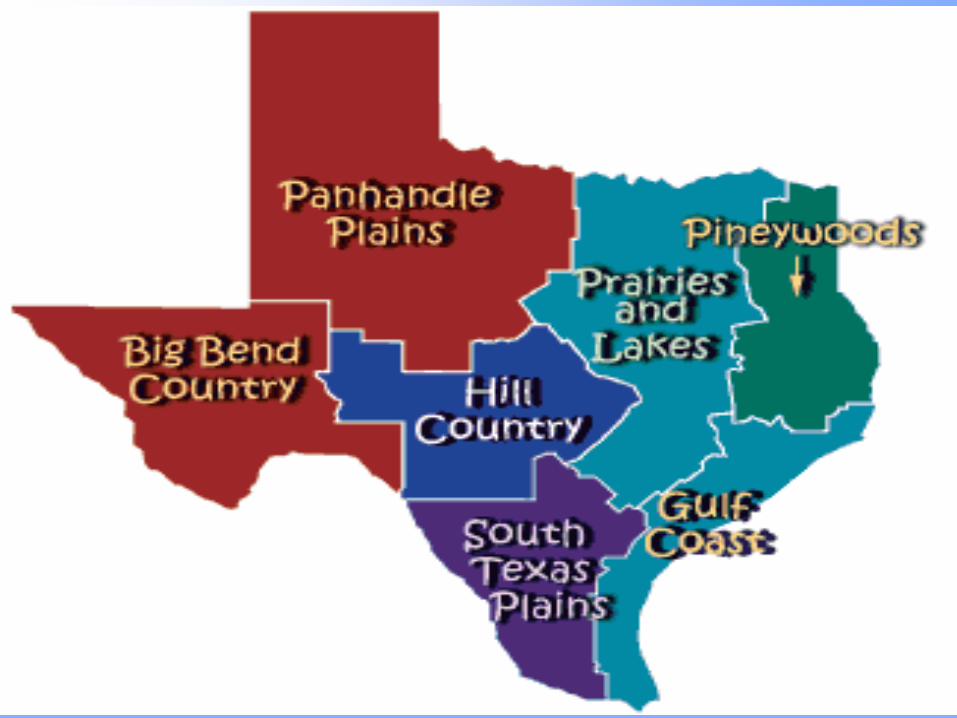

How are regions
defined?
They are defined by their
physical & human
characteristics
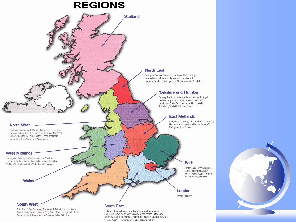


What are the types of
regions?
a. Formal: same as a
uniform region—has some
characteristic that is
measurable in common


b. Functional: defined by a
set of activities or
interactions


c. Perceptual: regions that
reflect human attitude or
feelings


How
man
y T
exas
shap
es c
an y
ou s
ee?

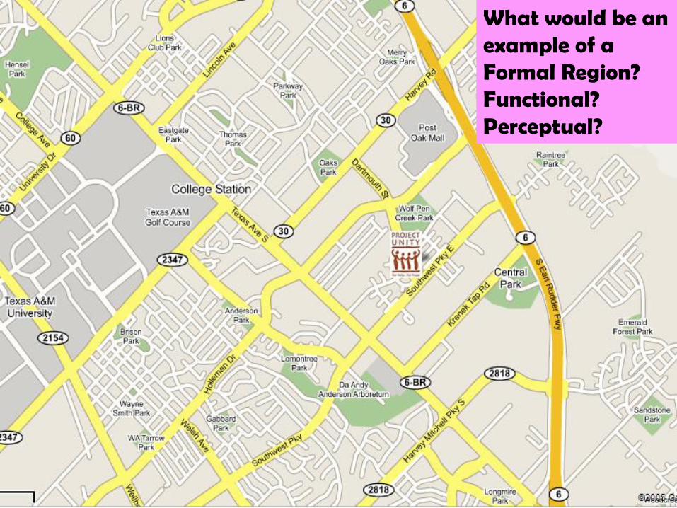
What would be an example of a Formal Region? Functional? Perceptual?
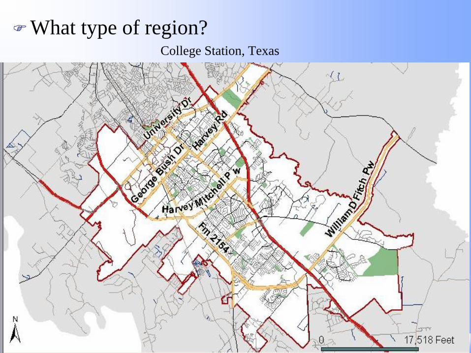
What type of region? College Station, Texas
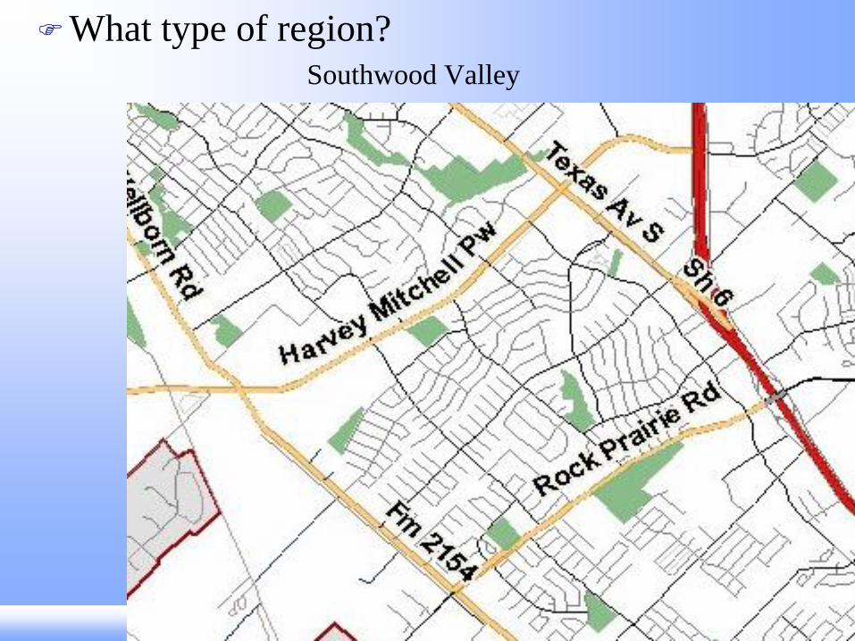
What type of region? Southwood Valley
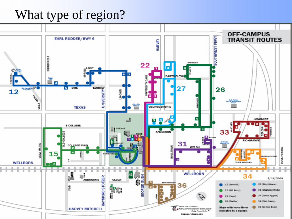
What type of region?
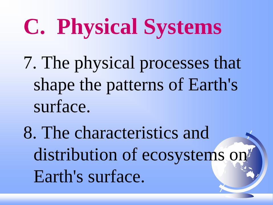
C. Physical Systems
7. The physical processes that
shape the patterns of Earth's
surface.
8. The characteristics and
distribution of ecosystems on
Earth's surface.

Ex. Tectonic Plates

Ex. El Nino

D. Human Systems
9. The characteristics, distribution
and migration of human
populations.
10. The characteristics, distribution
and complexity of Earth's cultural
mosaics.

11. The patterns and networks of
economic interdependence.
12. The processes, patterns, and
functions of human settlement.
13. How the forces of cooperation
and conflict among people
influence the division and
control of Earth's surface.
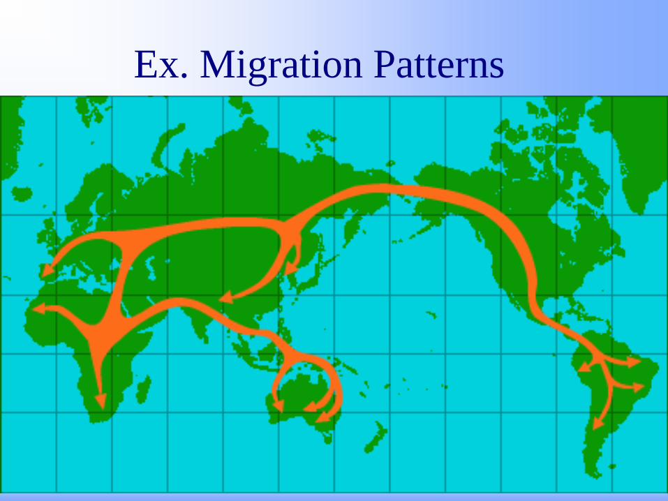
Ex. Migration Patterns

Ex.
Conflicts
/War

Diffusion 1. Spatial Interaction
• a. Definition—movement of people, materials and ideas or information across the earth.
b. How?
• 1) Transportation
• 2) Communication
[Diffusion--spread of an idea or invention.]

2. Regional Variation
[Spatial Differentiation]
a. Definition--not all
places are centrally
located or are easily
accessible.
b. People, materials and
ideas are spread
differently across space.

An historical example of an idea that diffused
around the world is the “use of the cow”.

What were
….some of the barriers to diffusion?
Religious taboos in India—do not eat meat
Culturally many people do not accept the
practice of bull fighting
The Masaai did not migrate out of East Africa and
Europeans did not migrate to Africa due to the
Sahara Desert.
More people in East Asia and Tropical Africa are lactose
intolerant—do not drink milk or eat cheeses very often
The Himalayas acted as a barrier between India and
China. Their cultures are very different.

What were
…..impacts on current cultures?
East Asian recipes rarely use beef,
milk, or cheeses
The use of the cow is similar between
Europe and the areas they settled.
Bull fighting is practiced in areas
settled by the Spanish
In India meat is not eaten by
many people due to religious
taboos.
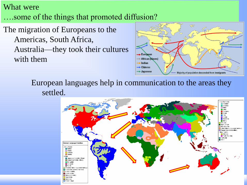
What were
….some of the things that promoted diffusion?
The migration of Europeans to the
Americas, South Africa,
Australia—they took their cultures
with them
European languages help in communication to the areas they
settled.

Barriers to Diffusion
PHYSICAL
• Distance
• Oceans
• Mountain
• Desert
?
CULTURAL/HUMAN
• Language
• Enemies/Conflict
• Taboos
• Religion does not accept new idea
Promotes Diffusion
PHYSICAL
• Distance--neighbors
•Accessible—harbor, river,
existing transportation
network
CULTURAL/HUMAN
• Communicate—Trade Language
• Friends—already share ideas
• Need the (technology)

• How do people view dogs? As pets?
As workers? As food?
Can you think of other examples of diffusion around the world that
spread differently due to physical and cultural conditions?
• What about beliefs? Are religions practiced
differently around the world? Where are there
similarities? Differences?
• What about chickens? Do people eat
chickens? Eggs? Fighting birds?

3. Spatial Distribution
a. Definition--the spread
of people, elements
or characteristics

b. Three aspects/parts:
1. Density--frequency of
occurrence of a
characteristic within a
given area. (How
much of something
is found in a
given area?)
2. Dispersion--the
extent of the spread of
the characteristic
within a given area.
(Where is it found?)
3. Pattern--geometric
arrangement (How
is it spread?)
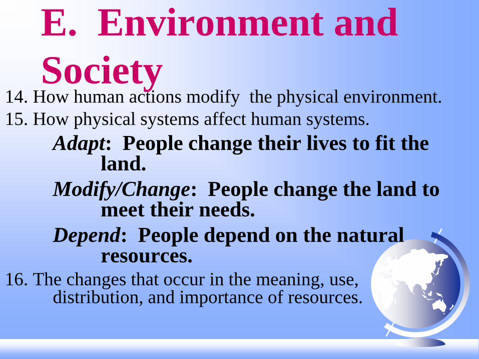
E. Environment and
Society 14. How human actions modify the physical environment.
15. How physical systems affect human systems.
Adapt: People change their lives to fit the land.
Modify/Change: People change the land to meet their needs.
Depend: People depend on the natural resources.
16. The changes that occur in the meaning, use, distribution, and importance of resources.

Ex.
Water
Needs
/Uses
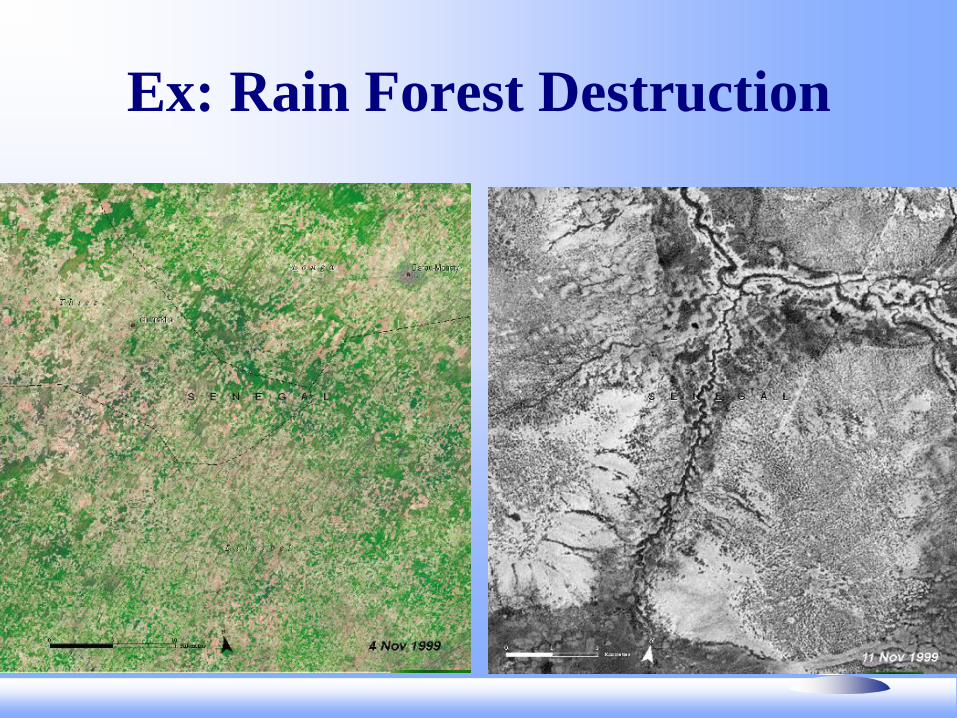
Ex: Rain Forest Destruction

F. The Uses of
Geography
17. How to apply geography to
interpret the past.
18. How to apply geography to
interpret the present and
plan for the future.

Ex. Katrina Evacuation


Six
Essential
Elements of
Geography
World in Spatial Terms
Maps
GIS
Satellites
Mental Mapping
Spatial Organization
Places & Regions
Physical Char.
Human Char.
Formal
Functional
Perceptual
Physical Systems
Plate Tectonics
Hazards--Earthquakes,
Volcanoes,
Tsunamis
Climate
Hurricanes
Tornadoes
Human Systems
Migration
Culture
Ethnicity
Beliefs
Government
Language
Institutions
Environment & Society
Flooding
Levees—natural/manmade
Resources
Accessibility
Adaptability
Change
The Uses of Geography
Past
Present
Future
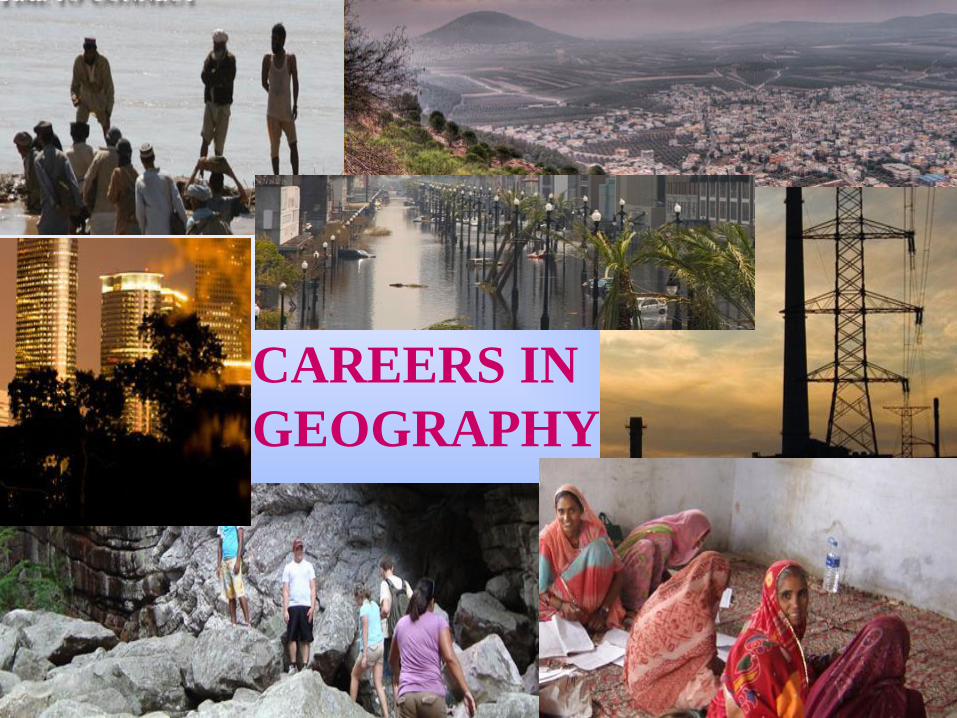
CAREERS IN
GEOGRAPHY

Human Geography
Historical Geography
Political Geography
Economic Geography
Medical Geography

Population (Demographics)
Geography
Urban & Regional
Planning
Physical Geography

Regional Geography
Environmental
Geography
Cartography
Geographic
Information Analysis
& Display

I. Map Skills Review A. Definitions
1. Globe--a model of
Earth--3 D
2. Map--a two dimensional
representation of all or
part of the Earth’s surface.

a. Mental Maps-- visual
or verbal maps
b. Standard Maps
1) General Information Maps--
gives general information about a
place (location, size, distance,
political or cultural
features, physical
features, etc.)

2) Thematic Maps-
-show more
specific
information,
often on a single
theme or topic. (Population,
Economic Maps,
Climates, Religions,
Languages, etc.)

B. Main Concepts of Standard Maps
“Mental maps should have a TOAD.”
“Standard maps need
TOADS or TODALS,
and some maps need s or IGs!”
TODALSIGs

T=Title: What, where and when
O=Orientation: Cardinal and
Intermediate Directions
D=Date: When was the map made?
A=Author: Who made the map?
L=Legend: What do the
symbols mean?

S=Scale: What is the map distance?
Verbal Ratio Graphic
1 inch = 1 mile 1:63,360
I=Index: Map address of a place.
G=Grid: Locates places on the map. Arbitrary Grid

s=Source: Where is the map
information from?
(Written in MLA work cited format.)
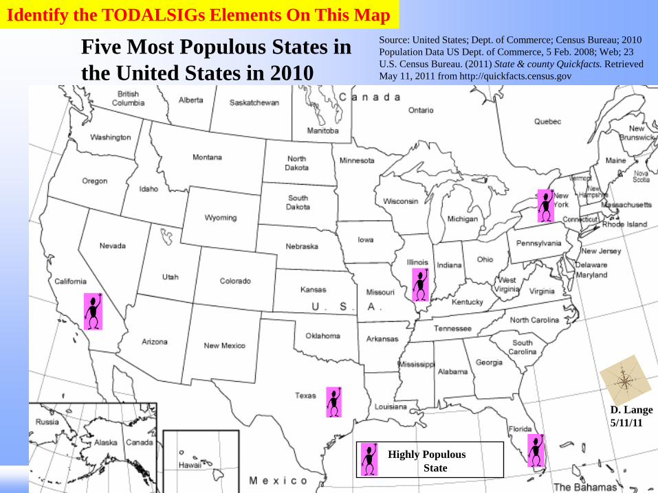
Five Most Populous States in
the United States in 2010
Highly Populous
State
D. Lange
5/11/11
Source: United States; Dept. of Commerce; Census Bureau; 2010
Population Data US Dept. of Commerce, 5 Feb. 2008; Web; 23
U.S. Census Bureau. (2011) State & county Quickfacts. Retrieved
May 11, 2011 from http://quickfacts.census.gov
Identify the TODALSIGs Elements On This Map

You will be drawing a map of the College Station area
Your map must include: Labeled streets Elements of the map- TODALS Places a new Aggie or some new to our community would need
to know—they must be placed on the map accurately Symbols or color coding for your legend/key COLOR! CREATIVITY
Your map should be neat, creative and
LEGIBLE Turn in your rubric with your map
The Lost Aggie Map Assignment

C. Additional Information
1. Projection--a way of
drawing the round
Earth as a flat map.

1) Cylindrical Projection—based on a
cylinder
Mercator
a) Used by navigators because it shows true
direction & shape
b) Exaggerated land masses at high latitudes
a. Three basic kinds of projections
Why do some people think that Greenland is a continent?

2) Conic Projection--based on a cone
shaped piece of paper--usually just
a portion of the earth.
a) Accurate for areas with long
east-west dimensions
b) Not as accurate for areas that
mostly extend north-south
Example: Lambert Equal-Area Example: Albers Equal-Area

c) Usually used for
country maps.
d) Usually used to compare distributions
between countries.

3) Planer or Zenithal Projection--
centered on one point.
a) Used by pilots and navigators because
it shows true direction, distance
and size
b) Distorts shape
Lambert Azimuthal
Equal-Area

Other examples of projections
Robinson Armadillo Projection
van Leeuwen
Canters EU

Equal-area Truncated Icosahedron Berghaus Star; 1879

Is this
“Upside
down” map
of the world
wrong?
Why are
our maps of
the world
always
depicted the
way they
are?
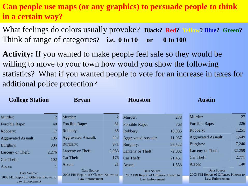
Can people use maps (or any graphics) to persuade people to think
in a certain way?
Murder: 2
Forcible Rape: 40
Robbery: 17
Aggravated Assault: 105
Burglary: 384
Larceny or Theft: 2,276
Car Theft: 102
Arson: 1
Data Source:
2003 FBI Report of Offenses Known to
Law Enforcement
Murder: 2
Forcible Rape: 81
Robbery: 85
Aggravated Assault: 443
Burglary: 971
Larceny or Theft: 2,963
Car Theft: 176
Arson: 21
Data Source:
2003 FBI Report of Offenses Known to
Law Enforcement
Murder: 278
Forcible Rape: 768
Robbery: 10,985
Aggravated Assault: 11,957
Burglary: 26,522
Larceny or Theft: 72,032
Car Theft: 21,451
Arson: 1,553
Data Source:
2003 FBI Report of Offenses Known to
Law Enforcement
Murder: 27
Forcible Rape: 226
Robbery: 1,251
Aggravated Assault: 1,649
Burglary: 7,240
Larceny or Theft: 32,259
Car Theft: 2,771
Arson: 140
Data Source:
2003 FBI Report of Offenses Known to
Law Enforcement
What feelings do colors usually provoke? Black? Red? Yellow? Blue? Green?
Think of range of categories? i.e. 0 to 10 or 0 to 100
Activity: If you wanted to make people feel safe so they would be
willing to move to your town how would you show the following
statistics? What if you wanted people to vote for an increase in taxes for
additional police protection?
College Station Bryan Houston Austin
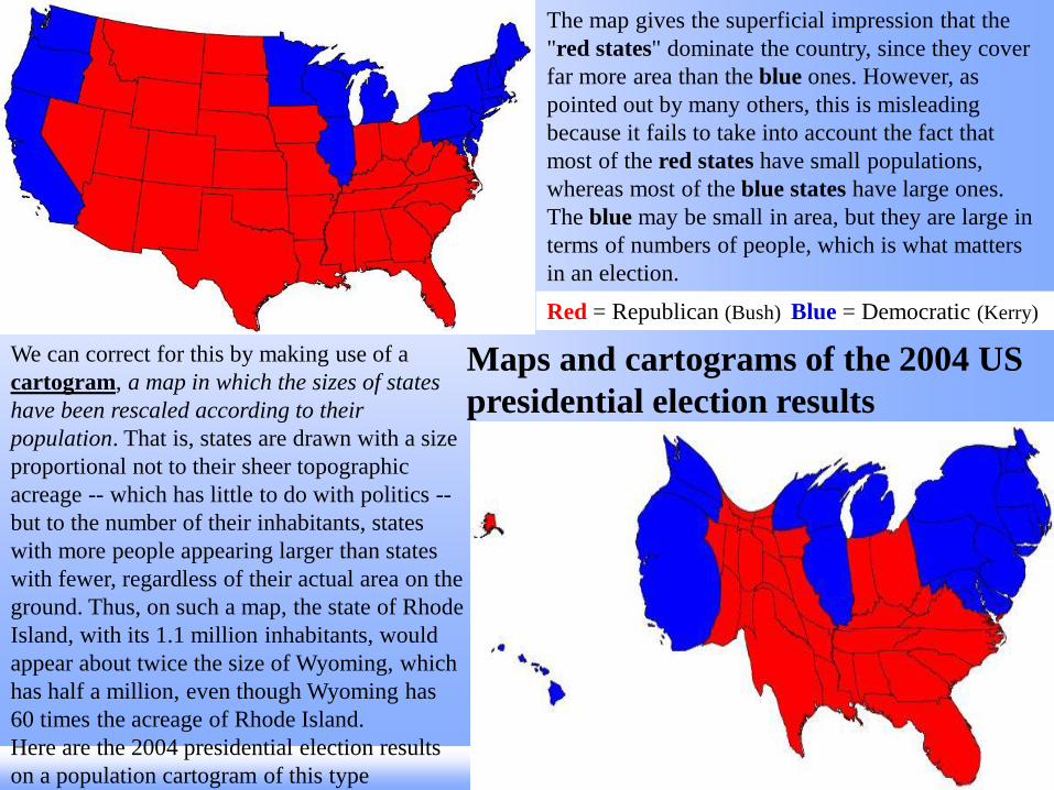
We can correct for this by making use of a
cartogram, a map in which the sizes of states
have been rescaled according to their
population. That is, states are drawn with a size
proportional not to their sheer topographic
acreage -- which has little to do with politics --
but to the number of their inhabitants, states
with more people appearing larger than states
with fewer, regardless of their actual area on the
ground. Thus, on such a map, the state of Rhode
Island, with its 1.1 million inhabitants, would
appear about twice the size of Wyoming, which
has half a million, even though Wyoming has
60 times the acreage of Rhode Island.
Here are the 2004 presidential election results
on a population cartogram of this type
The map gives the superficial impression that the
"red states" dominate the country, since they cover
far more area than the blue ones. However, as
pointed out by many others, this is misleading
because it fails to take into account the fact that
most of the red states have small populations,
whereas most of the blue states have large ones.
The blue may be small in area, but they are large in
terms of numbers of people, which is what matters
in an election.
Red = Republican (Bush) Blue = Democratic (Kerry)
Maps and cartograms of the 2004 US
presidential election results

Consider this 1914 German map of Europe. The Germans (in blue) and
their Austrian allies (yellow) look relatively normal, without the
grotesque or otherwise distorted heads and bodies found associated with
the other European nations depicted.
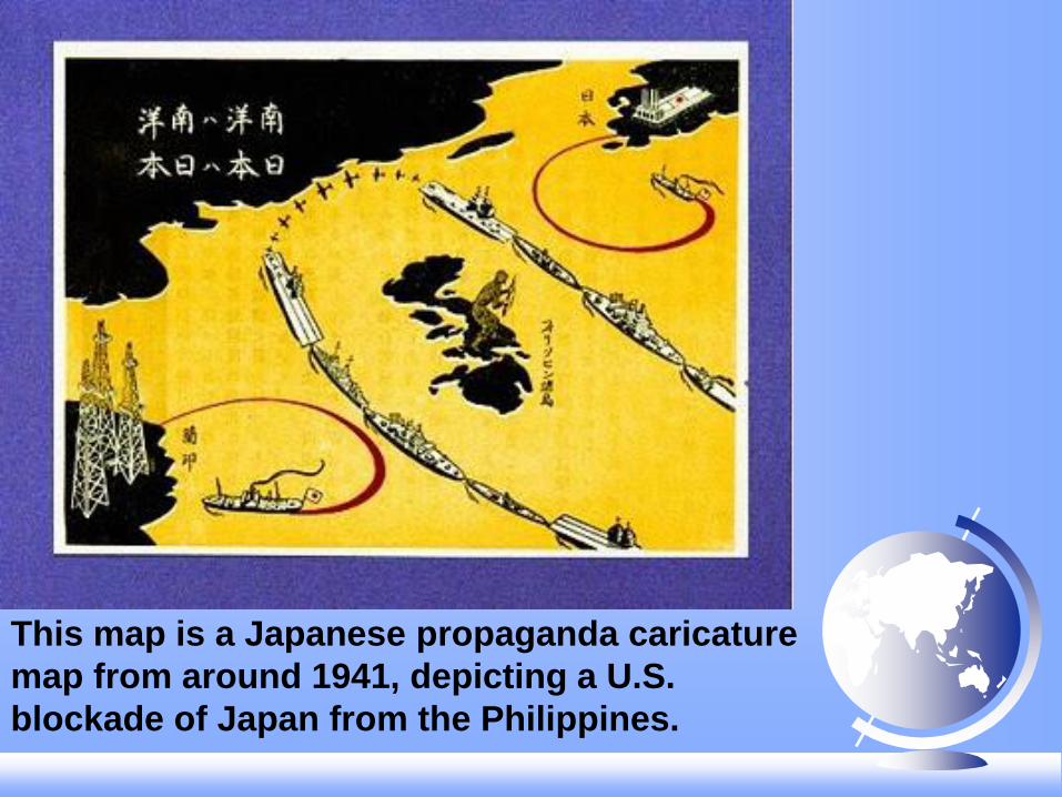
This map is a Japanese propaganda caricature
map from around 1941, depicting a U.S.
blockade of Japan from the Philippines.

This map demonstrates conflict taking place
during the Cold War when Ronald Regan
was president. This map was created to be
seen by Americans.
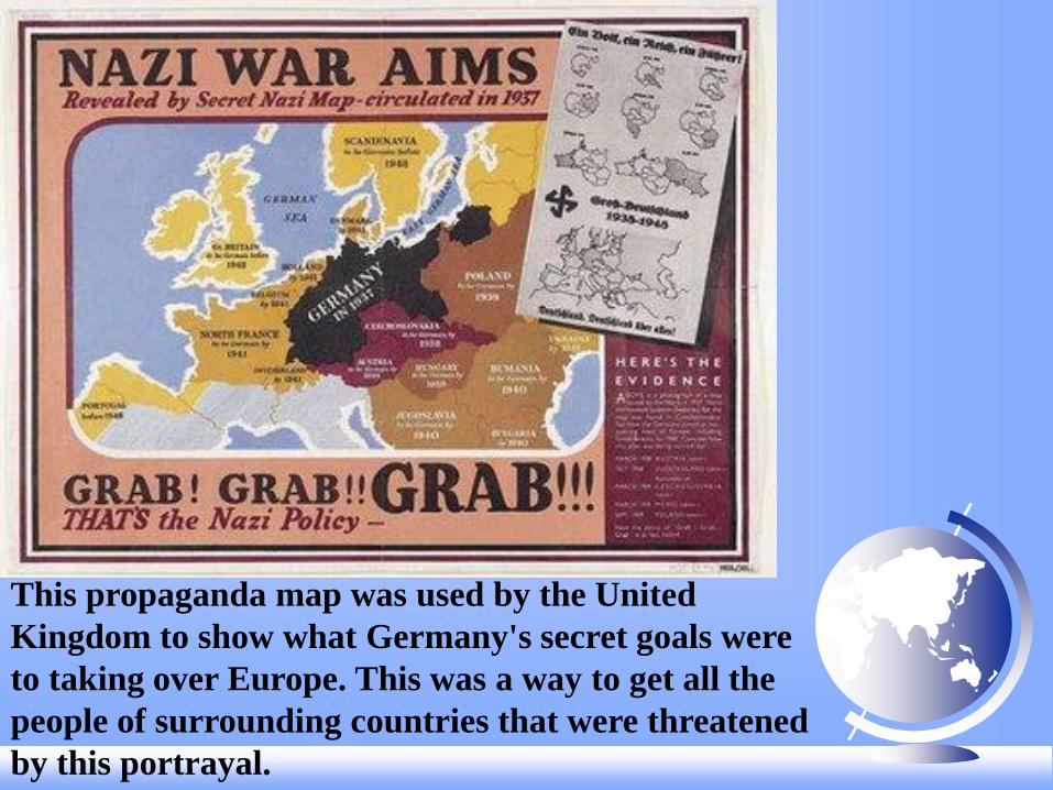
This propaganda map was used by the United
Kingdom to show what Germany's secret goals were
to taking over Europe. This was a way to get all the
people of surrounding countries that were threatened
by this portrayal.

DISCLAIMER: Australian Radiation Services is aware of information about
radioactive contamination being spread from the Japanese nuclear reactor
incident released under the ARS logo and name. We wish to be clear that this
information has not originated from ARS and as such distance ourselves from any
such misinformation.
From the Nuclear Regulatory Commission,
All the available information indicates weather conditions have taken the
small releases from the Fukushima reactors out to sea away from
the population. Given the thousands of miles between the two countries,
Hawaii, Alaska, the U.S. Territories and the U.S. West Coast are not
expected to experience any harmful levels of radioactivity.
b. Different Projections produce different
types of maps--Four basic types
1) Conformal--the shapes (or forms) are
correct. [distance, direction, and size are distorted]
2) Equivalent or Equal-Area--the size of
places are correct
[shapes, distances, and directions are distorted]
3) Equidistance—distances are correct.
[shapes, size, and directions are distorted]
4) Azimuthal--directions are correct.
[shapes, size, and distances are distorted]
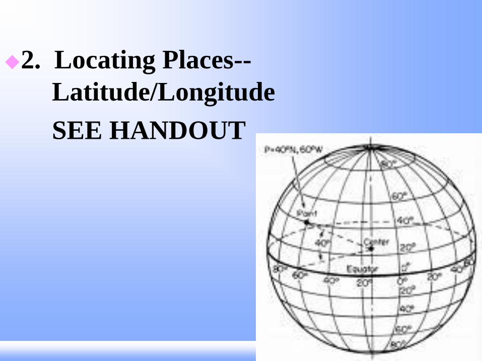
2. Locating Places--
Latitude/Longitude
SEE HANDOUT

3. Specialized Maps
a. Isopleth Maps—type of map that uses isolines to connect points (or places) of equal value
1) Contour Maps—lines connect points with the same elevation

2) Barometric Pressure Maps
—Isobars connect places where the barometric pressure is
the same
3) Temperature Maps —Isotherms connect places with the same temperatures

b. Chorophleth Maps
c. Proportional
Symbol Maps

d. Dot Maps
e. Topographic
Maps
Dot Maps – A thematic map in which a dot is used to
represent some frequency of the mapped variable.
A simple dot map of commercial wireless antennas
in the USA.

f. Contemporary Mapping
1) Remote Sensing—the accusation of data about
Earth’s surface from a satellite or other long
distance methods
2) GIS—Geographic Information System is a high
performance computer system that processes
geographic data. (Ex: Google Earth or Google Maps)
3) GPS—Global Positioning System takes signals
from a serious of satellites to pinpoint
the current location of a vehicle.
4) Etc.

Google Earth
Google Maps
Weather Channel
USGS
GIS: Examples
How might this information help people?
Can you think of other examples?