Embed Size (px)
Citation preview

West Midlands Community
Risks
2014
West Midlands Resilience Forum
PREPARING FOR EMERGENCIES
2
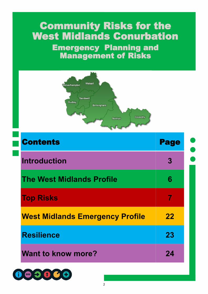
Community Risks for the
West Midlands Conurbation
Emergency Planning and
Management of Risks
Contents Page
Introduction 3
The West Midlands Profile 6
Top Risks 7
West Midlands Emergency Profile 22
Resilience 23
Want to know more? 24
3
Purpose
This document is designed to help
people understand the risks that could
occur where they live, so that they can
think about how they can be better
prepared in their homes, communities
and businesses.
Looking at all of the risks together can
also help emergency services, local
authorities and other organisations plan
their joint response.
The Local Resilience Forum
– Who We Are
The West Midlands Conurbation Local
Resilience Forum (LRF) is a partnership,
made up of all the organisations needed
to prepare for and respond to any major
emergency in the conurbation.
The West Midlands Conurbation covers
the following areas:
Birmingham
Coventry
Dudley
Sandwell
Solihull
Walsall
Wolverhampton
The LRF partners include the emergency
services, the seven local authorities,
health agencies and the Environment
Agency along with voluntary and other
agencies.
Under the Civil Contingencies Act (2004)
every part of the United Kingdom is
required to establish a resilience forum.
What We Do
The aim of the West Midlands
Conurbation LRF is:
To ensure that there is an appropriate
level of preparedness to enable an
effective multi-agency response to
emergency incidents, which have a
significant impact on the communities of
the WMC.
All services and organisations work
together to ensure that the best possible
preparations and plans are in place for
emergencies. These are regularly tested
and updated so that agencies can
respond immediately and effectively to
any threat.
Introduction
This Community Risk Register (CRR) for 2014-2017 provides information on the largest risks that may occur within the West Midlands Conurbation, together with an assessment of how they are to happen and the impacts if they do occur. These risks are regularly reviewed and have lead
to this updated CRR.

4
What is the Community Risk Register?
West Midlands Conurbation LRF
legally has to produce a Community
Risk Register (CRR) to look at the
likelihood and impact of a range of
hazards happening.
Nationally every LRF uses its own
professional judgement along with
guidance from the national version of
this document (National Risk
Register), to put together its CRR.
The national register is produced by
the Government using historical and
scientific data, and the professional
judgements of experts to analyse the
risks to the UK as a whole.
West Midlands Conurbation’s CRR
helps identify emerging issues and
also situations where a risk may be
increasing or decreasing in our
conurbation.
If a risk is included in the CRR, it
doesn’t mean that it will happen, it
means that we know that it is a
possibility, and that organisations have
made arrangements to reduce its
impact.
National Risk Assessment
The figures are taken from the National
Risk Register to demonstrate the risk of
terrorist and other malicious attacks in
Figure 1 and other risks in Figure 2.
Within the conurbation the risks mainly
focus on figure 2 although it is accepted
that all of Figure 1 risks are present,
these are dealt with in multi agency
plans separate to the LRF.
Figure 1: Risks of terrorist & other malicious attacks
Figure 2: Other risks

5
Scope of the CRR
The CRR does not assess every single risk.
It assesses the risks that are most likely to
happen and the impact these would have
across the conurbation.
The risk assessments included in the
register only cover non-malicious events
(i.e. hazards) rather than threats (i.e.
terrorist incidents). Specific information
about threats is not detailed in the CRR.
The CRR focuses on serious risks that
could result in an emergency, defined as:
An event or situation which threatens
serious damage to human welfare in a
place in the United Kingdom
An event or situation which threatens
serious damage to the environment of a
place in the United Kingdom
War or terrorism which threatens serious
damage to the security of the United Kingdom
Source: Civil Contingencies Act (2004)
Risk Context
The West Midlands Conurbation CRR puts the
national risks in a local context, by looking at
things like economic, geographic and
demographic factors, whether the risk has
happened before and what is in place to control it.
Risk Analysis
Each entry in the CRR has as lead organisation
responsible for co-ordinating the risk assessment.
This looks at the likelihood and the impact:
Likelihood is the probability of an incident
related to a hazard or threat, happening
over the next 5 years.
Impact is a measure of the severity of the
potential harm caused by the hazard or threat, looking at impacts on health, the economy, the environment and society.
Monitoring and Review
All risks in the CRR are reviewed continually and
changes are made as required.
The CRR has a review date showing when the
annual comprehensive review is carried out.
West Midlands Conurbation – Profile
Some risks are more likely to happen in the West
Midlands Conurbation, or they may have a bigger
impact here, compared to other parts of the
country.
To understand why some risks are more
significant in the West Midlands Conurbation, we
need to look at the profile of the area, including
social, economic and geographical factors. These
factors also influence how we can prepare for and
manage emergencies in this area.

6
To understand why some risks are more
significant in the West Midlands conurbation,
we need to look at the profile of the area,
including the social, economic and
geographical factors. These factors also
influence how we can prepare for and
manage emergencies locally.
The Local Resilience Forum area covers an
area of 348 square miles and serves a
population of almost 2.8million.
The West Midlands sits at the very heart of
the country and covers the three major
centres of Birmingham, Coventry and
Wolverhampton. It also includes the busy
and thriving districts of Sandwell, Walsall,
Solihull and Dudley.
Within the region the leisure, retail and
conference amenities, together with Premier
and Championship football teams attract
millions of visitors annually.
SOCIAL
The regions population continues to grow at
a higher rate than the national average.
The West Midlands is an area rich in
diversity, with 18 per cent of its population
from ethnic minority backgrounds—this
brings with it specific challenges in
identifying specific needs of the community
in the respect of emergency planning.
HEALTH
Within the West Midlands there are a
number of challenges that are faced. The
rates of premature deaths, cancer, heart,
lung & liver disease and strokes are amongst
the worst in the country.
ENVIRONMENT
West Midlands environment is a
predominantly urban although there are rural
communities within the LRF boundaries.
Throughout the region there is an abundance
of waterways and canals which continue to
be well used today.
INFRASTRUCTURE
The urban nature of the area means that
there is an excellent motorway and rail
network.
An average of 170,000 motorists alone travel
through the region daily, making the
motorways alone some of the busiest in
Europe.
The West Midlands
Conurbation Profile
There are some events that are more likely to occur in the West Midlands than other areas, or they may just have a larger impact when you compare it to other
parts of the country.

7
Top Risks
Influenza Type Disease 8
Flooding 10
Severe Weather 12
Environmental Pollution & Industrial Accidents 14
Loss of critical infrastructure 16
Fuel shortages 18
Transport Accidents 20

8
Influenza Type
Disease
An Influenza (flu) pandemic is a
worldwide event in which many
people are infected with a flu
virus in a short time.
The World Health Organisation
considers an outbreak to be a pandemic
when:
The infectious agent hasn't been
seen before and there is no natural
immunity to it
The agent infects humans
It spreads easily and survives in
humans.
Unlike a normal flu virus, which has a
‘season’ (October to May in the UK), a
flu pandemic can occur at any time.
Based on what has happened during
previous pandemics, a pandemic is
likely to occur in one or more waves,
possibly weeks or months apart. Each
wave may last around 15 weeks and
upto half of the population could be
directly affected.
HISTORY
The most notable influenza pandemic of
the last century occurred in 1918 and is
often referred to as ‘Spanish flu’. It
caused serious illness with an estimated
20 to 40 million deaths worldwide (with
the largest rates of death in people
between 20 and 45 years old) and major
disruption. In the UK alone there were
an estimated 228,000 additional deaths.
IN THE WEST MIDLANDS
As a result of rapid spread from person
to person, pandemics have significant
global consequences on communities
and economies, as well as on human
health.
The lead agency for this risk is the
NHS and Public Health England
TOP RISKS

9
Keep healthy—a healthy lifestyle will be
a great defence against flu and other
illnesses
Identify a flu friend—somebody who
would collect your medication, food and
other supplies allowing you to be
isolated from the public
Keep personal stocks of ‘over the
counter’ cold and flu medication to help
relieve your symptoms
Know the arrangements for your child's
school
Look out for and observe advice and
guidance from the NHS
We work together to plan for:
Management of the demand on the
NHS and social care
Distribution of anti-viral medication to
the public if required
Vaccinations
Public awareness and media
management
Managing excessive levels of death
Individual LRF organisations have their own
business continuity plans in place to cope in
RISK IMPACTS
Based on historical information, scientific
evidence and modelling, the following
impacts are predicted for future pandemics:
Many millions of people around the
world will become infected causing
global disruption and a potential
humanitarian crisis
Upto half the UK population may
become infected and between 50,000
and 750,000 additional deaths may have
occurred by the end of the pandemic
Healthcare and local authority social
care will become overloaded
Normal life if likely to face widespread
disruption, particularly due to staff
shortages affecting the provision of
essential services, including production
and transport of goods.
CONSEQUENCES
The consequences could include:
Vulnerable people exposed to lower
levels of care
Longer and more frequent disruptions
to essential utilities
Reduced levels of emergency services
cover
Disruptions to businesses and
organisations through staff shortages
and supply chain interruptions
Impacts on the national and local
economy
WHAT DO YOU
NEED TO DO?
WHAT ARE WE DOING IN
THE WEST MIDLANDS?
TOP RISKS

10
Flooding
As the events of summer 2007 and 2012
and the recent winter showed, flooding can
take different forms and, at its most serious,
can affect many different aspects of our
daily lives. Over the coming years rising
temperatures, sea levels, and an increase in
the frequency and severity of extreme
weather events are likely to raise the risk of
flooding in the UK.
The two main types of flood are river and
surface water flooding (caused by excessive
rainfall).
HISTORY
In the summer of 2007 the UK was seriously
affected by flooding. West Midlands
experienced this also, mainly as localised
flooding throughout all areas. The flooding
led to damaged properties, evacuation of
residents, and closure of roads.
In 2004 the village of Boscastle suffered
extensive damage from flash floods caused
by an exceptional amount of rain that fell
over the course of an 8 hour period. The
Boscastle flooding was caused by rainfall
which the river could not hold and the floods
were the worst in local memory. The
torrential rain led to a 2m rise in river level in
one hour. A 3m wave, (believed to have
been triggered by water pooling behind
debris caught under a bridge then being
suddenly released as the bridge collapsed)
surged down the main road. Water speed
was in excess of 10mph, which is more than
sufficient to cause structural damage. It is
estimated that 20 million tonnes (440 million
gallons) of water flowed through Boscastle
alone that day.
IN WEST MIDLANDS
Many agencies are involved in responding
to floods. Different agencies are best
equipped to deal with a specific type of
flood, for example, the highways service of
Dudley Council can manage flooding on a
public highway, while the local water
companies would deal with a burst water
main.
The Environment Agency maintains and
operates flood defences and provides a 24-
hour flood warning service for properties at
risk from river flooding in England and
Wales.
Lead agencies—Environment Agency
and Local Authorities
TOP RISKS

11
FLOOD WARNINGS DIRECT
FWD is a free service that gives advance
warning of flooding by telephone, mobile, fax
or pager. To register for the service call
FWD on 0845 988 1188; it is available 24
hours a day, seven days a week or online at
www.environment-agency.gov.uk/
floodline
To register all you need is a telephone
number where flood warnings can be sent 24
hours a day. Call to FWD are charged at
local call rates.
People can also find out what flood
warnings are in force in their area any
time of the day or night by:
Contacting FWD on 0845 988 1188 and
listening to recorded flood warning
messages or speaking to the
Environment Agency Staff
Viewing the flood warnings (updated
every 15 minutes) on the Environment
Agency Website www.environment-
agency.gov.uk/floodline
The Environment Agency is the main place
for information on past floods, floods maps,
and practical guidance on protecting your
home during a flood event. You can access
these services and more at www.gov.uk/
government/organisations/environment-
agency.
Find our if your property is within a flood
risk area
Plan where you will go if you have to
evacuate and how you will get there
Know what to do to protect your property
during a flood and have adequate insurance
Identify neighbours who may need
assistance or who may be able to provide
assistance to you, in case of evacuation
Have supplies in your home that will enable
you to cope for upto 3 days should you be
unable to evacuate
Sign upto Flood line Warnings Direct if you
are in a flood risk area
Where possible, move valuable/
irreplaceable items to upper floors during
times of flood risk.
Identification of where the flood water
could go and who is at risk
Production of multi-agency plans to assist
with the evacuation of those communities
who are at risk
Strategic are planning to protect areas at
risk
Provision of guidance for the public about
protecting property from flooding
Development of ways and means of alerting
the public as early as possible when there
is a significant flood risk
Continuing to invest in maintaining and
improving river defences in our high-risk
areas
Developing flood rescue and assistance for
those who become isolated by flooding
WHAT DO YOU
NEED TO DO?
WHAT ARE WE DOING IN
THE WEST MIDLANDS?
TOP RISKS

12
Severe Weather
The United Kingdom does experience
severe weather due to its temperate
climate with occasional continental and
arctic influences. These can bring with
them heavy rain or snow, strong winds
and extreme temperatures. As
experience has shown, severe weather
can take a variety of forms and at times
can cause significant problems and
disruption to normal life.
Over the coming years we are likely to see
rising temperatures and sea levels, and an
increase in the frequency and severity of
extreme weather events in the UK. Weather
forecasting can now give warning of most
events and offer general advice.
There are many types of severe weather
that can have a serious local impact in the
UK. The main types of severe weather that
we need to plan for include storms/gales,
low temperatures, heavy snow, heat waves
and drought.
HISTORY
A storm battered many parts of the UK on
18th January 2007, with gusts of wind upto
77mph recorded at Heathrow. This caused
9 deaths and widespread damage to trees
and buildings across the UK, along with
power disruption. Strong winds can cause
significant disruption to businesses due to
structural damage and route blockages.
In January 2010, snow caused disruption
across most of the UK resulting in school
closures, power outages and people being
unable to get to work for a number of days
depending on their location. November and
December 2010 saw temperatures in the
West Midlands fall in parts of the region to
minus 15 and upto 40 centimetres of snow
fell, which resulted in treacherous road
conditions and major disruption to transport
and essential services.
Going back further to 2003 the hot summer
is estimated to have resulted in more than
2000 excess deaths, mainly amongst
vulnerable people. Since then, the Health
Watch system has been introduced and
during the hot weather of July 2006
significantly fewer (680) excess deaths were
recorded.
IN THE WEST MIDLANDS
The urban nature of the West Midlands and
the dense population means that severe
weather can have a large impact on the day
to day activities of the population. Our
reliance on the Motorway network and the
main routes around the region becomes
very evident when it is disrupted by severe
weather events.
There is nothing we can do at a local level to
reduce the likelihood of severe weather
events, however we can be prepared for
these events in order to stay safe and
maintain essential services.
The lead agency will depend on the type
of severe weather and its impact.
TOP RISKS

13
Listen to weather forecasts and heed
any warnings of extreme weather
Plan any journeys or activities with the
weather in mind
If you have to travel in severe weather
make sure you have adequate clothing
and emergency supplies in your vehicle
Production of multi agency plans to
manage severe weather events
Consideration of weather forecasts prior
to any large events in the regions e.g.
Christmas Markets
Receiving and distributing early
notifications of severe weather
RISK IMPACTS
Storms and Gales
Danger to life from windswept objects
and structural failures
Damage to property
Damage to infrastructure and
communications networks
Travel disruption
Low temperatures and Heavy Snow
Travel disruption
Vulnerable people exposed to health
threatening temperatures
Power and water failures
School and public building closures
Heatwaves
An increased number of admissions to
hospital and consultations with GPs
due to sunburn, heat exhaustion,
respiratory problems and other
illnesses such as food poisoning
Increased vehicle breakdowns due to
overheating engines
Road surfaces deteriorating as tarmac
begins to melt.
CONSEQUENCES
The consequences of severe weather are
varied, some common issues include road
and travel disruptions, damage and disruption
to basic utilities, and damage to property.
These have a knock on consequence to
individuals, businesses and the ability for
organisations to deliver essential functions to
the community.
WHAT DO YOU
NEED TO DO?
WHAT ARE WE DOING IN
THE WEST MIDLANDS?
TOP RISKS

14
Environmental
Pollution &
Industrial Accidents
Certain industrial activities involving
dangerous substances have the
potential to cause accidents. Some
of these accidents may cause serious
injuries to people or damage to the
environment both nearby, and further
away from the site of the accident.
HISTORY
Buncefield–A recent experience of this type
of incident in the UK was at Hemel
Hempstead with the Buncefield Oil Depot
explosion in 2004. The explosion measured
2.4 on the Richter scale, and caused the
largest fire in Europe since the Second
World War. 2,000 people were evacuated
from their homes, and 370 businesses were
affected, employing 16,500 people. Sixty
members of the public required medical aid
and the accident caused major disruption to
roads, fuel supplies, and local businesses
and the supply chain.
COMAH
The Control of Major Accident Hazard
Regulations (COMAH)(1999) and their
amendments (2005), are the enforcing
regulations within the United Kingdom.
They aim to prevent major accidents
involving dangerous substances and to limit
the consequences to people and the
environment of any incidents that do occur.
They are determined by the Health and
Safety Executive and are applicable to any
organisation or site storing or handling large
quantities of industrial chemicals of
hazardous nature. Types of establishments
include chemical warehousing, chemical
production facilities and some distributors.
PUBLIC INFORMATION ZONES
Part of the COMAH Regulations puts a duty
on the ‘Competent Authority’ to determine
an area around a COMAH establishment in
which information must be made available.
This is known as the Public information
Zone (PIZ)
People within the PIZ must receive
information about how they may be affected
by a major accident at that establishment,
this includes information about the potential
major hazards and the safety measures that
are in place as well as how they will be
warned and kept informed in the event of a
major accident and the actions that they
should take.
The lead agencies are West Midlands
Fire & Rescue and the Environment
Agency
TOP RISKS

15
Be aware if you live near a hazardous
site. If you hear a warning of an
incident, go indoors, close all your
doors and windows and tune into BBC
West Midlands for advice
This advice also applies in the event of
a significant fire-related smoke plume
from any industrial site
Work directly with site operators who
management particularly hazardous
sites
Identification of ways and means of
communicating with the public
Support for local communities to
develop their own emergency plans
RISK IMPACTS
The predicted impacts could include:
Endangerment of life
Damage to property and the local area
Pollution of the local environment and
water courses
CONSEQUENCES
The consequences could include:
Impact to UK oil and gas supplies
Economic impacts through damage to
local businesses
Long-term restoration and recovery of
the local area
Contamination of crops and agricultural
land.
WHAT DO YOU
NEED TO DO?
WHAT ARE WE DOING IN
THE WEST MIDLANDS?
TOP RISKS
16
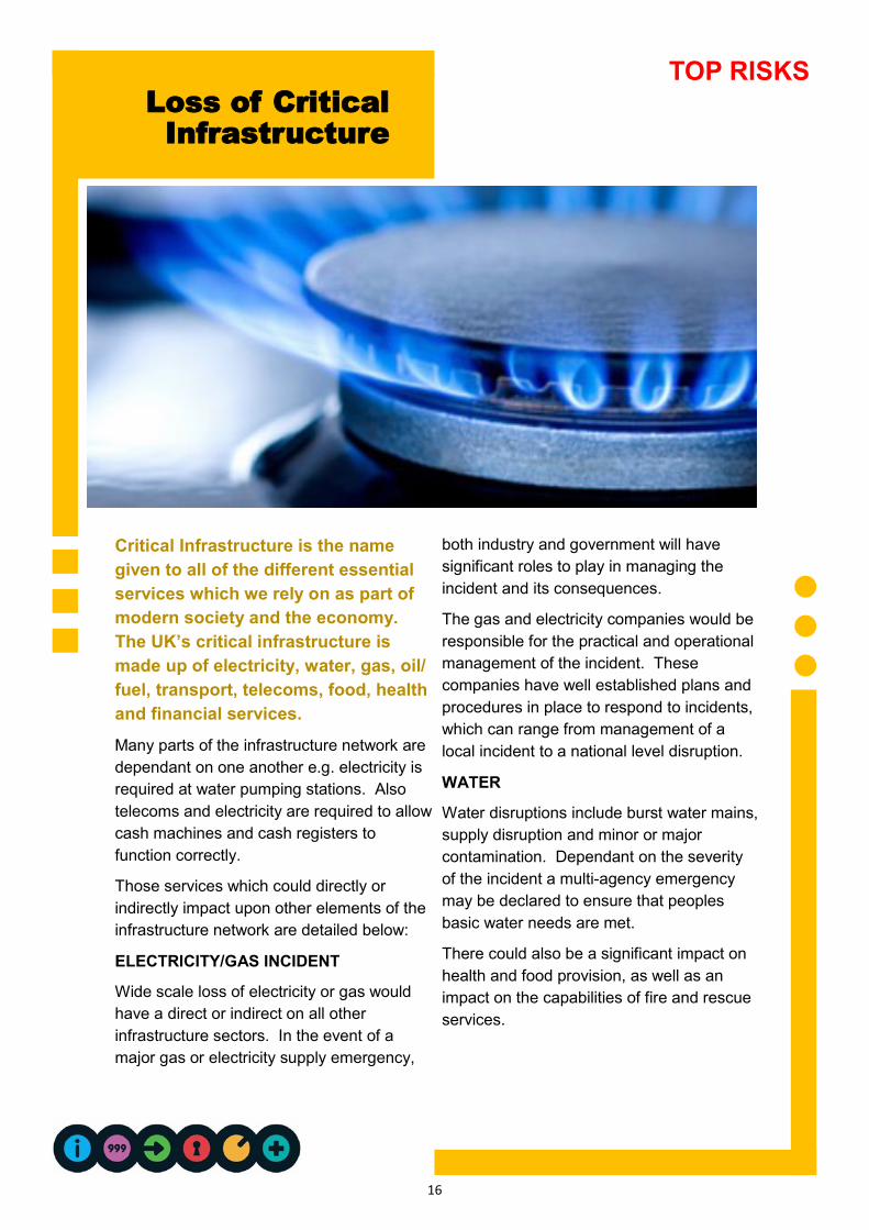
Loss of Critical
Infrastructure
Critical Infrastructure is the name
given to all of the different essential
services which we rely on as part of
modern society and the economy.
The UK’s critical infrastructure is
made up of electricity, water, gas, oil/
fuel, transport, telecoms, food, health
and financial services.
Many parts of the infrastructure network are
dependant on one another e.g. electricity is
required at water pumping stations. Also
telecoms and electricity are required to allow
cash machines and cash registers to
function correctly.
Those services which could directly or
indirectly impact upon other elements of the
infrastructure network are detailed below:
ELECTRICITY/GAS INCIDENT
Wide scale loss of electricity or gas would
have a direct or indirect on all other
infrastructure sectors. In the event of a
major gas or electricity supply emergency,
both industry and government will have
significant roles to play in managing the
incident and its consequences.
The gas and electricity companies would be
responsible for the practical and operational
management of the incident. These
companies have well established plans and
procedures in place to respond to incidents,
which can range from management of a
local incident to a national level disruption.
WATER
Water disruptions include burst water mains,
supply disruption and minor or major
contamination. Dependant on the severity
of the incident a multi-agency emergency
may be declared to ensure that peoples
basic water needs are met.
There could also be a significant impact on
health and food provision, as well as an
impact on the capabilities of fire and rescue
services.
TOP RISKS

17
Know where the cut off points are for your
utilities, in case of gas and water
emergencies. It may be necessary to shut
off the supply to every premise in the
affected area
Keep an emergency kit in your home
containing items such as a wind-up torch &
supplies of tinned food & drinking water
Outages may come with forewarning. If
this is the case considering how you can
be prepared e.g. fill the bath with drinking
water
Be on alert for bogus callers posing as
utility company workers
Work with the utility companies to manage
supply interruptions
Production of multi-agency plans to
manage long-term utilities outages
Identification of vulnerable people who will
need special treatment in the event of a
utilities outage
WHAT DO YOU
NEED TO DO?
WHAT ARE WE DOING IN
THE WEST MIDLANDS?
TOP RISKS
FOOD
There are no realistic scenarios within the UK which would lead to a shortage of food
supplies. However, if a large area of agricultural land became affected by an incident it may
affect the economy by impacting on food prices nationally.
IN THE WEST MIDLANDS
Because of out increasing reliance on utilities such as electricity, water and gas for so many
aspects of our lives, even localised losses can have a significant impact on those affected.
The lead agency for these risks are determined depending on the nature of the
emergency and its impacts.
RISK IMPACTS
The predicted impacts could include:
People exposed to poor sanitation and
lack of drinking water
Homes without heating and limited
ability to heat food and water
Limited ability to keep food cold or
frozen
No ability to get fuel from filling
stations
People unable to get cash from cash
machines or make card purchases
CONSEQUENCES
The consequences of a wide-scale
infrastructure incident could include:
Disruption to essential service and
activities
Endangerment of vulnerable people
Financial impact on businesses
Civil unrest
Increased demand on emergency
services
Travel disruptions

18
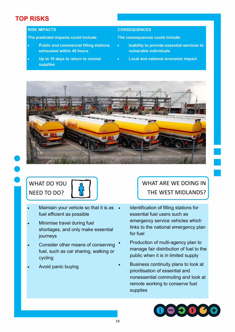
Fuel Shortages
All organisations rely too some
extent on fuel, whether it is for
getting staff to work,
distributing products or
providing services. The
availability of fuel within the UK
is generally very good, however
there have been examples
within recent years of brief
disruptions to supply on both a
regional and national basis.
A disruption could be caused by a
number of factors, including scarcity of
supply, a technical problem with part of
the fuel supply infrastructure, industrial
action or public protest. In the event of
such a disruption to supply, it is also
possible that stocks could further be
depleted through increase consumer
demand (panic buying)
HISTORY
In September 2000, blockades at key oil
distribution points caused nationwide
fuel shortages for more than a week.
Threats of similar action in August 2005
led to panic buying which caused
localised disruptions across the country.
The industrial action taken by Shell
tankers in June 2008 had a widespread
effect on fuel distribution throughout the
UK resulting in some filling stations
running out of fuel.
IN THE WEST MIDLANDS
As you know the West Midlands is
heavily dependant on the road network.
Many essential services, including daily
care of vulnerable people, are reliant on
adequate fuel supplies.
The lead agency for this risk the
Department for Business Enterprise
and Regulatory Reform (BERR)
TOP RISKS
19
Maintain your vehicle so that it is as
fuel efficient as possible
Minimise travel during fuel
shortages, and only make essential
journeys
Consider other means of conserving
fuel, such as car sharing, walking or
cycling
Avoid panic buying
Identification of filling stations for
essential fuel users such as
emergency service vehicles which
links to the national emergency plan
for fuel
Production of multi-agency plan to
manage fair distribution of fuel to the
public when it is in limited supply
Business continuity plans to look at
prioritisation of essential and
nonessential commuting and look at
remote working to conserve fuel
supplies
RISK IMPACTS
The predicted impacts could include:
Public and commercial filling stations
exhausted within 48 hours
Up to 10 days to return to normal
supplies
CONSEQUENCES
The consequences could include:
Inability to provide essential services to
vulnerable individuals
Local and national economic impact
WHAT DO YOU
NEED TO DO?
WHAT ARE WE DOING IN
THE WEST MIDLANDS?
TOP RISKS

20
Transport
Accidents
TOP RISKS
Just like our dependence on basic
utilities, almost all of us will rely on a
form of transport to get to and from
work, or to receive essential services.
The disruptive consequences of a
transport emergency are far reaching
and can further endanger life.
Transport emergencies can be the result of
accidents but also disruption caused by
severe weather such as snow and floods.
The situation can be further complicated by
extremes of temperatures if people are
trapped in their vehicles for long periods of
time.
ROAD
The road network is managed by both the
local authorities and the Highways Agency.
Most road accidents are within the routine
capabilities of the emergency services.
However, there is always the risk of an
accident going beyond these capabilities and
the need for a more extended multi-agency
involvement, especially if the accident
involved chemical or hazardous substances.
RAIL
The West Coast Main line passes through the
region and provides a direct link into London.
The community risk register (CRR)
acknowledges the possibility of a rail accident
occurring.
WATER
Although we are a region with no coast, we
still do have a risk from passenger vessels.
We have a large complex canal and waterway
system which may have a vessel on fire,
become stranded, colliding or sinking. This is
accommodated in the CRR.
AIR
Over 9 million passenger travel from
Birmingham International Airport. With over
95,000 aircraft movements the airport is the
busiest in the region. The region also hosts
Coventry airport which currently has private
and commercial flights only.

21
Have an emergency kit in your car or
basic items when you travel. You may
not be directly involved in an accident but
the transport disruption could last for
hours
When driving, abide by the rules of the
road, adhere to speed limits and drive
safely
Ensure your vehicle is kept in a
roadworthy and safe condition
Avoid non-essential journeys during times
of severe weather
Work with national transport companies
to plan for dealing with accidents
The Local Authority Highway
Departments work alongside the Highway
Agency to keep all major roads
accessible during times of severe weather
and motorway closures
Practicing our response to rail and aircraft
incidents through regular exercising and
training of plans
RISK IMPACTS
The predicted impacts could include:
Disruption to normal travel capabilities
Death or injury to people
People stranded in vehicles potentially in
extreme weather conditions
Environmental impacts if goods are spilled
into local environment
Possible damage to buildings or
infrastructure
CONSEQUENCES
The consequences could include:
Impact on local businesses through
delayed or failed deliveries
Delays in emergency services reaching
people
WHAT DO YOU
NEED TO DO?
WHAT ARE WE DOING IN
THE WEST MIDLANDS?
TOP RISKS
HISTORY
Birmingham Airport had two incidents in
2006 one being a near miss, and another an
emergency landing with damaged landing
gear.
On 27th February 2007, a passenger train
travelling from London to Glasgow derailed in
Cumbria. Local emergency crews had to
deal with only 1 fatality, and a large number
of hospitalised casualties, as well as walking
wounded.
IN THE WEST MIDLANDS
There is a large motorway network which
carries with it the risk of accidents and
disruption, even following just a small
incident a large impact can be felt especially
during rush hour.
The lead agency is West Midlands Police
(although lead agency can vary
depending on the nature of the transport
incident).
22
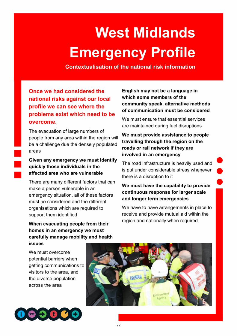
Once we had considered the
national risks against our local
profile we can see where the
problems exist which need to be
overcome.
The evacuation of large numbers of
people from any area within the region will
be a challenge due the densely populated
areas
Given any emergency we must identify
quickly those individuals in the
affected area who are vulnerable
There are many different factors that can
make a person vulnerable in an
emergency situation, all of these factors
must be considered and the different
organisations which are required to
support them identified
When evacuating people from their
homes in an emergency we must
carefully manage mobility and health
issues
We must overcome
potential barriers when
getting communications to
visitors to the area, and
the diverse population
across the area
English may not be a language in
which some members of the
community speak, alternative methods
of communication must be considered
We must ensure that essential services
are maintained during fuel disruptions
We must provide assistance to people
travelling through the region on the
roads or rail network if they are
involved in an emergency
The road infrastructure is heavily used and
is put under considerable stress whenever
there is a disruption to it
We must have the capability to provide
continuous response for larger scale
and longer term emergencies
We have to have arrangements in place to
receive and provide mutual aid within the
region and nationally when required
West Midlands
Emergency Profile Contextualisation of the national risk information

23
What can you do to be better
prepared in your home?
Some emergencies require evacuation, some
require staying put—are you ready?
In the case of major emergencies, the simple
advice is to go inside, stay inside, and tune
into local radio.
We use local radio to broadcast warnings and
information as it is one of the most accessible means of
communication. It can also be received in homes,
businesses and cars.
Radio is also very reliable as it can still broadcast and be
received during a power cut.
With most incidents the safest place to be is indoors,
and with correct preparation you should be able to
stay there safely for some time (remember in the case
of a fire in a building you are in—Get our Stay out)
The LRF organisations work together with the BBC and
other local media to make sure that they can give out
accurate and up-to-date information to keep people
fully informed on what to do during an emergency.
PLANNING FOR AN EMERGENCY
To prepare for an emergency, you should take time to
find out:
Where and how to turn off water, gas and electricity
supplies in your home
There emergency procedures for your children at
school
There emergency procedures at your workplace
How your family will stay in contact in the event of an
emergency
If any elderly or vulnerable neighbours might need
your help
How to tune into your local radio station
AT HOME IN AN EMERGENCY
If you are at home and an emergency happens, try to
gather together:
A list of useful phone numbers, e.g. for your doctor
and close relatives
House and car keys
Toiletries, sanitary supplies and any regularly
prescribed medication
A battery or wind-up radio with spare batteries
A battery or wind-up torch with spare batteries
A first aid kit
Your mobile phone and charger
Cash and credit cards
Spare clothes and blankets
Bottled water, ready-to-eat food (e.g. tinned food)
and a bottle/tin opener, in case you have to remain in
your home for several days.
Also check on your neighbours and vulnerable people in
your community where it is safe to do so.
LEAVING YOUR HOME IN AN EMERGENCY
In certain situations, you may be asked to leave your
home by the emergency services. If this happens, leave
as quickly and calmly as possible.
If you have time:
Turn off electricity, gas and water supplies, unplug
appliances and lock all doors and windows
Take the items listed earlier with you
If you leave by car, take bottled water and blankets
Take your pets (with suitable carriers or leads)
Tune into local radio for emergency advice and
instructions
Inform emergency services of where you have gone
and how you can be contacted
RETURNING HOME AFTER AN EMERGENCY
Listen to advice from emergency services or local
authorities about any specific actions which you must
follow when it is safe to return home.
Preparedness Knowing what to do during an
emergency is an important part of being
prepared and may make all the difference
when seconds count

24
PRODUCTION
The Community Risk Register is produced
by West Midlands Resilience Forum and has
had contributions by the following agencies:
West Midlands Ambulance Service
West Midlands Police
West Midlands Fire and Rescue
Birmingham City Council
Coventry City Council
Dudley Borough Council
Sandwell Borough Council
Solihull Borough Council
Walsall Council
Wolverhampton City Council
Birmingham Community Healthcare Trust
NHS England
Public Health England
British Transport Police
Environment Agency
Severn Trent Water
South Staffs Water
Dept. for Communities & Local
Government Resilience Emergencies
Division
Version 1 July 2014
CONTACT US
You can contact the LRF regarding any of
the individual risk assessments or any other
aspect of the work of the West Midlands
Resilience Forum by contacting us on:
Telephone 0345 113 5000 ext. 7982 6014
Or follow us on Twitter @WmidsPrepared
You can also write to us at:
Operations, Integrated Emergency Management
West Midlands Police
2nd floor Traffic Complex
199 Park Lane
Aston
Birmingham B6 5DD
REFERENCES
The following resources have been useful in
compiling this document
Census
National Risk Register & Security Strategy
Civil Contingencies Act
A large thank you to Lincolnshire Resilience
Forum in which we have based the format, style
and content on their 2012-2015 Community risk
Register.
Want to know more?
This document has been produced by West
Midlands Resilience Forum and should be
read alongside other Local resilience Forum
documents to establish the ethos, roles and
responsibilities, and detailed delivery plans
and work schedules for managing the risks
within the Region.