Embed Size (px)
Citation preview
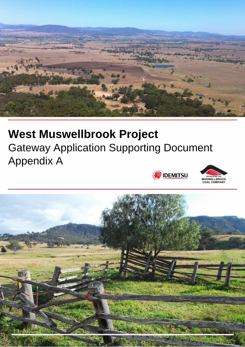
West Muswellbrook Project Gateway Application Supporting Document Appendix A
WEST MUSWELLBROOK PROJECT GATEWAY APPLICATION SUPPORTING DOCUMENT APPENDIX A
la tierra the earth PAGE 1 of 39
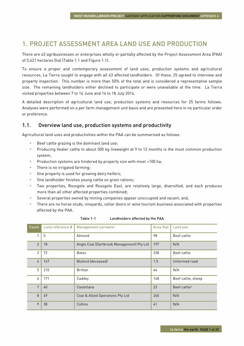
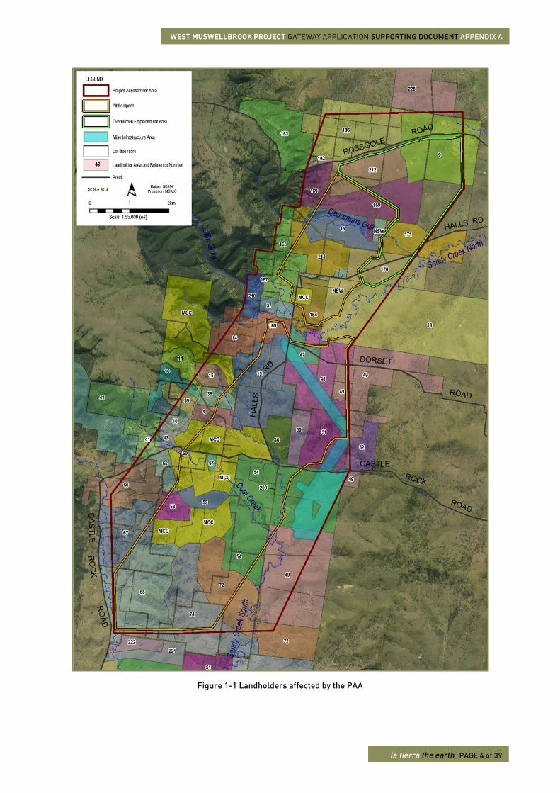
1. PROJECT ASSESSMENT AREA LAND USE AND PRODUCTION There are 43 agribusinesses or enterprises wholly or partially affected by the Project Assessment Area (PAA) of 5,621 hectares (ha) (Table 1.1 and Figure 1.1).
To ensure a proper and contemporary assessment of land uses, production systems and agricultural resources, La Tierra sought to engage with all 43 affected landholders. Of these, 25 agreed to interview and property inspection. This number is more than 50% of the total and is considered a representative sample size. The remaining landholders either declined to participate or were unavailable at the time. La Tierra visited properties between 7 to 14 June and 14 to 18 July 2014.
A detailed description of agricultural land use, production systems and resources for 25 farms follows. Analyses were performed on a per farm management unit basis and are presented here in no particular order or preference.
1.1. Overview land use, production systems and productivity
Agricultural land uses and productivities within the PAA can be summarised as follows.
• Beef cattle grazing is the dominant land use; • Producing Vealer cattle to about 300 kg liveweight at 9 to 12 months is the most common production
system; • Production systems are hindered by property size with most <100 ha; • There is no irrigated farming; • One property is used for growing dairy heifers; • One landholder finishes young cattle on grain rations; • Two properties, Rossgole and Rossgole East, are relatively large, diversified, and each produces
more than all other affected properties combined; • Several properties owned by mining companies appear unoccupied and vacant; and, • There are no horse studs, vineyards, cellar doors or wine tourism business associated with properties
affected by the PAA.
Table 1-1 Landholders affected by the PAA
Count Land reference # Management surname1 Area (ha) Land use
1 5 Almond 98 Beef cattle
2 18 Anglo Coal (Dartbrook Management) Pty Ltd 197 N/A
3 72 Bates 338 Beef cattle
4 167 Bluford (deceased) 1.5 Unformed road
5 210 Brittan 46 N/A
6 171 Caddey 148 Beef cattle, sheep
7 40 Castellana 23 Beef cattle2
8 49 Coal & Allied Operations Pty Ltd 265 N/A
9 38 Collins 41 N/A
WEST MUSWELLBROOK PROJECT GATEWAY APPLICATION SUPPORTING DOCUMENT APPENDIX A
la tierra the earth PAGE 2 of 39
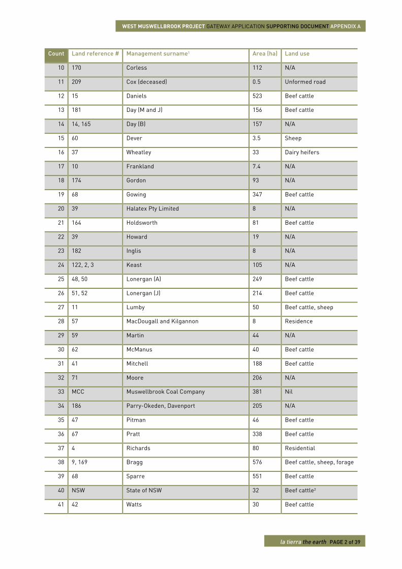
Count Land reference # Management surname1 Area (ha) Land use
10 170 Corless 112 N/A
11 209 Cox (deceased) 0.5 Unformed road
12 15 Daniels 523 Beef cattle
13 181 Day (M and J) 156 Beef cattle
14 14, 165 Day (B) 157 N/A
15 60 Dever 3.5 Sheep
16 37 Wheatley 33 Dairy heifers
17 10 Frankland 7.4 N/A
18 174 Gordon 93 N/A
19 68 Gowing 347 Beef cattle
20 39 Halatex Pty Limited 8 N/A
21 164 Holdsworth 81 Beef cattle
22 39 Howard 19 N/A
23 182 Inglis 8 N/A
24 122, 2, 3 Keast 105 N/A
25 48, 50 Lonergan (A) 249 Beef cattle
26 51, 52 Lonergan (J) 214 Beef cattle
27 11 Lumby 50 Beef cattle, sheep
28 57 MacDougall and Kilgannon 8 Residence
29 59 Martin 44 N/A
30 62 McManus 40 Beef cattle
31 41 Mitchell 188 Beef cattle
32 71 Moore 206 N/A
33 MCC Muswellbrook Coal Company 381 Nil
34 186 Parry-Okeden, Davenport 205 N/A
35 47 Pitman 46 Beef cattle
36 67 Pratt 338 Beef cattle
37 4 Richards 80 Residential
38 9, 169 Bragg 576 Beef cattle, sheep, forage
39 68 Sparre 551 Beef cattle
40 NSW State of NSW 32 Beef cattle2
41 42 Watts 30 Beef cattle
WEST MUSWELLBROOK PROJECT GATEWAY APPLICATION SUPPORTING DOCUMENT APPENDIX A
la tierra the earth PAGE 3 of 39
Count Land reference # Management surname1 Area (ha) Land use
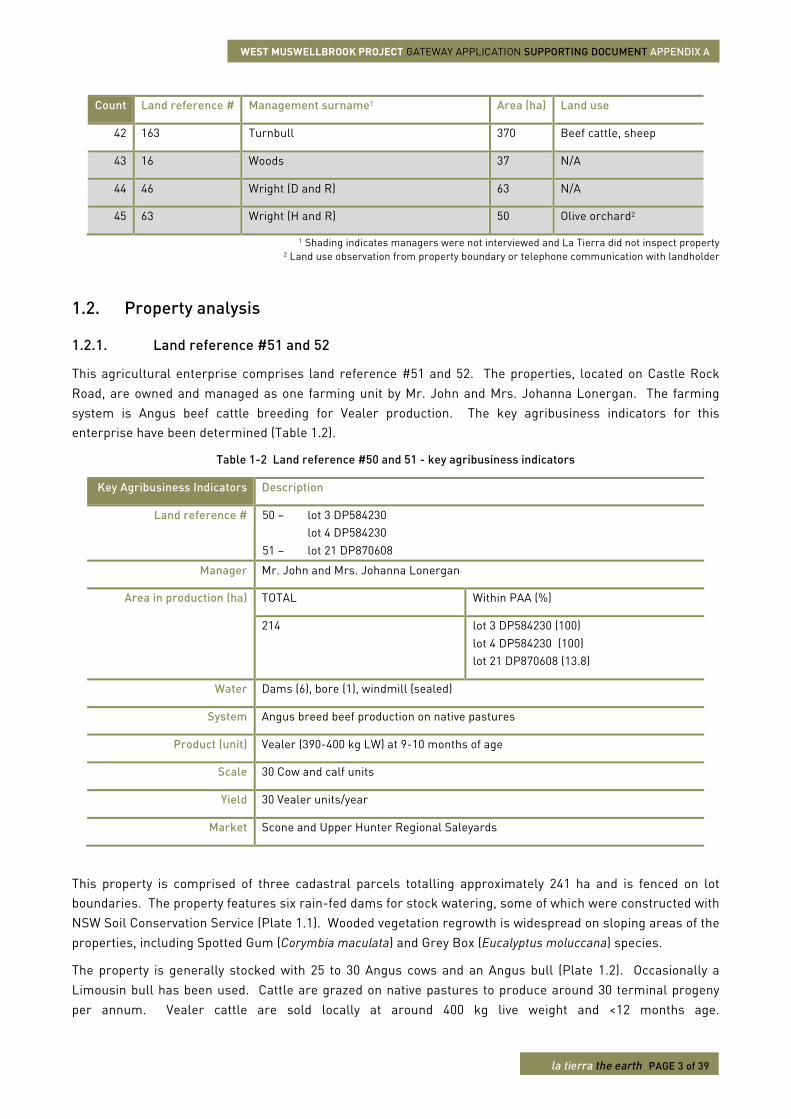
42 163 Turnbull 370 Beef cattle, sheep
43 16 Woods 37 N/A
44 46 Wright (D and R) 63 N/A
45 63 Wright (H and R) 50 Olive orchard2
1 Shading indicates managers were not interviewed and La Tierra did not inspect property 2 Land use observation from property boundary or telephone communication with landholder
1.2. Property analysis
1.2.1. Land reference #51 and 52
This agricultural enterprise comprises land reference #51 and 52. The properties, located on Castle Rock Road, are owned and managed as one farming unit by Mr. John and Mrs. Johanna Lonergan. The farming system is Angus beef cattle breeding for Vealer production. The key agribusiness indicators for this enterprise have been determined (Table 1.2).
Table 1-2 Land reference #50 and 51 - key agribusiness indicators
Key Agribusiness Indicators Description
Land reference # 50 – lot 3 DP584230 lot 4 DP584230
51 – lot 21 DP870608
Manager Mr. John and Mrs. Johanna Lonergan
Area in production (ha) TOTAL Within PAA (%)
214 lot 3 DP584230 (100) lot 4 DP584230 (100) lot 21 DP870608 (13.8)
Water Dams (6), bore (1), windmill (sealed)
System Angus breed beef production on native pastures
Product (unit) Vealer (390-400 kg LW) at 9-10 months of age
Scale 30 Cow and calf units
Yield 30 Vealer units/year
Market Scone and Upper Hunter Regional Saleyards
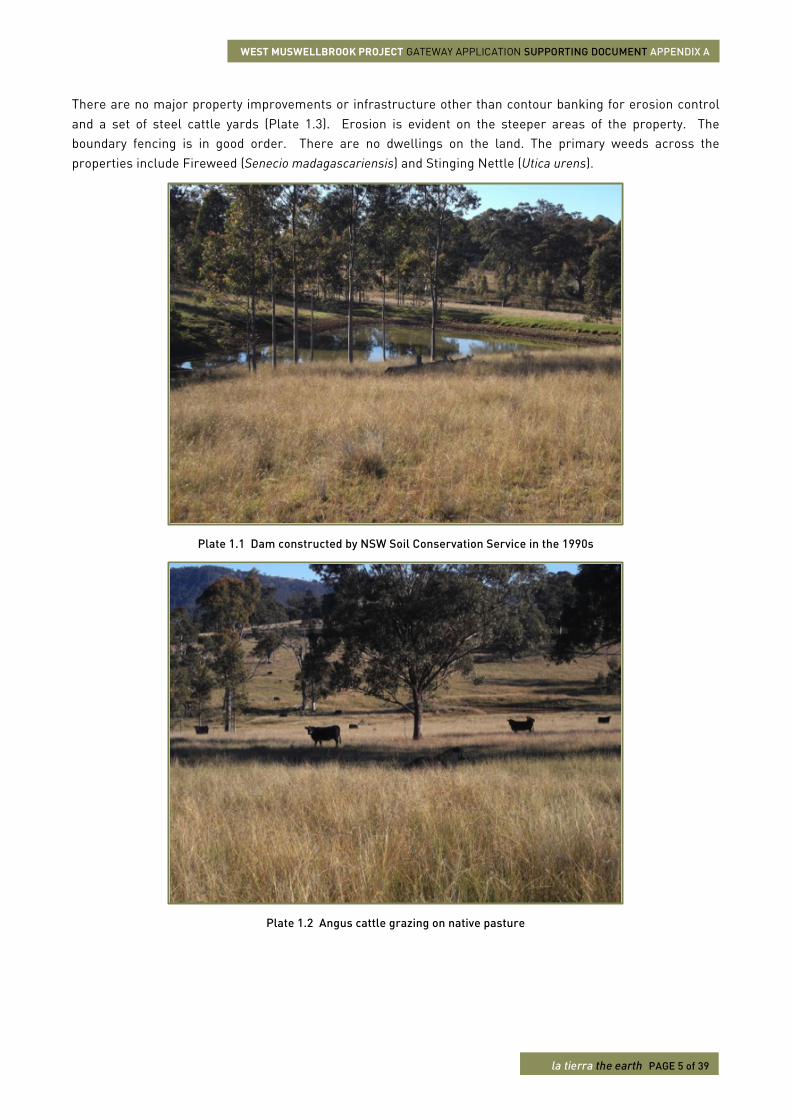
This property is comprised of three cadastral parcels totalling approximately 241 ha and is fenced on lot boundaries. The property features six rain-fed dams for stock watering, some of which were constructed with NSW Soil Conservation Service (Plate 1.1). Wooded vegetation regrowth is widespread on sloping areas of the properties, including Spotted Gum (Corymbia maculata) and Grey Box (Eucalyptus moluccana) species.
The property is generally stocked with 25 to 30 Angus cows and an Angus bull (Plate 1.2). Occasionally a Limousin bull has been used. Cattle are grazed on native pastures to produce around 30 terminal progeny per annum. Vealer cattle are sold locally at around 400 kg live weight and <12 months age.
WEST MUSWELLBROOK PROJECT GATEWAY APPLICATION SUPPORTING DOCUMENT APPENDIX A
la tierra the earth PAGE 4 of 39
Figure 1-1 Landholders affected by the PAA
WEST MUSWELLBROOK PROJECT GATEWAY APPLICATION SUPPORTING DOCUMENT APPENDIX A
la tierra the earth PAGE 5 of 39
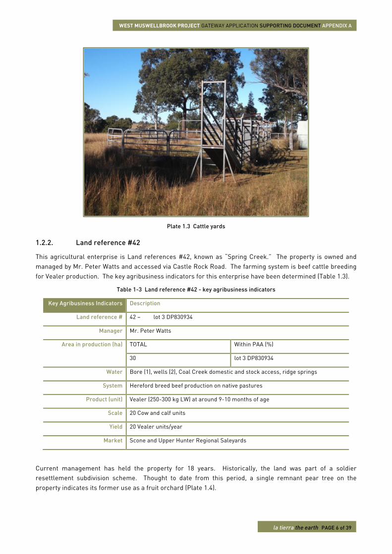
There are no major property improvements or infrastructure other than contour banking for erosion control and a set of steel cattle yards (Plate 1.3). Erosion is evident on the steeper areas of the property. The boundary fencing is in good order. There are no dwellings on the land. The primary weeds across the properties include Fireweed (Senecio madagascariensis) and Stinging Nettle (Utica urens).
Plate 1.1 Dam constructed by NSW Soil Conservation Service in the 1990s
Plate 1.2 Angus cattle grazing on native pasture
WEST MUSWELLBROOK PROJECT GATEWAY APPLICATION SUPPORTING DOCUMENT APPENDIX A
la tierra the earth PAGE 6 of 39
Plate 1.3 Cattle yards
1.2.2. Land reference #42
This agricultural enterprise is Land references #42, known as “Spring Creek.” The property is owned and managed by Mr. Peter Watts and accessed via Castle Rock Road. The farming system is beef cattle breeding for Vealer production. The key agribusiness indicators for this enterprise have been determined (Table 1.3).
Table 1-3 Land reference #42 - key agribusiness indicators
Key Agribusiness Indicators Description
Land reference # 42 – lot 3 DP830934
Manager Mr. Peter Watts
Area in production (ha) TOTAL Within PAA (%)
30 lot 3 DP830934
Water Bore (1), wells (2), Coal Creek domestic and stock access, ridge springs
System Hereford breed beef production on native pastures
Product (unit) Vealer (250-300 kg LW) at around 9-10 months of age
Scale 20 Cow and calf units
Yield 20 Vealer units/year
Market Scone and Upper Hunter Regional Saleyards
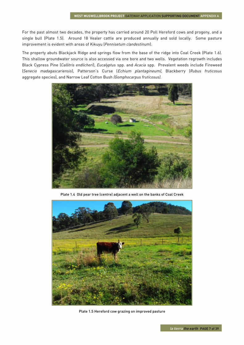
Current management has held the property for 18 years. Historically, the land was part of a soldier resettlement subdivision scheme. Thought to date from this period, a single remnant pear tree on the property indicates its former use as a fruit orchard (Plate 1.4).
WEST MUSWELLBROOK PROJECT GATEWAY APPLICATION SUPPORTING DOCUMENT APPENDIX A
la tierra the earth PAGE 7 of 39
For the past almost two decades, the property has carried around 20 Poll Hereford cows and progeny, and a single bull (Plate 1.5). Around 18 Vealer cattle are produced annually and sold locally. Some pasture improvement is evident with areas of Kikuyu (Pennisetum clandestinum).
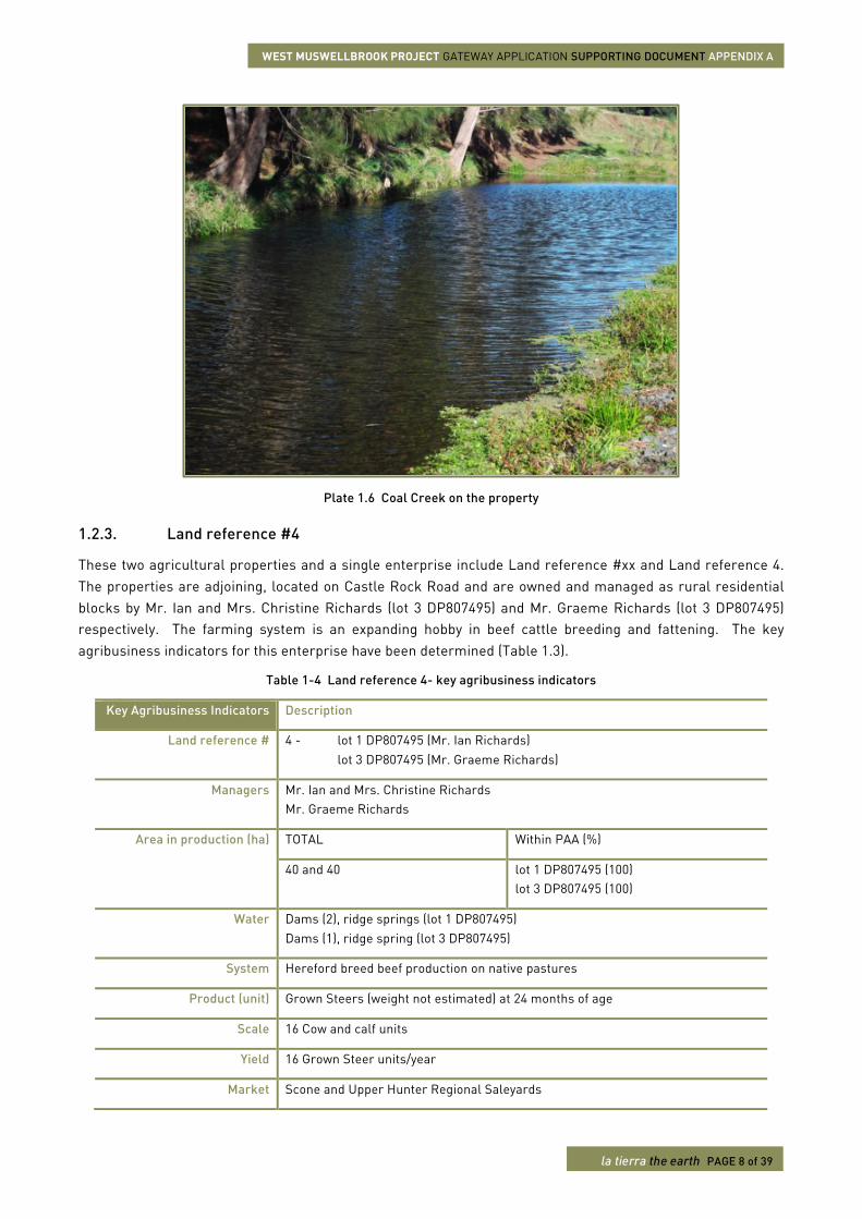
The property abuts Blackjack Ridge and springs flow from the base of the ridge into Coal Creek (Plate 1.6). This shallow groundwater source is also accessed via one bore and two wells. Vegetation regrowth includes Black Cypress Pine (Callitris endlicheri), Eucalyptus spp. and Acacia spp. Prevalent weeds include Fireweed (Senecio madagascariensis), Patterson’s Curse (Echium plantagineum), Blackberry (Rubus fruticosus aggregate species), and Narrow Leaf Cotton Bush (Gomphocarpus fruticosus).
Plate 1.4 Old pear tree (centre) adjacent a well on the banks of Coal Creek
Plate 1.5 Hereford cow grazing on improved pasture
WEST MUSWELLBROOK PROJECT GATEWAY APPLICATION SUPPORTING DOCUMENT APPENDIX A
la tierra the earth PAGE 8 of 39
Plate 1.6 Coal Creek on the property
1.2.3. Land reference #4
These two agricultural properties and a single enterprise include Land reference #xx and Land reference 4. The properties are adjoining, located on Castle Rock Road and are owned and managed as rural residential blocks by Mr. Ian and Mrs. Christine Richards (lot 3 DP807495) and Mr. Graeme Richards (lot 3 DP807495) respectively. The farming system is an expanding hobby in beef cattle breeding and fattening. The key agribusiness indicators for this enterprise have been determined (Table 1.3).
Table 1-4 Land reference 4- key agribusiness indicators
Key Agribusiness Indicators Description
Land reference # 4 - lot 1 DP807495 (Mr. Ian Richards) lot 3 DP807495 (Mr. Graeme Richards)
Managers Mr. Ian and Mrs. Christine Richards Mr. Graeme Richards
Area in production (ha) TOTAL Within PAA (%)
40 and 40 lot 1 DP807495 (100) lot 3 DP807495 (100)
Water Dams (2), ridge springs (lot 1 DP807495) Dams (1), ridge spring (lot 3 DP807495)
System Hereford breed beef production on native pastures
Product (unit) Grown Steers (weight not estimated) at 24 months of age
Scale 16 Cow and calf units
Yield 16 Grown Steer units/year
Market Scone and Upper Hunter Regional Saleyards
WEST MUSWELLBROOK PROJECT GATEWAY APPLICATION SUPPORTING DOCUMENT APPENDIX A
la tierra the earth PAGE 9 of 39
Mr. Ian and Mrs. Christine Richards own and manage the property called “Spring Hill”, as a primarily rural residential block with an expanding hobby in Hereford cattle breeding and fattening (lot 1 DP807495). Mr. Graeme Richards owns the adjoining property (lot 3 DP807495) as a vacant block with a Development Application submitted to Muswellbrook Shire Council to construct a single-storey dwelling and share Mr. Ian Richards’ agribusiness. Construction is anticipated to commence mid-2015. Mr. Graeme Richards currently lives in Kingswood near Sydney, NSW.
Mr. and Mrs. Ian Richards have been running the small-scale, low intensity cattle agribusiness for around eight years. They purchased the block in 1993 and built the family home on the property in 1998. In addition to the family house, other improvements on the property include a cottage, a shed and an in-ground pool. The Richards shared in the construction of the feeder road that runs through the property. Mr. Graeme Richards purchased his property in around 2004. Contour banking has been undertaken on both properties.
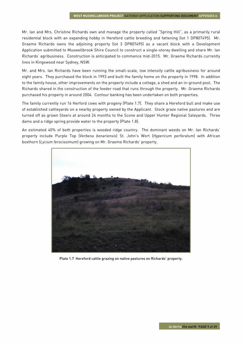
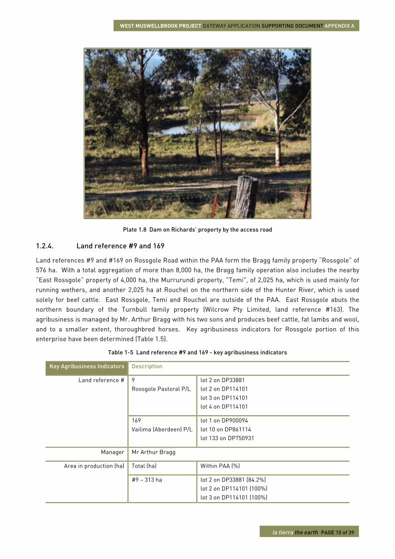
The family currently run 16 Herford cows with progeny (Plate 1.7). They share a Hereford bull and make use of established cattleyards on a nearby property owned by the Applicant. Stock graze native pastures and are turned off as grown Steers at around 24 months to the Scone and Upper Hunter Regional Saleyards. Three dams and a ridge spring provide water to the property (Plate 1.8).
An estimated 40% of both properties is wooded ridge country. The dominant weeds on Mr. Ian Richards’ property include Purple Top (Verbena bonariensis) St. John’s Wort (Hypericum perforatum) with African boxthorn (Lycium ferocissimum) growing on Mr. Graeme Richards’ property.
Plate 1.7 Hereford cattle grazing on native pastures on Richards’ property.
WEST MUSWELLBROOK PROJECT GATEWAY APPLICATION SUPPORTING DOCUMENT APPENDIX A
la tierra the earth PAGE 10 of 39
Plate 1.8 Dam on Richards’ property by the access road
1.2.4. Land reference #9 and 169
Land references #9 and #169 on Rossgole Road within the PAA form the Bragg family property “Rossgole” of 576 ha. With a total aggregation of more than 8,000 ha, the Bragg family operation also includes the nearby “East Rossgole” property of 4,000 ha, the Murrurundi property, "Temi", of 2,025 ha, which is used mainly for running wethers, and another 2,025 ha at Rouchel on the northern side of the Hunter River, which is used solely for beef cattle. East Rossgole, Temi and Rouchel are outside of the PAA. East Rossgole abuts the northern boundary of the Turnbull family property (Wilcrow Pty Limited, land reference #163). The agribusiness is managed by Mr. Arthur Bragg with his two sons and produces beef cattle, fat lambs and wool, and to a smaller extent, thoroughbred horses. Key agribusiness indicators for Rossgole portion of this enterprise have been determined (Table 1.5).
Table 1-5 Land reference #9 and 169 - key agribusiness indicators
Key Agribusiness Indicators Description
Land reference # 9 Rossgole Pastoral P/L
lot 2 on DP33881 lot 2 on DP114101 lot 3 on DP114101 lot 4 on DP114101
169 Vailima (Aberdeen) P/L
lot 1 on DP900094 lot 10 on DP861114 lot 133 on DP750931
Manager Mr Arthur Bragg
Area in production (ha) Total (ha) Within PAA (%)
#9 – 313 ha lot 2 on DP33881 (84.2%) lot 2 on DP114101 (100%) lot 3 on DP114101 (100%)
WEST MUSWELLBROOK PROJECT GATEWAY APPLICATION SUPPORTING DOCUMENT APPENDIX A
la tierra the earth PAGE 11 of 39
Key Agribusiness Indicators Description
lot 4 on DP114101 (100%)
#169 – 263 ha lot 1 on DP900094 (100%) lot 10 on DP861114 (100%) lot 133 on DP750931 (100%)
Water One dam in each paddock, two bores with one adjacent Dartbrook Creek
System Beef cattle, fat lambs and a small quantity of thoroughbred horses
Production unit Weaner steer, lamb and foal
Scale 750 head weaner cattle 2,000 head lambs 15 horses
Yield 750 weaner cattle (about 50:50 as steers and replacement heifers) 2,000 fat lambs
Markets Weaner steers at 400-450 kg LW to central western feedlotters, i.e. JBS Caroona Fat lambs at 35 kg LW to Tamworth or Dubbo store sheep sales Horses opportunity trade
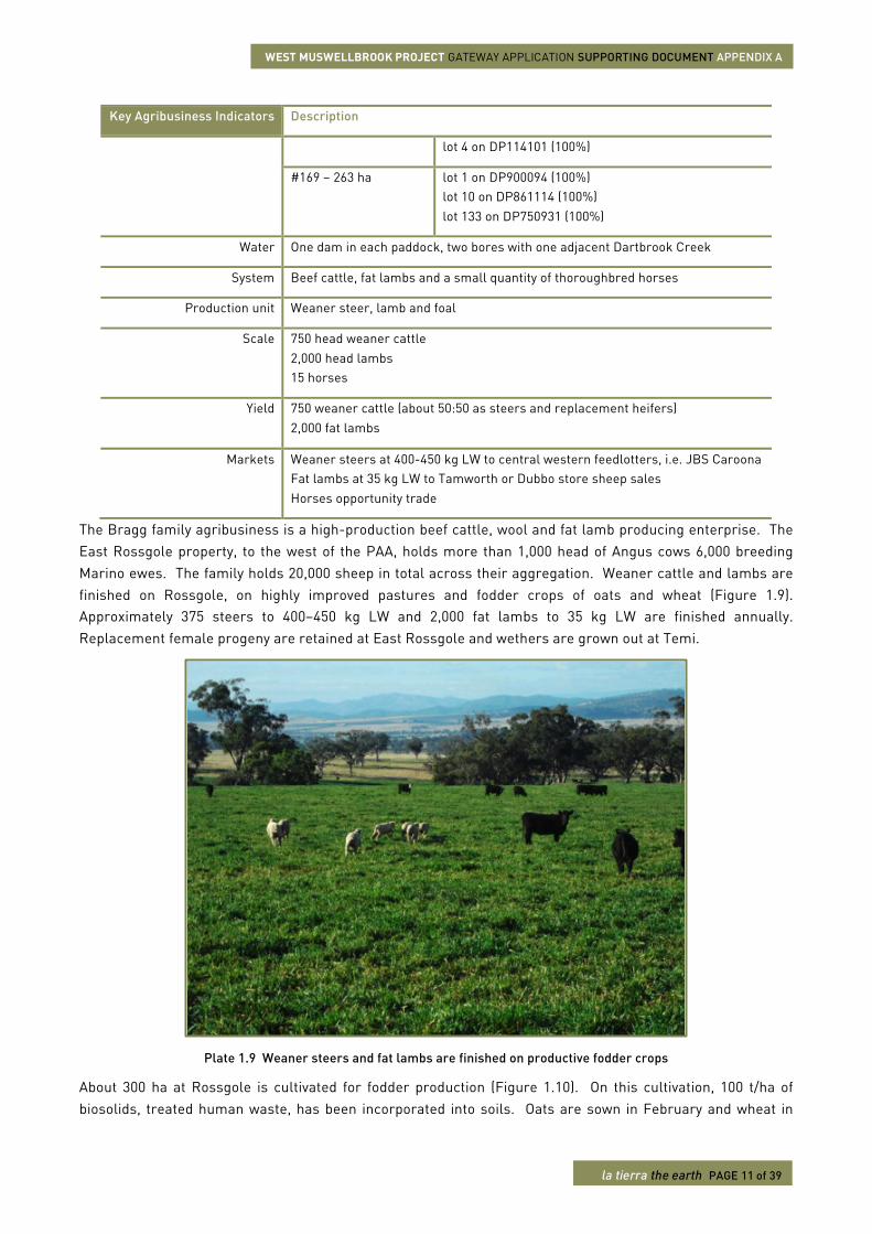
The Bragg family agribusiness is a high-production beef cattle, wool and fat lamb producing enterprise. The East Rossgole property, to the west of the PAA, holds more than 1,000 head of Angus cows 6,000 breeding Marino ewes. The family holds 20,000 sheep in total across their aggregation. Weaner cattle and lambs are finished on Rossgole, on highly improved pastures and fodder crops of oats and wheat (Figure 1.9). Approximately 375 steers to 400–450 kg LW and 2,000 fat lambs to 35 kg LW are finished annually. Replacement female progeny are retained at East Rossgole and wethers are grown out at Temi.
Plate 1.9 Weaner steers and fat lambs are finished on productive fodder crops
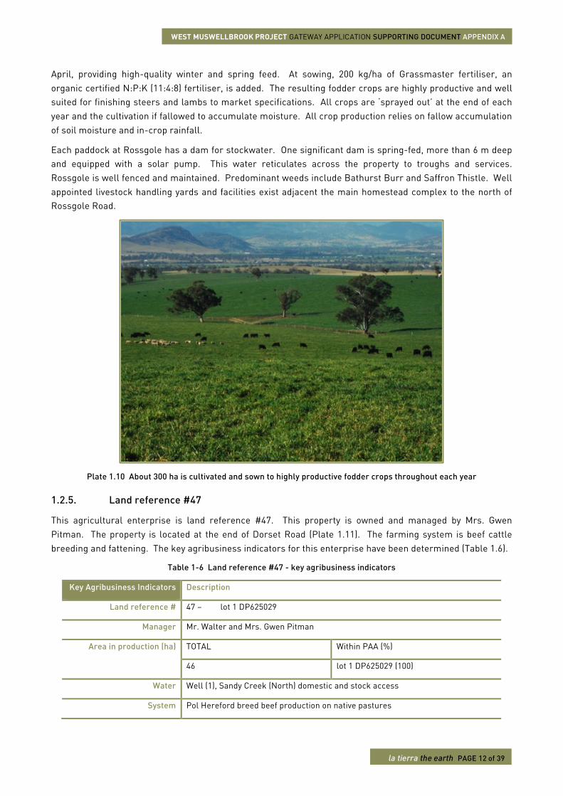
About 300 ha at Rossgole is cultivated for fodder production (Figure 1.10). On this cultivation, 100 t/ha of biosolids, treated human waste, has been incorporated into soils. Oats are sown in February and wheat in
WEST MUSWELLBROOK PROJECT GATEWAY APPLICATION SUPPORTING DOCUMENT APPENDIX A
la tierra the earth PAGE 12 of 39
April, providing high-quality winter and spring feed. At sowing, 200 kg/ha of Grassmaster fertiliser, an organic certified N:P:K (11:4:8) fertiliser, is added. The resulting fodder crops are highly productive and well suited for finishing steers and lambs to market specifications. All crops are ‘sprayed out’ at the end of each year and the cultivation if fallowed to accumulate moisture. All crop production relies on fallow accumulation of soil moisture and in-crop rainfall.
Each paddock at Rossgole has a dam for stockwater. One significant dam is spring-fed, more than 6 m deep and equipped with a solar pump. This water reticulates across the property to troughs and services. Rossgole is well fenced and maintained. Predominant weeds include Bathurst Burr and Saffron Thistle. Well appointed livestock handling yards and facilities exist adjacent the main homestead complex to the north of Rossgole Road.
Plate 1.10 About 300 ha is cultivated and sown to highly productive fodder crops throughout each year
1.2.5. Land reference #47
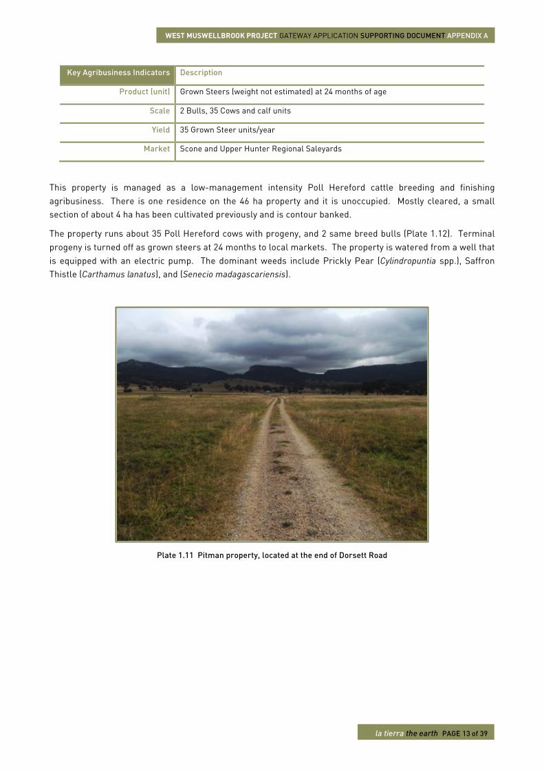
This agricultural enterprise is land reference #47. This property is owned and managed by Mrs. Gwen Pitman. The property is located at the end of Dorset Road (Plate 1.11). The farming system is beef cattle breeding and fattening. The key agribusiness indicators for this enterprise have been determined (Table 1.6).
Table 1-6 Land reference #47 - key agribusiness indicators
Key Agribusiness Indicators Description
Land reference # 47 – lot 1 DP625029
Manager Mr. Walter and Mrs. Gwen Pitman
Area in production (ha) TOTAL Within PAA (%)
46 lot 1 DP625029 (100)
Water Well (1), Sandy Creek (North) domestic and stock access
System Pol Hereford breed beef production on native pastures
WEST MUSWELLBROOK PROJECT GATEWAY APPLICATION SUPPORTING DOCUMENT APPENDIX A
la tierra the earth PAGE 13 of 39
Key Agribusiness Indicators Description
Product (unit) Grown Steers (weight not estimated) at 24 months of age
Scale 2 Bulls, 35 Cows and calf units
Yield 35 Grown Steer units/year
Market Scone and Upper Hunter Regional Saleyards
This property is managed as a low-management intensity Poll Hereford cattle breeding and finishing agribusiness. There is one residence on the 46 ha property and it is unoccupied. Mostly cleared, a small section of about 4 ha has been cultivated previously and is contour banked.
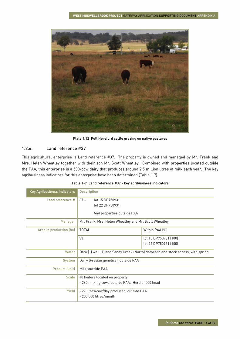
The property runs about 35 Poll Hereford cows with progeny, and 2 same breed bulls (Plate 1.12). Terminal progeny is turned off as grown steers at 24 months to local markets. The property is watered from a well that is equipped with an electric pump. The dominant weeds include Prickly Pear (Cylindropuntia spp.), Saffron Thistle (Carthamus lanatus), and (Senecio madagascariensis).
Plate 1.11 Pitman property, located at the end of Dorsett Road
WEST MUSWELLBROOK PROJECT GATEWAY APPLICATION SUPPORTING DOCUMENT APPENDIX A
la tierra the earth PAGE 14 of 39
Plate 1.12 Poll Hereford cattle grazing on native pastures
1.2.6. Land reference #37
This agricultural enterprise is Land reference #37. The property is owned and managed by Mr. Frank and Mrs. Helen Wheatley together with their son Mr. Scott Wheatley. Combined with properties located outside the PAA, this enterprise is a 500-cow dairy that produces around 2.5 million litres of milk each year. The key agribusiness indicators for this enterprise have been determined (Table 1.7).
Table 1-7 Land reference #37 - key agribusiness indicators
Key Agribusiness Indicators Description
Land reference # 37 – lot 15 DP750931 lot 22 DP750931
And properties outside PAA
Manager Mr. Frank, Mrs. Helen Wheatley and Mr. Scott Wheatley
Area in production (ha) TOTAL Within PAA (%)
33 lot 15 DP750931 (100) lot 22 DP750931 (100)
Water Dam (1) well (1) and Sandy Creek (North) domestic and stock access, with spring
System Dairy (Fresian genetics), outside PAA
Product (unit) Milk, outside PAA
Scale 40 heifers located on property - 260 milking cows outside PAA. Herd of 500 head
Yield - 27 litres/cow/day produced, outside PAA. - 200,000 litres/month
WEST MUSWELLBROOK PROJECT GATEWAY APPLICATION SUPPORTING DOCUMENT APPENDIX A
la tierra the earth PAGE 15 of 39
Key Agribusiness Indicators Description
Market Dairy Farmers
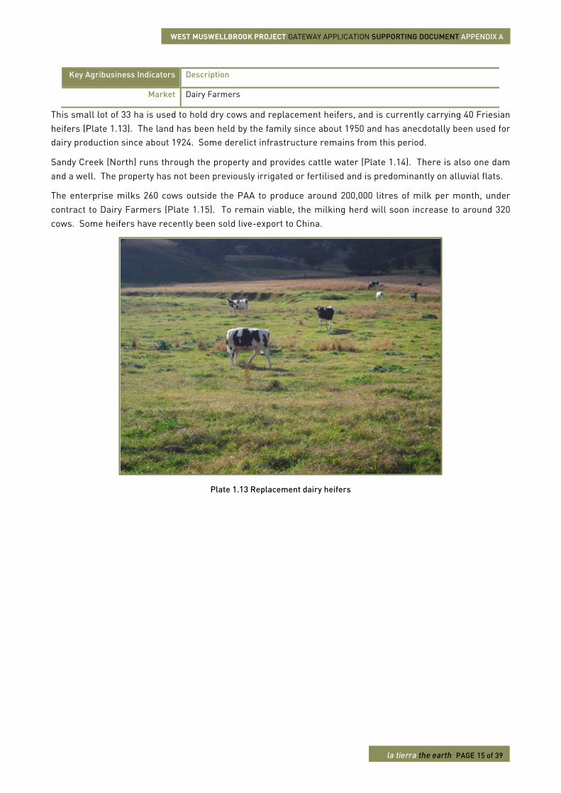
This small lot of 33 ha is used to hold dry cows and replacement heifers, and is currently carrying 40 Friesian heifers (Plate 1.13). The land has been held by the family since about 1950 and has anecdotally been used for dairy production since about 1924. Some derelict infrastructure remains from this period.
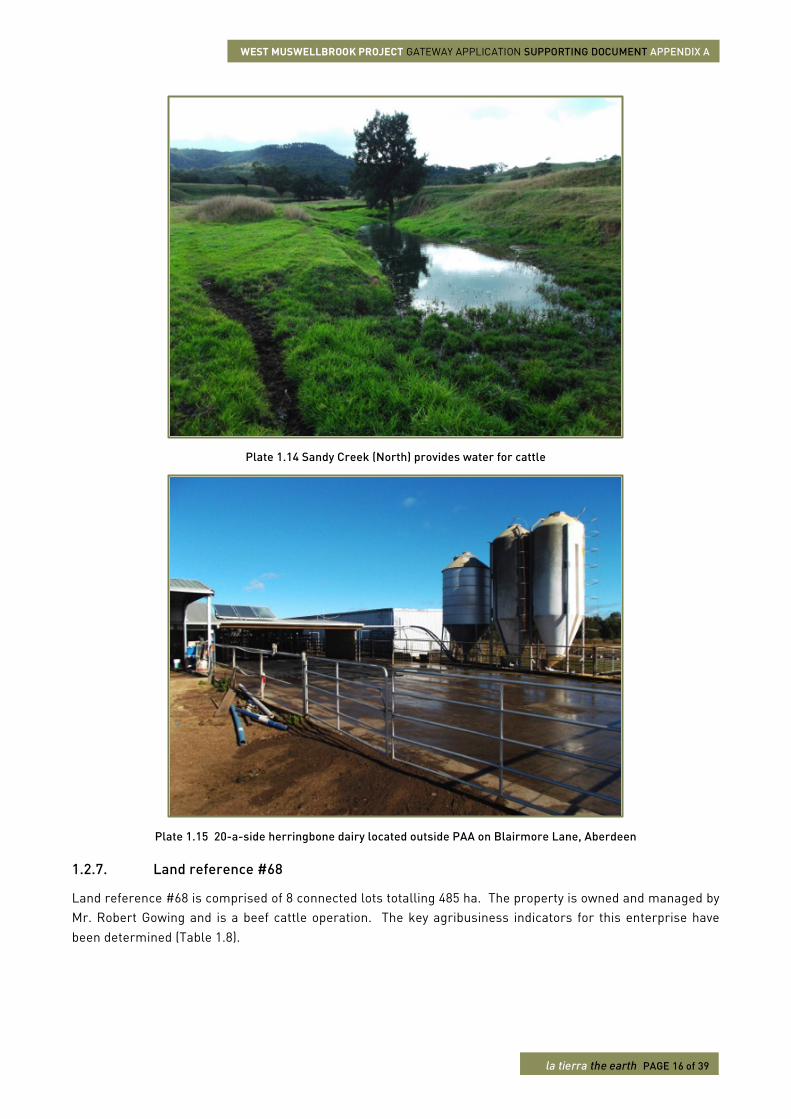
Sandy Creek (North) runs through the property and provides cattle water (Plate 1.14). There is also one dam and a well. The property has not been previously irrigated or fertilised and is predominantly on alluvial flats.
The enterprise milks 260 cows outside the PAA to produce around 200,000 litres of milk per month, under contract to Dairy Farmers (Plate 1.15). To remain viable, the milking herd will soon increase to around 320 cows. Some heifers have recently been sold live-export to China.
Plate 1.13 Replacement dairy heifers
WEST MUSWELLBROOK PROJECT GATEWAY APPLICATION SUPPORTING DOCUMENT APPENDIX A
la tierra the earth PAGE 16 of 39
Plate 1.14 Sandy Creek (North) provides water for cattle
Plate 1.15 20-a-side herringbone dairy located outside PAA on Blairmore Lane, Aberdeen
1.2.7. Land reference #68
Land reference #68 is comprised of 8 connected lots totalling 485 ha. The property is owned and managed by Mr. Robert Gowing and is a beef cattle operation. The key agribusiness indicators for this enterprise have been determined (Table 1.8).
WEST MUSWELLBROOK PROJECT GATEWAY APPLICATION SUPPORTING DOCUMENT APPENDIX A
la tierra the earth PAGE 17 of 39
Table 1-8 Land reference #68 - key agribusiness indicators
Key Agribusiness Indicators Description
Land reference # 68 – lot 56 DP750915 lot 90 DP750915 lot 57 DP750915 lot 324 DP829973 lot 51 DP750915 lot 33 DP750915 lot 5 DP1000366 lot 1 DP432670
Manager Mr. Robert Gowing
Area in production (ha) TOTAL Within PAA (%)
347 lot 56 DP750915 (100) lot 90 DP750915 (100) lot 57 DP750915 (100) lot 324 DP829973 (90.2) lot 51 DP750915 (100) lot 33 DP750915 (41.8) lot 5 DP1000366 (70.6) lot 1 DP432670 (100)
Water Dams (20-25) well (1) bore (1) and domestic and stock access to Spring Creek ridge spring
System Black Angus breed beef cattle production on largely native pastures and cultivation
Product (unit) Vealer (~6 months)
Scale 160 Cow and calf units
Yield 150 Vealer units/year
Market Scone and Upper Hunter Regional Saleyards
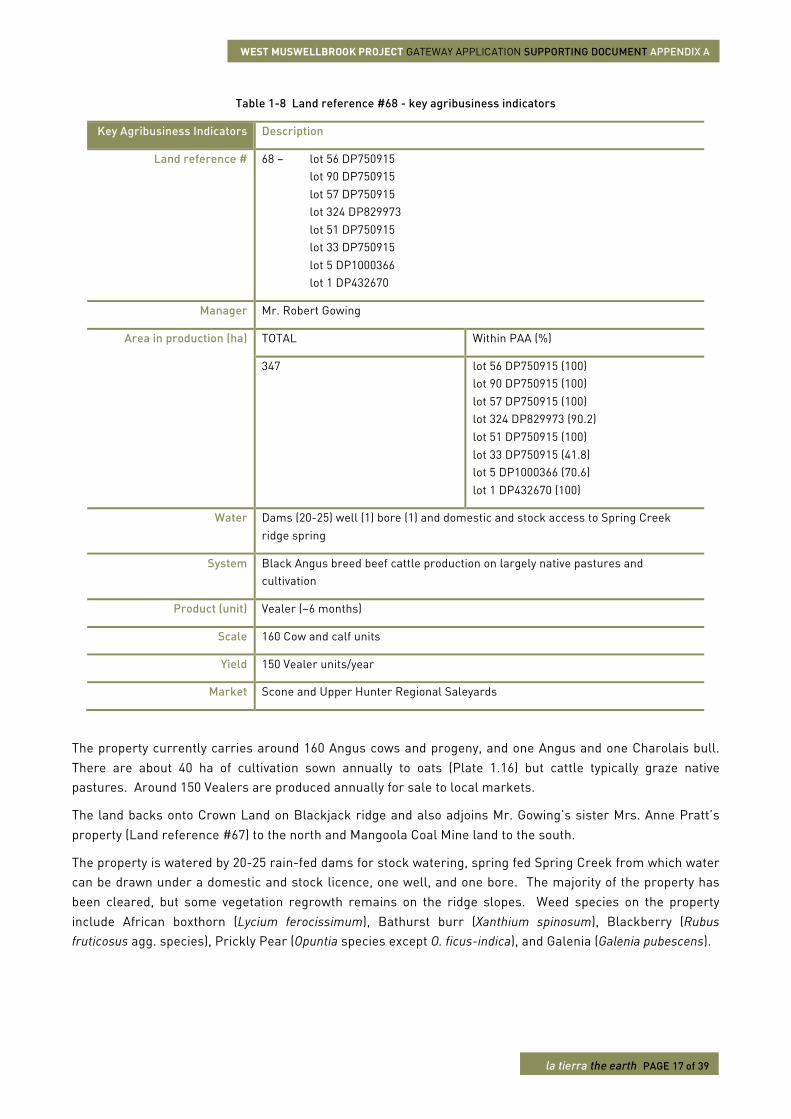
The property currently carries around 160 Angus cows and progeny, and one Angus and one Charolais bull. There are about 40 ha of cultivation sown annually to oats (Plate 1.16) but cattle typically graze native pastures. Around 150 Vealers are produced annually for sale to local markets.
The land backs onto Crown Land on Blackjack ridge and also adjoins Mr. Gowing’s sister Mrs. Anne Pratt’s property (Land reference #67) to the north and Mangoola Coal Mine land to the south.
The property is watered by 20-25 rain-fed dams for stock watering, spring fed Spring Creek from which water can be drawn under a domestic and stock licence, one well, and one bore. The majority of the property has been cleared, but some vegetation regrowth remains on the ridge slopes. Weed species on the property include African boxthorn (Lycium ferocissimum), Bathurst burr (Xanthium spinosum), Blackberry (Rubus fruticosus agg. species), Prickly Pear (Opuntia species except O. ficus-indica), and Galenia (Galenia pubescens).
WEST MUSWELLBROOK PROJECT GATEWAY APPLICATION SUPPORTING DOCUMENT APPENDIX A
la tierra the earth PAGE 18 of 39
Plate 1.16 Forage oats
1.2.8. Land reference #62
This agricultural property and enterprise is Land reference #62. This property is located on Castle Rock Road and is owned and managed as a rural residential block by Mr. Anthony and Mrs. Patricia McManus. The farming system is an expanding hobby in horticulture. The key agribusiness indicators for this enterprise have been determined (Table 1.8).
Table 1-9 Land reference #62 - key agribusiness indicators
Key Agribusiness Indicators Description
Land reference # 62 – lot 31 DP748710
Manager Mr. Anthony and Mrs. Patricia McManus
Area in production (ha) TOTAL Within PAA (%)
40 lot 1 DP748710 (100)
Water Dam (1), Coal Creek domestic and stock access
System Small horticulture
Product (unit) Seedlings, plants
Scale NA
Yield NA
Market Denman Farmers’ Market
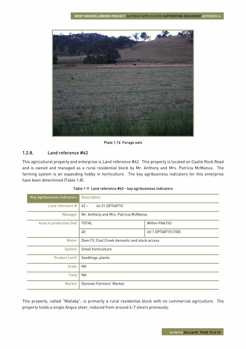
This property, called “Wallaby”, is primarily a rural residential block with no commercial agriculture. The property holds a single Angus steer, reduced from around 6-7 steers previously.
WEST MUSWELLBROOK PROJECT GATEWAY APPLICATION SUPPORTING DOCUMENT APPENDIX A
la tierra the earth PAGE 19 of 39
The property is watered by domestic and stock access to Coal Creek and one dam. There is one residence and associated sheds. An estimated 30% of the property is wooded ridge country (Plate 1.17). Weed species on the property include African boxthorn (Lycium ferocissimum) and Prickly Pear (Opuntia species except O. ficus-indica). Feral animals on the property include foxes, boars, and rabbits.
Plate 1.17 McManus native grass and wooded vegetation at the lower ridges of Castle Rock.
1.2.9. Land reference #41
This property is owned managed by Mrs. Ronda Mitchell and is accessed via Castle Rock Road. The farming system is beef cattle breeding for Vealer production. The key agribusiness indicators for this enterprise have been determined (Table 1.10).
Table 1-10 Land reference #41 - key agribusiness indicators
Key Agribusiness Indicators Description
Land reference # 41 – lot 140 DP750915 lot 1 DP715310
Manager Mrs. Ronda Mitchell
Area in production (ha) TOTAL Within PAA (%)
188 lot 140 DP750915 (>1) lot 1 DP715310 (36.2)
Water Dams (3), billabong (1), ridge springs, Coal Creek domestic and stock access
System Hereford breed beef production on native pastures
Product (unit) Vealer (weight not estimated) at around 9-10 months of age
Scale 30 Cow and calf units
Yield 15 Vealer units/year
WEST MUSWELLBROOK PROJECT GATEWAY APPLICATION SUPPORTING DOCUMENT APPENDIX A
la tierra the earth PAGE 20 of 39
Key Agribusiness Indicators Description
Market Scone and Upper Hunter Regional Saleyards
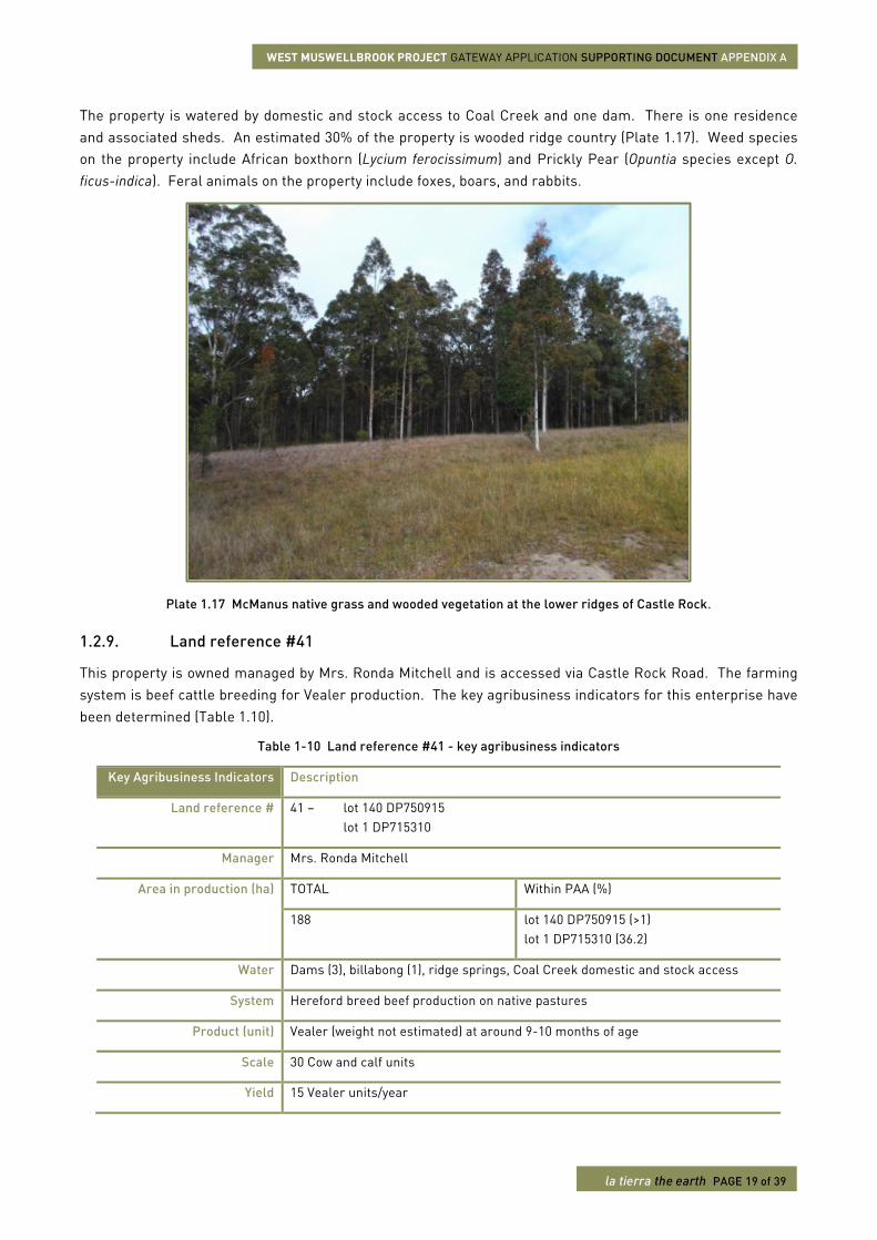
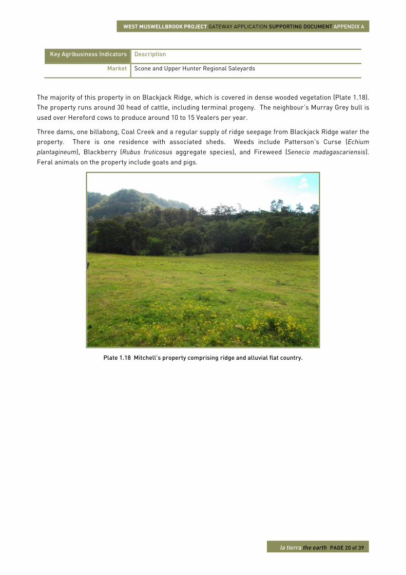
The majority of this property in on Blackjack Ridge, which is covered in dense wooded vegetation (Plate 1.18). The property runs around 30 head of cattle, including terminal progeny. The neighbour’s Murray Grey bull is used over Hereford cows to produce around 10 to 15 Vealers per year.
Three dams, one billabong, Coal Creek and a regular supply of ridge seepage from Blackjack Ridge water the property. There is one residence with associated sheds. Weeds include Patterson’s Curse (Echium plantagineum), Blackberry (Rubus fruticosus aggregate species), and Fireweed (Senecio madagascariensis). Feral animals on the property include goats and pigs.
Plate 1.18 Mitchell’s property comprising ridge and alluvial flat country.
WEST MUSWELLBROOK PROJECT GATEWAY APPLICATION SUPPORTING DOCUMENT APPENDIX A
la tierra the earth PAGE 21 of 39
1.2.10. Land reference #11
The property is owned managed by Mr. and Mrs. Michael Lumby and accessed via Castle Rock Road. The farming system is beef cattle and meat sheep production. The key agribusiness indicators for this enterprise have been determined (Table 1.11).
Table 1-11 Land reference #11 - key agribusiness indicators
Key Agribusiness Indicators Description
Land reference # 11 – lot 15 DP830934
Manager Mr. and Mrs. Michael Lumby
Area in production (ha) TOTAL Within PAA (%)
50 lot 15 DP830934 (7.2)
Water Ridge springs
System Charolais x Brahman cross breeds beef production on native pastures Damara x Dorper cross breeds fat lamb production
Product (unit) Weaner (weight not estimated) at around 9-10 months of age Fat lambs (weight and age not estimated)
Scale 100 Cow and calf units 32 Ewe and lamb units
Yield 15 Weaner units/year 50 Fat lambs/year
Market Scone and Upper Hunter Regional Saleyards Denman Saleyards
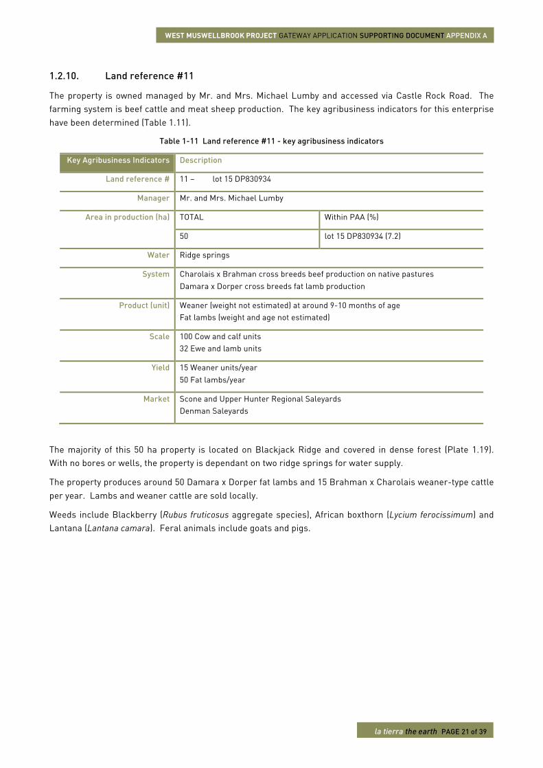
The majority of this 50 ha property is located on Blackjack Ridge and covered in dense forest (Plate 1.19). With no bores or wells, the property is dependant on two ridge springs for water supply.
The property produces around 50 Damara x Dorper fat lambs and 15 Brahman x Charolais weaner-type cattle per year. Lambs and weaner cattle are sold locally.
Weeds include Blackberry (Rubus fruticosus aggregate species), African boxthorn (Lycium ferocissimum) and Lantana (Lantana camara). Feral animals include goats and pigs.
WEST MUSWELLBROOK PROJECT GATEWAY APPLICATION SUPPORTING DOCUMENT APPENDIX A
la tierra the earth PAGE 22 of 39
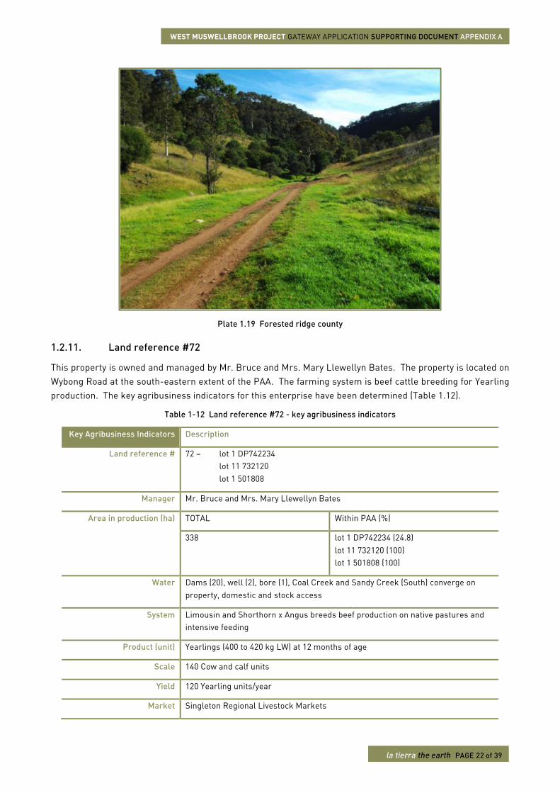
Plate 1.19 Forested ridge county
1.2.11. Land reference #72
This property is owned and managed by Mr. Bruce and Mrs. Mary Llewellyn Bates. The property is located on Wybong Road at the south-eastern extent of the PAA. The farming system is beef cattle breeding for Yearling production. The key agribusiness indicators for this enterprise have been determined (Table 1.12).
Table 1-12 Land reference #72 - key agribusiness indicators
Key Agribusiness Indicators Description
Land reference # 72 – lot 1 DP742234 lot 11 732120 lot 1 501808
Manager Mr. Bruce and Mrs. Mary Llewellyn Bates
Area in production (ha) TOTAL Within PAA (%)
338 lot 1 DP742234 (24.8) lot 11 732120 (100) lot 1 501808 (100)
Water Dams (20), well (2), bore (1), Coal Creek and Sandy Creek (South) converge on property, domestic and stock access
System Limousin and Shorthorn x Angus breeds beef production on native pastures and intensive feeding
Product (unit) Yearlings (400 to 420 kg LW) at 12 months of age
Scale 140 Cow and calf units
Yield 120 Yearling units/year
Market Singleton Regional Livestock Markets
WEST MUSWELLBROOK PROJECT GATEWAY APPLICATION SUPPORTING DOCUMENT APPENDIX A
la tierra the earth PAGE 23 of 39
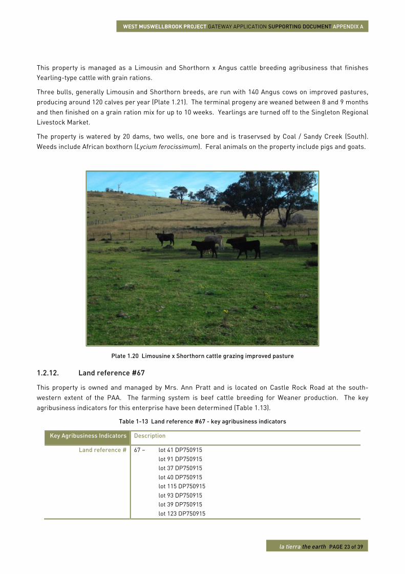
This property is managed as a Limousin and Shorthorn x Angus cattle breeding agribusiness that finishes Yearling-type cattle with grain rations.
Three bulls, generally Limousin and Shorthorn breeds, are run with 140 Angus cows on improved pastures, producing around 120 calves per year (Plate 1.21). The terminal progeny are weaned between 8 and 9 months and then finished on a grain ration mix for up to 10 weeks. Yearlings are turned off to the Singleton Regional Livestock Market.
The property is watered by 20 dams, two wells, one bore and is traservsed by Coal / Sandy Creek (South). Weeds include African boxthorn (Lycium ferocissimum). Feral animals on the property include pigs and goats.
Plate 1.20 Limousine x Shorthorn cattle grazing improved pasture
1.2.12. Land reference #67
This property is owned and managed by Mrs. Ann Pratt and is located on Castle Rock Road at the south-western extent of the PAA. The farming system is beef cattle breeding for Weaner production. The key agribusiness indicators for this enterprise have been determined (Table 1.13).
Table 1-13 Land reference #67 - key agribusiness indicators
Key Agribusiness Indicators Description
Land reference # 67 – lot 41 DP750915 lot 91 DP750915 lot 37 DP750915 lot 40 DP750915 lot 115 DP750915 lot 93 DP750915 lot 39 DP750915 lot 123 DP750915
WEST MUSWELLBROOK PROJECT GATEWAY APPLICATION SUPPORTING DOCUMENT APPENDIX A
la tierra the earth PAGE 24 of 39
Key Agribusiness Indicators Description
lot 42 DP750915 lot 142 DP750915
Manager Mrs. Ann Pratt
Area in production (ha) TOTAL Within PAA (%)
338 lot 41 DP750915 (41.5) lot 91 DP750915 (100) lot 37 DP750915 (38.1) lot 40 DP750915 (33.9) lot 115 DP750915 (100) lot 93 DP750915 (100) lot 39 DP750915 (42.3) lot 123 DP750915 (100) lot 42 DP750915 (100) lot 142 DP750915 (100)
Water Dam (10), Well (2), Coal Creek domestic and stock access with a constant spring supply
System Lowline stud and first cross Charolais/Angus or Charbray x Lowline beef production on native pastures and intensive feeding
Product (unit) Stud bulls, or bull cow and calf units Weaners (180 to 200 kg LW) at 9 months of age
Scale 80 Cow and calf units
Yield 60 Weaner units/year
Market Stud – Central Coast, Singleton Beef cattle – Scone and Upper Hunter Regional Saleyards
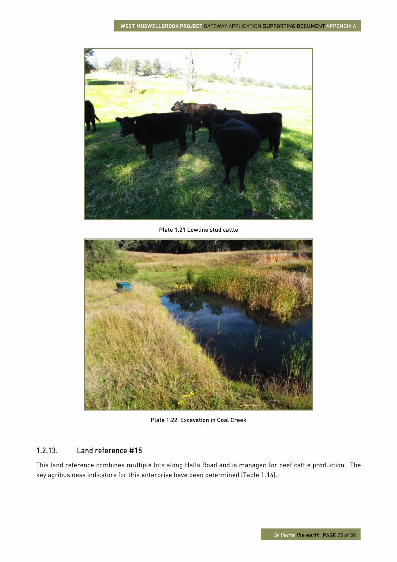
This 173 ha property mainly produces Lowline crossbred commercial cattle with limited production of Lowline stud cattle (Plate 1.21). Either a Charolais x Angus or Charbray bull is run with 80 Lowline cows to produce terminal progeny. Vealers at 8 to 9 months are sold through local markets. Much smaller quantities of stud Lowline cattle are sold to hobbyists throughout the broader region.
Held by the same family for many years, the property was operated as one of Australia’s early Charolais studs from 1945. Over this period some land was cultivated for lucerne, wheat and sorghum, but this has been discontinued. The current managers also lease 40 ha form neighbour Mr. Hylton Wright (Land reference #63).
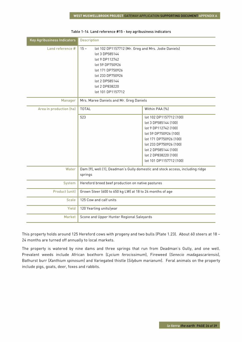
The property is watered by 10 dams, two wells and Coal Creek, in which holes have been excavated to provide reliable water. Prevalent weeds include Fireweed (Senecio madagascariensis), African boxthorn (Lycium ferocissimum), and Prickly Pear (Opuntia species except O. ficus-indica).
WEST MUSWELLBROOK PROJECT GATEWAY APPLICATION SUPPORTING DOCUMENT APPENDIX A
la tierra the earth PAGE 25 of 39
Plate 1.21 Lowline stud cattle
Plate 1.22 Excavation in Coal Creek
1.2.13. Land reference #15
This land reference combines multiple lots along Halls Road and is managed for beef cattle production. The key agribusiness indicators for this enterprise have been determined (Table 1.14).
WEST MUSWELLBROOK PROJECT GATEWAY APPLICATION SUPPORTING DOCUMENT APPENDIX A
la tierra the earth PAGE 26 of 39
Table 1-14 Land reference #15 - key agribusiness indicators
Key Agribusiness Indicators Description
Land reference # 15 – lot 102 DP1157712 (Mr. Greg and Mrs. Jodie Daniels) lot 3 DP585144 lot 9 DP112742 lot 59 DP750926 lot 171 DP750926 lot 233 DP750926 lot 2 DP585144 lot 2 DP838220 lot 101 DP1157712
Manager Mrs. Maree Daniels and Mr. Greg Daniels
Area in production (ha) TOTAL Within PAA (%)
523 lot 102 DP1157712 (100) lot 3 DP585144 (100) lot 9 DP112742 (100) lot 59 DP750926 (100) lot 171 DP750926 (100) lot 233 DP750926 (100) lot 2 DP585144 (100) lot 2 DP838220 (100) lot 101 DP1157712 (100)
Water Dam (9), well (1), Deadman’s Gully domestic and stock access, including ridge springs
System Hereford breed beef production on native pastures
Product (unit) Grown Steer (600 to 650 kg LW) at 18 to 24 months of age
Scale 125 Cow and calf units
Yield 120 Yearling units/year
Market Scone and Upper Hunter Regional Saleyards
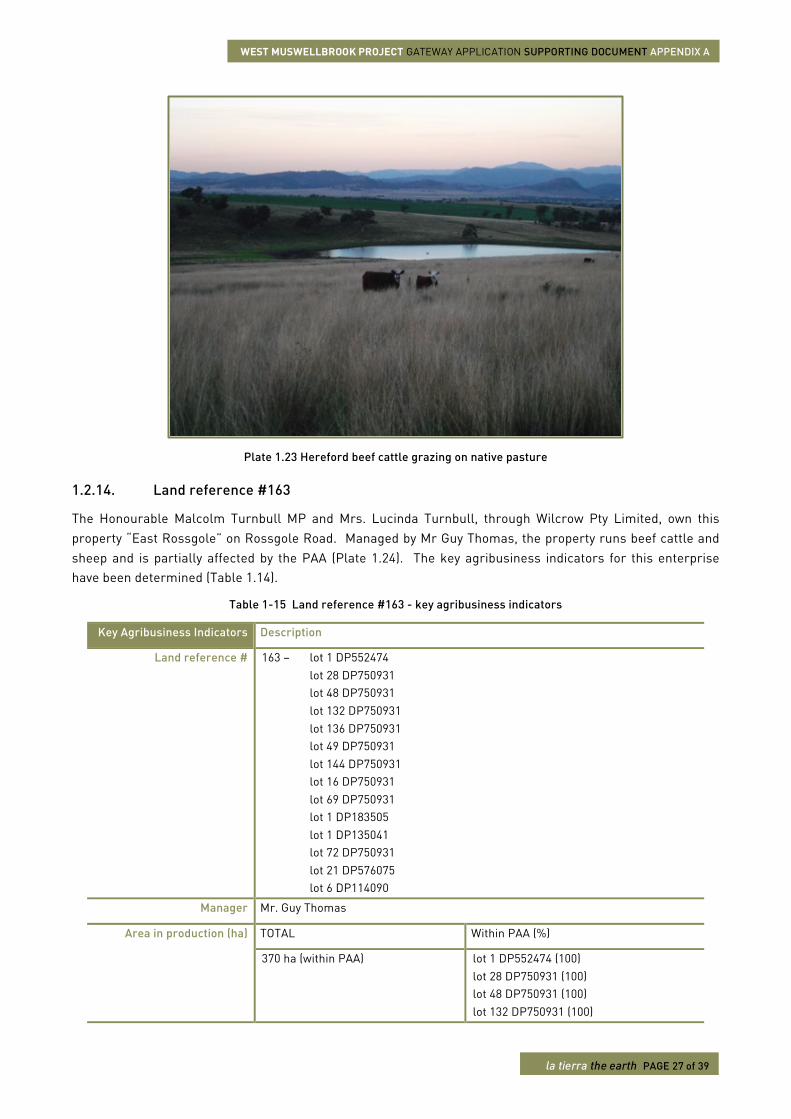
This property holds around 125 Hereford cows with progeny and two bulls (Plate 1.23). About 60 steers at 18 – 24 months are turned off annually to local markets.
The property is watered by nine dams and three springs that run from Deadman’s Gully, and one well. Prevalent weeds include African boxthorn (Lycium ferocissimum), Fireweed (Senecio madagascariensis), Bathurst burr (Xanthium spinosum) and Variegated thistle (Silybum marianum). Feral animals on the property include pigs, goats, deer, foxes and rabbits.
WEST MUSWELLBROOK PROJECT GATEWAY APPLICATION SUPPORTING DOCUMENT APPENDIX A
la tierra the earth PAGE 27 of 39
Plate 1.23 Hereford beef cattle grazing on native pasture
1.2.14. Land reference #163
The Honourable Malcolm Turnbull MP and Mrs. Lucinda Turnbull, through Wilcrow Pty Limited, own this property “East Rossgole” on Rossgole Road. Managed by Mr Guy Thomas, the property runs beef cattle and sheep and is partially affected by the PAA (Plate 1.24). The key agribusiness indicators for this enterprise have been determined (Table 1.14).
Table 1-15 Land reference #163 - key agribusiness indicators
Key Agribusiness Indicators Description
Land reference # 163 – lot 1 DP552474 lot 28 DP750931 lot 48 DP750931 lot 132 DP750931 lot 136 DP750931 lot 49 DP750931 lot 144 DP750931 lot 16 DP750931 lot 69 DP750931 lot 1 DP183505 lot 1 DP135041 lot 72 DP750931 lot 21 DP576075 lot 6 DP114090
Manager Mr. Guy Thomas
Area in production (ha) TOTAL Within PAA (%)
370 ha (within PAA)
lot 1 DP552474 (100) lot 28 DP750931 (100) lot 48 DP750931 (100) lot 132 DP750931 (100)
WEST MUSWELLBROOK PROJECT GATEWAY APPLICATION SUPPORTING DOCUMENT APPENDIX A
la tierra the earth PAGE 28 of 39
Key Agribusiness Indicators Description
Part of a total property size of 1,101 ha, including land managed outside of PAA.
lot 136 DP750931 (100) lot 49 DP750931 (100) lot 144 DP750931 (99.9) lot 16 DP750931 (100) lot 69 DP750931 (100) lot 1 DP183505 (100) lot 1 DP135041 (100) lot 72 DP750931 (100) lot 21 DP576075 (2.2) lot 6 DP114090 (100)
Water Dams (15), shared bore (1), well (1) – 2 x 76,000 L reticulated tanks by spring fed by Deadman’s Gully and Coffin Gully ridge springs
System Hereford x Hereford Angus first cross, Santa Gertrudis x Black Baldy, Angus x Hereford first cross beef production on native pastures and cultivation Border Leister x Merino and Dorset over Border Leister x Merino first cross ewes store lamb production on native pastures and cultivation
Product (unit) Weaners (250 kg LW) at 7 to 9 months of age Store lambs (14 to 22 kg dressed weight)
Scale 250 Cow and calf units 500 Ewe and lamb units
Yield 240 Weaner units/year 480 Store lamb units/year
Market Weaner – Tamworth Regional Livestock Exchange Store lamb – Tamworth Regional Livestock Exchange, Woolworths
Mr. Thomas has managed the 1,000 ha East Rossgole for 22 years. Approximately 610 ha are cultivated and grazed while 500 ha is forested ridge country and not accessed by livestock. The property is managed in conjunction with another larger property at Scott’s Creek, Murrurrundi.
The aggregation produces around 240 steers at 7 to 9 months and 250 kg live weight plus 1000 store lambs per year. Beef genetics include Hereford, Angus and Santa Gertrudis, while store lambs are Border Leister, Merino and Dorset crosses. There are 70 ha of cultivation at East Rossgole, used to grow forage oats, wheat, triticale, rye and clovers.
There is a main homestead, a manager’s house and a gardener’s cottage. Three individuals are employed to assist in managing the agricultural enterprise. Additional infrastructure on the property includes hay and machinery sheds. The property has a reliable well from which water is reticulated to each paddock. In addition, there are 15 dams and ridge springs from both Deadman’s Gully and Coffin Gully. The property also shares a bore with Bragg (Land reference #9) that is connected to Deadman’s Gully.
Weeds on the property include Blackberry (Rubus fruticosus agg. species), and Scotch thistle (Onopordum spp). Feral animals on the property include wild dogs, pigs, foxes, goats and some deer.
WEST MUSWELLBROOK PROJECT GATEWAY APPLICATION SUPPORTING DOCUMENT APPENDIX A
la tierra the earth PAGE 29 of 39
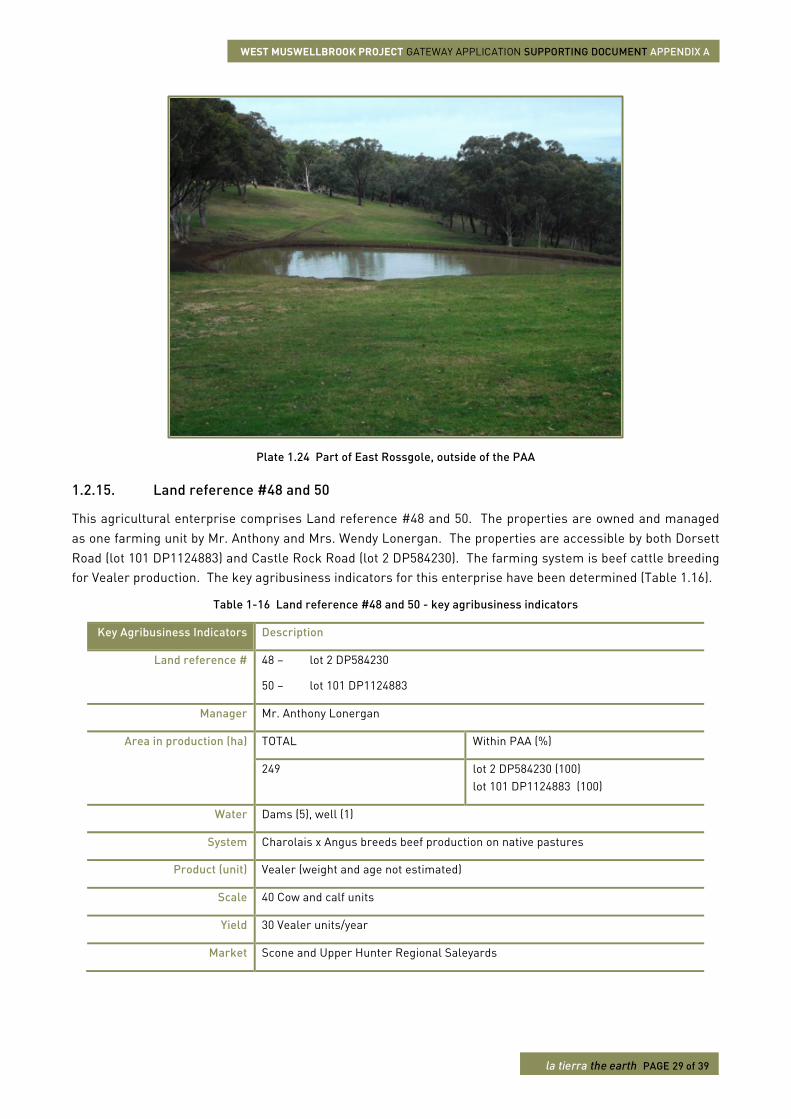
Plate 1.24 Part of East Rossgole, outside of the PAA
1.2.15. Land reference #48 and 50
This agricultural enterprise comprises Land reference #48 and 50. The properties are owned and managed as one farming unit by Mr. Anthony and Mrs. Wendy Lonergan. The properties are accessible by both Dorsett Road (lot 101 DP1124883) and Castle Rock Road (lot 2 DP584230). The farming system is beef cattle breeding for Vealer production. The key agribusiness indicators for this enterprise have been determined (Table 1.16).
Table 1-16 Land reference #48 and 50 - key agribusiness indicators
Key Agribusiness Indicators Description
Land reference # 48 – lot 2 DP584230
50 – lot 101 DP1124883
Manager Mr. Anthony Lonergan
Area in production (ha) TOTAL Within PAA (%)
249 lot 2 DP584230 (100) lot 101 DP1124883 (100)
Water Dams (5), well (1)
System Charolais x Angus breeds beef production on native pastures
Product (unit) Vealer (weight and age not estimated)
Scale 40 Cow and calf units
Yield 30 Vealer units/year
Market Scone and Upper Hunter Regional Saleyards
WEST MUSWELLBROOK PROJECT GATEWAY APPLICATION SUPPORTING DOCUMENT APPENDIX A
la tierra the earth PAGE 30 of 39
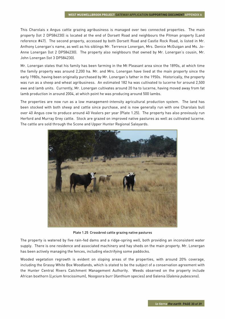
This Charolais x Angus cattle grazing agribusiness is managed over two connected properties. The main property (lot 2 DP584230) is located at the end of Dorsett Road and neighbours the Pitman property (Land reference #47). The second property, accessed by both Dorsett Road and Castle Rock Road, is listed in Mr. Anthony Lonergan’s name, as well as his siblings Mr. Terrence Lonergan, Mrs. Denice McGuigan and Ms. Jo-Anne Lonergan (lot 2 DP584230). The property also neighbours that owned by Mr. Lonergan’s cousin, Mr. John Lonergan (lot 3 DP584230).
Mr. Lonergan states that his family has been farming in the Mt Pleasant area since the 1890s, at which time the family property was around 2,200 ha. Mr. and Mrs. Lonergan have lived at the main property since the early 1980s, having been originally purchased by Mr. Lonergan’s father in the 1950s. Historically, the property was run as a sheep and wheat agribusiness. An estimated 182 ha was cultivated to lucerne for around 2,500 ewe and lamb units. Currently, Mr. Lonergan cultivates around 20 ha to lucerne, having moved away from fat lamb production in around 2004, at which point he was producing around 500 lambs.
The properties are now run as a low management-intensity agricultural production system. The land has been stocked with both sheep and cattle since purchase, and is now generally run with one Charolais bull over 40 Angus cow to produce around 40 Vealers per year (Plate 1.25). The property has also previously run Herford and Murray Grey cattle. Stock are grazed on improved native pastures as well as cultivated lucerne. The cattle are sold through the Scone and Upper Hunter Regional Saleyards.
Plate 1.25 Crossbred cattle grazing native pastures
The property is watered by five rain-fed dams and a ridge-spring well, both providing an inconsistent water supply. There is one residence and associated machinery and hay sheds on the main property. Mr. Lonergan has been actively managing the fences, including electrifying some paddocks.
Wooded vegetation regrowth is evident on sloping areas of the properties, with around 20% coverage, including the Grassy White Box Woodlands, which is stated to be the subject of a conservation agreement with the Hunter Central Rivers Catchment Management Authority. Weeds observed on the property include African boxthorn (Lycium ferocissimum), Noogoora burr (Xanthium species) and Galenia (Galenia pubescens).
WEST MUSWELLBROOK PROJECT GATEWAY APPLICATION SUPPORTING DOCUMENT APPENDIX A
la tierra the earth PAGE 31 of 39
1.2.16. Land reference #60
This agricultural enterprise is Land reference #60. This property is owned by Mr. Steven and Mrs. Mary Dever and is managed as a rural residential block, accessed via Castle Rock Road. The farming system is own-kill ewe and lamb production. The key agribusiness indicators for this enterprise have been determined (Table 1.17).
Table 1-17 Land reference #60 - key agribusiness indicators
Key Agribusiness Indicators Description
Land reference # 60 – lot 33 DP748710
Manager Mr. Steven and Mrs. Mary Dever
Area in production (ha) TOTAL Within PAA (%)
3.5 lot 33 DP748710 (100)
Water Well (1), rainwater tanks (3 x 20,000 L, 2 x 10,000 L)
System Mixed breed sheep production on native pastures
Product (unit) Self-supply
Scale 32 Ewe and lamb units
Yield 32 Fat lamb units/year
Market Self-supply
The Dever’s purchased this rural residential block some 12 years ago. They moved to the property around two years after purchase and now live with their two grandchildren. The property is a subdivided lot from the previous “Mirrabooka” deer and goat abattoir.
There is no commercial agribusiness at the property. The property produces around 32 ewe and lamb units as killers for self-supply. The family also keep two killer Steers and other farm animals. There is one residence on the property and one historical cottage. The land is professionally fenced and is watered by one well, as well as three 20,000 L and two 10,000 L rainwater tanks.
1.2.17. Land reference #181
This agricultural enterprise comprises Land reference #181. The property is owned by Mr. Bruce Day and managed by his brother Mr. Ross Day. The property is located on Rossgole Road. The farming system is beef cattle breeding for Weaner production. The key agribusiness indicators for this enterprise have been determined (Table 1.18).
Table 1-18 Land reference #181 - key agribusiness indicators
Key Agribusiness Indicators Description
Land reference # 181 – lot 1 DP416437
Manager Mr. Ross Day
Area in production (ha) TOTAL Within PAA (%)
156 lot 1 DP416437 (100)
WEST MUSWELLBROOK PROJECT GATEWAY APPLICATION SUPPORTING DOCUMENT APPENDIX A
la tierra the earth PAGE 32 of 39
Key Agribusiness Indicators Description
Water Dams (6), bore under windmill (1)
System Black Angus breed beef production on native pastures
Product (unit) Weaner (weight and age not known at interview)
Scale 55 Cows and calf
Yield 50 Weaner units/year
Market Scone and Upper Hunter Regional Saleyards
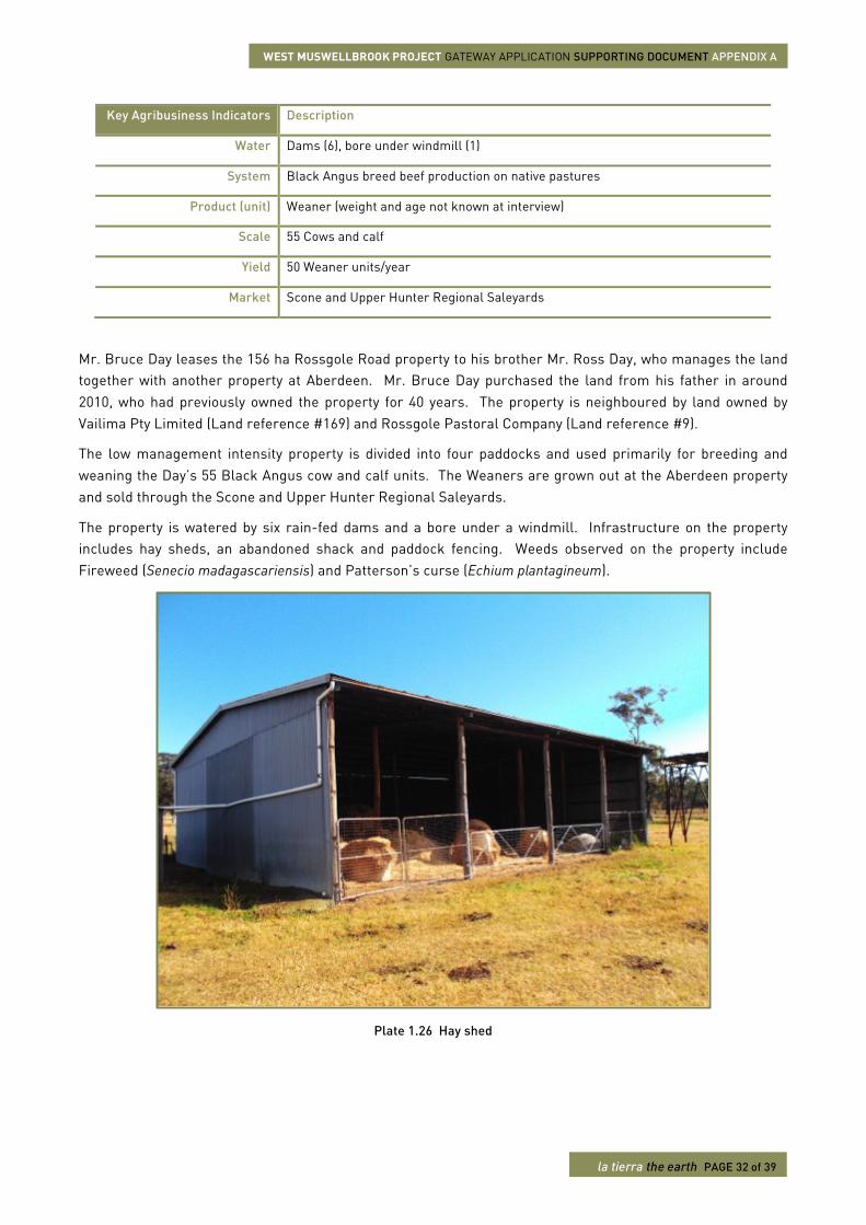
Mr. Bruce Day leases the 156 ha Rossgole Road property to his brother Mr. Ross Day, who manages the land together with another property at Aberdeen. Mr. Bruce Day purchased the land from his father in around 2010, who had previously owned the property for 40 years. The property is neighboured by land owned by Vailima Pty Limited (Land reference #169) and Rossgole Pastoral Company (Land reference #9).
The low management intensity property is divided into four paddocks and used primarily for breeding and weaning the Day’s 55 Black Angus cow and calf units. The Weaners are grown out at the Aberdeen property and sold through the Scone and Upper Hunter Regional Saleyards.
The property is watered by six rain-fed dams and a bore under a windmill. Infrastructure on the property includes hay sheds, an abandoned shack and paddock fencing. Weeds observed on the property include Fireweed (Senecio madagascariensis) and Patterson’s curse (Echium plantagineum).
Plate 1.26 Hay shed
WEST MUSWELLBROOK PROJECT GATEWAY APPLICATION SUPPORTING DOCUMENT APPENDIX A
la tierra the earth PAGE 33 of 39
1.2.18. Land reference #68
This agricultural enterprise is Land reference #68. The property is located on Castle Rock Road and is owned and managed by Mr. Graeme Sparre. The farming system and enterprise is beef cattle breeding for Vealer production. The key agribusiness indicators for this enterprise have been determined (Table 1.19).
Table 1-19 Land reference #68 - key agribusiness indicators
Key Agribusiness Indicators Description
Land reference # 68 – lot 63 DP750926 lot 5 DP750926 lot 62 DP750926 lot 61 DP750926 lot 1 DP136249 lot 2 DP136249 lot 4 DP21335 lot 1 DP1102585 lot 2 DP1102585
Manager Mr. Graeme Sparre
Area in production (ha) TOTAL Within PAA (%)
551 lot 63 DP750926 (100) lot 5 DP750926 (100) lot 62 DP750926 (100) lot 61 DP750926 (100) lot 1 DP136249 (88.9) lot 2 DP136249 (99.3) lot 4 DP21335 (100) lot 1 DP1102585 (100) lot 2 DP1102585 (100)
Water Dam (20), well with windmill (1), bore with windmill (2) and Sandy Creek (South) domestic and stock access, associated springs
System Black Angus breed beef cattle production on native pastures
Product (unit) Vealer (~6 months)
Scale 150 Cow and calf units
Yield 140 Vealer units/year
Market McCallum Inglis Stock and Station Agent, Aberdeen.
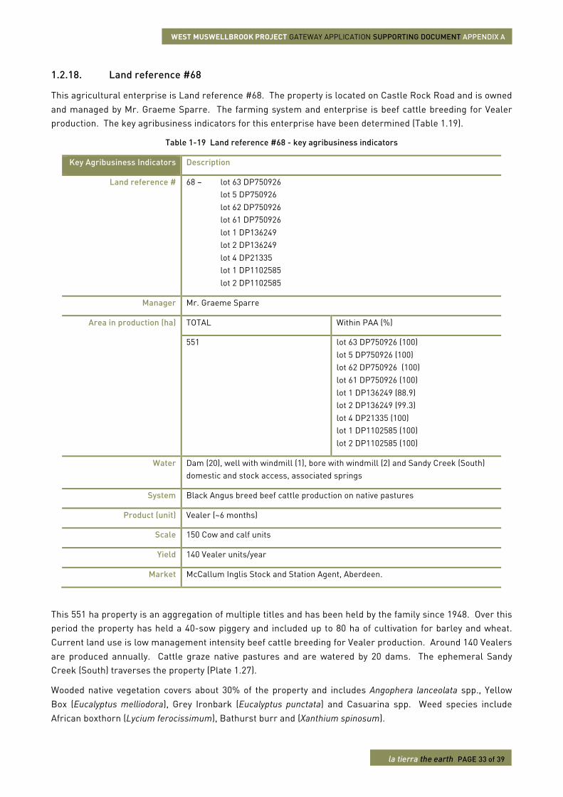
This 551 ha property is an aggregation of multiple titles and has been held by the family since 1948. Over this period the property has held a 40-sow piggery and included up to 80 ha of cultivation for barley and wheat. Current land use is low management intensity beef cattle breeding for Vealer production. Around 140 Vealers are produced annually. Cattle graze native pastures and are watered by 20 dams. The ephemeral Sandy Creek (South) traverses the property (Plate 1.27).
Wooded native vegetation covers about 30% of the property and includes Angophera lanceolata spp., Yellow Box (Eucalyptus melliodora), Grey Ironbark (Eucalyptus punctata) and Casuarina spp. Weed species include African boxthorn (Lycium ferocissimum), Bathurst burr and (Xanthium spinosum).
WEST MUSWELLBROOK PROJECT GATEWAY APPLICATION SUPPORTING DOCUMENT APPENDIX A
la tierra the earth PAGE 34 of 39
Plate 1.27 Sandy Creek (South), riparian vegetation and farm sheds
1.2.19. Land reference #63
This agricultural enterprise is Land reference #63. The property is located on Castle Rock Road and is owned and managed by Mr. Hylton Wright. This is an olive orchard and the key agribusiness indicators for this enterprise have been determined (Table 1.20).
Table 1-20 Land reference #63 - key agribusiness indicators
Key Agribusiness Indicators Description
Land reference # 63 – lot 3 DP836268
Manager Mr. Hylton Wright
Area in production (ha) TOTAL Within PAA (%)
50 lot 63 DP836268
Water Dams (3)
System Olives (Manzanilla)
Product (unit) Table olives, olive oil
Scale 1,400 trees over 4 ha
Yield Not estimated
Market Self-supply, family and local market
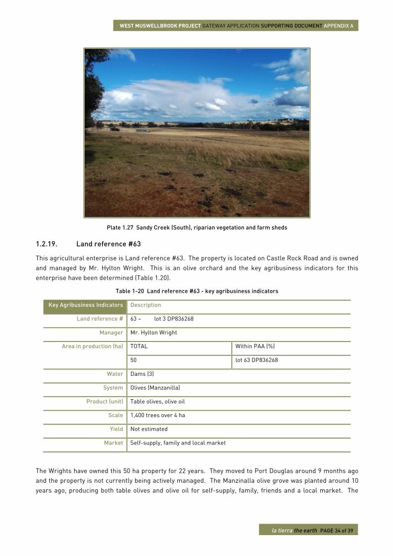
The Wrights have owned this 50 ha property for 22 years. They moved to Port Douglas around 9 months ago and the property is not currently being actively managed. The Manzinalla olive grove was planted around 10 years ago, producing both table olives and olive oil for self-supply, family, friends and a local market. The
WEST MUSWELLBROOK PROJECT GATEWAY APPLICATION SUPPORTING DOCUMENT APPENDIX A
la tierra the earth PAGE 35 of 39
olive grove comprises 1,400 trees over 4 ha and is harvested by hand (Plate 1.28). The property is watered by three dams.
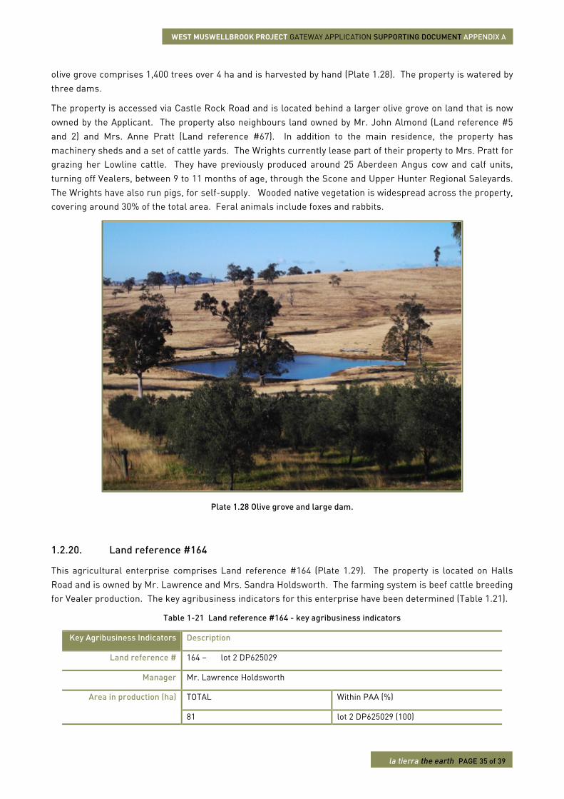
The property is accessed via Castle Rock Road and is located behind a larger olive grove on land that is now owned by the Applicant. The property also neighbours land owned by Mr. John Almond (Land reference #5 and 2) and Mrs. Anne Pratt (Land reference #67). In addition to the main residence, the property has machinery sheds and a set of cattle yards. The Wrights currently lease part of their property to Mrs. Pratt for grazing her Lowline cattle. They have previously produced around 25 Aberdeen Angus cow and calf units, turning off Vealers, between 9 to 11 months of age, through the Scone and Upper Hunter Regional Saleyards. The Wrights have also run pigs, for self-supply. Wooded native vegetation is widespread across the property, covering around 30% of the total area. Feral animals include foxes and rabbits.
Plate 1.28 Olive grove and large dam.
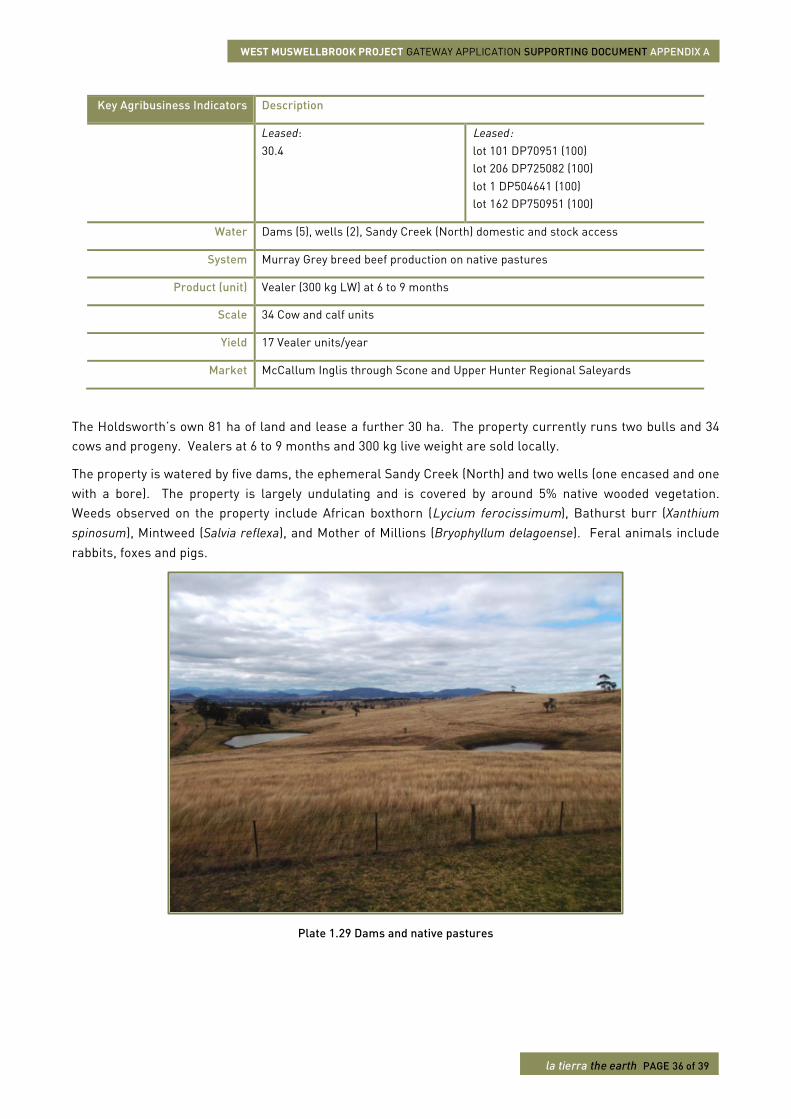
1.2.20. Land reference #164
This agricultural enterprise comprises Land reference #164 (Plate 1.29). The property is located on Halls Road and is owned by Mr. Lawrence and Mrs. Sandra Holdsworth. The farming system is beef cattle breeding for Vealer production. The key agribusiness indicators for this enterprise have been determined (Table 1.21).
Table 1-21 Land reference #164 - key agribusiness indicators
Key Agribusiness Indicators Description
Land reference # 164 – lot 2 DP625029
Manager Mr. Lawrence Holdsworth
Area in production (ha) TOTAL Within PAA (%)
81 lot 2 DP625029 (100)
WEST MUSWELLBROOK PROJECT GATEWAY APPLICATION SUPPORTING DOCUMENT APPENDIX A
la tierra the earth PAGE 36 of 39
Key Agribusiness Indicators Description
Leased: 30.4
Leased: lot 101 DP70951 (100) lot 206 DP725082 (100) lot 1 DP504641 (100) lot 162 DP750951 (100)
Water Dams (5), wells (2), Sandy Creek (North) domestic and stock access
System Murray Grey breed beef production on native pastures
Product (unit) Vealer (300 kg LW) at 6 to 9 months
Scale 34 Cow and calf units
Yield 17 Vealer units/year
Market McCallum Inglis through Scone and Upper Hunter Regional Saleyards
The Holdsworth’s own 81 ha of land and lease a further 30 ha. The property currently runs two bulls and 34 cows and progeny. Vealers at 6 to 9 months and 300 kg live weight are sold locally.
The property is watered by five dams, the ephemeral Sandy Creek (North) and two wells (one encased and one with a bore). The property is largely undulating and is covered by around 5% native wooded vegetation. Weeds observed on the property include African boxthorn (Lycium ferocissimum), Bathurst burr (Xanthium spinosum), Mintweed (Salvia reflexa), and Mother of Millions (Bryophyllum delagoense). Feral animals include rabbits, foxes and pigs.
Plate 1.29 Dams and native pastures
WEST MUSWELLBROOK PROJECT GATEWAY APPLICATION SUPPORTING DOCUMENT APPENDIX A
la tierra the earth PAGE 37 of 39
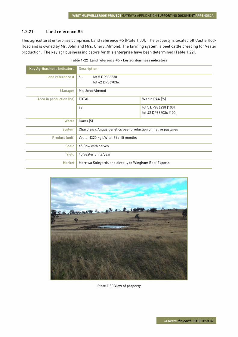
1.2.21. Land reference #5
This agricultural enterprise comprises Land reference #5 (Plate 1.30). The property is located off Castle Rock Road and is owned by Mr. John and Mrs. Cheryl Almond. The farming system is beef cattle breeding for Vealer production. The key agribusiness indicators for this enterprise have been determined (Table 1.22).
Table 1-22 Land reference #5 - key agribusiness indicators
Key Agribusiness Indicators Description
Land reference # 5 – lot 5 DP836238 lot 42 DP867036
Manager Mr. John Almond
Area in production (ha) TOTAL Within PAA (%)
98 lot 5 DP836238 (100) lot 42 DP867036 (100)
Water Dams (5)
System Charolais x Angus genetics beef production on native pastures
Product (unit) Vealer (320 kg LW) at 9 to 10 months
Scale 45 Cow with calves
Yield 40 Vealer units/year
Market Merriwa Saleyards and directly to Wingham Beef Exports
Plate 1.30 View of property
WEST MUSWELLBROOK PROJECT GATEWAY APPLICATION SUPPORTING DOCUMENT APPENDIX A
la tierra the earth PAGE 38 of 39
This agribusiness produces Charolais x or Brahman x Angus Vealer-type cattle. Currently, Charolais and Brahman bulls service 45 Angus cows to produce crossbred Vealers for sale at 9 to 10 months and 320 kg live weight. Terminal progeny are sold through Merriwa Saleyards or directly to Wingham Beef Exports.
The property is watered by five dams and has minimal infrastructure, i.e. cattle yards and fencing. Land is largely cleared and has been previously over-sown with improved pasture species. Weeds observed include African boxthorn (Lycium ferocissimum) and Bathurst burr (Xanthium spinosum).
1.2.22. Land reference #171
This agricultural enterprise comprises Land reference #171. The property is located off Castle Rock Road and is owned by Mr. and Mrs. Darryl Caddey and Mr. Phillip Caddey. The farming system is beef cattle breeding and fat lamb production. The key agribusiness indicators for this enterprise have been determined by phone interview (Table 1.23).
Table 1-23 Land reference #171 - key agribusiness indicators
Key Agribusiness Indicators Description
Land reference # 171 – lot 178 DP750951
Manager Mr. Darryl Caddey and Mr. Phillip Caddey
Area in production (ha) TOTAL Within PAA (%)
148 Leased: 17
lot 178 DP750951 (100) Leased: lot 205 DP722407 (100)
Water Dams (2), bore (1), well (1), Sandy Creek (North) irrigation licence and domestic and stock access
System Angus x Murray Grey breeds beef cattle production on native pasture and cultivation Dorper x Suffock breeds fat lamb production on native pasture and cultivation
Product (unit) Weaner (300 kg LW) at 9 to 10 months Fat lambs (weight not estimated)
Scale 60 Cow with calf units 40 Ewe and lamb units
Yield 40 Weaner units/year 40 Fat lambs/year
Market Scone and Upper Hunter Regional Saleyards
This 148 ha property on Halls Road has been in the same family since 1920. The Caddey brothers have been managing the property since 1980. The family also leases an additional 17 ha from the State of NSW. Of the three residences on the property, the oldest was built by Mr. Caddey’s father in 1946. Mr. Caddey’s daughter and son-in-law also live on the property. The family own and operate a seasonal dog boarding kennel business on the property.
The agricultural systems include breeding of Angus x Murray Grey Weaner-type cattle on improved native pastures and cultivation. The property currently holds around 60 cow and calf units, turning off around 40 Weaners per year at around 300 kg LW to the Scone and Upper Hunter Regional Saleyards. The Weaners are
WEST MUSWELLBROOK PROJECT GATEWAY APPLICATION SUPPORTING DOCUMENT APPENDIX A
la tierra the earth PAGE 39 of 39
fed out on a combination of native pasture and cultivated lucerne and oats, occasionally including wheat in the rotation. About 70% of the farm is currently cultivated and has been since 1920. The property also produces around 40 Dorper x Suffolk fat lambs each year. About 40 ewes and lambs are currently held at the property, following the same feed pattern as the cattle. The fat lambs are also sold through Scone.
In addition to an irrigation licence, the property is watered by two dams, one bore and one well. The property has domestic and stock access to Sandy Creek (North), which has a regular flow. Deadman’s Gully also traverses the property before converging with Sandy Creek (North). Around 10% of the land is covered in native wooded vegetation, including Ironbark (Eucalyptus raveretiana), Whitebox (Eucalyptus albens) and Casurina spp.
Other infrastructure on the property includes hay and machinery sheds, a set of cattle yards and a 76-dog kennel. Weeds observed include African boxthorn (Lycium ferocissimum) and Prickly pear (Opuntia species except O. ficus-indica). Feral animals include foxes, pigs and rabbits.