Embed Size (px)
Citation preview

Westward Expansion
Maps from 1775-1900
Sources:
http://www.lib.utexas.edu/maps/historical
http://www.aps-pub.com/lewisclarkmap.htm
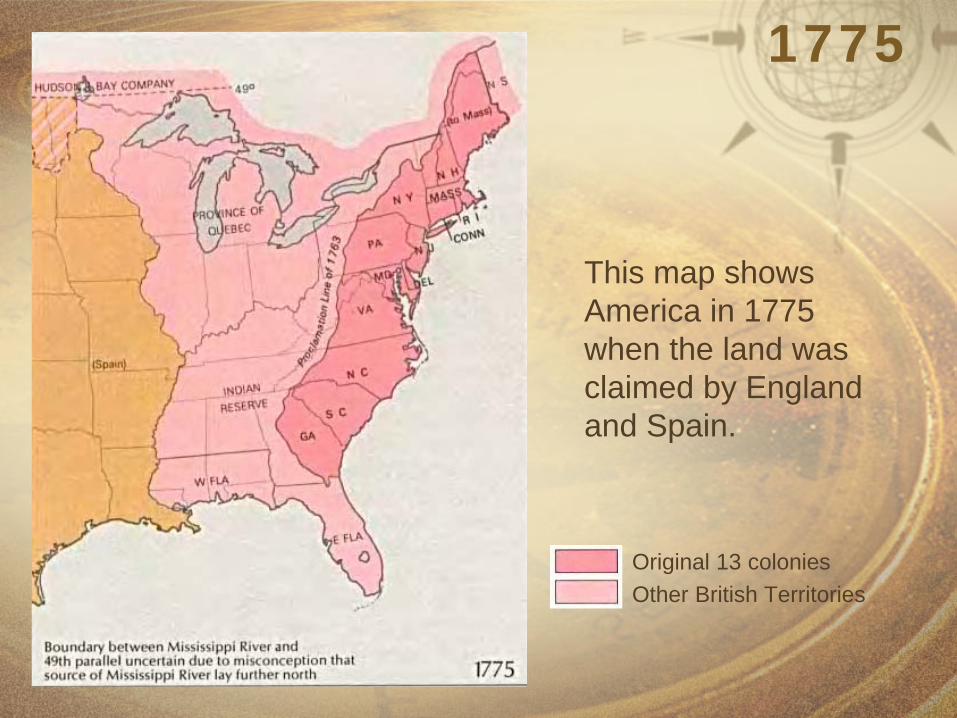
1775
Original 13 coloniesOther British Territories
This map shows America in 1775 when the land was claimed by England and Spain.

1783-1803
This historic map shows the states and territories claimed by the United States after its independence from England.
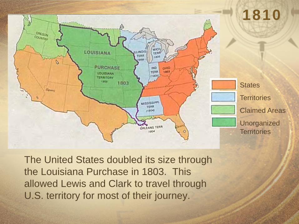
1810
The United States doubled its size through the Louisiana Purchase in 1803. This allowed Lewis and Clark to travel through U.S. territory for most of their journey.
States
Territories
Claimed Areas
Unorganized Territories
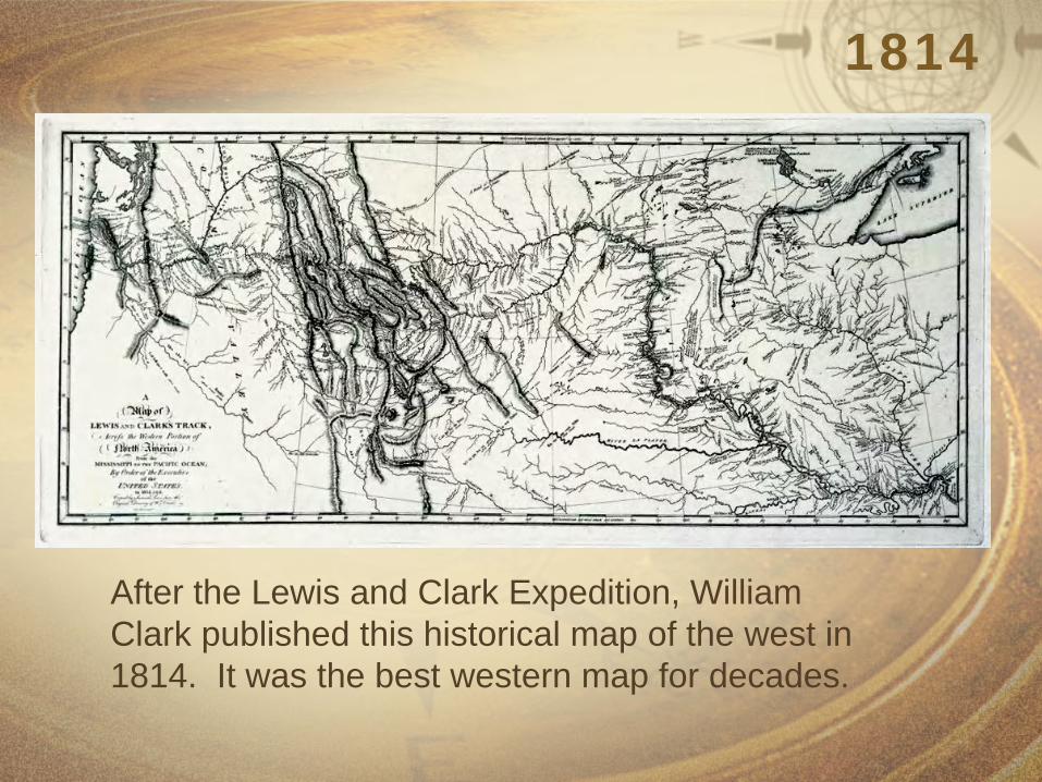
1814
After the Lewis and Clark Expedition, William Clark published this historical map of the west in 1814. It was the best western map for decades.

1850
By 1850, the United States had also added land in the southwest once belonging to Spain and Mexico.
States
Territories
Unorganized Territories

Oregon Trail
This historic map of the Oregon Trail was made in 1907. The Oregon Trail was used by emigrants moving west between 1843 and 1869.
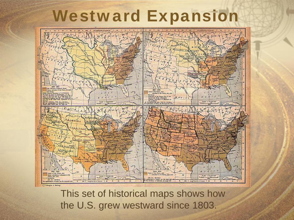
Westward Expansion
This set of historical maps shows how the U.S. grew westward since 1803.

Moving West
Click once to start an animated sequence of the U.S. Westward Movement.