Embed Size (px)
Citation preview
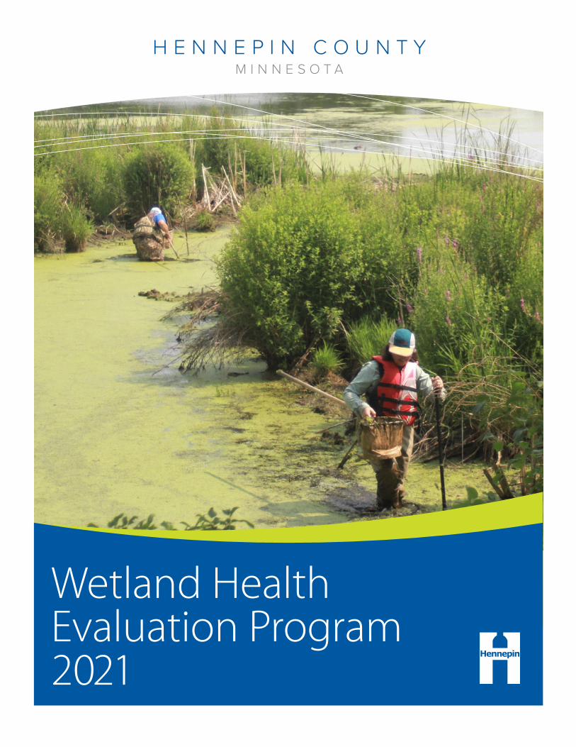
Wetland Health Evaluation Program 2021

The Wetland Health Evaluation Program (WHEP) is a citizen volunteer wetland monitoring program that is focused on educating the public on wetland ecology and quality issues; as well as providing local governments with wetland planning information.
WHEP is currently active in Dakota and Hennepin counties, with several cities sponsoring local monitoring teams.
The MPCA was instrumental in developing the WHEP sampling invertebrate and Citizen Plant Wetland Assessment Guide, which were adapted from the depressional wetland Indicies of Biological Integrity (IBI).
WHEP is coordinated in Hennepin County by staff in Environment and Energy.
Dipnetting at Diamond Lake
For more information please contact: Mary Karius Hennepin County Environment and Energy 612-596-9129 [email protected]
hennepin.us/your-government/get-involved/wetland-health-evaluation-program
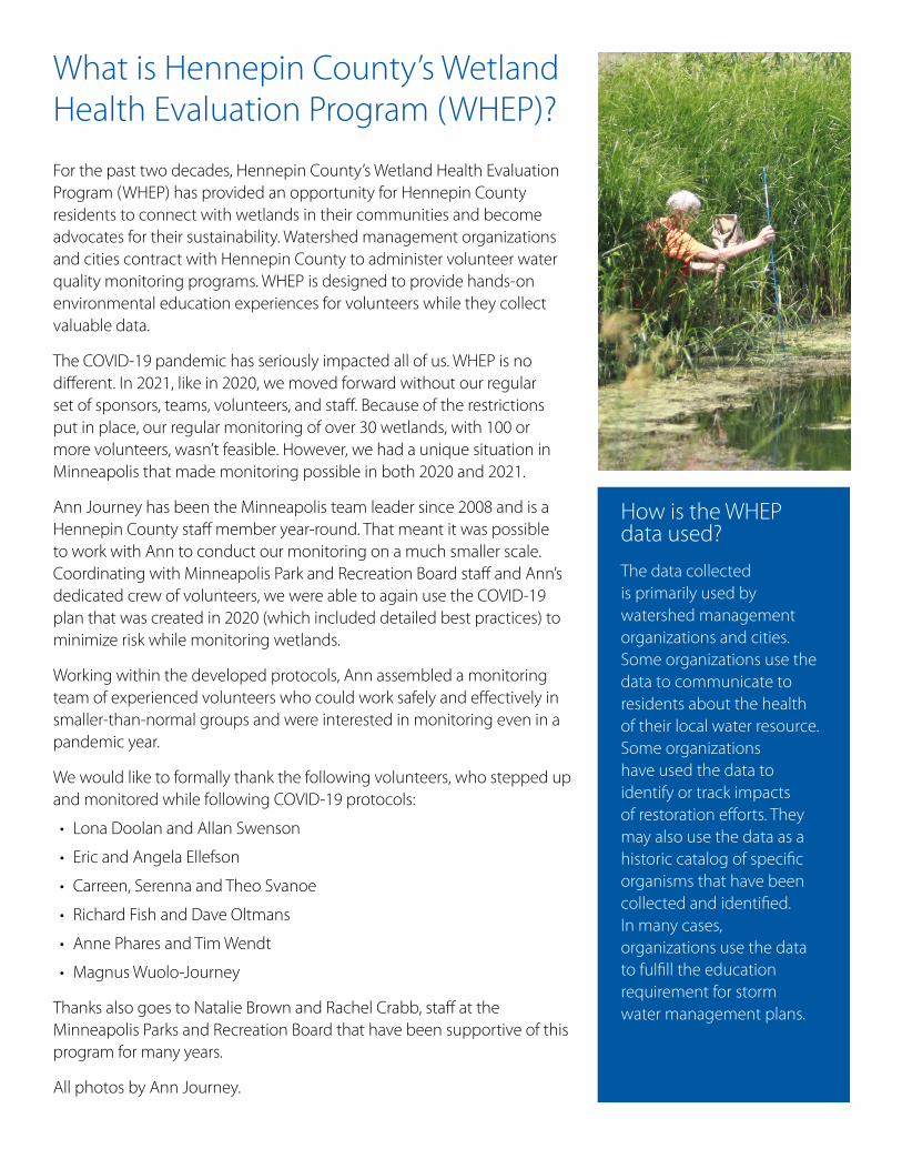
What is Hennepin County’s Wetland Health Evaluation Program (WHEP)?
For the past two decades, Hennepin County’s Wetland Health Evaluation Program (WHEP) has provided an opportunity for Hennepin County residents to connect with wetlands in their communities and become advocates for their sustainability. Watershed management organizations and cities contract with Hennepin County to administer volunteer water quality monitoring programs. WHEP is designed to provide hands-on environmental education experiences for volunteers while they collect valuable data.
The COVID-19 pandemic has seriously impacted all of us. WHEP is no different. In 2021, like in 2020, we moved forward without our regular set of sponsors, teams, volunteers, and staff. Because of the restrictions put in place, our regular monitoring of over 30 wetlands, with 100 or more volunteers, wasn’t feasible. However, we had a unique situation in Minneapolis that made monitoring possible in both 2020 and 2021.
Ann Journey has been the Minneapolis team leader since 2008 and is a Hennepin County staff member year-round. That meant it was possible to work with Ann to conduct our monitoring on a much smaller scale. Coordinating with Minneapolis Park and Recreation Board staff and Ann’s dedicated crew of volunteers, we were able to again use the COVID-19 plan that was created in 2020 (which included detailed best practices) to minimize risk while monitoring wetlands.
Working within the developed protocols, Ann assembled a monitoring team of experienced volunteers who could work safely and effectively in smaller-than-normal groups and were interested in monitoring even in a pandemic year.
We would like to formally thank the following volunteers, who stepped up and monitored while following COVID-19 protocols:
• Lona Doolan and Allan Swenson
• Eric and Angela Ellefson
• Carreen, Serenna and Theo Svanoe
• Richard Fish and Dave Oltmans
• Anne Phares and Tim Wendt
• Magnus Wuolo-Journey
Thanks also goes to Natalie Brown and Rachel Crabb, staff at the Minneapolis Parks and Recreation Board that have been supportive of this program for many years.
All photos by Ann Journey.
How is the WHEP data used?
The data collected is primarily used by watershed management organizations and cities. Some organizations use the data to communicate to residents about the health of their local water resource. Some organizations have used the data to identify or track impacts of restoration efforts. They may also use the data as a historic catalog of specific organisms that have been collected and identified. In many cases, organizations use the data to fulfill the education requirement for storm water management plans.
Dragonfly at Wirth Beach
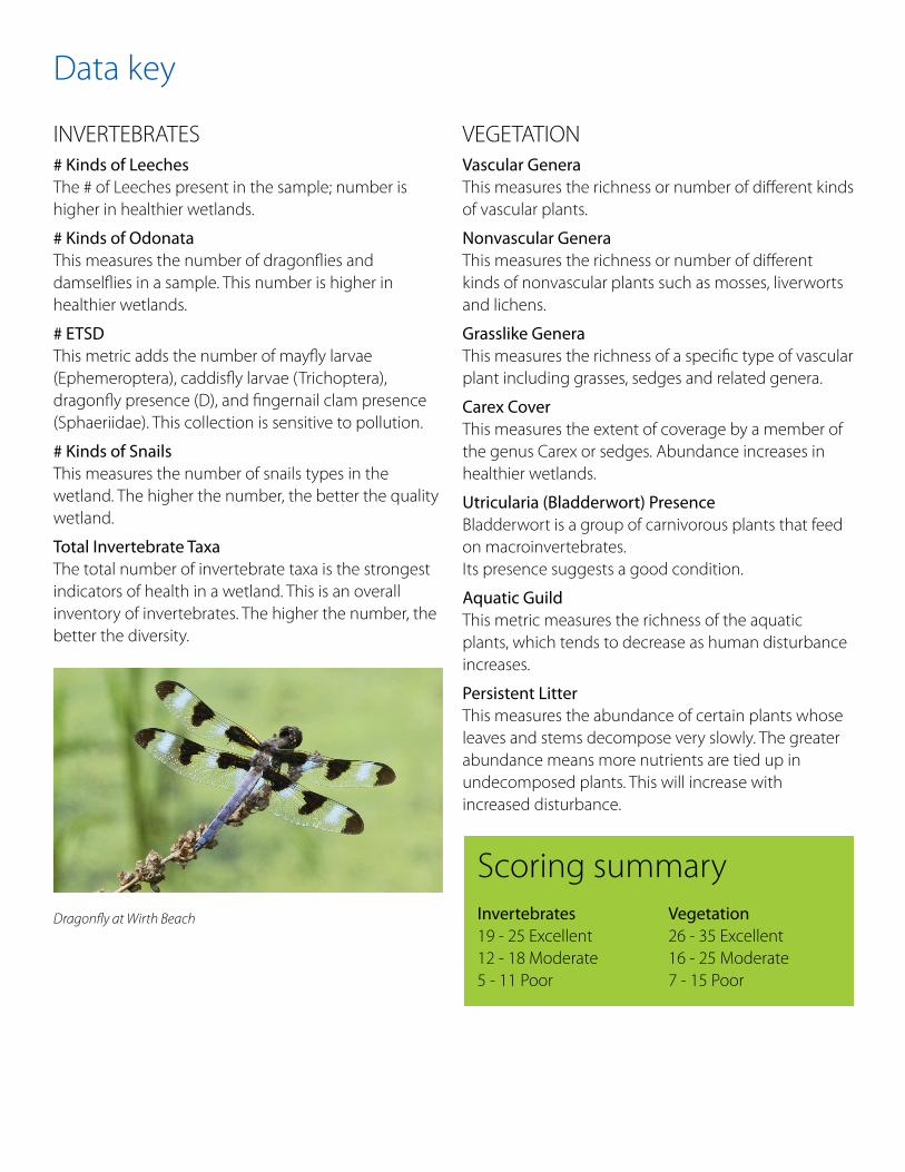
Data key
INVERTEBRATES # Kinds of Leeches The # of Leeches present in the sample; number is higher in healthier wetlands.
# Kinds of Odonata This measures the number of dragonflies and damselflies in a sample. This number is higher in healthier wetlands.
# ETSD This metric adds the number of mayfly larvae (Ephemeroptera), caddisfly larvae (Trichoptera), dragonfly presence (D), and fingernail clam presence (Sphaeriidae). This collection is sensitive to pollution.
# Kinds of Snails This measures the number of snails types in the wetland. The higher the number, the better the quality wetland.
Total Invertebrate Taxa The total number of invertebrate taxa is the strongest indicators of health in a wetland. This is an overall inventory of invertebrates. The higher the number, the better the diversity.
VEGETATION Vascular Genera This measures the richness or number of different kinds of vascular plants.
Nonvascular Genera This measures the richness or number of different kinds of nonvascular plants such as mosses, liverworts and lichens.
Grasslike Genera This measures the richness of a specific type of vascular plant including grasses, sedges and related genera.
Carex Cover This measures the extent of coverage by a member of the genus Carex or sedges. Abundance increases in healthier wetlands.
Utricularia (Bladderwort) Presence Bladderwort is a group of carnivorous plants that feed on macroinvertebrates. Its presence suggests a good condition.
Aquatic Guild This metric measures the richness of the aquatic plants, which tends to decrease as human disturbance increases.
Persistent Litter This measures the abundance of certain plants whose leaves and stems decompose very slowly. The greater abundance means more nutrients are tied up in undecomposed plants. This will increase with increased disturbance.
Scoring summary Invertebrates 19 - 25 Excellent 12 - 18 Moderate 5 - 11 Poor
Vegetation 26 - 35 Excellent 16 - 25 Moderate 7 - 15 Poor
Invertebrate Score
Vegetation Score
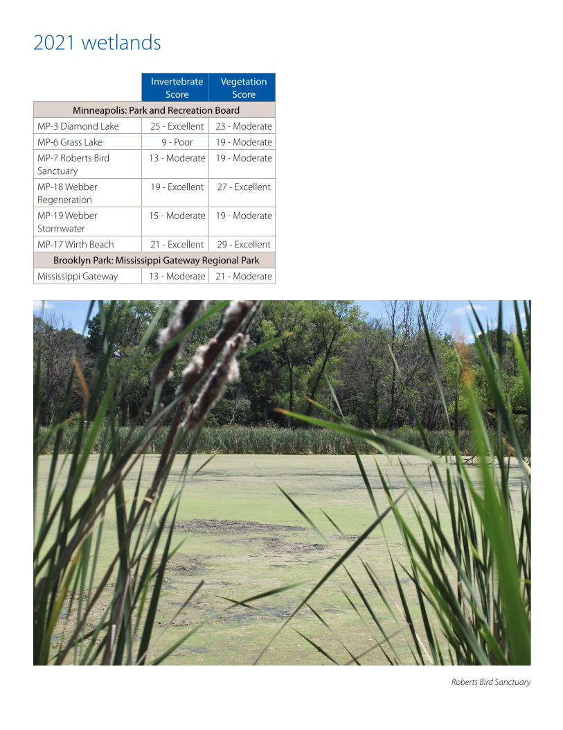
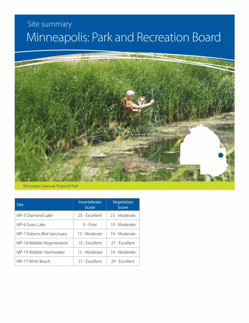
Minneapolis: Park and Recreation Board
MP-3 Diamond Lake 25 - Excellent 23 - Moderate
MP-6 Grass Lake 9 - Poor 19 - Moderate
MP-7 Roberts Bird Sanctuary
13 - Moderate 19 - Moderate
MP-18 Webber Regeneration
19 - Excellent 27 - Excellent
MP-19 Webber Stormwater
15 - Moderate 19 - Moderate
MP-17 Wirth Beach 21 - Excellent 29 - Excellent
Brooklyn Park: Mississippi Gateway Regional Park
Mississippi Gateway 13 - Moderate 21 - Moderate
2021 wetlands
Roberts Bird Sanctuary
SiteInvertebrate
ScoreVegetation
Score
MP-3 Diamond Lake 25 - Excellent 23 - Moderate
MP-6 Grass Lake 9 - Poor 19 - Moderate
MP-7 Roberts Bird Sanctuary 13 - Moderate 19 - Moderate
MP-18 Webber Regeneration 19 - Excellent 27 - Excellent
MP-19 Webber Stormwater 15 - Moderate 19 - Moderate
MP-17 Wirth Beach 21 - Excellent 29 - Excellent
Mississippi Gateway Regional Park
Minneapolis: Park and Recreation BoardSite summary
Vegetation Score
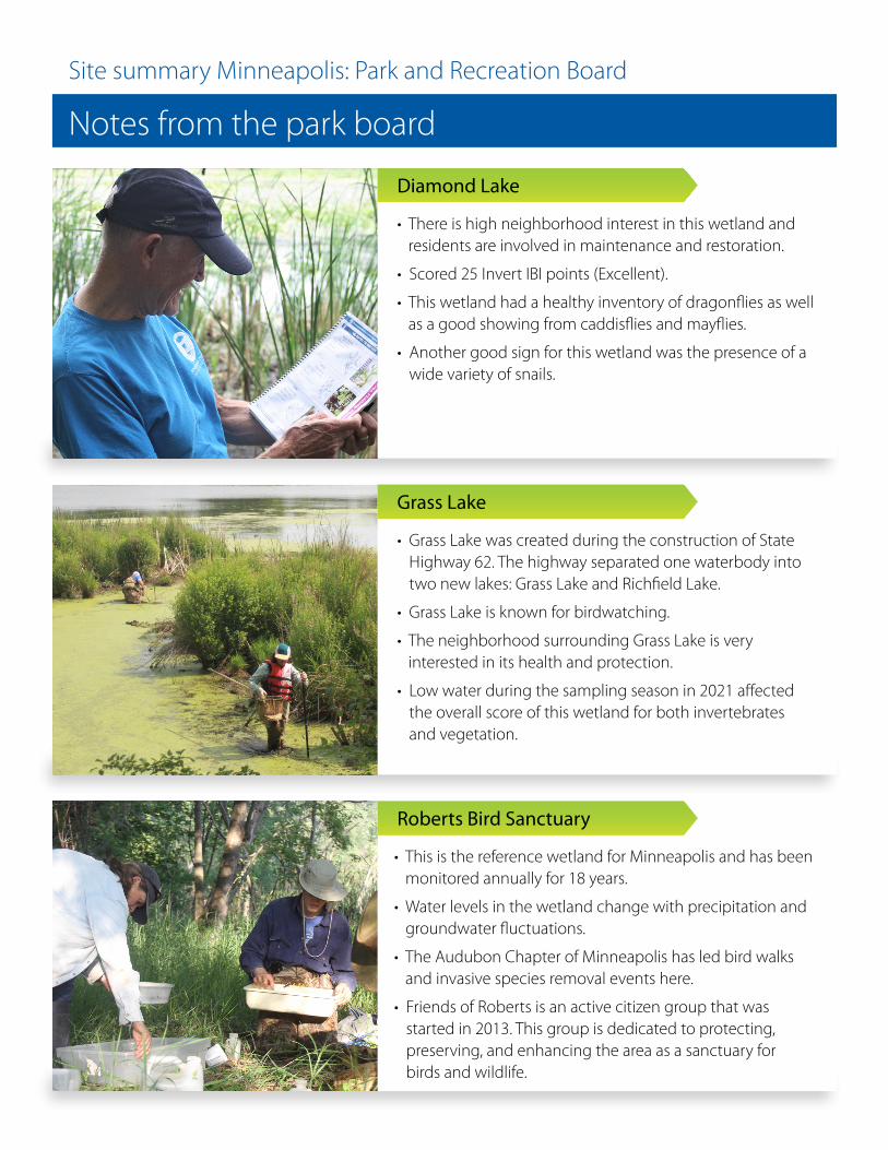
• There is high neighborhood interest in this wetland and residents are involved in maintenance and restoration.
• Scored 25 Invert IBI points (Excellent).
• This wetland had a healthy inventory of dragonflies as well as a good showing from caddisflies and mayflies.
• Another good sign for this wetland was the presence of a wide variety of snails.
• Grass Lake was created during the construction of State Highway 62. The highway separated one waterbody into two new lakes: Grass Lake and Richfield Lake.
• Grass Lake is known for birdwatching.
• The neighborhood surrounding Grass Lake is very interested in its health and protection.
• Low water during the sampling season in 2021 affected the overall score of this wetland for both invertebrates and vegetation.
• This is the reference wetland for Minneapolis and has been monitored annually for 18 years.
• Water levels in the wetland change with precipitation and groundwater fluctuations.
• The Audubon Chapter of Minneapolis has led bird walks and invasive species removal events here.
• Friends of Roberts is an active citizen group that was started in 2013. This group is dedicated to protecting, preserving, and enhancing the area as a sanctuary for birds and wildlife.
Notes from the park board
Site summary Minneapolis: Park and Recreation Board
Diamond Lake
Grass Lake
Roberts Bird Sanctuary
Vegetation Score
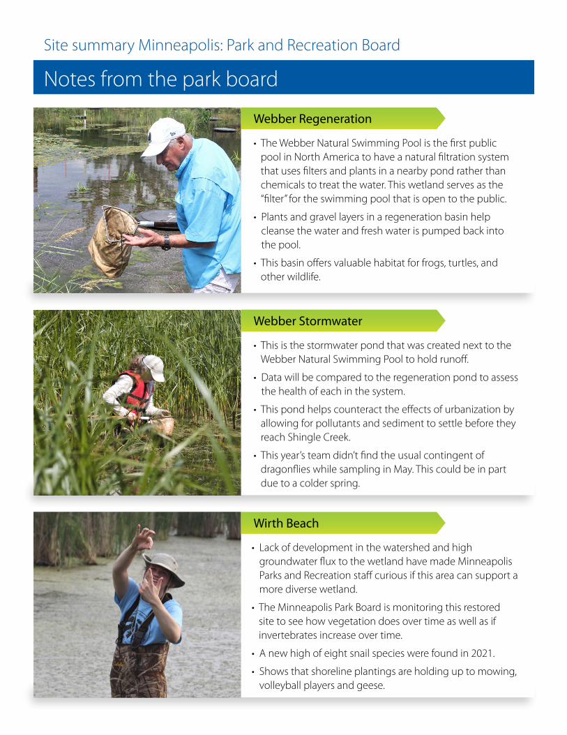
• The Webber Natural Swimming Pool is the first public pool in North America to have a natural filtration system that uses filters and plants in a nearby pond rather than chemicals to treat the water. This wetland serves as the “filter” for the swimming pool that is open to the public.
• Plants and gravel layers in a regeneration basin help cleanse the water and fresh water is pumped back into the pool.
• This basin offers valuable habitat for frogs, turtles, and other wildlife.
• This is the stormwater pond that was created next to the Webber Natural Swimming Pool to hold runoff.
• Data will be compared to the regeneration pond to assess the health of each in the system.
• This pond helps counteract the effects of urbanization by allowing for pollutants and sediment to settle before they reach Shingle Creek.
• This year’s team didn’t find the usual contingent of dragonflies while sampling in May. This could be in part due to a colder spring.
• Lack of development in the watershed and high groundwater flux to the wetland have made Minneapolis Parks and Recreation staff curious if this area can support a more diverse wetland.
• The Minneapolis Park Board is monitoring this restored site to see how vegetation does over time as well as if invertebrates increase over time.
• A new high of eight snail species were found in 2021.
• Shows that shoreline plantings are holding up to mowing, volleyball players and geese.
Notes from the park board
Site summary Minneapolis: Park and Recreation Board
Webber Regeneration
Webber Stormwater
Wirth Beach
SiteInvertebrate
ScoreVegetation
Score
Mississippi Gateway 13 -Moderate 21 -Moderate
Mississippi Gateway Regional Park
Mississippi Gateway Regional ParkSite summary
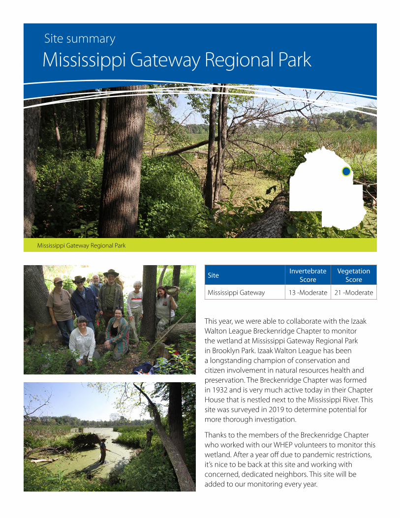
This year, we were able to collaborate with the Izaak Walton League Breckenridge Chapter to monitor the wetland at Mississippi Gateway Regional Park in Brooklyn Park. Izaak Walton League has been a longstanding champion of conservation and citizen involvement in natural resources health and preservation. The Breckenridge Chapter was formed in 1932 and is very much active today in their Chapter House that is nestled next to the Mississippi River. This site was surveyed in 2019 to determine potential for more thorough investigation.
Thanks to the members of the Breckenridge Chapter who worked with our WHEP volunteers to monitor this wetland. After a year off due to pandemic restrictions, it’s nice to be back at this site and working with concerned, dedicated neighbors. This site will be added to our monitoring every year.