Embed Size (px)
Citation preview

What Caused these Changes?

• BrainPOP Jr. | Science | Learn about Fast Land Changes
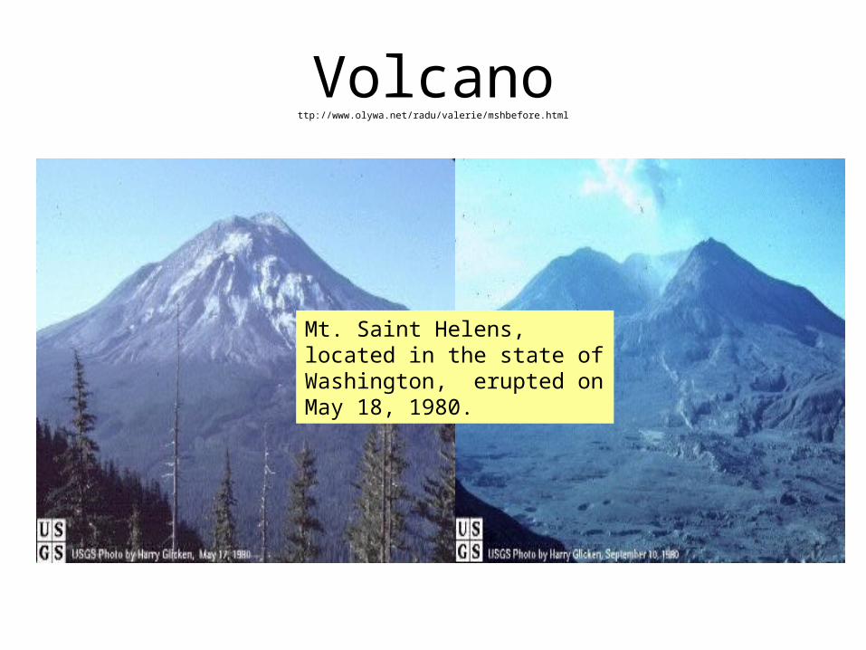
Volcanottp://www.olywa.net/radu/valerie/mshbefore.html
Mt. Saint Helens, located in the state of Washington, erupted on May 18, 1980.
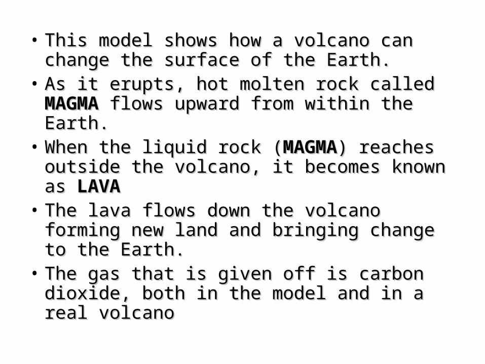
• This model shows how a volcano can This model shows how a volcano can change the surface of the Earth.change the surface of the Earth.
• As it erupts, hot molten rock called As it erupts, hot molten rock called MAGMA MAGMA flows upward from within the Earth.flows upward from within the Earth.
• When the liquid rock (When the liquid rock (MAGMAMAGMA) reaches ) reaches outside the volcano, it becomes known as outside the volcano, it becomes known as LAVALAVA
• The lava flows down the volcano forming The lava flows down the volcano forming new land and bringing change to the Earth.new land and bringing change to the Earth.
• The gas that is given off is carbon dioxide, The gas that is given off is carbon dioxide, both in the model and in a real volcanoboth in the model and in a real volcano

Weather Wiz Kids VolcanoesWeather Wiz Kids Volcanoes
Volcano BrainPopVolcano BrainPop
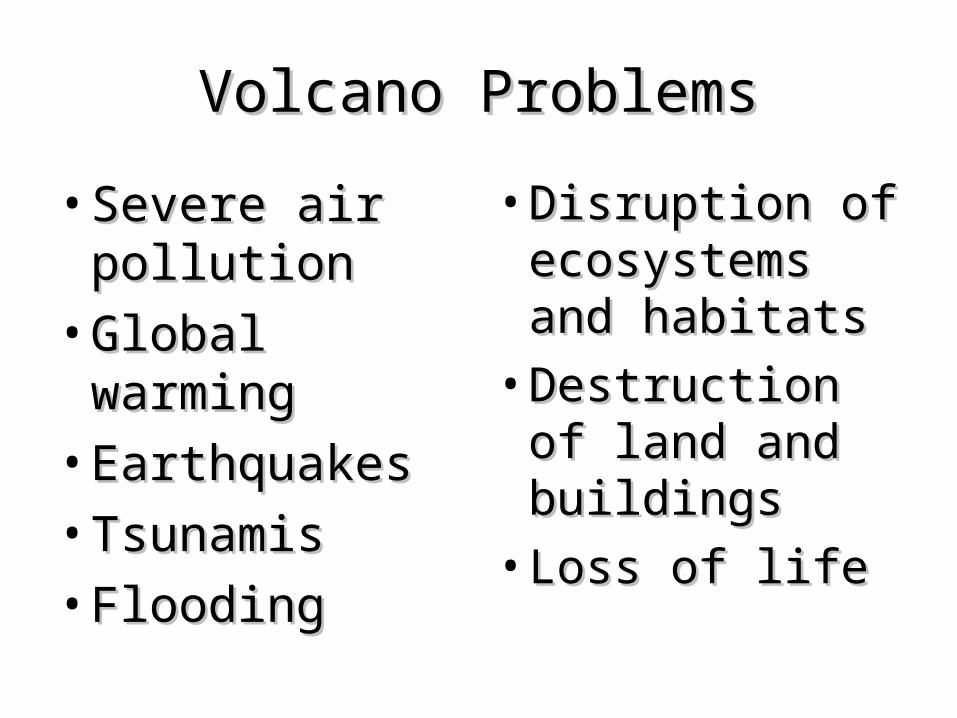
Volcano ProblemsVolcano Problems
• Severe air Severe air pollutionpollution
• Global warmingGlobal warming• EarthquakesEarthquakes• TsunamisTsunamis• FloodingFlooding
• Disruption of Disruption of ecosystems ecosystems and habitatsand habitats
• Destruction of Destruction of land and land and buildingsbuildings
• Loss of lifeLoss of life
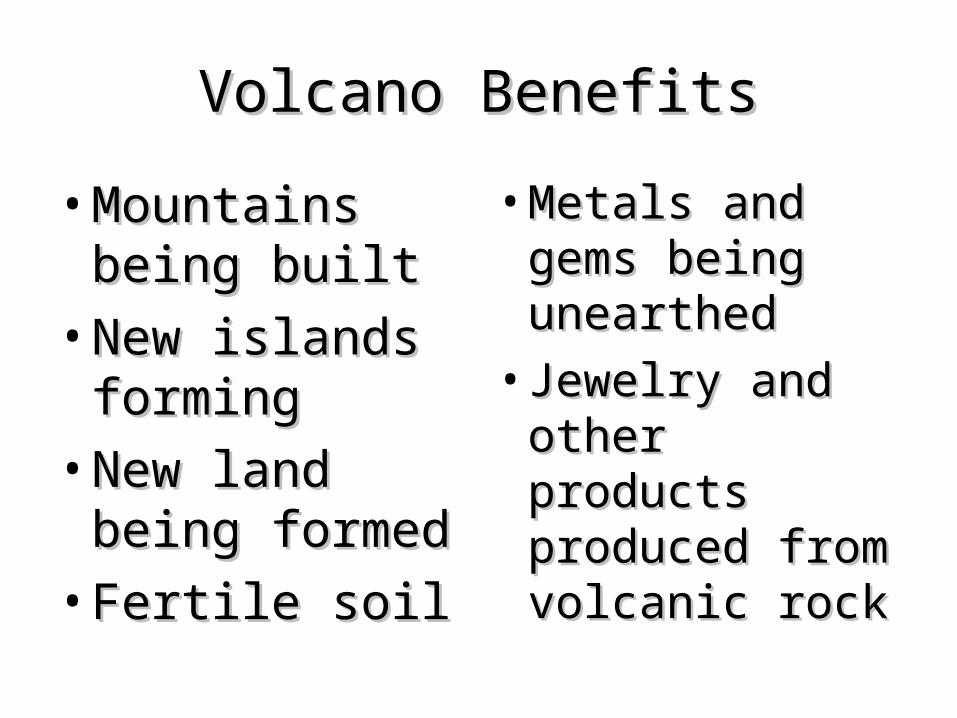
Volcano BenefitsVolcano Benefits
• Mountains Mountains being builtbeing built
• New islands New islands formingforming
• New land being New land being formedformed
• Fertile soilFertile soil
• Metals and Metals and gems being gems being unearthedunearthed
• Jewelry and Jewelry and other products other products produced from produced from volcanic rockvolcanic rock
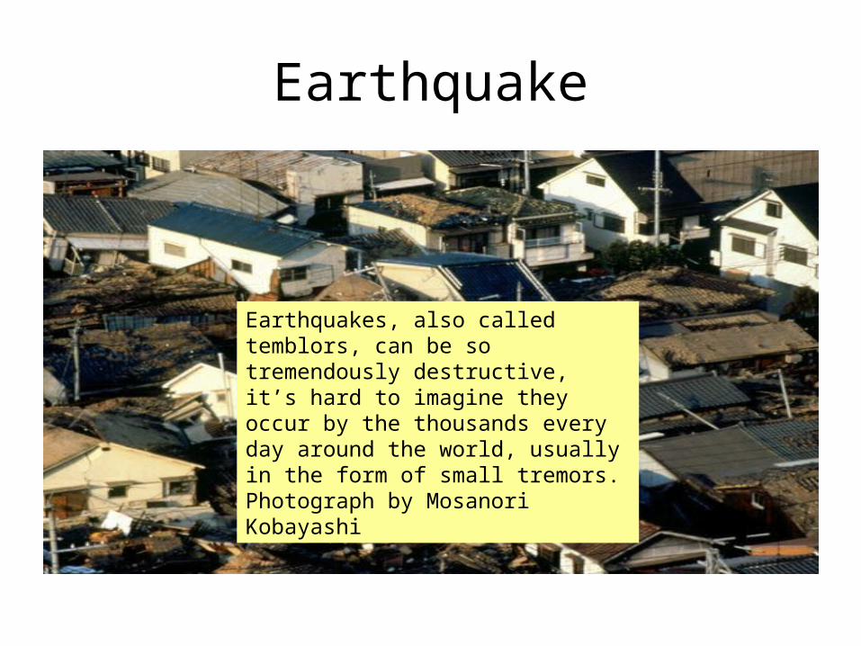
Earthquake
Earthquakes, also called temblors, can be so tremendously destructive, it’s hard to imagine they occur by the thousands every day around the world, usually in the form of small tremors. Photograph by Mosanori Kobayashi

• Earthquakes BrainPop
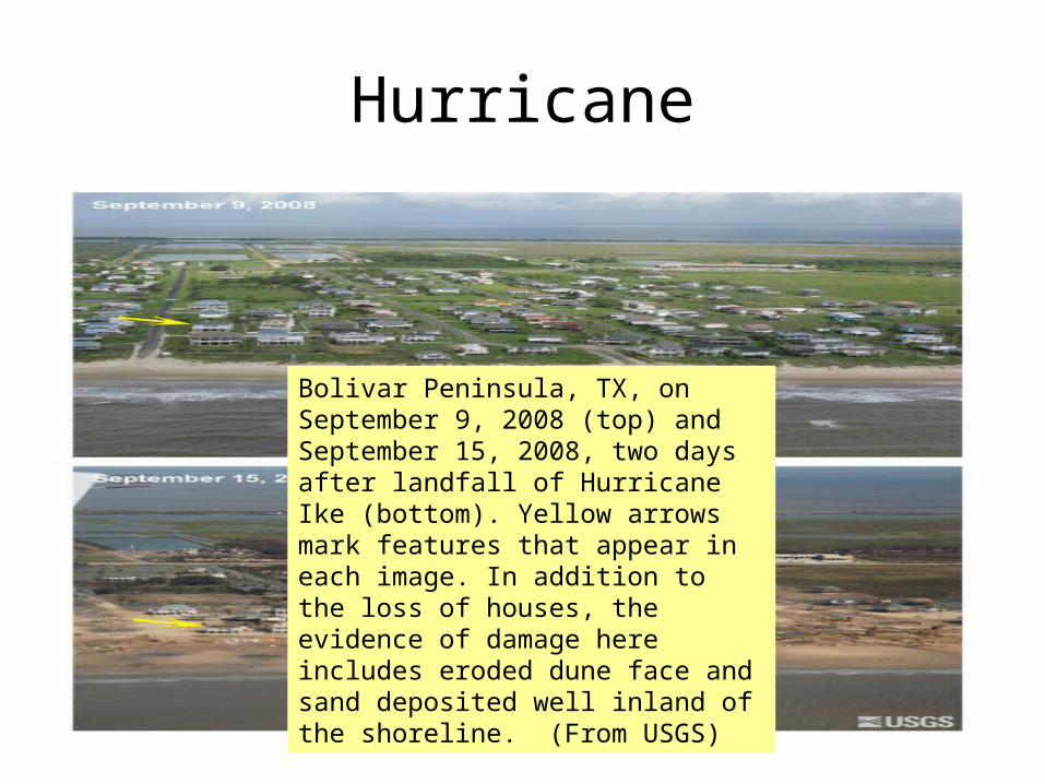
Hurricane
Bolivar Peninsula, TX, on September 9, 2008 (top) and September 15, 2008, two days after landfall of Hurricane Ike (bottom). Yellow arrows mark features that appear in each image. In addition to the loss of houses, the evidence of damage here includes eroded dune face and sand deposited well inland of the shoreline. (From USGS)

• BrainPOP | Science | Learn about Hurricanes
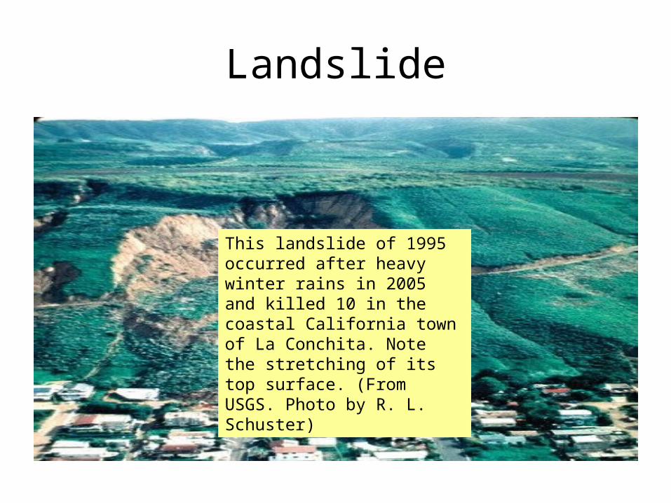
Landslide
This landslide of 1995 occurred after heavy winter rains in 2005 and killed 10 in the coastal California town of La Conchita. Note the stretching of its top surface. (From USGS. Photo by R. L. Schuster)

BrainPOP | Science | Learn about Natural Disasters
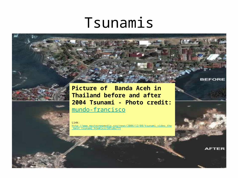
Tsunamis
Picture of Banda Aceh in Thailand before and after 2004 Tsunami - Photo credit: mundo-francisco
Link: http://www.masternewmedia.org/news/2006/12/08/tsunami_video_the_best_tsunami.htm#ixzz10Tu8u77Y

BrainPOP | Science | Learn about Tsunami