Embed Size (px)
Citation preview


What is the long river profile?

• The gradient is less steep than in the upper course.
• The valley gets wider and flatter.
• Erosion is more lateral (or sideways) than vertical.
• The river has surplus energy which it uses to transport material and erode.
• Meanders are formed.
Facts about the middle course.
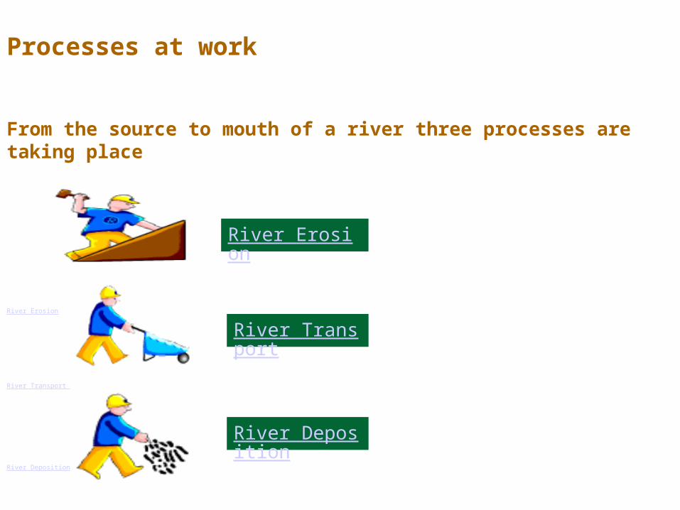
Processes at work
From the source to mouth of a river three processes are taking place
River Erosion
River Transport
River Deposition
River Erosion
River Transport
River Deposition

TractionHeavy rocks and boulders are rolled along the river bed. Happens most in
times of flood, when the current is strongest.

Saltation.Small stones and pebbles are
‘bounced’ along the river bed. Saltation can take place when the river flow is less than that needed for ‘Traction’ to take
place.

SuspensionVery small particles of sand or clay that are ‘suspended’ in the water.
These particles will ‘settle’ if kept in a jar of water overnight and the water
will look clear.

Solution.Takes place when material is dissolved in the
water, it is invisible and does not colour the water. Occurs often in limestone landscapes where the
water if very acidic. Some pollutants like weedkiller are also held in solution in the water

Methods of transport
Copy this picture into your books and add the title above and labels for each type of transport
Traction Saltation Suspension Solution
Shows the rate of flow needed
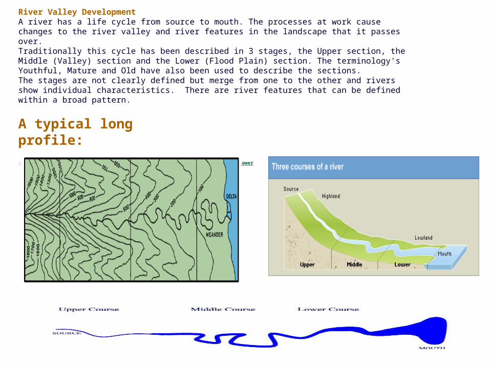
River Valley DevelopmentA river has a life cycle from source to mouth. The processes at work cause changes to the river valley and river features in the landscape that it passes over.Traditionally this cycle has been described in 3 stages, the Upper section, the Middle (Valley) section and the Lower (Flood Plain) section. The terminology's Youthful, Mature and Old have also been used to describe the sections. The stages are not clearly defined but merge from one to the other and rivers show individual characteristics. There are river features that can be defined within a broad pattern.
A typical long profile:upper middle lower


Which stage? How do you know?

1. How much energy do you think the river has here? How do you think the river uses its energy
here?
2. How do you think the channel
shape changes here?
3.In which direction is the river eroding here? How do
you know?4. Do you think the river is at
its fastest here? What do
you think happens to
velocity as you travel
downstream?5. What do you
think the rivers load is
like here? Why? Where does its load come from?
6. What processes of erosion do you
think may be happening here?
7. How do you think the river
transports here?
8. Do you think deposition occurs
here? If yes when?
9. What landforms do
you find in the upper stage?
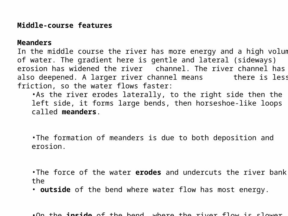
Middle-course features
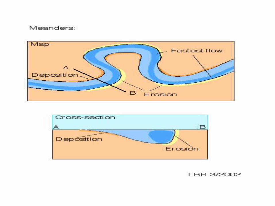
MeandersIn the middle course the river has more energy and a high volume of water. The gradient here is gentle and lateral (sideways) erosion has widened the river channel. The river channel has also deepened. A larger river channel means there is less friction, so the water flows faster:
•As the river erodes laterally, to the right side then the left side, it forms large bends, then horseshoe-like loops called meanders.
•The formation of meanders is due to both deposition and erosion.
•The force of the water erodes and undercuts the river bank on the• outside of the bend where water flow has most energy.
•On the inside of the bend, where the river flow is slower, material is deposited.

Watch the video clip of the middle course…
Describe what the middle course of the river is like. How is it different to the upper course?


Meander = a bend in a river

Meander formation
http://www.cleo.net.uk/resources/displayframe.php?src=309/consultants_resources%2F_files%2Fmeander4.swf
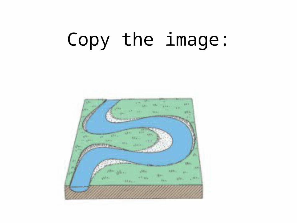
Copy the image:
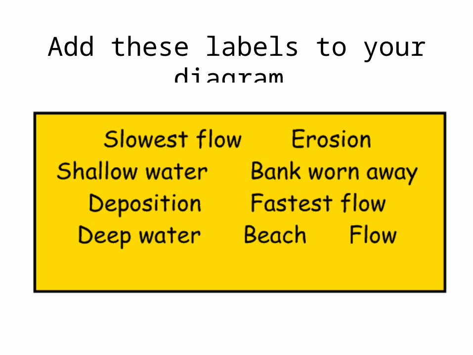
Add these labels to your diagram…
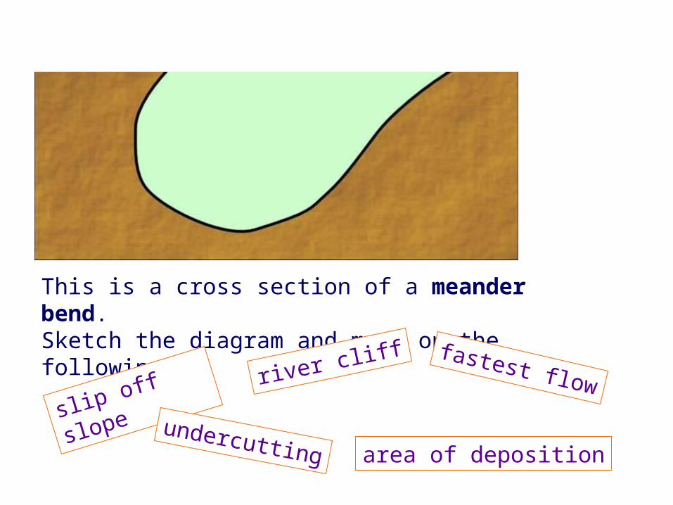
This is a cross section of a meander bend. Sketch the diagram and mark on the following:
slip off slope river cliff
area of depositionundercutting
fastest flow

Deep, fast water and erosion on the outside of the bend
Slow, shallow water and deposition on the inside of the bend


http://www.sln.org.uk/geography/oxbow/

Extension…
Describe and explain (and use diagrams? ) how this meander will turn into an ox bow lake.
Plenary
Add all of the information learnt today about the middle course to your profile of the river….