Embed Size (px)
Citation preview
Meet the Forest Service ................ inside front cover
What to do?Camping ................................ 2Picnicking ............................. 2Scenic Drives ......................... 2Wildlife Viewing ................... 2Hiking Trails ......................... 2Mountain Biking .................. 2Rock Climbing ...................... 2Canoeing and Flat Water
Boating .............................. 3Rafting and Kayaking .......... 3Four-wheel Driving ............... 3Dirt Bikes and ATVs ............. 3Skiing and Snowshoeing ...... 3Snowmobiling ....................... 3Fishing and Hunting ............ 3Horseback Riding ................. 3
Where to go? Scenic Byways ........................ 4Wilderness Areas .................. 6Cache la Poudre
Wild and Scenic River ...... 8Arapaho National
Recreation Area................ 9Historical and
Archeological Sites ........... 9ARP Area Map .....................10
What to know?Permits and Passes .............. 12Forests and Grassland
Ecosystems .......................14Campgrounds ..................... 15Outdoor Safety ....................18Volunteer Opportunities.... 20Order Form for Maps
and Passports .................. 21Handy Numbers and
Web Sites ............back cover
www.fs.usda.gov/arp ARP Central Office
2150 Centre Ave, Bldg EFort Collins, CO 80526
970-295-6700
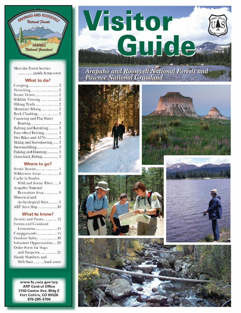
Visitor Guide
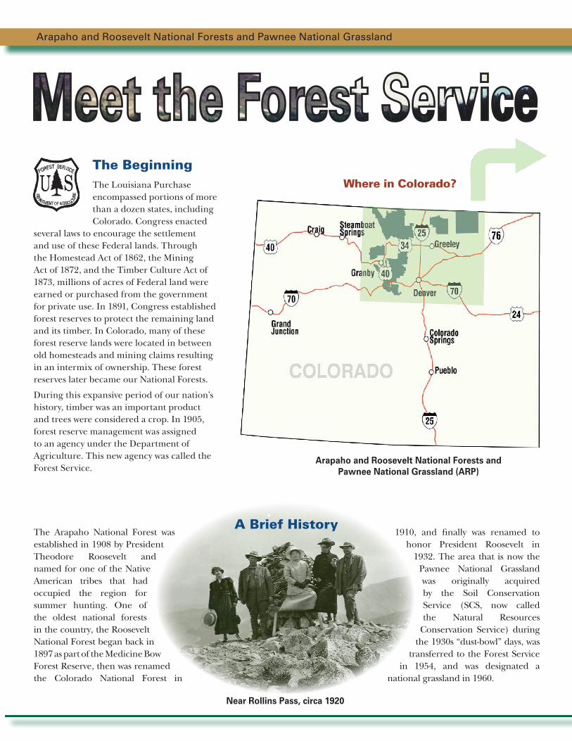
Where in Colorado?
Arapaho and Roosevelt National Forests and Pawnee National Grassland
The Arapaho National Forest was established in 1908 by President Theodore Roosevelt and named for one of the Native American tribes that had occupied the region for summer hunting. One of the oldest national forests in the country, the Roosevelt National Forest began back in 1897 as part of the Medicine Bow Forest Reserve, then was renamed the Colorado National Forest in
1910, and finally was renamed to honor President Roosevelt in
1932. The area that is now the Pawnee National Grassland was originally acquired by the Soil Conservation Service (SCS, now called the Natural Resources
Conservation Service) during the 1930s “dust-bowl” days, was
transferred to the Forest Service in 1954, and was designated a
national grassland in 1960.
Near Rollins Pass, circa 1920
A Brief History
The BeginningThe Louisiana Purchase encompassed portions of more than a dozen states, including Colorado. Congress enacted
several laws to encourage the settlement and use of these Federal lands. Through the Homestead Act of 1862, the Mining Act of 1872, and the Timber Culture Act of 1873, millions of acres of Federal land were earned or purchased from the government for private use. In 1891, Congress established forest reserves to protect the remaining land and its timber. In Colorado, many of these forest reserve lands were located in between old homesteads and mining claims resulting in an intermix of ownership. These forest reserves later became our National Forests.
During this expansive period of our nation’s history, timber was an important product and trees were considered a crop. In 1905, forest reserve management was assigned to an agency under the Department of Agriculture. This new agency was called the Forest Service.
Arapaho and Roosevelt National Forests and Pawnee National Grassland (ARP)
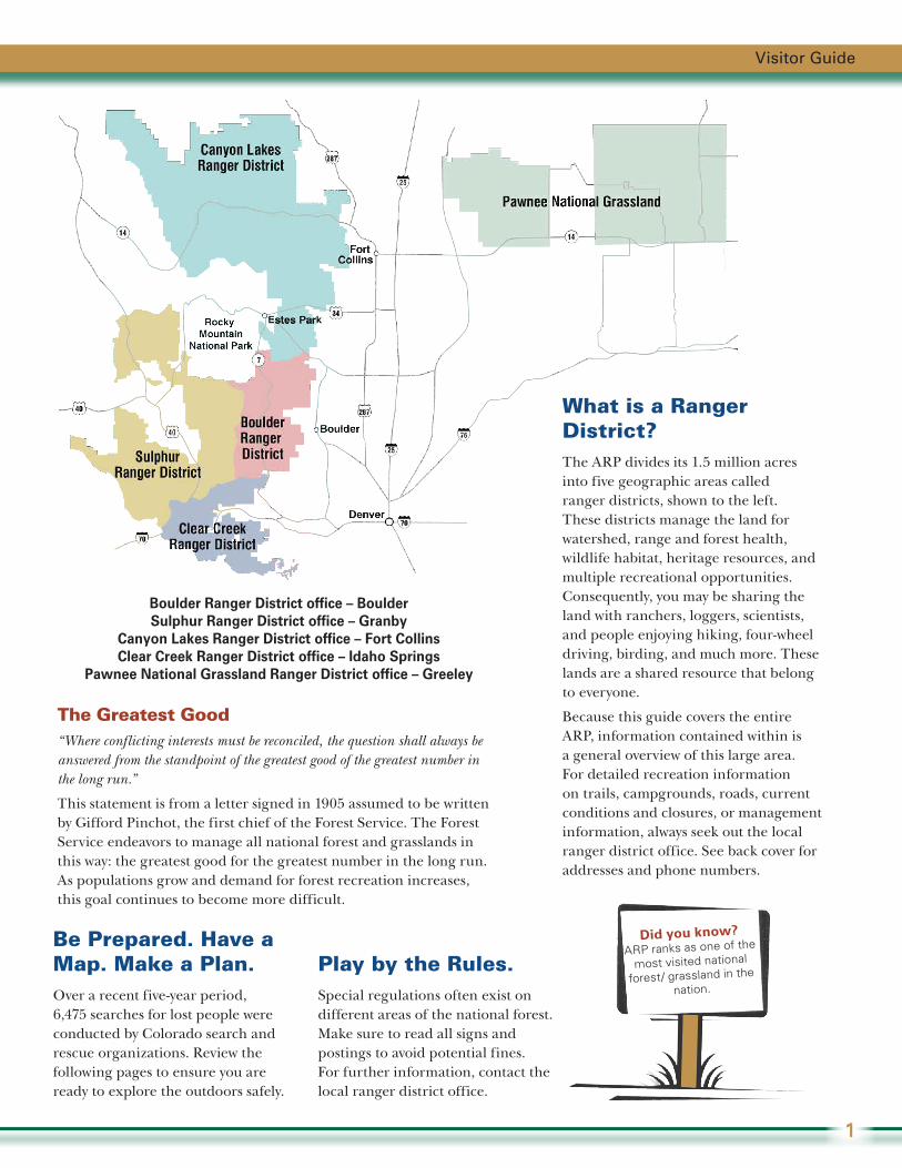
What is a Ranger District?The ARP divides its 1.5 million acres into five geographic areas called ranger districts, shown to the left. These districts manage the land for watershed, range and forest health, wildlife habitat, heritage resources, and multiple recreational opportunities. Consequently, you may be sharing the land with ranchers, loggers, scientists, and people enjoying hiking, four-wheel driving, birding, and much more. These lands are a shared resource that belong to everyone.
Because this guide covers the entire ARP, information contained within is a general overview of this large area. For detailed recreation information on trails, campgrounds, roads, current conditions and closures, or management information, always seek out the local ranger district office. See back cover for addresses and phone numbers.
Be Prepared. Have a Map. Make a Plan.Over a recent five-year period, 6,475 searches for lost people were conducted by Colorado search and rescue organizations. Review the following pages to ensure you are ready to explore the outdoors safely.
Play by the Rules.Special regulations often exist on different areas of the national forest. Make sure to read all signs and postings to avoid potential fines. For further information, contact the local ranger district office.
The Greatest Good“Where conflicting interests must be reconciled, the question shall always be answered from the standpoint of the greatest good of the greatest number in the long run.”
This statement is from a letter signed in 1905 assumed to be written by Gifford Pinchot, the first chief of the Forest Service. The Forest Service endeavors to manage all national forest and grasslands in this way: the greatest good for the greatest number in the long run. As populations grow and demand for forest recreation increases, this goal continues to become more difficult.
Visitor Guide
1
Did you know?
ARP ranks as one of the
most visited national
forest/ grassland in the
nation.
Boulder Ranger District office – BoulderSulphur Ranger District office – Granby
Canyon Lakes Ranger District office – Fort CollinsClear Creek Ranger District office – Idaho Springs
Pawnee National Grassland Ranger District office – Greeley

Camping Looking for an organized place to camp? Are you driving a motor home? Pulling a trailer? Wanting to pitch a tent? One of our 52 campgrounds has a spot for you! Most are open Memorial Day through Labor Day or longer. Some accept reservations; others are first come, first served. Fees vary. Don’t hesitate—in July and August, many campgrounds fill fast. See campground list on pages 16 and 17.
Prefer to sleep in an undeveloped area? Where allowed, just pull off the road and park in a way that does not obstruct traffic or damage resources. Never drive in fragile wetlands or meadows. Some areas allow camping only in designated sites, or not at all. No overnight camping is allowed at trailheads, picnic areas or in day-use parking areas.
PicnickingBring your picnic basket to one of our developed picnic areas scattered throughout the forests and grassland. Most locations have picnic tables, vault toilets, and fire grates or rings. These day-use areas are open from sunrise to sunset. All picnic areas are on a first-come basis (except for Crow Valley and Pickle Gulch picnic areas, which accept reservations). Some picnic areas may charge a fee, but others are free; see list of fee areas under American Lands & Leisure Day Use Pass on page 13.
Scenic DrivesFive State Scenic Byways, one National Scenic Byway, and other back roads will entice you past spectacular scenery and through historical towns, offering abundant opportunities to observe wildlife along the way (see page 4).
Wildlife ViewingFocus your binoculars or camera lens on the wide array of animals that enrich any ARP recreational experience—from elk to eagles, prairie dogs to prairie falcons, bighorn sheep to burrowing owls and bluebirds. Practice responsible viewing and keep your distance—wildlife may run away, abandon a nest or young, or even attack if you get too close. Learn to watch wildlife without being watched back!
Hiking TrailsHundreds of miles of trails will lure you from open prairie to gently sloping foothills and open forest to steep rocky slopes and wind-swept tundra. Hiking guides are available at ranger district offices. The guides describe the trails and identify special regulations, such as restrictions on dogs or horses, permit requirements, or other special trail regulations (see www.fs.usda.gov/goto/arp/hiking).
Mountain BikingPedal along numbered roads and trails, except in wilderness areas or other trails as posted. Enjoy the serenity and peacefulness of the great outdoors.
Rock ClimbingRock climbing opportunities can be found on the forest. As the popularity of this sport increases, it is becoming more important that everyone help prevent resource damage. Removable hardware and temporary anchors are preferred. Climbers are responsible for making sure they are on public land open to climbing. If unsure, please contact the local ranger district office.
Explore the Outdoors . . . Recreation Opportunities Abound!
The ARP offers a diversity of outdoor opportunities. These lands are yours—to visit, to care for, but most of all, to enjoy. So, what are you waiting for? Pack up
your family and friends and head for adventure in Colorado’s great outdoors on the Arapaho and Roosevelt National Forests and Pawnee National Grassland!
What to Do?
Arapaho and Roosevelt National Forests and Pawnee National Grassland
2
Skiing and SnowshoeingOur high country has been a mecca for skiers for decades and three downhill ski areas operate on the ARP under special-use permits—Winter Park, Loveland and Eldora. Snowshoeing and Nordic (cross-country) skiing are also available in many national forest locations. Always check weather and avalanche conditions before heading out (see back cover).
SnowmobilingMany areas often have excellent snow conditions for snowmobiling. Snowmobiles are never allowed in wilderness areas. Ranger district offices can direct you to areas with reliable snow cover. Be sure to register your snowmobile with Colorado State Parks (see back cover).
Fishing and Hunting The ARP offers unsurpassed fishing and hunting. State laws and regulations govern your outdoor experience so check with the Colorado Parks and Wildlife for information about licenses, regulations, closures and seasons. Call 303-291-7227 or view www.wildlife.state.co.us.
Horseback RidingRide or lead your horse along varied terrain. Ranger district offices offer trail information and detailed maps and can help you locate trailheads with adequate stock trailer parking. Pack animals are not allowed in most developed campgrounds or where otherwise posted. Certified weed-free hay is required (or pelletized feed or grain products).
Canoeing and Flat Water Boating Paddle quietly among the many lakes and reservoirs found throughout the forests, such as Shadow Mountain, Brainard, Dowdy and Chambers. A few lakes are large enough to allow motorized boating. Be sure to check with Colorado State Parks and register your boat if necessary (see back cover). Contact the local ranger district office to find out what is allowed and not allowed when you are canoeing or boating.
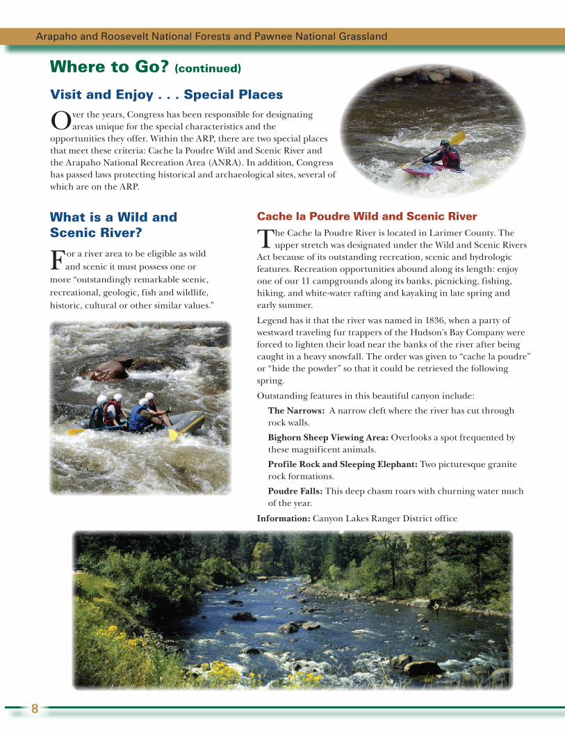
Rafting and KayakingExperience the thrill of white water on the Cache la Poudre River and parts of Clear Creek and Boulder Creek during spring and summer runoff. Go on your own or pick from a variety of exciting trips offered by commercial rafting companies operating under a special-use permit with the ARP.
Four-wheel DrivingFour-wheel driving is a popular activity on some of the more challenging roads. Motor Vehicle Use Maps (MVUM) designate where you can legally drive. Download these maps at www.fs.usda.gov/goto/arp/mvum. Check with ranger district offices if you want a free MVUM or to get involved to help maintain these roads. Keep in mind, forest roads are also shared with mountain bikers, hikers and others. Check for forest road openings at ranger district offices or the web at www.fs.usda.gov/goto/arp/roads
Dirt Bikes and All-terrain VehiclesMany roads and trails are open to dirt bikes and all-terrain vehicles (ATVs) called off-highway vehicles (OHVs). Roads and trails are designated, by the MVUM, as open or closed to various types of motorized vehicles. Bikes and vehicles must meet all state standards and regulations for noise levels, spark arresters, age of riders, helmet requirements and other restrictions. Your dirt bike or vehicle must be registered with Colorado State Parks (see back cover).
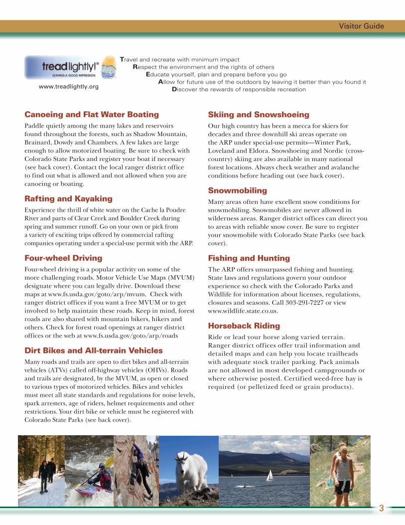
Travel and recreate with minimum impact Respect the environment and the rights of others Educate yourself, plan and prepare before you go Allow for future use of the outdoors by leaving it better than you found it Discover the rewards of responsible recreationwww.treadlightly.org
Visitor Guide
3
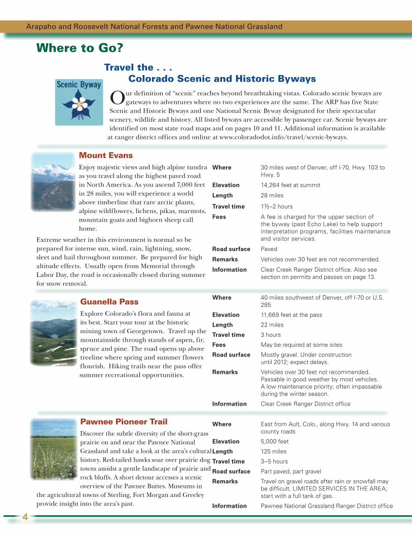
Where to Go? Travel the . . . Colorado Scenic and Historic Byways
Our definition of “scenic” reaches beyond breathtaking vistas. Colorado scenic byways are gateways to adventures where no two experiences are the same. The ARP has five State
Scenic and Historic Byways and one National Scenic Byway designated for their spectacular scenery, wildlife and history. All listed byways are accessible by passenger car. Scenic byways are identified on most state road maps and on pages 10 and 11. Additional information is available
at ranger district offices and online at www.coloradodot.info/travel/scenic-byways.
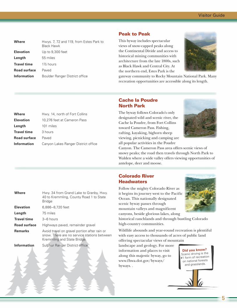
Mount Evans Enjoy majestic views and high alpine tundra as you travel along the highest paved road in North America. As you ascend 7,000 feet in 28 miles, you will experience a world above timberline that rare arctic plants, alpine wildflowers, lichens, pikas, marmots, mountain goats and bighorn sheep call home.
Extreme weather in this environment is normal so be prepared for intense sun, wind, rain, lightning, snow, sleet and hail throughout summer. Be prepared for high altitude effects. Usually open from Memorial through Labor Day, the road is occasionally closed during summer for snow removal.
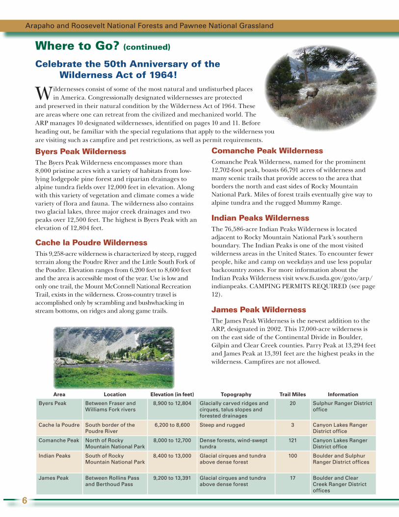
Guanella Pass Explore Colorado’s flora and fauna at its best. Start your tour at the historic mining town of Georgetown. Travel up the mountainside through stands of aspen, fir, spruce and pine. The road opens up above treeline where spring and summer flowers flourish. Hiking trails near the pass offer summer recreational opportunities.
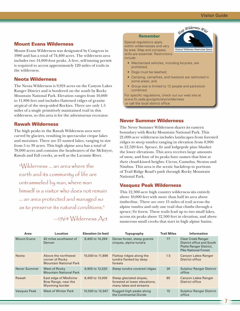
Pawnee Pioneer Trail Discover the subtle diversity of the short-grass prairie on and near the Pawnee National Grassland and take a look at the area’s cultural history. Red-tailed hawks soar over prairie dog towns amidst a gentle landscape of prairie and rock bluffs. A short detour accesses a scenic overview of the Pawnee Buttes. Museums in
the agricultural towns of Sterling, Fort Morgan and Greeley provide insight into the area’s past.
Where 30 miles west of Denver, off I-70, Hwy. 103 to Hwy. 5
Elevation 14,264 feet at summit
Length 28 miles
Travel time 1½–2 hours
Fees A fee is charged for the upper section of the byway (past Echo Lake) to help support interpretation programs, facilities maintenance and visitor services.
Road surface Paved
Remarks Vehicles over 30 feet are not recommended.
Information Clear Creek Ranger District office. Also see section on permits and passes on page 13.
Where 40 miles southwest of Denver, off I-70 or U.S. 285
Elevation 11,669 feet at the pass
Length 22 miles
Travel time 3 hours
Fees May be required at some sites
Road surface Mostly gravel. Under construction until 2012; expect delays.
Remarks Vehicles over 30 feet not recommended. Passable in good weather by most vehicles. A low maintenance priority; often impassable during the winter season.
Information Clear Creek Ranger District office
Where East from Ault, Colo., along Hwy. 14 and various county roads
Elevation 5,000 feet
Length 125 miles
Travel time 3–5 hours
Road surface Part paved, part gravel
Remarks Travel on gravel roads after rain or snowfall may be difficult. LIMITED SERVICES IN THE AREA; start with a full tank of gas.
Information Pawnee National Grassland Ranger District office
Arapaho and Roosevelt National Forests and Pawnee National Grassland
4
Visitor Guide
5
Peak to Peak This byway includes spectacular views of snow-capped peaks along the Continental Divide and access to historical mining communities with architecture from the late 1800s, such as Black Hawk and Central City. At the northern end, Estes Park is the gateway community to Rocky Mountain National Park. Many recreation opportunities are accessible along its length.
Cache la Poudre North ParkThe byway follows Colorado’s only designated wild and scenic river, the Cache la Poudre, from Fort Collins toward Cameron Pass. Fishing, rafting, kayaking, bighorn sheep viewing, picnicking and camping are all popular activities in the Poudre Canyon. The Cameron Pass area offers scenic views of snowy peaks; the road then travels through North Park to Walden where a wide valley offers viewing opportunities of antelope, deer and moose.
Colorado River HeadwatersFollow the mighty Colorado River as it begins its journey west to the Pacific Ocean. This nationally designated scenic byway passes through mountain valleys and magnificent canyons, beside glorious lakes, along historical ranchlands and through bustling Colorado high-country communities.
Wildlife abounds and year-round recreation is plentiful with easy access to thousands of acres of public land offering spectacular views of mountain landscape and geology. For more information and places to visit along this majestic byway, go to www.fhwa.dot.gov/byways/byways. .
Where Hwys. 7, 72 and 119, from Estes Park to Black Hawk
Elevation Up to 9,300 feet
Length 55 miles
Travel time 1½ hours
Road surface Paved
Information Boulder Ranger District office
Where Hwy. 14, north of Fort Collins
Elevation 10,276 feet at Cameron Pass
Length 101 miles
Travel time 3 hours
Road surface Paved
Information Canyon Lakes Ranger District office
Where Hwy. 34 from Grand Lake to Granby, Hwy. 40 to Kremmling, County Road 1 to State Bridge
Elevation 6,886–8,720 feet
Length 75 miles
Travel time 3–6 hours
Road surface Highways paved, remainder gravel
Remarks Avoid travel on gravel portion after rain or snow. There are no service stations between Kremmling and State Bridge.
Information Sulphur Ranger District officeDid you know?
Scenic driving is the
#1 form of recreation
on national forests
and grasslands.
Celebrate the 50th Anniversary of the Wilderness Act of 1964!
Wildernesses consist of some of the most natural and undisturbed places in America. Congressionally designated wildernesses are protected
and preserved in their natural condition by the Wilderness Act of 1964. These are areas where one can retreat from the civilized and mechanized world. The ARP manages 10 designated wildernesses, identified on pages 10 and 11. Before heading out, be familiar with the special regulations that apply to the wilderness you are visiting such as campfire and pet restrictions, as well as permit requirements.
Byers Peak WildernessThe Byers Peak Wilderness encompasses more than 8,000 pristine acres with a variety of habitats from low-lying lodgepole pine forest and riparian drainages to alpine tundra fields over 12,000 feet in elevation. Along with this variety of vegetation and climate comes a wide variety of flora and fauna. The wilderness also contains two glacial lakes, three major creek drainages and two peaks over 12,500 feet. The highest is Byers Peak with an elevation of 12,804 feet.
Cache la Poudre WildernessThis 9,258-acre wilderness is characterized by steep, rugged terrain along the Poudre River and the Little South Fork of the Poudre. Elevation ranges from 6,200 feet to 8,600 feet and the area is accessible most of the year. Use is low and only one trail, the Mount McConnell National Recreation Trail, exists in the wilderness. Cross-country travel is accomplished only by scrambling and bushwhacking in stream bottoms, on ridges and along game trails.
Where to Go? (continued)
Area Location Elevation (in feet) Topography Trail Miles Information
Byers Peak Between Fraser and Williams Fork rivers
8,900 to 12,804 Glacially carved ridges and cirques, talus slopes and forested drainages
20 Sulphur Ranger District office
Cache la Poudre South border of the Poudre River
6,200 to 8,600 Steep and rugged 3 Canyon Lakes Ranger District office
Comanche Peak North of Rocky Mountain National Park
8,000 to 12,700 Dense forests, wind-swept tundra
121 Canyon Lakes Ranger District office
Indian Peaks South of Rocky Mountain National Park
8,400 to 13,000 Glacial cirques and tundra above dense forest
100 Boulder and Sulphur Ranger District offices
James Peak Between Rollins Pass and Berthoud Pass
9,200 to 13,391 Glacial cirques and tundra above dense forest
17 Boulder and Clear Creek Ranger District offices
Comanche Peak WildernessComanche Peak Wilderness, named for the prominent 12,702-foot peak, boasts 66,791 acres of wilderness and many scenic trails that provide access to the area that borders the north and east sides of Rocky Mountain National Park. Miles of forest trails eventually give way to alpine tundra and the rugged Mummy Range.
Indian Peaks WildernessThe 76,586-acre Indian Peaks Wilderness is located adjacent to Rocky Mountain National Park’s southern boundary. The Indian Peaks is one of the most visited wilderness areas in the United States. To encounter fewer people, hike and camp on weekdays and use less popular backcountry zones. For more information about the Indian Peaks Wilderness visit www.fs.usda.gov/goto/arp/indianpeaks. CAMPING PERMITS REQUIRED (see page 12).
James Peak WildernessThe James Peak Wilderness is the newest addition to the ARP, designated in 2002. This 17,000-acre wilderness is on the east side of the Continental Divide in Boulder, Gilpin and Clear Creek counties. Parry Peak at 13,294 feet and James Peak at 13,391 feet are the highest peaks in the wilderness. Campfires are not allowed.
Arapaho and Roosevelt National Forests and Pawnee National Grassland
6
Mount Evans WildernessMount Evans Wilderness was designated by Congress in 1980 and has a total of 74,400 acres. The wilderness area includes two 14,000-foot peaks. A free, self-issuing permit is required to access approximately 120 miles of trails in the wilderness.
Neota Wilderness The Neota Wilderness is 9,924 acres on the Canyon Lakes Ranger District and is bordered on the south by Rocky Mountain National Park. Elevation ranges from 10,000 to 11,896 feet and includes flattened ridges of granite atypical of the steep-sided Rockies. There are only 1.5 miles of a single primitively maintained trail in this wilderness, so this area is for the adventurous recreator.
Rawah WildernessThe high peaks in the Rawah Wilderness area were carved by glaciers, resulting in spectacular cirque lakes and moraines. There are 25 named lakes, ranging in size from 5 to 39 acres. This high alpine area has a total of 78,000 acres and contains the headwaters of the McIntyre, Rawah and Fall creeks, as well as the Laramie River.
Area Location Elevation (in feet) Topography Trail Miles Information
Mount Evans 40 miles southwest of Denver
8,400 to 14,264 Dense forest, steep granite cirques, alpine tundra
77 Clear Creek Ranger District office and South Platte Ranger District, Pike National Forest
Neota Above the northwest corner of Rocky Mountain National Park
10,000 to 11,896 Flattop ridges along the tundra flanked by deep forests
1.5 Canyon Lakes Ranger District office
Never Summer West of Rocky Mountain National Park
8,900 to 12,520 Steep tundra-covered ridges 26 Sulphur Ranger District office
Rawah East edge of Medicine Bow Range, near the Wyoming border
8,400 to 13,000 Steep glaciated slopes, forested at lower elevations, many lakes and streams
85 Canyon Lakes Ranger District office
Vasquez Peak West of Winter Park 10,500 to 12,947 Rugged high peaks along the Continental Divide
15 Sulphur Ranger District office
Never Summer WildernessThe Never Summer Wilderness shares its eastern boundary with Rocky Mountain National Park. This 21,000-acre wilderness includes landscapes from forested ridges to steep tundra ranging in elevation from 8,900 to 12,520 feet. Spruce, fir and lodgepole pine blanket the lower elevations. This area receives large amounts of snow, and four of its peaks have names that hint at their cloud-kissed heights: Cirrus, Cumulus, Stratus and Nimbus. This area is the scenic backdrop to portions of Trail Ridge Road’s path through Rocky Mountain National Park.
Vasquez Peak WildernessThis 12,300-acre high country wilderness sits entirely above 10,000 feet with more than half its area above timberline. There are over 15 miles of trail across the alpine tundra and only one trail that climbs through a spruce/fir forest. These trails lead up to two small lakes, across six peaks above 12,500 feet in elevation, and above numerous small creeks that start in high alpine basins.
“Wilderness ... an area where the earth and its community of life are untrammeled by man, where man himself is a visitor who does not remain … an area protected and managed so as to preserve its natural conditions.”
—1964 Wilderness Act
Visitor Guide
7
RememberSpecial regulations apply within wildernesses and vary by area. Map and compass skills are essential. Restrictions include:
• Mechanized vehicles, including bicycles, are prohibited;
• Dogs must be leashed;
• Camping, campfires, and livestock are restricted in some areas; and
• Group size is limited to 12 people and packstock combined.
For specific regulations, check out our web site at www.fs.usda.gov/goto/arp/wilderness or call the local district office.
What is a Wild and Scenic River?
F or a river area to be eligible as wild and scenic it must possess one or
more “outstandingly remarkable scenic, recreational, geologic, fish and wildlife, historic, cultural or other similar values.”
Where to Go? (continued)
Visit and Enjoy . . . Special Places
Over the years, Congress has been responsible for designating areas unique for the special characteristics and the
opportunities they offer. Within the ARP, there are two special places that meet these criteria: Cache la Poudre Wild and Scenic River and the Arapaho National Recreation Area (ANRA). In addition, Congress has passed laws protecting historical and archaeological sites, several of which are on the ARP.
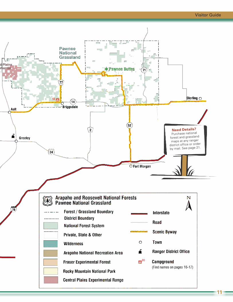
Cache la Poudre Wild and Scenic River
The Cache la Poudre River is located in Larimer County. The upper stretch was designated under the Wild and Scenic Rivers
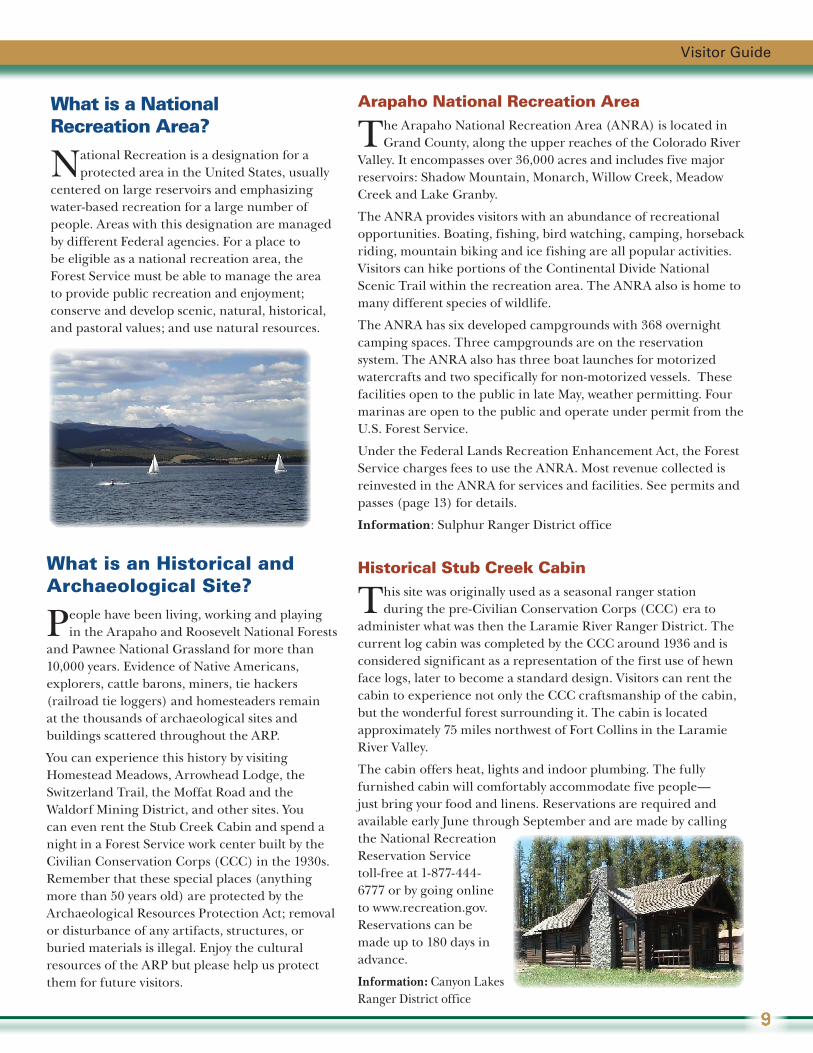
Act because of its outstanding recreation, scenic and hydrologic features. Recreation opportunities abound along its length: enjoy one of our 11 campgrounds along its banks, picnicking, fishing, hiking, and white-water rafting and kayaking in late spring and early summer.
Legend has it that the river was named in 1836, when a party of westward traveling fur trappers of the Hudson’s Bay Company were forced to lighten their load near the banks of the river after being caught in a heavy snowfall. The order was given to “cache la poudre” or “hide the powder” so that it could be retrieved the following spring.
Outstanding features in this beautiful canyon include:
The Narrows: A narrow cleft where the river has cut through rock walls.
Bighorn Sheep Viewing Area: Overlooks a spot frequented by these magnificent animals.
Profile Rock and Sleeping Elephant: Two picturesque granite rock formations.
Poudre Falls: This deep chasm roars with churning water much of the year.
Information: Canyon Lakes Ranger District office
Arapaho and Roosevelt National Forests and Pawnee National Grassland
8
Arapaho National Recreation Area
The Arapaho National Recreation Area (ANRA) is located in Grand County, along the upper reaches of the Colorado River
Valley. It encompasses over 36,000 acres and includes five major reservoirs: Shadow Mountain, Monarch, Willow Creek, Meadow Creek and Lake Granby.
The ANRA provides visitors with an abundance of recreational opportunities. Boating, fishing, bird watching, camping, horseback riding, mountain biking and ice fishing are all popular activities. Visitors can hike portions of the Continental Divide National Scenic Trail within the recreation area. The ANRA also is home to many different species of wildlife.
The ANRA has six developed campgrounds with 368 overnight camping spaces. Three campgrounds are on the reservation system. The ANRA also has three boat launches for motorized watercrafts and two specifically for non-motorized vessels. These facilities open to the public in late May, weather permitting. Four marinas are open to the public and operate under permit from the U.S. Forest Service.
Under the Federal Lands Recreation Enhancement Act, the Forest Service charges fees to use the ANRA. Most revenue collected is reinvested in the ANRA for services and facilities. See permits and passes (page 13) for details.
Information: Sulphur Ranger District office
Historical Stub Creek Cabin
This site was originally used as a seasonal ranger station during the pre-Civilian Conservation Corps (CCC) era to
administer what was then the Laramie River Ranger District. The current log cabin was completed by the CCC around 1936 and is considered significant as a representation of the first use of hewn face logs, later to become a standard design. Visitors can rent the cabin to experience not only the CCC craftsmanship of the cabin, but the wonderful forest surrounding it. The cabin is located approximately 75 miles northwest of Fort Collins in the Laramie River Valley.
The cabin offers heat, lights and indoor plumbing. The fully furnished cabin will comfortably accommodate five people—just bring your food and linens. Reservations are required and available early June through September and are made by calling the National Recreation Reservation Service toll-free at 1-877-444-6777 or by going online to www.recreation.gov. Reservations can be made up to 180 days in advance.
Information: Canyon Lakes Ranger District office
What is an Historical and Archaeological Site?
People have been living, working and playing in the Arapaho and Roosevelt National Forests
and Pawnee National Grassland for more than 10,000 years. Evidence of Native Americans, explorers, cattle barons, miners, tie hackers (railroad tie loggers) and homesteaders remain at the thousands of archaeological sites and buildings scattered throughout the ARP.
You can experience this history by visiting Homestead Meadows, Arrowhead Lodge, the Switzerland Trail, the Moffat Road and the Waldorf Mining District, and other sites. You can even rent the Stub Creek Cabin and spend a night in a Forest Service work center built by the Civilian Conservation Corps (CCC) in the 1930s. Remember that these special places (anything more than 50 years old) are protected by the Archaeological Resources Protection Act; removal or disturbance of any artifacts, structures, or buried materials is illegal. Enjoy the cultural resources of the ARP but please help us protect them for future visitors.
What is a National Recreation Area?
National Recreation is a designation for a protected area in the United States, usually
centered on large reservoirs and emphasizing water-based recreation for a large number of people. Areas with this designation are managed by different Federal agencies. For a place to be eligible as a national recreation area, the Forest Service must be able to manage the area to provide public recreation and enjoyment; conserve and develop scenic, natural, historical, and pastoral values; and use natural resources.
Visitor Guide
9

Arapaho and Roosevelt National Forests and Pawnee National Grassland
10
Visitor Guide
11
Need Details?Purchase national
forest and grassland
maps at any ranger
district office or order
by mail. See page 21.
Permits
Permits are required for certain individual and group activities and for all commercial activities
on national forests and grasslands. Check with your local ranger district office for information and to apply.
Wood ProductsPermits are required for collecting many forest resources including firewood, Christmas trees and tree transplants. Fees vary. Contact your local ranger district office for availability.
Indian Peaks WildernessGroup size is limited to 12 people and pack stock (e.g. horses) combined. Camping permits are required between June 1 and September 15. Large groups of 8-12 people and organized groups require permits year round for day and overnight trips. Purchase from the Boulder or Sulphur Ranger District offices.
Recreation Special Use Permits• Commercial and Non-commercial Events:
Any commercial event or event for which a fee is charged, such as races, organized tours, or rides; or for any non-commercial event with 75 participants or more, such as weddings, family reunions, etc., requires a special use permit. Application deadlines and fees may apply.
• Outfitters and Guides: Outfitters and guides have the knowledge, skill and equipment to enhance visitors’ experiences. The ARP has more than 100 permitted outfitters providing a variety of recreational opportunities including backpacking, horseback riding, hunting or fishing trips, whitewater rafting, rock climbing, snowmobiling, mountain biking, bird watching excursions, and other activities. Operations are regulated to ensure safety and quality public service.
What to Know?
Interagency Passes
A number of national passes may save you money. These passes admit the pass holder and passengers (in a private
non-commercial vehicle) to National Forests, National Parks and other federally managed lands and sites charging entrance or standard amenity use fees. Among those available:
Annual PassThis pass is valid for 12 months from the month of purchase. The cost is $80. Obtain by mail (see back page), online or in person at a ranger district office. This pass is not valid for camping or other discounts.
Senior Pass This pass is valid for the pass holder’s lifetime. The Senior Pass also may provide a 50 percent discount at U.S. Forest Service and other Federal campgrounds. Available to U.S. citizens or permanent residents 62 years of age or older. The cost is $10. Obtain in person at a ranger district office. Proof of age is required.
Access Pass This pass is valid for the pass holder’s lifetime. The Access Pass also may provide a 50 percent discount at U.S. Forest Service and other Federal campgrounds. Available free to U.S. citizens or permanent residents who are legally blind or permanently disabled. Obtain in person at a ranger district office. Documentation is required.
Golden PassesSome visitors may still have a Golden Age or Golden Access Passport. These passes are also valid for the pass holder’s lifetime with the identical benefits described above.
Most areas of national forests and grasslands are open, free of charge, for your use and enjoyment. Fees or permits may be required for use
of some areas, specific facilities or services. Business permit holders, such as campground concessionaires and outfitter guides, may provide services to public land users. Passes and permits are available at ranger district offices. Details online at www.fs.usda.gov/goto/arp/passes.
Arapaho and Roosevelt National Forests and Pawnee National Grassland
12
Did you know?
More than 30,000
private residences
are located within
ARP forests and grassland boundaries.
ARP Passes
Arapaho National Recreation Area Pass (ANRA)A pass is required for recreation within the ANRA. Types of passes accepted: ANRA pass; joint ANRA/Rocky Mountain National Park Pass; Interagency Access, Annual, Senior and Military Passes; and Golden Age and Access Passports. Passes can be obtained from the Sulphur Ranger District office or from the fee station on Arapaho Bay Road, near the towns of Grand Lake and Granby. For more information on the ANRA pass, visit www.fs.usda.gov/goto/arp/passes.
Mount Evans Recreation Area PassA standard amenity recreation fee is charged for the recreation area. A Mount Evans three-day or season pass is available. In addition, the Interagency Senior, Access, and Annual Passes and Golden Age and Access Passports are honored. Passes are sold at the Clear Creek Ranger District office and at the Mount Evans fee station on State Highway 5. For details, go to www.fs.usda.gov/goto/arp/mountevansroad.
American Land and Leisure Day Use PassAmerican Land and Leisure (AL&L) manages some day-use and picnic areas on Boulder and Canyon Lakes Ranger Districts. These areas require a vehicle or individual pass. The Interagency Annual, Senior, Military and Access passes and the Golden passports are honored. An AL&L Annual Pass is availabe at Brainard Lake, Chambers Lake, Mountain Park, Bellaire Lake, Dowdy Lake and West Lake day-use areas and all day-use areas operated by AL&L. For more information, contact the Boulder or Canyon Lakes Ranger District offices.
Visitor Guide
13
Do It Right!
Know Before You Go!
Our proximity to growing urban populations greatly influences the way the ARP is managed and the way in which visitors enjoy our great outdoors.
Here are a few common-sense tips.
Be Courteous!Extend your understanding and courtesy to others whose uses of the land may be different from yours. While hiking, you may see horseback riders, cattle grazing or timber harvesting; while riding your ATV you may be prohibited from some trails to enable others to experience a different kind of recreation.
Get Away from the PackTry to visit the forest on weekdays or try to space yourself from others so that all may enjoy nature without crowds.
BoundariesPrivate land is heavily intermixed within the ARP. As a visitor, it is your responsibility to make sure you know where you are and to stay on public lands. Detailed forest and grassland maps are available at any ranger district office.
Public RoadsVehicles are permitted on MVUM-designated routes only (see page 3). Look for signs to determine if you can travel the road. Four-wheel drive vehicles are recommended on many forest roads. Always check current road conditions, restrictions and openings before setting out. See www.fs.usda.gov/goto/arp/roads.
CampfiresCampfires are allowed in many places throughout the ARP. Never leave your fire unattended. Be sure your fire is completely extinguished and out cold before leaving. You may gather enough dead wood to use while visiting. Any leftover wood must be scattered. Consider using a camp stove as an alternative to campfires. Please remember there are some places where you may never have a fire. Check with your local ranger district office for current conditions and restrictions.
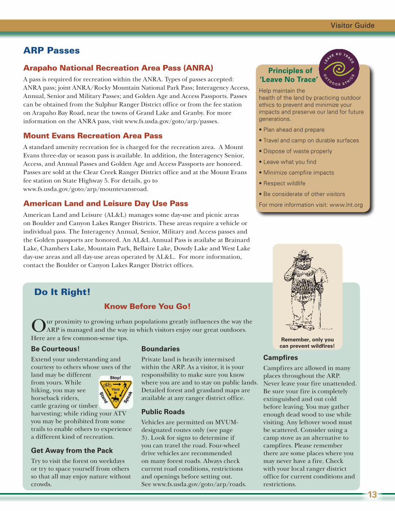
Principles of ‘Leave No Trace’Help maintain the health of the land by practicing outdoor ethics to prevent and minimize your impacts and preserve our land for future generations.
•Planaheadandprepare
•Travelandcampondurablesurfaces
•Disposeofwasteproperly
•Leavewhatyoufind
•Minimizecampfireimpacts
•Respectwildlife
•Beconsiderateofothervisitors
For more information visit: www.lnt.org
Remember, only you can prevent wildfires!
What to Know? (continued)
Arapaho and Roosevelt National Forests and Pawnee National Grassland
14
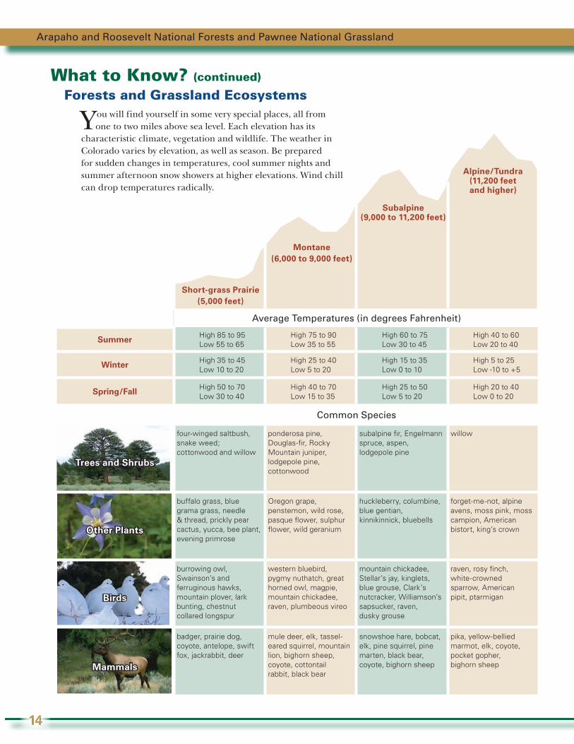
Forests and Grassland Ecosystems
Average Temperatures (in degrees Fahrenheit)
Summer High 85 to 95Low 55 to 65
High 75 to 90Low 35 to 55
High 60 to 75Low 30 to 45
High 40 to 60Low 20 to 40
Winter High 35 to 45Low 10 to 20
High 25 to 40Low 5 to 20
High 15 to 35Low 0 to 10
High 5 to 25Low -10 to +5
Spring/Fall High 50 to 70Low 30 to 40
High 40 to 70Low 15 to 35
High 25 to 50Low 5 to 20
High 20 to 40Low 0 to 20
Common Species
Trees and Shrubs
four-winged saltbush, snake weed; cottonwood and willow
ponderosa pine, Douglas-fir, Rocky Mountain juniper, lodgepole pine, cottonwood
subalpine fir, Engelmann spruce, aspen, lodgepole pine
willow
Other Plants
buffalo grass, blue grama grass, needle & thread, prickly pear cactus, yucca, bee plant, evening primrose
Oregon grape, penstemon, wild rose, pasque flower, sulphur flower, wild geranium
huckleberry, columbine, blue gentian, kinnikinnick, bluebells
forget-me-not, alpine avens, moss pink, moss campion, American bistort, king’s crown
Birds
burrowing owl, Swainson’s and ferruginous hawks, mountain plover, lark bunting, chestnut collared longspur
western bluebird, pygmy nuthatch, great horned owl, magpie, mountain chickadee, raven, plumbeous vireo
mountain chickadee, Stellar’s jay, kinglets, blue grouse, Clark’s nutcracker, Williamson’s sapsucker, raven, dusky grouse
raven, rosy finch, white-crowned sparrow, American pipit, ptarmigan
Mammals
badger, prairie dog, coyote, antelope, swift fox, jackrabbit, deer
mule deer, elk, tassel-eared squirrel, mountain lion, bighorn sheep, coyote, cottontail rabbit, black bear
snowshoe hare, bobcat, elk, pine squirrel, pine marten, black bear, coyote, bighorn sheep
pika, yellow-bellied marmot, elk, coyote, pocket gopher, bighorn sheep
Short-grass Prairie(5,000 feet)
Montane(6,000 to 9,000 feet)
Subalpine(9,000 to 11,200 feet)
Alpine/Tundra (11,200 feet and higher)
Y ou will find yourself in some very special places, all from one to two miles above sea level. Each elevation has its
characteristic climate, vegetation and wildlife. The weather in Colorado varies by elevation, as well as season. Be prepared for sudden changes in temperatures, cool summer nights and summer afternoon snow showers at higher elevations. Wind chill can drop temperatures radically.

Campgrounds
When you head out to the forests and grassland, you'll find 53 campgrounds available for your
enjoyment—either by reservation or on a first-come, first-served basis. Amenities and fees vary by campground and are noted in the table on the following pages. Many (but not all) are open by Memorial Day weekend.
Campground LocationsCampground locations range in elevation from 4,800 to 10,900 feet above sea level (see altitude sickness in outdoor safety section, page 19).
Please refer to the map on pages 10 and 11 for campground locations. The numbers on the map correspond to the numbers listed in the table on pages 16 and 17.
AmenitiesAmenities typically include toilets (usually vault toilets), picnic tables, and a fire ring or grate. Some campgrounds may include electricity, water and more. Water may not be available after Labor Day weekend.
Firewood is available for a fee at some campgrounds.
Make Sure You Fit A single site may hold up to eight people. Tents must fit on the pads provided. RVs, trailers or other vehicles must fit on the parking spur because driving or parking off road is not permitted. The campground table shows parking length ranges. Call the local ranger district office for site-specific measurements.
HousekeepingQuiet hours are from 10 p.m. to 6 a.m. This includes generators. Dogs are welcome in campgrounds but must be on a leash. Operating dirt bikes, ATVs and other non-street legal vehicles in the campgrounds is prohibited.
Season Dates and Stay LimitIn general, many campgrounds are open mid-May through late September depending upon weather and snow conditions. Some close later in the fall and a few are open year round. Due to the Mountain Pine Beetle epidemic, the Forest Service cannot guarantee a particular campground will be open. Please call the local ranger district office before planning your trip.
The stay limit in most campgrounds is 14 days. The Arapaho National Recreation Area (ANRA) is limited to seven consecutive days.
FeesFees vary by campsite size and location. Fees listed are for standard sized sites. Oversized sites accommodate more people and charge an extra fee. Premium sites, such as lakeside locations, may cost extra.
Interagency Senior, Interagency Access, Golden Age and Golden Access passes provide cardholders half price for campground fees (see page 12). For campgrounds with hookups, the electrical fee is full price for everyone.
Reservation TipsSome campsites may be reserved (see the “reservable” column on the next page), others are first come, first served. Make your reservations at www.recreation.gov or by calling 1-877-444-6777 as early as 180 days in advance. Reservations must be made at least four days prior to arrival, except for the five-day advanced reservation required in the ANRA. Campgrounds are often fully booked several months in advance.
Group Sites and Equestrian SitesBe respectful of other campers. Large groups should reserve a group campsite instead of multiple sites at a regular campground. Several campgrounds accommodate large groups (up to 100 people). Reservations may be made 360 days in advance. Equestrian sites are only available at Jack’s Gulch and South Fork. The table on the following pages identifies group sites.
Stillwater Campground
Peaceful Valley Campground
Visitor Guide
15
Campgrounds
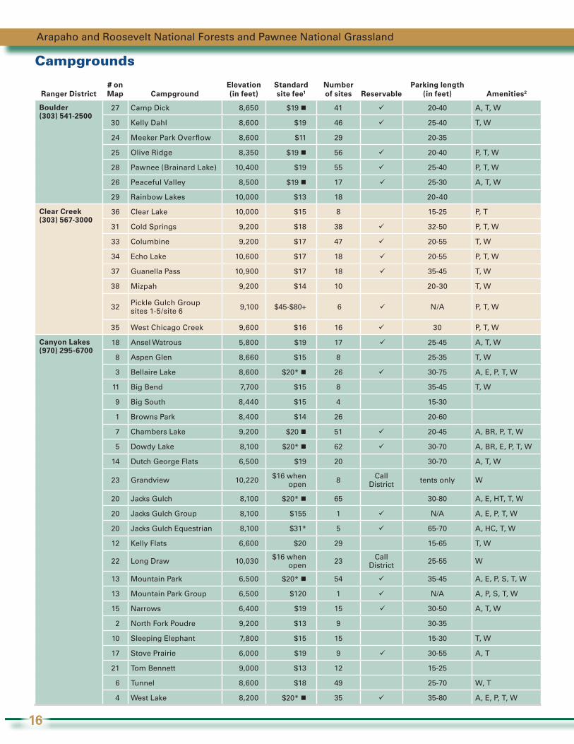
Ranger District# on Map Campground
Elevation (in feet)
Standard site fee1
Number of sites Reservable
Parking length (in feet) Amenities2
Boulder (303) 541-2500
27 Camp Dick 8,650 $19 41 20-40 A, T, W
30 Kelly Dahl 8,600 $19 46 25-40 T, W
24 Meeker Park Overflow 8,600 $11 29 20-35
25 Olive Ridge 8,350 $19 56 20-40 P, T, W
28 Pawnee (Brainard Lake) 10,400 $19 55 25-40 P, T, W
26 Peaceful Valley 8,500 $19 17 25-30 A, T, W
29 Rainbow Lakes 10,000 $13 18 20-40
Clear Creek(303) 567-3000
36 Clear Lake 10,000 $15 8 15-25 P, T
31 Cold Springs 9,200 $18 38 32-50 P, T, W
33 Columbine 9,200 $17 47 20-55 T, W
34 Echo Lake 10,600 $17 18 20-55 P, T, W
37 Guanella Pass 10,900 $17 18 35-45 T, W
38 Mizpah 9,200 $14 10 20-30 T, W
32 Pickle Gulch Group sites 1-5/site 6 9,100 $45-$80+ 6 N/A P, T, W
35 West Chicago Creek 9,600 $16 16 30 P, T, W
Canyon Lakes (970) 295-6700
18 Ansel Watrous 5,800 $19 17 25-45 A, T, W
8 Aspen Glen 8,660 $15 8 25-35 T, W
3 Bellaire Lake 8,600 $20* 26 30-75 A, E, P, T, W
11 Big Bend 7,700 $15 8 35-45 T, W
9 Big South 8,440 $15 4 15-30
1 Browns Park 8,400 $14 26 20-60
7 Chambers Lake 9,200 $20 51 20-45 A, BR, P, T, W
5 Dowdy Lake 8,100 $20* 62 30-70 A, BR, E, P, T, W
14 Dutch George Flats 6,500 $19 20 30-70 A, T, W
23 Grandview 10,220 $16 when open 8 Call
District tents only W
20 Jacks Gulch 8,100 $20* 65 30-80 A, E, HT, T, W
20 Jacks Gulch Group 8,100 $155 1 N/A A, E, P, T, W
20 Jacks Gulch Equestrian 8,100 $31* 5 65-70 A, HC, T, W
12 Kelly Flats 6,600 $20 29 15-65 T, W
22 Long Draw 10,030 $16 when open 23 Call
District 25-55 W
13 Mountain Park 6,500 $20* 54 35-45 A, E, P, S, T, W
13 Mountain Park Group 6,500 $120 1 N/A A, P, S, T, W
15 Narrows 6,400 $19 15 30-50 A, T, W
2 North Fork Poudre 9,200 $13 9 30-35
10 Sleeping Elephant 7,800 $15 15 15-30 T, W
17 Stove Prairie 6,000 $19 9 30-55 A, T
21 Tom Bennett 9,000 $13 12 15-25
6 Tunnel 8,600 $18 49 25-70 W, T
4 West Lake 8,200 $20* 35 35-80 A, E, P, T, W
Arapaho and Roosevelt National Forests and Pawnee National Grassland
16
Campgrounds
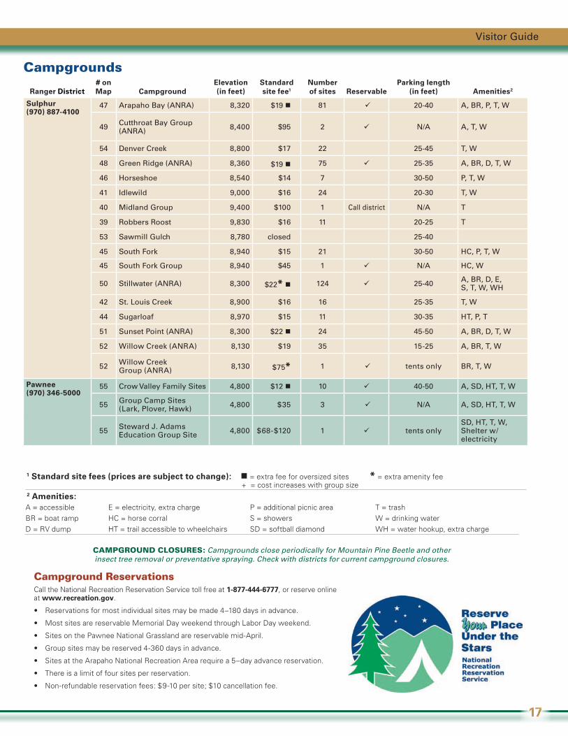
Ranger District# on Map Campground
Elevation (in feet)
Standard site fee1
Number of sites Reservable
Parking length (in feet) Amenities2
Sulphur(970) 887-4100
47 Arapaho Bay (ANRA) 8,320 $19 81 20-40 A, BR, P, T, W
49 Cutthroat Bay Group (ANRA) 8,400 $95 2 N/A A, T, W
54 Denver Creek 8,800 $17 22 25-45 T, W
48 Green Ridge (ANRA) 8,360 $19 75 25-35 A, BR, D, T, W
46 Horseshoe 8,540 $14 7 30-50 P, T, W
41 Idlewild 9,000 $16 24 20-30 T, W
40 Midland Group 9,400 $100 1 Call district N/A T
39 Robbers Roost 9,830 $16 11 20-25 T
53 Sawmill Gulch 8,780 closed 25-40
45 South Fork 8,940 $15 21 30-50 HC, P, T, W
45 South Fork Group 8,940 $45 1 N/A HC, W
50 Stillwater (ANRA) 8,300 $22* 124 25-40 A, BR, D, E, S, T, W, WH
42 St. Louis Creek 8,900 $16 16 25-35 T, W
44 Sugarloaf 8,970 $15 11 30-35 HT, P, T
51 Sunset Point (ANRA) 8,300 $22 24 45-50 A, BR, D, T, W
52 Willow Creek (ANRA) 8,130 $19 35 15-25 A, BR, T, W
52 Willow Creek Group (ANRA) 8,130 $75* 1 tents only BR, T, W
Pawnee (970) 346-5000
55 Crow Valley Family Sites 4,800 $12 10 40-50 A, SD, HT, T, W
55 Group Camp Sites (Lark, Plover, Hawk) 4,800 $35 3 N/A A, SD, HT, T, W
55 Steward J. Adams Education Group Site 4,800 $68-$120 1 tents only
SD, HT, T, W, Shelter w/electricity
Campground ReservationsCall the National Recreation Reservation Service toll free at 1-877-444-6777, or reserve online at www.recreation.gov.
• Reservations for most individual sites may be made 4–180 days in advance.
• Most sites are reservable Memorial Day weekend through Labor Day weekend.
• Sites on the Pawnee National Grassland are reservable mid-April.
• Group sites may be reserved 4-360 days in advance.
• Sites at the Arapaho National Recreation Area require a 5–day advance reservation.
• There is a limit of four sites per reservation.
• Non-refundable reservation fees: $9-10 per site; $10 cancellation fee.
1 Standard site fees (prices are subject to change): = extra fee for oversized sites * = extra amenity fee + = cost increases with group size 2 Amenities:A = accessible E = electricity, extra charge P = additional picnic area T = trashBR = boat ramp HC = horse corral S = showers W = drinking waterD = RV dump HT = trail accessible to wheelchairs SD = softball diamond WH = water hookup, extra charge
CAMPGROUND CLOSURES: Campgrounds close periodically for Mountain Pine Beetle and other insect tree removal or preventative spraying. Check with districts for current campground closures.
Visitor Guide
17
TravelDriving on mountain roads requires extra caution. Some dirt roads may narrow to one lane. There may be blind corners—travel slowly and be prepared to stop in half the sight distance.
• Be sure to study a map before heading out.
• When sightseeing, use roadside-pullout areas to allow others to pass.
• Be aware of current forest road and highway conditions (see back cover for phone numbers and websites).
CommunicationsTell someone where you are going, when you expect to return and what to do if you don’t.
• Cellular phones often have sporadic or no reception in mountain and grassland areas.
• It is a good idea to travel in groups of four so if someone is injured, one person can stay with the injured person and the other two can travel for help.
If You are Lost If you get lost or become disorientated, stay calm and stay put! Stop and pay close attention to your surroundings and landmarks; relate this to your location on a map.
• Panic is your greatest enemy. Stay calm and try to remember how you got to your present location.
• Trust your map and compass, and do not walk aimlessly. If you are on a trail, don’t leave it.
• Stay put if it is nightfall, if you are injured or if you are near exhaustion.
• Keeping warm is more important than finding food and water.
• As a last resort, follow a drainage or stream downhill. This can be hard going but will often lead to a trail or road.
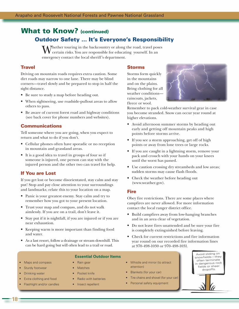
StormsStorms form quickly in the mountains and on the plains. Bring clothing for all weather conditions—raincoats, jackets, fleece or wool. Remember to pack cold-weather survival gear in case you become stranded. Snow can occur year round at higher elevations.
• Avoid afternoon summer storms by heading out early and getting off mountain peaks and high points before storms arrive.
• If you see a storm approaching, get off of high points or away from lone trees or large rocks.
• If you are caught in a lightning storm, remove your pack and crouch with your hands on your knees until the worst has passed.
• Use caution crossing dry streambeds and low areas; sudden storms may cause flash floods.
• Check the weather before heading out (www.weather.gov).
FireObey fire restrictions. There are some places where campfires are never allowed. For more information contact the local ranger district office.
• Build campfires away from low-hanging branches and in an area clear of vegetation.
• Do not leave fires unattended and be sure your fire is completely extinguished before leaving.
• Check for current restrictions and fire information year round on our recorded fire information lines at 970-498-1030 or 970-498-1031.
What to Know? (continued)
Outdoor Safety … It’s Everyone’s Responsibility
Whether touring in the backcountry or along the road, travel poses certain risks. You are responsible for educating yourself. In an
emergency contact the local sheriff’s department.
Arapaho and Roosevelt National Forests and Pawnee National Grassland
18
Essential Outdoor Items• Maps and compass
• Sturdy footwear
• Drinking water
• Extra clothing and food
• Flashlight and/or candles
• Rain gear
• Matches
• Pocket knife
• Radio with batteries
• Insect repellent
• Whistle and mirror (to attract attention)
• Blankets (for your car)
• Tire chains and shovel (for your car)
• Personal safety equipment
Avoid sliding on
snowfields—they
often terminate
in dangerous rock
fields or sheer dropoffs.

DehydrationThe dry Colorado air draws moisture out of the body in all temperatures. While traveling, you may be miles away from a clean water source.
• Take and drink water wherever you travel on the forests or grassland.
• If you must drink water from a stream, boil or properly filter all free-flowing drinking water to kill Giardia and other parasites.
Altitude The major cause of altitude sickness is going too high, too fast. Elevations in Colorado range from 5,000 feet to over 14,000 feet. Mild altitude sickness affects up to 30 percent of Colorado visitors. At higher elevations, the air becomes “thinner,” which means you get less oxygen to breathe. Altitude sickness symptoms may include shortness of breath, nausea, heart palpitations, extreme thirst, weakness, headaches and “tunnel vision.”
• If you experience any of these symptoms, slow down and drink water. If symptoms persist, proceed to a lower elevation and seek medical attention.
• Reduce the chance of experiencing “mountain sickness” by drinking plenty of water and avoiding caffeine, alcohol and heavy meals.
• Allow yourself time (1 to 3 days) to acclimate if arriving from lower elevations. The amount of time needed will depend on your physiology and total elevation changed.
• Ultraviolet radiation (UV) is increased two-fold at 10,000 feet compared to sea level. To prevent sunburn, wear sunscreen and a brimmed hat. Wear sunglasses to protect your eyes.
HypothermiaLife-threatening hypothermia is possible even in mid-summer and is caused when the body’s core temperature is lowered by cold and wind. It can happen even at temperatures of 50 degrees Fahrenheit. Symptoms range from feeling extremely cold to sluggish behavior, slurred speech or unconcern for the cold.
• Stay warm and dry; wool and some synthetic clothing help you stay warm even when wet.
• If anyone in your group begins to show symptoms, act immediately to re-warm them. Get out of the wind and rain, remove wet clothing, build a fire, and give hot liquids only if they are conscious.
Abandoned MinesAbandoned mines can be safety hazards. Many of these structures contain dilapidated frames, open shafts and water-filled pits, and poor or lethal air quality. Dangers include old explosives, hazardous chemicals, snakes, spiders, mice, bats and vertical shafts.
AvalanchesAbout 2,300 avalanches are reported to the Colorado Avalanche Center in an average winter. About 98 percent of all avalanches occur on slopes of 25–50 degrees.
• Learn to recognize and avoid avalanche terrain and signs of unstable snow.
• Carry and know how to use avalanche rescue gear.
• Call the Colorado Avalanche Information Center for the latest mountain weather, snow and avalanche conditions at 303-275-5360 or check online at http://avalanche.state.co.us.
PetsLeashes protect dogs from becoming lost and from hazards such as porcupines and mountain lions. Leashed dogs are less likely to intimidate or harm others.
• Pets must be under voice control or on a leash at all times.
• Dogs must be leashed in campgrounds, picnic areas, most wilderness areas and on some trails.
Forests and Grassland CreaturesPlease help keep wildlife “wild” by not approaching or feeding them. If an animal approaches you, move away and maintain a safe distance.
• Use binoculars, spotting scopes and telephoto lenses to minimize stress to animals and provide a safe viewing distance for you.
• Be aware of various wildlife that may be in the area and how to prevent dangerous encounters.
• Check for wood ticks in the spring and early summer.
• Use insect repellent during mosquito season.
• Always secure your food and keep a clean camp.
Visitor Guide
19
You Can Help: Volunteer OpportunitiesVolunteers are the heartbeat of the Forest Service and the ARP!
The ARP is among the top national forests and grasslands for recreational volunteers in the country.
Volunteers have dedicated thousands of hours of service and accomplished projects to enhance recreational opportunities across the ARP, and their support greatly influences the work that is accomplished every year.
Numerous opportunities exist for volunteers on the ARP, from trail work to education to restoration, and much more—almost anything except tasks associated with law enforcement. You can participate in a one-time project or serve over several months, seasons or year round in various programs. Every person who donates time makes immeasurable contributions to the land, our visitors and our employees.
Contact any local ranger district office to find out what opportunities are waiting for you, or check the web at www.fs.usda.gov/goto/arp/volunteers.
The Arapaho and Roosevelt National Forests and Pawnee National Grassland (ARP) Foundation was formed in 2003 to help the Forests and Grassland achieve their goals. The foundation is always looking for people who want to help by being board members, serving as elected officials or by supporting the foundation in others ways to help the foundation achieve its educational, charitable and scientific mission. If you are interested in learning more about the ARP Foundation, please contact Tammy Williams at (970) 295-6693 or e-mail her at [email protected]. http://arp-foundation.org
Arapaho and Roosevelt National Forests and Pawnee National Grassland
20
Land Management for Multiple UsesRecreation and So Much More!
While recreating, remember the land is managed for a variety of uses:
• Biodiversity and ecosystem sustainability;
• Air, soil, vegetation, water quality and water supply;
• Sustainable recreational opportunities (developed and dispersed), wilderness use and motorized travel; and
• Land uses and ownership.
Multiple-use management is complicated by:
• Private and public land intermix;
• Invasive species;
• Unmanaged recreation; and
• Fuels and fire.
Fraser Experimental ForestThe 22,400-acre Fraser Experimental Forest (FEF) was established in 1937 near the town of Fraser to study subalpine forests and water yield in the central Rocky Mountains. In 1976, the United Nations Educational, Scientific and Cultural Organization designated the FEF as a Biosphere Reserve, dedicated to conserving the diversity and integrity of plant and animal communities. Although the FEF is primarily managed for research, most of this special area is available for limited public use. Please contact the Sulphur Ranger District office for information about both summer and winter recreational opportunities and restrictions. Additional information is also available on the web at www.fs.fed.us/rm/fraser.
Mountain Pine Beetles and Fuels ManagementMountain Pine Beetles are killing trees at epidemic levels and will be affecting the landscape for years to come. Trees can fall at any time. When visiting the forest, do not park, camp, or picnic under dead trees. The ARP’s response to the beetle infestation includes timber harvesting, firewood sales and prescribed fires. We work to reduce the potential of wildfire in our communities, while keeping the public and firefighters safe, increasing forest diversity, and keeping recreation areas open to the public.
Order Form for Maps and the Interagency Annual Pass
Item Quantity Unit Price Total Price
Forest Maps – (free shipping)
Arapaho and Roosevelt National Forests – Plastic ________ $10 ________
Pawnee National Grassland – Plastic ________ $10 ________
Other Forest and Grassland Maps (Please call for pricing and availability of maps in Colorado, South Dakota, Kansas, Nebraska and most of Wyoming. Call or consult the web site www.fs.usda.gov/main/r2/maps-pubs
$9 or $10
________(No shipping fee)
Rocky Mountain Region National Forests and Grasslands (free shipping) Shows all national forests and grasslands in the region.
________ free N/A
Interagency Annual Pass (See Passes, page 12) ________ $80 ________
Prepayment is required for all mail orders.
Total items ordered ________
Total amount enclosed ________
Name ____________________________________________________
Address __________________________________________________
City, State, Zip ____________________________________________
e-mail ____________________________________________________
Mail your completed order form and payment (including any applicable shipping costs) to:
Forest Map Order ARP Visitor Center 2150 Centre Ave., Bldg. E Fort Collins, CO 80526
Make checks payable to: USDA Forest Service.For credit card purchases please call 970-295-6700.
National Forest and Grassland MapsNational forests and grassland maps include detailed information on campgrounds, roads, hiking trails and points of interest on land managed by the U.S. Forest Service. Maps also show the location of private land within national forest boundaries. Different forest maps may have different scales, but generally, the scale will be ½-inch to the mile (1:126,720). Maps come in either paper ($9) or plastic ($10). Plastic maps have a Mylar coating, are water-resistant and tear-resistant. There is no charge for shipping Forest Service maps.
U.S. Geological Survey Topographic MapsU.S. Geological Survey (USGS) topographic maps— also known as quadrangle maps—show contours, roads, and geological and human-made features. These USGS maps have a 1:24,000 scale, are paper, and cost $8 each plus shipping. To find out the quadrangle name for the map you want, consult the quadrangle index (located on all national forest maps). You can also contact any retail store that sells topographic maps or call any ranger district office for assistance. Topographic maps can be ordered online at http://topomaps.usgs.gov/ordering_maps.html.
Purchase items at ranger district offices or by mail.Questions? Call 970-295-6700.
+
Visitor Guide
21
Handy Numbers and Web SitesARP Central Office 970-295-6700
www.fs.usda.gov/ARPEMERGENCY: 911 or _________________________________ (fill in the blank depending
on your destination – remember cell phones may not work in the forests or grassland)
ARP Fire Information 970-498-1030 or 970-498-1031 www.inciweb.nwcg.gov
ARP Forest Roads contact local ranger district office www.fs.usda.gov/goto/arp/roads
Colorado Avalanche Information (November through April) 303-275-5360 http://avalanche.state.co.us
Colorado Parks and Wildlife (hunting and fishing) 303-291-7227 www.wildlife.state.co.us
Colorado Highway Conditions 303-639-1111 www.cotrip.org
Colorado State Parks (register OHVs, snowmobiles and boats) 303-791-1920 www.parks.state.co.us
National Recreation Reservation Service (campground and cabin reservations) 877-444-6777 www.recreation.gov
State Fire Restrictions www.dola.colorado.gov/dem/public_information/firebans/firebans.htm
Weather www.weather.gov
Forest Maps www.fs.usda.gov/goto/arp/maps
The U.S. Department of Agriculture (USDA) prohibits discrimination in all its programs and activities on the basis of race, color, national origin, age, disability, and where applicable, sex, marital status, familial status, parental status, religion, sexual orientation, genetic information, political beliefs, reprisal, or because all or part of an individual’s income is derived from any public assistance program. (Not all prohibited bases apply to all programs.) Persons with disabilities who require alternative means for communication of program information (Braille, large print, audiotape, etc.) should contact USDA’s TARGET Center at (202) 720-2600 (voice and TDD). To file a complaint of discrimination, write to USDA, Director, Office of Civil Rights, 1400 Independence Avenue, S.W., Washington, D.C. 20250-9410, or call (800) 795-3272 (voice) or (202) 720-6382 (TDD). USDA is an equal opportunity provider and employer.
www.fs.usda.gov/ARP CENTRAL OFFICE2150 Centre Ave., Bldg. EFort Collins, CO 80526970-295-6700
BOULDER RANGER DISTRICT OFFICE2140 Yarmouth AvenueBoulder, CO 80301303-541-2500
CANYON LAKES RANGER DISTRICT OFFICE2150 Centre Ave., Bldg. EFort Collins, CO 80526970-295-6700
CLEAR CREEK RANGER DISTRICT OFFICE101 Chicago Creek RoadP.O. Box 3307Idaho Springs, CO 80452303-567-3000
PAWNEE NATIONAL GRASSLAND RANGER DISTRICT OFFICE660 O StreetGreeley, CO 80631970-346-5000
SULPHUR RANGER DISTRICT OFFICE9 Ten Mile DriveP.O. Box 10Granby, CO 80446970-887-4100
Please recycle this document.
Layout/design and editorial services provided by EMC Publishing Arts
Published March 2014Printed on recycled paper