Embed Size (px)
Citation preview

WHAT’S NEW POWER PORTFOLIO 2015
November 07, 2014
Table of Contents
Introducing the Power Portfolio ..................................................................................................... 3
2015 Power Portfolio Release Overview ....................................................................................... 4
Producer .................................................................................................................... 4
Provider ..................................................................................................................... 4
Platform ..................................................................................................................... 4
2015 Power Portfolio Release Features ........................................................................................ 5
Producer Suite ............................................................................................................ 5
Provider Suite ........................................................................................................... 10
Platform Suite ........................................................................................................... 13
About Hexagon Geospatial .......................................................................................................... 19

Power Portfolio 2015
November 07, 2014 3
Introducing the Power Portfolio The Hexagon Geospatial Power Portfolio helps you understand change and derive the information you require to make mission- and business-critical decisions. With creative and intuitive interfaces, smart workflows, and automated technologies, the Power Portfolio enables you to transform multi-source content into actionable information.
Every business has different needs; the ability to identify the right tools and combine technologies across products is crucial to success. We recognize this and we will assist you in pinpointing exactly the tools you require, while maintaining the flexibility to easily work across products and suites.
The three Suites of the Power Portfolio group our industry-leading products into descriptive categories while still retaining their globally-recognized names:
The Producer Suite empowers you to collect, process, analyze and understand raw geospatial data. Derive and deliver usable information with Hexagon Geospatial’s desktop-based GIS, remote sensing, and photogrammetry offerings.
The Provider Suite allows you to manage and deliver your data to others. Organize and optimize enterprise-wide data holdings into a centralized library, and distribute to desktop, web and mobile applications.
The Platform Suite provides the tools to build customized geospatial apps and solutions using a sophisticated set of developer-focused technologies. Extend geospatial functionality where you need it through modern and dynamic toolkits.
Power Portfolio 2015
November 07, 2014 4
2015 Power Portfolio Release Overview
Producer Intelligently author, analyze, process, and map multiple sources of data
Extract business graphics from GIS – Gain even deeper insights from sophisticated analyses in GeoMedia and GeoMedia Smart Client. Make compelling and informative pie charts, bar graphs and more. Extract relevant business knowledge from rich GIS data, adding a spatial dimension to your business analysis.
Easily extend remote sensing workflows – Greatly expand capabilities and target specific customer demands by plugging your own unique operations into customizable models in ERDAS IMAGINE. Take advantage of newly-constructed custom workflows in the 2015 release, including
change detection for property appraisal and UAV processing workflows.
Create point clouds from satellite imagery – The Semi Global Matching (SGM) algorithm in IMAGINE Photogrammetry now enables you to generate very dense and accurate point clouds from satellite imagery, providing rich elevation information for subsequent visualization and interpretation.
Provider Comprehensively manage and deliver volumes of geospatial and business data
Stream LiDAR point clouds – Whether on desktop, browser or mobile devices, you can now easily discover and view LAS-formatted point cloud data without downloading the dataset. ERDAS APOLLO manages large LiDAR datasets and efficiently streams them to end users on any device.
Compress imagery and LiDAR data – ERDAS Image Compressor rapidly compresses imagery to ECW or JPEG2000 formats. It also compresses point cloud data to Hexagon Point Cloud (HPC) format, which is 5-20% of its original size, and prepared for streaming via ERDAS APOLLO.
Platform Efficiently build and deploy smart solutions that fit your needs
Powerful browser workflows – The new Workflow Manager lets you construct highly-focused, attribute-based processes that can be made available in the browser and through Geospatial Portal. No programming skills required.
Offline mobile apps – Offline vector workflows mean work always continues within Mobile MapWorks, even in areas with little or no connectivity.
Get more ‘D’ in your 3D – Significant improvements to 3D rendering in the Geospatial Portal like
the ability to simulate buildings and other 3D features for quick measurement and investigation.
Power Portfolio 2015
November 07, 2014 5
2015 Power Portfolio Release Features
Producer Suite
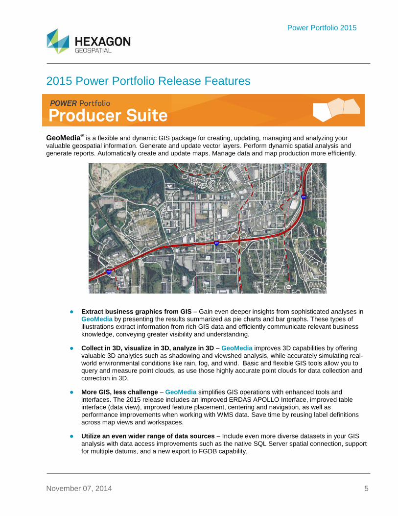
GeoMedia® is a flexible and dynamic GIS package for creating, updating, managing and analyzing your
valuable geospatial information. Generate and update vector layers. Perform dynamic spatial analysis and generate reports. Automatically create and update maps. Manage data and map production more efficiently.
Extract business graphics from GIS – Gain even deeper insights from sophisticated analyses in GeoMedia by presenting the results summarized as pie charts and bar graphs. These types of illustrations extract information from rich GIS data and efficiently communicate relevant business knowledge, conveying greater visibility and understanding.
Collect in 3D, visualize in 3D, analyze in 3D – GeoMedia improves 3D capabilities by offering valuable 3D analytics such as shadowing and viewshed analysis, while accurately simulating real-world environmental conditions like rain, fog, and wind. Basic and flexible GIS tools allow you to query and measure point clouds, as use those highly accurate point clouds for data collection and correction in 3D.
More GIS, less challenge – GeoMedia simplifies GIS operations with enhanced tools and interfaces. The 2015 release includes an improved ERDAS APOLLO Interface, improved table interface (data view), improved feature placement, centering and navigation, as well as performance improvements when working with WMS data. Save time by reusing label definitions across map views and workspaces.
Utilize an even wider range of data sources – Include even more diverse datasets in your GIS analysis with data access improvements such as the native SQL Server spatial connection, support for multiple datums, and a new export to FGDB capability.
Power Portfolio 2015
November 07, 2014 6
Increase productivity through easy customization – More tools for customizing your geospatial applications lead to less distraction, more focus, and greater productivity. GeoMedia exposes new APIs for loading the ribbon bar and enabling commands along with the ability to add custom construction aids.
Enhanced enterprise operations – Administer, configure and share GeoMedia feature cache across workgroups. Expanded customizable user descriptions facilitate common asset usage across the organization.
Even more power and versatility – We have packed more tools than ever into GeoMedia with the
inclusion of the expansion packs.
Out of the shop and into the field – Take GeoMedia with you on a tablet, laptop computer or field device (such as the Leica GeosystemsCS25), for data collection and analysis with GeoMedia Mobile.
Advanced spatial analysis on utility data – Improve your current workflows by leveraging the built-in G/Tech Interoperability in GeoMedia.
Learning – Our approach to product training has been completely revamped. New eLearning videos provide the knowledge you need through short but focused topics on your own schedule. We will also provide all new tutorials and on line training.
Other Enhancements
Image Scout – New Synthetic Aperture Radar (SAR) support. Pan-Sharpening is improved with added Colour Space support and the sharpening is applied on-the-fly. Improved Multispectral Support includes selectable sensor-specific band profiles in addition to automatically recognizing image sensor types.
GeoMedia Motion Video Analyst Professional – Native database support for archive and query, clip marks, and registrations using SQL Server 2012 and 2014, including the Express variant (TerraShare requirement is removed). Unicast support is added to provide secure network transmission. Support for the Catalina Ground station and “Lite” version 3.2 is added and Catalina 3.1 support is continued.
ERDAS IMAGINE® performs advanced remote sensing analysis and spatial modelling to create new
information. With ERDAS IMAGINE, you can visualize your results in 2D, 3D, movies, and on cartographic-quality map compositions. Optional modules (add-ons) provide specialized functionalities to enhance your productivity and expand capabilities.
Power Portfolio 2015
November 07, 2014 7
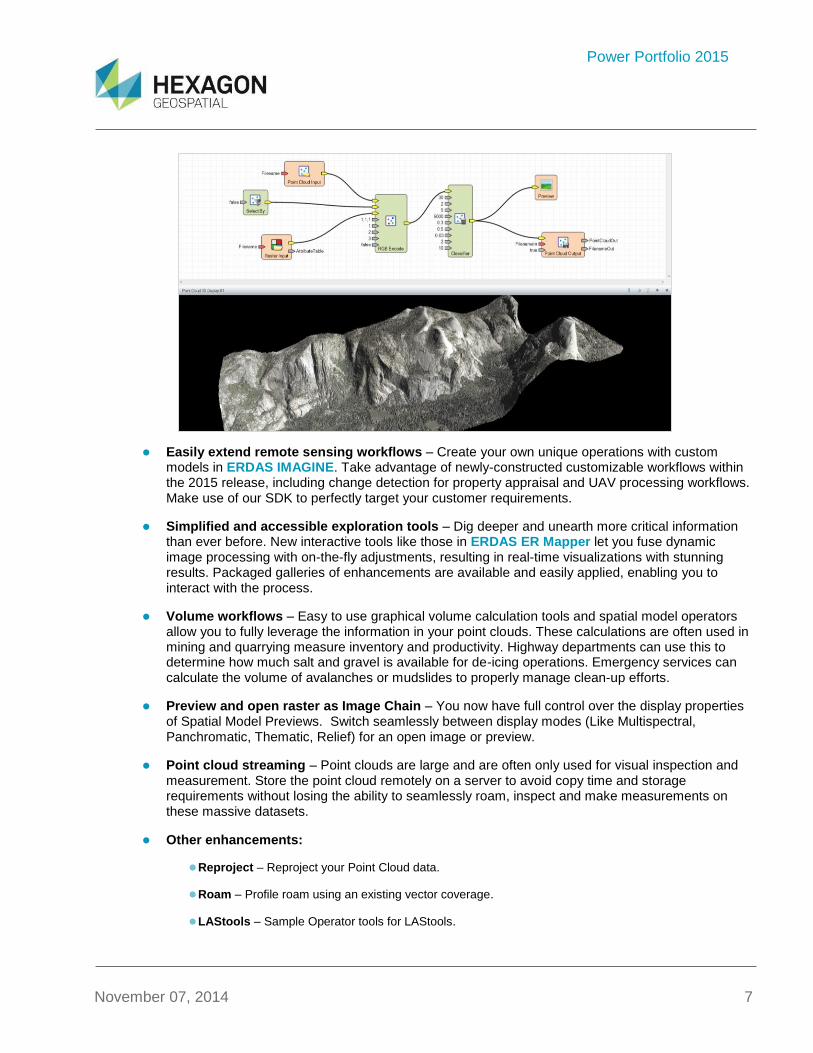
Easily extend remote sensing workflows – Create your own unique operations with custom models in ERDAS IMAGINE. Take advantage of newly-constructed customizable workflows within the 2015 release, including change detection for property appraisal and UAV processing workflows. Make use of our SDK to perfectly target your customer requirements.
Simplified and accessible exploration tools – Dig deeper and unearth more critical information than ever before. New interactive tools like those in ERDAS ER Mapper let you fuse dynamic image processing with on-the-fly adjustments, resulting in real-time visualizations with stunning results. Packaged galleries of enhancements are available and easily applied, enabling you to interact with the process.
Volume workflows – Easy to use graphical volume calculation tools and spatial model operators allow you to fully leverage the information in your point clouds. These calculations are often used in mining and quarrying measure inventory and productivity. Highway departments can use this to determine how much salt and gravel is available for de-icing operations. Emergency services can calculate the volume of avalanches or mudslides to properly manage clean-up efforts.
Preview and open raster as Image Chain – You now have full control over the display properties of Spatial Model Previews. Switch seamlessly between display modes (Like Multispectral, Panchromatic, Thematic, Relief) for an open image or preview.
Point cloud streaming – Point clouds are large and are often only used for visual inspection and measurement. Store the point cloud remotely on a server to avoid copy time and storage requirements without losing the ability to seamlessly roam, inspect and make measurements on these massive datasets.
Other enhancements:
Reproject – Reproject your Point Cloud data.
Roam – Profile roam using an existing vector coverage.
LAStools – Sample Operator tools for LAStools.
Power Portfolio 2015
November 07, 2014 8
LAS Attributes – LAS attribute viewing using a table or form view.
Display Encode – Burn point cloud display color into RGB.
MosaicPro Speed – Increased processing speed for all output file formats.
Stretch Panel – Integrated Stretch Panel for defining radiometric enhancements.
KOMPSAT5 Support - This SAR sensor is now supported.
Ribbonize OrthoRadar - OrthoRadar now makes full use of the ribbon interface.
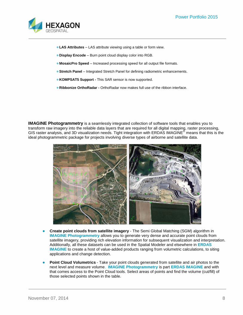
IMAGINE Photogrammetry is a seamlessly integrated collection of software tools that enables you to
transform raw imagery into the reliable data layers that are required for all digital mapping, raster processing, GIS raster analysis, and 3D visualization needs. Tight integration with ERDAS IMAGINE
® means that this is the
ideal photogrammetric package for projects involving diverse types of airborne and satellite data.
Create point clouds from satellite imagery - The Semi Global Matching (SGM) algorithm in IMAGINE Photogrammetry allows you to generate very dense and accurate point clouds from satellite imagery, providing rich elevation information for subsequent visualization and interpretation. Additionally, all these datasets can be used in the Spatial Modeler and elsewhere in ERDAS IMAGINE to create a host of value-added products ranging from volumetric calculations, to siting
applications and change detection.
Point Cloud Volumetrics - Take your point clouds generated from satellite and air photos to the next level and measure volume. IMAGINE Photogrammetry is part ERDAS IMAGINE and with that comes access to the Point Cloud tools. Select areas of points and find the volume (cut/fill) of those selected points shown in the table.

Power Portfolio 2015
November 07, 2014 9
DEM Editing Enhancement in Terrain Editor – Load your large DEMs faster than ever with this new DEM handling. To further enhance your editing performance, you can now utilize your AOIs for editing.
ImageStation® software suite enables digital photogrammetry production workflows, including project
creation, orientation and triangulation from aerial and satellite imagery. It also provides stereo GIS feature collection and editing, digital terrain model (DTM) collection and editing, as well as orthophoto production and editing. ImageStation is specially designed for high-volume photogrammetry and production mapping customers who need to move large quantities of raw spatial information to an actionable or exploitable format.
Ingest and process even larger files and projects than ever before! – The DTM processing of ImageStation DTMQue has been converted to a 64-bit application, enabling it to access extended memory space well beyond that which can be accessed by 32-bit addressing. ImageStation Automatic Elevation performance is also greatly improved.
Accelerate your projects – Let ImageStation Image Formatter apply Look Up Tables for automated image processing and distribute its processes across systems on the network when combined with Condor for Hexagon.
Even more advanced automated point matching – ImageStation Automatic Triangulation takes advantage of the active elevation parameter for photos in the photo file. Export photo coordinates, GPS/INS, and ground control information for use in the ORIMA CAP-A bundle adjustment program. Users can then import the results from ORIMA back into ImageStation for further exploitation. The Thinning command has a new option to remove 2-ray points that fall in areas where 3 or more photos overlap. PhotoT reports which Correction Grids were used during the bundle adjustment.
Intelligent project import and management – Streamlined import into ImageStation Photogrammetric Manager allows you to assign both Photo ID and Image ID in the same column. Assigning Strip IDs automatically compares the kappa value of adjacent photos to determine which
Power Portfolio 2015
November 07, 2014 10
photos belong to which strips. The project overview image is automatically added as a Map Photo and the Footprint Viewer now recognizes Oblique photos. Greatly simplified and more automated import of ADS images and metadata.
Increase your throughput – ImageStation Automatic Elevations processes ADS models dramatically faster when projects are created with the new Import ADS command in ImageStation Photogrammetric Manager.
A wider range of formats – Addition of the Grid float (.FLT) and compressed LAS (.LAZ) formats expands the processing options in ImageStation OrthoPro.
Faster custom edits – Change into editing mode in ImageStation DTM Collection by picking a fence, existing polygon, or digitizing a new polygon.
Stereo work is easier than ever – Copy and Move Edit commands in ImageStation Stereo for GeoMedia use the Z value of the stereo cursor during edits. A new Edge Distance parameter specifies the distance from the edge of the stereo model in which Auto King’s Move will automatically switch models. The Z direction of the stereo cursor is now automatically reversed when the user switches from normal stereo to pseudo (base out) stereo. Improved performance with ADS images – faster load time for stereo models, faster ground to image projections, and less memory use.
Greater control when inspecting and editing images – ImageStation PixelQue has more zoom factors for more granularity in setting the window size during image inspection. Non-product images can be added as auxiliary images and used as source images for raster editing while using Inspect Images or Review Problem Markers.
Efficient Roam and Zoom – Use hot keys to zoom in while roaming in ImageStation Stereo Display. When you are done zooming, automatically resume your roam. Improved performance with ADS images – faster load time for stereo models, faster ground to image projections, and less memory use.
Save time in feature collection – Enabling deletion of surface mass points that fall within a specified distance of linear features while they are being digitized with ImageStation Feature Collection.
Provider Suite
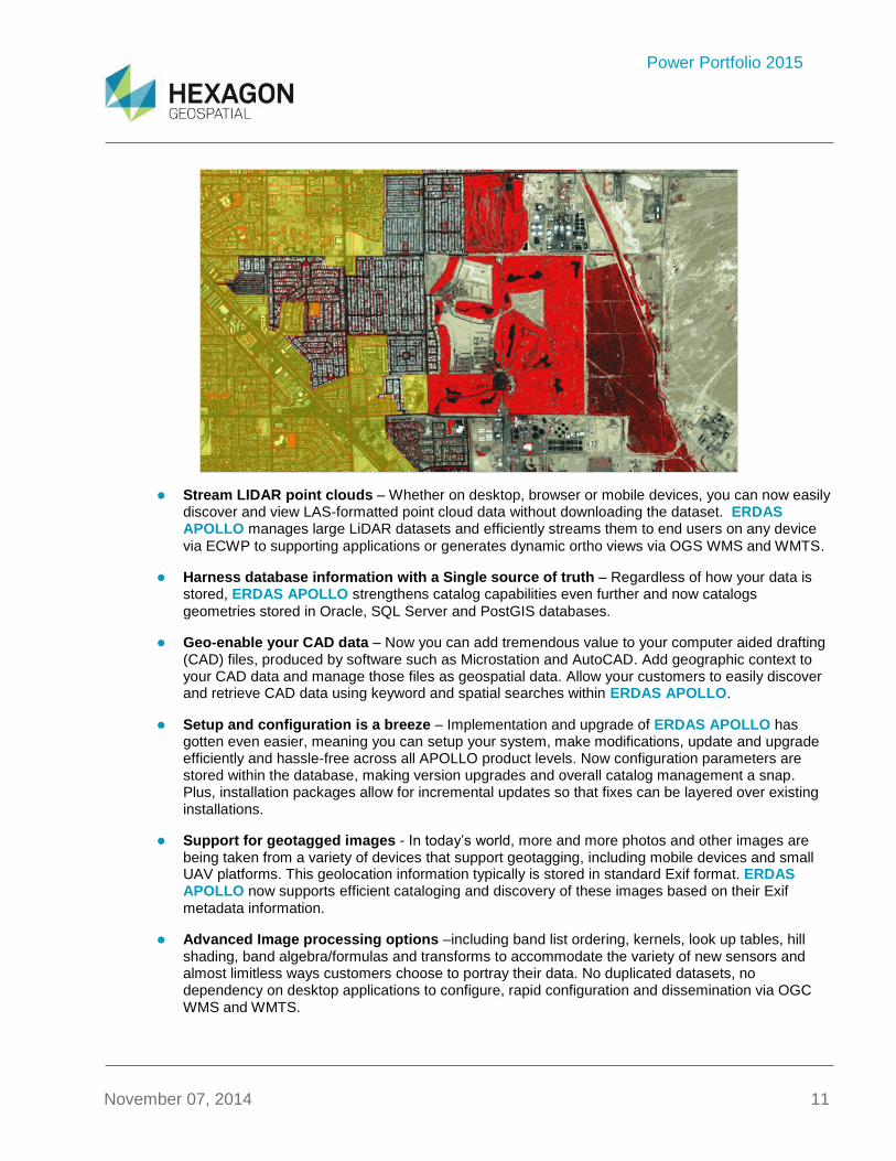
ERDAS APOLLO is a comprehensive data management, analysis, and delivery system. It enables an
organization to organize and deliver massive volumes of data, and consistently delivers geospatial data faster and with less hardware than competing server-based products.
Power Portfolio 2015
November 07, 2014 11
Stream LIDAR point clouds – Whether on desktop, browser or mobile devices, you can now easily discover and view LAS-formatted point cloud data without downloading the dataset. ERDAS APOLLO manages large LiDAR datasets and efficiently streams them to end users on any device
via ECWP to supporting applications or generates dynamic ortho views via OGS WMS and WMTS.
Harness database information with a Single source of truth – Regardless of how your data is stored, ERDAS APOLLO strengthens catalog capabilities even further and now catalogs
geometries stored in Oracle, SQL Server and PostGIS databases.
Geo-enable your CAD data – Now you can add tremendous value to your computer aided drafting (CAD) files, produced by software such as Microstation and AutoCAD. Add geographic context to your CAD data and manage those files as geospatial data. Allow your customers to easily discover and retrieve CAD data using keyword and spatial searches within ERDAS APOLLO.
Setup and configuration is a breeze – Implementation and upgrade of ERDAS APOLLO has gotten even easier, meaning you can setup your system, make modifications, update and upgrade efficiently and hassle-free across all APOLLO product levels. Now configuration parameters are stored within the database, making version upgrades and overall catalog management a snap. Plus, installation packages allow for incremental updates so that fixes can be layered over existing installations.
Support for geotagged images - In today’s world, more and more photos and other images are being taken from a variety of devices that support geotagging, including mobile devices and small UAV platforms. This geolocation information typically is stored in standard Exif format. ERDAS APOLLO now supports efficient cataloging and discovery of these images based on their Exif
metadata information.
Advanced Image processing options –including band list ordering, kernels, look up tables, hill shading, band algebra/formulas and transforms to accommodate the variety of new sensors and almost limitless ways customers choose to portray their data. No duplicated datasets, no dependency on desktop applications to configure, rapid configuration and dissemination via OGC WMS and WMTS.
Power Portfolio 2015
November 07, 2014 12
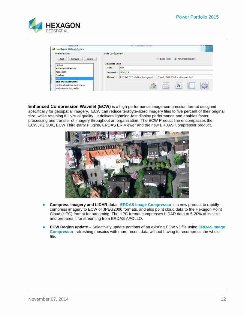
Enhanced Compression Wavelet (ECW) is a high-performance image-compression format designed
specifically for geospatial imagery. ECW can reduce terabyte-sized imagery files to five percent of their original size, while retaining full visual quality. It delivers lightning-fast display performance and enables faster processing and transfer of imagery throughout an organization. The ECW Product line encompasses the ECWJP2 SDK, ECW Third-party Plugins, ERDAS ER Viewer and the new ERDAS Compressor product.
Compress imagery and LIDAR data - ERDAS Image Compressor is a new product to rapidly compress imagery to ECW or JPEG2000 formats, and also point cloud data to the Hexagon Point Cloud (HPC) format for streaming. The HPC format compresses LIDAR data to 5-20% of its size, and prepares it for streaming from ERDAS APOLLO.
ECW Region update – Selectively update portions of an existing ECW v3 file using ERDAS Image Compressor, refreshing mosaics with more recent data without having to recompress the whole
file.

Power Portfolio 2015
November 07, 2014 13
Mosaic throughput improvements – Continued optimization has seen the mosaic process increase in some cases by 400%, allowing users to create larger output projects faster than ever before.
Significant decoding improvements – Optimized decoding in both ECW and JPEG2000 formats
enhance all existing workflows that use these formats across the Hexagon Geospatial 2015 release.
Platform Suite
GeoMedia® Smart Client is a GIS workflow management system that connects tasks and dependencies
across different roles in a process, and dynamically configures to reflect a users’ role and specific workflow steps. End users are able to utilize advanced geospatial functionality via simple-to-use map-based tools, disentangling them from non-essential tasks and focusing their time on their area of expertise.
Power Portfolio 2015
November 07, 2014 14
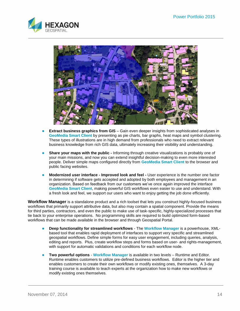
Extract business graphics from GIS – Gain even deeper insights from sophisticated analyses in GeoMedia Smart Client by presenting as pie charts, bar graphs, heat maps and symbol clustering. These types of illustrations are in high demand from professionals who need to extract relevant business knowledge from rich GIS data, ultimately increasing their visibility and understanding.
Share your maps with the public - Informing through creative visualizations is probably one of your main missions, and now you can extend insightful decision-making to even more interested people. Deliver simple maps configured directly from GeoMedia Smart Client to the browser and
public facing websites.
Modernized user interface - Improved look and feel - User experience is the number one factor in determining if software gets accepted and adopted by both employees and management in an organization. Based on feedback from our customers we’ve once again improved the interface GeoMedia Smart Client, making powerful GIS workflows even easier to use and understand. With
a fresh look and feel, we support our users who want to enjoy getting the job done efficiently.
Workflow Manager is a standalone product and a rich toolset that lets you construct highly-focused business
workflows that primarily support attributive data, but also may contain a spatial component. Provide the means for third parties, contractors, and even the public to make use of task-specific, highly-specialized processes that tie back to your enterprise operations. No programming skills are required to build optimized form-based workflows that can be made available in the browser and through Geospatial Portal.
Deep functionality for streamlined workflows - The Workflow Manager is a powerhouse, XML-based tool that enables rapid deployment of interfaces to support very specific and streamlined geospatial workflows. Define simple forms for easy user engagement, including queries, analysis, editing and reports. Plus, create workflow steps and forms based on user- and rights-management, with support for automatic validations and conditions for each workflow node.
Two powerful options - Workflow Manager is available in two levels – Runtime and Editor. Runtime enables customers to utilize pre-defined business workflows. Editor is the higher tier and enables customers to create their own workflows or modify existing ones, themselves. A 3-day training course is available to teach experts at the organization how to make new workflows or modify existing ones themselves.

Power Portfolio 2015
November 07, 2014 15
GeoMedia® WebMap is a fully-scalable server solution for building and deploying web services and websites.
Create high-performance web applications, with real-time enterprise access and geospatial analysis using the familiar tools in GeoMedia desktop as a publishing platform.
Geospatial SDI is an interoperable and scalable spatial data infrastructure designed for data providers that
need to manage and serve secure or licensed information using standards-based web services. It ensures adherence to OGC, INSPIRE, and ISO standards for web services and metadata compliance.
Power Portfolio 2015
November 07, 2014 16
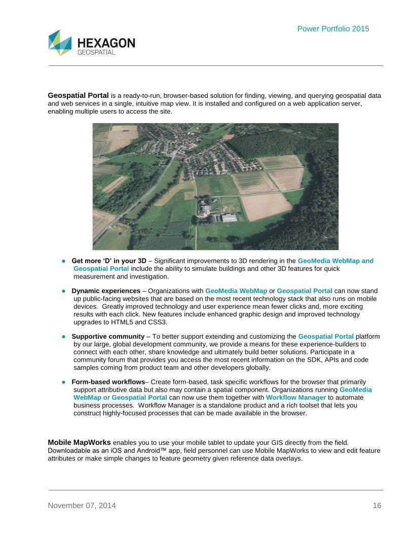
Geospatial Portal is a ready-to-run, browser-based solution for finding, viewing, and querying geospatial data
and web services in a single, intuitive map view. It is installed and configured on a web application server, enabling multiple users to access the site.
Get more ‘D’ in your 3D – Significant improvements to 3D rendering in the GeoMedia WebMap and Geospatial Portal include the ability to simulate buildings and other 3D features for quick
measurement and investigation.
Dynamic experiences – Organizations with GeoMedia WebMap or Geospatial Portal can now stand up public-facing websites that are based on the most recent technology stack that also runs on mobile devices. Greatly improved technology and user experience mean fewer clicks and, more exciting results with each click. New features include enhanced graphic design and improved technology upgrades to HTML5 and CSS3.
Supportive community – To better support extending and customizing the Geospatial Portal platform by our large, global development community, we provide a means for these experience-builders to connect with each other, share knowledge and ultimately build better solutions. Participate in a community forum that provides you access the most recent information on the SDK, APIs and code samples coming from product team and other developers globally.
Form-based workflows– Create form-based, task specific workflows for the browser that primarily support attributive data but also may contain a spatial component. Organizations running GeoMedia WebMap or Geospatial Portal can now use them together with Workflow Manager to automate business processes. Workflow Manager is a standalone product and a rich toolset that lets you construct highly-focused processes that can be made available in the browser.
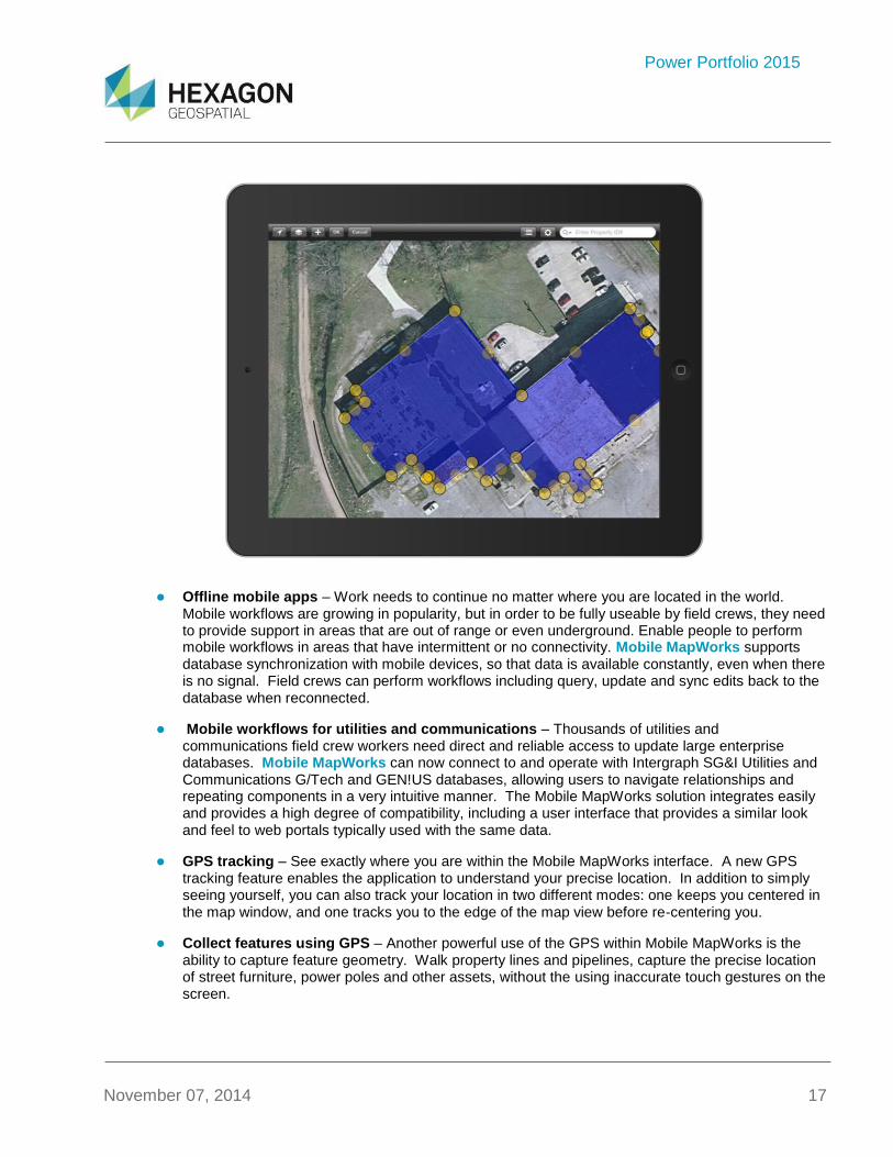
Mobile MapWorks enables you to use your mobile tablet to update your GIS directly from the field.
Downloadable as an iOS and Android™ app, field personnel can use Mobile MapWorks to view and edit feature attributes or make simple changes to feature geometry given reference data overlays.
Power Portfolio 2015
November 07, 2014 17
Offline mobile apps – Work needs to continue no matter where you are located in the world. Mobile workflows are growing in popularity, but in order to be fully useable by field crews, they need to provide support in areas that are out of range or even underground. Enable people to perform mobile workflows in areas that have intermittent or no connectivity. Mobile MapWorks supports database synchronization with mobile devices, so that data is available constantly, even when there is no signal. Field crews can perform workflows including query, update and sync edits back to the database when reconnected.
Mobile workflows for utilities and communications – Thousands of utilities and communications field crew workers need direct and reliable access to update large enterprise databases. Mobile MapWorks can now connect to and operate with Intergraph SG&I Utilities and Communications G/Tech and GEN!US databases, allowing users to navigate relationships and repeating components in a very intuitive manner. The Mobile MapWorks solution integrates easily and provides a high degree of compatibility, including a user interface that provides a similar look and feel to web portals typically used with the same data.
GPS tracking – See exactly where you are within the Mobile MapWorks interface. A new GPS tracking feature enables the application to understand your precise location. In addition to simply seeing yourself, you can also track your location in two different modes: one keeps you centered in the map window, and one tracks you to the edge of the map view before re-centering you.
Collect features using GPS – Another powerful use of the GPS within Mobile MapWorks is the ability to capture feature geometry. Walk property lines and pipelines, capture the precise location of street furniture, power poles and other assets, without the using inaccurate touch gestures on the screen.
Power Portfolio 2015
November 07, 2014 18
Mobile platform - Now, partners and customers can build and deploy unique iOS and Android apps that meet their customer’s specific mobile needs. The apps can leverage the various map rendering technologies of the platform, including myVR. Additionally the app can be used to access websites built with WebGIS products.
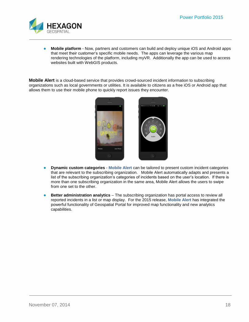
Mobile Alert is a cloud-based service that provides crowd-sourced incident information to subscribing
organizations such as local governments or utilities. It is available to citizens as a free iOS or Android app that allows them to use their mobile phone to quickly report issues they encounter.
Dynamic custom categories - Mobile Alert can be tailored to present custom incident categories that are relevant to the subscribing organization. Mobile Alert automatically adapts and presents a list of the subscribing organization’s categories of incidents based on the user’s location. If there is more than one subscribing organization in the same area, Mobile Alert allows the users to swipe from one set to the other.
Better administration analytics – The subscribing organization has portal access to review all reported incidents in a list or map display. For the 2015 release, Mobile Alert has integrated the powerful functionality of Geospatial Portal for improved map functionality and new analytics capabilities.
Power Portfolio 2015
November 07, 2014 19
About Hexagon Geospatial Hexagon Geospatial helps you make sense of the dynamically changing world. Known globally as a maker of leading-edge technology, we enable our customers to easily transform their data into actionable information, shortening the lifecycle from the moment of change to action. Hexagon Geospatial provides the software products and platforms to a large variety of customers through direct sales, channel partners, and Hexagon businesses, including the underlying geospatial technology to drive Intergraph
® Security, Government &
Infrastructure (SG&I) industry solutions. Hexagon Geospatial is a division of Intergraph® Corporation. For more
information, visit www.hexagongeospatial.com.
Intergraph® Corporation is part of Hexagon (Nordic exchange: HEXA B). Hexagon is a leading global provider of
design, measurement and visualisation technologies that enable customers to design, measure and position objects, and process and present data.
Learn more at www.hexagon.com.
© 2014 Intergraph® Corporation. All rights reserved. Hexagon Geospatial is a part of Intergraph Corporation. Intergraph is part of Hexagon.
Intergraph and the Intergraph logo are registered trademarks of Intergraph Corporation or its subsidiaries. Hexagon and the Hexagon logo are registered trademarks of Hexagon AB or its subsidiaries. All other trademarks or servicemarks used herein are property of their respective owners. Intergraph believes the information in this publication is accurate as of its publication date. Such information is subject to change without notice.