Embed Size (px)
Citation preview

Wheatstone Marine Operations Pilotage - Passage Plan
WMT to Onslow Port Limit
Document ID: WS1-COP-00173 Document Approvals Signature/Date Revision ID: 3.0 Revision Date: 1 August 2017 Reviewer WSSD Information Sensitivity: Public Approver HAMU Uncontrolled when printed Page 1 of 10
1.0 INTRODUCTION Vessels entering the Port of Ashburton require an approved berth to berth passage plan in accordance with IMO Resolution A.893(21) (See ANNEX 25) which can be shared between the Pilot and the vessel’s Master.
This work instruction has been compiled in accordance with documents:
WS1-COP-00174 - Wheatstone Marine Operations - Pilotage - Passage Plan Approval Procedure.
WS1-COP-00175 - Wheatstone Marine Operations - Pilotage - Passage Plan Guideline.
1.1 Purpose This document provides the Pilots, Masters and bridge navigation teams port specific information required to navigate a vessel safely along the prescribed route in a safe and controlled manner, reducing the risk to personnel, environment and property.
1.2 Scope
This Work Instruction provides details from the commencement to the completion of the pilotage route:
From: The Wheatstone Marine Terminal (WMT) To: Onslow Port Limit
CAUTION: This passage plan may be tidally restricted. UKC calculations must be undertaken prior to any move. Caution must be exercised when using buoys for navigation, particularly post severe storm/cyclone activity.
1.3 Target Audience This work instruction is primarily intended for use by ABU Marine Pilots, vessel Masters and vessel bridge navigation teams.
State changed to Approved on 2017/08/04 02:19:09 (UTC)
State changed to Approved by document control

Wheatstone Marine Operations Pilotage - Passage Plan
WMT to Onslow Port Limit
Document ID: WS1-COP-00173 Revision ID: 3.0 Revision Date: 1 August 2017 Information Sensitivity: Public Uncontrolled when printed Page 2 of 10
1.4 Acronyms and Abbreviations The below table defines the acronyms and abbreviations used in this document
Acronym/Abbreviation Meaning AMSA Australian Maritime Safety Authority AtoN Aids to Navigation BRM Bridge Resource Management CRT Constant Radius Turn ECDIS Electronic Chart Display Information System GPS Global Positioning System Kts Knots m Metres MCC Marine Control Centre MPX Master Pilot Exchange MN Marine Notice NM Nautical Mile OOW Officer of the Watch PBG Pilot Boarding Ground PI Parallel Index PP Passage Plan ROT Rate of Turn UKC Under Keel Clearance WMT Wheatstone Marine Terminal
WP Waypoint ZOC Zone of confidence
State changed to Approved on 2017/08/04 02:19:09 (UTC)
State changed to Approved by document control

Wheatstone Marine Operations Pilotage - Passage Plan
WMT to Onslow Port Limit
Document ID: WS1-COP-00173 Revision ID: 3.0 Revision Date: 1 August 2017 Information Sensitivity: Public Uncontrolled when printed Page 3 of 10
2.0 PASSAGE PLAN – WMT to Onslow Port Limit
Waypoint
Berth
• Pilot shall board the vessel and carry out the MPX prior to taking conduct of the vessel. • Call “ Ashburton Marine” on VHF 14 advising outbound from the berth and requesting
traffic updates. • In keeping with port safety procedures, the vessel must be alongside and in position
prior to “letting go” mooring lines. • Number of tugs and positioning shall be considered for each vessel ensuring compliance
with the Pilbara Ports Authority and Pilot’s requirements (as per Chevron ABU procedures).
• Ensure adequate clearing distances between the vessel and her tugs from obstructions such as other vessels, navigational marks and mooring dolphins.
• Manoeuver clear of the berth into the turning basin and align vessel to make the approach into the channel for a course of 014° (T).
• It is expected that vessels will be berthed port side alongside. However, there may be instances, when due to manifold configurations, a vessel may be berthed starboard side alongside.
• Leads mark the centre of the channel. The day boards are rectangular (Height 3.3m x Width 1.66m) and painted in Red-White-Red vertical stripes. The lights are Green Isophase 4s (synchronised) with a nominal range of 6 NM.
• The Ebb tide sets to the West / the Flood tide sets to the East and may affect the vessel. • In the event of any failure, which affects the act of pilotage, consider escorting the
vessel to the Turning Basin, maintaining position utilising tugs, escorting the vessel to the berth or anchoring.
Latitude
-
Longitude
-
Course
Var
Speed
<1.5 knots
Leg Distance
Var
Minimum Charted Depth
13.4 m
Maximum Cross-track Error
N/A
Primary Position Fixing
Visual / PPU / ECDIS
Secondary Position Fixing
Chart /Radar/GPS
Parallel Index
N/A
State changed to Approved on 2017/08/04 02:19:09 (UTC)
State changed to Approved by document control

Wheatstone Marine Operations Pilotage - Passage Plan
WMT to Onslow Port Limit
Document ID: WS1-COP-00173 Revision ID: 3.0 Revision Date: 1 August 2017 Information Sensitivity: Public Uncontrolled when printed Page 4 of 10
Waypoint 03
• The Turning Basin: Dredged to a depth of 13.4 m. • PI to be utilised. • Maximum Cross-track error is 50m until 1 mile north of “Gate 1” when it increases to
100m. • The vessel shall increase her speed to a maximum of 8.5 knots in the channel. • AToN “Gate 8” marks the approx. limits of water depths less than 8 m at chart datum on
either side of the channel. Vessels shall be constrained to the channel unless draughts otherwise allow.
• Between “Gate 8” and “Gate 6”, the vessel may expect an increase in current. • Tugs shall remain fast until the vessel is clear of “Gate 1”. • Tugs to be let go at an approximate speed of 8 - 10 knots once clear of the defined channel. • Be aware of Onslow Salt vessels when near waypoint A2. • Leads mark the centre of the channel. The day boards are rectangular (Height 3.3m x Width
1.66m) and painted in Red-White-Red vertical stripes. The lights are Green Isophase 4s (synchronised) with a nominal range of 6 NM.
• Call “Ashburton Marine” on VHF 14 on exiting the Port of Ashburton port limit (0.14 NM north of “Gate 1”).
• In the event of any failure, which affects the act of pilotage, consider escorting the vessel to the WMT Turning Basin, maintaining position utilising tugs, or anchoring.
CAUTION: The area surrounding Saladin Shoal is a No-Go Area.
Latitude
21° 40.40’ S
Longitude
115° 00.53’ E
Course
013.7°T
Speed
1.5 knots increasing to 8.5 knots
Leg Distance
12 NM
Minimum Charted Depth
13.4 m
Maximum Cross-track Error
50 m increasing to 100 m
Primary Position Fixing
Visual / PPU / Radar
Secondary Position Fixing
Chart /ECDIS/GPS
Parallel Index 013.7° x 0.06 NM
Channel Spar Buoys
State changed to Approved on 2017/08/04 02:19:09 (UTC)
State changed to Approved by document control

Wheatstone Marine Operations Pilotage - Passage Plan
WMT to Onslow Port Limit
Document ID: WS1-COP-00173 Revision ID: 3.0 Revision Date: 1 August 2017 Information Sensitivity: Public Uncontrolled when printed Page 5 of 10
Waypoint A2
• An alteration of 035° to Starboard is required. • This is a 1.0 NM CRT. • The vessel alters course 2.5 NM NNE of the Channel. • The vessel’s speed may be increased if UKC allows and tugs are clear. • PI is recommended to be utilised. • Be aware of Onslow Salt vessels navigating in this area. • The vessel will adjust course and speed as it approaches the PBG to provide an adequate
lee for the safe disembarkation of the pilot. • Vessel and Pilot Boat Masters are to discuss and agree on vessel’s speed and heading prior
to transfer to ensure a good lee for transfer. The pilot ladder shall be rigged as per SOLAS 2010 Chapter V Reg 23 as amended, and secured to a height above the waterline as requested by the Pilot Boat Master.
• Once the Pilot/Master is satisfied with the vessels position, course and speed the pilot will hand over the conduct of the vessel to the Master.
• Call “ Ashburton Marine” on VHF 14 notifying them of pilot disembarkation - advise them the vessel is outbound to Onslow Port Limit and request traffic updates.
• In the event of any failure, which affects the act of pilotage, the vessel should be stabilised in a safe position and if required anchored.
CAUTION: The area surrounding Sultan Reef is a No-Go Area.
ENVIRONMENTAL WARNING: During the whale migration season, be aware of whales passing
through this area
Latitude
21° 29.03’S
Longitude
115°03.50’E
Course
049.0°T
Speed
8 - 10 knots
Leg Distance
4.3 NM
Minimum Charted Depth
14.2 m
Maximum Cross-track Error
200 m
Primary Position Fixing
Visual / PPU / Radar
Secondary Position Fixing
Chart /ECDIS/GPS
Parallel Index 049o x 2.08 NM
Sultan Shoal Buoy
State changed to Approved on 2017/08/04 02:19:09 (UTC)
State changed to Approved by document control

Wheatstone Marine Operations Pilotage - Passage Plan
WMT to Onslow Port Limit
Document ID: WS1-COP-00173 Revision ID: 3.0 Revision Date: 1 August 2017 Information Sensitivity: Public Uncontrolled when printed Page 6 of 10
Waypoint Ashburton PBG A (A1)
• Visual Reference: “Sultan Reef” Buoy bearing 319° (T) x 2.08 NM. • Visual Reference: “Saladin A” monopod bearing 265o (T) x 3.5 NM. • Once the Pilot has disembarked, the vessel will proceed to Onslow Port Limits. • PI is recommended to be utilised. • Be aware of Onslow Salt vessels navigating in this area. • In the event of any failure, which affects the act of pilotage, the vessel should be stabilised
in a safe position and if required anchored. • The shallowest water (13.9m) exists in approximate position 21°24.5’S 115° 09.15’E
• IT IS RECOMMENDED THAT ALL VESSELS CARRY OUT THEIR OWN UKC CALCULATIONS
TAKING THE FOLLOWING INTO CONSIDERATION: 1. REFERENCE TO ADMIRALTY SAILING DIRECTIONS NP13 – AUSTRALIA PILOT VOL. 1 2. MOBILE SAND WAVES EXISTING IN THE AREA. 3. IN THE EVENT OF LARGE SWELLS, UKC IS FURTHER REDUCED. 4. THE CHARTED APROACH IS ZOC A2
CAUTION: The area surrounding Sultan Reef is a No-Go Area.
ENVIRONMENTAL WARNING: During the whale migration season, be aware of whales passing
through this area
Latitude
21° 26.20’S
Longitude
115°07.00’E
Course
049.0°T
Speed
8 - 10 knots
Leg Distance
6.5 NM
Minimum Charted Depth
13.9 m
Maximum Cross-track Error
As per vessel’s passage plan
Primary Position Fixing
As per vessel’s passage plan
Secondary Position Fixing
As per vessel’s passage plan
Parallel Index As per vessel’s passage plan
State changed to Approved on 2017/08/04 02:19:09 (UTC)
State changed to Approved by document control

Wheatstone Marine Operations Pilotage - Passage Plan
WMT to Onslow Port Limit
Document ID: WS1-COP-00173 Revision ID: 3.0 Revision Date: 1 August 2017 Information Sensitivity: Public Uncontrolled when printed Page 7 of 10
Waypoint Onslow Port Limit (A0)
• Visual reference: Sultan Reef Buoy bearing 247° (T) x 6.85 NM • Call “Ashburton Marine” on VHF 14 upon exiting Onslow Port Limit - advise them of exiting
Onslow Port Limit. • In the event of any failure which affects the safety of the act of pilotage, the vessel shall
be stabilised and if required anchored.
ENVIRONMENTAL WARNING: During the whale migration season, be aware of whales passing
through this area
Latitude
21°21.91’S
Longitude
115°12.29’E
Course
As per vessel’s passage plan
Speed
As per vessel’s passage plan
Leg Distance
N/A
Minimum Charted Depth
N/A
Maximum Cross-track Error
As per vessel’s passage plan
Primary Position Fixing
As per vessel’s passage plan
Secondary Position Fixing
As per vessel’s passage plan
Parallel Index
As per vessel’s passage plan
State changed to Approved on 2017/08/04 02:19:09 (UTC)
State changed to Approved by document control
Wheatstone Marine Operations Pilotage - Passage Plan
WMT to Onslow Port Limit
Document ID: WS1-COP-00173 Revision ID: 3.0 Revision Date: 1 August 2017 Information Sensitivity: Public Uncontrolled when printed Page 8 of 10
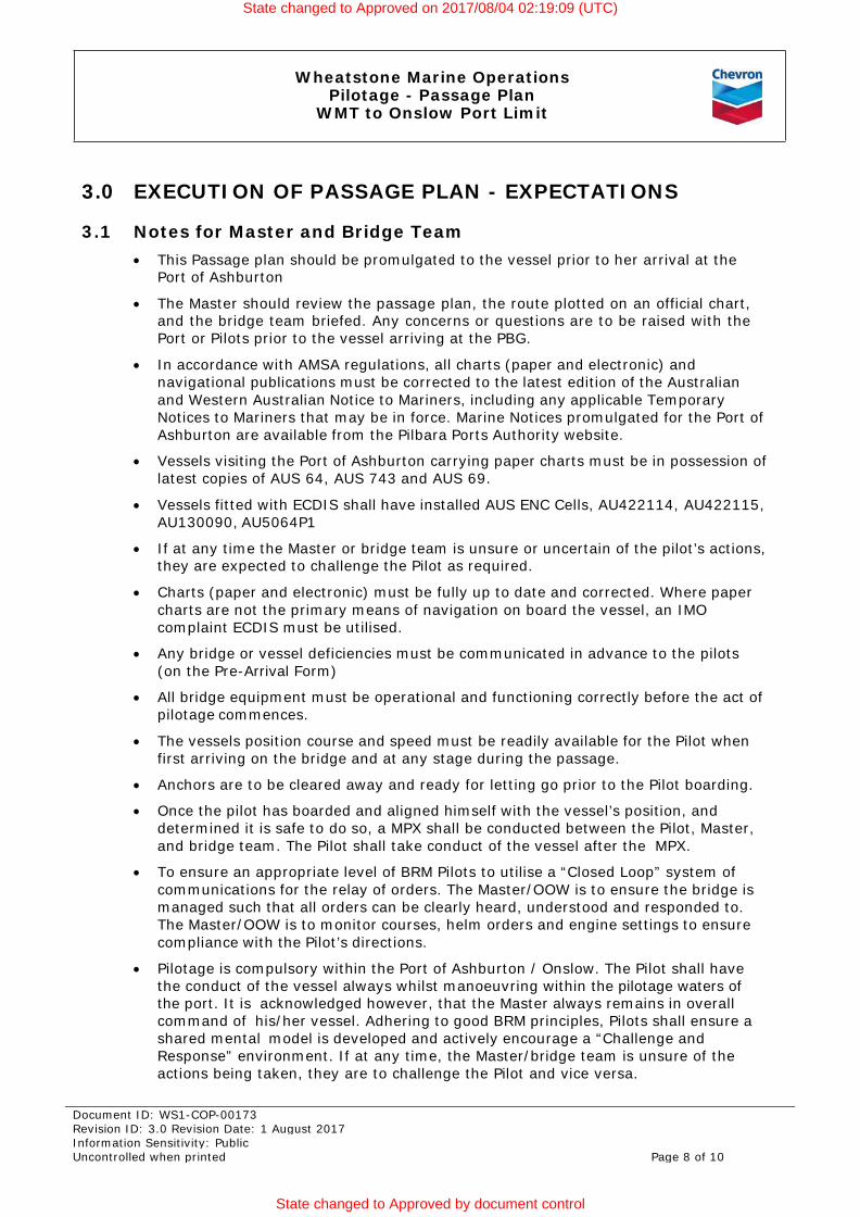
3.0 EXECUTION OF PASSAGE PLAN - EXPECTATIONS
3.1 Notes for Master and Bridge Team • This Passage plan should be promulgated to the vessel prior to her arrival at the
Port of Ashburton
• The Master should review the passage plan, the route plotted on an official chart, and the bridge team briefed. Any concerns or questions are to be raised with the Port or Pilots prior to the vessel arriving at the PBG.
• In accordance with AMSA regulations, all charts (paper and electronic) and navigational publications must be corrected to the latest edition of the Australian and Western Australian Notice to Mariners, including any applicable Temporary Notices to Mariners that may be in force. Marine Notices promulgated for the Port of Ashburton are available from the Pilbara Ports Authority website.
• Vessels visiting the Port of Ashburton carrying paper charts must be in possession of latest copies of AUS 64, AUS 743 and AUS 69.
• Vessels fitted with ECDIS shall have installed AUS ENC Cells, AU422114, AU422115, AU130090, AU5064P1
• If at any time the Master or bridge team is unsure or uncertain of the pilot’s actions, they are expected to challenge the Pilot as required.
• Charts (paper and electronic) must be fully up to date and corrected. Where paper charts are not the primary means of navigation on board the vessel, an IMO complaint ECDIS must be utilised.
• Any bridge or vessel deficiencies must be communicated in advance to the pilots (on the Pre-Arrival Form)
• All bridge equipment must be operational and functioning correctly before the act of pilotage commences.
• The vessels position course and speed must be readily available for the Pilot when first arriving on the bridge and at any stage during the passage.
• Anchors are to be cleared away and ready for letting go prior to the Pilot boarding.
• Once the pilot has boarded and aligned himself with the vessel’s position, and determined it is safe to do so, a MPX shall be conducted between the Pilot, Master, and bridge team. The Pilot shall take conduct of the vessel after the MPX.
• To ensure an appropriate level of BRM Pilots to utilise a “Closed Loop” system of communications for the relay of orders. The Master/OOW is to ensure the bridge is managed such that all orders can be clearly heard, understood and responded to. The Master/OOW is to monitor courses, helm orders and engine settings to ensure compliance with the Pilot’s directions.
• Pilotage is compulsory within the Port of Ashburton / Onslow. The Pilot shall have the conduct of the vessel always whilst manoeuvring within the pilotage waters of the port. It is acknowledged however, that the Master always remains in overall command of his/her vessel. Adhering to good BRM principles, Pilots shall ensure a shared mental model is developed and actively encourage a “Challenge and Response” environment. If at any time, the Master/bridge team is unsure of the actions being taken, they are to challenge the Pilot and vice versa.
State changed to Approved on 2017/08/04 02:19:09 (UTC)
State changed to Approved by document control

Wheatstone Marine Operations Pilotage - Passage Plan
WMT to Onslow Port Limit
Document ID: WS1-COP-00173 Revision ID: 3.0 Revision Date: 1 August 2017 Information Sensitivity: Public Uncontrolled when printed Page 9 of 10
• Ship’s position, proximity to dangers and UKC shall be continuously monitored by the Master/OOW and cross-referenced with the passage plan.
• If the Master leaves the bridge there must be a clear and concise handover of responsibility and duties to the OOW, and the pilot notified of any changes to members of the bridge team. If there is any doubt as to the pilot’s actions or intentions, members of the bridge team are required to seek clarification from the pilot.
• Proper, formal records of navigational activities and any incidents must be recorded in the appropriate logbooks. Information recorded must be of an appropriate standard so that the vessels progress into the Port can be reconstructed later.
3.2 Notes for the Pilot
• The pilot shall take conduct of the vessel in a clear and unambiguous manner.
• The pilot shall assist the bridge team to ensure radar conspicuous points, parallel indexing, and any clearing bearings/ranges are properly understood.
• Pilot shall ensure tug numbering and communication protocols are fully explained.
• The pilots shall carry out a MPX and present this to the Master for agreement prior to commencing the passage.
• If for any reason there is a need to deviate from the standard Passage Plan, a revised Passage Plan shall be formulated and agreed between the Pilot and Master; any additional hazards will be identified and any mitigations/controls must be detailed on the Master Pilot Exchange (MPX) document.
If there is a need to deviate from the passage plan for any reason, the bridge team must be fully briefed as to the pilot’s intentions, and the pilot should make every opportunity to return to the passage plan as soon as possible.
State changed to Approved on 2017/08/04 02:19:09 (UTC)
State changed to Approved by document control

Wheatstone Marine Operations Pilotage - Passage Plan
WMT to Onslow Port Limit
Document ID: WS1-COP-00173 Revision ID: 3.0 Revision Date: 1 August 2017 Information Sensitivity: Public Uncontrolled when printed Page 10 of 10
4.0 REFERENCES The following documentation is to be utilised by the Pilot for communication of the passage plan to all relevant parties.
Ref. No. Description Document ID 1 Wheatstone Marine Operations - Pilotage - Master Pilot Exchange -
WMT
WS1-COP-00368
2 SOLAS 2010 Chapter V Reg 23 3 IMO Resolution A.893(21) (See ANNEX 25)
5.0 PASSAGE PLAN APPROVAL The preparation, review and approval of this Passage Plan has been carried out in conjunction with requirements as laid out in Document Number WS1-COP-00174
Document Author Peter Gracias Approver Hamish Murray
Reviewer List Wayne Schwartz Manjur Khan
6.0 DOCUMENT CONTROL
6.1 Ownership
Document Author Peter Gracias Owner Dave Acomb
Approver Hamish Murray
6.2 Revision History
Rev Description Date Prepared By Approved By
1.0 Issued for Use 03 Sept 2015 Simon Bishop Dave Acomb
2.0 Issued for use – minor changes 27 May 2016 Manjur Khan Dave Acomb
3.0
Issued for use – passage plan extended to Onslow Port Limit. Document Title amended.
27 July 2017 Peter Gracias Hamish Murray
State changed to Approved on 2017/08/04 02:19:09 (UTC)
State changed to Approved by document control