Embed Size (px)
Citation preview

1
Where the Sidewalk Ends: Using Object-Based Classification to Identify Sidewalks
Elizabeth Clapp Geography 582 June 9, 2009
Introduction
n Many people have trouble adhering to traditional fitness regimens
n “Daily life activities” may impact overall fitness n Researchers have used street networks for connectivity studies
n Chin et al. (2008) compared connectivity using street vs. pedestrian networks
n Results: connectivity increased up to 120% when pedestrian networks were factored into the analyses
2
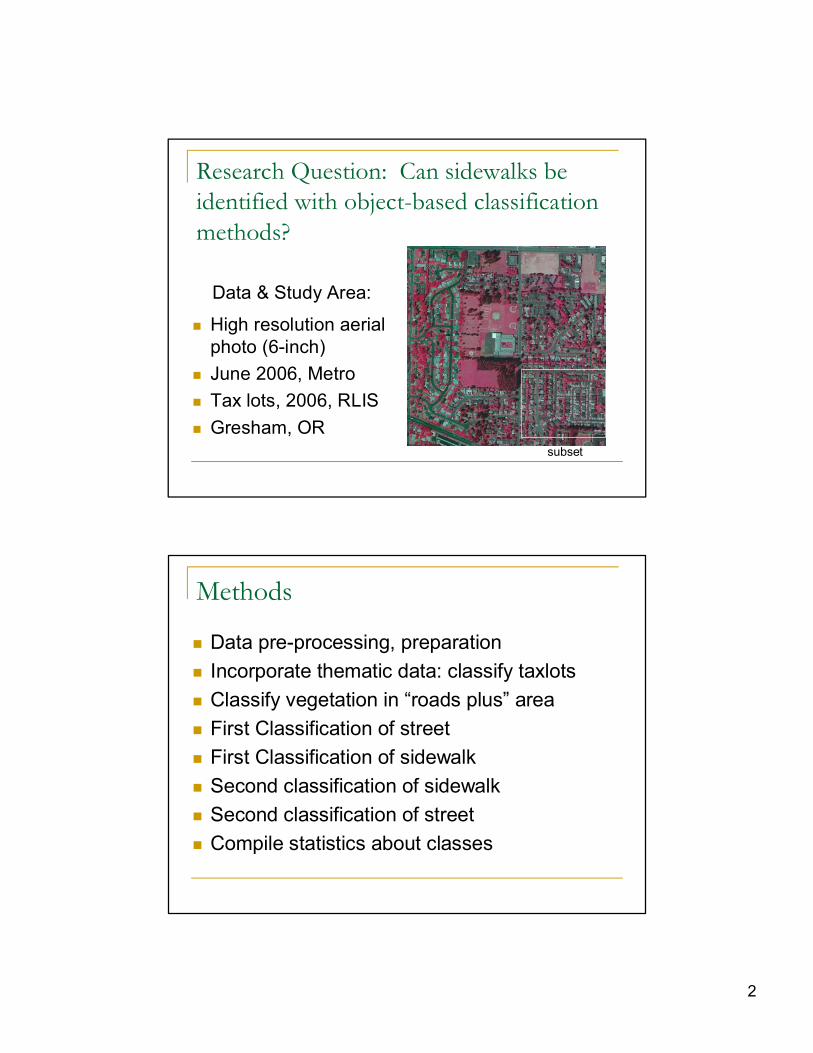
Research Question: Can sidewalks be identified with object-based classification methods?
n High resolution aerial photo (6inch)
n June 2006, Metro n Tax lots, 2006, RLIS n Gresham, OR
Data & Study Area:
subset
Methods
n Data preprocessing, preparation n Incorporate thematic data: classify taxlots n Classify vegetation in “roads plus” area n First Classification of street n First Classification of sidewalk n Second classification of sidewalk n Second classification of street n Compile statistics about classes

3
Data pre-processing, preparation
n Convert image from .jpeg to .img n Reproject image to that of thematic data (tax lots from RLIS)
n Subset image due to memory issues n Clip tax lot to study area n Create attribute in tax lot data (road = 0 or 1)
Incorporate Thematic Data: tax lots
n Coarse chessboard classification
n Strange tax lot shapes
General strategy: classify easy objects first, narrow down unclassified area

4
Classify Tax lot: Attribute
n Road = 0 n Left with “roads plus” to classify
Quadtree Segmentation nontaxlot areas: 1 pixel
Multiresolution segment region grow: scale = 40
Re-segment: Vegetation & Sidewalks

5
Classify Vegetation: Spectral Info.
n NIR ratio>=.305 n Included vegetation
shadows
Challenges to Classifying Sidewalk
n Spectrally, street and sidewalk very similar n Strips of vegetation between taxlot and sidewalk n Dead vegetation or unlandscaped parkway confused for sidewalk
n Cars blocking sidewalk n Vegetation covering sidewalk – causes smaller, irregularly shaped segments
n Odd shaped “sliver” segments

6
Manual Editing
n Cut segment n Merge segment
Classification of Street: Area, Spectral, Relation to Object
Relatively larger street segments

7
Classification of Sidewalk: Area & Relation to Object
Relatively larger sidewalk segments (to avoid other “sliver” segments contiguous to taxlot)
Classification of Sidewalk_sm: Area & Spectral
Relatively smaller sidewalk segments

8
Classification of Street_2: Relation to Object
Relatively larger street segments after created very large segments
Process Tree

9
Results
Results: Mean (Standard Deviation)
N/A .32 (.03) .39 (.07) .29 (.05) N/A Vegetation (n=528)
.01 (.03) .35 (.01) .29 (.02) .36 (.01) 1266 (1287) Street_2 (n=17)
.01 (.04) .35 (.00) .28 (.01) .37 (.01) 2593 (1981) Street (n=45)
0 .35 (.01) .29 (.01) .36 (.01) 144 (149) Sidewalk_sm (n=39)
.30 (.16) .34 (.02) .31 (.06) .35 (.04) 371 (347) Sidewalk (n=124)
Relative Border to Tax Lot
Ratio Green Ratio NIR
Ratio Red Area Class

10
Conclusions
n Leafoff image would be preferable n Objectbased classification requires iterative process of segmenting & classifying
n Online user forum very helpful n Use thematic data as much as possible n Be clear about defining “sidewalk” at onset n Future plan: accuracy assessment using digitized sidewalk as ground truth
References
n Chin, G.K.W., Van Niel, K.P., GilesCorti, B., & Knuiman, M. (2008). Accessibility and connectivity in physical activity studies: The impact of missing pedestrian data. Preventive Medicine, 46, 4145.
n Randall, T.A. & Baetz, B.W. (2001). Evaluating pedestrian connectivity for suburban sustainability. Journal of Urban Planning and Development, 127, 115.
n Definiens AG. (2008). Definiens Analyst 7 User Guide. Definiens AG: Munich, Germany.
n Definiens AG. (2007). Definiens Developer 7 Reference Book. Definiens AG: Munich, Germany.


![[Shel Silverstein] Where the Sidewalk Ends(BookFi.org)](https://img.pdfslide.net/doc/110x75/5465ab95b4af9f623f8b50ed/shel-silverstein-where-the-sidewalk-endsbookfiorg.jpg)