Embed Size (px)
Citation preview
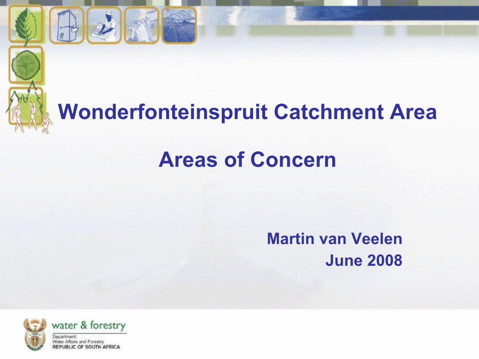
Wonderfonteinspruit Catchment Area
Areas of Concern
Martin van Veelen
June 2008
2
Contents
• Introduction• Objective• Approach• Methodology• Results
3
Acknowledgement
• The information presented here was derived from work done by Professor Frank Winde, School of Environmental Sciences and Development, North West University
4
Introduction
• A Specialist Task Team has been appointed by the DWAF and the NNR to formulate a plan of action for the remediation of radioactive contamination in the Wonderfonteinspruit Catchment Area
• The STT consists of local and international specialists
5
STT Composition
• Mr Marius Keet :DWAF :Proj Man• Dr Martin van Veelen :Team Leader• Ms Kavita Pema :Admin• Mr Mogwera Khoathane• Ms Gugu Mlangeni• Prof Frank Winde• Prof Gerrit Basson• Mr Ronald Cohen• Dr Gert de Beer• Dr Don Lush
6
Objective
• The objective is to identify, categorize and prioritise areas where radioactivity as a result of mining activities poses a health risk to the community, with the view of developing a plan of action to reduce the risk to acceptable levels
7
Approach
• Use information from existing studies– IWQS (1999)– WRC 1214 (2004)– BSA (2007) (‘Brenck Report’)
• Define what constitutes risk– Level of contamination– Accessibility
8
Methodology
• Create a base map– River system– Mining activities– Human activities– Geology– Areas identified by previous studies
• Assess risk• Categorise and rank
9
Base Maps
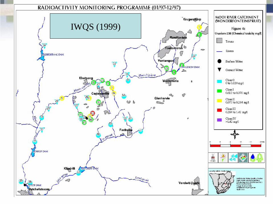
• IWQS (1999) focussed on uranium in water
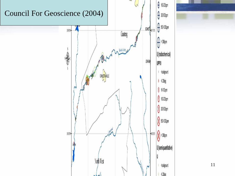
• Council for Geoscience (2004) focussed on sediment
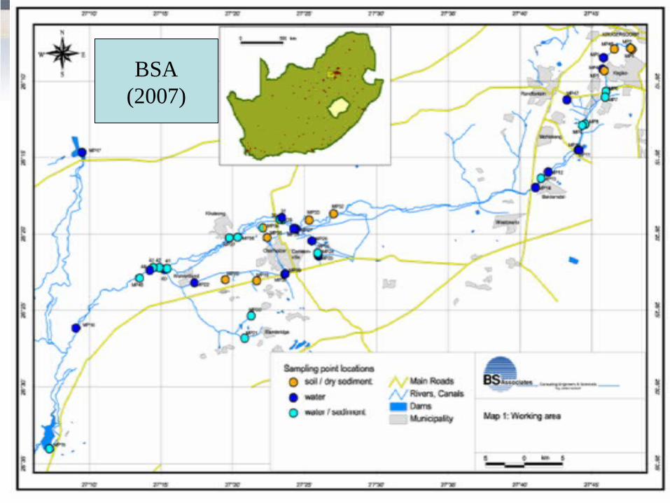
• BSA (2007) considered pathways
10
IWQS (1999)
11
Council For Geoscience (2004)
12
BSA(2007)
13
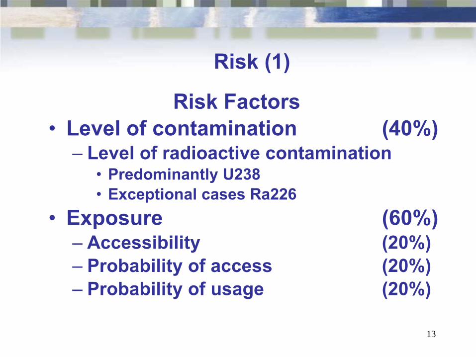
Risk (1)
Risk Factors• Level of contamination (40%)
– Level of radioactive contamination• Predominantly U238• Exceptional cases Ra226
• Exposure (60%)– Accessibility (20%)– Probability of access (20%)– Probability of usage (20%)
14
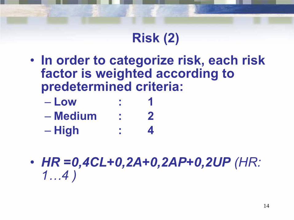
Risk (2)
• In order to categorize risk, each risk factor is weighted according to predetermined criteria:– Low : 1– Medium : 2 – High : 4
• HR =0,4CL+0,2A+0,2AP+0,2UP (HR: 1…4 )
15
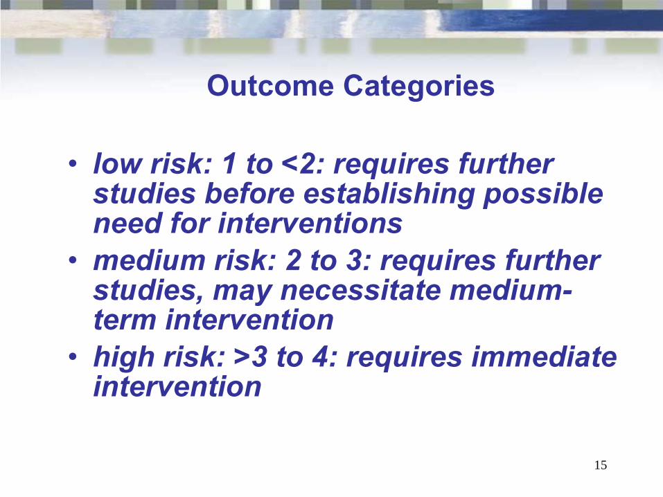
Outcome Categories
• low risk: 1 to <2: requires further studies before establishing possible need for interventions
• medium risk: 2 to 3: requires further studies, may necessitate medium-term intervention
• high risk: >3 to 4: requires immediate intervention
16
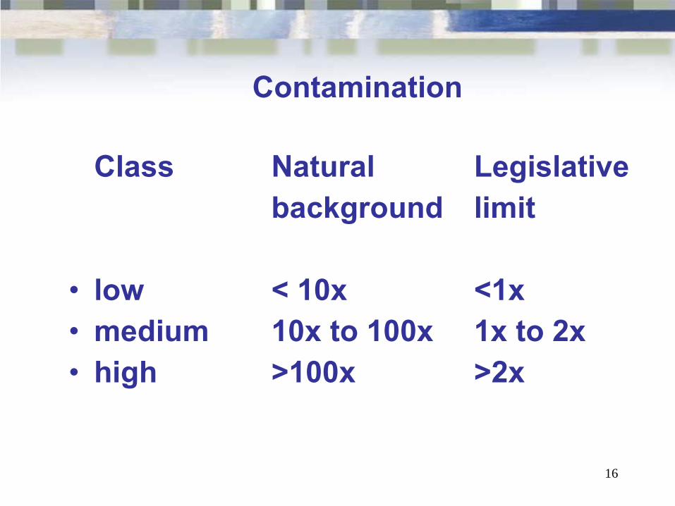
Contamination
Class Natural Legislativebackground limit
• low < 10x <1x• medium 10x to 100x 1x to 2x• high >100x >2x
17
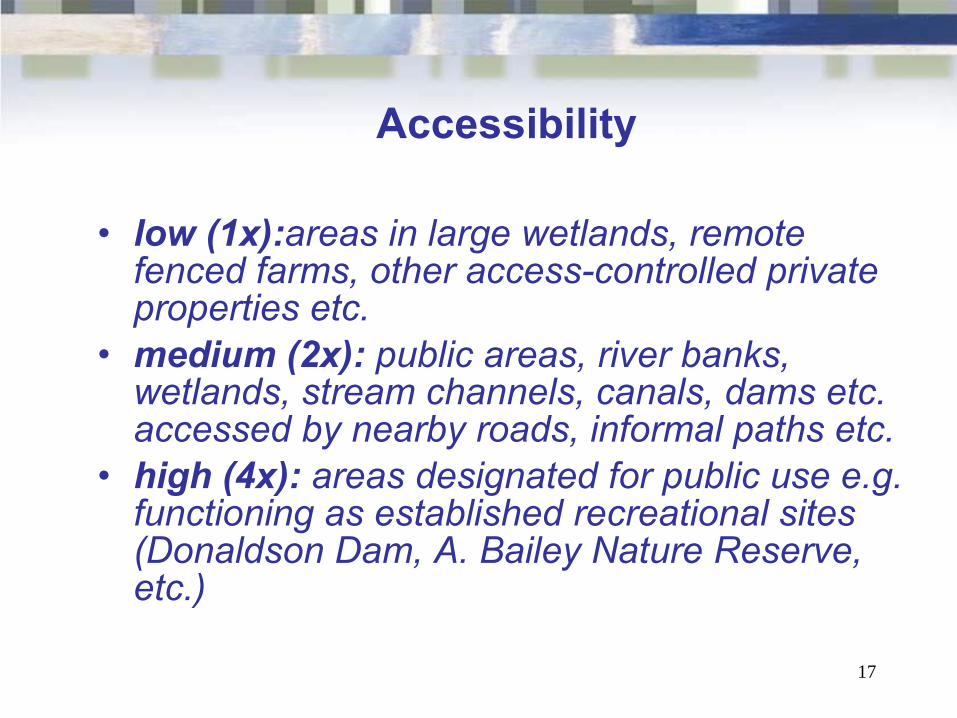
Accessibility
• low (1x):areas in large wetlands, remote fenced farms, other access-controlled private properties etc.
• medium (2x): public areas, river banks, wetlands, stream channels, canals, dams etc. accessed by nearby roads, informal paths etc.
• high (4x): areas designated for public use e.g. functioning as established recreational sites (Donaldson Dam, A. Bailey Nature Reserve, etc.)
18
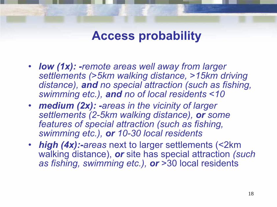
Access probability
• low (1x): -remote areas well away from larger settlements (>5km walking distance, >15km driving distance), and no special attraction (such as fishing, swimming etc.), and no of local residents <10
• medium (2x): -areas in the vicinity of larger settlements (2-5km walking distance), or some features of special attraction (such as fishing, swimming etc.), or 10-30 local residents
• high (4x):-areas next to larger settlements (<2km walking distance), or site has special attraction (such as fishing, swimming etc.), or >30 local residents
19
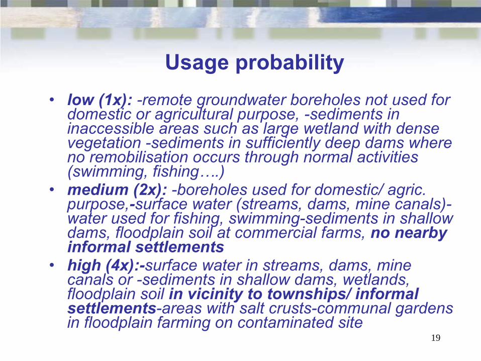
Usage probability
• low (1x): -remote groundwater boreholes not used for domestic or agricultural purpose, -sediments in inaccessible areas such as large wetland with dense vegetation -sediments in sufficiently deep dams where no remobilisation occurs through normal activities (swimming, fishing….)
• medium (2x): -boreholes used for domestic/ agric. purpose,-surface water (streams, dams, mine canals)-water used for fishing, swimming-sediments in shallow dams, floodplain soil at commercial farms, no nearby informal settlements
• high (4x):-surface water in streams, dams, mine canals or -sediments in shallow dams, wetlands, floodplain soil in vicinity to townships/ informal settlements-areas with salt crusts-communal gardens in floodplain farming on contaminated site
20
21
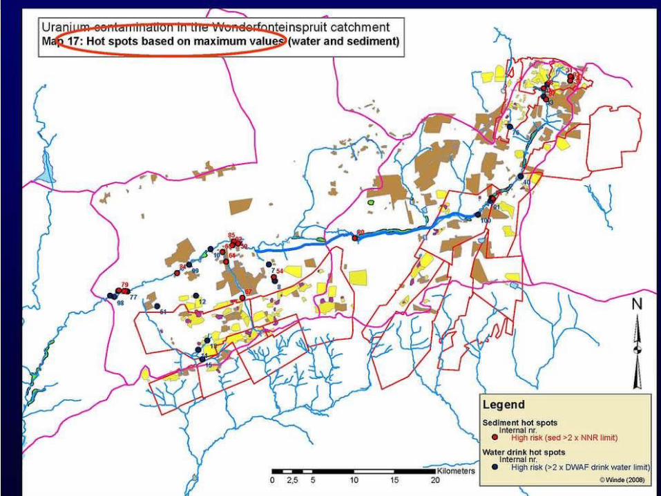
Conclusion
• The map is a work in process and not meant to be conclusive
• The areas of concern are categorised and do not represent a quantification
• It identifies priority areas for urgent action
• All contamination will have to addressed in due course