Embed Size (px)
Citation preview
Climate and Biomes
I. Determinants of Global ClimateA. Solar Radiation
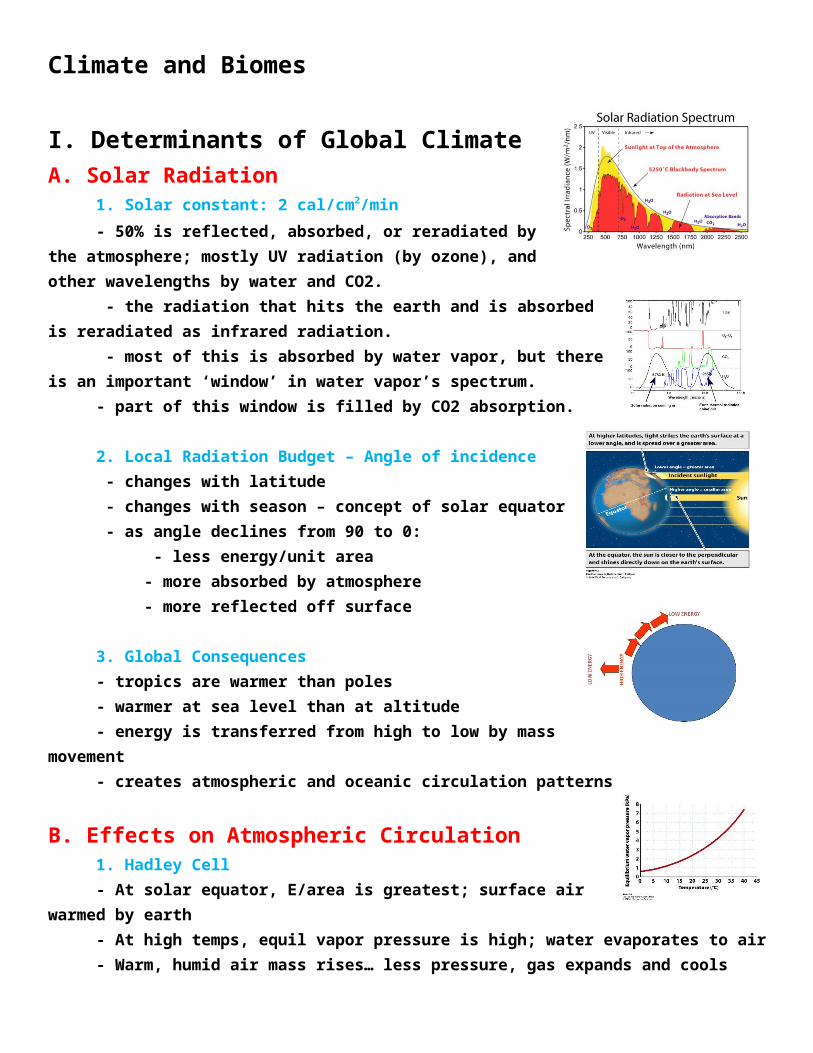
1. Solar constant: 2 cal/cm2/min- 50% is reflected, absorbed, or reradiated by the atmosphere;
mostly UV radiation (by ozone), and other wavelengths by water and CO2. - the radiation that hits the earth and is absorbed is reradiated as
infrared radiation. - most of this is absorbed by water vapor, but there is an important ‘window’
in water vapor’s spectrum.- part of this window is filled by CO2 absorption.
2. Local Radiation Budget – Angle of incidence - changes with latitude - changes with season – concept of solar equator - as angle declines from 90 to 0:
- less energy/unit area- more absorbed by atmosphere- more reflected off surface
3. Global Consequences- tropics are warmer than poles- warmer at sea level than at altitude- energy is transferred from high to low by mass movement- creates atmospheric and oceanic circulation patterns
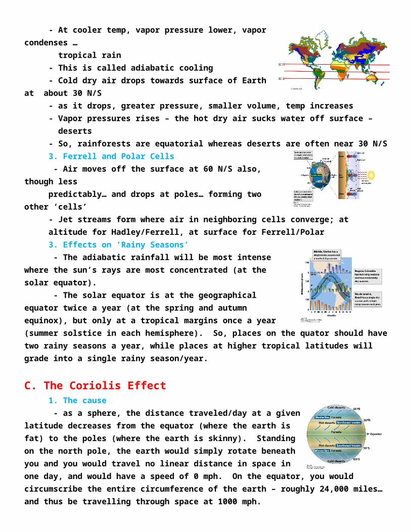
B. Effects on Atmospheric Circulation1. Hadley Cell- At solar equator, E/area is greatest; surface air warmed by earth- At high temps, equil vapor pressure is high; water evaporates to air- Warm, humid air mass rises… less pressure, gas expands and cools- At cooler temp, vapor pressure lower, vapor condenses … tropical rain- This is called adiabatic cooling- Cold dry air drops towards surface of Earth at about 30 N/S- as it drops, greater pressure, smaller volume, temp increases- Vapor pressures rises – the hot dry air sucks water off surface – deserts- So, rainforests are equatorial whereas deserts are often near 30 N/S
3. Ferrell and Polar Cells - Air moves off the surface at 60 N/S also, though less predictably… and drops at poles… forming two other ‘cells’- Jet streams form where air in neighboring cells converge; at altitude for Hadley/Ferrell, at surface for Ferrell/Polar3. Effects on ‘Rainy Seasons’ - The adiabatic rainfall will be most intense where the sun’s rays are
most concentrated (at the solar equator). - The solar equator is at the geographical equator twice a year (at the
spring and autumn equinox), but only at a tropical margins once a year (summer solstice in each hemisphere). So, places on the quator should have two rainy seasons a year, while places at higher tropical latitudes will grade into a single rainy season/year.
C. The Coriolis Effect1. The cause - as a sphere, the distance traveled/day at a given latitude decreases from
the equator (where the earth is fat) to the poles (where the earth is skinny). Standing on the north pole, the earth would simply rotate beneath you and you would travel no linear distance in space in one day, and would have a speed of 0 mph. On the equator, you would circumscribe the entire circumference of the earth – roughly 24,000 miles… and thus be travelling through space at 1000 mph.
2. The Effect- air dropping from altitude at 30 N and S is dragged to the east by the earth – at the speed the earth
is moving at that latitude. This air mass is now moving to the east at that given speed. As THAT AIR MASS IS DEFLECTED POLEWARD (as part of the Ferrell Cells), it conserves it easterly momentum. Underneath it, the earth is slowing down. So, relative to the earth, this air mass is moving progressively faster, to the east, than the earth. So, as this air mass moves poleward from 30N and 30S, it “outraces” the earth to the east (eastward deflection).
- Likewise, as the air at 30 N/S moves towards the equator (as part of their respective Hadley Cells), it experiences an earth that is moving progressively faster, to the east. So, the air mass “loses ground to the east” relative to the earth.. ie, it is deflected west.
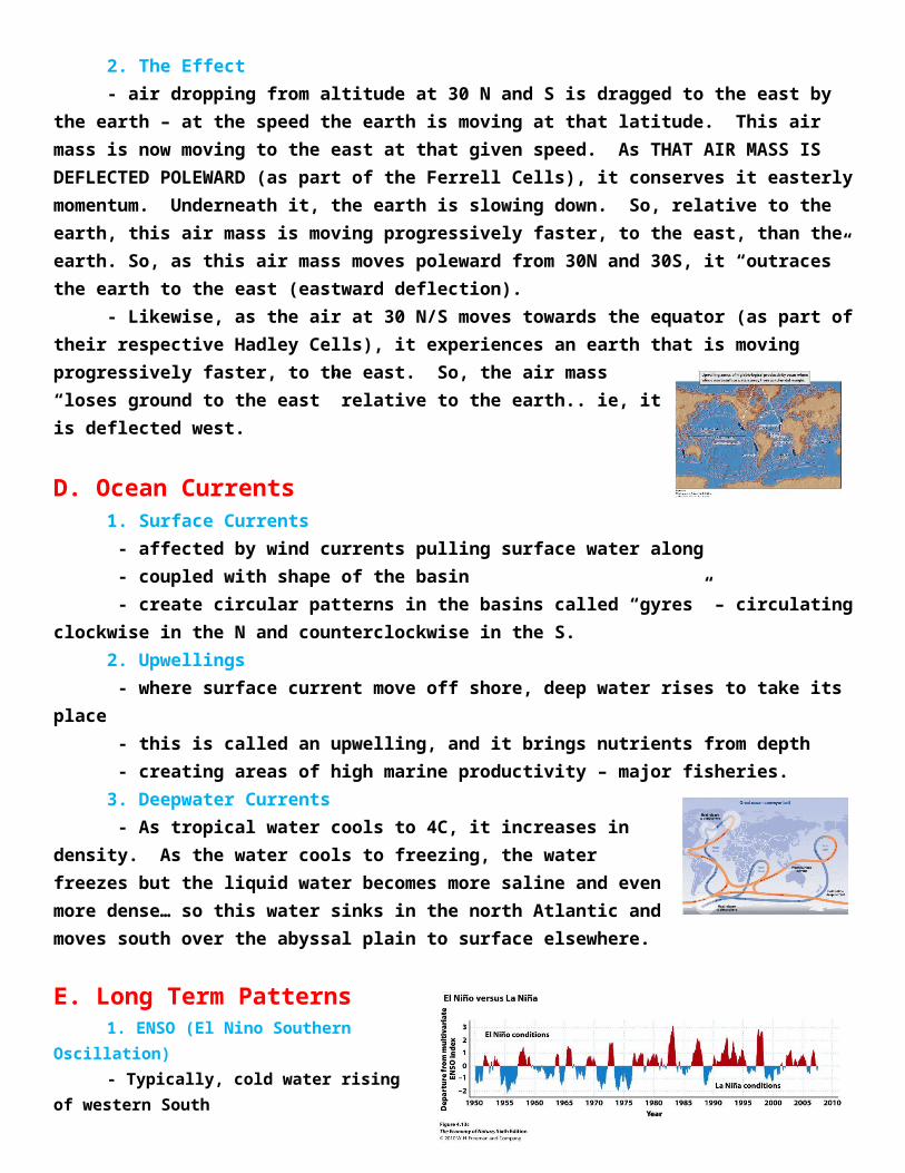
D. Ocean Currents1. Surface Currents - affected by wind currents pulling surface water along - coupled with shape of the basin - create circular patterns in the basins called “gyres” – circulating clockwise in the N and
counterclockwise in the S.2. Upwellings - where surface current move off shore, deep water rises to take its place
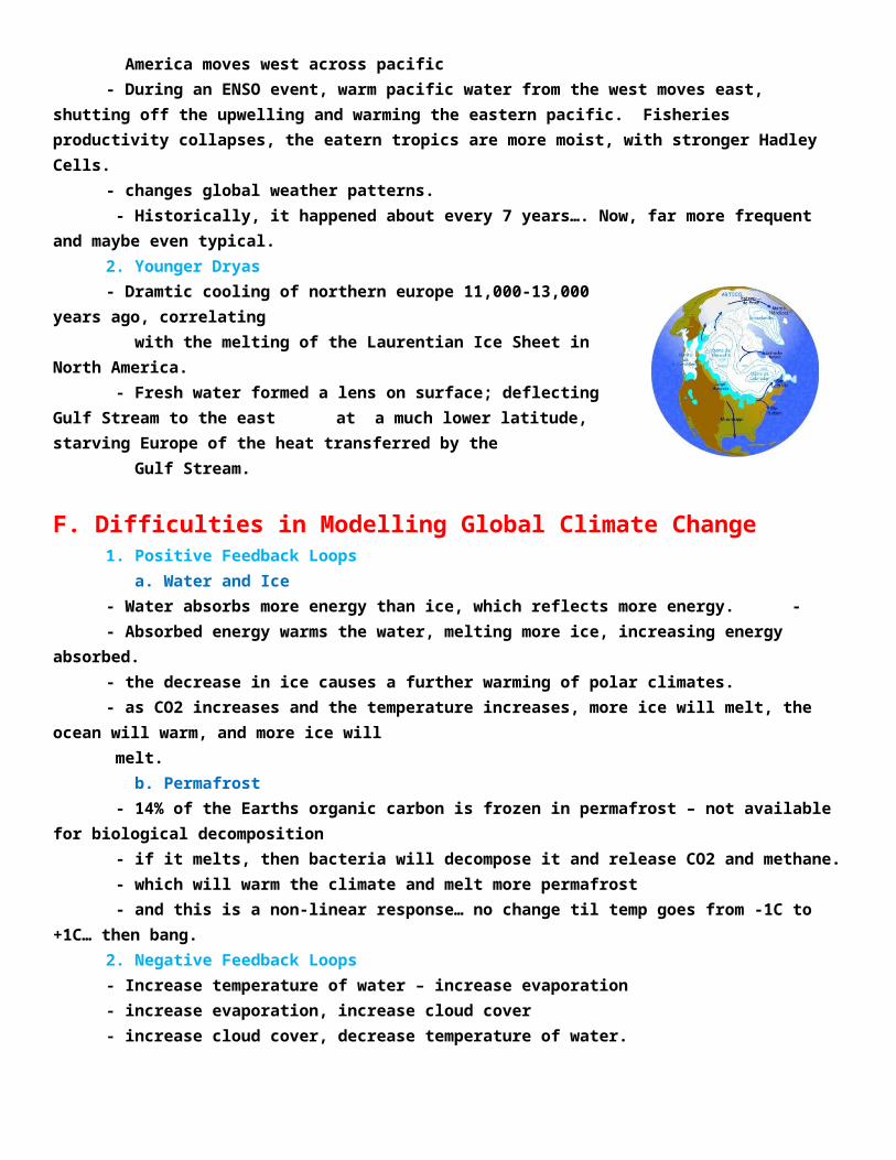
- this is called an upwelling, and it brings nutrients from depth - creating areas of high marine productivity – major fisheries.3. Deepwater Currents - As tropical water cools to 4C, it increases in density. As the water cools to
freezing, the water freezes but the liquid water becomes more saline and even more dense… so this water sinks in the north Atlantic and moves south over the abyssal plain to surface elsewhere.
E. Long Term Patterns1. ENSO (El Nino Southern Oscillation)- Typically, cold water rising of western South America moves west across pacific- During an ENSO event, warm pacific water
from the west moves east, shutting off the upwelling and warming the eastern pacific. Fisheries productivity collapses, the eatern tropics are more moist, with stronger Hadley Cells.
- changes global weather patterns. - Historically, it happened about every 7 years…. Now, far more frequent and maybe even typical.2. Younger Dryas - Dramtic cooling of northern europe 11,000-13,000 years ago, correlating with the melting of the Laurentian Ice Sheet in North America. - Fresh water formed a lens on surface; deflecting Gulf Stream to the east
at a much lower latitude, starving Europe of the heat transferred by the Gulf Stream.
F. Difficulties in Modelling Global Climate Change1. Positive Feedback Loops a. Water and Ice- Water absorbs more energy than ice, which reflects more energy. - - Absorbed energy warms the water, melting more ice, increasing energy absorbed.- the decrease in ice causes a further warming of polar climates.- as CO2 increases and the temperature increases, more ice will melt, the ocean will warm, and more ice will melt. b. Permafrost - 14% of the Earths organic carbon is frozen in permafrost – not available for biological decomposition - if it melts, then bacteria will decompose it and release CO2 and methane. - which will warm the climate and melt more permafrost - and this is a non-linear response… no change til temp goes from -1C to +1C… then bang.2. Negative Feedback Loops- Increase temperature of water – increase evaporation- increase evaporation, increase cloud cover- increase cloud cover, decrease temperature of water.
II. Determinants of Local Climates
A. Topography
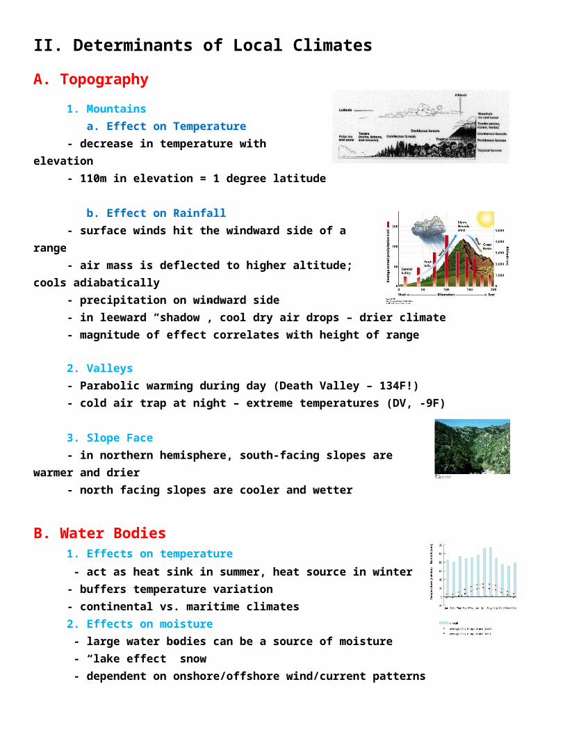
1. Mountains a. Effect on Temperature- decrease in temperature with elevation- 110m in elevation = 1 degree latitude
b. Effect on Rainfall- surface winds hit the windward side of a range- air mass is deflected to higher altitude; cools adiabatically- precipitation on windward side- in leeward “shadow”, cool dry air drops – drier climate- magnitude of effect correlates with height of range
2. Valleys- Parabolic warming during day (Death Valley – 134F!)- cold air trap at night – extreme temperatures (DV, -9F)
3. Slope Face- in northern hemisphere, south-facing slopes are warmer and drier- north facing slopes are cooler and wetter
B. Water Bodies1. Effects on temperature - act as heat sink in summer, heat source in winter- buffers temperature variation- continental vs. maritime climates2. Effects on moisture - large water bodies can be a source of moisture - “lake effect” snow - dependent on onshore/offshore wind/current patterns
C. Additive Effects - The Atacama Desert in northern Chile is the driest place on the planet. It is
behind a tall mtn range, it is at 30S latitude, and there are offshore currents. No source of moisture, and some weather stations with no recorded rainfall in 100 years.
III. BiomesA. Overview
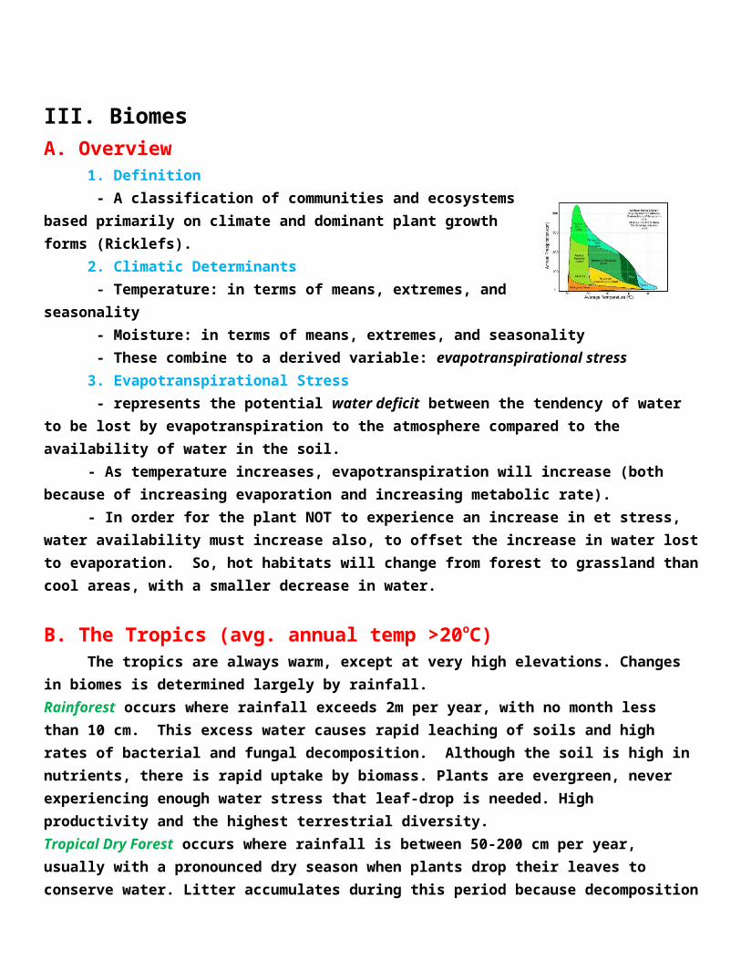
1. Definition - A classification of communities and ecosystems based primarily on
climate and dominant plant growth forms (Ricklefs).2. Climatic Determinants - Temperature: in terms of means, extremes, and seasonality - Moisture: in terms of means, extremes, and seasonality - These combine to a derived variable: evapotranspirational stress3. Evapotranspirational Stress - represents the potential water deficit between the tendency of water to be lost by
evapotranspiration to the atmosphere compared to the availability of water in the soil.- As temperature increases, evapotranspiration will increase (both because of increasing evaporation
and increasing metabolic rate).- In order for the plant NOT to experience an increase in et stress, water availability must increase
also, to offset the increase in water lost to evaporation. So, hot habitats will change from forest to grassland than cool areas, with a smaller decrease in water.
B. The Tropics (avg. annual temp >20oC)The tropics are always warm, except at very high elevations. Changes in biomes is determined
largely by rainfall. Rainforest occurs where rainfall exceeds 2m per year, with no month less than 10 cm. This excess water causes rapid leaching of soils and high rates of bacterial and fungal decomposition. Although the soil is high in nutrients, there is rapid uptake by biomass. Plants are evergreen, never experiencing enough water stress that leaf-drop is needed. High productivity and the highest terrestrial diversity.Tropical Dry Forest occurs where rainfall is between 50-200 cm per year, usually with a pronounced dry season when plants drop their leaves to conserve water. Litter accumulates during this period because decomposition rates slow when it is dry. Lower productivity, shorter, less dense vegetation, and less diversity that is strongly seasonal in activity. This grades into “scrub forests” of tall bushes, and then to tropical grasslands (savannah).Savannahs occur where rainfall is less than 50 cm per year. This is highly seasonal, and grasses grow in rainy season. Animal communities dominated by larger grazers and their predators.
C. The Temperate Zone (avg. annual temp between 5oC and 20oC)The climate varies seasonally, both in temperature and rainfall. Transtions occur as a consequence
of the joint effects influencing evapotranspirational stress. At a given rainfall level, the biome will transition from “moister” biome to a drier biome (like forest to grassland) more rapidly as temperature increases.

Temperate rainforest occurs on coasts with onshore wind patterns that bring moisture and moderate the temperate through the year. Low diversity, but the tallest trees on Earth. Low light in the understory retards growth of understory plants.Temperate deciduous forests are further inland or where currents are offshore, creating wide variation in seasonal temperatures and rainfall; with cold winters and warm wet summers. Trees drop their leaves in winter, but growing season is long enough to regrow leaves and still produce enough energy to store over the non-photosynthetic winter period. Soils are deep and rich in nutrients. In areas with sandy soils (that are drier and lower in nutrients, pines dominate (coastal plain and dry mountain slopes).Temperate Grasslands occur in the center of continents where rainfall is low and seasonal. Evaporational stress is high, C4 grasses dominate. Soils are the richest in nutrients because leaching rates are low. Large grazers and their predators dominate.Deserts have < 25 cm of rainfall per year, with high evaporational stress. In Phoenix, AZ, the ES = 130 cm year, but there is only 18 cm of rainfall. Plant growth is exclusively during rainy season. Soils are very poor in nutrients and decomposition rates are very slow. Salts are drawn up by evaporation of soil water, creating difficult conditions for root growth. CAM plants and C4 plants dominate.
D. Boreal and Polar Zones (avg. annual temp below 5oC)There is a very short growing season, the length determined by latitude.
Boreal forest (Taiga) occurs when the growing season is long enough to support the growth of trees. These trees must be evergreen, as season is too short to “waste time” growing new leaves. The leaves are waxy and cylindrical (pines, spruces, fir) to reduce water loss during winter, when available water is frozen. Dratic seasonality, and most animals must migrate or hibernate to avoid harsh winter conditions.Arctic and alpine grasslands (Tundra) occur when the growing season is too short (50-60 days) to sustain the energetic demands of a tree. Soils are shallow, underlain by permafrost.
STUDY QUESTIONS:
1) How do energy levels vary from tropics to poles and from the surface of the Earth to the upper atmosphere, and what relationship do these energy gradients have for wind and ocean circulation patterns?
2) Describe the greenhouse effect, whereby the atmosphere is warmed more by the Earth than the sun, in terms of absorption spectra of atmospheric gases.
3) How are tropical rains produced at the solar equator? Why is this effect most dramatic at the solar equator than elsewhere? Include the changes in pressure, temperature, and volume. Why does the number of rainy seasons vary in the tropics?
4) Why are deserts at 30degrees latitude? Include the effects of pressure, volume, and temperature.
5) Explain the Coriolis effect, as a consequence of the conservation of momentum, using air moving from 30-60 degrees latitude as an example.
6) The patterns in the temperate zone are less stable, associated with fronts of High and Low pressure systems. Explain why rain is associated with low pressure and clear skies with high pressure.
7) What happens in an El Nino event?
8) What happened during the Younger Dryas event?
9) Why is climatic modeling so difficult? Make reference to at least one positive and one negative feedback loop.
10) Describe a rain shadow effect.
11) How can slopeface affect local climatic conditions?
12) How do continental and maritime climates differ, and why?
13) Why is the Atacama desert the driest place on the planet? Consider three variables.
14) Why are there two rainy seasons at the equator but one at the tropic of cancer/capricorn?
16) Tropical rainforest soils are nutrient rich, but nutrient transport is rapid. Describe the inputs and outputs to the soil, and describe how these change when the vegetation is cleared.
17) Explain why trees drop their leaves in tropical dry forest.
18) Describe how evapotranspirational stress changes with temperature and water availability.
20) Why are tropical rainforests equatorial, while dry forests and grasslands are at higher latitudes?
22) Why are temperate rain forest coastal?
23) Why do deciduous trees dominate in the deciduous forest, but evergreens dominate in the boreal forest?
25) Describe the organic and inorganic content of a desert soil.