Embed Size (px)
Citation preview
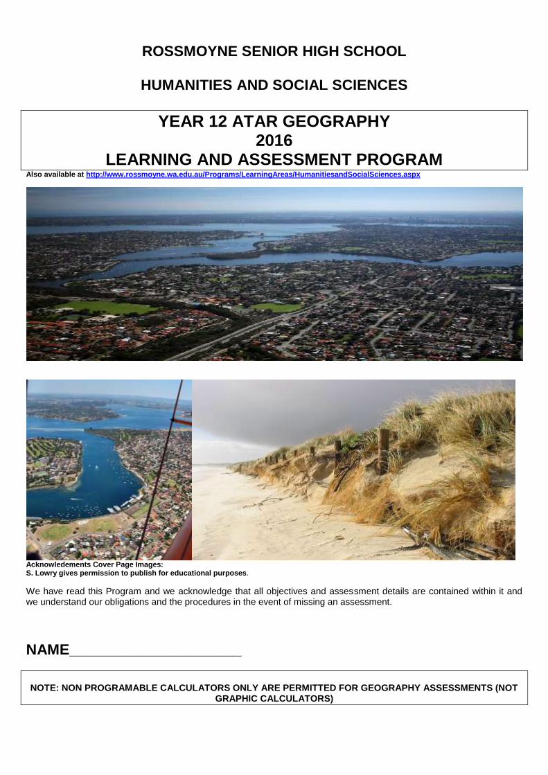
ROSSMOYNE SENIOR HIGH SCHOOL
HUMANITIES AND SOCIAL SCIENCES
YEAR 12 ATAR GEOGRAPHY 2016
LEARNING AND ASSESSMENT PROGRAM Also available at http://www.rossmoyne.wa.edu.au/Programs/LearningAreas/HumanitiesandSocialSciences.aspx
Acknowledements Cover Page Images: S. Lowry gives permission to publish for educational purposes.
We have read this Program and we acknowledge that all objectives and assessment details are contained within it and we understand our obligations and the procedures in the event of missing an assessment.
NAME_____________________
NOTE: NON PROGRAMABLE CALCULATORS ONLY ARE PERMITTED FOR GEOGRAPHY ASSESSMENTS (NOT
GRAPHIC CALCULATORS)

YEAR 12 ATAR GEOGRAPHY 2016 ASSESSMENT RECORD
UNIT 3
WEEK ASSESSMENT (Objectives)
LENGTH
WEIGHTING RAW SCORE
MY SCORE
2015 Term 4 Week 6 16 Nov
Task 1 Practical Skills
Content: 1-4, 14-17 Skills: 13-19, 36-39
1 hour
2.5%
/20
/5%
2016 Term 1 Week 2 8 Feb
Task 2
Geographical Inquiry: Global Content: 14-22 Skills: 1-12, 44-47
1 hour
2.5%
/10
/5%
Term 1 Week 7 14 Mar
Task 3
Fieldwork Depth Study 1: Global environmental Fieldtrip 16/3/16
Content: 5-13 Skills: 20-28, 48-50
1 hour
10%
/20
/10%
Term 1 Week 9 30 Mar
Task 4
Short answer and extended response Depth Study 2: Global environmental change Content: 5-13 Skills: 13-19, 29-43
5-6 weeks 1 hour
15%
/30
/10%
Term 2 Weeks 3-4 9 -20 May
Task 5
Exam on Unit 3 (1-22) Geographical inquiry skills (all)
3 hours 10 minutes
20%
/100
/20% SUBTOTAL: /50%
UNIT 4
WEEK ASSESSMENT (Objectives)
LENGTH
WEIGHTING RAW SCORE
MY
SCORE
Term 2 Week 6 30 May
Task 6
Geographical Inquiry Depth Study 2: Megacity Content: 15-25 (where applicable) Skills: 1-12, 44-
1 hour
5%
/30
/7%
Term 2 Week 9 20 Jun
Task 7
Short Answer and Extended response Depth Study 2: Megacity Content: 15-25 (where applicable) Skills: 28, 38, 42
1 hour
5%
/30
/7%
Term 3 Week 6 22 Aug
Task 8
Fieldwork/practical skills Depth Study 1: Metropolitan Perth Fieldtrip Metropolitan Perth 23/8/15
Content: 6-14 (where applicable) Skills: 20-28, 48-50
1 hour
5%
/30
/8%
Term 3 Week 7 29 Aug
Task 9
Short and extended responses Depth Study 1: Content: 1-14 (where applicable) Skills: 13-19, 29-43
5 - 6 weeks 1 hour
15%
/50
/20%
Term 3 Weeks 9 -10 12-23 Sept
Task 10
Exam Unit 4(1-25) Geographical inquiry skills (all)
3 hours 10 minutes
20%
/100
/20%
SUBTOTAL: /50%
YEAR TOTAL: /100%
*It is your responsibility to keep all your assessments until the grades are confirmed by the School Curriculum and Standards Authority at the end of the year.

Rationale The study of geography draws on students’ curiosity about the diversity of the world’s places and their peoples, cultures and
environments. It enables them to appreciate the complexity of our world and the diversity of its environments, economies and cultures
and use this knowledge to promote a more sustainable way of life and awareness of social and spatial inequalities.
In the senior secondary years, the Geography ATAR course provides a structured, disciplinary framework to investigate and analyse a
range of challenges and associated opportunities facing Australia and the global community. These challenges include rapid change in
biophysical environments, the sustainability of places, dealing with environmental risks, and the consequences of international
integration.
Geography addresses questions about the interaction of natural and human environments within various natural and social systems. It
examines the factors that impact upon decisions about sustainability, the conflicting values between individuals and groups over
sustainability and the degree of commitment towards sustainable development.
Geography as a discipline values imagination, creativity and speculation as modes of thought. It provides a systematic, integrative way
of exploring, analysing and applying the concepts of place, space, environment, interconnection, sustainability, scale and change.
These principal geographical concepts are applied and explored in depth through unit topics to provide a deeper knowledge and
understanding of the complex processes shaping our world. Taken together, the ability of students to apply conceptual knowledge in
the context of an inquiry, and the application of skills, constitute ‘thinking geographically’ – a uniquely powerful way of viewing the
world.
The course builds students’ knowledge and understanding of the uniqueness of places and an appreciation that place matters in
explanations of economic, social and environmental phenomena and processes. It also develops students’ knowledge about the
interconnections between places. Nothing exists in isolation. Consequently, the subject considers the significance of location, distance
and proximity.
Through the study of geography, students develop the ability to investigate the arrangement of biophysical and human phenomena
across space in order to understand the interconnections between people, places and environments. As a subject of the humanities
and social sciences, geography studies spatial aspects of human culture using inquiry methods that are analytical, critical and
speculative. In doing so, it values imagination and creativity. As a science, geography develops an appreciation of the role of the
biophysical environment in human life, and an understanding of the effects human activities can have on environments. As a result, it
develops students’ ability to identify, evaluate and justify appropriate and sustainable approaches to the future by thinking holistically
and spatially in seeking answers to questions. Students are encouraged to investigate geographical issues and phenomena from a
range of perspectives, including those of Aboriginal and Torres Strait Islander Peoples.
In the Geography ATAR course, students investigate geographical issues and phenomena at a variety of scales and contexts. This
may include: comparative studies at the same scale; studying the same issue or phenomenon at a range of scales; or seeking
explanations at a different scale to the one being studied. The ability to perform multi-scale and hierarchical analysis is developed
further in this syllabus.
Students learn how to collect information from primary and secondary sources, such as field observation and data collection, mapping,
monitoring, remote sensing, case studies and reports. Fieldwork, in all its various forms, is central to geographical inquiries as it
enables students to develop their understanding of the world through direct experience.
Students develop a range of skills that help them to understand the physical world, interpret the past, scrutinise the present, and
explore sustainable strategies for the future care of places. They are able to understand recent and future developments, such as
urban planning, climate change, cultural diffusion, environments at risk, sustainable development practices, and the unequal
distribution of resources throughout the world.
The Geography ATAR course promotes students’ communication abilities by building their skills of spatial and visual representation
and interpretation through the use of cartographic, diagrammatic, graphical, photographic and multimodal forms. In addition, students
communicate their conclusions by written and oral means.
Aims The Geography ATAR course aims to develop students’:
knowledge and understanding of the nature, causes and consequences of natural and ecological hazards, international integration
in a range of spatial contexts, land cover transformations, and the challenges affecting the sustainability of places
understanding and application of the concepts of place, space, environment, interconnection, sustainability, scale and change
through inquiries into geographical phenomena and issues
ability to critically use geographical inquiry methods and skills, and to think and communicate geographically
ability to identify, evaluate and justify alternative responses to the geographical challenges facing humanity, and propose and
justify actions, taking into account environmental, social and economic factors
understandings, skills, knowledge and values to ensure they are well placed for tertiary study and/or employment.

Organisation This course is organised into a Year 12 syllabus.
Structure of the syllabus
The Year 12 syllabus is divided into two units, each of one semester duration, which are typically delivered as a pair. The notional time
for each unit is 55 class contact hours.
Unit 3 – Global environmental change In this unit, students assess the impacts of land cover transformations with particular reference to climate change or biodiversity loss.
Unit 4 – Planning sustainable places In this unit, students investigate how the outcomes of processes vary depending on local responses and adaptations, for example, population growth and decline, and economic restructuring. Students also examine the causes and consequences of urbanisation as well as challenges that exist in metropolitan and regional centres and megacities. Each unit includes:
a unit description – a short description of the focus of the unit
learning outcomes – a set of statements describing the learning expected as a result of studying the unit
unit content – the content to be taught and learned
The content in each unit is divided into an overview and one or more depth studies. The content descriptions associated with the overview are designed to be taught at a broad level and in a short timeframe. The content descriptions associated with the depth study are designed to be taught in a more focused and detailed way, and therefore to take more time to teach.
Organisation of content
The Geography ATAR course has two interrelated strands: Geographical Knowledge and Understanding, and Geographical Inquiry
and Skills. This strand organisation provides an opportunity to integrate content in flexible and meaningful ways.
Geographical Knowledge and Understanding
Geographical knowledge refers to the facts, generalisations, principles, theories and models developed in the Geography ATAR
course. This knowledge is dynamic and its interpretation can be contested. Opinions and conclusions must be supported by evidence
and logical argument.
Geographical understanding is the ability to see the relationships between items of knowledge and construct explanatory frameworks to
illustrate these relationships. It is also the ability to apply this knowledge to new situations or to solve new problems.
Geographical Inquiry and Skills
This strand is about the skills required to conduct a geographical inquiry and the geographical skills needed to find and communicate
information and data. It contains two sub-strands: Geographical Inquiry Skills and Geographical Skills.
Geographical Inquiry is a process undertaken by individual students or groups to investigate geographical questions, information, data,
problems or issues to deepen their understanding. This process requires students to apply the following geographical inquiry skills:
observing, questioning and planning
collecting, recording, evaluating and representing
interpreting, analysing and concluding
communicating
reflecting and responding
Inquiries may vary in scale and geographic context.
When using geographical information and data and communicating, students develop the following geographical skills:
mapping skills (use of maps and atlases)
remote sensing skills (use of remote sensing products, such as ground level photographs, aerial photographs, radar imagery and
satellite imagery)
geographical and statistical data skills (use of geographical and statistical data in formats such as tables, graphs, maps and
diagrams)

skills in the use of information and communication technology (ICT) and geographical information systems (GIS) in a geographical
context
fieldwork skills (use of fieldwork observations and measurements)
Relationships between the strands
The two strands are interrelated and the content has been written in a way that enables integration of the strands in the development of
a teaching and learning program. The Geographical Knowledge and Understanding strand provides the contexts through which
particular inquiries and skills are to be developed. The same set of geographical skills has been included in each of the units to provide
a common focus for the teaching and learning of content in the Geographical Knowledge and Understanding strand.
Progression from the Year 7–10 curriculum
This syllabus continues to develop student understanding and skills developed from the Year 7–10 Geography curriculum. It uses the
same strands of the Year 7–10 curriculum to further develop students’ ability to explore, analyse and apply the concepts of place,
space, environment, interconnection, sustainability, scale and change. It does, however, feature a wider range of geographical
concepts and contexts and introduces students to a more diverse, and increasingly sophisticated, range of geographical tools and
skills.
Representation of the general capabilities
The general capabilities encompass the knowledge, skills, behaviours and dispositions that will assist students to live and work
successfully in the twenty-first century. Teachers may find opportunities to incorporate the capabilities into the teaching and learning
program for the Geography ATAR course. The general capabilities are not assessed unless they are identified within the specified unit
content.
Literacy
In the Geography ATAR course, students use literacy skills to explore, interpret and evaluate geographical phenomena and issues and
communicate geographically. Students work with oral, print, visual and digital texts to gather, synthesise and analyse information from
a range of sources, and present and justify ideas, conclusions and opinions within a broad range of geographical contexts. They
understand how language is used and modified for specific purposes, and question attitudes and assumptions embedded in texts.
Geography students also develop visual literacy skills as they make meaning of information communicated through maps, graphs,
cartoons and other images.
Numeracy
In the Geography ATAR course, students use numeracy skills to identify and describe a wide range of patterns and relationships,
including those that can be visually represented on a graph or map. Geography students also apply numeracy skills to interpret and
manipulate data. These skills help students to realise and describe change as it occurs over time. Students demonstrate numeracy
capability by making connections between apparently diverse facts and suggesting solutions to problems in a range of circumstances,
for example, the relationship between weather patterns and the likelihood of natural hazards, such as, drought or landslides.
Information and communication technology capability
In the Geography ATAR course, students use Information and communication technology (ICT) to develop geographical understanding
and to support the application of geographical skills. They use digital tools, including spatial technologies, to support their inquiries into
geographical phenomena and issues. They also use these tools to collect and analyse data, represent it in digital form, access and
manipulate databases, and model conceptual constructs. In addition, students critically analyse the quality of digital information and
sources of information. They also create multimodal and multifaceted reports and presentations to represent and communicate the
results of geographical inquiry.
Students recognise the relative possibilities, limitations and consequences of using different forms of digital information and methods of
distributing this information, and apply sophisticated understandings of social and ethical practices in the use of digital information and
communications. In particular, they consider how geographical and demographic data may be used and the ethics involved.
Critical and creative thinking
Critical and creative thinking processes and skills are used by students when examining diverse interactions between people,
perspectives, interpretations, phenomena and environments. Through multifaceted problem posing and solving, they explore the
interconnections, uncertainty and consequences of these relationships.
Thinking laterally, visualising possibilities, testing options using criteria, and making judgements are essential skills for conducting
geographical investigations connected with the environment, space, sustainability, scale and change. When seeking answers to
questions, students think holistically and spatially, using skills such as analysis, interpretation, extrapolation from trends, synthesis of
relationships and exploration of anomalies evident in patterns.
Through developing dispositions such as intellectual openness, curiosity and showing initiative, students investigate biophysical and
human phenomena. As independent and autonomous thinkers who seek explanations and value discovery, they turn creativity and
innovation into action, apply new knowledge to identified gaps, and justify their actions.

Personal and social capability
Personal and social capability involves students taking responsible personal, social and environmental action against, or in support of,
decisions by organisations, governments or other bodies. Through the study of geography, students are provided with learning
opportunities to assist them to develop, rehearse and refine their skills in listening to, respecting and acknowledging diverse
perspectives and opinions. Students participate in collaborative investigative group work to make ethical, rational social decisions and
solve problems that relate to their social and environmental contexts. Developing these personal and social capabilities positions them
to advocate for opportunities and methods for change in a democratic society. Personal and social capability occurs when responsible
social and environmental actions and participation are promoted, and this should be a logical outcome of many geographical
investigations.
Ethical understanding
Ethical understanding plays an important role in geographical inquiry. Students uncover and assess ethical considerations, such as the
links between human rights and responsibilities and the ways diverse perspectives, values and cultures impact on geographical issues.
Through geographical inquiry, students have the opportunity to analyse, qualify and test their own attitudes, values and beliefs and
explore how people’s knowledge, attitudes and values affect judgements, decisions and actions as they apply to their interact ion with
environments. They become aware of the need for social responsibility when confronted with alternative opinions and when seeking to
resolve problems. Students apply ethical standards to guide their use of digital representations of phenomena and statistics associated
with biophysical and environmental factors and relationships.
Intercultural understanding
Students deepen their intercultural understanding as they examine geographical issues in a broad range of cultural contexts. This
involves students in developing their understanding of the complexity and diversity of the world’s cultures and evaluating alternative
responses to the world’s environments and challenges. It enables students to find interconnections and sustainable solutions in an
internationally integrated world, and consider the implications of their responses from different cultural responses.
Representation of the cross-curriculum priorities
The cross-curriculum priorities address contemporary issues which students face in a globalised world. Teachers may find
opportunities to incorporate the priorities into the teaching and learning program for the Geography ATAR course. The cross-curriculum
priorities are not assessed unless they are identified within the specified unit content.
Aboriginal and Torres Strait Islander histories and cultures
In the Geography ATAR course, there is a range of opportunities to learn about Aboriginal and Torres Strait Islander histories and
cultures. Students can, for example, investigate how Aboriginal and Torres Strait Islander Peoples may be unequally affected by
natural and ecological hazards, are represented in the challenges faced by places and the process of international cultural integration.
More broadly, students develop a range of capabilities that enable them to independently construct informed responses to the range of
geographical issues involving Aboriginal and Torres Strait Islander Peoples.
Asia and Australia's engagement with Asia
In the Geography ATAR course, students can investigate a wide range of contexts that draw on Asia and Australia’s engagement with
Asia. This priority can be addressed through: the study of natural and ecological hazards and how the risks associated with such
occurrences can be managed to eliminate or minimise harm to people and the environment; and other transformations taking place as
a result of economic and cultural integration.
Sustainability
Students explicitly address sustainability in the Geography ATAR course through an investigation of the approaches to sustainability
and through an evaluation of alternative responses to geographical issues and phenomena. In doing so, they use economic, social and
environmental criteria to frame investigative questions and measure the capacity of something to be maintained indefinitely into the
future.
Unit 3 – Global environmental change Unit description This unit focuses on the changing biophysical cover of the Earth’s surface, the creation of anthropogenic biomes and the resulting impacts on either global climate or biodiversity. Land cover transformations have changed both global climate and biodiversity through their interaction with atmospheric and ecological systems. Conversely, climate change and loss of biodiversity are producing further transformations in land cover. Through applying the concept of sustainability, students are given the opportunity to examine and evaluate a program designed to address the negative effect of land cover change. Aspects of physical, environmental and human geography provide students with an integrated and comprehensive understanding of the processes related to land cover change, their local, regional and global environmental consequences, and possible sustainable solutions. The Earth’s surface is constantly changing and all environments are, to a greater or lesser extent, being modified by human activity. Students examine the processes causing change in land cover. The scale at which these processes are occurring is so extensive that very few truly ‘natural’ environments still exist and most are now, to some degree, anthropogenic in nature. Human action has altered local and regional climates and hydrology, damaged ecosystem services, contributed to the loss of biodiversity and altered soils. This unit begins with an overview of land cover change drawn from different regions and countries. Two depth studies provide greater detail. The first study focuses on the interrelationship between land cover and either global climate change or biodiversity loss. The second study focuses on the evaluation of a local land cover change initiative designed to address either climate change or biodiversity loss. In undertaking these depth studies, students develop an understanding of the use and application of geographical inquiry, tools such as spatial technologies, fieldwork and other skills, to investigate human–environment systems.
Learning outcomes By the end of this unit, students: understand the nature, extent and causes of the changing land cover of the Earth’s surface, including the emergence of
anthropogenic biomes, and evaluate projections of future changes in global land cover
understand the local and regional effects of land cover change on ecosystems, and the interrelationships
between land cover change and either global climate change or biodiversity loss
understand and apply key geographical concepts as part of a geographical inquiry, including place, space, environment, interconnection, sustainability, scale and change
evaluate the sustainability of a program aimed at alleviating the negative impacts of land cover change by considering its environmental, economic and social benefits and costs
apply geographical inquiry and a range of skills, including spatial technologies and fieldwork, to evaluate land cover change and its consequences and sustainable solutions.
Unit content This unit includes the knowledge, understandings and skills described below. This is the examinable content.
Geographical Knowledge and Understanding Overview of nature, extent, causes and consequences of land cover change
1. Reference should be made to global forests, agriculture and urban land cover using illustrative examples drawn from different regions and countries and at different scales.
2. the concepts of environment, natural and anthropogenic biomes, land cover change, ecosystem structure and dynamics,
biodiversity loss, climate change and sustainability
3. the identification and classification of land cover changes with reference to global forests, agriculture and urban land cover
4. the use of remote sensing images, other spatial technologies, and fieldwork to identify and measure the location, nature, rate, extent and consequences of land cover change
5. the implications of anthropogenic biomes to the functioning of the world's ecosystems
6. world population growth, growing affluence, advances in technology and their impact on the nature, rate and extent of land
cover change and biodiversity loss

7. processes of land cover change (deforestation, the expansion and intensification of agriculture, rangeland modification, land and soil degradation, irrigation, land drainage and reclamation, and the growth of urban settlement, industry and mining)
8. the differences in the process of land cover change between countries due to factors such as government policy, institutional
arrangements, land ownership, type of economy, ideology and culture projecting changes in land cover using existing spatial models, incorporating both environmental and socioeconomic variables
9. indigenous peoples' land management practices and their impact on land cover over time, including those of Aboriginal and
Torres Strait Islander Peoples
10. the impacts of land cover change on local and regional environments, including changes to the water cycle, soil erosion and degradation, loss of habitat and biodiversity, the degradation of aquatic and marine environments, loss of ecosystem services, changes to regional climates, and urban heat islands.
Students complete two depth studies which are taught with the requisite geographical inquiry skills and additional geographical skills
as described as part of this unit.
Depth study one Students investigate the links between changes in land cover and changes in either global climate or biodiversity.
Global climate change
11. the spatial distribution of the world’s rainfall and temperature patterns
12. the key elements of the following natural systems: heat budget (including the greenhouse effect), hydrological cycle, carbon cycle and the causes (natural and anthropogenic) and rate of global climate change
13 one major type of evidence for climate change through geological time
14 one major type of evidence for climate change in recent human history
15 the interrelationship between land cover change and climate, including changes to surface reflectivity (albedo) and the process of natural carbon sequestration
16 the effects of climate change on land cover in natural and anthropogenic biomes (vegetation, ice sheets, glaciers, coastal
systems and coral reefs, agriculture, urban settlements and industry)
17 the projected impacts of global climate change
18
OR Loss of biodiversity
11. the spatial distribution of the world’s biomes
12 the key elements of ecosystem structure and dynamics (biotic and abiotic elements, food chains and webs, biomass, trophic levels, flows of matter and energy)
13 the causes (natural and anthropogenic) and rate of declining biodiversity
14 one major type of evidence for loss of biodiversity through geological time
15 one major type of evidence for loss of biodiversity in recent human history
16 the interrelationships between land cover change and biodiversity loss, including shifting ecological boundaries, evolutionary
diversification and species extinction
17 the effects of biodiversity loss in natural and anthropogenic biomes on ecosystem services and species, ecosystem and genetic diversity; loss of human foods and medicinal plants
18 the projected impacts of loss of biodiversity
Depth study two Using fieldwork and/or secondary sources, students investigate how the impacts of land cover change are being addressed and evaluated.
19 approaches to land cover restoration and rehabilitation, and the mitigation of future land cover changes, including preservation strategies
20 the current and proposed strategies, at local to global levels, implemented to mitigate the adverse effects of either global
climate change or loss of biodiversity
21 how human activity has adapted, or may be required to adapt, to either global climate change or loss of biodiversity

22 a program designed to address the impacts of land cover change on local and regional environments
23 an evaluation of the program, giving consideration to environmental, economic and social benefit and costs
24 an evaluation of at least one alternative approach to the management of land cover change in the area being studied, using
the concept of sustainability to determine the extent to which the approach has the potential to address the issue into the future
Geographical Inquiry and Skills All the following skills should be taught during the unit. Relevant skills will be emphasised for each depth study.
Geographical inquiry skills Observing, questioning and planning
25 formulate geographical inquiry questions
26 plan a geographical inquiry with clearly defined aims and appropriate methodology
Collecting, recording, evaluating and representing
27 collect geographical information, incorporating ethical protocols, from a range of primary sources (interviews, questionnaires, student’s own experiences, and field observations) and secondary sources (online maps, websites, spatial software applications, print resources and visual media)
28 record observations in a range of graphic representations using spatial technologies and information and communication
technologies
29 evaluate the reliability, validity and usefulness of geographical sources and information
30 acknowledge sources of information and use an approved referencing technique
Interpreting, analysing and concluding
31 analyse geographical information and data from a range of primary and secondary sources, and a variety of perspectives, to draw reasoned conclusions and make generalisations
32 identify and analyse relationships, spatial patterns and trends, and make predictions and inferences
Communicating
33 communicate geographical information, ideas, issues and arguments using appropriate written and/or oral, cartographic, multimodal and graphic forms
34 use geographical language in appropriate contexts to demonstrate geographical knowledge and understanding
Reflecting and responding
35 apply generalisations to evaluate alternative responses to geographical issues at a variety of scales
36 propose individual and collective action, taking into account environmental, social and economic factors, and predict the outcomes of the proposed action
Geographical skills The following geographical skills should be taught within the specified content of each unit.
Mapping skills (use of maps and atlases)
37 identify and interpret a variety of topographic and thematic maps (physical, political, and social maps, synoptic charts and
climate maps) at different scales (local, national and global)
38 understand the significance of map projections (cylindrical, conical and azimuthal) for mapping the Earth interpret and apply data from different types of statistical maps (isopleth/isoline maps, choropleth maps, proportional circle maps, overlay and dot distribution maps)
39 interpret marginal information represented on maps (title, conventional signs contained in the legend, north point, numerical
and linear scale)

40 establish position on a map using alphanumeric grid coordinates, eastings and northings, four figure area references, six
figure grid references, and latitude and longitude expressed in degrees and minutes
41 establish direction on a map using general compass directions (16 points) and bearings
42 interpret and express scale in written, linear and ratio (representative fraction) formats, and convert scale from one format to another
43 apply the map scale to basic calculations to determine time, speed, distance and area
44 interpret relief on a map using contours and height information (spot heights), to describe the steepness and shape of a slope
(concave, convex and uniform), and calculate the average gradient
45 identify different relief features (landforms, including hills, valleys, plains, spurs, ridges, escarpments, saddles, cliffs), types of natural vegetation cover and hydrological features (land subject to inundation, perennial and intermittent water bodies)
46 interpret, construct and annotate cross sections to show natural and cultural features on the landscape
47 construct simple annotated sketch maps using map conventions (border, title, legend, north point and approximate scale)
48 identify and interpret natural features and cultural features on a map
49 describe the site and situation of places
50 identify, describe and interpret spatial patterns (including land use, settlement and transport), and spatial relationships
between natural and cultural features on maps
51 interpret and describe changing patterns and relationships that have taken place over time
Remote sensing skills (Use of remote sensing products, such as ground level photographs, aerial photographs, radar imagery and satellite imagery)
52 identify and describe natural and cultural features and their patterns on the Earth’s surface using ground level photographs, aerial photographs (vertical and oblique), radar imagery and satellite imagery (Landsat, weather satellites and Google Earth)
53 compare the different types of information available from remote sensing products with the information depicted on a
topographic map
54 use remote sensing products as an aid to interpreting natural and cultural features shown on topographic maps
55 determine direction on remote sensing products
56 apply scale to the calculation of distance on remote sensing products
57 interpret the difference in scale between a photograph and a topographic map of the same place
58 use combinations of remote sensing products and topographic maps to provide information based on change over time
Geographical and statistical data skills (use of geographical and statistical data in formats such as tables, graphs, maps and diagrams)
59 calculate and interpret descriptive statistics, including central tendency (arithmetic mean, median, mode), variation (maximum, minimum and range) and frequency
60 interpret indexes
61 identify correlations between variables
62 interpret and apply data from different types of statistical maps (isopleth/isoline maps, choropleth maps, proportional circle
maps, overlay and dot distribution maps)
63 interpret and construct tables and graphs, including: picture graphs; line, bar and compound graphs; histograms; scattergrams; climatic graphs; pie graphs; flowcharts and population pyramids
64 use systems and flow diagrams to organise thinking about relationships
65 understand that statistical or spatial association does not prove a causal relationship
66 extrapolate trends over time to forecast future conditions

Skills in the use of information and communications technology and geographical information systems (In a geographic context)
67 use the internet as a tool for geographical research
68 use simple applications, software and online resources (including Google Earth and Google Maps) to access atlases and remote sensing products (photographs, radar imagery and satellite imagery) for the purpose of describing and interpreting spatial patterns and relationships
69 access databases, such as Australian Bureau of Statistics, and Bureau of Meteorology, for spatial and statistical information
70 use geospatial technologies, including global positioning systems (GPS), to collect and map spatial data
Fieldwork skills (use of field observations and measurements)
71 collect primary data using field techniques, including: surveys and interviews, observing and recording, listening, questioning, sketching and annotating, measuring and counting, photographing and note‐taking
72 collate primary data using techniques, including listing, tabulating, report writing, graphing, constructing diagrams and
mapping
73 analyse and interpret primary data
Unit 4 – Planning sustainable places Unit description Challenges exist in designing urban places to render them more productive, vibrant and sustainable. How people respond to these challenges, individually and collectively, will influence the sustainability and liveability of places into the future. While all places are subject to changes produced by economic, demographic, social, political and environmental processes, the outcomes of these processes vary depending on local responses, adaptations and planning practices. Urban planning involves a range of stakeholders who contribute to decision making and the planning process. Students examine how governments, planners, communities, interest groups and individuals attempt to address these challenges in order to ensure that places are sustainable. They also investigate the ways in which geographical knowledge and skills can be applied to identify and address these challenges. The present and future needs of society are addressed by the allocation and reallocation of land uses, improving infrastructure and transport systems and enhancing amenities to meet the needs of the population as perceived by the different perspectives of the various stakeholders. The unit begins with a global scale overview of the process of urbanisation and its consequences. Urbanisation not only affects human wellbeing and the rate of world population growth, it has created a range of challenges for urban, rural and remote places, including Indigenous communities. The interconnected challenges faced in places, and other matters related to liveability, are a focus of this unit. Two depth studies provide greater detail. The first study focuses on challenges in metropolitan Perth or a regional urban centre in Western Australia. The second study focuses on challenges faced in a megacity. Students examine the concepts, processes and roles of planning in these selected contexts. This approach enables students to also develop an understanding of the challenges in two urban places. In undertaking these depth studies, students will use and apply geographical tools, such as spatial technologies and skills, to investigate the sustainability of places.
Learning outcomes By the end of this unit, students:
74 understand the processes resulting in changes in places and how the places investigated can be made more sustainable
75 understand the outcomes of the processes creating change in different communities
76 understand and apply key geographical concepts – including place, space, environment, interconnection, sustainability, scale and change – as part of a geographical inquiry
77 gather and analyse primary and secondary data to reveal trends in, and relationships between, the processes resulting in
change in places
78 apply geographical inquiry and a range of skills, including spatial technologies and fieldwork, to investigate a challenge associated with the sustainability of places
79 evaluate alternative planning strategies or proposals to manage a selected challenge.

Unit content
This unit builds on the content covered in Unit 3. This unit includes the knowledge, understandings and skills described below. This is the examinable content.
Geographical Knowledge and Understanding Overview of places and their challenges
Places:
80 the process of urbanisation and its implications for world population growth and human wellbeing in urban and rural places
81 the economic and environmental interdependence of urban and rural places
82 the historical, cultural, economic and environmental factors that have contributed to the spatial distribution of urban and rural places in Australia
83 the processes of urban sprawl, invasion and succession, renewal, planning, land use competition, inertia and agglomeration
that have contributed to the characteristics and functions of urban and rural places in Australia
84 the changing demographic, economic and social characteristics, including age, gender and socioeconomic and cultural distribution, in urban and rural places in Australia
85 Challenges facing places:
86 an overview of the challenges facing rural and remote places in Australia, including Indigenous communities. Challenges
include: population loss, economic restructuring, employment, housing, service and water provision, concentrations of socially vulnerable populations, social inclusion and exclusion, transportation, resource degradation, land use conflicts, declining
political influence, isolation and remoteness, fly‐in/fly‐out work patterns.
87 an overview of the challenges facing megacities and Australian metropolitan and regional centres.
88 Challenges include: housing, economic restructuring, employment, transportation, congestion, environmental degradation,
waste management, personal safety, land abandonment, urban sprawl, socio‐spatial inequality, social inclusion and exclusion,
changing demographics. Students complete two depth studies which are taught with the requisite geographical inquiry and additional geographical skills
described as part of this unit. Depth study one
Using fieldwork and/or secondary sources, students investigate significant related challenges in either metropolitan Perth or a regional urban centre in Western Australia and how these challenges are being addressed. For the purpose of this unit, a regional urban centre is a place large enough to support a school with Year 12 students. For the selected place, students study:
89 the site, situation, internal and external morphology and functions 90 the demographics
Students study four of the following challenges:
housing
economic restructuring
employment
transportation
congestion
environmental degradation
waste management
personal safety
land abandonment
urban sprawl
socio‐spatial inequality
social inclusions and exclusions
changing demographics

In order to investigate:
the nature, scope and causes of each of the four selected challenges being confronted, and the implication for the place
the views and attitudes of major stakeholder groups related to each of the four selected challenges
the range of planning strategies that have been used to address each of the four selected challenges, and how these compare with, and/or have been informed by, responses implemented in other places, both inside and outside Australia
the extent to which the planning strategies adopted in the selected place have been, or could be, informed by the concept of sustainability
the strategies adopted in the selected place to address these challenges
the extent to which these strategies have enhanced its sustainability and liveability.
Depth study two
Using fieldwork and/or secondary sources, students investigate two significant challenges faced in one megacity. For the selected megacity, students study:
88 the site, situation, internal and external morphology and functions 89 the demographics
Students study any two of the following challenges:
housing
economic restructuring
employment
transportation
congestion
environmental degradation
waste management
personal safety
land abandonment
urban sprawl
socio‐spatial inequality
social inclusion and exclusion
changing demographics In order to investigate:
the nature, scope and causes of each of the two selected challenges being addressed, and the implications for the selected megacity
the range of planning strategies used to address each of the two selected challenges, and how these compare with, and/or have been informed by, responses implemented in other world megacities
the extent to which the planning strategies adopted in the selected megacity have been, or could be, informed by the concept of sustainability
the strategies adopted in the selected megacity to address these challenges
the extent to which these strategies have enhanced the sustainability and liveability of the selected megacity.
Geographical Inquiry and Skills All the following skills should be taught during the unit. Relevant skills will be emphasised for each depth study.
Geographical inquiry skills
Observing, questioning and planning
24 formulate geographical inquiry questions
25 plan a geographical inquiry with clearly defined aims and appropriate methodology

Collecting, recording, evaluating and representing
26 collect geographical information, incorporating ethical protocols, from a range of primary sources (interviews, questionnaires, student’s own experiences, and field observations) and secondary sources (online maps, websites, spatial software applications, print resources and visual media)
27 record observations in a range of graphic representations using spatial technologies and information and communication
technologies 28 evaluate the reliability, validity and usefulness of geographical sources and information 29 acknowledge sources of information and use an approved referencing technique
Interpreting, analysing and concluding
30 analyse geographical information and data from a range of primary and secondary sources, and a variety of perspectives, to
draw reasoned conclusions and make generalisations 31 identify and analyse relationships, spatial patterns and trends, and make predictions and inferences
Communicating
32 communicate geographical information, ideas, issues and arguments using appropriate written and/or oral, cartographic, multimodal and graphic forms
33 use geographical language in appropriate contexts to demonstrate geographical knowledge and understanding
Reflecting and responding
34 apply generalisations to evaluate alternative responses to geographical issues at a variety of scales
35 propose individual and collective action, taking into account environmental, social and economic factors, and predict the outcomes of the proposed action
Geographical skills
The following geographical skills should be taught within the specified content of each unit.
Mapping skills (use of maps and atlases)
36 identify and interpret a variety of topographic and thematic maps (physical, political, and social maps, synoptic charts and
climate maps) at different scales (local, national and global)
37 understand the significance of map projections (cylindrical, conical and azimuthal) for mapping the Earth interpret and apply data from different types of statistical maps (isopleth/isoline maps, choropleth maps, proportional circle maps, overlay and dot distribution maps)
38 interpret marginal information represented on maps (title, conventional signs contained in the legend, north point, numerical
and linear scale)
39 establish position on a map using alphanumeric grid coordinates, eastings and northings, four figure area references, six figure grid references, and latitude and longitude expressed in degrees and minutes
40 establish direction on a map using general compass directions (16 points) and bearings
41 interpret and express scale in written, linear and ratio (representative fraction) formats, and convert scale from one format to
another
42 apply the map scale to basic calculations to determine time, speed, distance and area
43 interpret relief on a map using contours and height information (spot heights), to describe the steepness and shape of a slope (concave, convex and uniform), and calculate the average gradient
44 identify different relief features (landforms, including hills, valleys, plains, spurs, ridges, escarpments, saddles, cliffs), types of
natural vegetation cover and hydrological features (land subject to inundation, perennial and intermittent water bodies)
45 interpret, construct and annotate cross sections to show natural and cultural features on the landscape
46 construct simple annotated sketch maps using map conventions (border, title, legend, north point and approximate scale)
47 identify and interpret natural features and cultural features on a map
48 describe the site and situation of places
49 identify, describe and interpret spatial patterns (including land use, settlement and transport), and spatial relationships between natural and cultural features on maps
50 interpret and describe changing patterns and relationships that have taken place over time
Remote sensing skills (use of remote sensing products, such as ground level photographs, aerial photographs, radar imagery and satellite imagery)
51 identify and describe natural and cultural features and their patterns on the Earth’s surface using ground level photographs, aerial photographs (vertical and oblique), radar imagery and satellite imagery (Landsat, weather satellites and Google Earth)
52 compare the different types of information available from remote sensing products with the information depicted on a
topographic map
53 use remote sensing products as an aid to interpreting natural and cultural features shown on topographic maps
54 determine direction on remote sensing products
55 apply scale to the calculation of distance on remote sensing products
56 interpret the difference in scale between a photograph and a topographic map of the same place
57 use combinations of remote sensing products and topographic maps to provide information based on change over time
Geographical and statistical data skills (use of geographical and statistical data in formats such as tables, graphs, maps and diagrams)
58 calculate and interpret descriptive statistics, including central tendency (arithmetic mean, median, mode), variation (maximum,
minimum and range) and frequency
59 interpret indexes
60 identify correlations between variables
61 interpret and apply data from different types of statistical maps (isopleth/isoline maps, choropleth maps, proportional circle maps, overlay and dot distribution maps)
62 interpret and construct tables and graphs, including: picture graphs; line, bar and compound graphs; histograms;
scattergrams; climatic graphs; pie graphs; flowcharts and population pyramids
63 use systems and flow diagrams to organise thinking about relationships
64 understand that statistical or spatial association does not prove a causal relationship
65 extrapolate trends over time to forecast future conditions
YEAR 12 ATAR GEOGRAPHY 2016 PROGRAM AND OUTLINE Week Key teaching points Term 4 2015 Wk 3-7 26 Oct – 27 Nov
Overview of nature, extent, cause and consequences of land cover change • Define the concepts of environment, natural and anthropogenic biomes, land cover change, ecosystem structure and dynamics, biodiversity loss, climate change and sustainability • Identify and classify examples of land cover changes with reference to global forests, agriculture and urban land cover Geographical skills
mapping skills
remote sensing skills
geographical and statistical data skills
skills in the use of information and communications technology and geographical information systems • Use remote sensing images, other spatial technologies, and fieldwork to identify and measure the location, nature, rate, extent and consequences of land cover change

• The implications of anthropogenic biomes to the functioning of the world's ecosystems • The impact of world population growth, growing affluence, advances
Task 1: Practical skills test, based on topographical map interpretation and data analysis
Term 1 2016 Wk 1-3 1 Feb
The processes of land cover change (deforestation, the expansion and intensification of agriculture, rangeland modification, land and soil degradation, irrigation, land drainage and reclamation, and the growth of urban settlement, industry and mining) • The differences in the process of land cover change between countries due to factors such as government policy, institutional arrangements, land ownership, type of economy, ideology and culture • Projecting changes in land cover using existing spatial models, incorporating both environmental and socioeconomic variables • Indigenous peoples' land management practices and their impact on land cover over time, including those of Aboriginal and Torres Strait Islander Peoples • The impacts of land cover change on local and regional environments, including changes to the water cycle, soil erosion and degradation, loss of habitat and biodiversity, the degradation of aquatic and marine environments, loss of ecosystem services, changes to regional climates, and urban heat islands
Task 2: Geographical inquiry investigating the link between land cover change and biodiversity
Wk 4-6 22 Feb
Depth study one – the links between changes in land cover and changes in biodiversity
• the spatial distribution of the world’s biomes • the key elements of ecosystem structure and dynamics (biotic and abiotic elements, food chains and webs, biomass, trophic levels, flows of matter and energy) the causes (natural and anthropogenic) and rate of declining biodiversity fossil records as a major type of evidence for loss of biodiversity through geological time
Term 1 Wk 7-8 14 Mar
• the loss of ecosystems as a major type of evidence for loss of biodiversity in recent human history • the projected impacts of loss of biodiversity
• the interrelationships between land cover change and biodiversity loss, including shifting ecological boundaries, evolutionary diversification and species extinction • the effects of biodiversity loss in natural and anthropogenic biomes on ecosystem services and species, ecosystem and genetic diversity; loss of human foods and medicinal plants Task 3: Fieldwork Depth Study 1 – Practical skills test based on Geographical skills Global environmental 16/3/16
Wk 9-10 30 Mar
Depth study two – how the impacts of land cover change are being addressed and evaluated
• approaches to land cover restoration and rehabilitation, and the mitigation of future land cover changes, including preservation strategies • the current and proposed strategies, at local to global levels, implemented to mitigate the adverse effects of loss of biodiversity • how human activity has adapted, or may be required to adapt, to loss of biodiversity how agroforestry addresses the impact of land and soil degradation in the Western Australian wheat belt • an evaluation of agroforestry, giving consideration to environmental, economic and social benefit and costs Task 4: Short and extended response based on the content covered in Depth Study 2

Term 2 Wk 1 26 Apr
• an evaluation of one alternative approach to the management of land and soil degradation in the Western Australian Wheat belt • using the concept of sustainability to determine the extent to which the approach has the potential to address the issue into the future
Wk 2 2 May
Revision Assessment Free Week
Wk 3-4 9 – 20 May
Task 5: Semester 1 examination
SEMESTER TWO UNIT 4 PLANNING SUSTAINABLE PLACES Term 2 Wk 5-6 23 May
Depth study two – Using fieldwork and/or secondary sources, students investigate two significant challenges faced in New York.
For New York, students study: • the site, situation, internal and external morphology and functions • the demographics in relation to the following challenges:
congestion
waste management. Students investigate:
• the nature, scope and causes of each challenge and the implications for New York • the range of planning strategies used to address each challenge, and how these compare with, and/or have been informed by, responses implemented in other world megacities Task 6: Geographical inquiry investigating the following two challenges: congestion and waste management in New York and how these challenges are being addressed
Wk 7-9 7 Jun
• the extent to which the planning strategies adopted in the New York have been, or could be, informed by the concept of sustainability • the strategies adopted in New York to address these challenges • the extent to which these strategies have enhanced the sustainability and liveability of New York. Geographical skills
• mapping skills • remote sensing skills • graphical and statistical data skills Task 7: Short and extended response test based on content covered in Depth Study 2
Wk 10 27 Jun
Overview of places and their challenges - Places
• the process of urbanisation and its implications for world population growth and human wellbeing in urban and rural places • the economic and environmental interdependence of urban and rural places • the historical, cultural, economic and environmental factors that have contributed to the spatial distribution of urban and rural places in Australia

• the processes of urban sprawl, invasion and succession, renewal, planning, land use competition, inertia and agglomeration that have contributed to the characteristics and functions of urban and rural places in Australia • the changing demographic, economic and social characteristics, including age, gender and socioeconomic and cultural distribution, in urban and rural places in Australia
Term 3 Wk 1-6 19 Jul l
Overview of places and their challenges - Challenges facing places
• an overview of the challenges facing rural and remote places in Australia, including Indigenous communities (i.e. population loss, economic restructuring, employment, housing, service and water provision, concentrations of socially vulnerable populations, social inclusion and exclusion, transportation, resource degradation, land use conflicts, declining political influence, isolation and remoteness, fly-in/fly-out work patterns) • an overview of the challenges facing megacities and Australian metropolitan and regional centres (i.e. housing, economic restructuring, employment, transportation, congestion, environmental degradation, waste management, personal safety, land abandonment, urban sprawl, socio-spatial inequality, social inclusion and exclusion, changing demographics) Depth study one – Using fieldwork and/or secondary sources, students investigate four significant related challenges in metropolitan Perth and how these challenges are being addressed.
• Geographical inquiry skills For metropolitan Perth, students investigate: • the site, situation, internal and external morphology and functions • the demographics In relation to each of the following challenges
transportation
congestion
environmental degradation
urban sprawl. Task 8: Fieldwork Depth Study 1. Practical skills test based on Geographical skills Perth Metropolitan 23/8/16
Wk 7 29 Aug
Students investigate: • the nature, scope and causes of each challenge and the implications for metropolitan Perth • the views and attitudes of major stakeholder groups related to each challenge
the range of planning strategies that have been used to address each challenge, and how these compare with, and/or have been informed by, responses implemented in other places, both inside and outside Australia • the extent to which the planning strategies adopted in metropolitan Perth have been, or could be, informed by the concept of sustainability • the strategies adopted in metropolitan Perth to address these challenges • the extent to which these strategies have enhanced its sustainability and liveability. Task 9: Short and extended response test based on the overview of places and challenges
Wk 8 5 Sept
Revision - Assessment Free Week
Wk 9- 10 12-23 Sept
Task 10 Semester 2 examination

School-based assessment
The Western Australian Certificate of Education (WACE) Manual contains essential information on principles, policies and procedures for school‐based assessment that needs to be read in conjunction with this syllabus.
Teachers design school‐based assessment tasks to meet the needs of students. The table below provides details of the assessment
types for the Geography ATAR Year 12 syllabus and the weighting for each assessment type.
Assessment table – Year 12
Type of Assessment Weighting Geographical inquiry
Students plan and conduct investigations, process and translate information, and communicate findings following ethical protocols and procedures. Both primary and secondary information sources are used. Formats can include: investigation, assignment, report and/or an oral or multimedia presentation.
15%
Fieldwork/practical skills
Fieldwork involves students actively engaged in collecting primary data. Practical skills involve the collection and interpretation of data from a number of sources. Formats can include: excursions, map interpretation, and/or data analysis.
15%
Short and extended response
Questions can require students to respond to stimulus material. Formats can include: multiple‐choice questions, short responses, sectionalised extended responses, extended responses, and/or a combination of these. Typically these tasks are administered under test conditions.
30%
Examination
Typically conducted at the end of each semester and/or unit and reflecting the examination design brief for this syllabus.
40%
Teachers are required to use the assessment table to develop an assessment outline for the pair of units. The assessment outline must:
include a set of assessment tasks
include a general description of each task
indicate the unit content to be assessed
indicate a weighting for each task and each assessment type
include the approximate timing of each task (for example, the week the task is conducted, or the issue and submission dates for an extended task).
In the assessment outline for the pair of units, each assessment type must be included at least twice. The set of assessment tasks must provide a representative sampling of the content for Unit 3 and Unit 4. Assessment tasks not administered under test/controlled conditions, such as inquiries and fieldwork, require appropriate validation/authentication processes. This validation can involve a task (for example, short closed and/or open questions requiring the analysis of data or an extended response) which is completed in class after the final presentation has been submitted.
Grading Schools report student achievement in terms of the following grades:
Grade Interpretation
A Excellent achievement
B High achievement
C Satisfactory achievement
D Limited achievement
E Very low achievement The teacher prepares a ranked list and assigns the student a grade for the pair of units. The grade is based on the student’s overall performance as judged by reference to a set of pre‐determined standards. These standards are defined by grade descriptions and
annotated work samples. The grade descriptions for the Geography ATAR Year 12 syllabus are provided in Appendix 1. They can also be accessed, together with annotated work samples, through the Guide to Grades link on the course page of the Authority website at www.scsa.wa.edu.au

To be assigned a grade, a student must have had the opportunity to complete the education program, including the assessment program (unless the school accepts that there are exceptional and justifiable circumstances). Refer to the WACE Manual for further information about the use of a ranked list in the process of assigning grades.
WACE examination All students enrolled in the Geography ATAR Year 12 course are required to sit the WACE examination. The examination is based on a representative sampling of the content for Unit 3 and Unit 4. Details of the WACE examination are prescribed in the examination design brief on the following page. Refer to the WACE Manual for further information.
Examination design brief – Year 12 Time allowed
Reading time before commencing work: ten minutes Working time for paper: three hours Permissible items
Standard items: pens (blue/black preferred), pencils (including coloured), sharpener, correction fluid/tape, eraser, ruler, highlighters Special items: approved drawing and measuring instruments (i.e. dividers, drawing compass, string, protractor, mathomat), non‐programmable calculators approved for use in the WACE examinations.
Provided by the supervisor
a broadsheet containing source material
SECTION SUPPORTING INFORMATION Section One
Multiple choice
20% of the total examination
20 questions
Suggested working time: 30 minutes
Questions typically require the candidate to refer to source material on the broadsheet and apply geographical skills.
Section Two
Short response
40% of the total examination
7–12 questions
Suggested working time: 70 minutes
Questions can require the candidate to define, describe, explain, interpret, construct, calculate, analyse and/or evaluate information. Questions can require the candidate to refer to source material on the broadsheet and apply geographical skills.
Section Three
Extended response
Part A: Unit 3
20% of the total examination
One question from a choice of two
Suggested working time: 40 minutes
Part B: Unit 4
20% of the total examination
One question from a choice of two
Suggested working time: 40 minutes
Questions can consist of parts which are typically of increasing difficulty. Questions can require the candidate to refer to source material on the broadsheet and apply geographical skills.

Appendix 1 – Grade descriptions Year 12
A Geographical knowledge and understandings Engages in detailed and comprehensive discussions and provides integrated information about features, activities, spatial patterns and associations, processes, relationships and/or factors. Makes appropriate and frequent reference to models, concepts and/or theories.
Geographical terminology and concepts Accurately applies relevant geographical terminology and concepts to develop cohesive, concise and articulate discussions.
Geographical skills Demonstrates correct geographical thinking, skills and processes and makes clear and direct links between them. Accurately applies mapping and/or diagrammatic skills and processes to enhance explanations and descriptions in a wide variety of contexts.
Constructs effective responses with well‐developed sentences, paragraphs and/or extended answers. Use of supportive evidence
Consistently selects and correctly applies a wide range of appropriate supporting evidence (including quotations, sources, statistics, data, maps and/or sketches) to develop and strengthen discussions.
B Geographical knowledge and understandings Produces detailed and comprehensive discussions and provides complete and accurate information about features, activities, spatial patterns and associations, processes, relationships and/or factors. Makes reference to models, concepts and/or theories.
Geographical terminology and concepts Applies relevant geographical terminology and concepts to develop cohesive and detailed discussions.
Geographical skills Exhibits correct geographical thinking, skills and processes and usually makes clear links between them. Applies mapping and/or diagrammatic skills and processes to further develop explanations and description in a variety of contexts
Constructs responses with well‐developed sentences, paragraphs and/or extended answers.
Use of supportive evidence Selects and applies a range of supporting evidence (including quotations, sources, statistics, data, maps and/or sketches) to develop and expand discussions.
C Geographical knowledge and understandings Presents appropriate discussions and provides general, relatively accurate information about features, activities, spatial patterns and associations, processes, relationships and/or factors. Makes general reference to models, concepts and/or theories.
Geographical terminology and concepts Applies geographical terminology and concepts.
Geographical skills Shows geographical thinking, mapping and/or diagrammatic skills and processes and shows links between them. Applies skills and processes in some contexts to further develop and/or support explanations. Constructs responses which show some detail, but may have difficulty articulating ideas.
Use of supportive evidence Selects and applies some supporting evidence (including quotations, sources, statistics, data, maps and/or sketches) which may develop discussions.
D Geographical knowledge and understandings Presents limited discussions with some generalised information about features, activities, spatial patterns and associations, processes, relationships and/or factors. Makes occasional reference to models, concepts and/or theories.
Geographical terminology and concepts Makes limited use of geographical terminology and concepts.
Geographical skills Displays occasionally correct geographical thinking, mapping and/or diagrammatic skills and processes that may be applied in appropriate and relevant ways. Uses skills and processes in some contexts to develop explanations and descriptions. Mainly unstructured responses
Use of supportive evidence Presents limited evidence to support statements and generalisations
E Geographical knowledge and understandings Presents very basic discussions with little detail.
Makes very limited reference to models, concepts and/or theories.
Geographical terminology and concepts Makes limited reference to geographical terminology and concepts.
Geographical skills Seldom displays geographical thinking, mapping and/or diagrammatic skills and processes. Applies limited or no skills and processes to develop explanations and descriptions. Exhibits poor literacy skills that may contribute to responses that are difficult to understand.
Use of supportive evidence Presents insufficient evidence and responses contain frequent generalisations and ambiguities

Appendix 2 – Glossary This glossary is provided to enable a common understanding of the key terms in this syllabus.
Adaptation Alteration or adjustment in response to a changed environment.
Anthropocene An informal term commonly used to define the most recent period of geologic
time. It is used to highlight the extent to which human activities have impacted on
the Earth’s ecosystems. Evidence of human impact, such as the proliferation and
spread of managed and constructed elements of environments, together with
climate change, habitat loss and species extinctions, are cited by scientists as
evidence that human impact has significantly changed the nature of the Earth's
biodiversity. There is not, however, a consensus on when the anthropocene
commenced. Some scientists identify the Industrial Revolution as the start date.
Others trace its beginnings to the rise of agriculture and the Neolithic Revolution
some 12,000 years ago.
Anthropogenic biomes Biomes that are the result of sustained direct human interactions with
ecosystems.
Biodiversity The type, number and variety of living organisms within a given environment.
Biome A community of life forms adapted to a large natural area.
Biophysical processes The atmospheric, biological, chemical and physical processes that take place in the
lithosphere, hydrosphere, atmosphere and biosphere. They can be further broken
down, for example, soil forming processes, mass wasting, cloud forming processes,
fluvial processes, marine processes, glacial processes and biogeochemical cycling.
Change The concept of change involves both time and space. Geographical phenomena
are constantly changing, and can often be best understood by investigating how
they have developed over time periods ranging from a few years to thousands.
This is important in helping students to understand what is happening around
them and seeing their world as dynamic.
Economic restructuring Significant and enduring changes to the nature and structure of an economy.
Ecosystem A community of plants and animals in a non-living environment.
Environment The term ‘environment’, where unqualified, means the living and non-living
elements of the Earth’s surface and atmosphere. It includes human changes to the
Earth’s surface, for example, croplands, planted forests, buildings and roads.
Fieldwork Fieldwork is an integral part of geographical learning. It provides a planned
opportunity for students to engage with the environment – to observe and
investigate in the “real world” the geographical phenomena, issues and processes
studied in the classroom. It also enables students to explore different perspectives
or points of view on important geographical issues. There are multiple approaches
to fieldwork ranging from the observational to the fully participatory. Fieldwork
can be undertaken in a range of settings, including the school grounds. It includes
“virtual fieldwork” – the use of the internet to virtually visit a site and engage in a
guided geographical inquiry. A virtual field trip provides students with the
opportunity to investigate geographical phenomena not normally accessible due
to distance or cost.

Geographical inquiry
methodologies
An approach to the study focused on the development of a wide variety of skills,
such as observing, reading, gathering, organising, preparing, presenting, analysing,
interpreting and synthesising geographic information from a variety of sources,
including spatial technologies and fieldwork. In short, it involves the skills needed
to formulate questions and initiate, plan and implement an inquiry relevant to a
geographical issue, process or phenomenon.
Geographical processes The combination of physical and human forces that form and transform our world.
Global distribution The spatial distribution of geographical phenomena throughout the world,
for example, megacities, earthquake hazards, deforestation and fashion design.
Globalisation The increased interconnectedness and interdependence of people and countries
resulting from the expanding integration of trade, finance, people, and ideas in
one global marketplace. Advancements in technology, communication, science,
transport and industry have accelerated the pace of this integration over the past
few decades.
Interconnection The concept of interconnection emphasises that no object of geographical study
can be viewed in isolation. It is about the ways in which geographical phenomena
are connected to each other through environmental processes, the movement of
people, flows of trade and investment, the purchase of goods and services,
cultural influences, the exchange of ideas and information, political power and
international agreements. Interconnections can be complex, reciprocal or
interdependent, and have a strong influence on the characteristics of places. An
understanding of the significance of interconnection leads to holistic thinking and
helps students to see the various aspects of geography as connected rather than
separate bodies of knowledge.
Land cover transformation Refers to the changes that have taken place in natural environments due to a
variety of natural and/or human-induced causes.
Liveability The quality of space and the built environment. The concept of liveability has been
linked to a range of factors, for example, quality of life, health, sense of safety,
access to services, cost of living, comfortable living standards, mobility and
transport, air quality and social participation.
Megacity Typically defined as a metropolitan area with a total population in excess of
10 million.
Metropolitan Refers to a region with a densely populated core urban area and its less populated
surrounding suburbs that are mutually dependent upon infrastructure and
industries.
Mitigation The ability to moderate the severity of a hazard or similarly adverse occurrence.
Natural carbon sequestration The process of capture and long-term storage of atmospheric carbon dioxide by
the natural biogeochemical cycling of carbon.
Natural system A set of naturally occurring interrelated parts with distinct inputs, throughputs and
outputs.
Perspective A way of viewing the world, the people in it, their relationships to each other and
their relationships to communities and environments.
Socio-spatial inequality Social and economic inequalities across space. This includes unequal access to
essential goods and services depending on the area or location in which a person
lives.
Place Places play a fundamental role in human life. The world is made up of places, from
those with largely natural features, for example, an area of rainforest, to those
with largely constructed features, such as the centre of a large city. They are
where we live and grow up. Our most common relationships are likely to be with
people in the same place. The environmental and human qualities of places
influence our lives and life opportunities. Places are, therefore, cultural constructs.
They are sites of biodiversity, locations for economic activity, centres of decision
making and administration, sites for the transmission and exchange of knowledge
and ideas, meeting places for social interaction, sources of identity, belonging and
enjoyment, and areas of natural beauty and wonder. They are where major events
occur, from natural disasters and financial crises to sporting events. Places can also
be laboratories for the comparative study of the relationships between processes
and phenomena, because the uniqueness of each place means that similar
processes and influences can produce different outcomes in different places. The
importance of Country/Place to Aboriginal and Torres Strait Islander Peoples is an
example of the interaction between culture and identity, and shows how places
can be invested with spiritual and other significance.
Resilience The ability to recover or adjust in response to a changed situation.
Risk management In this curriculum it is defined in terms of preparedness, mitigation and/or
prevention of a natural or ecological hazard. Preparedness involves planning the
interventions required to prevent or mitigate the effects of a hazard. Mitigation
involves the implementation of the strategies to eliminate or minimise the effects
of these hazards. Adaptation involves adjusting to the changed environmental
circumstances.
Rural and remote The Australian Bureau of Statistics defines ‘rural’ as any area which is not part of
any urban area. The remoteness of a place is determined by the physical distance
of a location from the nearest urban area.
Scale The concept of scale is used to analyse phenomena and look for explanations at
different spatial levels, from the personal to the local, regional, national and
global. Different factors can be involved in explaining phenomena at different
scales, for example, in studies of vegetation, climate is the main factor at the
global scale but soil and drainage may be the main factors at the local scale.
Deciding on the appropriate scale for an inquiry is therefore important. Scale is
also involved when geographers look for explanations or outcomes at different
levels. Local events can have global outcomes, for example, the effects of local
actions such as permanent vegetation removal on global climate. National and
regional changes can also have local outcomes, as in the effects of economic
policies on local economies. Scale, however, may be perceived differently by
diverse groups of people and organisations, and can be used to elevate or diminish
the significance of an issue, for example, by labelling it as local or global.
Social exclusion The processes by which individuals and even entire communities are
systematically blocked from rights, opportunities and resources,
for example, housing, employment, healthcare, civic engagement, democratic
participation and due process that are normally available to members of society,
and which are key to social integration.
Social justice The concept that all people have the right to fair treatment and equal access to
the benefits of society.

Space The concept of space includes location, spatial distribution and the organisation of
space. Location plays an important role in determining the environmental
characteristics of a place, the viability of an economic activity or the opportunities
open to an individual, but the effects of location on human activities also depend
on the infrastructure and the technologies that link places, and the ways in which
these are managed by businesses and governments.
Spatial distribution, the second element in the concept of space, underlies much
geographical study. The geographical characteristics of places have distributions
across space that form patterns, and the analysis of these patterns contributes to
an understanding of the causes of these characteristics and of the forms they take
in particular places. Spatial distributions also have significant environmental,
economic, social and political consequences. Students learn to identify and
evaluate these consequences and the policies that could be adopted to respond to
them.
The organisation of space concerns how it is perceived, structured, organised and
managed by people within specific cultural contexts, and how this creates
particular types of spaces.
Spatial association The relationship between the distribution patterns of different phenomena on the
Earth’s surface.
Spatial distribution The arrangement of geographical phenomena or activities across the Earth's
surface.
Spatial interaction The effects of movement or flows of air, water, material, life forms, people, goods
or information between different locations on the Earth’s surface.
Spatial technologies Any software or hardware that interacts with real-world locations. The use of
spatial technologies forms the basis of many geographers’ work practice. global
positioning systems (GPS), Google Earth, geographic information systems (GIS) and
the use of satellite images are the most commonly used spatial technologies to
visualise, manipulate, analyse, display and record spatial data.
The use of spatial technologies is integral to the inquiry and skills process. The
spatial technology application links geographic locations to information about
them in order to:
• find information about places across the globe or locally
• analyse relationships between locations
• make decisions on the location of facilities
• map the demographics of target markets
• integrate maps with information from a variety of sources.
Sustainability Meeting the needs of current and future generations through simultaneous
environmental, social and economic adaptation and improvement.
Temporal distribution The distribution of geographical phenomena over time.