Embed Size (px)
Citation preview

You might know your position precisely but do you know where you are?
22/05/2015 Presented to CADCORP BLUEGROWTH Conference, London
1
Whosoever wishes to know about the world must learn about it in its particular details. Heraklietos of Ephesos
The possession of knowledge does not kill the sense of wonder and mystery. There is always more mystery. Anais Nin
We must learn our limits. We are all something, but none of us are everything. Blaise Pascal
Any piece of knowledge I acquire today has a value at this moment exactly proportioned to my skillto deal with it. Tomorrow, when I know more, I recall that piece of knowledge and use it better. Mark van Doren
Knowledge is of two kinds: we know a subject ourselves, or we know where we can find information upon it. Samuel Johnson
The Lie to Children (Wittgenstein’s Ladder) Terry Pratchet
22/05/2015 Presented to CADCORP BLUEGROWTH Conference, London
2
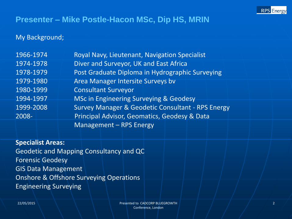
My Background;
1966-1974 Royal Navy, Lieutenant, Navigation Specialist1974-1978 Diver and Surveyor, UK and East Africa1978-1979 Post Graduate Diploma in Hydrographic Surveying1979-1980 Area Manager Intersite Surveys bv1980-1999 Consultant Surveyor1994-1997 MSc in Engineering Surveying & Geodesy1999-2008 Survey Manager & Geodetic Consultant - RPS Energy2008- Principal Advisor, Geomatics, Geodesy & Data
Management – RPS Energy
Specialist Areas:Geodetic and Mapping Consultancy and QCForensic GeodesyGIS Data ManagementOnshore & Offshore Surveying OperationsEngineering Surveying
Presenter – Mike Postle-Hacon MSc, Dip HS, MRIN
322/05/2015 Presented to CADCORP BLUEGROWTH Conference, London
Overview (1)
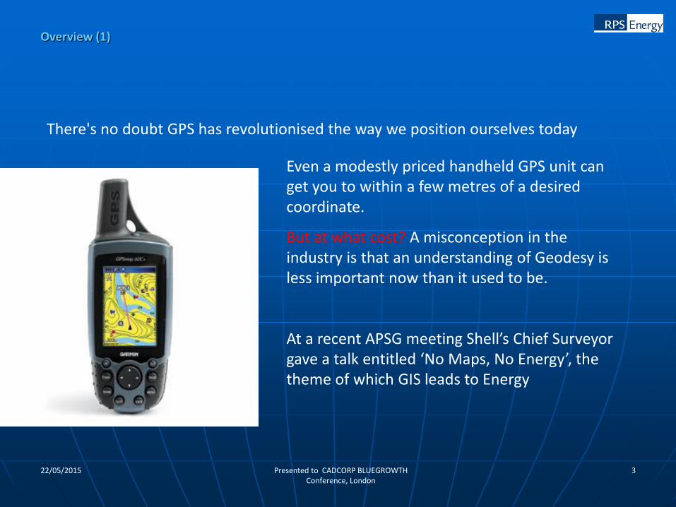
There's no doubt GPS has revolutionised the way we position ourselves today
Even a modestly priced handheld GPS unit can get you to within a few metres of a desired coordinate.
But at what cost? A misconception in the industry is that an understanding of Geodesy is less important now than it used to be.
At a recent APSG meeting Shell’s Chief Surveyor gave a talk entitled ‘No Maps, No Energy’, the theme of which GIS leads to Energy

422/05/2015 Presented to CADCORP BLUEGROWTH Conference, London
An estimated 80% of E & P data has spatial
content
Exploration
Appraisal
Development
Production
Decommissioning
If a position contains an error, that error is pervasive along
the workflow where the position data is used.
Why is geodesy important?
Current Industry Data Status (Databases and Projects Estimate)
• Seismic – 15-20% misplaced
• Surface Well – 40% misplaced by
> 30m
• Sub Surface Directional Well -
25% misplaced by > 150m
• Boundary – 30-50% misplaced

522/05/2015 Presented to CADCORP BLUEGROWTH Conference, London
Licence Area definition
Satellite Image geo-referencing
Geological and topographic maps
Geophysical data acquisition
Geological Sampling
Traded and Inherited Data
Rig Site Surveys
Rig Positioning
Well Bore Surveying
Production development
Pipelines
Roadworks
Why is this important?
Land Ownership/Compensation
Environmental Constraints
Archaeological Constraints
Other Site Specific Constraints
Ordnance Issues
Restricted Areas
Other Safety Issues
It is important that positional data
from different sources is correctly
related to other data for effective,
prosperous and safe operations

622/05/2015 Presented to CADCORP BLUEGROWTH Conference, London
Consider the following statements
• The co-ordinates of a point are 252 345.9, 204 301.6
• The point bears 245° 6 miles from the light house
• The latitude is 54° 10’ 45” North, the longitude is 003° 30’ 20” West
• The height above Mean Sea level is 24.2m
• The height of the structure is 3152mm
What can you say about these expressions?
Concepts of Co-ordinate Systems

722/05/2015 Presented to CADCORP BLUEGROWTH Conference, London
X
Y
z
3D Cartesian System
u
r
2D Polar System
Co-ordinate systems referenced to objects
N
E
A 2D Cartesian System
X
Y
Another 2D
Cartesian System
Examples of Co-ordinate systems
822/05/2015 Presented to CADCORP BLUEGROWTH Conference, London
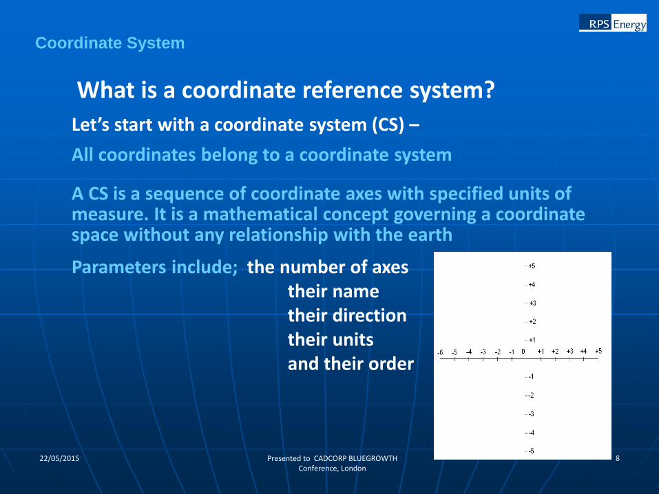
What is a coordinate reference system?
Let’s start with a coordinate system (CS) –
All coordinates belong to a coordinate system
A CS is a sequence of coordinate axes with specified units of measure. It is a mathematical concept governing a coordinate space without any relationship with the earth
Parameters include; the number of axestheir nametheir directiontheir unitsand their order
Coordinate System

922/05/2015 Presented to CADCORP BLUEGROWTH Conference, London
Coordinate Systems are referenced to the earth through a datum. A datum specifies the relationship of a CS to the earth by defining the size and shape of the earth and the origin and orientation of the coordinate system
What we are saying is when coordinates are used to describe position on the earth, they belong to a coordinate reference system (CRS).
So, a coordinate reference system is a coordinate system which is referenced to the earth based on a datum.
Coordinate Reference System

1022/05/2015 Presented to CADCORP BLUEGROWTH Conference, London
What is position and how is it defined?
• Geographic - Latitude and Longitude (φ, λ)
Angular measurements - Latitude and Longitude depend on an assumed size and shape of the
earth, a science known as geodesy
• Projected Grid – Easting and Northing (E, N)
Denoted in lots of E&P software as X, Y - (But beware former Soviet Union countries often use X for northing and Y for easting so always confirm convention)
Meaningful only if accompanied by both the earth figure and details of the projection
• Earth Centred Cartesian – X, Y, Z
Used in 3D calculations of space positions relative to earth centre and axes –used to derive positions from GPS
Position is usually defined through a system of coordinates and we have three commonly used ways to represent this;
1122/05/2015 Presented to CADCORP BLUEGROWTH Conference, London
Numerical Values - 2 or 3 numbers described by both their units and geodetic system to give them meaning
Units – essential > radians, grads or degrees for angular measurements, feet, links or metres for linear measure. If linear units are not international metres they should be fully described.
Accuracy – of a measurement is it’s closeness to the truth (e.g. +/- 1m)
Precision – of a measurement is the unit size to which it is measured (e.g.0.1m)
Repeatability – is the closeness to which one may return to a point having previously established its position.
Consistency – requires that all positional data in an operational area is referred to the same geodetic and mapping system so that it may all closely relate
Attributes of coordinates
13 different feet and 2 metre definitions

1222/05/2015 Presented to CADCORP BLUEGROWTH Conference, London
Latitude and Longitude are
NOT UNIQUE
Important fact Number 1 –
Coordinates define a position unambiguously
only when the CRS to which those coordinates
are part has been identified
Important Fact 1
Lies to Children

LATITUDE & LONGITUDE ARE NOT UNIQUE
Locations with same latitude and longitude values on three different datums
51°30’45”N000° 20’20”W
WGS84
0 250m
51°30’45”N000° 20’20”W
OSGB36X
51°30’45”N000° 20’20”W
ED50X
X
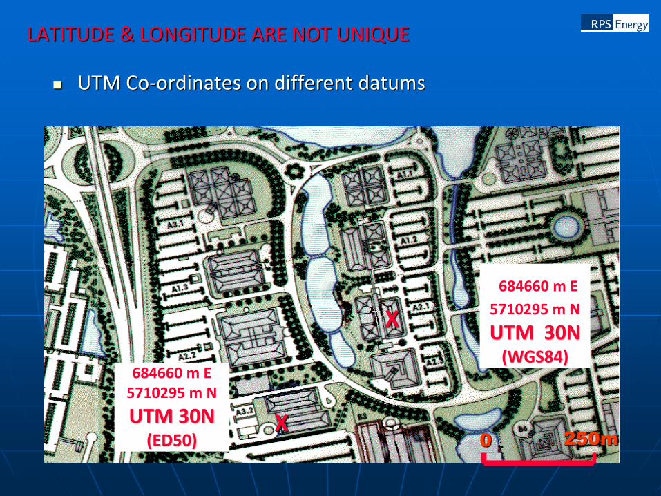
LATITUDE & LONGITUDE ARE NOT UNIQUE
UTM Co-ordinates on different datums
684660 m E
5710295 m N
UTM 30N(WGS84)
0 250m
X
684660 m E5710295 m N
UTM 30N(ED50)
X

1522/05/2015 Presented to CADCORP BLUEGROWTH Conference, London
Mistaken Identity

1622/05/2015 Presented to CADCORP BLUEGROWTH Conference, London
Many datums use the same ellipsoid but have a different relationship to the mass centre of the earth.
Of the 431 geodetic datums, both historical and current, documented in the EPSG database common ellipsoids used are;
29.5% International 1924
23.7% One of the Clarke Ellipsoids
12.1% GRS80
9.3% Bessel
4.6% WGS84
3% Krassovky
2.6% Everest
127 different documented datums
Ellipsoids and Datums

1722/05/2015 Presented to CADCORP BLUEGROWTH Conference, London
Ellipsoid = International 1924 & Datum = ???
1822/05/2015 Presented to CADCORP BLUEGROWTH Conference, London
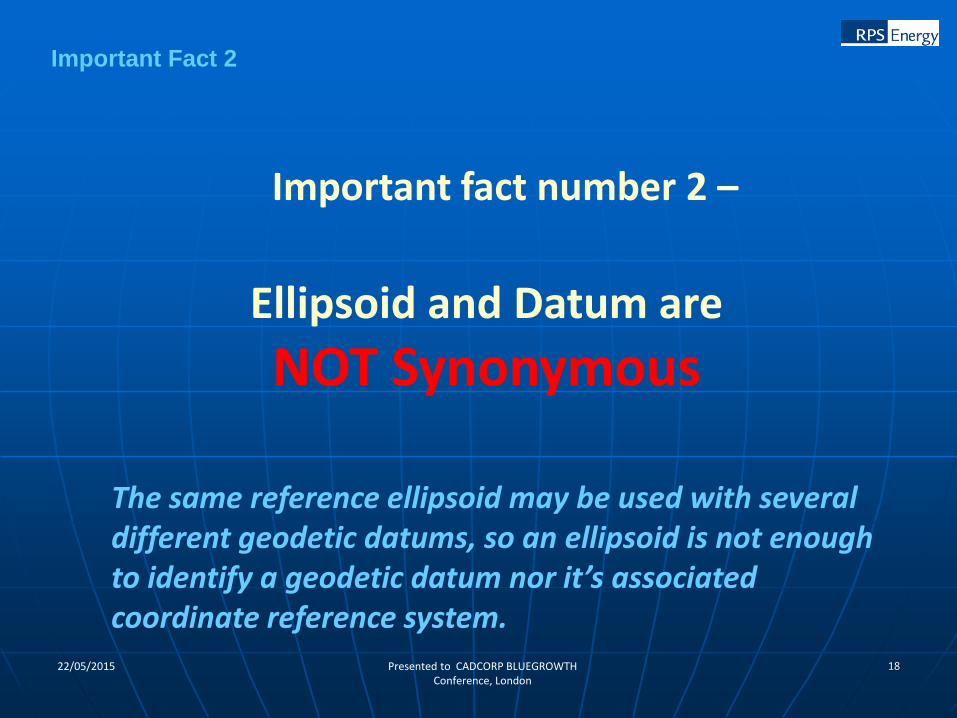
Ellipsoid and Datum are
NOT Synonymous
Important fact number 2 –
The same reference ellipsoid may be used with several different geodetic datums, so an ellipsoid is not enough to identify a geodetic datum nor it’s associated coordinate reference system.
Important Fact 2