!!
!!
!!!!
!!!!
!! !! !! !!
!!!!
!!!!!!
!!
!!!!
!!
!!!!
!!!!
!!!!
!! !! !! !! !! !!!!!!
!!!!
!! !! !! !! !! !!
!!
!
!! !! !! !!!!
!!!!!!
!!!!!!
!!
!!!!
!!!!
!!!!
!!!!!!
!
!
!!
!!
!!
!
!!
!!!
!
!
! ! ! !
!!
!!
!
!!!!
!!!!
!!!!
!!!!
!!
!!!!!!
!!!!
!!!!!
!!
!!
!!
!!
!!
!
!!
#*
#*
#*
#*
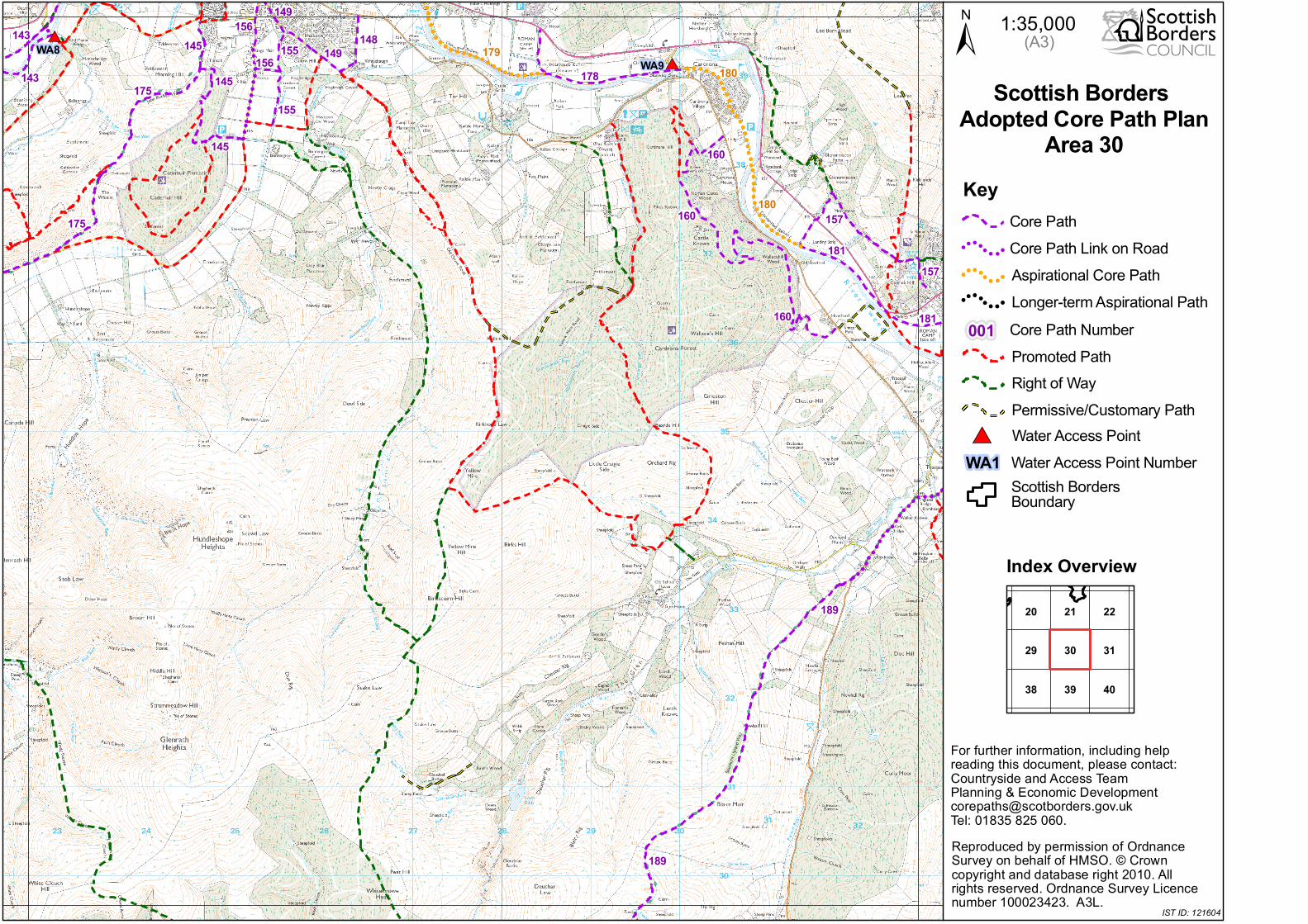
155 149
145
180160
189
181160
189
178175
181
143
157
155
148156
145
149
160
157
156
175
145 179180
143
WA9WA8 ± 1:35,000
29 3130
4038 39
222120
Index Overview
Scottish Borders Adopted Core Path Plan
Area 30
(A3)
Reproduced by permission of Ordnance Survey on behalf of HMSO. © Crown copyright and database right 2010. All rights reserved. Ordnance Survey Licence number 100023423. A3L.
For further information, including help reading this document, please contact:Countryside and Access TeamPlanning & Economic [email protected]: 01835 825 060.
IST ID: 121604
Key
!!
!! !! !!
!!
!! !!
!!
Core Path
Promoted PathRight of WayPermissive/Customary Path
Aspirational Core PathCore Path Link on Road
Longer-term Aspirational Path
!!
!! !! !!
!!
!! !!
!!
!
! ! !
!
! !
!
Water Access Point#*
Core Path Number001
Scottish Borders Boundary
Water Access Point NumberWA1
Recommended