City of WascoSchool Traffic Safety Study
September 2013


City of Wasco
School Traffic Safety Study
Prepared by:
Alta Planning + Design
In Partnership with:
Ruettgers & Schuler Civil Engineers
Prepared for:
City of Wasco


Acknowledgements
Mayor and City Council
Fred West, Jr., Mayor
Tilo Cortez, Jr
Danny Espitia
John Martin
Cherylee Wegman
City Project Staff
Roger Mobley, Planning Director
Kerri Cobb, Senior Planner
Alta Project Staff
Brett Hondorp, Principal
Jennifer Donlon Wyant, Project Manager
Lucas Woodward, Planner
Sarah Fine, Planner
Ryan Johnson, Planner

This page intentionally left blank.

Table of Contents
Alta Planning + Design | i
Table of Contents
1. Introduction ...................................................................................................................................... 1-1
2. Teresa Burke Elementary School ..................................................................................................... 2-1
3. Karl Clemens Elementary School ..................................................................................................... 3-1
4. Thomas Jefferson Middle School ..................................................................................................... 4-1
5. Palm Avenue Elementary School ..................................................................................................... 5-1
6. John Prueitt Elementary School ....................................................................................................... 6-1
7. Implementation ................................................................................................................................ 7-1
Table of Tables
Table 2-1: Summary of Teresa Burke Elementary Recommendations ........................................................................... 2-4
Table 3-1: Summary of Karl Clemens Elementary Recommendations .......................................................................... 3-4
Table 4-1: Summary of Thomas Jefferson Middle School Recommendations ............................................................. 4-4
Table 5-1: Summary of Palm Avenue Elementary Recommendations ........................................................................... 5-4
Table 6-1: Summary of John Prueitt Elementary Recommendations ............................................................................. 6-3
Table 7-1: Prioritization Criteria ............................................................................................................................................... 7-1
Table 7-2: Safe Routes to School Project Ranking ............................................................................................................... 7-3
Table 7-3: Safe Routes to School Improvement Unit Costs ............................................................................................. 7-4
Table of Figures
Figure 1-1: Safe Routes to School Design Elements ............................................................................................................. 1-2
Figure 1-2: Safe Routes to School Design Elements ............................................................................................................. 1-3
Figure 2-1: Teresa Burke Elementary School Recommended Improvements .............................................................. 2-5
Figure 3-1: Karl Clemens Elementary School Recommended Improvements ............................................................. 3-5
Figure 4-1: Thomas Jefferson Middle School Recommended Improvements ............................................................. 4-5
Figure 5-1: Palm Avenue Elementary School Recommended Improvements .............................................................. 5-5
Figure 6-1: John Prueitt Elementary School Recommended Improvements ............................................................... 6-5

Wasco School Traffic Safety Study
ii | Alta Planning + Design
This page intentionally left blank.

Introduction
Alta Planning + Design | 1-1
1. Introduction The purpose of this report is to identify potential infrastructure projects that could improve student safety
and support walking and biking to school in Wasco.
These recommendations were developed through a series of walk audits held at five schools in Wasco from
January 28 – February 1, 2013. At the walk audits, a group of stakeholders, including school and district staff,
parents and community members, City staff, and transportation professionals walked the school grounds and
discussed opportunities and challenges for each site.
Each visit began with a discussion of current challenge areas and what types of issues observers should pay
attention to. The team then observed student access and reviewed the area near each school for quality of
sidewalks, curb ramps, signage, and other engineering elements and patterns of activity. Summaries of these
walk audits appear in Appendix B of the Existing Conditions and Needs Analysis.
Based on the observations and input provided by school staff and parents, the project team developed a report
with observations and recommendations for each school site. The recommendations for improvements in the
public right-of-way may be implemented by the City. Recommended improvements on school grounds may
be implemented by the school district. This report presents the infrastructure recommendations for each
school.
Figure 1-1 and Figure 1-2 present and describe the most frequently recommended improvements. These
measures comprise a “toolbox” that planners and engineers can reference for future school area improvements.

Wasco School Traffic Safety Study
1-2 | Alta Planning + Design
Figure 1-1: Safe Routes to School Design Elements

Introduction
Alta Planning + Design | 1-3
Figure 1-2: Safe Routes to School Design Elements

Wasco School Traffic Safety Study
1-4 | Alta Planning + Design
This page intentionally left blank.

Teresa Burke Elementary School
2-1 | Alta Planning + Design
Teresa Burke Elementary School
Principal: D. Bowling
Enrollment 709
School Arrival 8:05 AM
School Dismissal K-3: 1:55
4-6: 2:25
Dropping students off at the Kindergarten entrance
2. Teresa Burke Elementary School
School Information
Layout
Teresa Burke Elementary School is the newest school in
Wasco, located in the southeastern part of the city at
the intersection of Filburn Street and Griffith
Avenue. Its enrollment area includes much of the
south side of town and rural areas to the east and
south of the city.
Site Visit
The project team conducted a walk audit on Wednesday, January 30, 2013 during morning arrival. Weather
was cool and sunny. Audit participants observed the period immediately prior to morning arrival then walked
the school grounds while discussing issues and opportunities for the school site.
Loading Zones
There are two principal loading zones, the south side of Filburn Street in front of the school and an off-street
loading loop on Griffith Avenue. Parents were also observed dropping students off at the Kindergarten
entrance. However, in order to maintain campus security, the school community discussed consolidating this
entrance with the gate to the south, where there is a large parking area available for school travel.
Crossing Guard Information
A crossing guard assists students crossing at the intersection of Griffith Avenue and Filburn Street.
Issues and Recommendations
School Grounds
School administrators expressed concerns about their
ability to monitor multiple school entrances, observing
that many parents and volunteers do not sign in at the
front desk. The kindergarten area is separate from the
rest of the school and accessed through a different gate.
Consolidate loading of kindergarteners and
other students at the gate accessed from the
Griffith Avenue loading loop.

Wasco School Traffic Safety Study
2-2 | Alta Planning + Design
Students bicycling on the Filburn Street sidewalk
A family pausing before crossing at Catalina Avenue
While some parents choose to accompany their children into the school site, others prefer to drop students off
at the curb. District staff expressed interest in establishing an additional loading zone at the northeast corner
of the school. However, due to the complex traffic interactions that would likely occur when motorists exit
the loading loop onto Griffith Avenue, which also experiences significant school-related traffic, congestion
may back up into Filburn Street. Staffing the existing loading areas to improve efficiency may be a better
option.
Consider staffing loading zones to improve efficiency of passenger drop-off and pick-up
Filburn Street
Filburn Street is the main street that serves east-west
trips in southern Wasco. It is both a commuter and
school route, and has a pedestrian path between Poplar
Avenue and Griffith Avenue, with pedestrian access
provided to the street from culs-de-sac in nearby
developments.
Despite a 24-hour traffic volume count of 3,596 vehicles,
Filburn Street is very wide – exceeding 90’ in the school
neighborhood – encouraging high traffic speeds. This
space could be used for bicycle facilities, streetscape
improvements, as recommended in Chapter 4, or traffic
calming. Its width encourages high traffic speeds. While
there is Assembly C signage, the width of the street
reduces their visibility
Consider speed feedback signs on east and
west approaches to school.
Stripe buffered bike lanes on both sides of
Filburn Street. Consider enhancements where bike
facilities and passenger loading vehicles cross paths.
Consider 14’ landscaped median or other
streetscape improvements to provide pedestrian
refuge and calm traffic
Consider lane configuration that would allow
left turn pockets for turns into Teresa Burke parking
lot
The school community expressed concern about parents and students crossing at Catalina Drive The
intersection does not have a marked crosswalk and crosswalks on Poplar and Griffith Avenue are spaced 1300
feet apart. While using the marked crosswalk would be advisable, it may be prudent to focus on making the
crossing as safe as possible. A high-visibility crosswalk with a median refuge, Rectangular Rapid Flash
Beacon, or Assembly B and D signage would increase the visibility of crossing pedestrians.
Consider high-visibility crosswalk with median refuge and enhanced crossing treatments at
Catalina Drive.

Teresa Burke Elementary School
Alta Planning + Design | 2-3
Students crossing Filburn Street at Griffith Avenue
Institute a Walking School Bus or locate staff at Catalina Drive to direct students to the
crosswalk at Griffith Avenue.
Griffith Avenue at Filburn Street
The intersection of Griffith Avenue and Filburn Street is the main intersection at the school site. A crossing
guard assists students crossing at this location. While the crossing guard improves safety at the intersection,
students still contend with extremely wide crossing distances and turning pockets that expose them to
multiple streams of traffic. In addition, if motorists yield
as required to the crossing guard, the long crossing
distances increase motorist delay along the corridor.
Consider curb extensions on northeast,
northwest, and southwest corners of intersection to
shorten crossing distances, improve visibility, and
reduce the amount of time the crossing guard stops
traffic.
Filburn Street at Broadway
A continuation of the existing multi-use path is proposed
in the Bicycle Recommendations chapter. To continue
the path to the east, a crossing at Broadway will be required. This would be an uncontrolled crossing and
should be demarcated with enhanced crossing treatments
Stripe high-visibility white crosswalk at west leg of intersection
Install trail crossing signage, and yield markings
Consider in-street yield paddles and pedestrian-actuated Rectangular Rapid Flash Beacons
16th Street
The school community identified 16th Street as a recommended route to school. The street serves residents
from the north and east and provides controlled crossings of D Street, Griffith Avenue, and Broadway, along
with curb ramps. Marking crosswalks can identify this as a key school route and improve pedestrian visibility.
Stripe transverse yellow crosswalks on 16th Street at intersections with Griffith Avenue,
Broadway, and D Street
Install advance stop bars on cross-street approaches to 16th Street
Griffith Avenue
Griffith Avenue is currently an on-street loading zone and provides access to an off-street loading loop with
parking. School administrators reported that U turns are common on the street, made by motorists wishing to
avoid traffic in the off-street loading loop. A double yellow line down to the Griffith Avenue gate would
discourage U turns at least in areas where they are most hazardous to pedestrians.
Stripe double yellow centerline from Filburn Street to entrance to loading loop
Install signage prohibiting U-turns adjacent to the school.
Table 2-1 summarizes recommendations for Teresa Burke Elementary School and Figure 2-1 illustrates the
recommendations.

Wasco School Traffic Safety Study
2-4 | Alta Planning + Design
Table 2-1: Summary of Teresa Burke Elementary Recommendations
Location Recommendation Cost Responsibility
School Grounds - Consolidate loading of kindergarten and other grades at the
southernmost gate on Griffith Avenue
- Consider staffing loading zones to improve efficiency of drop-
off and pick-up
WUESD
Poplar Avenue at
Filburn Street
- Stripe high-visibility yellow crosswalk across the east and west
legs of the intersection
- Stripe transverse yellow crosswalk across the south leg of the
intersection
$1,300 City
Filburn Street - Consider speed feedback signs in both directions
- Stripe buffered bike lanes on both sides of Filburn Street
- Install 14’ landscaped median to provide pedestrian refuge and
calm traffic.
- Consider lane configuration that would allow left-turn pockets
for turns into Teresa Burke parking lot.
- Consider high-visibility crosswalk with crossing treatments at
Catalina Drive
See Bicycle
Master
Plan costs
+
$4,800
City
Filburn Street at
Griffith Avenue
-Stripe high-visibility crosswalks at north and west legs of
intersection
- Consider curb extensions to shorten crossing distance, improve
visibility, and reduce the amount of time that the crossing guard
needs to stop traffic
$90,800 City
Filburn Street at
Broadway
- Implement crossing treatments for proposed multi-use path.
These may include high-visibility crosswalks, trail crossing
signage, yield teeth, in-street yield to pedestrian signage, or
Rectangular Rapid Flash Beacons
$6,900 City
16th Street - Install transverse yellow crosswalks on 16th Street at
intersections with Griffith Avenue, Broadway, and D Street. Install
advance stop bars in both directions on these streets
$4,800 City
Griffith Avenue - Stripe double yellow line from Filburn Street to the entrance to
the loading loop
- Post signage prohibiting U turns
$800 City

Teresa Burke Elementary School
Alta Planning + Design | 2-5
Figure 2-1: Teresa Burke Elementary School Recommended Improvements

Wasco School Traffic Safety Study
2-6 | Alta Planning + Design
This page intentionally left blank.

Karl Clemens Elementary School
Alta Planning + Design | 3-1
Karl Clemens Elementary
Principal: Danny Arellano
Enrollment 633
School Arrival 8:05 AM
School Dismissal Regular day: 2:25
Minimum Day: 1:10
Crossing students at 6th and Broadway
3. Karl Clemens Elementary School
School Information
Layout
Karl Clemens Elementary School is the oldest public
elementary school in Wasco, located in a residential
neighborhood near the downtown business district. Its
downtown location presents opportunities for walking
and bicycling and most students live in close proximity
to the school.
Site Visit
The project team conducted a walk audit on Friday, February 1, 2013 during morning arrival. Weather was
mild and sunny. Audit participants observed the period immediately prior to morning arrival, then walked the
school grounds while discussing issues and opportunities for the school site.
Loading Zones
There are two principal loading zones, one providing
access to the north gate of the school on 5th Street and
another loading zone on Broadway. There is an alley
south of the school that is not currently used for any
function. It leads to a parking lot that is currently
unused.
Crossing Guard Information
Three crossing guards assist pedestrians and bicyclists at
Karl Clemens Elementary School. They are located at the
intersection of Griffith Avenue and 5th Street, the
intersection of 5th Street and Broadway, and the
intersection of 6th Street and Broadway.
Issues and Recommendations
School Grounds
School staff noted that the school functionally only has two streets because Griffith Avenue is a District
staging area and a row of businesses separate the school from 7th Street. This focuses school-related
congestion in a smaller area and reduces circulation options for motorists. There is an alley south of the school

Wasco School Traffic Safety Study
3-2 | Alta Planning + Design
Students crossing 6th Street to get to the crosswalk
that could be used for passenger loading or for a low-stress bicycling route to school. Some truck traffic was
observed delivering to businesses located on 7th Street. While there is no off-street loading available on the
Karl Clemens Elementary School grounds, it is also a centrally located school with higher rates of walking and
bicycling and therefore the loading zone may be less of a priority than improved pedestrian and bicycle access.
Stencil shared lane markings in unused alley south of the school to provide convenient bicycle
route for students arriving from the south and west
Alternatively, consider establishing passenger loading loop in the alley. If loading zone is
established, stripe yellow crosswalks across entrances on Broadway and Griffith Avenue.
Personal safety issues include a large number of loose dogs running around the school site. An animal control
officer was summoned to the school during morning arrival. Continuing the relationship between the school
and animal control services and performing neighborhood outreach about stray dogs may effectively improve
confidence and safety for students walking to school.
Broadway at 6th Street
This intersection is a key location for pedestrians and
bicyclists and was cited as a key route to school and a
high priority for the city during the community meeting.
6th Street is stop controlled and Broadway is
uncontrolled suggesting that pedestrian enhancements
may improve the walking and bicycling experience for
students and parents. A crossing guard assists students
using the intersection and she is effective and
appreciated by the school community.
Replace crosswalks with high-visibility
yellow crosswalks
Stencil SLOW SCHOOL XING on Broadway
in both directions
Install Assembly B and D signage on Broadway in both directions
Consider traffic calming treatments for Broadway
There are sidewalk gaps on 6th Street which encourage pedestrians to walk in traffic and cross outside marked
crosswalks.
Close sidewalk gaps on 6th Street
Broadway at 5th Street
Broadway at 5th street is a four-way stop-controlled intersection with relatively high traffic volumes. A
crossing guard assists pedestrians and bicyclists at the intersection, although she has not received any formal
training and appeared to be challenged by the high vehicle volumes. Many possible strategies can improve
operations at this intersection.
Consider curb extensions on all four corners of the intersection to limit traffic to one lane, and
improve visibility.
Consider removal of crosswalk across north leg of Broadway to limit the number of intersection
legs to monitor.

Karl Clemens Elementary School
Alta Planning + Design | 3-3
Sidewalk gap on 6th Street
Curb ramps improve accessibility not only for the disabled, but for parents with strollers and
sidewalk bicyclists
6th Street
The community identified 6th Street as a key corridor for
walking and bicycling, not just for students at the
school, but for pedestrians and bicyclists traveling to
other destinations. It provides an opportunity to cross
the railroad tracks and passes near downtown
destinations. A number of issues pose challenges to
pedestrians and bicyclists along this street, including
sporadic sidewalk gaps, lack of curb ramps, lack of
marked crosswalks, and high traffic volumes on cross
streets.
Install curb extension on southeast corner of
intersection with D Street
Stripe high-visibility yellow crosswalk across
north and south legs of D Street
Install curb ramps at intersections with D
Street and E Street
Close sidewalk gaps
A number of specific improvements will improve the key
crossing along this walking and biking route at the
intersection with F Street. F Street has high traffic
volumes and speeds, and parked cars on F Street
obstruct visibility. Note that any of these improvements
would require coordination with Caltrans. However,
there is support for pedestrian and bicycle enhancements
under the Caltrans Main Street guidelines, as described in Chapter 1.
Stripe red curb on F Street south of intersection
Install curb ramps on southeast and southwest corners of intersection
Stripe high-visibility yellow crosswalk across south leg of intersection
Install in-street yield-to-pedestrians sign and pavement markings
Install Assembly D signage and Rectangular Rapid Flash Beacons on F Street
Stencil SLOW SCHOOL XING northbound and southbound on F Street
7th Street
The central commercial district in the city, 7th Street is a slow, landscaped street on walking routes to Karl
Clemens Elementary School that also serves as a community focal point. There are gateway treatments in the
downtown area and angled median parking east of D Street. Angled parking poses many possible conflict
points between bicyclists and motorists, so 6th Street has been identified as the bike route through
downtown. The following improvements make crossings easier for pedestrians and promote the character of
the downtown neighborhood
Implement recommendations of the Bicycle Master Plan, including bike lanes on 7th Street from
Magnolia Street to D Street
Wasco School Traffic Safety Study
3-4 | Alta Planning + Design
Consider streetscape improvements on 7th Street between Griffith Avenue and D Street to serve
as a gateway to the downtown area. One possibility is a landscaped median with left turn
pockets and pedestrian refuges. Space can be allocated for improvements by reconfiguring
angled parking as parallel parking.
Table 3-1 summarizes recommendations for Karl Clemens Elementary School and Figure 3-1 maps them.
Table 3-1: Summary of Karl Clemens Elementary Recommendations
Location Recommendation Cost Responsibility
School Grounds - Stencil shared lane markings in unused alley south of school
- Alternatively, consider establishing passenger loading loop in
alley south of school. Alley would ideally be accessed only from the
east, allowing curbside loading adjacent to the school yard. If
additional loading area is established, stripe yellow crosswalks
across entrances at Broadway and Griffith
$800 WUESD
Broadway at 6th
Street
- Replace crosswalks with high-visibility yellow crosswalks
- Stencil SLOW SCHOOL XING on Broadway
- Install Assembly B and D signage at intersection
- Consider traffic calming treatments for Broadway
- Close sidewalk gaps on 6th Street
$4,400 City
Broadway at 5th
Street
- Install high-visibility crosswalks on all approaches
- Consider curb extensions on all four corners of intersection
$122,000 City
6th Street from D
Street to E Street
- Stripe high-visibility yellow crosswalk across both legs of D Street.
Install curb ramps for all approaches
- Install curb extension on southeast corner of intersection.
- Install curb ramps at intersections of 6th Street with E Street
- Close sidewalk gaps on 6th Street
$86,400 City
6th Street at F
Street
- Stripe red curb on F Street south of intersection
- Install curb ramps on southeast and southwest corners
- Stripe high-visibility yellow crosswalk across south leg of
intersection
- Install in-street yield-to-pedestrians sign and shark’s teeth
- Install Assembly D signage and Rectangular Rapid Flash Beacons
on F Street.
- Stencil SLOW SCHOOL XING northbound and southbound on F
Street
$27,600 City
7th Street - Implement bikeway recommendations including bike lanes on 7th
Street from Magnolia Street to D Street.
- Consider streetscape improvements between Griffith Avenue and
D Street
See
Chapter 4
City

Karl Clemens Elementary School
Alta Planning + Design | 3-5
Figure 3-1: Karl Clemens Elementary School Recommended Improvements

Wasco School Traffic Safety Study
3-6 | Alta Planning + Design
This page intentionally left blank.

Thomas Jefferson Middle School
Alta Planning + Design | 4-1
Thomas Jefferson Middle School
Principal: Rafaela Lopez
Enrollment 663
School Arrival 8:05 AM
School Dismissal Regular day: 2:41
Minimum Day: 1:10
Passenger loading on 4th Street
4. Thomas Jefferson Middle School
School Information
Layout
Thomas Jefferson Middle School is the public middle
school for the City of Wasco and the surrounding area. It
is located at 305 Griffith Avenue between 2nd Street and
4th Street, with its main entrance on Griffith Avenue.
Site Visit
The project team conducted a walk audit on Monday, January 28, 2013 during morning arrival. Weather was
unusually cool but clear and sunny. Audit participants observed the period immediately prior to morning
arrival, then walked the school grounds while discussing
issues and opportunities for the school site.
Loading Zones
There is no official passenger loading loop for Thomas
Jefferson Elementary School. Student drop-off was
observed on Griffith Avenue in front of the main school
entrance and on 4th Street. U turns were observed on
both Griffith Avenue and 4th Street after dropping off
students. School bus loading occurs in a dedicated
loading loop on the west side of the school.
Crossing Guard Information
A crossing guard monitors the intersection of 4th Street and Birch Avenue.
Issues and Recommendations
School Grounds
Bicycle parking is currently located on the edge of the school grounds adjacent to Griffith Avenue. This
location is not highly visible from the school building or otherwise secured, and audit participants reported
that bike thefts have occurred on campus.
Move bicycle parking to more secure location near gymnasium
Other personal security issues are challenging to address directly with a Safe Routes to School Program, but
should be taken into consideration: The principal reported that school fights had been an issue in the past at
Wasco School Traffic Safety Study
4-2 | Alta Planning + Design
Motorist failing to yield at Griffith Avenue crosswalk
Crosswalk aligns with storm drain instead of curb ramp
Thomas Jefferson Middle School, but that conditions are improving. Loose dogs were also observed on
campus.
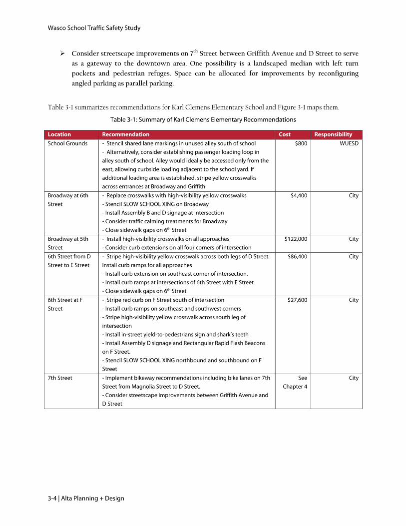
Students from all over Wasco are enrolled at Thomas Jefferson Middle School. Students approaching the
school from the west enter the school from the intersection of 2nd Street and Birch Avenue where there is a bus
exit driveway and a locked school gate. The crosswalk aligns with the school gate, so unlocking it would
encourage students to use the crosswalk and not enter the school at a conflict point with motor vehicles.
Unlock entry gate along Birch Avenue across
from 2nd Street during school hours
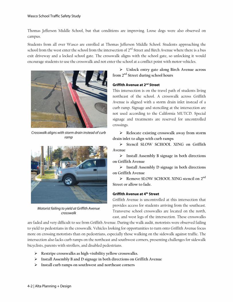
Griffith Avenue at 2nd Street
This intersection is on the travel path of students living
northeast of the school. A crosswalk across Griffith
Avenue is aligned with a storm drain inlet instead of a
curb ramp. Signage and stenciling at the intersection are
not used according to the California MUTCD. Special
signage and treatments are reserved for uncontrolled
crossings.
Relocate existing crosswalk away from storm
drain inlet to align with curb ramps
Stencil SLOW SCHOOL XING on Griffith
Avenue
Install Assembly B signage in both directions
on Griffith Avenue
Install Assembly D signage in both directions
on Griffith Avenue
Remove SLOW SCHOOL XING stencil on 2nd
Street or allow to fade.
Griffith Avenue at 4th Street
Griffith Avenue is uncontrolled at this intersection that
provides access for students arriving from the southeast.
Transverse school crosswalks are located on the north,
east, and west legs of the intersection. These crosswalks
are faded and very difficult to see from Griffith Avenue. During the walk audit, motorists were observed failing
to yield to pedestrians in the crosswalk. Vehicles looking for opportunities to turn onto Griffith Avenue focus
more on crossing motorists than on pedestrians, especially those walking on the sidewalk against traffic. The
intersection also lacks curb ramps on the northeast and southwest corners, presenting challenges for sidewalk
bicyclists, parents with strollers, and disabled pedestrians.
Restripe crosswalks as high-visibility yellow crosswalks.
Install Assembly B and D signage in both directions on Griffith Avenue
Install curb ramps on southwest and northeast corners

Thomas Jefferson Middle School
Alta Planning + Design | 4-3
Access gate for pedestrians on Birch Avenue
A crossing guard monitors the intersection of Griffith Avenue and 5th Street, which is an all-way stop. The
crossing guard may be better utilized at this intersection. This issue may be reconsidered depending on the
effectiveness of the above recommendations.
Perform crossing guard warrant analysis for the intersection
Birch Avenue at 2nd Street
The school community identified 2nd Street as a
recommended walking and bicycling route during the
walk audit. Enhancements to its uncontrolled crossing of
Birch Avenue would improve safety and visibility for
pedestrians along a key pedestrian route. The
intersection currently lacks any school crossing signage
and students were reported crossing outside the
crosswalk to access the open driveway instead of the
closed gate to the school.
Stripe high-visibility yellow crosswalk across
Birch Avenue
Install Assembly B and D signage on Birch
Avenue in both directions
Birch Avenue at 4th Street
School administrators suspect that the intersection of 4th Street and Birch Avenue has the highest pedestrian
and bicycle volumes in the school neighborhood. The existing transverse yellow crosswalks are faded. Traffic
on 4th Street is uncontrolled and a crossing guard monitors the intersection. The school community expressed
interest in a four-way stop at this location, but pedestrian, bicycle, and motor vehicle volumes did not meet
warrant guidelines. Engineering judgment may still call for a four way stop at this intersection, but given
present traffic controls, improvements to the crossing and traffic calming measures are recommended.
Stripe high-visibility crosswalks on east and west legs of the intersection.
Install Assembly B and D signage on 4th Street.
Implement traffic calming measures on 4th Street. These may include speed tables or other
interventions.
If issues are still reported, consider four-way stop at intersection
Birch Avenue
Birch Avenue was recommended as a suggested route to school for students walking and bicycling to school
from the south. The recommended route passes by Cormack Park, which audit participants described as a
gathering place for students and families. Walking on the east side of Birch Avenue increases visibility for the
intersection of 4th Street and reduces crossing movements requiring crossing guard assistance, so the
following improvements are designed to encourage students to walk on the east side of the street.
Stripe high-visibility crosswalk across east leg of Birch Avenue and 6th Street.
Install curb ramps to access crosswalk.
Stripe high-visibility school crosswalk across east leg of 5th Street
Wasco School Traffic Safety Study
4-4 | Alta Planning + Design
Stencil SLOW SCHOOL XING for both directions on 5th Street
Install Assembly B and D signage for both directions on 5th Street
Griffith Avenue at Highway 46
Griffith Avenue provides one of three signalized crossings of Highway 46. Audit participants reported that
many students cross Highway 46 at this location to access businesses located northwest of the intersection. A
crosswalk currently serves the east side of the intersection but students prefer to cross on the west side.
Counts performed as part of this Plan showed that while only three pedestrians crossed Highway 46 during
the morning peak hour, all used the west side. Afternoon volumes are likely higher due to students leaving
school.
Work with Caltrans to establish a high-visibility crosswalk on the west side of the intersection
Table 4-1 summarizes recommendations for Thomas Jefferson Middle School and Figure 4-1 illustrates the
recommendations.
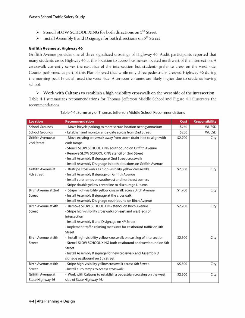
Table 4-1: Summary of Thomas Jefferson Middle School Recommendations
Location Recommendation Cost Responsibility
School Grounds - Move bicycle parking to more secure location near gymnasium $250 WUESD
School Grounds - Establish and monitor entry gate across from 2nd Street $250 WUESD
Griffith Avenue at
2nd Street
- Move existing crosswalk away from storm drain inlet to align with
curb ramps
- Stencil SLOW SCHOOL XING southbound on Griffith Avenue
- Remove SLOW SCHOOL XING stencil on 2nd Street
- Install Assembly B signage at 2nd Street crosswalk
- Install Assembly D signage in both directions on Griffith Avenue
$2,700 City
Griffith Avenue at
4th Street
- Restripe crosswalks as high-visibility yellow crosswalks
- Install Assembly B signage on Griffith Avenue
- Install curb ramps on southwest and northeast corners
- Stripe double yellow centerline to discourage U-turns.
$7,500 City
Birch Avenue at 2nd
Street
- Stripe high-visibility yellow crosswalk across Birch Avenue
- Install Assembly B signage at the crosswalk
- Install Assembly D signage southbound on Birch Avenue
$1,700 City
Birch Avenue at 4th
Street
- Remove SLOW SCHOOL XING stencil on Birch Avenue
- Stripe high-visibility crosswalks on east and west legs of
intersection
- Install Assembly B and D signage on 4th Street
- Implement traffic calming measures for eastbound traffic on 4th
Street
$2,200 City
Birch Avenue at 5th
Street
- Install high-visibility yellow crosswalk on east leg of intersection
- Stencil SLOW SCHOOL XING both eastbound and westbound on 5th
Street
- Install Assembly B signage for new crosswalk and Assembly D
signage eastbound on 5th Street
$2,500 City
Birch Avenue at 6th
Street
- Stripe high-visibility yellow crosswalk across 6th Street.
- Install curb ramps to access crosswalk
$5,500 City
Griffith Avenue at
State Highway 46
- Work with Caltrans to establish a pedestrian crossing on the west
side of State Highway 46.
$2,500 City

Thomas Jefferson Middle School
Alta Planning + Design | 4-5
Figure 4-1: Thomas Jefferson Middle School Recommended Improvements

Wasco School Traffic Safety Study
4-6 | Alta Planning + Design
This page intentionally left blank.

Palm Avenue Elementary School
Alta Planning + Design | 5-1
Palm Avenue Elementary School
Principal: Brad Maberry
Enrollment 720
School Arrival 8:05 AM
School Dismissal K-3: 1:55, Min: 12:45
4-6: 2:25, Min: 1:10
Minimum Day: 1:10
Staff assist the loading zone on 9th Place
5. Palm Avenue Elementary School
School Information
Layout
Palm Avenue is one of four public elementary schools
serving the City of Wasco and surrounding area. It is one
of the two elementary schools with more urban
locations, at the intersection of Palm Avenue and 9th
Place. Its main entrance is located n Palm Avenue
Site Visit
The project team conducted a walk audit on Tuesday, January 29, 2013 during morning arrival. Weather was
cool and sunny. Audit participants observed the period immediately prior to morning arrival, then walked the
school grounds while discussing issues and opportunities for the school site.
Loading Zones
Palm Avenue has an unusual loading zone configuration
with a fenced-off loop accessed from Palm Avenue
adjacent to angled parking. Passenger loading was also
observed at a supervised location on 9th Place and Peters
Street. Bus loading occurs on Jubilee Drive at the
southern edge of the school grounds.
Crossing Guard Information
Crossing guards monitor the intersections of Palm
Avenue and 9th Place and Palm Avenue and Jubilee Drive.
Issues and Recommendations
School Grounds
The Jubilee Drive bus loading location is distant from the school building entrance, without a designated
pedestrian path. Generally bus loading should occur as close as possible to the school; students accessing a
school from a school bus tend to walk in larger groups that reduce sidewalk space for other users and the
school bus driver is able to monitor students as they walk to the school building.
Parking south of the loading loop is underutilized and therefore presents an opportunity to relocate the bus
loading zone without impacting other passenger loading. Congestion on the Palm Avenue sidewalk was
observed. To accommodate parents who currently use the fenced-off loading area, existing angled parking

Wasco School Traffic Safety Study
5-2 | Alta Planning + Design
A crossing guard assists students crossing Palm Avenue
A parent crossing midblock with students after parking on the far side of the street.
Crowded sidewalk on Palm Avenue
spaces south of the passenger loading loop could be reconfigured as a loading zone, which would create
additional space for sidewalk expansion.
Move bus loading zone from its present location to the fenced-off curbside loading area on Palm
Avenue.
Remove parking spaces south of the loading loop as needed to accommodate the turning radii
for exiting buses.
Consider establishing passenger loading area
south of the existing loading area and widening the
sidewalk on Palm Avenue
The other on-street passenger loading area is located on
9th Place north of the school. Angled parking on 9th Place
is not fully utilized, with some parents choosing to
double-park. Motorists were also observed not pulling
forward through the loading area, adding to congestion
on 9th Place.
Install “Please Pull Forward” stencil in
loading area
Remove two parking spaces on 9th Place to
accommodate a longer passenger loading area
Consider establishing a student valet program
Palm Avenue at 9th Place
Palm Avenue at 9th Place is the main school intersection,
monitored by one crossing guard and controlled on all
approaches with a four-way stop. Palm Avenue and 9th
Place were both identified as good walking and bicycling
routes in both directions. Crossing distances at this
intersection, especially across Palm Avenue, are long, and
for intersections patrolled with crossing guards, this
leads to additional traffic delay as motorists are required
to wait until the crossing guard leaves the intersection to
proceed.
Install curb extensions on all corners of the
intersection. Alternatively consider reducing curb
radii.
Restripe crosswalks as high-visibility yellow
crosswalks
Remove SLOW SCHOOL XINGS stencils
from 9th Place or allow to fade

Palm Avenue Elementary School
Alta Planning + Design | 5-3
Crosswalk does not access curb ramp and crosses into the angled parking area
9th Place
The school community identified 9th Place as a key walking and bicycling route to school, providing access to
the high numbers of students that live to the east of the school site. However, parents expressed concerns
about crossings along the route and the street is missing some key walking infrastructure that would facilitate
safe and comfortable pedestrian travel.
Install curb ramps where missing at intersections with Cypress Avenue and Maple Avenue
Stripe transverse yellow crosswalks on north and south legs of both intersections
9th Place at Griffith Avenue
The most challenging crossing on the recommended walking route on 9th Place is the intersection with
Griffith Avenue. Visibility is hindered by cars parked on Griffith Avenue, vegetation, and privately-owned
fences, and Griffith Avenue is uncontrolled. In addition, this intersection serves a church and private school,
facilities that would also benefit from improved walking and bicycling conditions.
Stripe red curb at corners of intersection to discourage parking
Install SLOW SCHOOL XING stencils and Assembly B and D signage on both approaches of
Griffith Avenue
Replace crosswalks with high-visibility crosswalks
Peters Street at 9th Place
Many vehicles pass through this intersection to access
the 9th Place loading area. A neighborhood path from 9th
Street to 9th Place provides access for pedestrians and
bicyclists. A crosswalk striped approximately 50 feet
east of the intersection crosses through the parking bay
and does not have a curb ramp. Enhancements to the
intersection and path area can improve school travel
conditions and enhance other walking trips through the
neighborhood.
Install curb ramps for both approaches to
Peters Path
Improve east crosswalk with curb extension
and curb ramp
Install Assembly D and Assembly B signage on 9th Place to alert drivers to uncontrolled
crosswalk.
Stripe red curb at southwest corner of intersection
Poso Drive at Palm Avenue
Poso Drive poses a barrier to northbound and southbound pedestrians and bicyclists to Palm Avenue
Elementary. Its intersection with Palm Avenue is the only controlled crossing opportunity for students
traveling from points south of the school. The intersection is a four-way stop with two lanes in each direction
on Poso Drive, exposing pedestrians to multiple lanes of traffic. At 66 feet, the intersection is unusually wide.
Though signage and stenciling would not be appropriate for the controlled intersection, high-visibility

Wasco School Traffic Safety Study
5-4 | Alta Planning + Design
crosswalks would increase pedestrian visibility. Buffered bike lanes on Poso Drive, as recommended in
Chapter 4, would reduce exposure to motor vehicles.
Replace crosswalks with high-visibility crosswalks
Perform crossing guard warrant analysis for existing crossing guard at Jubilee Drive intersection
and for intersection of Poso Drive and Palm Avenue.
Table 5-1 summarizes recommendations for Palm Avenue Elementary School and Figure 5-1 illustrates the
recommendations.
Table 5-1: Summary of Palm Avenue Elementary Recommendations
Location Recommendation Cost Responsibility
School Grounds - Move bus loading zone from its present location to the fenced-off
curbside area on Palm Avenue.
- Remove parking spaces as needed to accommodate the turning
radii for exiting buses
- Consider establishing passenger loading area south of the existing
loading area and widening the sidewalk on Palm Avenue
$300 WUESD
School Grounds - Remove parking spaces on 9th Place to accommodate a longer
passenger loading area
- Consider establishing a student valet program
- Install “Please Pull Forward” stencil in loading area
$700 WUESD
Palm Avenue at
9th Place
- Install curb extensions on all corners of the intersection
- Restripe crosswalks as high-visibility yellow crosswalks
- Remove SLOW SCHOOL XINGS stencil from 9th Place
$122,200 City
9th Place - Install curb ramps where missing at intersections with Cypress
Avenue and Maple Avenue
- Stripe transverse yellow crosswalks on north and south sides of
Cypress Avenue and Maple Avenue
- Close sidewalk gaps on both sides of 9th Place from Broadway to
Palm Avenue
$36,700 City
9th Place at
Griffith Avenue
- Install curb extensions on southeast and southwest corners of the
intersection
- Install SLOW SCHOOL XING stencils on Griffith Avenue. Install
Assembly D and Assembly B signage at the intersection
- Replace crosswalks with high-visibility yellow crosswalks
$63,400 City
Peters Street at
9th Place
- Install curb ramps on both approaches to Peters Path
- Relocate crosswalk from east side to west side of intersection
- Replace crosswalks with high-visibility yellow crosswalks
- Install Assembly D and Assembly B signage on 9th Place
$7,800 City
Poso Drive - Replace crosswalks with high-visibility yellow crosswalks $1,500 City

Palm Avenue Elementary School
Alta Planning + Design | 5-5
Figure 5-1: Palm Avenue Elementary School Recommended Improvements

Wasco School Traffic Safety Study
5-6 | Alta Planning + Design
This page intentionally left blank.

John Prueitt Elementary School
Alta Planning + Design | 6-1
John Prueitt Elementary School
Principal: D. Torres
Enrollment 512
School Arrival 8:05 AM
School Dismissal Regular day: 2:25
Minimum Day: 1:10
Congestion encourages drivers to seek alternate drop-off sites
6. John Prueitt Elementary School
School Information
Layout
John Prueitt Elementary School is located on the
northwest edge of town, at the intersection of 7th
Street and Magnolia Avenue. The school enrollment
area is vast, including areas directly north and west of
the city proper. Many students are bused.
Site Visit
The project team conducted a walk audit on Thursday, January 31, 2013 during morning arrival. Weather was
cool with some fog. Audit participants observed the period immediately prior to morning arrival, then walked
the school grounds while discussing issues and opportunities for the school site.
Loading Zones
There are two loading zones on site. An off-street loop accessed from 7th Street and an on-street area on
Strawberry Lane. At both loading zones, some parents opted to park on the other side of the street off the
pavement, crossing 7th Street and Strawberry Lane outside of crosswalks. The loading zone on 7th Street is
always managed by at least one staff member, sometimes two, and moved efficiently with three staff during
the audit. School buses unload in a bus bay on Magnolia Avenue that functions well.
Crossing Guard Information
There are no crossing guards working at John Prueitt Elementary School.
Issues and Recommendations
School Grounds
Parents were observed parking across the street on 7th Street and
Strawberry Lane and walking their children into school or dropping
them off. Many vehicles were observed parked in the unpaved area off
the street on Strawberry Lane. Motorists were observed backing into the
unpaved area across 7th Street from the school to facilitate easier turning
around.
Consider formalizing parking area on the southeast corner of
the 7th Street/Strawberry Lane intersection, Options include
Wasco School Traffic Safety Study
6-2 | Alta Planning + Design
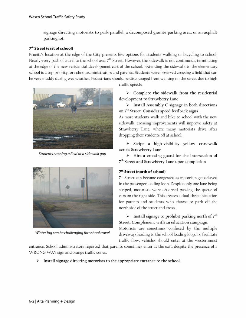
Winter fog can be challenging for school travel
Students crossing a field at a sidewalk gap
signage directing motorists to park parallel, a decomposed granite parking area, or an asphalt
parking lot.
7th Street (east of school)
Prueitt’s location at the edge of the City presents few options for students walking or bicycling to school.
Nearly every path of travel to the school uses 7th Street. However, the sidewalk is not continuous, terminating
at the edge of the new residential development east of the school. Extending the sidewalk to the elementary
school is a top priority for school administrators and parents. Students were observed crossing a field that can
be very muddy during wet weather. Pedestrians should be discouraged from walking on the street due to high
traffic speeds.
Complete the sidewalk from the residential
development to Strawberry Lane
Install Assembly C signage in both directions
on 7th Street. Consider speed feedback signs.
As more students walk and bike to school with the new
sidewalk, crossing improvements will improve safety at
Strawberry Lane, where many motorists drive after
dropping their students off at school.
Stripe a high-visibility yellow crosswalk
across Strawberry Lane
Hire a crossing guard for the intersection of
7th Street and Strawberry Lane upon completion
7th Street (north of school)
7th Street can become congested as motorists get delayed
in the passenger loading loop. Despite only one lane being
striped, motorists were observed passing the queue of
cars on the right side. This creates a dual-threat situation
for parents and students who choose to park off the
north side of the street and cross.
Install signage to prohibit parking north of 7th
Street. Complement with an education campaign.
Motorists are sometimes confused by the multiple
driveways leading to the school loading loop. To facilitate
traffic flow, vehicles should enter at the westernmost
entrance. School administrators reported that parents sometimes enter at the exit, despite the presence of a
WRONG WAY sign and orange traffic cones.
Install signage directing motorists to the appropriate entrance to the school.

John Prueitt Elementary School
Alta Planning + Design | 6-3
7th Street and Central Avenue meet at a wide intersection that poses challenges to pedestrians
Central Avenue at 7th Street
Central Avenue is the nearest street crossing 7th Street
east of the school. It is especially important as a walking
and bicycling route, as students can arrive from the north
on 5th Street and Woodside Drive and from the south
from several residential streets and Beckes Street.
Especially as sidewalk improvements are implemented,
crossing treatments should direct students to walk along
the south side of 7th Street, facing oncoming traffic.
Stripe high-visibility yellow crosswalks at
east and south legs of intersection.
Implement bike lane recommendations
specified in Chapter 1 of this document for
Central Avenue and 7th Street
Over the long term, concurrent with any possible residential development, consider a sidewalk
on the west side of Central Avenue north of 7th Street.
Consider streetscape improvements to 7th Street.
Table 6-1 summarizes recommendations for John Prueitt Elementary School and Figure 6-1 illustrates the
recommendations.
Table 6-1: Summary of John Prueitt Elementary Recommendations
Location Recommendation Cost Responsibility
School Grounds - Consider formalizing parking area on the southeast corner of the
7th Street/Strawberry Lane intersection. Options include signage
directing motorists to parallel park, decomposed granite parking
area, or an asphalt parking lot.
N/A WUESD
7th Street (north
of school)
- Install signage to prohibit parking north of 7th Street
- Install signage directing westbound motorists to school entrance
$800 City
7th Street (east of
school)
- Install sidewalk with curb and cutter on south side of 7th Street that
continues existing sidewalk.
- Stripe a high-visibility yellow crosswalk across Strawberry Lane
- Hire crossing guard for 7th Street/Strawberry Lane intersection (cost
not included, WUESD responsibility)
- Consider Assembly C Speed Feedback Sign for 7th Street
$67,350 City
Central Avenue
at 7th Street
- Stripe high-visibility yellow crosswalk on east, south, and west legs
of intersection.
- Continue bike lane on Central Avenue
- Consider streetscape improvements to 7th Street such as a
landscaped median or other gateway treatment.
- Stripe bike lanes on both sides of 7th Street
$151,500 City

Wasco School Traffic Safety Study
6-4 | Alta Planning + Design
This page intentionally left blank.

John Prueitt Elementary School
Alta Planning + Design | 6-5
Figure 6-1: John Prueitt Elementary School Recommended Improvements
Wasco School Traffic Safety Study
6-6 | Alta Planning + Design
This page intentionally left blank

Implementation
Alta Planning + Design | 7-1
7. Implementation
7.1. Prioritization of Improvements Every recommendation in this Study will improve walking and bicycling conditions at schools in Wasco.
However, because funding and other constraints for the implementation of pedestrian and bicycle
improvements may be unknown or limited, this section prioritizes recommendations so that the most
effective improvements will be implemented first.
7.1.1. Prioritization Criteria
Projects were evaluated based on their effectiveness at achieving the goals of the Plan. Safety, connectivity,
and importance to the community are all represented in the criteria listed below. The maximum possible score
is 8 points.
Table 7-1: Prioritization Criteria
Criteria Description Points Possible
Located in
School Zone
A “School Zone” is defined as the area within 500 feet of the grounds of a school. Improvements to traffic safety near schools are a critical focus of this Plan, and therefore, projects located within a school zone receive one point.
1
Community
Outreach
This criterion emphasizes those recommendations directly from the community outreach process that included five walk audits and a community meeting in January 2013. Community members provided project recommendations and were asked to identify their highest priorities of the projects discussed. Consensus community priorities receive two points and other community-identified improvements receive one point.
2
Located on
Walking
Route to
School
During the series of walk audits held at each school, the community suggested walking and bicycling routes to schools. Improvements along these routes will be especially important because of their location on streets where students are encouraged to walk and bike. Projects located on suggested walking and bicycling routes receive one point.
1
Land Use
(Commercial
Zone)
Schools are a major destination for both children and adults, but are otherwise well-represented in the prioritization criteria. The city’s commercial areas provide employment, shopping, and community gathering spaces. This criterion assigns one point to recommendations that serve areas with commercial zoning classifications.
1
Barrier
Crossing
While many streets within Wasco have low traffic speeds and volumes and are therefore comfortable for pedestrians and bicyclists, other streets pose barriers. Providing infrastructure that allows pedestrians and bicyclists of all ages and ability levels to cross barriers is a priority of this planning effort. Projects that improve barrier crossing receive one point.
1
Collision
Score
Pedestrian and bicycle-related collisions between 2006 and 2010 that occurred within 300 feet of each recommended facility. The raw numbers of collisions are compared. These projects also break naturally into three groups based on the frequency of nearby collisions, and receive zero to two points.
2
Total points possible 8
Wasco School Traffic Safety Study
7-2 | Alta Planning + Design
Projects were then placed into three phasing groups: Tier 1, Tier 2, and Tier 3.
4-8 points: Tier 1 projects have the highest potential for addressing the City’s goals for safe pedestrian
and bicycle transportation to schools and are intended for near-term project implementation within
one to five years.
3 points: Tier 2 projects are intended for development within 6 to 10 years.
1-2 points: Tier 3 projects are not currently ready for implementation but are included as long-term
potential bicycle-specific projects over the next 11 to 20 years.
7.1.2. Project List
Table 7-2 lists Safe Routes to School projects. Projects are listed by priority ranking within each school zone.
“Map ID” refers to the location of each project on the respective School Recommended Improvements map,
located in Chapters 2 through 6.

Implementation
Alta Planning + Design | 7-3
Table 7-2: Safe Routes to School Project Ranking
Map ID School School Zone Outreach
Walking Route
Land Use
Barrier Cross
Collision Score Composite Responsibility
D Teresa Burke 1 1 1 0 1 0 4 City
B Teresa Burke 0 1 1 0 1 0 3 City
F Teresa Burke 0 1 1 0 0 0 2 City
E Teresa Burke 0 0 1 0 0 0 2 City
G Teresa Burke 1 1 0 0 0 0 2 City
A Teresa Burke 1 1 0 0 0 0 2 WUESD
E Karl Clemens 0 2 1 1 1 2 7 City
C Karl Clemens 1 1 1 0 0 2 5 City
B Karl Clemens 1 2 1 0 0 1 5 City
D Karl Clemens 0 2 1 1 0 1 5 City
D Karl Clemens 0 2 1 1 0 0 4 City
A Karl Clemens 1 1 0 1 0 0 3 WUESD
H Thomas Jefferson 0 2 1 1 1 1 6 City
E Thomas Jefferson 1 2 1 0 0 1 5 City
F Thomas Jefferson 1 2 1 0 0 1 5 City
B Thomas Jefferson 1 1 1 0 0 2 5 WUESD
C Thomas Jefferson 1 1 1 0 0 1 4 City
D Thomas Jefferson 1 1 1 0 0 0 3 City
G Thomas Jefferson 0 1 1 0 0 0 2 City
A Thomas Jefferson 1 1 0 0 0 0 2 WUESD
C Palm Avenue 1 2 1 0 0 1 5 City
E Palm Avenue 0 2 1 0 0 2 5 City
F Palm Avenue 1 1 1 0 0 1 4 City
G Palm Avenue 1 2 0 0 0 1 4 City
A Palm Avenue 1 2 0 0 0 0 3 WUESD
D Palm Avenue 0 1 1 0 0 0 2 City
C John Prueitt 1 2 1 0 0 1 5 City/WUESD
A John Prueitt 1 2 1 0 0 1 5 WUESD
B John Prueitt 1 2 1 0 0 1 5 City/WUESD
D John Prueitt 1 1 1 0 0 0 3 City
E John Prueitt 0 1 1 0 0 0 2 City
Wasco School Traffic Safety Study
7-4 | Alta Planning + Design
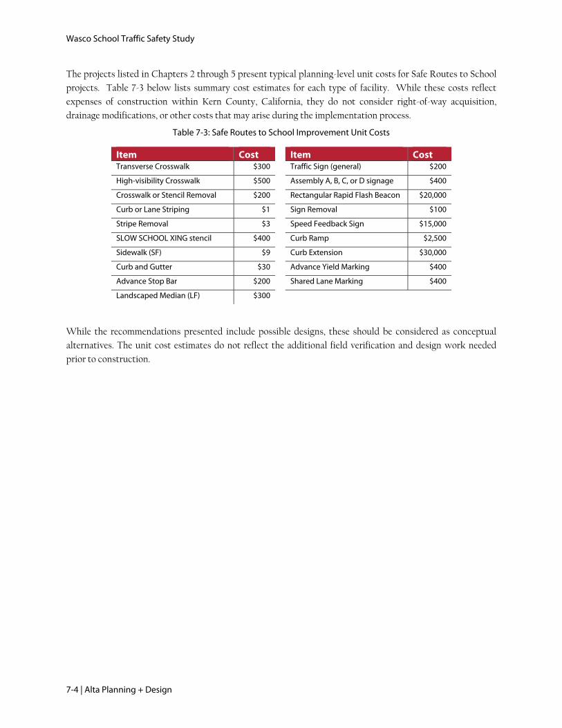
The projects listed in Chapters 2 through 5 present typical planning-level unit costs for Safe Routes to School
projects. Table 7-3 below lists summary cost estimates for each type of facility. While these costs reflect
expenses of construction within Kern County, California, they do not consider right-of-way acquisition,
drainage modifications, or other costs that may arise during the implementation process.
Table 7-3: Safe Routes to School Improvement Unit Costs
Item Cost Item Cost Transverse Crosswalk $300 Traffic Sign (general) $200
High-visibility Crosswalk $500 Assembly A, B, C, or D signage $400
Crosswalk or Stencil Removal $200 Rectangular Rapid Flash Beacon $20,000
Curb or Lane Striping $1 Sign Removal $100
Stripe Removal $3 Speed Feedback Sign $15,000
SLOW SCHOOL XING stencil $400 Curb Ramp $2,500
Sidewalk (SF) $9 Curb Extension $30,000
Curb and Gutter $30 Advance Yield Marking $400
Advance Stop Bar $200 Shared Lane Marking $400
Landscaped Median (LF) $300
While the recommendations presented include possible designs, these should be considered as conceptual
alternatives. The unit cost estimates do not reflect the additional field verification and design work needed
prior to construction.
Recommended