Clyde Wahrhaftig Collection
GOGA 35329
Golden Gate National Recreation Area
ATTN: Park Archives and Records Center
Building 201, Fort Mason
San Francisco, CA 94123
[Mailing Address]
Park Archives and Records Center
Presidio of San Francisco
Building 667 McDowell Ave.
San Francisco, CA 94129
[Physical Address]
go.nps.gov/gogacollections
Phone: 415-561-2807
Fax: 415-441-1618

35329fa Clyde Wahrhaftig Collection 2
Introduction
Golden Gate National Recreation Area
Park Description
Golden Gate National Recreation Area (GGNRA), a unit of the National Park Service, was
established by an Act of Congress on October 27, 1972. The 80,000-acre park encompasses a
great diversity of cultural and natural resources in and around the Bay Area of San Francisco,
California. It includes Muir Woods National Monument and Fort Point National Historic Site.
The park holds almost five million three-dimensional and documentary artifacts dating from the
time before European contact to the present. They are preserved and maintained for the public
by the Division of Cultural Resources and Museum Management, which includes the Park
Archives and Records Center (PARC).
Park Archives and Records Center (PARC)
Historical Note
GGNRA and the sites within it have been collecting records since their inception. The PARC
was established in 1994 to receive records and archival collections from the U.S. Army and the
Presidio Army Museum after the closure of the Presidio of San Francisco as an Army base.
The collections continue to grow through the donation of materials by private individuals,
transfer of inactive park records by staff, and acquisition of relevant documentary materials.
Scope of Collections
The archival collections in the custody of the GGNRA document the history and activity of the
various sites and groups associated with the park, described in the park’s Scope of Collection
Statement (2009).
The PARC contains U.S. Army and National Park Service facility records for the Presidio of
San Francisco, forts and coast defense sites in the area, and various GGNRA sites. Subjects
and sites documented include the United States Army (Bear Flag Revolt, Civil War, Spanish-
American War, Mexican War, World War I, Army Air Service, Coast Artillery, Army
medical facilities and issues, World War II, Army support during natural disasters, Viet Nam
War, and Operation Desert Storm); Alcatraz Island (Army fortress, Army Disciplinary
Barracks, U.S. Penitentiary, and Indian Occupation); the natural resources conservation
movement resulting in the establishment of Muir Woods National Monument; agriculture in the
Marin Headlands; Point Reyes Peninsula and Bolinas Lagoon areas; U.S. Lifesaving/Coast
Guard Services; San Francisco Earthquake and Fire of 1906; Panama Pacific International
Exposition of 1915; natural resources and environmental issues; and preservation of open

35329fa Clyde Wahrhaftig Collection 3
space in the Bay Area. Also included in the PARC are many of the GGNRA administrative
records that document the development and expansion of this park.
Visiting the PARC for Research
The PARC is located in an historic brick building, formerly a cavalry stable, on the Presidio of
San Francisco. Collections and archives support services are available for walk-in research
during open hours or by appointment. Please contact the PARC (see below) for the current
schedule of reference hours.
Copy Services
Black and white photocopy services for standard and oversize materials are available on-site.
Color photocopying, photographic duplication, and duplication of other media are available by
special arrangement. Researchers are charged for all duplicates on a cost-recovery basis.
Rights and Publications
Copies are provided under the Fair Use provisions of the Copyright Law (Title 17, U.S.C.).
Researchers must complete a Permission to Publish Contract form with the Park Archivist for
any other intended use of these materials (such as publication or exhibit). Researchers should
consult with staff regarding their needs for commercial or public use of materials.
Legal Status of Holdings
Many holdings of the PARC were acquired/transferred prior to the establishment of the
archives program, and have little documentation on their provenance (source/chain of custody).
All materials received after 1994 have been accessioned and documented. If provenance
cannot be determined, the PARC assumes that it owns the property rights, but does not own
the copyright. Staff will provide assistance, but it is the responsibility of the researcher to
acquire permission from the copyright holder to cite, quote, or reproduce collection materials.
Collections developed by or for government organizations or operations are in the public
domain and may be used, cited, and quoted without restriction, provided they are properly
credited to the PARC. The archives contain no national security classified materials.
Donations to the Collections
The PARC welcomes donations of a variety of historic materials that meet the criteria in the
Scope of Collections Statement and do not duplicate existing holdings. Collections are
maintained for research use in perpetuity; there is no guarantee that items will be exhibited. If
you own materials that may be relevant to the themes of GGNRA and would like to deposit
them in the PARC, please consult with an archivist.

35329fa Clyde Wahrhaftig Collection 4
How to Use This Finding Aid
This document contains information on the contents and significance of an archival collection.
It includes descriptive information; repository information; collection history; biographical or
historical information on creators of the collection; and a container or folder list of everything
in the collection. After reviewing the finding aid, please discuss your specific needs with the
archivist who will locate and retrieve the relevant materials.
How to Use the Collections
Please follow all rules and regulations regarding research, the use of the research facility, and
the handling of collection materials. This will protect the collections so they continue to be
available and usable for generations to come. If anything appears to be out of order or
damaged, please notify a staff member.
Contacts
For additional information on the use of archival collections at GGNRA, please contact the
Park Archives and Records Center:
Mailing Address:
National Park Service
Golden Gate National Recreation Area
Attn: Park Archives and Records Center
Fort Mason, Bldg. 201
San Francisco, CA 94123
Physical Address:
Park Archives and Records Center
Presidio of San Francisco
Building 667 McDowell Avenue
San Francisco, CA 94129
Phone: (415) 561-2807
Fax: (415) 441-1618

35329fa Clyde Wahrhaftig Collection 5
Clyde Wahrhaftig Collection
Title
Clyde Wahraftig Collection
Alternate Title: Wahraftig Collection
Dates
Inclusive: 1954-1993
Collection Number
Catalog Number GOGA 35329 (Accession Number GOGA-3418)
Provenance
The collection was gathered at the home of Clyde Wahrhaftig after his death at his home
in San Francisco in 1994 at the request of his sister.
Volume
60.6 LF
Description
The Clyde Wahrhaftig Collection is organized by three media types. The first is
manuscripts & papers, second is photographs, and third is maps. Each type is further
developed into series.
Included in the manuscripts and papers portion of this collection are papers he wrote,
documents from his teaching, manuscripts and notes from A Streetcar to Subduction and
other Plate Tectonic Trips by Public Transport in San Francisco (a book he wrote in
1979 and revised in 1984 about visiting geological sites in San Francisco using only
public transportation), documents from professional organizations and clubs he was a
member of, miscellaneous papers & documents, and books from his own personal
collection. The manuscript materials can be found in series 1 – 7.
The photograph section of the Clyde Wahrhaftig collection consists of slides,
photographs, and orthophotographs (an aerial photograph with distortions due to tilt,
curvature, and ground relief removed that has the accuracy of a map and the clarity of a
photograph) primarily of the San Francisco Bay Area. Photographic materials can be
found in series 8 – 11.
The last portion of the Clyde Wahrhaftig collection consists of his maps. There are
several different types of maps including geographic maps, topographic maps, quadrangle

35329fa Clyde Wahrhaftig Collection 6
maps, and street maps. Most of the maps are from California, but there are some from
other states and other countries. Maps can be found in series 12 – 19.
History
Clyde Wahrhaftig was born in Fresno, California on December 1, 1919, and raised there,
a member of a pioneer California family whose early members planted orchards in the
Sacramento Valley. He earned a bachelor's degree in geology at Caltech in 1941, and a
Ph.D. in geology at Harvard in 1953. He taught at Berkeley for 22 years, from 1960 to
1982 but the central institution of his professional life was with the Geological Survey
(USGS) from 1941 till his death in 1994.
He spent most of his summers in the mountains—mainly in Alaksa with the Geological
Survey or in the Sierra Nevada. In the mid- 1980s heart problems slowed him down.
When he was no longer able to work in the higher mountain ranges, he switched his
attention to the lower coast ranges of California. He then became familiar with the hills
and cliffs and rock outcrops from the Peninsula to the Marin Headlands. Wahrhaftig
disliked automobiles and airplanes and used public transportation as much as possible.
Traveling to his Geological Surveys in Alaska, he transported by sea while his colleagues
took planes. He used horse-pack trains to support his field work in Alaska and Sierra
Nevada.
Among his academic achveivements and geological accomplishments, he also held many
leadership roles and responsibilities with different associations and within the university
system. He was on PhD. oral committees, Leader of applying geolocical science to
environmental problems with the State Forest Practices Act, Chair member of the
Geological Society of America (GSA), appointed to the California Board of Forestry, and
Chair and Director of the Environmental Sciences major at UC Berkeley. He was an
active member of the Technical Advisory Committee on Bolinas Lagoon, the Marin
County Recreation Department, Mayor’s Twin Peaks Committee, and on study
committees for the Golden Gate National Recreation Area and the Bay Area Ridge Trail.
Clyde also contributed to his local community holding summer camps, extra-curricular
education programs and led groups of minority youth on geological field trips around the
city of San Francisco using public transportation. One of his many field trip guides was
published into a book by the American Geophysical Union, titled “A Streetcar to
Subduction”; a guide to outcrops in the San Francisco Area using public transportation.
Other field guides that were published include “A Walker’s Guide to the Geology of San
Franciscco” and “The Hayward Fault in Hayward and Fremont, via BART”.

35329fa Clyde Wahrhaftig Collection 7
Clyde Wahrhaftig worked diligently until his death on April 6, 1994. He died of heart
failure at the age of 74 in San Francisco.
Biographical information was used from
http://eps.berkeley.edu/alumni/wahrhaftig.php
Preferred Citation
“Golden Gate NRA, Park Archives, Clyde Wahrhaftig Collection, GOGA 35329”
Index
Manuscripts/Papers
Alaska
American Geophysical Union
Bay Area Ridge Trail Council
Bolinas Lagoon (Calif.)
Bolinas Lagoon Technical Advisory Committee
California
California Coastal Zone Conservation Commission
California. Legislature. Assembly. Natural Resources Committee
California. State Board of Forestry
Curry, Robert
Denver (Colo.)
Geological Society of America
Geology--California--Marin County
Geology--California, Northern
Geology--California--San Francisco Bay Area
Geology--Field work
Golden Gate National Parks Association
Outer Continental Shelf Review Committee
Point Reyes National Seashore (Calif.)
San Francisco (Calif.)
San Francisco Bay Area (Calif.)
Soil Erosion Study Advisory Committee
University of California at Berkeley
Wahrhaftig, Clyde, 1919-1994
Yosemite National Park (Calif.)
Photographs
Alcatraz Island (Calif.)
Angel Island (Calif.)
Baker Beach (San Francisco, Calif.)
Bolinas Lagoon (Calif.)
California
Carmel (Calif.)

35329fa Clyde Wahrhaftig Collection 8
Fort Funston (Calif.)
Geology--California, Northern
Geology--Field work
Golden Gate Bridge (San Francisco, Calif.)
Golden Gate National Parks Association
Land's End (San Francisco, Calif.)
Marin County (Calif.)
Mendocino (Calif.)
Monticello Dam
Muir Woods National Monument (Calif.)
Ocean Beach (San Francisco, Calif.)
Point Reyes National Seashore (Calif.)
San Francisco (Calif.)
San Francisco Bay Area (Calif.)
Wahrhaftig, Clyde, 1919-1994
Yosemite National Park (Calif.)
Maps
Alameda County (Calif.)
Alaska
Arizona
Australia
California
Canada
Colorado
Contra Costa County (Calif.)
Denmark
Finland
Geology--California, Northern
Geology--California--San Francisco Bay Area
Golden Gate National Parks Association
Great Britain
Hawaii
India
Indonesia
Marin County (Calif.)
Mexico
Montana
Napa County (Calif.)
Nevada
New Mexico
New Zealand
North Dakota
Ohio
Oregon
Pennsylvania

35329fa Clyde Wahrhaftig Collection 9
Point Reyes National Seashore (Calif.)
San Francisco (Calif.)
San Francisco Bay Area (Calif.)
San Mateo County (Calif.)
Santa Clara County (Calif.)
Solano County (Calif.)
Sonoma County (Calif.)
Sweden
Switzerland
Utah
Wahrhaftig, Clyde, 1919-1994
Washington
Wyoming
Yosemite National Park (Calif.)
Formats
Manuscripts & Papers
Aerial Photographs
Articles
Black-and-White Photographs
Books
Brochures
Bus Route Maps
Clippings
Color Photographs
Correspondence
Field Notes
Figures (Illustrations)
Forms (Documents)
Geological Maps
Lecture Notes
Manuscripts
Maps
Minutes
Newsletters
Notes
Press Releases
Professional Papers
Quadrangle Maps
Speeches
Topographic Maps

35329fa Clyde Wahrhaftig Collection 10
Photographs
Aerial Photographs
Black-and-White Negatives
Black-and-White Photographs
Color Negatives
Color Photographs
Color Slides
Filmstrips
Maps
Aerial Photographs
Black-and-White Photographs
Brochures
Clippings
Field Notes
Figures (Illustrations)
Geological Maps
Maps
Professional Papers
Quadrangle Maps
Topographic Maps
Processing Information
Processed by Aja Sorensen
Completed in May 2005
Re-Cataloged by Terryn Liljedahl
Completed in October 2012

35329fa Clyde Wahrhaftig Collection 11
Collection and Series Description
Manuscripts & Papers
Series 1: Clyde Wahrhaftig
Volume: 4.7 LF [8 document boxes and 7 folders]
Formats: Black-and-White Photographs
Correspondence
Field Notes
Lecture Notes
Meeting Minutes
Professional Papers
Topographic Maps
Description: Documents that Clyde Wahrhaftig created. It includes his papers,
correspondences, teaching documents, documents from field trips, and
miscellaneous documents. Most of the documents are from his teaching
career at the University of California, Berkeley, from the 1960s to the
1980s.
Sub-Series 1: Papers
Volume: 0.5 LF
Arrangement: Alphabetically by name
Formats: Professional Papers
Description: Papers that Clyde Wahrhaftig wrote covering a range of topics. Also
included in this sub-series are speeches and statements made by
Wahrhaftig.
Sub-Series 2: Correspondences
Volume: 0.5 LF
Arrangement: Chronologically
Formats: Correspondence
Description: Wahrhaftig’s professional correspondences from 1959-1990. Letters and
memos are addressed to and from him and cover a wide range of
topics. Also included in this sub-series is a set of letters from a second
grade class at Buena Vista Alternative Education School thanking
Wahrhaftig for taking them on a field trip.

35329fa Clyde Wahrhaftig Collection 12
Sub-Series 3: Courses
Volume: 2 LF
Arrangement: Subject
Formats: Correspondence
Lecture Notes
Meeting Minutes
Professional Papers
Description: Documents from when Wahrhaftig was a professor at the University of
California, Berkeley. This series contains lecture notes, handouts from his
courses at UC Berkeley, documents from other courses he taught,
lectures he gave, PhD dissertations for which he was an advisor, and other
student papers and master’s degree theses. Also in this series are
correspondences and faculty meeting minutes from the Department of
Geology, University of California, Berkeley, from the 1970s and 1980s.
Sub-Series 4: Field Trips
Volume: 1.5 LF
Arrangement: Subject
Formats: Black-and-White Photographs
Field Notes
Topographic Maps
Description: Field trips that Wahrhaftig led as a professor or as a professional
geologist. This series includes field trips that he took with his classes and
professional organizations. Also included in this series are notes from
field trips to different areas containing maps and photographs from the
INQUA [International Union for Quaternary Research/ International
Association for Quaternary Research] trip in Clear Lake, Denver,
Colorado, in 1961-1963.
Sub-Series 5: Miscellaneous Documents
Volume: 0.7 LF
Arrangement: Format
Formats: Color Photographs
Figures (Illustrations)
Maps
Notes

35329fa Clyde Wahrhaftig Collection 13
Professional Papers
Description: Documents that are directly from Wahrhaftig or written by him but did not
fall into any of the above categories. Included in this sub-series are typed
and handwritten notes by Wahrhaftig not associated with any other
documents. Also included are miscellaneous photographs, maps, and
figures that were found among the other documents in this series but are
unrelated.
Sub-Series 6: Books
Volume: 1 LF [10 Boks]
Arrangement: Chronologically
Formats: hard and paper bound books
Description: The books in this sub-series are ones that Clyde Wahrhaftig used in his
early years as a student or the subject of the books are related to the topic
he studied throughout his life i.e., geology, math, science, etc. The books
are located in the rare book cabinets.
Series 2: Streetcar to Subduction
Volume: 2.9 LF [4document boxes and 9 folders]
Formats: Clippings
Color Photographs
Correspondence
Figures (Illustrations)
Field Notes
Manuscripts
Notes
Professional Papers
Description: Documents related to the researching, writing, and publishing of Clyde
Wahrhaftig’s book A Streetcar to Subduction and other Plate Tectonic
Trips by Public Transport in San Francisco in 1979 and the revised
edition in 1984. This series contains manuscripts and figures in final and
draft form as well as notes from the field trips he took while researching
the book.
Sub-Series 1: Manuscripts
Volume: 0.59 LF
Arrangement: Chronologically

35329fa Clyde Wahrhaftig Collection 14
Formats: Manuscripts
Description: Manuscripts that Wahrhaftig wrote and worked on while finishing A
Streetcar to Subduction and other Plate Tectonic Trips by Public
Transport in San Francisco. There are a number of copies of manuscripts
that are undated and unlabeled. This sub-series is organized by edition
when that is known. Undated manuscripts are grouped together at the end.
Sub-Series 2: Figures
Volume: 0.5 LF
Arrangement: Chronologically
Formats: Figures (Illustrations)
Description: Figures and maps that are found in the book A Streetcar to Subduction and
other Plate Tectonic Trips by Public Transport in San Francisco. There
are copies of the figures, the line drawings, and the original photographs
from which the figures were made. Most of the figures are unlabeled and
undated so it is not possible to determine which version they are from.
Sub-Series 3: Trips
Volume: 0.5 LF
Arrangement: Geographically
Formats: Color Photographs
Field Notes
Description: Field notes and photographs taken during the field trips that Wahrhaftig
took while researching the book. Also included in this sub-series are
materials from the Sedentary Survey to accompany its field notes.
Sub-Series 4: Miscellaneous Documents
Volume: 3 folders
Arrangement: Format
Formats: Correspondence
Notes
Description: Documents related to A Streetcar to Subduction and other Plate Tectonic
Trips by Public Transport in San Francisco that did not fit in the other
sub-series. This sub-series contains correspondences and handwritten
notes by Wahrhaftig regarding the book.
Sub-Series 5: Research Copies

35329fa Clyde Wahrhaftig Collection 15
Volume: 0.5 LF
Arrangement: Format
Formats: Clippings
Figures (Illustrations)
Manuscripts
Professional Papers
Description: This sub-series contains copies of research materials used during
Wahrhaftigs research for the book. This includes figures, maps,
manuscripts, newspaper clippings, reference copies, and papers not written
by Wahrhaftig.
Series 3: Professional Organizations
Volume: 6 LF [12 document boxes]
Format: Brochures
Correspondences
Forms (Documents)
Maps
Manuscripts
Meeting Minutes
Newsletters
Press Releases
Professional Papers
Speeches
Description: Professional organizations and committees that Wahrhaftig belonged to as
a professional geologist. This series also includes other organizations that
he belonged to as a consultant or an interested citizen. The documents in
this series are mostly meeting minutes and correspondences with some
papers and reports relevant to each organization. The organizations
represented here are the Bay Area Ridge Trail, American Geophysical
Union, Assembly Committee on Natural Resources and Conservation,
Bolinas Lagoon Technical Advisory Committee, California Coastal Zone
Conservation Committee, Geological Society of America, Humboldt Bay,
Land Use Institute, The Mayor’s Twin Peaks Committee, Outer
Continental Shelf (OCS) Review Committee, State Board of Forestry, Soil
Erosion Study Advisory Committee, United States Environment and
Resources Council, and San Francisco Hiking Club, and Government
Agencies.

35329fa Clyde Wahrhaftig Collection 16
Sub-Series 1: Bay Area Ridge Trail
Volume: 0.5 LF
Arrangement: Format
Format: Brochures
Correspondences
Maps
Meeting Minutes
Newsletters
Professional Papers
Description: Documents relating to the Bay Area Ridge Trail. There are meeting
minutes, correspondences, maps, reports, and other information. The Bay
Area Ridge Trail council is a non-profit group that plans and oversees the
care of the Bay Area Ridge Trail – a trail around the San Francisco Bay
Area for hiking, biking, and other similar activities. As of 2005, it was
300 miles long and will eventually be 500 miles long.
Sub-Series 2: American Geophysical Union
Volume: 3 folders
Format: Correspondence
Professional Papers
Description: American Geophysical Union regarding its Increased Minority
Participation in the Earth Sciences Program. There are correspondences
and papers from the late 1970s regarding this program. The American
Geophysical Union is a non-profit scientific organization with over 40,000
scientists in over 100 countries as members.
Sub-Series 3: Assembly Committee on Natural Resources and Conservation
Volume: 4 folders
Arrangement: Format
Format: Correspondences
Press Releases
Speeches
Description: Correspondences, statements, and press releases from the Assembly
Committee on Natural Resources and Conservation from the 1970s. The
Assembly Committee on Natural Resources and Conservation was a part
of the California Legislature.

35329fa Clyde Wahrhaftig Collection 17
Sub-Series 4: Bolinas Lagoon Technical Advisory Committee
Volume: 5 folders
Arrangement: Format and Chronologically
Format: Correspondences
Meeting Minutes
Description: Correspondences and meeting minutes from the Bolinas Lagoon Technical
Advisory Committee from the 1970s. The Bolinas Lagoon Technical
Advisory Committee advises the Marin Open Space District on how to
preserve and manage the Bolinas Lagoon Open Space Preserve.
Sub-Series 5: California Coastal Zone Conservation Committee
Volume: approximately 1 LF
Arrangement: Subject and Format
Format: Manuscripts
Newsletters
Professional Papers
Description: Plan elements, drafts of papers, and other documents from the California
Coastal Zone Conservation Committee from the 1970s, a State of
California agency whose mission is to monitor the use of land and water in
the coastal zone areas following the Coastal Act. This series contains Plan
Elements for various subjects which include recommendations by the
State Commission for each topic, drafts of the Energy Element, volumes
of Energy drafts and more on the energy element and also documents for
the geology element.
Sub-Series 6: Geological Society of America
Volume: approximately 1 LF
Arrangement: Format
Format: Bulletins
Correspondences
Meeting Minutes
Newsletters
Professional Papers
Description: Materials from the Geological Society of America, mostly pertaining to
the Committee on Environment and Public Policy. The Committee on
Environment and Public Policy materials include correspondences,
meeting minutes, and various documents regarding their 1972 Annual

35329fa Clyde Wahrhaftig Collection 18
Meeting. In this sub-series are documents about a 1973 conference
on Earth-Sciences and Environmental Decision Making and their 1991
annual meeting. There also includes membership materials such as
bulletins and newsletter due to Wahrhaftig being a member of the GSA.
The Geological Society of America is a non-profit organization dedicated
to the geosciences. There are thousands of members in many countries
from different fields including academia, government, and business.
Sub-Series 7: Humboldt Bay
Volume: 2 folders
Arrangement: Format
Format: Correspondences
Meeting Minutes
Description: Correspondences and meeting minutes about Humboldt Bay from the
1970s. This group was researching the safety of the Humboldt Bay Plant
site for earthquake hazards.
Sub-Series 8: International Union for Quaternary Research [INQUA]
Volume: 2 folders
Arrangement: Chronological
Format: Booklets
Description: INQUA, the International Union for Quaternary Research, was founded
in 1928 by a group of scientists seeking to improve understanding of
environmental change during the glacial ages through interdisciplinary
research. Today, more than 35 member countries, spread throughout the
world. Wahrhaftig led field trips with the INQUA and contributed some
writings as well. In this sub-series, there is a field trip guidebook with
INQUA and a review piece for congress from the INQUA.
Sub-Series 9: Land Use Institute
Volume: 5 folders
Arrangement: Format
Format: Correspondences
Forms (Documents)
Meeting Minutes
Newsletter
Description: Correspondences, meeting minutes, and other documents from the Land
Use Institute from the 1970s. The Land Use Institute is a panel of people

35329fa Clyde Wahrhaftig Collection 19
from various scientific and professional fields who examine environmental
problems and advise local groups or individuals on possible solutions.
Sub-Series 10: The Mayor’s Twin Peaks Committee
Volume: 4 folders
Arrangement: Format
Format: Correspondences
Maps
Meeting Minutes
Description: Correspondences, meeting minutes, and maps from The Mayor’s Twin
Peaks Committee from the 1980s. The Mayor’s Twin Peaks Committee
was formed by former San Francisco Mayor Diane Feinstein to help the
City of San Francisco develop plans to develop and improve Twin Peaks.
Sub-Series 11: OCS (Outer Continental Shelf) Review Committee
Volume: 0.5 LF
Arrangement: Format and Alphabetically
Format: Correspondences
Meeting Minutes
Professional Papers
Description: Correspondences, meeting minutes, papers, and other documents for the
Review Committee on Environmental Impact of Oil and Gas Production
on the Outer Continental Shelf (OCS Review Committee) from the 1970s.
There are a variety of documents in this sub-series, but most of them are
papers written for the OCS Review Committee. They focused on
researching the impact of oil and gas production on the Pacific Coast,
especially in Alaska.
Sub-Series 12: State Board of Forestry
Volume: 0.5 LF
Arrangement: Format
Format: Correspondences
Meeting Minutes
Professional Papers
Speeches
Description: Correspondences, meeting minutes, statements, papers, and reports for the
State Board of Forestry from the 1970s and 1980s. There are a number of

35329fa Clyde Wahrhaftig Collection 20
documents and papers regarding logging in state forests. The State Board
of Forestry is a State of California agency that works with policy and the
public to protect that state’s forests.
Sub-Series 13: Soil Erosion Study Advisory Committee
Volume: 7 folders
Arrangement: Format
Format: Correspondences
Meeting Minutes
Professional Papers
Description: Correspondences, meeting minutes, and papers from the Soil Erosion
Study Advisory Committee from the 1980s. The Soil Erosion Study
Advisory Committee was established by the State of California
Department of Forestry to study soil erosion for the Department and to
ensure that the studies by the Department are valid. Various studies and
reports were prepared by the committee.
Sub-Series 14: United State Environment and Resources Council
Volume: 1 folder
Format: Meeting Minutes
Description: Meeting minutes from the United States Environment and Resources
Council from the 1970s. The United States Environment and Resources
Council does not seem to be a part of the government and was formed to
assist in an exchange of ideas and developments between different
organizations that focus on the environment and earth resources.
Sub-Series 15: San Francisco Hiking Club
Volume: 1 folder
Format: Maps
Description: Maps and other documents for the San Francisco Hiking Club. The San
Francisco Hiking Club is a not-for-profit group that meets on weekends to
go on hikes.
Sub-Series 16: Workshop on Environmental Problems in the Extractive Industries
Volume: 4 folders
Arrangement: Format

35329fa Clyde Wahrhaftig Collection 21
Format: Correspondences
Professional Papers
Speeches
Bulletins
Newsletters
Description: Correspondences, papers, and speeches for the Workshop on
Environmental Problems in the Extractive Industries from 1972-1973.
The workshop took place at Wright State University in Dayton, Ohio, and
was co-sponsored by the Geological Society of America. The workshop
was open to industry professionals and university professors who work on
environmental issues. This sub-series is included in this series because the
topic fits in with the other organizations, and it was co-sponsored by the
Geological Society of America.
Sub-Series 17: Government Agencies
Volume: approximately 1.25 LF
Arrangement: Agency
Format: Brochures
Bulletins
Forms
Records
Description: Documents, brochures, forms, and committee and congressional records
provided by various government agencies. Most of the agencies are at the
federal level, but there are some at the state level. This sub-series is
included because it contains agencies and committees that Wahrhaftig was
or was not on.
Series 4: Geographic Areas
Volume: 6.5 LF [13 document boxes]
Format: Aerial Photographs
Black-and-White Photographs
Brochures
Bus Route Maps
Color Photographs
Correspondences
Maps
Professional Papers

35329fa Clyde Wahrhaftig Collection 22
Description: Materials from geographic areas. Most of the documents in this series are
academic papers that were written about a specific area. There are also
maps, brochures, and other documents about the areas. The geographic
directions in this series are based on San Francisco as a center point and
expanding outward. There are four main geographic areas in this series:
San Francisco; areas south of San Francisco; areas east of San Francisco;
and areas north of San Francisco, including up along the Pacific Coast to
Alaska. Included at the end of this series is a sub-series of street maps,
which are grouped by geographic areas, and a sub-series of transit guides
for the San Francisco Bay Area and brochures. These have been included
in this series because they are based on geographic areas, but have been
separated because they are distinct from the materials in the other sub-
series.
Sub-Series 1: Golden Gate National Recreation Area
Volume: 0.5 LF
Arrangement: Geographically
Format: Brochures
Maps
Professional Papers
Description: Documents relating to the Golden Gate National Recreation Area. The
locations represented here are Alcatraz, Fort Funston, Marin Headlands,
The Presidio of San Francisco, and Ocean Beach.
Sub-Series 2: San Francisco
Volume: 0.5 LF
Arrangement: Geographically
Format: Aerial Photographs
Maps
Professional Papers
Description: Maps and papers about San Francisco. There are maps and
orthophotographs that document the city. There are also geology papers
about the San Francisco area. The John McLaren Park document is
included in this series because it is a city park.
Sub-Series 3: South of San Francisco

35329fa Clyde Wahrhaftig Collection 23
Volume: 0.5 LF
Arrangement: Geographically
Format: Maps
Professional Papers
Description: Papers and other documents about locations that are found south of San
Francisco. The papers are mainly about geology and related scientific
disciplines. The locations covered by these materials extend south
through California to Mexico.
Sub-Series 4: East of San Francisco
Volume: 0.5 LF
Arrangement: Geographically
Format: Maps
Professional Papers
Description: Papers and maps of locations that are found to the east of San Francisco,
including the general East Bay of the San Francisco Bay. The papers
focus on geology, the environment, and other related disciplines. Most of
the locations are found between San Francisco and the Sierra Nevada
Mountains, with some papers about Nevada. At the end of this sub-series
are documents on Texas and Greenland. Also included in this sub-series
are papers about California in general and maps.
Sub-Series 5: North of San Francisco
Volume: 3.5 LF
Arrangement: Geographically and Format
Format: Aerial Photographs
Black-and-White Photographs
Brochures
Color Photographs
Correspondences
Maps
Professional Papers
Description: Maps, photographs, papers, and other documents about areas north of San
Francisco including Oregon, Washington, and Alaska. The locations
covered by these materials extend north through California and the Pacific
Coast. In this sub-series are papers that discuss the Pacific Coast. Also
included are Bolinas Lagoon, Tomales Bay, and Point Reyes materials that

35329fa Clyde Wahrhaftig Collection 24
are cross referenced with the Golden Gate National Recreation Area sub-
series.
Sub-Series 6: Street Maps
Volume: 0.5 LF
Arrangement: Geographically
Format: Maps
Description: Street maps of the San Francisco Bay Area, California, and several other
states, that range from the 1960s to the 1990s. The street maps are
grouped by location and are in geographic order: San Francisco, North
Bay, East Bay, California, other California cities, and other states. Also
included in this sub-series are street maps of national forests in California.
Sub-Series 7: Transit Guides and Brochures
Volume: 0.5 LF
Arrangement: Geographically
Format: Brochures
Bus Route Maps
Description: Transit guides from systems in the San Francisco Bay Area and brochures.
The transit guides include the Bay Area Rapid Transit (BART), MUNI in
San Francisco County, SamTrans in San Mateo County, Golden Gate
Transit in Marin County, and AC Transit in Alameda and Contra Costa
Counties. Also included in this sub-series are brochures. While not all the
brochures focus on a geographic area, the presentation is the same so they
are included in this sub-series.
Series 5: Papers
Volume: 2.5 LF [5 document boxes]
Arrangement: Alphabetically and Subject
Format: Brochures
Clippings
Maps
Professional Papers
Description: Papers that were written on a variety of subjects but do not fall under one
of the other series. Most are academic papers, but not all are published.
If there is no author, then they are in alphabetical order by title.
Most of the papers are about geology or a related scientific discipline. This

35329fa Clyde Wahrhaftig Collection 25
series contains student papers [not his own] and papers relating to
earthquakes as well.
Series 6: Miscellaneous
Volume: 0.5 LF [1 document box]
Arrangement: Subject
Format: Brochures
Clippings
Newsletters
Professional Papers
Description: Materials that did not fit into another series. The documents are a
miscellaneous collection of booklets, museum information, and other
documents.
Series 7: Small Notebooks
Volume: approximately 1 LF [4 small boxes]
Format: Notes
Description: Small notebooks. These notebooks contain handwritten notes by
Wahrhaftig and are very difficult to read.
Series 8: Slides
Photographs
Volume: 1 LF [2 document boxes]
Arrangement: Geographic order
Formats: Color Slides
Description: Slides from various locations, mostly in California. The slides are in
geographic order starting with the Golden Gate National Recreation Area
and then cover other National Parks followed by State Parks. After that
the slides follows a geographic order starting in San Francisco then
expand outward based on distance from San Francisco. There are also
slides of graphs.
Series 9: Photographs
Volume: 0.5 LF [1 document box]
Arrangement: Geographic order

35329fa Clyde Wahrhaftig Collection 26
Formats: Black-and-White Negatives
Black-and-White Photographs
Color Negatives
Color Photographs
Description: Black and white and color photographs from various locations, primarily
Golden Gate National Recreation Area. The photographs are grouped by
location and ordered by geographic area. It starts with Golden Gate
National Recreation Area, then other National Parks, and then other
photographs.
Series 10: Orthophotographs
Volume: approximately 6.2 LF [2 document boxes, 1 oversize box]
Arrangement: Geographical and chronological order
Formats: Aerial Photographs
Black-and-White Negatives
Description: Orthophotographs of the San Francisco Bay Area and Marin County form
the 1950s to the 1970s. They are grouped by area and date starting with
San Francisco and moving north. Within each area they are arranged
chronologically. See attached inventory of the oversized
orthophotographs.
Series 11: Filmstrips
Volume: approximately .3 LF [1 flat box]
Formats: Filmstrip
Description: Two filmstrips: Fire Under the Sea: The Origin of Pillow Lava and
“History of Pacific Basin” Pt 2.
Series 12: California
Maps
Volume: approximately 0.75 LF [1.5 document boxes]
Arrangement: Geographically
Formats: Geological Maps
Maps
Professional Papers

35329fa Clyde Wahrhaftig Collection 27
Quadrangle Maps
Topographic Maps
Description: Maps of California and large regions of California. The series begins with
California and condenses to more specific areas of the state.
Series 13: San Francisco Bay Area Counties
Volume: approximately 6.75 LF [4.5 document boxes and 15 map rolls]
Arrangement: Geographically and Alphabetically
Formats: Geological Maps
Maps
Professional Papers
Quadrangle Maps
Topographic Maps
Description: Maps of the nine counties of the San Francisco Bay Area: Alameda
County, Contra Costa County, Marin County, Napa County, San Mateo
County, Santa Clara County, Solano County, and Sonoma County (there
are no maps from San Francisco County). In each county, the titles are
grouped alphabetically. The series begins with maps from the San
Francisco Bay Region and condenses to more specific parts of the Bay
Area, and then the counties are in alphabetical order.
Series 14: San Francisco Bay Area Cities
Volume: 1.5 LF [3 document boxes]
Arrangement: Alphabetically
Formats: Geological Maps
Maps
Quadrangle Maps
Topographic Maps
Description: Maps of cities from the nine counties of the San Francisco Bay Area.
Some of the titles are of regions instead of cities.
Series 15: California Counties
Volume: 2 LF [4 document boxes]
Arrangement: Alphabetically
Formats: Geological Maps
Maps
Quadrangle Maps

35329fa Clyde Wahrhaftig Collection 28
Topographic Maps
Description: Maps from 35 of California’s counties.
Series 16: California Cities
Volume: 4 LF [8 document boxes]
Arrangement: Alphabetically
Formats: Brochures
Geological Maps
Maps
Quadrangle Maps
Topographic Maps
Description: Maps of cities throughout California. Some of the titles are of regions
instead of cities.
Series 17: Out of State
Volume: 3.1 LF [5 document boxes and 2 map rolls]
Arrangement: Geographically and Alphabetically
Formats: Geological Maps
Maps
Quadrangle Maps
Topographic Maps
Description: Maps of the United States and several states. The series begins with the
United States and several regions followed by the states: Alaska, Arizona,
Colorado, Hawaii, Montana, Nevada, New Mexico, North Dakota, Ohio,
Oregon, Pennsylvania, Utah, Washington, and Wyoming.
Series 18: International
Volume: 1.5 LF [3 document boxes]
Arrangement: Alphabetically and Geographically
Formats: Geological Maps
Maps
Quadrangle Maps
Topographic Maps
Description: Maps from various countries around the world: Australia, Canada,
Denmark, Finland, Great Britain, India, Indonesia, Mexico, New Zealand,
Sweden, and Switzerland. Also included at the end of this series are maps
from larger regions of the world, like oceans and sea floors, and maps
from the Moon and Mars.

35329fa Clyde Wahrhaftig Collection 29
Series 19: Miscellaneous Maps, Charts, Brochures
Volume: approximately 0.5 LF [one doc box]
Arrangement: Alphabetical
Formats: Brochures
Charts
Figures (Illustrations)
Maps
Description: Miscellaneous maps and pieces of maps. This series contains maps that
did not fit in other series or where the location is unknown. Also included
in this series are map pieces, brochures of places with a map on it, charts
of a map, and notes of or about maps.
35329fa Clyde Wahrhaftig Collection 30
Box and Folder List
Collection Title: Clyde Wahrhaftig Collection
Collection Number: GOGA 35329
Box
#
Folder
#
Description
1 Series 1: Clyde Wahrhaftig
Manuscripts and Papers
Sub-Series 1: Papers
1 “Effects of Glaciation on Yosemite National Park”, talk by Clyde
Wahrhaftig, 1990.
2 “Explanation for the Map of the Quaternary Deposits of the San Francisco
Bay 1:1,000,000 Sheet” by Scott Stine and Clyde Wahrhaftig, 1982
3 “Note on the sources of Lobos Creek, San Francisco” by Clyde Wahrhaftig
4 “Notes on the structural geology of the Delta River Canyon” by Clyde
Wahrhaftig.
5 “Outer Continental Shelf Oil and Gas—An evaluation of the resources and
its impact” By Clyde Wahrhaftig.
6 Discussion drafts
7 Clyde Wahrhaftig’s papers
8 Clyde Wahrhaftig’s published papers
9 “Commencement talk at graduation ceremony: Department of Paleontology
and Geology and Geophysics, University of California, Berkeley” by Clyde
Wahrhaftig, June 18, 1982.
10 Speeches by Clyde Wahrhaftig
11 Statements by Clyde Wahrhaftig
12 Statement on sabbatical leave by Clyde Wahrhaftig
13 Emigrant basin documents—papers, statements
2 Sub-Series 2: Correspondences
1 Professional Correspondences: No date, 1959, 1964, 1965, 1969
2 Professional Correspondences: 1971-1974
3 Professional Correspondences: 1975
4 Professional Correspondences: 1976-1977
5 Professional Correspondences: 1978-1979
6 Professional Correspondences: 1980-1989
7 Letters from second grade students at Buena Vista Alternative Education
School, 1990.
8 Letters regarding Lake Ranch to Marin County board of supervisors,

35329fa Clyde Wahrhaftig Collection 31
Senator Cramston, April 1969.
3 Sub-Series 3: Courses
1 Geology 1 handouts
2 Geology 5 handouts
3 Geology 101 handouts
4 Geology 117 lecture notes, F1/2
5 Geology 117 lecture notes, F2/2
6 Geology 214 problem set Interdepartmental studies (IDS) 10B:
Environmental issues/ selected readings Reader, F1/4
7 Interdepartmental studies (IDS) 10B: Environmental issues/ selected
readings Reader, F1/4
8 Interdepartmental studies (IDS) 10B: Environmental issues/ selected
readings Reader, F2/4
9 Interdepartmental studies (IDS) 10B: Environmental issues/ selected
readings Reader, F3/4
4 1 Interdepartmental studies (IDS) 10B: Environmental issues/ selected
readings Reader, F4/4
2 Yosemite course 802
3 Course syllabus—High Sierra—Emigrant Basin
4 “Land Use and Erosion in the Northern Coast Ranges of California—how to
begin in geology and end up in politics” by Clyde Wahrhaftig, Hoots
Lecture, Stanford, Ca., February 6, 1978.
5 Quaternary stratigraphy—lecture 2
6 Ice age lecture notes.
7 Seminar: geology of the Marin Headlands
8 Solar energy course, 1978
9 Presidio docent training notes, 1993.
5 1 “A Study of Soil Development Using the Geochronology of Merced River
Deposit, Ca.” PhD Thesis by Jennifer Willa Harden, 1982.
2 “Sediment Mobilization and Production from a Small Mountain Catchment:
Lone Tree Creek, Marin County, CA” by Andrea Kenneth Lehre (PhD
Dissertation, February 1982) 1/3
3 “Sediment Mobilization and Production from a Small Mountain Catchment:
Lone Tree Creek, Marin County, CA” by Andrea Kenneth Lehre (PhD
Dissertation, February 1982) 2/3
4 “Sediment Mobilization and Production from a Small Mountain Catchment:
Lone Tree Creek, Marin County, CA” by Andrea Kenneth Lehre (PhD
Dissertation, February 1982) “Sediment Mobilization and Production from a
Small Mountain Catchment: Lone Tree Creek, Marin County, CA” by
35329fa Clyde Wahrhaftig Collection 32
Andrea Kenneth Lehre (PhD Dissertation, February 1982) 3/3
5 “Sequence of Podzolic Soils along the Coast of Northern California” by
Robert Alexander Gardner (Thesis) 1/2
6 Sequence of Podzolic Soils along the Coast of Northern California” by
Robert Alexander Gardner (Thesis) 2/2
6 1 “The Stratigraphy and Distribution of the Colma Formation San Francisco,
CA” By Laurel Huggins Hochstetler (Master’s Thesis)
2 “The Nature and Origin of a Chert-Rich Beach Sand, Rodeo Cove, Marin
Peninsula, CA” by John R. Wakeley (Master’s Thesis, 1968)
3 Student Papers
4 Department of Geology, University of California Berkeley—
Correspondences, 1979-1980
5 Department of Geology, University of California Berkeley—
Correspondences, 1981-1982
6 Department of Geology, University of California Berkeley—Faculty
Meeting Minutes and Recollections
7 Department of Geology, University of California Berkeley—Miscellaneous
University of California Berkeley
8 University of California Berkeley
9 A directory: Cooperative Extension expertise in renewable natural
resources, University of California.
10 Studies of Heterogeneous strain in experimentally deformed calcite, marble,
and phyllite. University of California Press Berkeley and Los Angeles.
University of California Publications in Geological Studies
11 The Eocene Green River Flora of North Western Colorado and North Eastern
Utah, by H.D. MacGinitie, University of California Press, Berkeley and Los
Angeles, 1969.
Sub-Series 4: Field Trips
12 Geology 5 Field Trip
13 Geology 101 Field Trips
7 1 Geology 117 Field Trips
2 Geology 213 Field Trips
3 American geophysical field trips
4 Geological Society of America field trips, April 1977
5 U.S.G.S. Field trip to Fort Funston—Thornton beach [2 copies]
6 Field trip to Fort Funston [3 copies]
7 Career—education program in earth sciences field trip 1: Telegraph Hill and
Coit Tower.
8 Excursion around San Francisco bay
9 Trip 6. A boat-trip to the BLUECHIST FACIES: Angel Island and the

35329fa Clyde Wahrhaftig Collection 33
metamorphosed Franciscan.
10 Excursion to pan toll— Lone tree spring, January 18, 1975
11 Kehoe beach field trip 1987
12 Kirby cove hike
13 Northern California Geological Society Hayward-Hollister Field Trip
14 Alaska range field trip
15 Field trip via train
16 Field trip miscellaneous.
8 B/W Photographs w/negatives from INQUA Trip Clear Lake, Denver, CO
1961-1963 1/7
2 B/W Photographs w/negatives from INQUA Trip Clear Lake, Denver, CO
1961-1963 2/7
3 B/W Photographs w/negatives from INQUA Trip Clear Lake, Denver, CO
1961-1963 3/7
4 B/W Photographs w/negatives from INQUA Trip Clear Lake, Denver, CO
1961-1963 4/7
5 B/W Photographs w/negatives from INQUA Trip Clear Lake, Denver, CO
1961-1963 5/7
6 B/W Photographs w/negatives from INQUA Trip Clear Lake, Denver, CO
1961-1963 6/7
7 B/W Photographs w/negatives from INQUA Trip Clear Lake, Denver, CO
1961-1963 7/7
8 Field Book from INQUA Trip Clear Lake, Denver, CO 1961-1963
9 Maps from INQUA Trip Clear Lake, Denver, CO 1961-1963 1/4
10 Maps from INQUA Trip Clear Lake, Denver, CO 1961-1963 2/4
11 Maps from INQUA Trip Clear Lake, Denver, CO 1961-1963 3/4
12 Maps from INQUA Trip Clear Lake, Denver, CO 1961-1963 4/4
9 1 Guidebook to field trips in Alameda and Contra Costa Counties, April 11,
1963 [2 copies]
2 Glaciomarine environments and Fraser Glaciation in North West
Washington, guidebook for field conference, September 24-25, 1966.
3 State of Colorado Geological Survey road log for field trip 10 of the
Geological Society of America, May 3-6, 1973
4 Field Trip Guidebook for the Friends of Pleistocene, 1979. [2 copies; one
with writings]
5 Friends of the Pleistocene: field trip guidebook, August 5-8, 1982.
6 Geology of San Francisco and vicinity, field trip guidebook T105, July 1-7,
1989. [2 copies]
7 Field trip to the Cenzoic rocks of Calaveras county, n.d.

35329fa Clyde Wahrhaftig Collection 34
Sub-Series 5: Miscellaneous
8 “Presentation of the 1967 Kirk Bryan Award to Clyde A. Wahrhaftig”
9 “High Sierra Hiking Guide #18, Sonora Pass” 1976. [includes
correspondence to Clyde Wahrhaftig in booklet]
10 Clyde Wahrhaftig’s Field Notes photocopies.
11 Clyde Wahrhaftig’s Notes
12 Clyde Wahrhaftig’s Handwritten Notes [1/2]
13 Clyde Wahrhaftig’s Handwritten Notes [2/2]
10 1 Clyde Wahrhaftig’s Rock Storage List
2 Probable pre-neiglacial age of the type temple Lake Moraine, Wyoming:
Discussion and additional relative-age data. Arctic and Alpine Research,
Vol. 6, No. 3, 1974.
3 Miscellaneous
4 Miscellaneous figures and tables
5 Miscellaneous forms
6 Miscellaneous maps
7 Miscellaneous photographs
8 Miscellaneous writings
Rare
Book
Cab
Sub-Series 6: Books
Geological Observations: On the Volcanic Islands and Parts of
South America visited during the Voyage of H.M.S. ‘Beagle’. By
Charles Darwin, M.A., F.R.S., Etc. 1900
High School Algebra By J.H. Tanner, PhD. 1907
Forest Trees of the Pacific Slope By George B. Studworth,
Dendroligist. Issued 1908.
Tertiary Faunas, Volume I, By A.M. Davies,1935
Handbook of Chemistry and Physics Twenty-Second, Edition, Editor
in Chief Charles D. Hodgman, M.S., 1937
San Francisco, the Bay and its Cities, American Guide Series, 1937
The Quarenty of the United States, A review volume for the VII
congress of the International Association for quarenty research,
H.E. Wright, Jr. and David G. Frey, Editors, 1965
The Earth, an introduction to physical geology, By John Verhoogen,
Francis J. Turner, Lionel E. Weiss, Clyde Wahrhaftig, 1970.
Issues in Outdoor Recreation, By Clayne R. Jensen and Clark T.
Thorstenson, 1972
Ecology, Impact Assessment, and Environmental Planning, By
Walter E. Westman, 1985
Series 2: Streetcar to Subduction (SS)

35329fa Clyde Wahrhaftig Collection 35
Sub-Series 1: Manuscripts
9 A Streetcar to Subduction and other Plate Tectonic Trips by Public
Transport in San Francisco by Clyde Wahrhaftig, 1979
10 A Streetcar to Subduction and other Plate Tectonic Trips by Public
Transport in San Francisco (Revised Edition) by Clyde Wahrhaftig, 1984
11 SS, Manuscript for 1st edition
12 SS, First Edition – Partial Text
13 SS, 2nd
edition – Early drafts of text and illustrations
14 SS – Copies of Trip 6 from Revised Edition
15 SS – Original Outline
16 SS: Clyde’s Marked Copy Manuscript
17 SS – Manuscript
11 1 SS – Partial Manuscript
2 SS: “Printout” – Partial Manuscript
3 SS: “New” – Partial Manuscript
4 SS: “New Text” – Partial Manuscript
5 SS – Text Printout
6 SS – Edited Text
7 SS – Text Printout
8 SS – Bibliography Notes
9 SS – Appendices B, C, D
10 SS – Word List
12 Sub-Series 2: Figures
1 SS – Original Drafted Copy for Line Drawings for 1st
edition 1979
2 SS – Misc. Illustrations, 1st edition
3 SS – 2nd
copy, annotated illustrations
4 SS – Sketches of title page
5 SS – Figures
6 SS – Figures and Captions
7 SS – Illustrations
8 SS – Copies of Figures
9 SS – Figures
10 SS – Figures
11 SS – Figures
12 SS – Maps
13 Streetcar to Subduction – Misc. Photographs and Maps
13 Sub-Series 3: Trips
1 SS – Field Notes and Photographs for Trip 1
2 SS – Field Notes and Photographs for Baker’s Beach/Fort Point

35329fa Clyde Wahrhaftig Collection 36
3 SS – Field Notes, Photographs, Maps for Angel Island
4 SS – Angel Island Trip Text
5 SS – Field Notes for “Bart Trip to a Transform Fault”
6 SS – Field Notes for “Sedentary Survey”
7 SS – Photographs and Illustrations for “Sedentary Survey”
8 SS – Sedentary Survey, 2nd
draft
Sub-Series 4: Miscellaneous Documents
9 SS – Correspondences
10 SS – Handwritten Notes
11 SS – Misc.
14 Sub-Series 5: Research copies
1 SS – Copies of References 1/2
2 SS – Copies of References 2/2
3 SS – Papers
4 SS – Figures and Transparencies
5 SS – Large Figures
6 SS – Newspaper Clippings
7 SS – Photocopies of Various Maps
8 SS – Stratigraphy Maps
9 SS – Author Galleys
10 SS – Revised Edition Manuscript
11 SS – The Golden Gate Bridge: A Technical Description in Ordinary
Language
Series 3: Professional Organizations
15 Sub-Series 1: Bay Area Ridge Trail [BART]
1 BART – Information (Trail, Volunteering, Events)
2 BART – Newsletters and Reports
3 BART – Clyde Wahrhaftig Writings
4 BART – Papers
5 BART – Correspondences
6 BART – Maps and Orthophotographs
7 BART – Committee Meeting Minutes
8 BART – Technical Committee Memos
9 BART – “Plans”
10 BART – Signage
11 BART – Presidio Section
12 BART – Misc.
Sub-Series 2: American Geophysical Union [AGU]
13 AGU – Increased Minority Participation in the Earth Sciences Program
35329fa Clyde Wahrhaftig Collection 37
(IMPES)
16 1 EOS transactions, American Geophysical Union, Vol. 61, No. 45, 1980.
2 EOS Transactions, American Geophysical Union, Vol. 64, No. 9, 1983
Sub-Series 3: Assembly Committee on Natural Resources and
Conservation [NRC]
3 NRC – Correspondences
4 NRC – Statements
5 NRC – Press Releases
6 NRC – Misc.
Sub-Series 4: Bolinas Lagoon Technical Advisory Committee [BLTAC]
7 BLTAC – Correspondences, 1972-1975
8 BLTAC – Correspondences, 1976-1977
9 BLTAC – Correspondences, 1978-1979
10 BLTAC – Meeting Minutes, 1974-1976
11 BLTAC – Meeting Minutes, 1977-1979
Sub-Series 5: California Costal Zone Conservation Committee
[CCZCC]
12 CCZCC – The Coast Plan Bulletin
13 CCZCC – Plan Element: Appearance and Design
14 CCZCC – Plan Element: Coastal Land Environment
15 CCZCC – Plan Element: Government, Powers, and Funding to Carry out the
Coastal Plan
16 CCZCC – Plan Element: Intensity of Development
17 1 CCZCC – Plan Element: Recreation
2 CCZCC – Plan Element: Transportation
3 CCZCC – Plan Element: Energy
4 CCZCC – Draft: Energy Volume I: An Overview and the Potential for
Conservation
5 CCZCC – Draft: Energy Volume II: Petroleum and Natural Gas: Demand
and Supply
6 CCZCC – Draft: Energy Volume III: Alternative Energy Sources
7 CCZCC – Draft: Energy Volume IV: Electrical Energy and Power Plants
8 CCZCC – Draft: Energy Volume V: Petroleum Development
9 CCZCC – Drafts: Energy Volume VI: Tanker Terminals, Refineries, LNG
Facilities
10 CCZCC – Drafts: Chapters of Energy Element
11 CCZCC – Drafts: Chapters of Energy Element
12 CCZCC – Final Drafts: Chapters of Energy Element
18 1 CCZCC – Drafts: Alternative Energy Sources

35329fa Clyde Wahrhaftig Collection 38
2 CCZCC – Draft: Petroleum
3 CCZCC – Revised Draft: Energy
4 CCZCC – Energy
5 CCZCC – The Coastal Land Environment
6 CCZCC – Forestry
7 CCZCC – Plan Element: Geology
8 CCZCC – Geology
9 CCZCC – Geology
10 CCZCC – The Marine Environment
11 CCZCC – Public Access to the Coast
12 CCZCC – Misc.
19 1 CCZCC- Preliminary coastal plan, hearing draft, March 1975, pages 1-288.
[1/2]
2 CCZCC- Preliminary coastal plan, hearing draft, March 1975, pages 289-
end. [2/2]
Sub-Series 6: Geological Society of America [GSA]
3 GSA – Committee on Environment and Public Policy – Correspondences,
1971
4 GSA – Committee on Environment and Public Policy – Correspondences
1972
5 GSA – Committee on Environment and Public Policy – Annual Meeting
1972
6 GSA – Committee on Environment and Public Policy – Misc.
7 GSA – 1973 Conference: Earth-Sciences and Environmental Decision
Making
8 GSA – Annual Meeting, 1991
9 GSA – Rock Color Chart
10 GSA- Stepped topography of the Northern Sierra Nevada, Ca. [2 copies]
11 GSA- annual meeting, Fresno, Ca., 1965 [2 copies]
12 GSA- Cordilleran Section, March, 1970. Principles of strontium isotope
geology.
13 GSA- bulletin, Vol. 61, No.12, Pt. 2
20 1 GSA- bulletin, Vol. 64, No. 12, Pt.2, December 1953
2 GSA- bulletin, Vol. 65, No. 12, Pt.2, December 1954
3 GSA- bulletin, Vol. 70, No.4, April 1959
4 GSA- bulletin, Vol.76, No.10, October 1965
5 GSA- bulletin, Vol. 87, No.8, August 1976
6 GSA- News and information, monthly newsletter, Vol. 11, Nos. 2,3,6
[1989] and Vol. 12., Nos. 6,9 [1990]

35329fa Clyde Wahrhaftig Collection 39
7 GSA Today, Newspaper, Vol.1 Nos.1,6, Vol. 2, Nos. 1, 6, Vol.3, Nos. 2,7,
Vol.4, No.1
8 GSA- directory 1984
9 GSA- directory 1989
Sub-Series 7: Humboldt Bay
10 Humboldt Bay Correspondences
11 Humboldt Bay Meeting Minutes
Sub-Series 8: INQUA
12 Guidebook for field conference I, Northern great basin and California. Aug-
Sep 1965.
13 A review volume for the VII congress of the INQUA, 1965
21 Sub-Series 9: Land Use Institute [LUI]
1 LUI – Correspondences
2 LUI – Meeting Minutes
3 LUI – Requests for Technical Assistance
4 LUI – People for Open Space
5 LUI – Misc.
Sub-Series 10: The Mayor’s Twin Peaks Committee [MTPC]
6 MTPC – Correspondences
7 MTPC – Meeting Minutes
8 MTPC – Maps
9 MTPC – Misc.
Sub-Series 11: Outer Continental Shelf Review Committee [OCS]
10 OCS – Correspondences
11 OCS – Meeting Minutes
12 OCS – Meetings
13 OCS – CEQ Information
14 OCS – “Atlantic and Alaskan OCS Petroleum Study”
15 OCS – “Issues in the Assessment of Environmental Impacts of Oil and Gas
Production on the Outer Continental Shelf”
16 OCS – “The National Energy Scene”
17 OCS – “Offshore Economic Model”
18 OCS – Reports
22 1 OCS – Other Writings
2 OCS – News Articles
3 OCS – Misc.
4 OCS- an environmental assessment, 1974
5 OCS- issues in the environmental assessment impacts, 1974
Sub-Series 12: State Board of Forestry [SBF]

35329fa Clyde Wahrhaftig Collection 40
6 SBF – Correspondences
7 SBF – Meeting Minutes
8 SBF – Statements
9 SBF – Papers
10 SBF – Reports
11 SBF – Logging
23 1 SBF – Timber and Logging Effects on Soil
2 SBF- Factors influencing soil and erosion on timber
3 SBF – Misc.
Sub-Series 13: Soil Erosion Study Advisory Committee [SES]
4 SES – Correspondences
5 SES – Meeting Minutes
6 SES – Studies
7 SES – Reports
8 SES – Writings
9 SES – Papers
10 SES – Misc.
Sub-Series 14: United State Environment and Resources Council [ERC]
11 ERC – Meeting Minutes
Sub-Series 15: San Francisco Hiking Club
12 San Francisco Hiking Club
Sub-Series 16: Workshop on Environmental Problems in the Extractive
Industries [workshop]
13 Workshop – Correspondences
14 Workshop – Speeches
24 1 Workshop – Papers
2 Workshop – Misc.
Sub-Series 17: Government Agencies
3 Department of the Interior
4 Department of the Interior- Geological Survey Bulletin, bibliography of
North American Geology, 1940-1949 [1/7]
5 Department of the Interior- Geological Survey Bulletin, bibliography of
North American Geology, 1950-1959 [2/7]
25 1 Department of the Interior- Geological Survey Bulletin, geology and coal
deposits, 1955 [3/7]
2 Department of the Interior- Geological Survey Bulletin, bibliography of
North American Geology, 1960 [4/7]
3 Department of the Interior- Geological Survey Bulletin, changes in
stratigraphic nomenclature by the U.S. Geological Survey, 1968 [5/7]

35329fa Clyde Wahrhaftig Collection 41
4 Department of the Interior- Geological Survey Bulletin, schists of the
central Alaska range, 1968 [6/7]
5 Department of the Interior- Geological Survey Bulletin, the Coal-Bearing
group in the Nena Coal Field, Alaska, 1969 [7/7]
6 Department of the Interior- Geological Survey Professional Papers, 1958; 2
copies [1/2]
7 Department of the Interior- Geological Survey Professional Papers, 1972
[2/2]
8 Department of the Interior- Geological Circular 310
9 Department of the Interior- U.S. Geological Survey—San Francisco
Peninsula, extracted from the 15th
annual report of the survey, 1893-1894
10 Department of the Interior- U.S. Geological Survey, San Francisco, Lake
Merced, and Golden Gate Park areas, 1990.
11 Department of the Interior- Geological Survey Brochures [1/2]
26 1 Department of the Interior- Geological Survey Brochures [2/2]
2 Department of Agriculture- booklets
3 Department of Defense- booklets
4 State policy committee
5 Congressional Records
6 A Reappraisal of U.S. Energy Policy, Report of the Joint Economic
Committee, Congress of the United States, March 1974
7 California State Parks brochures
8 Department of Real Estate of the State of California
9 State of California Department of Parks and Recreation brochures
10 California Legislature- Assembly Committee on natural resources, 1966
11 California Legislature- Committee on open space land, 1970
12 A report to the state water resources control board, August 1982
13 Bay area regional planning program, regional geology, association of bay
area governments, August 1968.
14 Geologist and Geophysicist Act
15 San Francisco Bay region environment and resources planning study,
September 1974.
16 “Suggested Criteria for Hydrologic Design of Storm-Drainage Facilities in
the San Francisco Bay Region California” 1971
Series 4: Geographic Areas
27 Sub-Series 1: Golden Gate National Recreation Area [GGNRA]
1 GGNRA, Environmental Assessment, main trail designated issues.
2 GGNRA, hydrology report
3 “Paths of Gold, In and Around the Golden Gate National Recreation Area”

35329fa Clyde Wahrhaftig Collection 42
by Margot Patterson Doss.
4 Alcatraz- brochures
5 Fort Funston: “Descriptions in beds exposed at Fort Funston”
6 Ocean Beach- report
7 Presidio of San Francisco- papers
8 Addendum: Natural Resources Management plan, GGNRA
9 Draft: Natural Resources Management plan, GGNRA.
10 Marin Headlands, Portals of Time, GGNRA.
Sub-Series 2: San Francisco
11 San Francisco- maps
28 1 San Francisco- orthophotographs
2 San Francisco- miscellaneous
3 San Francisco’s Fisherman’s Wharf, by Henry Evans- booklet
4 Golden Gate Park- maps and guides
5 Use of USGS earth science products by city planning agencies in the San
Francisco Bay Region, CA.
6 The Lhersolite-Serpentine and Associated Rocks of the Potrero, San
Francisco.
7 The Development of Folds in layered chert of the Franciscan assemblage
near san Francisco, CA. [1/3]
8 The Development of Folds in layered chert of the Franciscan assemblage
near san Francisco, CA. [2/3]
9 The Development of Folds in layered chert of the Franciscan assemblage
near san Francisco, CA. [3/3]
10 Franciscan Geology of Northern California, 1984.
11 Native shrubs of the San Francisco Bay region- book
29 1 San Francisco the urbanized estuary, by T.J. Conomos, editor.
2 Beaches near San Francisco, Ca., 1957-1958
3 Draft: Environmental impact report, San Francisco, May 1977.
4 Draft: Environmental management plan for the San Francisco Bay region,
summary, December 1977.
5 John McLaren Park- master plan, draft, February 1989
6 California Geology, March 1974, San Francisco Earthquake and Fire.
Sub-Series 3: South of San Francisco
7 “Pliocene and Lower Pleistocene of the Western Part of the San Francisco
Peninsula” by William Glen, 1959
8 “Paleocene turbidites and modern landslides of the Point San Pedro-Devil’s
Slide Area, San Mateo County, CA” by Tor H. Nilsen and James C. Yount,
1987

35329fa Clyde Wahrhaftig Collection 43
9 “Cultural and Natural History of Alum Rock Park” by Dr. R.J. Hartesveldt
and Dr. H.T. Harvey, December 1972
10 Santa Cruz- field trip
11 “Geology of Coastal California from Pescadero to Point Año” by George W.
Moore, 1986
12 “Hydrological and Erosional Analysis of the Upper Butano Creek
Watershed” by Raymond M. Rice, June 1990
13 “Geology of Observatory Site Harris Ranch, Hollister” by John Proffett,
May 1965
14 “The Quaternary Deltaic and Channel System in the Central Great Valley,
CA” by Roy J. Shlemon, January 1971
15 “Big Sure Excursion” by William R. Dickinson, December 1969
16 Pinnacles- brochure
17 “Correlation and Provenance of Upper Mesozoic Chert-rich Conglomerate
of California” by Victor M. Seiders, July 1983
18 Yosemite- brochures, maps, papers, and survey maps.
19 Sequoia and Kings Canyon- map
20 Santa Barbara Channel Offshore Tour, January 1974
21 “Effects of Hydraulic Pumping Operations on the Fauna of Tijuana Slough”
by James R. Bybee, 1969
30 Sub-Series 4: East of San Francisco
1 Berkeley Hills Field Maps
2 “San Pablo Bay: An Environmental Perspective” June 1980
3 “Blackhawk: Environmental Impact of a large Suburban Development in
Contra Costa County, CA” June 1975
4 “An Evaluation of Improved Accessibility to the Livermore Valley and its
Effects on Population Growth and Air Quality” November 1974
5 “Attempts to Correlate Late Quaternary Climatic Records between San
Francisco Bay, the Sacramento-San Joaquin delta, and the Mokelumne
River, CA” by Brian H. Atwater (Dissertation, May 1980)
6 Preliminary Draft: “The Geological Background of Calaveras County” by
W.P. Fuller, Jr. 1979
7 “The Lower American River Area, CA: A Model of Pleistocene Landscape
Evolution” by Roy J. Shleman
8 Sierra Nevada – Reports
9 Sierra Nevada – Papers
10 “Paleomagnetic results from the central Sierra Nevada: Constraints on
reconstruction of the Western United States” by Leah S. Frei et. al.
11 “Geotechnical Evaluation of Road Construction and Timber Harvest Plan –

35329fa Clyde Wahrhaftig Collection 44
Henthorne Lakes Area” by Donald H. Gray, February 1978, with
Correspondences
31 1 Squaw Valley- correspondence and condition reports
2 “Tree Improvement Master Plan for the California Region”
3 “The Status of the Concept of Quaternary Soil-Forming Intervals in the
Western United States” by P.W. Birkeland and R.R. Shroba
4 “Correlation of Soils of Stratigraphic Importance in Western Nevada and
California” by Peter W. Birkeland, 1967
5 Environmental Geological Atlas of the Texas Coastal Zone
6 “On the Physiography and late-Glacial Deposits in Northern Lapland” by
Erkki Mikkola, 1932
7 “The General Geological Map of Finland: Explanation to the Map of
Rocks” by Erkki Mikkola, 1941
8 Finland: Brochures
9 Finland: Papers and Figures
10 “Facts about Finland”, 1960
11 Finland: Newspaper
12 Greenland- pamphlets on the country’s landscape
13 “Stratigraphy and Volcanism of the Trondheimsfjord Area Norway” by
Harold Carstens, 1960
14 Maps [maps are mainly of California/Bay Area regions]
Sub-Series 5: North of San Francisco
15 Gulf of Farallones- brochure
16 Marin County Papers
32 1 Western Marin County- geology for planning
2 Marin Headlands – Maps
3 Marin Headlands – Photographs
4 Marin Headlands – Orthophotographs
5 Marin Headlands – Misc.
6 California Geology: Geology of the Marin Headlands, April 1974
7 “Structure of the Marin Headlands Block, CA” by Clyde Wahrhaftig
8 “Sedimentologic, Diagenetic, and Geochemical Analysis of Upper
Mesozoic Ribbon Cherts from the Franciscan Assemblage at the Marin
Headlands, CA” by Susan M. Karl
9 Muir Woods- booklet, handouts, and brochures
10 Stinson Beach- brochure handouts and sewage report
11 “Geologic Report, and Selected Geotechnical Aspects of the City of
Larkspur, CA” by James C. Bangert 1974
12 Bolinas Lagoon – Rowntree Dissertation 1/2

35329fa Clyde Wahrhaftig Collection 45
13 Bolinas Lagoon – Rowntree Dissertation 2/2
14 Bolinas Lagoon – Studies
33 1 Bolinas Lagoon – Reports
2 Recent sediments of Bolinas Bay, Part A, 1968.
3 Recent sediments of Bolinas Bay, Part B, 1969.
4 Preliminary studies of sedimentation and hydrology in Bolinas Lagoon, May
1967-June 1968.
5 Bolinas Lagoon- book
6 Biological considerations in Bolinas Lagoon Planning, January 1971
7 Bolinas Lagoon plan- report
8 Bolinas Lagoon foraminifera, student laboratory and field guide, 1975
9 Bolinas Lagoon maps
10 Bolinas Lagoon miscellaneous
11 Point Reyes- booklets, maps, and reports
34 1 Point Reyes sewage disposal plant plans
2 Point Reyes station sewer disposal project, 1976
3 Guide to Point Reyes peninsula and the San Andreas fault zone [2 copies]
4 Geologic guidebook to Point Reyes, Ca., 1989.
5 Geologic guidebook to Point Reyes, Ca., Second Edition, 1990
6 Marine Geology of Tomales Bay
7 Summary of existing data on Tomales Bay
8 Tomales Bay environment study, compendium of reports, 1972.
9 Santa Rosa- maps
35 1 Medocino County- report for the Mendocino county board of supervisors.
2 Irish Gulch Project – Correspondences
3 Irish Gulch Project – “Revised Environmental Impact Report for Extension
of Irish Beach” by James R. Barrett et. al.
4 Irish Gulch Project – Reports
5 Irish Gulch Project – Misc.
6 Middle Fork Eel River- reports
7 Proposal: Appropriate Rural Technology Middle Fork Eel River Watershed
8 Drainage Reports of Garcia River Basin
9 Trinidad, California- soil development and weathering of the marine terrace
sequence
10 “Permo-Triassic Accretionary Subduction Complex, Southwestern Klamath
Mountains, Northern California” by James E. Wright
11 Medicine Lake Volcano, CA- handouts, charts, maps, and informative
papers.
12 Douglas Fir Region – Papers

35329fa Clyde Wahrhaftig Collection 46
36 1 Douglas Fir Region- Statements
2 “Water Management for Fishery Enhancement on North Coastal Streams”
by Bill Brown, May 1974
3 Seashore plants of the Northern California, by E. Yale Dawson.
4 Technical Report on Cooperative Beach Erosion Study of Coast of Northern
California.
5 “Relative Motions Between Oceanic and Continental Plates in the Pacific
Basin” by David Cal Engebretson (PhD Dissertation, December 1982)
37 1 “Complex Mass Movement Terrains in the Western Cascade Range,
Oregon” by Frederick J. Swanson and Douglas N. Swanston
2 “Paleomagnetic Evidence for Tectonic Rotation of the Oregon Coast
Range” by Robert Whitten Simpson (PhD Dissertation, July 1977)
3 “Cenozoic Tectonic Rotations of Oregon and Washington” by James Robert
Magill (PhD Dissertation, June 1981)
4 Alaska
5 Alaska – Papers
6 “Plate Kinematics of the Denali Fault System” by James H. Stout and
Clement G. Chase, February 1980
7 Draft Final Report: “Potential Onshore Effects of Oil and Gas Production on
the Atlantic and Gulf of Alaska Outer Continental Shelf” December 1973
38 Sub-Series 6: Street Maps
1 San Francisco – Street Maps, 1967, 1969, 1970, 1971, 1974, 1976, 1988,
1992
2 North Bay – Street Maps, 1976, 1977, 1980, 1988
3 East Bay – Street Maps, 1969-1971, 1977
4 California – Street Maps, 1970, 1971, 1975, 1976
5 Misc. California Cities – Street Maps, 1969, 1972, 1973
6 National Forests – Street Maps, 1972, 1974-1976
7 Out of State Street Maps, 1970, 1973, 1974
39 Sub-Series 7: Transit Guides and Brochures
1 Transportation Memos
2 San Francisco Bay Area Rapid Transit District Station Fact Sheets
3 MUNI Transit Guides
4 SamTrans Transit Guides
5 Golden Gate Transit Transit Guides
6 AC Transit Transit Guides
7 Amtrak booklets
8 Misc. Transit Guides

35329fa Clyde Wahrhaftig Collection 47
9 American Geological Institute – Brochures/Publications
10 Foreign Brochures
11 Electricity Brochures
12 Misc. Booklets
40 Series 5: Papers
1 “Formation of Spaced Cleavage and Folds in Brittle Limestone by
Dissolution” by Walter Alvarez et. al., November 1976
2 “Major Flood Effects on Subsequent Suspended Sediment Discharge” by
Henry W. Anderson, 1968
3 “Correlation of Soils of Stratigraphic Importance in Western Nevada and
California and their Relative Rates of Profile Development” by Peter W.
Birkeland
4 “Conceptual Economic Issues in Conserving the California Condor” by
Richard C. Bishop
5 “Managing Water Quality” by George W. Brown
6 “Must Helpless Man Roll Darkling?” by John C. Crowell
7 “Processing of Organic Matter in Small Stream Ecosystems” by Kenneth W.
Cummins
8 “Mineral Supply Problems – Extractions vs. Conservation” by Dr. Raul A.
Deju and Dr. Roshan B. Bhappu, June 1973
9 “Construction of Sediment Budgets for Catchments” by William E. Dietrich
et. al., Spring 1980
10 “System dynamics modeling of the United States” by Richard R. Doell
11 “Prevention and Correction of Landslides” by James Michael Duncan, April
1971
12 “The Effect of the Tree’s Roots upon the Shear Strength of Soil” by Taizo
Endo and Takeo Tsuruta
13 “Offshore Drilling and Production Technology – Where do we stand and
Where are we Headed” by R.L. Geer, April 1973
14 “Toppling of Rock Slopes” by Richard E. Goodmand and John W. Bray,
1976
15 “A State Perspective on Mining Research Needs of the Forest Service” by
Priscilla C. Grew, April 1982
16 “The Relevance of Pure Science” by Priscilla C. Grew, June 13, 1980
17 “Fusion Energy in Context: Its Fitness for the Long-Term” by John P.
Holdren
18 “Soil Conservation” by Norman Hudson, 1971
19 “Heat Flow in the Basin and Range Province and Thermal Effects of
Tectonic Extension” by Arthur J. Lachenbruch, August 1977

35329fa Clyde Wahrhaftig Collection 48
20 “Hydrologic Research on Instrumented Watersheds” by Luna B. Leopold,
October 1970
21 “The California Department of Forestry’s Watershed Mapping Project under
the Supervision of Robert Malain” November 1972
22 “Long-Term Environmental Change” by Patricia F. McDowell
23 “Treatise on Invertebrate Paleontology” by Raymond C. Moore, 1954
24 “Let’s Put a Price on Natural Beauty” by Dick Norgaard, December 1969
25 “John Woodward: ‘A Droll Sort of Philosopher’” by Roy Porter, September
1979
41 1 “Vertical Diffusion Beneath an Oil Slick: Progress Report II” by R.J.
Powers and J.B. Lassiter III, December 1973
2 “Experimental Program for Analysis and Validation of Watershed Models”
by Hasan K. Qashu, December 1970
3 “The Nomenclature and Classification of Colluvium and Sedentary Mantle”
by G.M. Richard et. al. with Correspondences and other Documents
4 “Technical Problems in Meeting the Energy Needs” by Hubert E. Risser,
November 1973
5 “Numerical Simulation of Floodwave Modification due to Bank Storage” by
Stanley P. Sauer and George F. Pinder, December 1970
6 “General Two-Dimensional Stochastic Model for the Transport and
Dispersion of Bed-Material Sediment Particles” by William W. Sayre and
W. Jay Conover
7 “Environmental Effects of the Production of Energy and Minerals in the
United States” by S. Fred Singer, June 1971
8 “Stability of Natural Slopes and Embankment Foundations” by A.W.
Skempton and J. Hutchinson, 1969
9 “Summary and Evaluation of Methods of Detecting Hydrologic Changes”
by Willard M. Snyder, April 1970
10 “An Annotated Bibliography of the Effects of Off-Road Vehicles on the
Environment” by Robert H. Webb and Howard G Wilshire
11 “Impacts of Off-Road Vehicles on Vegetation” by Howard G. Wilshire et.
al.
12 “The Physiography of the Watershed and Relation to Redwood
Preservation” by Paul J. Zinke, May 1966
13 “Analyses of Soils in the Madera, Merced, and Eastern Stanislaus Areas,
California” with other documents
14 “Buffers Discussed by the Redwood National Park Study Team” Draft,
April 1972
15 “Carbon Dioxide Hydrate and Floods on Mars”

35329fa Clyde Wahrhaftig Collection 49
16 “The Effects of Clearcut Harvesting on Forest Soils”
17 “Endangered, Rare, and Threatened Animals of California” March 1982
18 “Plutonic Rocks: Classification and Nomenclature recommended by the
IUGS Subcommission on the Systematics of Igneous Rocks” October 1973
19 “Roadlog, Beginning at Le Grand”
20 “Sea Shore and Coasts: Challenges in Shoreline Development and
Conservation” August 1968
42 1 Joint Bureau of Mines – Geological Survey: Mineral Resource
Classification
2 Papers on Debris in Streams
3 Papers on Grammar by Frank C. Calkins
4 Primer on Environmental Law in California
5 Excerpt from Sewage Treatment Plant Design
6 Untitled Papers
7 Robert Coats Folder
8 Robert Curry Documents – Papers
9 Robert Curry Documents – Statements
10 Robert Curry Documents – Misc.
11 Portions of Dave Rogers MSC Thesis
43 1 “Applications of Tailings Flow Analyses to Field Conditions” Sam Bryant’s
PhD Thesis 1/3
2 “Applications of Tailings Flow Analyses to Field Conditions” Sam Bryant’s
PhD Thesis 2/3
3 “Applications of Tailings Flow Analyses to Field Conditions” Sam Bryant’s
PhD Thesis 3/3
4 Other Student Papers
44 1 Earthquakes – Papers 1/2
2 Earthquakes – Papers 2/2
3 Earthquakes – Maps and Diagrams
4 Earthquakes – Brochures
5 Earthquakes – Newspaper Clippings
6 Earthquakes – Misc.
7 The Plate Tectonics Game by Allan Cox, 1981 1/2
8 The Plate Tectonics Game by Allan Cox, 1981 2/2
45 Series 6: Miscellaneous
1 Adopt – A – Beach News
2 “Flyer” Magazine, August 1951
3 “The National Geographic Magazine” August, 1953
4 Greenbelt Alliance

35329fa Clyde Wahrhaftig Collection 50
5 “The S.F. Bay Area Directory of Environmental Activists” Fall 1976
6 Amended Constitution and By-Laws of the California Academy of Sciences,
October 1976
7 Exploratorium
8 “Three Dimensional Models of Simple Crystal Forms” Construction Kit,
1957
9 Teacher’s Manual: Natural Regions of the United States and Canada
10 “The Strands Walk”
11 International Environmental Resources Network
12 College of the Atlantic Catalog, 1977-1978
13 Solar Heating Information
14 Newspaper Clippings
15 Miscellaneous Xerox Copies
16 Miscellaneous Geological Survey Papers.
Series 7: Small Notebooks
46 Seventeen (17) small notebooks
47 Fourteen (14) small notebooks
48 Fourteen (14) small notebooks
49 Three (3) small notebook
One (1) field book
One (1) small binder
One (1) small envelope
50 Series 8: Slides
Photographs
1 Miscellaneous Slide Sets (1960’s-1980’s)
2 Unmarked Graphs, Illustrations, Maps, Aerial Photos
3 California - 1962 (Set ½)
4 California - 1962 (Set 2/2)
5 Lake Tahoe - 1962
6 White Mountain Park - 1962
7 Tower Peak - 1962 (Set 1/3)
8 Tower Peak - 1962 (Set 2/3)
9 Tower Peak - 1962 (Set 3/3)
10 Yosemite - 1962
11 Poleta Folds - 1962
12 Grand Teton - 1967
13 Virgin Narrows - 1967
14 Bryce Canyon - 1967
15 Yellowstone - 1967 ( Grand Canyon, Tower Falls, Mammoth Hot Springs)

35329fa Clyde Wahrhaftig Collection 51
51 1 Photos w/John Cadman - 1970 ( Tollhouse Grade & Grant Grove)
2 Marin - Dillon Beach 1970
3 Mt. Tamalpais - Pt. Reyes and Bolinas (1970-1987)
4 Mammoth Mountain - Deadman Pass 1971
5 Pt. Reyes National Seashore - Bolinas (1974-1987)
6 Cinko L. - 1973
7 Baker Beach (Set ½) - 1979
8 Baker Beach (Set 2/2) - (1982-1989)
9 “Streetcar to Subduction” - Ft. Funston, Sutro Baths Angel Island, Legion of
Honor (1979-1980)
10 Angel Island - Land’s End Beach, Views from Ft. Mason Pier (1979-1983)
11 Mudflows - First Valley, Inverness 1982
12 Various Locations: Diablo Pt., Marin Headlands, Pajaro Valley, Sierra de
Salinas, San Andreas Fault, Coyote Hills to San Jose - 1982
13 Santa Lucia Mountains - 1982
14 San Bruno Mountain - 1982
15 Amtrak Return Trips: Ontario, Sacramento (Set ½) - (1982-1983)
16 Amtrak Return Trips: Missouri, Oxnard, Pt. Arguello (Set 2/2) - (1989 -
1991)
52 1 Slides From Talks: AGU Marin Headlands, SEPM Talk on Subsidence at
Golden Gate, AAAs Talks - (1983 - 1985)
2 Slides From Talks: Marin Headlands, Presidio Docent Training ( 1988 -
1991)
3 GGNRA Series (1983 - 1988)
4 Bryant and Army Housing Project - 1984
5 Calera Valley - 1985
6 Ft. Funston/Ocean Beach - (1985 - 1988)
7 Yerba Buena Center - 1986
8 Land’s End Beach - 1986
9 Quarry, Beach Views, Landslide & Golden Gate Bridge - 1988
10 Monticello Dam & Crissy Field Fireworks - (1988-1989)
11 Earthquake Damage & Bay Bridge Walk - 1989
12 Alcatraz, Redwood Regional Park Hike (1991 -1992)
13 SFHC - Bay Area Hikes: Rockridge, Bay Area Ridge Trail, Indian Valley
(Set ½) - (1991 - 1992)
14 SFHC - Mt. Diablo Loop & Whale Watching (Set 2/2) - (1993 - 1994)
53 1 Marin Headlands - Bonita Cove, Tenn. Valley, Green Gulch, Geol. 118, -
1978
2 Marin Headlands - Mt. Tamalpais, Baker’s Beach, Ft. Mason - 1979

35329fa Clyde Wahrhaftig Collection 52
3 Marin Headlands - Geol. 118, Kirby Cove - 1979
4 Marin Headlands - Geol. 101, Maguire Park, Bonita Cove, Sunol Valley
Regional Park - 1982
5 Marin Headlands - J Church line , Orinda, Sunol Park - 1982
6 Marin Headlands - Tenn. Cove, Sunol Park, Mt. Tamalpais, Bonita Cove -
1982
7 Marin Headlands - Bonita Cove & Yosemite Park - (1983 - 1984)
8 Marin Headlands - 1985
9 Marin Headlands - Twin Peaks, Ocean Beach, Ft. Funston, Golden Gate
Bridge - 1985
10 Marin Headlands - Merced trip, Bonita Cove - 1986
11 Marin Headlands - Trip to Rainier, St. Helens, Tenn. Valley - 1986
12 Marin Headlands - Golden Gate Bridge - 1993
54 1 W.C. Bradley Trip - Jackson Meadow, Mammoth Road - 1966
2 Summer Field Camps - Yosemite, Wyman Canyon - 1966
3 Friends of Pleistocene - Trip to Oregon, Geol. 117 - 1970
4 Geol. Class 118 - Plant and Flower Species
5 Geol. Class/Davis Students, Marin Headlands, Tenn. Valley, Livermore
Valley, Ft. Funston, Boat Trip, Oyster Point - 1981
6 Ben Smith’s Class - Table Mountain Trip, Marin Headlands, Baker Beach,
Golden Gate Bridge - 1982
7 Geol. 119 and Geol. 101 - Maguire Park, Welch Creek, Wedge Valley -
1982
8 Field Trips w/ Scott Stine in San Jose & Santa Cruz - 1982
9 Geol. Class 119 & 110 - Little Yosemite Valley, Views from Grizzly Peak,
Tenn. Cove, Sunol Valley Regional Park - 1982
10 Field Trip w/ Ernie Rich - Rodeo Cove - 1983
11 Angel Island Overnight Trip & Geol. Beach Walk, Pt. Reyes National
Seashore - 1986
12 IGC Field Trips - Marin Headlands, Angel Island, Kehoe Beach, Presidio,
Pt. Reyes - (Set ½) (1988-1989)
13 IGC Field Trips - Napa Valley, San Andreas Rift Valley, Olema, Larkspur
Ferry, Berkeley Hills, Hayward Fault - (Set 2/2) 1989
14 Ebbet’s Pass - 1989
15 BLTAC Field Trip - Lone Tree Creek, Rockaway Beach, Moss Beach -
1989
16 Field Trip w/ Peter England - Marin Headlands, Point Lobos, Pt. Reyes -
1991
17 Carmel (Point Lobos) & Point Reyes - 1991

35329fa Clyde Wahrhaftig Collection 53
18 Meteoritical Assn. Trip - Henry Cowell Redwoods, Moss Landing - 1991
19 Cal Tech Tour - Western Santa Monica Mountains - 1991
55 Series 9: Photographs
1 Thornton Beach/Mt. Tamalpais (b/w) 1/2
2 Thornton Beach/Mt. Tamalpais with negatives and notes (b/w) 2/2
3 GGNRA Roll 1 with negatives (color) – Marin Headlands
4 GGNRA Roll 2 with negatives (color) – Marin Headlands
5 GGNRA Roll 3 with negatives (color) – Marin Headlands
6 GGNRA Roll 4 with negatives (color) – Marin Headlands
7 GGNRA Roll 5 (color) – Marin Headlands
8 GGNRA Roll 6 with negatives (color) – Lands End/Sutro Baths
9 GGNRA Roll 8 with negatives (color) – Marin Headlands
10 GGNRA Unmarked Prints and Negatives (b/w and color)
11 Bolinas Lagoon with map (b/w)
12 Unlabeled: Erosion Studies/Bolinas? (b/w)
13 Five Mounted Photographs: Rock Formations/Geology Class in Field (b/w)
14 Other California Geological Photographs with Caption Sheet and Letter
(b/w)
15 Submarine Lava (b/w)
16 Europe – Greece/Salzburg with negatives (b/w)
17 Unlabeled: Europe – Greece/Salzburg with negatives (b/w)
18 Unlabeled: Europe – Greece/Salzburg with negatives (b/w)
56 Series 10: Orthophotogtraphs
1 Negatives
2 San Francisco
3 San Francisco 1954
4 San Francisco 1959
5 San Francisco 1965
6 San Francisco 1967
7 San Francisco 1970
8 Angel Island
9 Marin June 1965 1/3
10 Marin June 1965 2/3
11 Marin June 1965 3/3
57 1 Marin July 1965 1/3
2 Marin July 1965 2/3
3 Marin July 1965 3/3
4 Marin September 1965
5 Bolinas Lagoon

35329fa Clyde Wahrhaftig Collection 54
6 Mendocino 1972
7 Location Unknown 1952
8 Location Unknown 1969
9 Location Unknown 1972
10 Unmarked
11 Misc. Papers
58 O.S.
box
1 San Francisco 1-6
2 San Francisco 1-10
3 San Francisco 1-61
4 San Francisco 1-63
5 San Francisco 10-12
6 San Francisco 12-7
7 Marin
8 Location Unknown 6/12/52
9 Location Unknown 6/15/52, 6/15/53
10 Location Unknown 4/30/70
11 Unmarked
59 Series 11: Filmstrips
Fire Under the Sea: The Origin of Pillow Lava
“History of Pacific Basin” Pt 2
60 Series 12: California
Maps
1 California, 1961-1982
2 California, 1969-1978
3 California, 1975-1980
4 California, 1968
61 1 Central Valley, 1958
2 Northern Coast Ranges, 1978
3 Southern Coast Ranges, 1979
4 Southern California, 1960
Series 13: San Francisco-Bay Area Counties
5 San Francisco Bay Region, 1942-1980
6 San Francisco Bay Region, 1975-1989
7 San Francisco Bay Region, 1970-1972
62 1 San Francisco Bay Region, 1972, 1974
2 San Francisco Bay Region – Interpretive Reports, 1973-1974
3 San Francisco Bay Area, 1965-1978
4 San Francisco-San Jose, 1990

35329fa Clyde Wahrhaftig Collection 55
5 Peninsula, 1973, 1975
6 East Bay, 1980-1987
63 1 Multiple Counties, 1972-1980
2 Alameda County, 1972
3 Contra Costa County, 1968-1980
4 Marin County, 1953-1971
5 Marin County, 1954-1971
64 1 Marin County, 1954-1976
2 Napa County, 1960-1980
3 San Mateo County, 1952-1983
4 San Mateo County, 1961-1977
5 San Mateo County, 1972, 1974
65 1 Santa Clara County, 1953-1989
2 Solano County, 1973, 1985
3 Sonoma County, 1943-1979
4 Sonoma County, 1943-1980
5 Sonoma County, 1954-1974
66 Series 14: San Francisco- Bay Area Cities
1 Año Nuevo, 1955, 1968
2 Antioch, 1968
3 Benicia, 1968
4 Bodega, 1942, 1944
5 Calistoga, 1959, 1980
6 Carquinez
7 Castle Rock Ridge, 1968
8 Chittenden, 1968
9 Concord and Concord Fault, 1973, 1980
10 Cupertino, 1980
11 Diablo Range, 1971-1991
12 Eylar Mountain, 1976
13 Franklin Point, 1955, 1968
14 Fremont, 1962
15 The Geysers, 1959
16 Golden Gate National Recreation Area
17 Half Moon Bay
18 Hayward, 1956-1974
19 Healdsburg, 1972
20 Honker Bay, 1973
21 Jersey Island, 1968
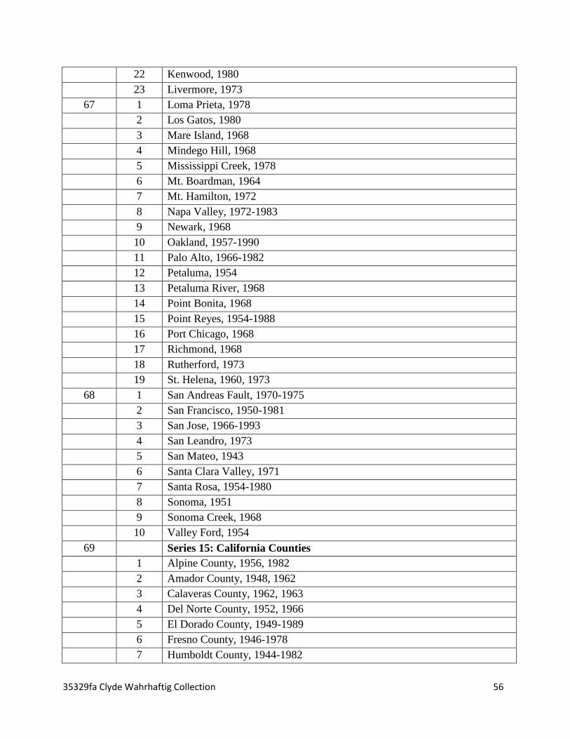
35329fa Clyde Wahrhaftig Collection 56
22 Kenwood, 1980
23 Livermore, 1973
67 1 Loma Prieta, 1978
2 Los Gatos, 1980
3 Mare Island, 1968
4 Mindego Hill, 1968
5 Mississippi Creek, 1978
6 Mt. Boardman, 1964
7 Mt. Hamilton, 1972
8 Napa Valley, 1972-1983
9 Newark, 1968
10 Oakland, 1957-1990
11 Palo Alto, 1966-1982
12 Petaluma, 1954
13 Petaluma River, 1968
14 Point Bonita, 1968
15 Point Reyes, 1954-1988
16 Port Chicago, 1968
17 Richmond, 1968
18 Rutherford, 1973
19 St. Helena, 1960, 1973
68 1 San Andreas Fault, 1970-1975
2 San Francisco, 1950-1981
3 San Jose, 1966-1993
4 San Leandro, 1973
5 San Mateo, 1943
6 Santa Clara Valley, 1971
7 Santa Rosa, 1954-1980
8 Sonoma, 1951
9 Sonoma Creek, 1968
10 Valley Ford, 1954
69 Series 15: California Counties
1 Alpine County, 1956, 1982
2 Amador County, 1948, 1962
3 Calaveras County, 1962, 1963
4 Del Norte County, 1952, 1966
5 El Dorado County, 1949-1989
6 Fresno County, 1946-1978
7 Humboldt County, 1944-1982

35329fa Clyde Wahrhaftig Collection 57
70 1 Inyo County, 1951-1981
2 Kern County, 1943-1976
3 King’s County, 1953-1954
4 Lake County, 1958-1968
5 Los Angeles County, 1961
6 Madera County, 1961-1965
7 Mariposa County, 1947-1962
8 Mendocino County, 1951-1967
9 Merced County, 1953-1978
71 1 Mono County, 1954-1972
2 Monterey County, 1947-1974
3 Nevada County, 1949-1950
4 Orange County, 1948-1970
5 Placer County, 1952-1977
6 Sacramento County, 1952-1954
7 San Benito County, 1955-1969
8 San Bernardino County, 1964-1970
9 San Diego County, 1960, 1975
10 San Joaquin County, 1952, 1968
72 1 San Luis Obispo County, 1943-1975
2 Santa Cruz County, 1954-1989
3 Shasta County, 1963, 1965
4 Stanislaus County, 1953, 1971
5 Sutter County, 1954
6 Trinity County, 1973-1979
7 Tulare County, 1921-1987
8 Tuolumne County, 1948-1984
9 Yuba County, 1947
73 Series 16: California Cities
1 Alleghany, 1949
2 Alturas, 1958
3 Angels Camp, 1962
4 Avenal Gap and Avenal, 1954
5 Apple Valley, 1960
6 Bakersfield, 1965, 1971
7 Bartlett Springs, 1942
8 Bass Lake, 1953
9 Ben Hur, 1948
10 Big Basin, 1955, 1968

35329fa Clyde Wahrhaftig Collection 58
11 Big Meadow, 1956
12 Big Pine, 1958
13 Bishop, 1957
14 Blanco Mountain, 1951, 1966
15 Bliss Ranch, 1960
16 Bradley, 1961
17 Bruceville, 1953
18 Brush Creek, 1970
19 California Hot Springs, 1958
20 Camptonville, 1948
21 Carbondale, 1953
22 Catclaw Flat, 1972
23 Cerro Colorado, 1969
24 Channel Island, 1979
25 Charleston School, 1956
26 Chicago Park, 1949
27 Cholame, 1943
28 Chowchilla, 1960, 1978
29 Chico, 1962
30 Citrus Heights, 1951
31 Clarksville, 1953
32 Clay, 1953
33 Clearlake Oaks, 1960
34 Colfax, 1951
35 Colyear Springs, 1973
36 Copperopolis, 1962
37 Coulterville, 1949
74 1 Covelo, 1952
2 Crevison Peak, 1971
3 Dardanelles Cone, 1956
4 Death Valley, 1958, 1963
5 Detert Reservoir, 1980
6 Donner Pass, 1955
7 Dunlap, 1944
8 Dutch Flat, 1950
9 El Cajon, 1979
10 Eldorado National Forest, 1974
11 Emigrant Gap, 1955
12 Feather River

35329fa Clyde Wahrhaftig Collection 59
13 Fern Canyon, 1966
14 Fiddletown, 1949
15 Folsom, 1954
16 Forbestown, 1970
17 Foresthill, 1949
18 Fortuna, 1963
19 French Corral, 1948
20 French Gulch, 1964
21 Fresno, 1946, 1971
22 Gabilan Range, 1972
23 Galt, 1953
24 Garberville, 1979
25 Georgetown, 1949
26 Giant Forest, 1956
27 Goose Creek, 1953
28 Grant Lake, 1943
29 Greenwood, 1949
30 Gridley, 1952
31 Gualala, 1960
32 Haystack Mountain, 1948
33 Herndon, 1946
34 Hetch Hetchy Reservoir, 1956
35 Hollister, 1955
36 Hopland, 1960
37 Horsecamp Mountain, 1948
38 Howard Ranch, 1971
39 Huntington Lake, 1972
75 1 Inyo Mountains, 1967, 1978
2 Inyo National Forest, 1972
3 Jackson, 1962
4 Jawbone, 1949
5 Jenny Lind, 1962
6 Joshua Tree, 1967
7 Kaiser Peak, 1971
8 Kelseyville, 1959
9 Kernville, 1956
10 Kettleman Hills, 1934
11 Keystone, 1962
12 King Range, 1980

35329fa Clyde Wahrhaftig Collection 60
13 Kingman, 1961
14 Klamath Mountains, 1982
15 La Cima, 1963
16 La Honda, 1982
17 Laguna Seca Ranch, 1956, 1971
18 Lake Eleanor, 1956, 1987
19 Lakeport, 1951, 1958
20 Lamont Peak, 1956
21 Lanes Bridge, 1946
22 Laurel, 1968
23 Le Grand, 1961
24 Leggett, 1952
25 Little Lake, 1954
26 Lodoga, 1961
27 Lone Pine, 1958
28 Long Beach, 1962
29 Long Valley and Owens Valley, 1963
30 Lonoak, 1969
76 1 Los Angeles, 1957-1975
2 Los Padres National Forest, 1978
3 Lower Lake, 1945, 1958
4 Mariposa, 1947-1985
5 Melons Dam, 1962
6 Merced Falls, 1916
7 Merced Peak, 1980
8 Mercy Hot Springs, 1969
9 Meridian, 1952
10 Michigan Bluff, 1952
11 Millerton Lake, 1965, 1982
12 Minarets Wilderness, 1980
13 Miramonte, 1966
14 Mojave Desert, 1962
15 Mokelumne Hill, 1948
16 Monache Mountain, 1956
17 Mono Craters, 1953, 1966
18 Mono Creek, 1973
19 Monocline Ridge, 1955
20 Monterey, 1948-1981
21 Morongo Valley, 1967

35329fa Clyde Wahrhaftig Collection 61
22 Mount Abbot, 1975
23 Mount Goddard, 1965
77 1 Mount Shasta, 1979
2 Mt. Tom, 1954
3 Mount Whitney, 1956, 1981
4 Mountain Springs Canyon, 1953
5 Needles, 1964
6 Newman, 1971
7 North Fork, 1965
8 Orange Cove, 1966
9 Oregon House, 1948
10 Orick, 1982
11 Ornbaun Valley, 1960
12 Ortigalita Peak, 1969
13 Owens Reservoir, 1962
14 Pacheco Pass, 1955
15 Packwood, 1943
16 Panoche, 1969
17 Parkfield, 1943
18 Pennington, 1954
19 Pickle Meadow, 1954
20 Pike, 1949
21 Pilot Hill, 1954
22 Plainsburg, 1960
23 Plumas National Forest, 1984
24 Point Arena, 1943-1981
25 Point Sur, 1982
26 Prospect Peak, 1964
27 Prunedale, 1954
28 Raymond, 1962, 1982
29 Raynor Creek, 1961
30 Redding, 1958, 1962
31 Rio Linda, 1950
32 Riverbank, 1916
33 Rocklin, 1954
78 1 Sacramento, 1948-1981
2 San Bernardino, 1966, 1969
3 San Diego, 1962, 1979
4 San Felipe, 1955

35329fa Clyde Wahrhaftig Collection 62
5 San Gabriel Mountains, 1969
6 San Gorgonio Mountains, 1964
7 San Joaquin Valley, 1978
8 San Juan Bautista, 1955
9 San Luis Obispo, 1969, 1979
10 Sanborn Slough, 1952
11 Santa Ana, 1966
12 Santa Cruz, 1958-1970
13 Santa Maria, 1959, 1969
79 1 Sequoia National Park, 1958, 1975
2 Shandon and Orchard Peak, 1974
3 Shaver Lake, 1953-1980
4 Shuteye Peak, 1968
5 Sierra Nevada, 1972-1987
6 Silver Lake, 1956
7 Six Rivers National Forest, 1969
8 Smartville, 1949
9 Snelling, 1953, 1962
10 Solyo, 1971
11 Sonora, 1948, 1956
12 Stanislaus, 1948
13 Stanislaus National Forest, 1977
14 Stockton, 1989
15 Stonyford, 1964
16 Sutter, 1952, 1962
17 Tahoe National Forest, 1976, 1983
18 Tectah Creek, 1952
19 Tent Hills, 1943
20 Terra Bella, 1942
21 Three Sisters, 1954
22 Tower Peak, 1956
23 Trona, 1963
24 Tucker Mountain, 1966
25 Tumey Hills, 1956, 1971
26 Tunnel Hill, 1950
80 1 Tuolumne, 1948
2 Tuolumne Meadows, 1956, 1983
3 Turlock, 1948, 1953
4 Twentynine Palms, 1968

35329fa Clyde Wahrhaftig Collection 63
5 Ukiah, 1958-1979
6 Valley Springs, 1962
7 Valyermo, 1954
8 Walker Lake, 1963
9 Wallace, 1962
10 Watsonville, 1954, 1980
11 Washington, 1950
12 Weaverville, 1963
13 Whispering Pines, 1958
14 White Mountain
15 White River, 1936
16 Willow Creek, 1952, 1978
17 Woodward Island, 1968
18 Yosemite, 1946-1970
19 Yosemite, 1970-1989
20 Zyante Creek Basin
81 Series 17: Out of State
1 California/Nevada, 1947-1977
2 California/Nevada, 1967-1977
3 California/Oregon, 1966
4 United States, 1932-1978
5 Regional Areas, 1954-1966
6 West Coast, 1951-1974
82 1 Western United States, 1942-1975
2 Western United States, 1955-1976
3 Multiple State Street Maps, 1966, 1976
4 Alaska, 1951-1981
5 Alaska, 1958-1966
6 Alaska, 1970
7 Arizona, 1962
8 Colorado, 1910-1973
83 1 Colorado, 1952-1962
2 Colorado, 1955, 1962
3 Hawaii, 1979-1988
4 Montana, 1949-1955
5 Montana, 1951-1955
6 Montana, 1961-1968
84 1 Nevada, 1950-1969
2 Nevada, 1951-1978

35329fa Clyde Wahrhaftig Collection 64
3 New Mexico, 1963, 1984
4 North Dakota, 1963
5 Ohio, 1961
6 Oregon, 1954-1977
7 Oregon, 1961-1977
85 1 Pennsylvania, 1955
2 Utah, 1956, 1970
3 Washington, 1951-1971
4 Washington, 1951-1968
5 Washington, 1962-1966
6 Wyoming, 1956-1965
86 Series 18: International
1 Australia, 1954
2 Canada, 1960
3 Denmark, 1958
4 Finland, 1910-1959
5 Great Britain, 1946, 1956
6 India, 1966
7 Indonesia, 1978
8 Italy, 1961-1962
9 Mexico, 1978-1988
87 1 Mexico
2 New Zealand, 1942-1964
3 New Zealand, 1958-1973
4 New Zealand, 1960-1966
88 1 New Zealand, 1959-1965
2 New Zealand, 1959-1965
3 Sweden, 1955
4 Switzerland, 1933-1958
5 Indian Ocean, 1963
6 Pacific Ocean, 1953, 1969
7 The Moon, 1967-1968
8 Mars, 1978
9 The Age of the Ocean Basins, 1974
10 The Geology of Plate Margins, 1986
89 Series 19: Miscellaneous Maps, Charts, Brochures.
1 Summary Sheets of Sedimentary Deposits, 1974
2 Unknown Locations
3 Map Pieces

35329fa Clyde Wahrhaftig Collection 65
4 Map pieces taped together (location unknown), 1968-1980
5 Adventure into San Joaquin Valley, 1987
6 A Geologic Time Scale, 1989
7 East Bay Regional Park District: Brochures
8 Landslide Maps (photocopies), 1953
9 Lithia Park Woodland Trail
10 Midpeninsula Regional Open Space District: Brochures
11 National Park Service: Brochures
12 Pinnacles Geological Trail, 1972
13 San Francisco Bay Model, 1965
14 Santa Clara County Transit System Map, April 1991
15 Sequoia Forest Trail
16 Sequoia National Park, 1981
17 Skyline to the Sea Trail, 1977, 1985
18 State of California, Department of Parks and Recreation: Brochures
19 Summary of Displacement History of San Gregorio Fault, 1977
20 Sunol Valley Field Trip: Maps, 1976
21 Sunol Valley Field Trip: Figures
22 U.S. Geological Survey: Catalog of Maps, 1987 and Wahrhaftig’s list of
maps
23 Wulff Stereonet
24 Miscellaneous.
Oversize Boxes : 0.4 LF
1 1 State of California, Department of Parks and Recreation: Brochures
2 East Bay Regional Park District: Brochures
3 Midpeninsula Regional Open Space District: Brochures
4 Amtrak booklets
5 Santa Clara County Transit System Map, April 1991
6 Lithia Park Woodland Trail
2 1 California Cities (G-P), 1943-1969
2 California Cities (S-Y), 1944-1962
3 Hawaii, Virginia, Washington, Massachusetts, Nevada, Rhode Island, 1929-
1958
4 Misc. Maps and Figures
5 Transparencies
6 Orthophotographs: San Francisco, 1964, Unmarked
3 1 Geologic Atlas: Bidwell Bar, California, 1898
2 Geologic Atlas: Colfax, California, 1900
3 Geologic Atlas: Downieville, California, 1897

35329fa Clyde Wahrhaftig Collection 66
4 Geologic Atlas: Pyramid Peak, California, 1896
5 Geologic Atlas: Redding, California, 1906
6 Geologic Atlas: San Luis, California, 1904
7 Geologic Atlas: Santa Cruz, California, 1909
8 Geologic Atlas: Washington, D.C., 1901
9 Geologic Atlas: Colorado, 1899-1910
4 1 Geologic Atlas: Idaho, 1898
2 Geologic Atlas: Montana, 1915
3 Geologic Atlas: Oregon, 1901-1924
4 Geologic Atlas: Pennsylvania, 1904-1910
5 Geologic Atlas: Wyoming, 1906
Map Cases : 0.6 LF
1 Orthophotograph maps of Marin and Angel Island
2 California
3 Hawaii, North Carolina, Tennessee, Virginia, Washington, Great Britain,
Mexico
4 Orthophoto maps of Marin, 6/12/65. 6/27/65, 9/27/65
5 Orthophoto maps of Marin, 7/27/65; Unmarked
6 Map Transparencies, Posters
Series 13: San Francisco-Bay Area Counties [continued]
Fifteen [15] Map Rolls
4.5 LF
Orthophotographs:
An orthophotograph is a uniformed scale version of an aerial photograph. Unlike aerial
photos, orthophotographs can be used to measure true distances because it is an accurate
representation of the earth’s surface. Orthophotographs are commonly used for a system
designed to capture, store, analyze, manage, and present all kinds of geographically referenced
data, also known as GIS (Geographic Information System). On orthophotographs there is usually
the date of when the photo was taken and an identification mark.
In this collection, the dates of the photographs were taken in the same month and year but
on different days. Each map has its own identification mark based on when the orthophoto was
taken and where it was taken. The orthophotographs of San Francisco are identified by an “SF”
while the orthophotographs of the San Mateo county are identified by a “SM”.
Orthophotographs of San Francisco
Roll# Description
1 SF 1-2, May 11, 1965

35329fa Clyde Wahrhaftig Collection 67
1 SF 1-4, May 11, 1965
1 SF 1-6, May 11, 1965
2 SF 1-8, May 11, 1965
2 SF 1-10, May 11, 1965
2 SF 1-59, May 11, 1965
3 SF 1-61, May 11, 1965
3 SF 1-63, May 11, 1965
3 SF 1-65, May 11, 1965
4 SF 1-67, May 11, 1965
4 SF 1-72, May 11, 1965
4 SF 1-74, May 11, 1965
5 SF 1-76, May 11, 1965
5 SF 1-78, May 11, 1965
5 SF 1-80, May 11, 1965
6 SF 1-139, May 11, 1965
6 SF 1-140, May 11, 1965
7 SF 10-6, May 16, 1965
7 SF 10-8, May 16, 1965
7 SF 10-10, May 16, 1965
8 SF 10-12, May 16, 1965
8 SF 10-14, May 16, 1965
9 SF 12-5, May 17, 1965
9 SF 12-7, May 17, 1965
9 SF 12-9, May 17, 1965
10 SF 12-11, May 17, 1965
10 SF 12-13, May 17, 1965
10 SF 12-64, May 17, 1965
11 SF 12-66, May 17, 1965
11 SF 12-68, May 17, 1965
11 SF 12-70, May 17, 1965
11 SF 12-72, May 17, 1965
Orthophotographs of San Mateo County
Roll # Description
12 SM 1-12, May 11, 1965
12 SM 1-14, May 11, 1965
12 SM 1-16, May 11, 1965
13 SM 1-53, May 11, 1965
13 SM 1-55, May 11, 1965
13 SM 1-57, May 11, 1965
14 SM 1-82, May 11, 1965
14 SM 1-84, May 11, 1965

35329fa Clyde Wahrhaftig Collection 68
14 SM 1-86, May 11, 1965
14 SM 10-16, May 16, 1965
Maps of San Francisco and Marin: No Dates
Roll # Description
15 Map of San Francisco Area, includes:
Alcatraz, Angel Island, Crissy Field, Fort Funston, Fort Mason, Fort Miley, Fort
Point, Fort Scott, , Golden Gate Park, Harding Park, Lincoln Park, Marina District,
Presidio, Ocean Beach, Richmond District, Sunset District, Sutro District.
15 Map of Marin Area, includes:
Fort Baker, Fort Barry, Fort Cronkhite, Marin Peninsula, Mill Valley, Muir Woods,
Mt. Tamalpais, Point Reyes, Sausilito.
Series 17: Out of State [continued]
Two [2] map rolls
.6 LF
Out of State Topographs, Geological, and Chart Maps
Roll # Description
16 Topograph Map of Maui, Hawaii, 1957
16 Topograph Map of Zion National Park, Utah, 1977
16 Geological Map of Zion National Park, Utah, 1978
17 Geological Map of Eastern Grand Canyon National Park, Arizona, 1986
17 Mesozoic-Cenozoic Cycle Chart, 1986
Recommended